Wednesday, April 30, 2014

Easy Passage to Yap

The wind died off about 10pm, so we had to motor the rest of the night. But by morning we could see Yap in the distance. We finally anchored in the inner harbor about 10am. Yap has a pretty well-marked channel coming in--with a few of the markers with proper red and green lights on them. And our CM93 chart, and the Google Earth charts we made, are pretty accurate.

We called the Port Captain on VHF on our way in, and made arrangements to meet the officials on shore at 11am. When we got there a few minutes late, John, the Port Captain representative was the only one there. He put us in his air conditioned pickup and drove us 100 yards to the air conditioned Immigration office (across from the Marina Restaurant). There we were waved into a chair and proceeded to meet 6 different officials to complete our check-in (Port, Immigration, Customs, Quarantine, Health, EPA). Quite a lot of paperwork for such a small island, and especially considering we've been in their country for almost 3 months already.

There was a question about our holding tank capacity--as usual, everyone wants you to have a holding tank, but nobody has the facilities to pump it out. We told them we'd be using the facilities ashore. Which, I am absolutely positive, DON'T go to a sewage treatment plant, but probably just a septic tank and then into the water (if it is a recently-built modern structure).

Also the quarantine guy wanted us to keep all our "garbage" (wet trash) aboard. But literally EVERYTHING (fruits and vegs) we have onboard were purchased in the FSM. They just don't get the difference between a cruising yacht and a big ship.

The EPA guy had a form for us to fill out about what fuel and other possible contaminants we had on board--in case we went aground or sunk, so they knew how to clean up our spill site. Methinks they've been training too much in the U.S. In contrast, I've seen guys in the islands just toss an outboard motor oil plastic container over the side when they were finished topping off their tank.

Anyway, everyone was friendly and fairly efficient. We hadn't brought enough copies of our crew list, but the Immigration lady kindly made a couple of copies for us. By 11:45 we were finished, and Dave and I went to lunch at the Marina Restaurant (no Marina to go with the Restaurant, but a nice view of our boat on anchor).

Backbeat Hauled Out in Yap

After lunch, we stopped in to say hello to Backbeat, a catamaran on the haulout ramp. We had heard of Backbeat when they went aground in Woleai last December when Typhoon Haiyan passed over... a huge saga.

They were fine, and the boat MOSTLY intact... except the keel running along one hull snapped sideways and made a major hole the length of the keel. They are designed as breakaway keels, but I guess it didn't break away cleanly.

After a couple of months making temporary repairs in Woleai, they were towed to Yap. But during the 2-3 day trip from Woleai, the leaks increased to the point where the boat was basically being towed underwater. So the entire interior, including engines and generator, is a total loss. By the end of it all, they have their bare hull (with some signficant issues), and a pretty good rig, and their lives.

Stripped Out Inside, Repairing the Keel

They are stuck here is sleepy Yap until they can get their boat sound enough (and at least one engine working) to move to someplace else--probably the Philippines, which are only about 5-7 days downwind--to complete their re-fit.

Marie from Backbeat was kind enough to load us up in her air conditioned car and give us the nickel tour of Yap, with quick stops in all 3 primary grocery stores to pick up what veggies we could find.

We'll be here for a week or two, experiencing Yap, and then on to Palau if the wind ever comes back.
-----
At 04/28/2014 7:00 AM (utc) our position was 09°30.86'N 138°07.35'E

Monday, April 28, 2014

A Few Days at Ulithi Atoll

We ended up having to turn on the engine about 30 miles out of Ulithi, to make sure we made it in to an anchorage before dark. We crossed over Zohhoiiyoru Bank on our approach. The water depth goes from several thousand meters deep to 30 feet, for half a mile, and back to deep again. So we put the fishing lines out, but got nary a nibble, over the bank, up the slot, and into the atoll. We did see two different sets of mating turtles though, out near the islands at Z-- Bank. Amazing that there are any turtles left at all here--the Micronesians have no concept of turtle conservation, and they're all going to be gone soon.

Soggy Paws Anchored Off Sorlen Island

We arrived in Ulithi late in the day on Thursday, and dropped anchor off Sorlen Island just before sunset. We chose this spot partly because of its protection from tne NE winds, but also because it was NOT one of the "inhabited islands". After a week at Woleai doing the village thing, we were ready for a break and some time to ourselves. I picked the anchoring spot off Google Earth, and it turned out to be as nice as it looked from space... nice big sand area in about 25 feet, and off a pretty sand beach.

In spite of all my worries about the weather--there was a "low level circulation" to the SE of us, meandering NW towards us--the weather turned out pretty good for our whole stay. The Low scooted off toward Guam this morning without bringing us any bad weather.

Since no other cruisers we knew about had gone to Mog Mog Island, we had to figure it our for ourselves. Friday morning, Dave got on the VHF radio and called "Mog Mog Island, Mog Mog Island." After a couple of calls, someone actually answered us back! This turned out to be Stanley, who is the official "greeter" for Mog Mog. (Note, the locals pronounce it more like "Mo Mo").

Dave asked permission for us to come and anchor at their island and come ashore, and get a tour around. When we arrived in front of Mog Mog, Stanley was waiting for us on the beach. Stanley turned out to be similar to Matthais at Woleai--he had grown up on Mog Mog, and ended up in government service in Yap. He had recently retired from his job as liaison for the Yap Governer, and was enjoying the slow pace of life back on his home island.

Stanley Checking Out Dave's Coke Bottles

We kept waiting for Stanley to ask for paperwork, or money, but he did neither--a pleasant surprise. Dave asked if he could get a tour of the island--specifically the former US Navy facilities. Stanley opted to take us himself. He told Dave up front that there wasn't much to see--and he was right. In the 70 years since the fleet was in Ulithi Atoll, between time, typhoons, and scavenging locals, there was almost nothing left of the old facilities, besides the rusting remnants of piers we had seen on our way in.

The "Officer's Pier"

Stanley told us that one pier was for officers and one for enlisted men. We saw the remains of a seaplane ramp--a few flat bits of concrete. But where the old hospital was (according to Stanley), there was nothing left. Stanley walked us nearly all the way around the small island, on the old "Navy Road", which is now more like a wide path than a road.

Sherry & Stanley on the Old Navy Road

Mog Mog's New Solar System

Remnants of the American Presence

More Old Machines

Seaplane Ramp

Another request that Dave had was "old Coke bottles". He had heard from someone that Ulithi, like Majuro, having been a big R&R facility during the war, had old Coke bottles laying around. Stanley took us to the former dump (now their taro patch), and we rooted around in the dirt and found a couple of 1944 Coke bottles (the month and year that the bottle was made is stamped on the bottle). Dave has been contacted by a friend of a friend who's an executive with Coca Cola in Atlanta who asked for a couple of old bottles for their collection.

Dave and His 1944/1945 Coke Bottles

The Women's Meeting House on Mog Mog (Prohibited to Men)

The wind came up in the afternoon, more easterly than forecast, so the anchorage off Mog Mog wasn't very good. We motored the short distance back to Sorlen and enjoyed another quiet night by ourselves there. Before we left Mog Mog, Dave asked Stanley for permission to go ashore on Sorlen. Stanley said that island didn't belong to Mog Mog, but he would ask someone who could give us permission. The next morning Stanley called us on VHF to say we could go ashore.

There is another old metal pier at Sorlen, and just inshore of that, a concrete building that looked like someone's home, now abandoned. There was a nice grave next to the house with lots of flowers on it. We spent the morning poking around the beaches of Sorlen, looking for World War II era traces. There were hunks of metal in various spots off the beach--mostly unidentifiable. And there were a few concrete pads we found. Dave found a couple of bullets and shell casings of various sizes embedded in the coral on the rocky shore. We checked a portion of the windward beach to see if there were any glass balls there, but found nothing but lots of abandoned shoes, plastic bottles, and fishing floats of various sizes and configurations.

We also saw a 3-foot monitor lizard run out of the dense coconut palm thicket, down the beach and into the water. Dave tried to get a picture of it on its way back up the beach, but we're not sure how well it came out.

We had a nice steak and baked potato dinner for Dave's birthday, and really enjoyed watching the sunset in the solitude of the Sorlen anchorage.

Dave went back to Mog Mog to say goodbye to Stanley (and return a book he had lent us on Micronesia). He took 2 big bunches of bananas with him--as usual, all the bananas we had been given in Woleai when we left came ripe at once, and there was no way we'd be able to eat them. He had fun handing out bananas on the beach to the kids. Stanley also appreciated the gifts of cigarettes, coffee, AA batteries, and a few fishhooks Dave gave him. Plus Dave took a few paperbacks in for one of the men who'd asked us for reading material the day before.

This morning, we up-anchored from our pretty little anchorage at Sorlen and headed south inside the atoll to check out the wreck site of the USS Mississinewa. This ship was torpedoed by a Japanese "manned torpedo" (or mini-sub) while at anchor in Ulithi on 20 November 1944. We had 3 different waypoints for the ship--one from Wikipedia, one from a US Navy report, and one indicated on our CM93 chart. Arriving in the area, we motored around the 3 waypoints (close but not on top of each other) and were very surprised to find that the one from the chart was the correct waypoint. Once we found the ship (using our fishfinder depthsounder, we could see it's profile as we went over it), we looked up and said, "Hey, there's a bouy!". Duh. It wasn't a very big buoy, so it was easy to miss until we were right on top of it.

Finding the Mississinewa Using Our Fishfinder

Dave's Snorkel Picture of the Mississinewa Bow

I tried to get Dave interested in making a short dive on the Mississinewa while I waited onboard Soggy Paws (without anchoring), but he thought that was too risky. So he jumped in with mask and fins and snorkel and just looked at it from snorkel depths. He could clearly see the bow section about 70 feet below him. He took a picture. That was good enough to say "mission accomplished" on that one.

We left by one of many breaks in the reef on the west side of the atoll at 10am this morning, and are on our way to Yap right now (ETA tomorrow morning).

All our anchoring, pass, and wreck waypoints are written up in our Micronesia Compendium, if you are interested in details.
-----
At 04/27/2014 10:39 AM (utc) our position was 09°51.63'N 139°04.62'E

Thursday, April 24, 2014

Enroute to Ulithi Atoll

All our friends (Kokomo, Westward II, and La Gitana) headed west toward Palau when we left Woleai. But Dave is on a mission to see as much of the World War II history of Micronesia as he can. So we are headed for Ulithi Atoll. Ulithi was a major staging area for U.S. ships just before the two big battles for the Philippines (late 1944 and early 1945).

Here is what we've garnered off the internet about Ulithi: The atoll is composed of 49 islands, only four of which – Falalop, Mogmog, Asor and Fassarai – are inhabited. Total population is approximately 700. Of the atoll's 209-square mile lagoon, total landmass of the 49 islands is only 1.75 square miles. As usual, Wikipedia has a great writeup on Ulithi. Here are a couple of excerpts:

"Within a month of the occupation of Ulithi, a complete floating base was in operation. Six thousand ship fitters, artificers, welders, carpenters, and electricians arrived aboard repair ships, destroyer tenders, and floating dry docks. The USS Ajax had an air-conditioned optical shop and a metal fabrication shop with a supply of base metals from which she could make any alloy to form any part needed. The USS Abatan, which looked like a big tanker, distilled fresh water and baked bread and pies. The ice cream barge made 500 gallons a shift. The dry docks towed to Ulithi were large enough to lift dry a 45,000 ton battleship. The small island of Mog Mog became a rest and recreation site for sailors.

The Seabees completed a fleet recreation center at Mog Mog island that could accommodate 8,000 men and 1,000 officers daily. A 1,200-seat theatre, including a 25-by-40-foot stage with a Quonset hut roof was completed in 20 days. At the same time, a 500-seat chapel was built. A number of the larger islands were used both as bases to support naval vessels and facilities within the lagoon.

By March 13 there were 647 ships at anchor at Ulithi, and with the arrival of amphibious forces staging for the invasion of Okinawa the number of ships at anchor peaked at 722."

http://en.wikipedia.org/wiki/Ulithi

Unfortunately, for a sailing yacht, Ulithi doesn't offer much protection. So we are only planning to stay a day or two, and then move on to the fully-protected harbor at Yap, another 100 miles SW of Ulithi. Dave wants to stop at Mog Mog, and maybe we'll try to dive the USS Mississinewa, a US ship that was sunk by a Japanese manned (ie Kamikaze) torpedo.

Once we get to Yap, we'll only be able to stay a week or so there, as we've scheduled SSCA-sponsored Ham Exams in Palau (a 2-3 day sail from Yap) on May 24th.

We have about 30 miles to go to the pass at Ulithi--as long as the wind holds, we should make it there before sunset today.
-----
At 04/24/2014 12:08 AM (utc) our position was 09°47.58'N 140°10.22'E

Easter at Woleai

April 17-21

Well, I have finally had my "National Geographic Experience".

The Men on Woleai

We found Woleai Atoll to be a unique blend of very traditional Micronesian, and fairly modern. And one of the most welcoming and generous groups of people we have encountered in the last 7 years of cruising.

Our Yachtie Group on Easter Morning

Dave/Sherry - Soggy Paws, VK & Michelle - La Gitana, Steve/Selena - Westward II, Peter/Donna - Kokomo

On the "traditional" side, the islanders still wear traditional dress, which for the men is basically a loincloth, and the women, a wrap-around lava lava, with no top. Western dress is discouraged. The women still weave their own lava lavas on a "backstrap loom". Though there are fiberglass launches (about 1 for each clan) with outboard motors, the men do most of their fishing in proa-style dugout canoes.

A Traditional Woleain Canoe

The housing on Woleai is also fairly traditional... mostly woven palm leaf and thatch construction, with the cooking facility separate in an outdoor (but covered) area. The men have a gathering area separate from the women. Both the elementary school and the high school have cultural classes that teach traditional skills... for the boys, traditional navigation methods, canoe-making, etc... for the girls, weaving and basket-making.

On the modern side--they actually have internet on Woleai, with wifi, and we were allowed to use it for a modest fee of $5. Plus they have a generator on the island, and power to most of the houses. There are a couple of vehicles on the island (one belongs to the school system for transporting supplies from the beach to the high school on the other side of the island). Many of the people own VHF radios, and there's a lot of chatter on their channels--10 and 11--a kind of party line.

As part of the Easter celebration, we participated in a Holy Thursday mass, and a Friday morning processional.

Holy Thursday Mass

The Mass was interesting--the church has no seats--just lines painted on the concrete floor. So everyone sits on the floor. The service was entirely in Woleain, except for a welcome from the priest. So we didn't understand much of what was going on. But 12 (I think) men from the village were up front, seated in chairs, with palm leaf baskets of food (I think) on a table before them. Toward the end of the service, the priest and his helper went around to each man and washed his feet--symbolic of the Last Supper, I assume. There was praying and singing, and then administration of the sacrament.

The Good Friday Processional

The processional started at one end of the island, with two young men carrying a big cross. Nearly everyone on the island was there, following along. Every 100 yards or so, there was a "station", where a family had made a small simple altar of some kind. The procession would stop, kneel and pray, sing a song, pray again, and then move on. At the first station, I understood why I'd seen the young women each carrying a small mat (to kneel on in the dirt). At the far end of the island, the cross was planted, and there was more singing and praying. We enjoyed participating and were thanked by several people for taking part.

We passed on the Friday evening Mass. But on Saturday afternoon, helped to decorate the church.

All day Saturday, the men were butchering pigs for the Easter feast. We were told that each big clan did 2 pigs and the smaller clans only one pig. And of course the women were preparing all the other food--taro, breadfruit, coconuts, bananas, bread, and "doughnuts".

On Easter morning, we could have participated in the church service, but since it started at 4am (4AM!!), we opted not to. But we went in at 8:30 after church was over to participate in the rest of the day's activities. On arriving at Matthias's house, his wife Joanna presented me with a lava lava of my own. Fortunately they didn't demand that I go completely native--I was allowed to keep my top on. We were all also given garlands of flowers. Dave was relieved that the guys were not presented with a sarong.

Chillin' in front of the Church

We spent most of the day sitting on the ground in clanly groups, doing "fun and games" in front of the church.

Our Picnic Lunch
The games ranged from the straw pass (pass a straw from person to person between your toes) to the coconut carry (how many coconuts can you carry?) to musical coconuts (like musical chairs but with coconuts instead), and a "guys in drag" show (which VK from La Gitana did a great job representing the yachties). There was also a relay race in the water. There was a little bit of traditional dancing--to western pop music and some Hawaiian music. There was a lot of hilarity. For almost every game, some adult got up and acted silly, which cracked everyone up.

The Pencil Pass

The Coconut Carry

VK from La Gitana, In Drag

They asked us yachties to participate with a game of our own. Dave and I favored holding a 3-legged race, but Stephen from Westward II prevailed with a shoe toss (a traditional Australian thing at gatherings is a boot toss). It was amazing how far one guy managed to sail his flip-flop... Everyone really appreciated us joining in.

One thing we noticed was that the games were somewhat competitive, but there were no prizes given and no overall winner. As each team finished each competition, winning or losing, they celebrated. This was all about participation, and not about winning. Very Micronesian.

Some of the Cute Kids at Woleai

At 3pm, the games broke up so the men could go to their Tuba Circles and celebrate without the women and children. While our men felt obligated to participate in this manly social event, I was relieved that the socializing was over, and I could quit smiling and go back to the quiet of our boat. The women generally were lounging...rolling out mats in the shade outside their family complex, and taking a nap.

What's interesting is that we never did figure out when they had their "feast". There was food given to us during the games (lots of food... breadfruit, taro, bananas, cooked pork), but it was more of a picnic lunch rather than what we'd imagined as an Easter feast. I guess traditions are different.

The next day we said our goodbye's around the island. We took some gifts in for specific people... a thank-you to Julian for guiding Dave around the Japanese stuff, a thank-you to Joanna for the lava lava, and a pair of sunglasses for Francis, the old blind chief.

Late in the afternoon, while we were aboard getting Soggy Paws ready for passage, we were visited by 4 different canoes carrying gifts--we ended up with 3 large bunches of bananas, a huge basket of papayas, and 2 different sets of drinking coconuts. Wow!! What a place--sorry we couldn't stay longer.

An Embarrasment of Bananas

Too bad we are now feeling schedule pressure and needed to move on at the first weather window. It appears the "SW Trades", which normally are not due until June, have moved in early this year. For the last 10 days we have had westerlies, fortunately mostly very light. The current forecast promises about 5-6 days of wind from an easterly quadrant, and then back to westerlies. So we needed to go on the east wind.

We left Woleai Tuesday morning, on our way NW to Ulithi Atoll for a short visit, then on to Yap. It's 300 miles from Woleai to Ulithi, and then another 100 miles to Yap, before we'll be in a nice protected anchorage where we can relax a little, restock, eat out, etc.

Japanese Relics on Woleai

April 17-21

While talking with the chiefs on our first day in Woleai, Dave arranged for a guide to take him on a tour of the Japanese relics on the island. Dave was assigned Julian, who is a 30-something man from the paramount chief's clan. (I was going to go too, but got volunteered to sew a sail for the chief's canoe instead).

Airplanes in the Jungle at Woleai

Most of the young men on any give atoll that has World War II stuff know where all the stuff is (tanks, anti-aircraft guns, airplane remnants, torpedoes, etc), but none know very much about what they are looking at. So when Dave does his tour, he takes along books like "Military Aircraft of World War II", and prints of photos from the internet, and tries to educate them about what they have in their jungle. Dave is so enthusiastic about this stuff, that he tends to get everyone else fired up about it too.

More Airplanes in the Jungle at Woleai

Dave took a lot of pictures, and left them on Matthias's computer. The computer guys at the high school want to use them for a website about Woleai. (insert best pics below when possible).

The last day we were there, we snorkeled on an H8K "Emily" Japanese flying boat. It was sunk while at anchor in the atoll, not far from where we were anchored. We really should have hauled out the dive stuff and done a proper dive on it, but we were leaving the next day and didn't want to go through all the bother (mainly rinsing, drying, and re-stowing the gear). The Emily is in 35 feet of water, so is a bit deep for a snorkel. But Dave still got some pictures of it. The entire wing with all 4 engines is intact, upside down. You can see two of the outer floats nearby. And an aft gun turret with the gun still sticking out. GPS 07-21.92N / 143-54.083E We'll post a couple of pics when we next have internet.

The Emily in 35 Feet of Water

The Nearly-Intact Dorsal Gun Turret


There is usually a WWII picture of a formerly Japanese-occupied atoll on Wikipedia. And A friend sent a link from the internet regarding the Japanese surrender at Woleai (thanks, Roger!). This is a telling account of what Woleai (and many many other Japanese-occupied atolls) went through toward the end of World War II
http://www.desausa.org/images5/uss_sloat_de_245_woleai_surrender.htm#Photos

Tuesday, April 22, 2014

Woleai Arrival

April 16-18

We arrived in Woleai the Wednesday before Easter, having had to motor the final 12 hours in almost no wind. What a gorgeous place!

The Beautiful Beach at Woleai

Our friends on Westward II and Kokomo have been at Woleai for a couple of weeks--stuck there by the light winds and westerly winds. So they already knew the whole village, and quickly introduced us around.

Checking In with Matthias

First, we checked in with Matthias, who is the official "greeter" for Woleai. Matthias is recently retired from a government (marine division) job in Pohnpei, the capital of FSM. He has a nice "office" set up under an awning next to his house (a thatched-roof traditional building with detached cooking area).

Matthias's wife, Joanna, has been helping Selena from Westward II weave a traditional women's "lava lava" (wrap-around skirt). This is done the old fashioned way--with a backstrap loom, by hand. The lava lava, with belt is the ONLY traditional wear for women on Woleai. Yep, they go topless. The men wear a sarong wrapped around their waist and between their legs while working in the taro fields, while fishing, while swimming. On Woleai, the men's sarongs don't expose the buttocks, but the little boys' sarongs have their cheeks hanging out, which is just so cute.

Chief Francis (with the sunglasses we gave him)

Matthias had set us up an audience with the two primary chiefs of the village--both men named Francis. The paramount chief is a lively 79-year old with a quick wit and a ready smile. He is totally blind, so he was led to the meeting by his son, a big strapping handsome man. Francis understands English well, but prefers to speak Woleain and have Matthais translate for him. We met in the chief's "boathouse", a large open-air thatch-roofed building that is essentially where the men of his clan hang out (and where they store boat parts, fishing gear, and fish traps, and work on their canoes). In general, women are prohibited from the boathouse, though they make an exception in certain circumstances for visiting yachties.

Woleai has a tiny hospital (aka dispensary), an elementary school, and a high school. This is the primary high school for all the islands surrounding Woleai atoll. We were amazed to find out that the dispensary has recently been equipped with a satellite internet system, with wifi. This is compliments of the Japanese government. The wifi was made available to us yachties for an astoundingly low fee of $5. It was slow, but usable, and enabled us to catch up on a few critical items (Facebook, blogs of our friends, bill paying, etc).

Stephen and Selena had been there long enough that they had been asked to do several talks at the schools about Australia, New Zealand, and where they'd been in their travels. They had also done at least one Movie Night on the grounds in front of the church. So they were totally plugged into the local scene.

A Special Invite to the Cruiser Ladies to Drink Tuba

One huge aspect of the local scene for men is the evening "tuba circles". Tuba is a drink made by tapping a coconut palm. It is collected in an empty coconut that has naturally occurring yeast in it. This juice, by evening, makes a potent alcoholic beverage.

The Men in Their Nightly Tuba Circle

So the men gather near their boathouse, in a circle, and pass around the Tuba. (also known as Faluba in this part of FSM). The making, collecting, and drinking of tuba is fairly regulated by the council of elders, to keep things from getting out of hand. The men from our 4 boats went to several tuba circles. Dave, and Peter from Kokomo, didn't like the taste, and so took along mixers for their tuba. But Stephen and VK from La Gitana liked the traditional way, from a passed-around coconut shell. The yachtie women were invited to participate in Matthais's circle one evening. Normally I'm up for anything alcoholic, but I didn't like tuba. But for the islanders (and yachties who didn't provision well enough and are out of alcohol), the price is right and it can be very intoxicating.

Dave Choking Down His Tuba

Since Woleain is the 4th different language in 4 stops, we never even picked up a word of it. Fortunately enough of the people speak pretty good English that we could get along OK.

Unlike Chuuk, where no one on the entire (large, populated) atoll seemed to own or use a VHF, everyone in Woleai uses one... both for the "safety while at sea" reason, but also as a party line for communications. We and they quickly learned each other's callsigns, and it was nice being able to contact people by radio. This was one of the items the yachties were asked for, and each of the other 3 boats ended up selling a hand-held to someone on the island (I couldn't get Dave to part with ours).

Sherry Sewing the Big Sail in the Men's Canoe House

One of the things we were asked to do while we were in Woleai was sew a sail for them. Apparently a politician running for office in the FSM gave a roll of good sailcloth to each clan on the Yap outer islands. I got volunteered by Stephen on Westward II--their sewing machine runs of 220v, and trying to rig up power for it would be a pain. Since we have a good sewing machine, it was impossible to refuse to at least try. So with Stephen assisting (Dave was out touring Japanese relics), I spent the day in the Chief's canoe house, sitting on a log, sewing a traditional canoe sail. The cloth was brand new 7oz Dacron, stiff and slippery. Fortunately, I had some double-sided tape to help stick the pieces together, or we'd have never gotten done.

The Chief's son did all the measuring and cutting (with a couple of coconuts and some "string" from a coconut leaf)--all we needed to do was sew the panels together. The first panel was 26 feet long!! But the 6th panel was only about 5 ft. It got to be quite a job to move the growing sail around, and we ended up with about 3-4 boys helping us out and another half dozen men and boys hanging around watching. They loved to see the needle fly. My sewing machine wasn't doing the best job--with occasional broken needles and frequent broken threads. But with two rows with V92 thread in each overlapping seam, it's probably sturdier and certainly a lot easier than them hand-sewing the whole thing. I was worried that the job would drag over into our weather window, but once I got all the panels sewn, my job was done. They would finish the edges--custom fitting it to the lateen rig, and hand-sewing the edges. Of course, the next clan down the island then approached me to sew THEIR sail, but we had to decline.
-----
At 04/16/2014 9:02 PM (utc) our position was 07°22.05'N 143°54.14'E

Wednesday, April 16, 2014

No Eclipse, but a Far Star

We eagerly watched for the Blood Moon eclipse at near sunset yesterday, but persistent squally weather in the area blocked everything out until it was all over.

Otherwise, we've had a decent overnight passage... light winds and easy sailing. However, we haven't been able to make either the course or speed we planned for. So at 7am this morning, we reluctantly pulled in the genoa and turned on the engine, so we get in to Woleai before dark (about 40 miles to go).

La Gitana, who left Olimarao a couple of hours after us, and has gone a little faster and pointed a little higher than us, is still sailing. Since Woleai has a fairly wide pass, and we have good Google Earth charts, they are planning to come in after dark.

Westward II and Kokomo have been in Woleai for nearly 2 weeks, waiting for enough wind to sail to Palau. Guess we'll all spend Easter together in Woleai, and then hope for a little wind.


I want to send a huge CONGRATULATIONS to our friend Kennedy, on s/v Far Star, who just completed his single-handed Circumnavigation, by crossing his track in Grenada. We traveled in and out of company with Far Star for nearly a two years, and last shared an anchorage with Kennedy in Fiji. For the last year I've been saying, "If Kennedy, an early 60's retired lawyer in a 38 foot boat, can make it around South Africa by himself, we can too!!" Way to go, Kennedy!! Have a cold Caribe for us!!

Far Star

Tuesday, April 15, 2014

Underway for Woleai

As much as we were enjoying having Olimarao all to ourselves, we are still anxious to keep moving west. So when a tenuous weather window presented itself, we jumped on it.

We left Olimarao this morning, with winds about 8kts WNW. We are headed for Woleai, 120 nm WSW. The winds are forecast to go a tiny bit more N of west, so we are hoping to be able to sail most of the way to Woleai, and then motor in when the winds drop again tomorrow.

So far, things have gone as planned, we are sailing with the engine off at about 4 knots, in mostly the right direction. Right now we've got 92 miles to go and 24 hours to get there before dark tomorrow. There is more wind now than we've seen in a week or so. If only it would go a little more north, then we'd have a beautiful sail on a full moon night.
-----
At 04/15/2014 6:18 AM (utc) our position was 07°31.68'N 145°25.98'E
http://svsoggypaws.com/currentposition.htm

Saturday, April 12, 2014

Stopping at Olimarao for a Couple of Days

The winds haven't been as forecast the whole trip. There has been a trough laying across all of western Micronesia, and the GRIB files just haven't been able to predict where the trough was going to go, and what the resulting wind was going to be. Instead of the forecast E 10-12 we have had winds all over the map, and very unsettled weather. We thought we would be able to sail slowly the first 2 full days, then probably have to motor in the last 50 miles. But instead we were having to motor frequently when the wind dropped to zilch.

Then yesterday afternoon the wind switched to strong WSW--right in our face. We had a fall-back plan--fall off and head WNW to intermediate atolls of Lamotrek or Olimarao, and wait for the winds to change. Fortunately the wind eased to 8-10 knots and eventually swung around to the north. We had a beautiful calm sail all night long. Other than 3 hours of drizzle (but no accompanying violent weather), it was a perfect overnight sail.

Lamotrek was too close to stop--we passed it in the middle of the night. Olimarao was a bit further, and we arrived off the pass around 8am. It is an uninhabited satellite atoll of Lamotrek--the men from Lamotrek come up here periodically to fish, but no one is permanently based here. (So we don't have to do the "village" la-di-da--something that gets tiring after two or three of them in a row).

Our friends on La Gitana have been here a week--with VK laid up with an infection on his foot. We have been following their tracks, and talking with them on the radio for the past two years, but have never met them. So we thought we'd pop in to Olimarao to socialize for a couple of days. We'll poke around here, get a couple of nights good sleep (we hope!) and then move on.

The winds for the next week across the whole region are forecast to be light--5-8 knots most of the time. In a couple of days, they are forecast turn NW-W again, and then we may get a decent light-air sail for the next 120 mile hop to Woleai (slightly south of west).

Some sailors would opt to wait for more wind, with no chance of having to motor. But given the choice, we'd much prefer to go in light air, and motor if we have to, than go in the heavy wind and seas. On this last trip of ~200 miles, which lasted 50 hours duration, we motor-sailed about 17 hours. Our fuel consumption while motor-sailing "easy" is about .6-.8 gallons per hour. So we burned about 10 gallons of diesel to go 200 miles in easy conditions. We'll take it. We have plenty of fuel to motor all the way to Yap, if we have to. And we can top off in Yap without too much trouble. Fuel out here in the major cities is around $5-$5.50 per gallon--not cheap, but cheaper than trying to acquire some in the outer atolls, where we were quoted $10-$11/gallon, if it's available.
-----
Sherry & Dave
Heading west across Micronesia in 2014
http://svsoggypaws.blogspot.com

At 04/12/2014 2:24 AM (utc) our position was 07°42.04'N 145°52.80'E
http://svsoggypaws.com/currentposition.htm

Thursday, April 10, 2014

Underway from Puluwat Westward

Watching the weather has been aggravating the last few days. The forecast changes radically every 6 hours. But at least we were in a nice protected location. We had a couple of nice days, but also several squally blustery days. One weather window we let go by, because the forecast the day before had looked ugly, and we'd committed Dave to fixing someone's water tank in the village. When the day dawned sunny and with the right winds, we weren't ready to leave.

We finally opted to leave this morning in light winds in an iffy window. However, there's no better window in the works in the next week. It looks like the ITCZ (or something similar) is hanging right over 7N in western Micronesia. Waiting another couple of days may bring westerly winds. So we opted to go in light easterlies in somewhat still-unsettled weather.

So far, in the 7 hours we've been underway, we have seen wind from the East, South, and North. There is a really weak low hanging around with light circulating winds. I think we just sailed through the north edge of it. So we are motorsailing right now, trying to see what the wind is going to do before making yet another huge sail change.

It's 300 miles to Woleai, our primary destination. But we go right past Lamotrek in 150 miles, and there are two other smaller atolls between Lamotrek and Woleai, so if things get ugly unexpectedly, we have several places we could duck in.
-----
Sherry & Dave
Heading west across Micronesia in 2014
http://svsoggypaws.blogspot.com

At 04/10/2014 5:29 AM (utc) our position was 07°21.59'N 148°39.42'E
http://svsoggypaws.com/currentposition.htm

Sunday, April 6, 2014

Enjoying Puluwat & Waiting for Weather

The Low that we've been watching for a week his finally turned into a named storm--Typhoon Peipah. Fortunately it is west of us now, so we don't have any worries from it. But it is trailing the entire ITCZ behind it, so we've had messy weather on and off for the last couple of days. We are on a radio net talking daily with friends in Palau, and Peipah is forecast to go close to Palau in the next 36 hours. Fortunately, current wind forecasts are not too bad--45-55 knots.

We were thinking of leaving here tomorrow and heading for Lamotrek, the next stop, about 170 miles due west of Puluwat, but there's another weak circulation forecast to pass here in about 48 hours, and Puluwat is the best place to be in this whole area for westerly winds. So we'll probably stay here until mid-week and let it go by us. Unfortunately, once it goes by, the wind is forecast to drop to under 10 knots. Sigh.

Oh well, we could be stuck in worse places. Puluwat is gorgeous, and is very traditional. It has a small enclosed lagoon with pretty good protection all around--and a "hurricane hole" we could get into if we needed to. There are nice white sand beaches and millions of palm trees to look at.

We have dipped the entrance to the inner lagoon and found it to be over 6 feet all the way in, so we could go in there if we needed to. We took a couple of waypoints on a sunny day so we could get in even in bad weather.

We are the only boat here. Our friends on Westward II and Kokomo are in Woleai, about 200 miles west, and La Gitana is in Olimarao, a similar distance WNW. The boats at Woleai report that Woleai just got internet as of 1 April!! The times they are a-changing, that's for sure. There are two or three boats behind us in Pohnpei, and one in Yap. By early May, everyone will be in Palau, or down in the Solomons. After May, the typhoons get more frequent and stronger, so boats rarely cross this area except Jan-April.

Here in Puluwat they are still mostly living in traditional houses constructed of natural materials. Some people have concrete or wood frame and corrugated aluminum houses, but not as many as in places like Pohnpei or Chuuk. All the "boat houses" are traditional thatch-roofed wooden huts. There are at least two fiberglass open boats here (one for each village, I think), but almost everyone gets around using handmade wooden "proas". Most are about 12-15 feet long and narrow--hewn out of a single breadfruit tree trunk--they are designed for one big guy. Two smaller guys can manage, but balance is an issue. They have a single outrigger, lashed to the main part of the canoe with small poles and coconut fiber ropes (or sometimes, heavy monofilament fishing line). Some are rigged with sails, but most are just paddled. We have pictures, and will post them later. We have heard that there are several larger ocean-going canoes here, but we haven't seen them out yet.

We have kept ourselves busy here while waiting for a good weather window. We met a very nice guy in Relong village (one of two here) named Sky, who speaks very good English. He sent two of his sons with Dave to show him the way to the old Japanese lighthouse on Alet Island, to the west of where we are anchored. Dave and the guys spent all day on Alet. They left the boats on the southern beach of Alet, and went down the beach almost to the lighthouse, then cut in on a trail to explore the lighthouse. Dave says "It's not an ordinary lighthouse. The construction makes it seem more like an upscale house rather than just a lighthouse." On their way back, they took the old Japanese road down the center of the island, and the guys showed Dave all the Japanese artifacts they knew about, including:

- 10 Japanese howitzer type guns on trailers
- Lots of trucks, road graders, rollers, tracked and wheeled tractors and much other construction equipment
- Several bunkers

Dave was in heaven. I was happily back on the boat enjoying not going on yet another "jungle stomp". I had wrenched my knew on the rough passage from Chuuk, and wanted to give it a rest.

The next day, it was pouring down rain, but during a break, Sky showed Dave where the wing of a downed American airplane was. He marked it on the GPS so we could come back and snorkel it on a sunny day.

Yesterday, we had a beautiful sunny day in the morning, and we went to snorkel on the plane. All we knew about it was that Sky said the plane came in low from the west, and was shot down by anti-aircraft fire and landed in the lagoon. While we were anchoring the dinghy, all the guys from the village came past in their canoes--two to a canoe. They were headed to the edge of the reef to catch fish for Sunday dinner. Normally they would go outside the reef in the big canoes, but the wind was still blowing pretty hard, so they were going to use a net to catch smaller fish in the safety of the lagoon.

A B24/PB4Y

Sky said as he went past in the canoe "There are more parts of the plane that way," pointing west. What we found when we snorkeled on the wreckage was a large part of one large wing. It was resting in 10-20 feet just on the edge of the sand bank, clearly visible from the surface. We snorkeled it, and Dave took a bunch of pictures (to help identify what kind of plane it was). I got quickly bored of Dave's minute investigation of what was there, and set off to see if I could find more of the plane.

It took awhile, but I finally located two huge airplane propellers and part of one engine, a long way from this wing piece. I finally got Dave's attention and he brought the dinghy closer. In 15 minutes of snorkeling around this spot, we located more parts of the airplane--the other wing, we thought, because we could see another wheel strut under this one too. And pieces of 4 engines. The two propellers I had found were the only ones we located. They were bent in the usual way, which indicates the engines were turning when they hit the water. After looking through some of his aircraft ID books, Dave is pretty sure this is an American B-24. He's emailed a couple of friends to see if anyone can find any info on this particular plane. Though we found the biggest parts of two wings, and most of the engine pieces, we still haven't located the body of the plane, which should be pretty big.

We also dinghied around looking in all the nooks and crannies of the 3 or 4 uninhabited islands. All the people on the two villages live on the one easternmost island. One village is Catholic and one is Protestant, but there is a path between the two villages and lot of intermingling on a daily basis. We heard the traditional chief from Rewo village, the one we're anchored off of, has married someone from Relong and is now living there. We are told there are about 300 people on island. A few speak very good English--apparently it is common to send the young kids off to relatives in Guam to educate them. There are also a lot of people from Puluwat living and working on Chuuk and in Guam.

One Puluwatian we met in Chuuk was Gideon. He is the manager of the stevedores (dock workers) in Chuuk at the main ship dock. He was very helpful to us when we were trying to get in contact with the officials. So when he asked us if we could carry something to his sister in Puluwat, we readily agreed. We ended up with a 20-lb box of frozen "turkey tails", a 50-lb sack of rice, and a big cardboard box of miscellenous stuff. The only address we had was "Judith, 3rd house from the right in Rewo Village)". The box of turkey tails was too big to fit in either our fridge or freezer, so I put it on the floor in the head, and put as much insulation around it as I could manage. I worried about it the whole trip. But it was still partially frozen when we arrived in Puluwat.

We had no trouble finding Judith when we arrived. We had dropped anchor almost right in front of her boat house. Judith was totally surprised by our delivery--apparently Gideon hadn't been able to get word to her that we were coming. She didn't have any refrigeration, but said the turkey tails would be shared out around the extended family. She gave us a handful of limes and a couple of breadfruit as thanks for delivering the stuff from her brother.

Some waypoints for cruisers following in our wake:

Airplane Wing #1 - 07-21.16N / 149-11.24E
Propellers 07-21.14N / 149-11.13E
Airplane Wing #2 07-21.14N / 149-11.14E (and 2 engines)
Jap Dock on Alet 07-21.31N / 149-11.59E (the road starts here)
Patrol Boat 07-21.59N / 149-11.42E
Lighthouse 07-22.28N / 149-10.22E

Because the weather's not been great a lot of the time, and we've been preoccupied with WWII stuff when the weather has been good, we haven't socialized much ashore. But people from both villages have asked us for books & magazines, DVD's, and fishing supplies. We also came prepared with small bags of rice, instant coffee, and cans of Spam. Though we have been offered breadfruit and coconuts, we keep asking for bananas and papayas, indicating we are willing to trade for them. But so far, we haven't been offered any. Mason in Chuuk told us that the Chuukese don't eat papaya much--they use it more for cleaning and medicinal purposes.
-----
At 04/02/2014 3:25 AM (utc) our position was 07°21.11'N 149°11.54'E
http://svsoggypaws.com/currentposition.htm

Thursday, April 3, 2014

Passage from Chuuk to Puluwat

By the time we got checked out from Chuuk and ready to go, the weather forecast had changed drastically for our trip. When we had set our departure date, the winds had been forecast at about 10 knots. By the time we left, the forecast was for 20+ knots!!

Had we been in Pohnpei, a harbor with very good protection and much easier communication with the officials, we would have stayed a couple of days and waited for a better window. But Chuuk isn't the best place to be if the weather deteriorates. AND the text forecast we got at the same time as the GRIB file, was more optimistic about the forecast. At the time there was a tropical depression forming to the east of Chuuk, forecast to drift slowly WNW. We wanted to beat it to Puluwat, which has a better anchorage for weird winds. Since supposedly, a weather forecaster creates the text forecast from the machine-generated GRIB forecast, we opted to believe their forecast over the GRIB files.

Turns out, this time at least, that the GRIB file was more accurate.

We left Chuuk in fairly pleasant conditions, and were congratulating ourselves on the decision to go, right up until about 1am, when the wind (as forecast by the GRIB files) started to pick up. Our "Genoa only, on a pole" sail plan, which was OK when the winds were 10 knots, turned out to be terrible (for steering) when the winds got up to 20 knots. Neither the wind vane nor the autopilot was very good in the windy conditions with large waves going down wind, with only the single headsail out, at least on the heading we were trying to make. Had we had a wing-on-wing configuration with either the mainsail or staysail on the opposite from the genoa, it would have been better. But we don't do sailhandling in the middle of the night in rough conditions if we can avoid it. So we just gutted it out and hand-steered when forced to, when the wind got up.

At dawn it was obvious that we had the GRIB-forecast conditions, not the text forecast conditions. As best we could tell without a real-time satellite photo, the depression had moved west and was nearly at our same latitude but 150 miles south of us. We had about 20-22 knots steady with gusts a little higher when the squalls went past. The seas had built to about 6-8 feet and were pushing the stern around a lot, making the steering situation even worse. (Overall, these are not terrible conditions, we just normally don't choose to go out in weather like this if we can help it).

We finally rolled in the genny to "squall size" and turned on the engine to help steady out the steering. We also pulled out the staysail, sheeted in hard on the other side, to help with the roll. By now the winds had gone east far enough that we were going dead down wind. Had we been on a longer passage, we would have adjusted our sail plan and/or angled off to a heading (temporarily) that would be easier for the steering.

The engine helped a lot for the steering, but I hated to be running the engine when we (finally) had some wind. It also helped us pick the speed up some. We wanted to get in AS SOON AS POSSIBLE. At that point, we were both pretty tired--not much sleep during the night, on or off watch, in those conditions.

On the approach to Puluwat, there is a couple of shoal areas, which I was worried about. The CM93 chart is vague, with few soundings, and the Google Earth chart is "air brushed" out in part of the area. Though the CM93 chart was fairly accurate in Chuuk, it's not accurate everywhere out here. So we got on the morning SSB net and asked about going over those banks in our current nasty weather. Fortunately we were assured that it would be OK. Others in previous weeks had come through there in similar conditions. So we headed straight for our waypoint at 07-20.5N / 149-11.8E just off the entrance to Puluwat's narrow channel.

Going over the banks I'd been worried about, we avoided the shallowest spot (30 feet on the charts, coming up abruptly from about 6000 feet), and so saw least depth of about 40 feet during the whole last 5 miles. But most of the time it was 150 feet or more, only occasionally rising to 60 feet and then dropping off again. I had worried about nasty washing machine seas with this variable bottom, but didn't notice the seas much worse near the banks.

The next thing I was worried about was having seas breaking across the channel. There isn't much protection from the big wind and seas until you get up inside the channel. The depths go from 150 feet to 40 feet to 20 feet in about 100 yards.

We had been warned that it was narrow, and it was! If I hadn't had good Google Earth charts, a good set of waypoints from friends, and assurances that others had come in in similar conditions, we might not have ventured in.

Dave was standing on our lookout position giving encouragement and directions, as I steered our way using the waypoints. One tiny end of a wave did break across the entrance, but we could see it wasn't bad. Fortunately we were between squalls, so visibility was reasonable, at noon, even with the overcast. One minute we were out in the storm, the next minute... ahhh... calm and quiet in a pretty little lagoon with a 25-30' deep sand bottom, and a sand beach. Very pretty and very quiet.

Our waypoints on the way in (from Kokomo) were:

07 20.624N 149 11.529E
07 20.745N 149 11.521E
07 20.802N 149 11.514E
07 20.867N 149 11.516E
07 20.917N 149 11.527E
07 20.982N 149 11.536E
07 21.270N 149 11.528E anchored here

We checked out Kokomo's anchor spot but it looked corally. Later we found that most (but not all) of the black spots on the bottom are grass and not coral. So their anchorage was OK. We anchored further south at 07-21.13N / 149-11.56E

Glad to be here. More on Puluwat later.


-----
Sherry & Dave
Heading west across Micronesia in 2014
http://svsoggypaws.blogspot.com

At 04/02/2014 3:25 AM (utc) our position was 07°21.11'N 149°11.54'E
http://svsoggypaws.com/currentposition.htm

Chuuk Cruising Information

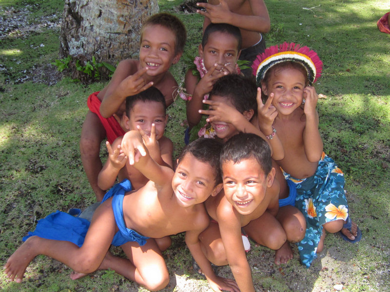
At no time in the nearly 2 weeks we were in Chuuk did we feel threatened. We DID NOT get harassed, shot at, accosted, nor did we have rocks thrown at us. People we met were in general very friendly and helpful, and interested in us. They hardly get any cruisers through Chuuk, so the people we met on the street assumed we were working there or diving there.

We DID abide advice from other cruisers and locals about where and where not to go. (Do: Truk Stop and Blue Lagoon anchorages. Don't: Anywhere else and especially not in the Tol area). And we made sure we were pretty much theft-proofed on board (same as we would cruising most of the Eastern Caribbean and Central America).

Some useful waypoints and information for cruisers following behind us:

SE Pass we used: 07-12.00N / 151-59.74E Outside
07-13.54N / 151-59.47E Inside

This is basically a on direct line from the Mortlocks (Lekinioch/Satawan) to Chuuk. Visibility entering at 8am was fine, and all the hazards in the lagoon matched our CM93 (2010) chart and Google Earth chart reasonably well. From there we went north around Dublon/Tonowas and up the west side of Moen/Weno.

Truk Stop Moorings: 07-26.52N / 151-50.25E
Our Best Anchorage: 07-26.51N / 151-50.205E

The moorings would be preferred, but there are 2 semi-permanent boats there right now. Their moorings are 3/8" chain around coral heads, and they have the best anchoring spots. Where we anchored was as close as we could get with 360-degree swing. We dropped in sand, but ended up hanging over some coral, so we bouyed our anchor chain with buoys at 90' and 125'. Depending on the wind, we ended up in the middle of the "morning rush hour" small boat traffic lanes. Make sure you have a bright anchor light at all times. To get closer in, out of the traffic, there's not enough swinging room.

Dinghy dock is the Truk Stop pier, where we were welcomed, as long as we didn't get in the way of the dive boats. They also didn't mind if we dumped our trash in their bins. Fuel if you need it in small quantities is by jugging. Large quantities of fuel or water could be had by arrangement at the commercial pier. Gasoline was $5.25 per gallon at the gas station.

Commercial Pier: 07-26.69N / 151-50.39E

This is a large/high concrete pier with big black rubber fenders to keep you off the concrete. It is nicely protected from all directions except west. You will need long lines to tie up here, as the bollards are high and widely spaced. There are usually dock workers loitering about to take your lines (you will need someone on shore to get tied up).

Getting on and off the boat at the pier is a problem--a scramble up the high sides of the pier. Almost all the officials opted to deal with us from up on the dock vs coming aboard. One, the Immigration guy on check-out, wanted to come aboard and take a look around. We weren't sure whether he was looking for stow-aways, or just curious. He was nice and friendly and was more interested in our lifestyle than anything else.

There is no one to contact before going in--NO ONE uses VHF in Chuuk (not the officials, not the dive operations or the dive boats). If there's space at the dock, feel free to tie up. Depth to about 25-30 feet, so no problems for sailboats. If there's no space on the south face, you might be able to raft to someone for clearing in, or use the west face of the dock, or anchor close off the west face until you can arrange to come alongside (mandatory we are told for clearing in). The large ships that come in, do dock on the west face, but they only come in for a few hours once every 2 weeks. The dock workers will know if there is a ship coming in soon. Most of the time there was plenty of space at the pier for a sailboat.

There is a 24 hour guard on the dock, so we felt pretty secure, but we still were at Code Yellow status (everything loose on deck stowed below, and the boat locked up when we left). We had no troubles whatsoever anywhere in Chuuk, and had we not been warned about all the possible bad stuff beforehand, we'd have found Chuuk very friendly.

Blue Lagoon Anchorage: 07-24.86N / 151-50.47E

This is nestled up in a sand spot as close in as we could get, with decent protection from NW through E and almost to S. In about 25' sand. We bouyed the anchor with 2 sets of bouys to minimize any coral damage (this is within snorkeling distance of the Blue Lagoon Resort). We went ashore at night, leaving our dinghy on the beach, and had dinner. There is a security guy roaming the grounds.

Blue Lagoon Odyssey Mooring: 07-24.8N / 151-50.4E

This is the mooring for the Odyssey live-aboard dive boat. It is normally vacant except for Saturday and Sunday evenings, when they do the guest change-over. You can probably use it with permission. But we could not raise Odyssey on VHF, even when we came in and anchored very close next to them. There is reportedly another mooring for Odyssey on the east side of the Blue Lagoon peninsula, but we don't know the exact location.

When we asked where we should go if the winds went west, someone told us "on the other side of the airport". Good Google Earth charts of the north and east side of Weno/Moen would be recommended if you're staying long in Chuuk. We did not do any exploring over there, but a day trip on a calm day exploring would be worthwhile, to suss out a spot for a westerly blow.

NW Pass we used on Exit: 07-26.21N / 151-33.05E

This is a wide-open pass with easy exit. The route direct from the Commercial Pier to this pass is fairly easy. Our CM93 (2010) chart showed 2 or 3 small shallow spots, which (on close inspection) we also found on the Google Earth chart. But this pass is 17 miles from the pier/Truk Stop, so you need to get an early start so you're not navigating with the sun in your eyes. There are two or 3 passes to the north of this one that are closer (closest is about 13 miles, and more to the NW so you wouldn't be absolutely into the sun in the afternoon).

Checking out: We started by making sure we had the phone numbers of all the officials we needed to see on checkout when we checked in. (they are listed in our Micronesia Compendium) Then a day ahead of time, call them and set your departure time and make a firm appointment for them to come visit. Understand that the airplane schedule will affect when they visit. Currently, on Sunday night, there is a 3am flight (they will be less responsive in general on Monday because of this). On M-W-Fr, the regular flight is in the morning. On T-Thu-Sat, the regular flight is in the afternoon.

Because we wanted to leave first thing Tuesday morning, we set up for a Monday afternoon checkout, and planned to pay for an extra night and stay at the concrete dock overnight. They said they normally didn't allow checking out a day in advance, but they allowed us to do it. (Dave was so nice and courteous to everyone, I think it helps).

Once we got into the dock, it turned out that Monday was a holiday, and we paid overtime anyway to Immigration and Customs--double on Holidays, a total of $75. But this was our fault, and once informed by the Immig guy, we could have opted to wait til the next day and not pay any overtime (March 31 was "Cultural Day"). If we'd waited til Tues am, we would have only had to pay the port charges ($130 total, itemized, with a receipt, no overtime included).

The only official we had trouble with was again the Port Captain. Never got an answer on his cell phone. I think he never has it on or doesn't carry it. He told us a text message would have been better, because it's there when he turns his cell phone on. He also said he passes the port a couple of times a day, and will see any boats that are there. Once we got him at the boat, he was friendly and efficient. He went away to prepare the "port clearance" paperwork and came back an hour later with that and the "port charges" bill.

Again, everyone was polite and friendly. I think each official wanted another copy of the crew list, even though it was the same one we gave them on clearing in. I had also made several copies of our Cruising Permit in anticipation, but I don't think anyone asked for it.

We dinghied over to Truk Stop for a last meal, and loaded the dinghy that night, and left about 7am Tuesday morning.

Some helpful people--Mason Fritz--associated with Truk Stop (cell 930-6424). Speaks good English, related to several of the officials, and generally very interested in seeing that visiting yachts have a good experience. Also, a guy by the name of Gideon, who is the head/manager of the stevedores at the port. Speaks good English, and knows the workings of the port well. (cell 932-2644). Gideon has family on Puluwat, so if you are going there after Chuuk, you can thank him by carrying a few items for his family (we took a cardboard box, 50lbs of rice and 20 lbs of "turkey tails" to his sister).

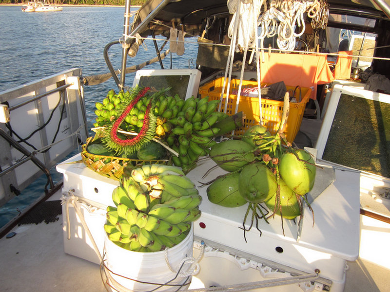
Provisioning: There is an ATM (Bank of FSM) and a grocery store across from Truk Stop. Fair supply of goods. About a block down towards the airport (next to the Yamaha place and just across from the port) is another store with better (and more expensive) stuff. I think it is called Shigato. They had a good supply of veggies after the ship came in. There are two ships. The blue "Hibiscus" ship doesn't carry veggies. The other ship that comes in 3-4 days after Hibiscus has the good veggies, according to the owner of Shigato. Hibiscus is the same ship that stops in Majuro and Kwaj and Pohnpei, so if you figure out the schedule (every 2 weeks) in one of those places, you can have an idea when the ships are due in to Chuuk. Hibiscus came in on a Sunday, and the other ship on Weds. By 10 days after the ship came in, we had trouble finding any veggies that weren't essentially dead. Between Truk Stop and Shigato, there's a Bank of Guam. There's also a lady who sometimes has local vegs for sale (bananas and papayas).

WARNING: We were warned several times NOT to stop at Tol... This is the big set of islands near the far western end of the atoll. These people have a bad reputation as being a bit lawless. It is also pretty reefy getting through there. This is where C'est La Vie ran into trouble. It would be tempting to stop there coming in from the west late in the day, but not recommended. Better to come in the south pass and stop overnight behind Uman, if you have to.

Stopping ANYWHERE but the Commercial Pier, Truk Stop, or Blue Lagoon, and you are likely to be asked for a fee to stay. This is the Chuukese way, and applies to everyone, not just foreign vessels (unless you are part of the clan or connected by friends/family).

This info will all be incorporated into our Micronesia Compendium on svsoggypaws.com when we next have internet, so if you have a later version than A.7, you will have all this info in the Chuuk section already.

Chuuk Wrap-Up

We had a nice time the last few days at Chuuk. Our final count on dives was 15 dives. Deepest depths we went was about 130 feet, but most dives we did you could see all you wanted above 100 feet.

Nitrox matters, so if you can get Nitrox certified before you go, and opt for the $10 per tank Nitrox fee. At least one day, Cindy from the Truk Stop Dive Shop said "you won't need Nitrox today--no need for you to pay for it extra if you don't need it."

Good buoyancy also matters a lot, so an Advanced PADI certification (or equivalent) and practice on maintaining neutral bouyancy is important. When you are in enclosed spaces in a wreck, with lots of silt around, you need absolute minimum "finning". One ill-placed push of a fin will "brown out" the whole area. Rob and Cindy are great at coaching on wreck diving techniques--at at gearing your dive to your likes/dislikes and capabilities. Even as experienced as we are, we learned a lot from them about wreck diving. That's why we recommend Truk Stop over the other dive operations at Chuuk. A very small diver-to-guide ratio means you get real personal service (and fewer people clouding up the wreck you are diving on).

As for "which dive operation", after 10 days in Chuuk and diving with Truk Stop, and seeing the other operations, we felt that Truk Stop was best for diving. The others have more divers and thus less personal attention and not as good diver-to-guide ratio. Truk Stop makes it a point to leave early in the morning so as to be the first on the wrecks in the morning, therefore you have best visibility. People we met who had stayed on Odyssey for a week the previous year said they had a much better experience diving the wrecks with Truk Stop (fewer divers messing up the visibility). But Odyssey apparently had great food, and an open bar. (The bar is quite expensive at both Truk Stop and Blue Lagoon). Truk Stop is in town, so it's easy to go to a store, get cash, see something besides their place (though, there's not much to see). Blue Lagoon is more of an all-encompassing resort, so if you have non-divers with you, they will probably be happier at Blue Lagoon. Blue Lagoon does more boat trips per day, so its easier to pick and choose what dive you want to do. But Truk Stop works really hard to tailor their dives to what you want to see, on any given day. They have 3 boats, so can accommodate both the tech divers and the recreational divers. If you're going out to Odyssey, you might stop at Truk Stop on the way in or out, as Cindy will take you to places she knows Odyssey doesn't go.

The weather turned nasty in Chuuk unexpectedly one afternoon while we were there. Completely un-forecast, the wind went a little west of North, and picked up to about 15-20. We had 2-3 foot waves where we were. We were safe enough, but uncomfortable, and so opted to pick up late in the afternoon and move down to Blue Lagoon, where there was better protection from the north. (another option would have been to pull into the commercial pier, but there wasn't room at the time). Fortunately we had stopped in at Blue Lagoon on our way in to Chuuk and scoped out an anchor spot, and we had a track there. We snuggled in just inside the live-aboard dive boat Odyssey, who was on their Blue Lagoon mooring to change over passengers on the weekend.

Dave and I went into dinner when we stayed overnight at Blue Lagoon--a very nice-looking resort. Compared to Truk Stop, the restaurant at Blue Lagoon has less ambiance, and the food was not nearly as good. A day or two before the next supply ship was due, and they were out of several key ingredients for their menu, so the selection was limited and what we got was uninspiring. But a little cheaper than Truk Stop. Truk Stop has better internet (free for guests).

We did two land tours while in Chuuk. Both were arranged through Truk Stop and conducted by Mason Fritz (cell 930-6424). The first was a drive-around Weno to several World War 2 sights, including a couple of caves, gun emplacements, and Xavier High School. Even without the sights, a couple of hours talking to Mason gives you excellent background and historical information about Chuuk. Second, we arranged with Mason to get a boat to take us to Dublon (now called Tonowas), which was the main island for the Japanese. There truthfully isn't a lot to see--most Japanese things are either levelled--by U.S. bombings, the locals, or typhoon, or so far back in the jungle that it would be a messy hike to visit (which Mason wasn't offering, but could probably be arranged). But Mason took us around the island and we saw some Japanese sights, and got a lot more of the history. We ended the day at his family's residence, next to an old church, and the site of the large Japanese hospital. He arranged for us to see some handicrafts (sold by the makers at a much cheaper price than at the gift shops), and for a taste of local food at his sister's house at the end of the trip. Both trips were well worth the time and expense, if you want to do more than just dive dive dive at Chuuk.

The internet was totally down for the last 2-3 days of our stay. So I can't post pictures now of our land tours. Maybe later.
-----
Sherry & Dave
Heading west across Micronesia in 2014
http://svsoggypaws.blogspot.com

At 04/02/2014 3:25 AM (utc) our position was 07°21.11'N 149°11.54'E
http://svsoggypaws.com/currentposition.htm