Tired, footsore, and bug-bitten, but happy to have gone.
Ciudad Perdida Pictures
Tuesday, July 29, 2008
Back from Ciudad Perdida
We are back from our 6 day hike to Ciudad Perdida (Lost City) in Colombia.
Friday, July 25, 2008
Ciudad Perdid, Hiking Up
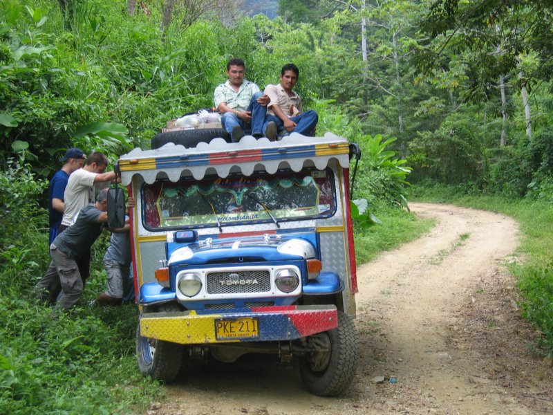
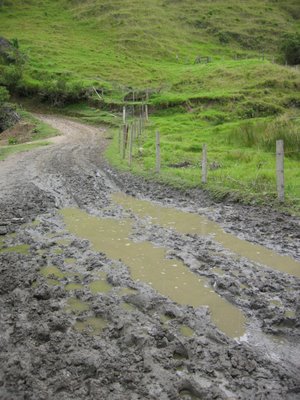
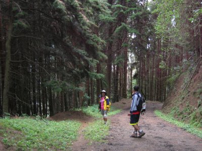
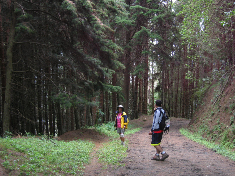
The trip up started with a 2 hr jeep ride... first on road and then on a really bad dirt road. We got stuck once when we had to pull off to let a truck pass. Fortunately it wasn't raining (yet).
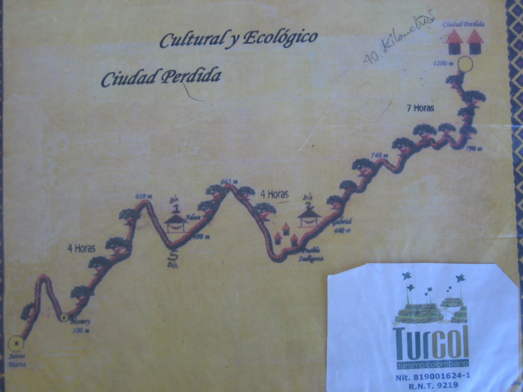
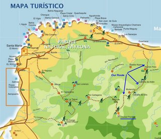
The above map shows the trip. Hiking up took 3 days, where we hiked 4-6 hours a day.
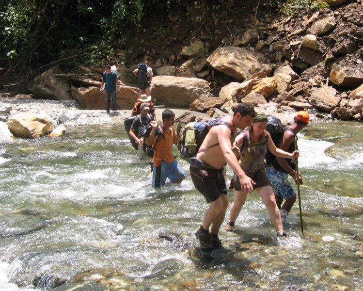
 The first day, we didn't get started hiking until about 2pm, so we ended up hiking the last bit in the rain and rapidly fading light. (Slipping and sliding in the mud).
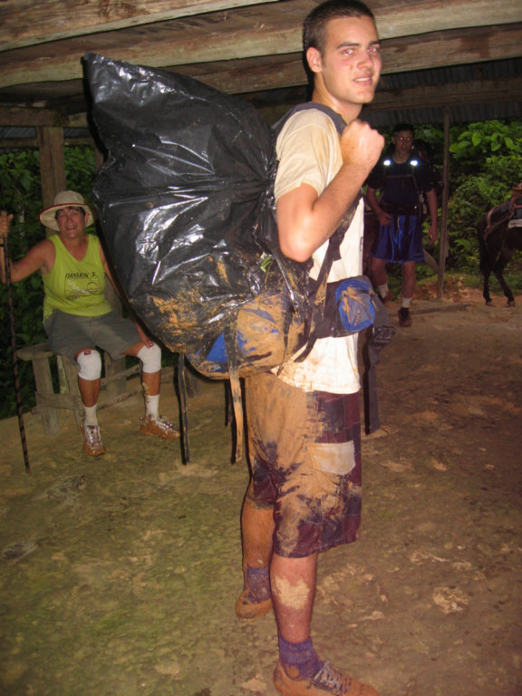
We each carried our own personal packs. Ours we packed as light as possible... 1 set of clothes (shorts/T's) we wore every day while hiking. Then we'd shower and change into our one 'clean' set of clothes. The only thing we had new for every day was clean socks. Between the mud on the first day and the stream crossings on the rest of the days, we needed a change of socks every day. There were plenty of opportunities to wash stuff at the end of the day, but nothing ever quite got dry. So we'd put on damp (but clean) clothes in the morning. They'd just about get dry before we sweated them all up again.
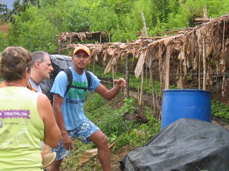
I have to confess that I never had to carry a pack. Jose, our guide, took one look at me (aging, overweight, knee braces) and insisted on carrying my pack. I was delighted, actually, and Jose got a BIG tip as a result.
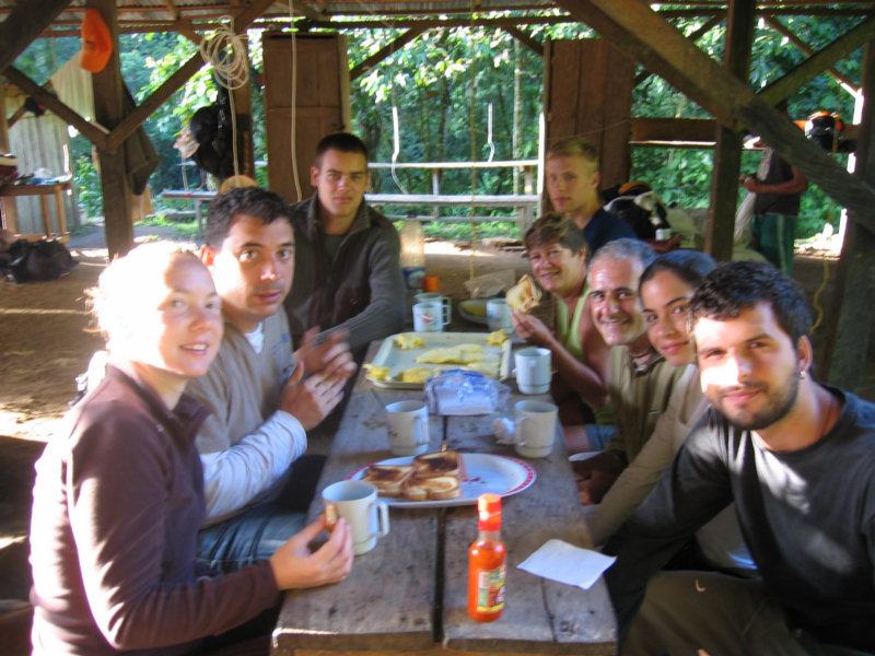
We ended up with 9 'touristas' in our group. Dave and I were the oldest by far. The rest were mostly youngsters, college age to mid-twenties. We did see some younger kids in another group, but no one older than us.
)
At night we slept in hammocks with blankets and mosquito netting. This was the first time most of us actually ever SLEPT in a hammock. It took a little getting used to (especially because I'm normally a stomach-sleeper).
Days 2 and 3 we got an early start and were in camp by about 2pm, before the rains started. We took several rest stops each day, and our guides always had a snack for us (pineapple, mangos, etc). We stopped a couple of times at indigenous villages.
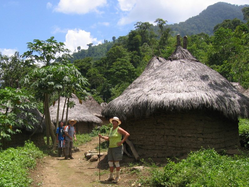
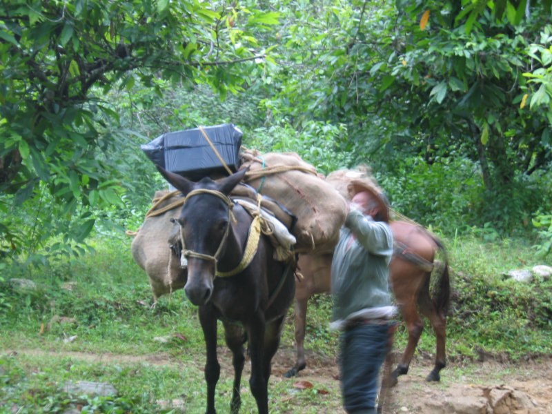
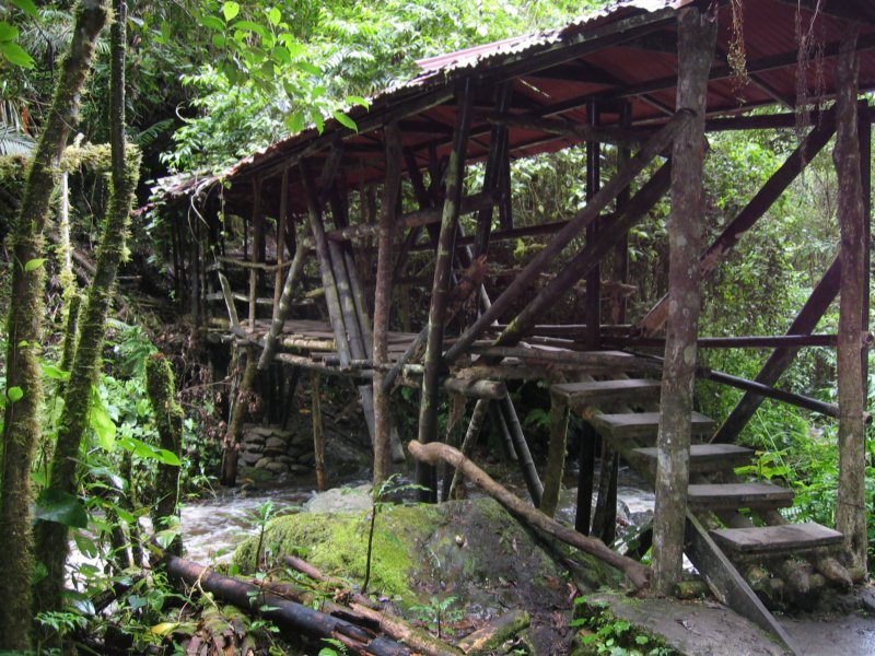
There are NO facilities on the trail, except the camps that the tour companies have set up. They had to pack everything but water in... by mule the first two days, and then using indigenous 'porters' for the last day (mules can't make it).
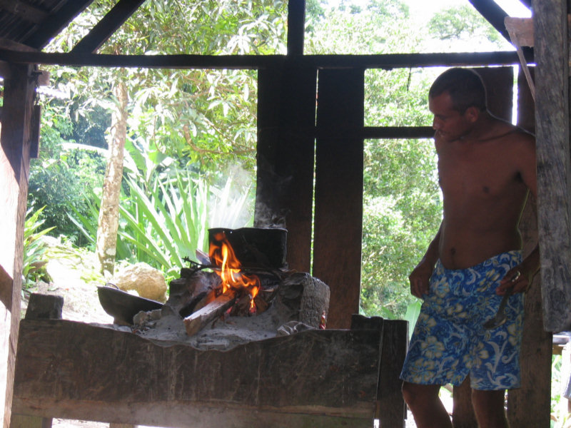
However, the camps were quite decent. In each place they had rigged 'running water' by piping it in from the stream we were camped next to. They had concrete or packed dirt floors, some benches and tables, and an open-air hearth to cook on.
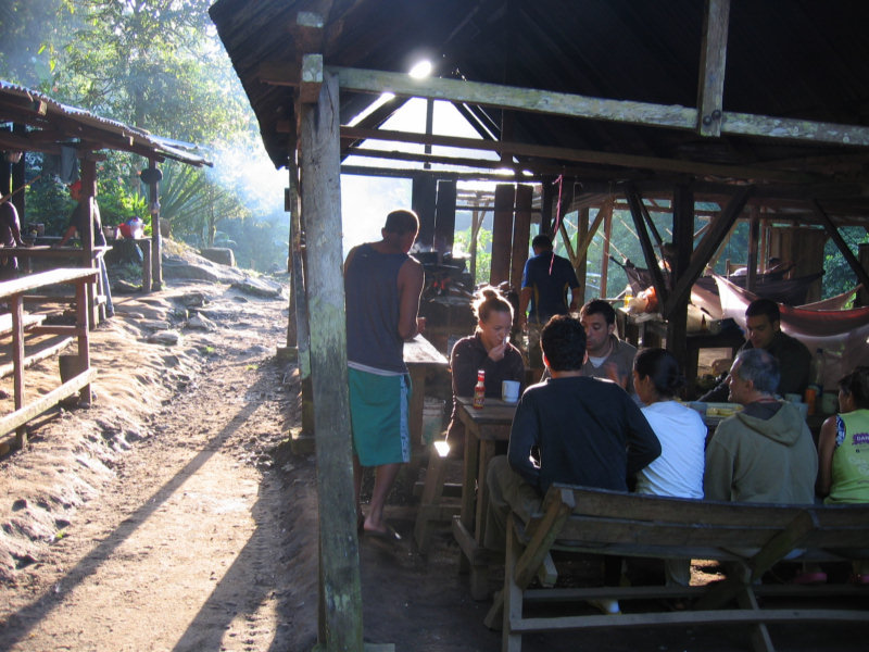
Our guides did all the cooking on the wood-fired campfires. Except for 2 lunches of baloney sandwiches, we had 3 hots a day. Some of our group, though, passed on the 'tuna taco arepas' (fried) for breakfast. But Dave and I ate our fill when it was put in front of us.
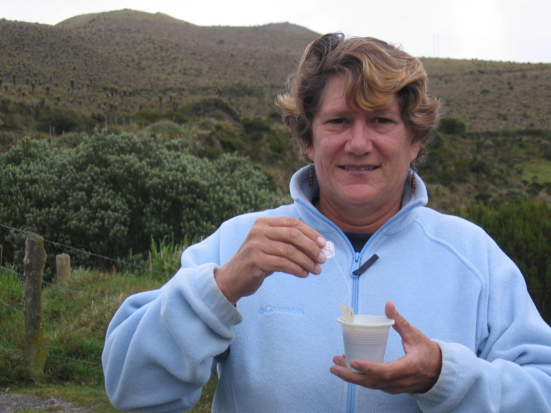
We took 2 water bottles with us, and used our water treatment tables to treat stream water before we set out each day. Several of our group were battling stomach issues on the trip, but we'd been 'in country' long enough to be long over those issues. Though we do take some precautions, we can pretty much eat anything these days without worrying about the 'Montezuma's Revenge'.
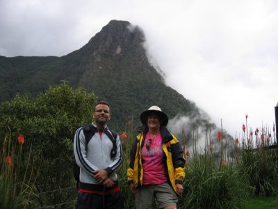
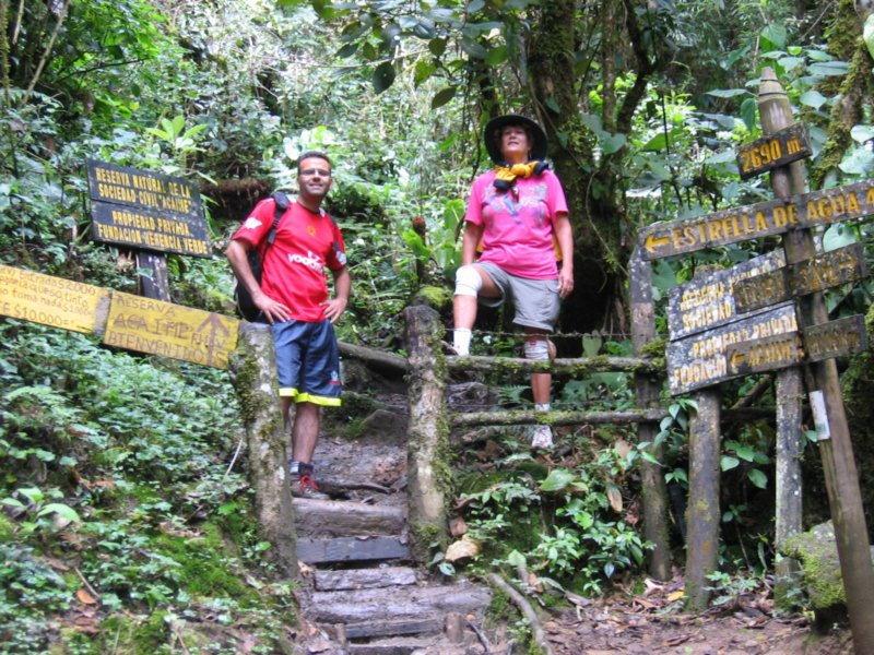
The last day, we crossed the same river 8 times, fording in water as high as our waist. And then we scrambled up 1,300 steps to get to the site.
When we arrived, the first thing that we saw were Colombian soldiers. There is a permanent encampment of soldiers at the site. There are also guards checking permits, people, and luggage on the road. So we felt pretty safe. There hasn't been an incident with tourists in this area since they stopped the fighting in 2003.
And the government is making a huge effort to control the drug trade. Though we did see a few coca plants on our trip... those in the indigenous villages, where they are part of their culture... we didn't see any fields. And in fact, we saw coffee plants being cultivated, as a result of goverment incentives to change out coca for coffee and other legal cash crops.
Once we got up to Ciudad Perdida, we had a day and a half to explore the site and rest, before we had to make our way back down. (next post)
Tuesday, July 22, 2008
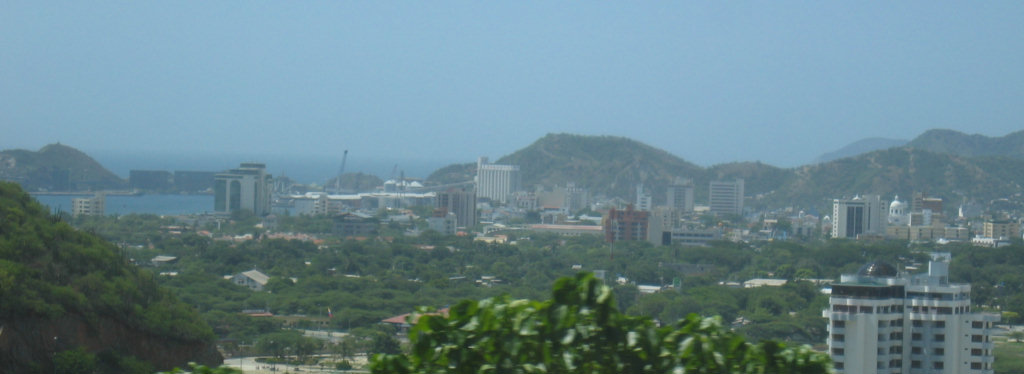
Santa Marta, Colombia
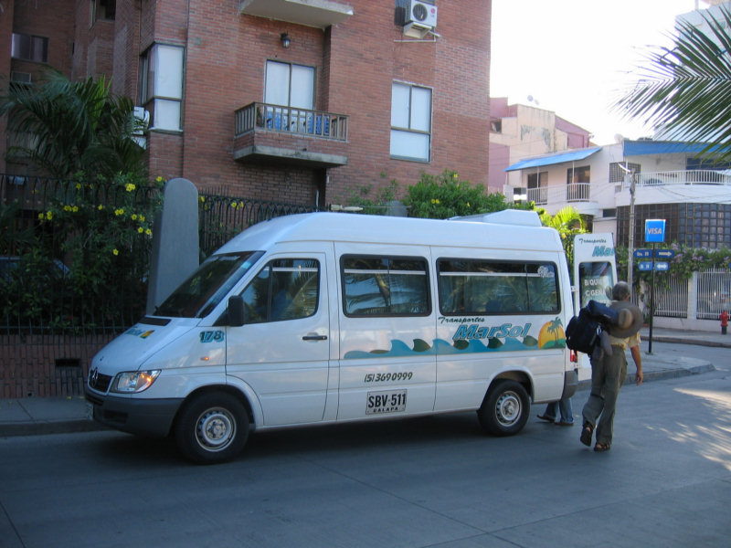 We arrived in Santa Marta today via Baranquilla, where we stopped to pick up Dave's new passport. We used the MarSol Shuttle again for both legs of the trip.
When we got to Santa Marta, we called Turcol, and they came and picked us up from where the shuttle dropped us off (a few blocks away, it turned out). In no time, we had finished the paperwork and had checked in to the hotel next door.
As part of Turcol's 'special price' we received a free night's hotel room at Hotel Sol. Dave said he saw the Turcol lady slip them 40,000 pesos for our room. The location is great... right on the ocean. But the entire establishment is quite run down. Dave declared it "entirely adequate". No hot water in the shower, but no A/C either, so we never missed the hot water.
We spent the afternoon wandering the streets of Santa Marta looking for a few things. We found the local market street and Dave bought a new small backpack. We also found the Exito... a Target-like place. We bought a few snacks for the trip.
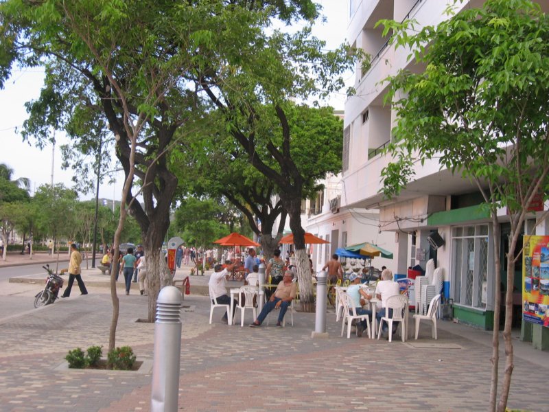
After watching a nice sunset on the water, we ate dinner nearby at an almost-fast-food place that had A/C, and then repacked our backpacks (for the 3rd time).
More Pictures
Monday, July 21, 2008
Colombian Independence Day / Peace Marches
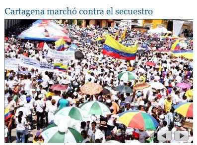
It was really neat to see the 'hearts and minds' campaign at work in Colombia.
The government and the establishment really promoted the idea of a national (and international) demonstration for peace in Colombia.
There were large peace marches in every major city in Colombia, and many places around the world.
On local TV here, the marches were really played up. The message that is being sent is that 'everyone' wants the FARC to quit being bad guys and go home.
There's a lot of PR in this, but our experience in Colombia, talking with the regular people, is that they pretty much all feel that way.
We talked to one guy down in San Agustin that said "If anyone sees any rebels around, they use their cell phone and call the security forces. They are there in 15 minutes, and take them out." EVERYONE these days in Colombia has a cell phone. It would be a powerful weapon for the government if they can get the people to turn against the FARC rebels. Which it seems has happened.
We have also seen signs put up by the government "You have a right to peace."
Everyone is just damned tired of unrest and uncertainty. This country is really set to bloom, if they can just put 'the rebels' behind them.
Sunday, July 20, 2008
Cuidad Perdida Trip
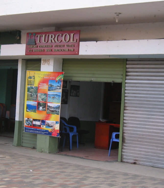
Well, we have officially booked ourselves on the Lost City trip. Tomorrow we catch a shuttle van from Cartagena to Santa Marta, where the trip starts. On the way, we'll stop in Barranquilla and pick up Dave's passport from the US Consular Services Office.
We overnight in Santa Marta, and then on Tuesday morning, we set out in a jeep to the base of the mountain.
 Here's the rough itinerary for the next 6 days:
Day 1: Drive to end of road. Hike uphill 4 hours. Camp at a ranch and sleep in hammocks.
Day 2: Hike 4-5 hours, with a stop at an indigenous village and see coca processing demonstration. Camp at a makeshift camp and sleep in hammocks.
Day 3: Hike a little, cross a river 8 times, walk up a huge number of steep stairs to get to plateau where the ruins are. Camp in wooden building left by archaeologists and sleep in hammocks.
Day 4: Enjoy a guided tour (in Spanish) of the ruins
Day 5: Hike back down 2-days worth to first night's camp
Day 6: Hike the rest of the way down and take jeep back to civilization, beds, and hot showers.
Day 7: (Monday, July 28) Take the shuttle van back to the boat
We are getting a 'rainy season special' from Turcol, the tour company that arranges everything. With this special deal, the trip costs 430,000 pesos ($250) each, and we get one free night's hotel stay in Santa Marta. The trip cost includes everything (jeep transportation, food, lodging, guides, porters/burros (for the food)). We have to carry our own backpacks with our own clothes and bedding.
It will start out hot in Santa Marta (about sea level) and end up at about 4,000 feet, where it will get quite cool at night.
More Info:
One Hiker's Account of the Trip
Lost City Info from HostelTrail.com
Turcol's Page about the Trip
Friday, July 18, 2008
Back on the Boat... for now
We made it back to Cartagena without further incident.
We are enjoying the warm weather... wearing shorts, T-shirts, and sandals for the first time in 2 weeks. And, of course, we are really glad to be home and sleeping in our own bed again.
But, we have one more trip to do before we leave Colombia... Ciudad Perdida (a 6 day hike up a mountain). More to follow.
Thursday, July 17, 2008
Unplanned Overnight in Bogota
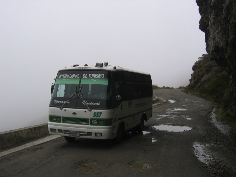
We were supposed to fly back to Cartagena today. We had debated whether to take a 5hr bus to Medellin and fly from there, or fly out of Manizales. We finally opted for the flight from Manizales, it was more expensive but just so much easier. (We paid $220 each one way on Avianca, flying via Bogota).
So we had an easy morning this morning, breakfast and internet before we left. However, once we got to the Manizales airport, we discovered that the airport was closed due to 'bad weather'. The approach end of the runway was fogged in.
The long and short of it is that we did eventually get to Bogota, but all the afternoon flights from Bogota to Cartagena were booked solid. So we had to stay overnight (at our own expense) in Bogota. We have seats on a noon flight out of Bogota.
We are again staying at the Platypus Plus, but the price has gone up since we were here 2 weeks ago... from 45,000 pesos to 75,000 pesos. We negotiated it down to 65,000 (about $37). But the room is the nicest we've stayed in since we left Cartagena, so I don't mind too much.
The place seems pretty full, even at these prices. There seems to be an intermediate class of travelers developing... that demand more than the $7/night backpacker place usually offers, but who don't want to pay 'gringo' prices for the big hotels.
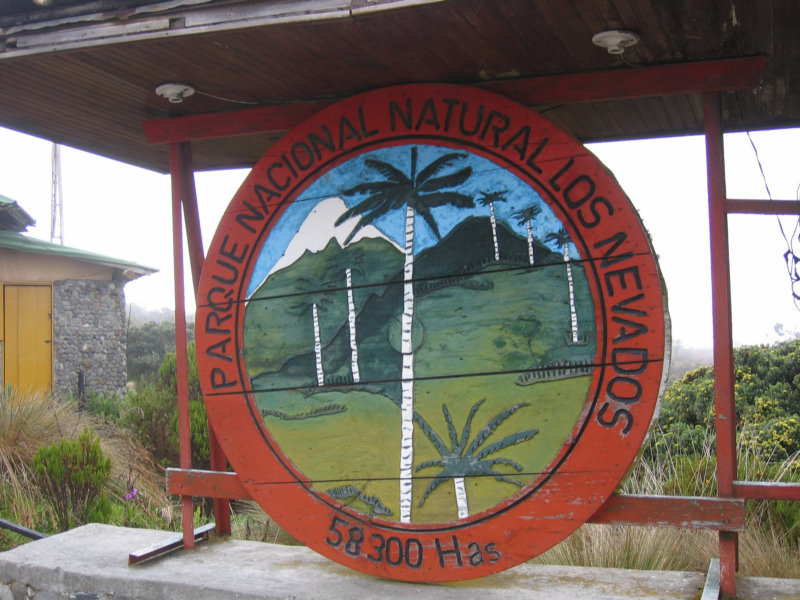
Parque Nacional de Los Nevados (Manizales)
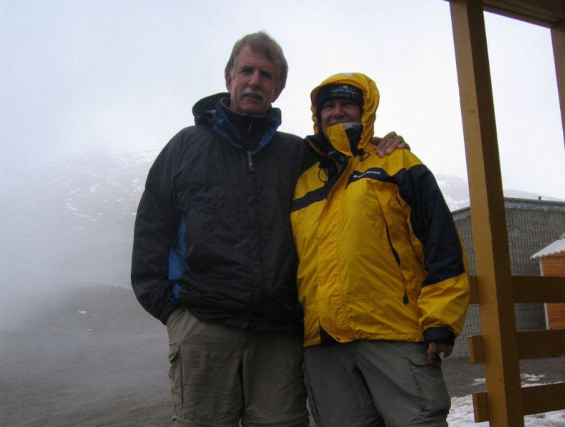
On the advice of Shai, an Israeli friend we hiked with in Salento, we booked an all day tour via Beatrice at Mountain House, to Parque Nacional de Los Nevados. It was expensive... 95,000 pesos (about $55) each. But Shai had raved about the trip and said we MUST do it.
We weren't quite sure exactly what the trip was about... except a spectacular national park, a mountain, and some hot springs. We also knew that it was an all day trip and the price included breakfast, lunch and all entrance fees. (We did get a detailed explanation, in Spanish, from Beatrice, but we didn't follow the whole explanation).
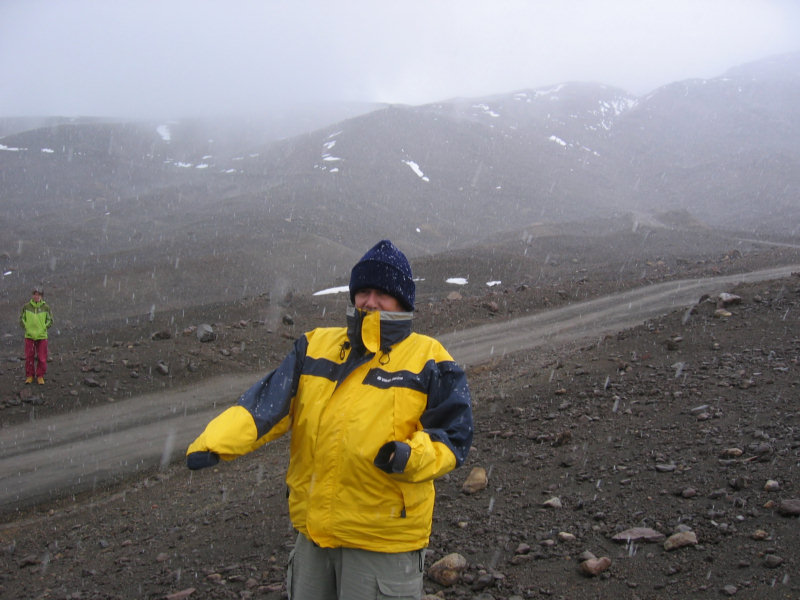
What we didn't know was that this mountain was REALLY high, that we would hike up above the snow line, above 15,000 feet, and that it would be snowing!
We only wore our lightweight multipurpose (zip off at the knee) hiking pants. But did wear our fleece jackets and took rain jackets as well. My jogging shoes were still wet from the hike in Salento, but I took them along with an extra pair of socks, just in case. Otherwise I was wearing my hiking sandals with socks because of the cold. Dave had on 5 layers by the time we were in the snow.
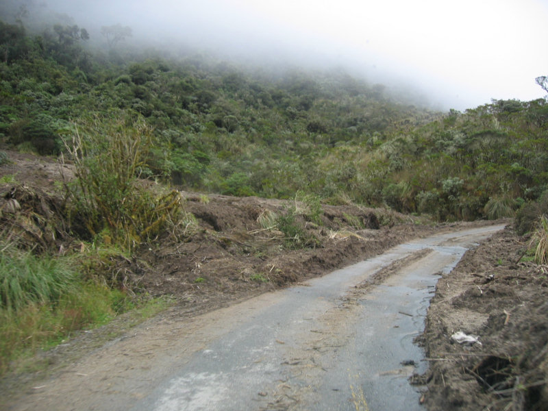
It took us 2 hours in the bus to get from Manizales to the park, with a short stop for breakfast. Our guide, Milton Caesar, also made us buy a bottle of water and some fruit to help with the altitude. Inside the park, the road deteriorated rapidly as we wound our way higher and higher, passing a number of mud slides beside the road. And Milton told us about a big mud slide that happened yesterday and knocked a bus and big truck over a ravine and killed some people. The newspaper said that the main road from Manizales to Bogota will be closed for awhile until they move 40,000 cubic meters of mud off the road.
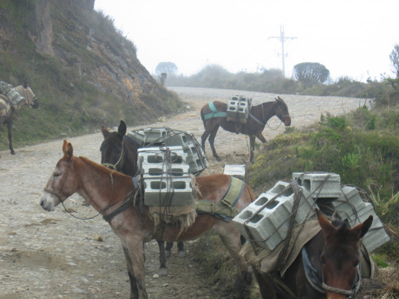 Mule Road Repair
Finally the scenery changed from the amazing green hillsides we were used to, to the more rugged terrain of the higher altitudes. We still kept climbing. At the end, it looked like a moonscape... just rocks and snow with no trees or anything. We stopped a couple of times. At one place, called Laguna Negro, we bought 'coca tea' (to help with altitude sickness). It got colder and colder as we went up. We started out pretty cold, so by the time we stopped near Laguna Negro (Black Lagoon), I bought a wool hat to keep my ears warm. Dave laughed at me, but I was SO glad I had it when we were up on the mountain.
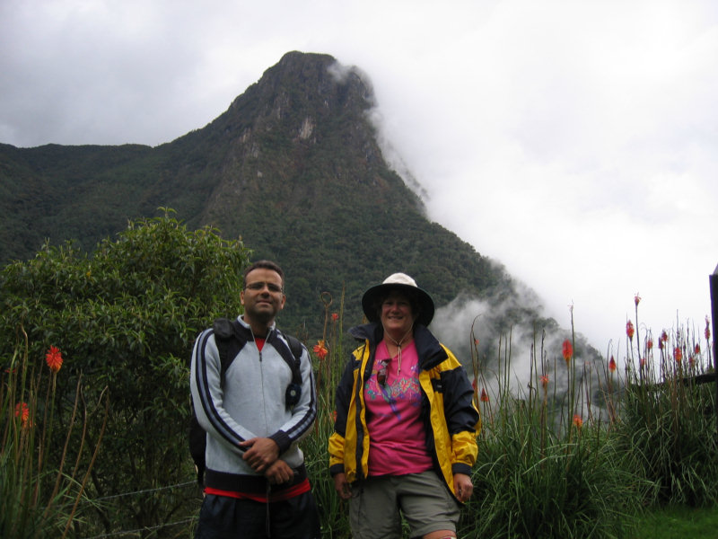
After some time the road ended and we continued up and up on a pot holed gravel track. Our progress was slowed to about 5mph as we bumped along. We finally got to the Refugio at the top of the road, just 300 meters from the top of the highest mountain in the park. It was at about 4,900 meters (16,000 feet), and it was snowing, windy and very cold.
Our guide told us that we couldn't hike all the way to the glacier or mountain top today because of the weather. But we could hike up to the 5,000 meter mark. We didn't feel much 'altitude sickness' until we started climbing up. Then I felt a headache, dizziness, and shortness of breath. We'd walk about 10 steps and then stop and rest. I couldn't catch my breath, and my heart was pounding. It was agonizing, but at least for once I wasn't worrying about my knees.
 The original goal was to hike to the flag (about 4,950 meters). But then the guide told us we 'had' to go on up to the 5,000 meter mark. At that point I had had enough, and decided to stay there. But Dave went on with most of the rest of the group. However, after a few minutes of rest, I kept going up as well. Finally I made it to just 5,003 meters. Dave made it a little higher, to 5024 meters, before the guide made everyone turn back because of the time. We verified the height with my portable GPS, of course (5,000 meters = 16,404 feet).
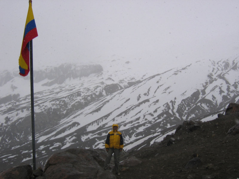
Back on the bus, everyone was totally wiped out, even the guide.
Then we bumped and wound our way back down the bad road to the hot springs (and lunch). At that point, I was so woozy that I was just hoping that it was getting so late that we'd skip the hot springs and go on down. I was still dizzy and exhausted from the hike, and the bouncing bus was making me a little nauseous (me, with the cast iron stomach).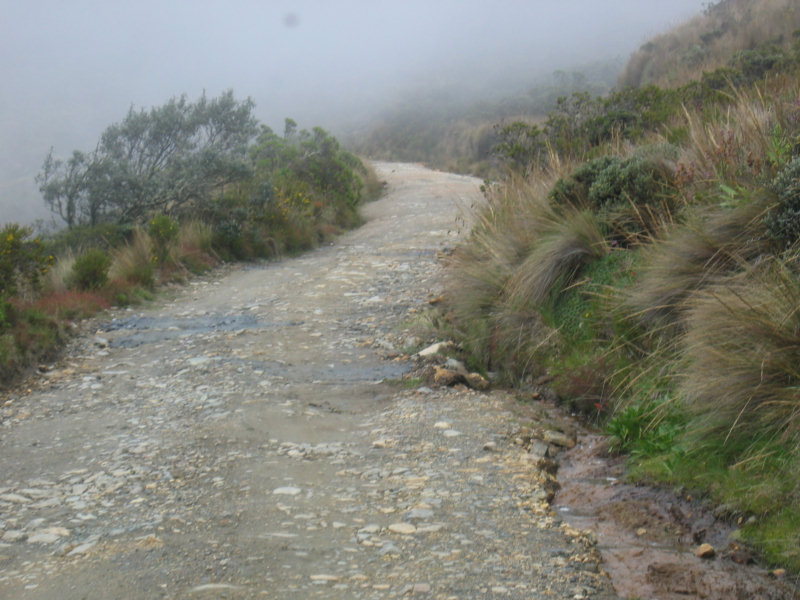
But we finally made it to the hot springs. After a good hot lunch, and a soak in the hot springs, I was finally warmed up and felt much better. But even a few hours later, I was still feeling the effects--it felt like I'd been up partying all night.
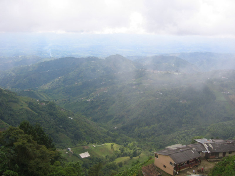
The trip back down the mountain to Manizales was spectacular! We were well above the cloud line and had to descend almost 10,000 feet. As the sun was setting we could see the cloud tops and green sunlit fields and forests far below. Since the van was moving at such a rapid pace and the windshield was still wet from the snow, it was hard to get a good photo that would show what we were seeing. The sheer drops and scenery reminded us of pictures we have seen of trekking in the Himalayas.
Early on Milton had told us that the road in the park was the 5th highest in the world behind three in the Himalayas and one in the Cordillera Blanca in northern Peru. What a trip and what a place! We finally got back to our hostel in Manizales at about 6 PM, just in time for dinner and a good sleep.
Even though it was a tough hike, we were really glad we went. We highly recommend this trip to others.
More pictures of the Los Nevados hike
Wednesday, July 16, 2008
Moving on to Manizales
We left Salento with mixed feelings... regret because we never made it to the coffee plantation tour. We heard the small coffee farmer that does the local tour looks just like Juan Valdez and does a good tour.
But it rained the afternoon we were going to go, and we just decided we didn't feel like slogging thru the muddy roads (with our last remaining pair of clean shoes and socks) to get there.
But we were ready to move on... the kind of grungy surroundings at Plantation House were getting to us.
So we took a two-hop bus trip from Salento to Pereira and from there into Manizales. We got a $3 taxi from the bus station. Everything went perfectly and we were at the Mountain House by 11:30am.
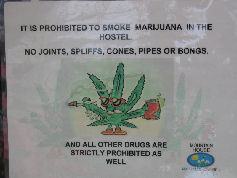
 After a look at our room (nice), we got a very nice local briefing by Beatrice, the manager. We also booked ourselves on an all day tour to a mountain for the next day, as recommended by our friend, Shai. We made note of this interesting sign on the 'smoking porch'. I guess people are obeying the rules, we never smelled anything funny while we were there.
We then set off on foot to see what we could of Manizales in an afternoon. We walked up to the Cable Mall (just a few blocks away) and did a little sightseeing in a 3 story mall. We had lunch in the food court (a Colombian 'Ejecutivo Lunch Special', though, not McDonalds).
Then we caught a local bus headed for 'Chipre'. Chipre is an area in Manizales that runs along a ridge with a great view over one of the valleys. There are two parks and some more beautiful scenery.
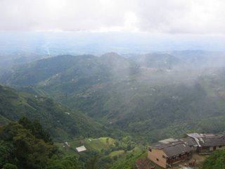
View from Chipre
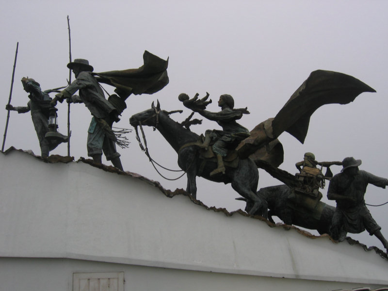
One of the parks has a really interesting sculpture that is a tribute to the founders of the city. Unfortunately, the writeup about the scene is all in Spanish and we didn't take the time to translate it. But it looks like an interesting story.
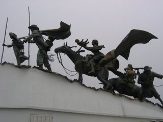
Monument to Early Settlers
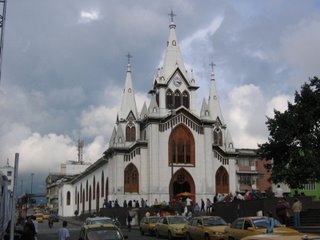
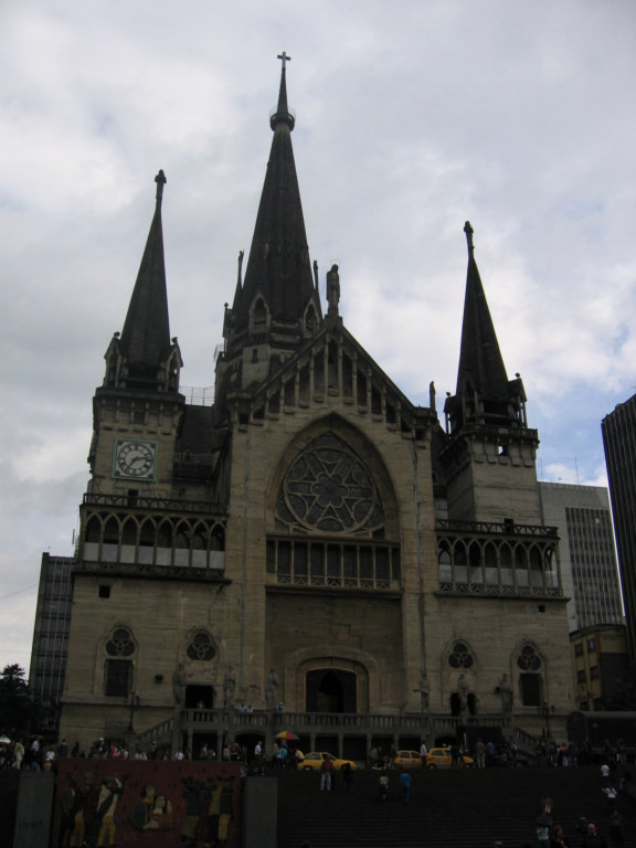
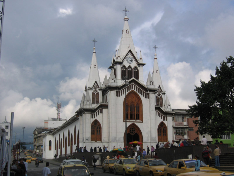
Then we walked down into the center of Manizales, to look at the 'historical center'. We found a church that the locals claim to be the 3rd highest in the world.
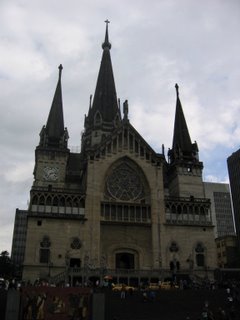
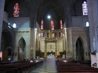
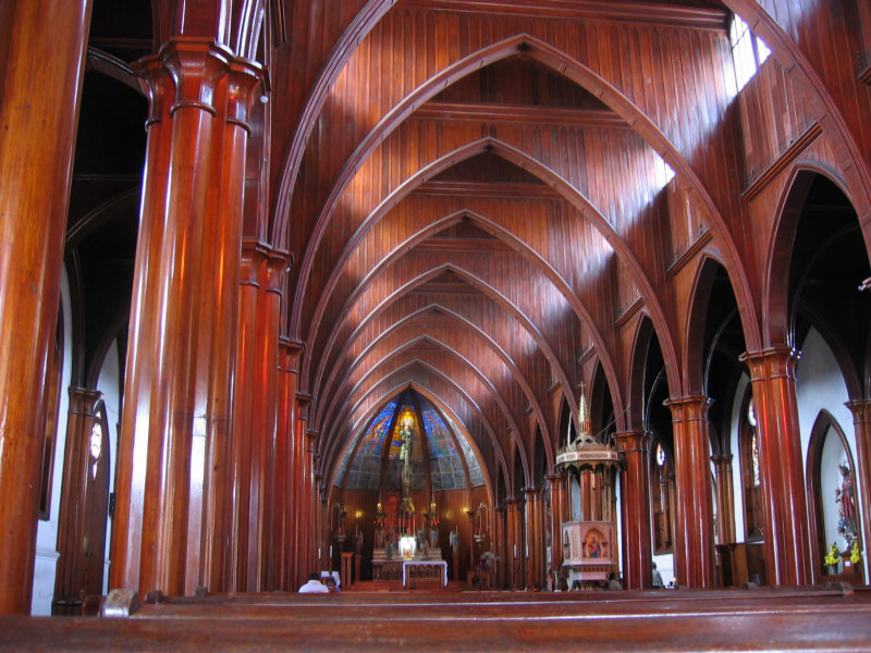
We went into another church that had all the big arches and the altar made completely of cedar (no stone).

We just enjoyed strolling the streets. Manizales has 10 colleges and a total college student population of about 50,000, so it's a pretty lively town.
When we got tired, we hopped another bus heading back to 'Cable'. As everywhere in Colombia, the buses are plentiful and cost only about 75 cents to ride.
More Manizales City Pictures
But it rained the afternoon we were going to go, and we just decided we didn't feel like slogging thru the muddy roads (with our last remaining pair of clean shoes and socks) to get there.
But we were ready to move on... the kind of grungy surroundings at Plantation House were getting to us.
So we took a two-hop bus trip from Salento to Pereira and from there into Manizales. We got a $3 taxi from the bus station. Everything went perfectly and we were at the Mountain House by 11:30am.
 After a look at our room (nice), we got a very nice local briefing by Beatrice, the manager. We also booked ourselves on an all day tour to a mountain for the next day, as recommended by our friend, Shai. We made note of this interesting sign on the 'smoking porch'. I guess people are obeying the rules, we never smelled anything funny while we were there.
We then set off on foot to see what we could of Manizales in an afternoon. We walked up to the Cable Mall (just a few blocks away) and did a little sightseeing in a 3 story mall. We had lunch in the food court (a Colombian 'Ejecutivo Lunch Special', though, not McDonalds).
Then we caught a local bus headed for 'Chipre'. Chipre is an area in Manizales that runs along a ridge with a great view over one of the valleys. There are two parks and some more beautiful scenery.
One of the parks has a really interesting sculpture that is a tribute to the founders of the city. Unfortunately, the writeup about the scene is all in Spanish and we didn't take the time to translate it. But it looks like an interesting story.
Then we walked down into the center of Manizales, to look at the 'historical center'. We found a church that the locals claim to be the 3rd highest in the world.

We went into another church that had all the big arches and the altar made completely of cedar (no stone).
We just enjoyed strolling the streets. Manizales has 10 colleges and a total college student population of about 50,000, so it's a pretty lively town.
When we got tired, we hopped another bus heading back to 'Cable'. As everywhere in Colombia, the buses are plentiful and cost only about 75 cents to ride.
More Manizales City Pictures
Sunday, July 13, 2008
Hiking in Cocora Valley
The scenery even at the hotel is breathtaking. But we had heard so much about hiking in Valle de Cocora that we decided to go hiking in the valley yesterday. We had lots of adventures.
Our first adventure was the ride from town to the valley. We picked up a collectivo jeep in the Salento town square at 9am for the hour long ride to the Valle de Cocora. When they hustled us to the jeep, Dave thought it was too crowded (there were only 5 people in it then). By the time we arrived at our destination, there were 18 people in and on that Jeep!

The women and children went inside... 3 in the front seat (plus driver) and we had 6 adults and 3 children in the back. Dave and the other guy with us rode by standing on a 10" wide platform bolted across the back of the jeep, and hanging onto the top. They ended up with 5 guys hanging on the back. The last guy to get picked up rode sitting on the metal rack on top of the jeep. The 50 minute ride only cost us $1.50, and the driver went pretty slow, so as not to lose any passengers. Sorry we were too busy hanging on to get pictures!

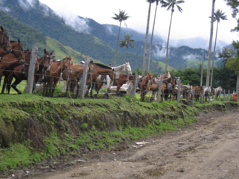
Horses for Rent at the Trailhead
We ended up hiking 15 km through the mountains and forests without a map of any kind. The owner of the Plantation House said we could get a map in town. In town they said we could get a map up in the 'park'. Up in the park they said they didn't have any maps, but we could hire a guide. We decided to wing it on our own.
If we'd have known we couldn't get a printed map, we would have asked someone at the hostal to sketch a trail chart for us by hand. Fortunately the main crossroads have signposts. And we did find a few people to ask (in Spanish) along the way, to confirm we were on the right trail.

Anyway, we asked the guy from the jeep where to start, he pointed to the path with the blue metal gate, leading off the road.

We Set Out With No Map
Tim from Plantation House had encouraged us to rent 'Wellies' (boots) from him for hiking, for about $3 a day, because the trails and roads can get pretty muddy. We had weighed the pros and cons and decided to go with our own shoes. My jogging shoes have nice support, and are very light, and by now they are pretty much trashed as jogging shoes. So I wasn't too worried about getting them muddy, and I didn't want to hike in uncomfortable rubber boots. Dave brought some rugged 'water shoes' that he likes to hike in. For the first half mile we thought it wasn't too bad, and congratulated ourselves on the good decision. After that, the trail got muddier and muddier.
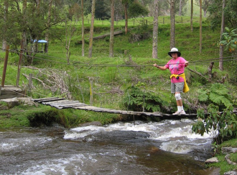
On the way up to our first stop, the trail runs along the Quindio River (strong stream at this point). We ended up crossing this river 6 times on rickety foot bridges. In one short stretch, the trail had fallen into the river, and we had to hike up into the woods for a few hundred yards. Getting back down to the trail, Dave slipped and got all muddy (sorry no picture).

Our First Bridge
 >
>A Better Bridge
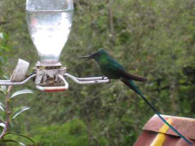
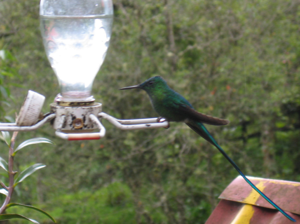
After hiking for 2 hours, mostly uphill, and on some very muddy trails, we finally reached Acaime. We had seen some 2'x1' hand-lettered signs advertising hot drinks and a place to spend the night at Acaime. It turned out to be a very nice little place run by a nice old couple. They have hummingbird feeders out, and just sitting there having a cup of coffee, we saw about 4 different varieties... from black and white ones to an iridescent green one with a long tail. That was WAY cool.

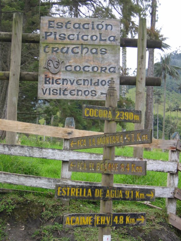
Sherry and Shai at Another Signpost
 An Iridescent Green Hummingbird
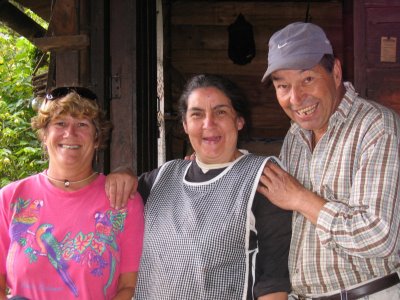 Our Hosts
It is possible to stay the night at this small place, for 10,000 pesos. The rooms looked clean and comfortable. There are some other hikes from this location, one to a mirador (scenic overlook) about a half hour away.
In the 2 minute description of the hike given to us by Tim of Plantation House the afternoon before, he had mentioned 2 places to go, Acaime and Montana. In our marginal Spanish, we queried the man at the Acaime house where the other place was. It turned out to be Finca del Montana (Ranch of the Mountain). At that point, we had two options, we could retrace our steps, or try to find Finca del Montana, and go down a different way (which turned out to be a dirt road rather than a hiking trail). The guy told us it was only marginally longer to go back via Montana. So we decided to go for it.
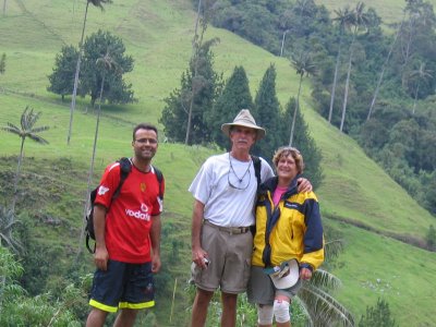
We retraced our steps about 45 minutes, crossing back over one of the 6 bridges, to the crossroads (where I'd previously seen the sign for Finca del Montana), and headed up the trail in that direction. After an hour of hard slogging on muddy trails, we finally made it up to Finca del Montana. In spite of the fact that the mud sucked my shoe off my foot and I ended up with totally muddy and wet feet, and the last quarter mile was nearly straight uphill, it was totally worth it. The view from that spot was fantastic. We were now up nearly 10,000 feet, and could see the whole valley (and the mountain) before us. The clouds drifted in and out around us and below us, making for some really exotic pictures.
Above the Clouds at Finca La Montana
Dave asked them if they rented rooms up there. They do, for 16,000 pesos per night. The manager's name is Luis Alberto and you can call ahead for reservations at 746-0665 (or -0641, -0645). You can actually take a jeep all the way up there, if you want to. Or horses.
They asked us to sign their book. This is fairly common in the parks... the government likes to track where their tourism is coming from. I glanced at the other signatures on the page. Mostly Colombian. There were no other Americans. Shai, the guy hiking with us, was from Israel, and he said he saw no other Israeli's there either.
Headed Back Down
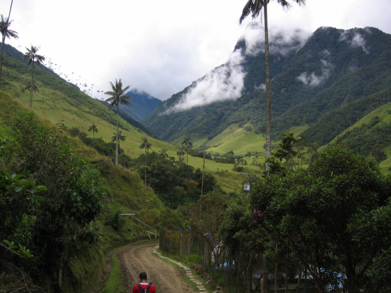
Luis at the finca told us it was about a 45 minute hike down from there. "Oh good, we can make the 4 o'clock jeep". Well, 4 o'clock came and went and there was no sign of the the little cluster of buildings where the jeeps were. Since we were now hiking on a road, we had hoped to maybe hitch a ride down with someone, but we never saw another soul all the way down. Lots of cows, lots of wax palms, and incredible views, but no people. We stopped a couple of times to rest and enjoy the view, and finally made it down to the jeep area just before 5:00.
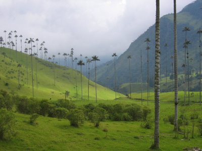
The Famous Wax Palms of Cocora Valley
 Glad to be Back!
There we met a couple of Germans that had passed us on horses quite awhile back. They were also waiting for a jeep. They told us their 2 hour horse trip (to Finca de la Montana) cost 45,000 pesos each. That included a guide to show you the trail and hustle the horses along.
The 5:00 jeep filled up with locals rather quickly, and our only option would have been riding outside. None of us really wanted to hang outside for the 45 minute trip back, after 7 hours of hiking. So we ended up hiring our own jeep... 24,000 pesos and we had the whole jeep to ourselves. Split 5 ways, it only cost us a dollar more apiece.
When we got to the square in Salento, it looked like they were preparing for a fiesta. The square was lined with food stalls and people were everywhere. We weren't sure whether this was regular weekend tourist traffic, or whether there was something special going on. Even though we were wet and muddy from hiking, we were starving (no lunch on the trail), so we decided to sit right there and eat. We had a delicious 'trout in garlic sauce' for about $6 apiece.
More Pictures of Salento and the Cocora Valley
Our first adventure was the ride from town to the valley. We picked up a collectivo jeep in the Salento town square at 9am for the hour long ride to the Valle de Cocora. When they hustled us to the jeep, Dave thought it was too crowded (there were only 5 people in it then). By the time we arrived at our destination, there were 18 people in and on that Jeep!
The women and children went inside... 3 in the front seat (plus driver) and we had 6 adults and 3 children in the back. Dave and the other guy with us rode by standing on a 10" wide platform bolted across the back of the jeep, and hanging onto the top. They ended up with 5 guys hanging on the back. The last guy to get picked up rode sitting on the metal rack on top of the jeep. The 50 minute ride only cost us $1.50, and the driver went pretty slow, so as not to lose any passengers. Sorry we were too busy hanging on to get pictures!
We ended up hiking 15 km through the mountains and forests without a map of any kind. The owner of the Plantation House said we could get a map in town. In town they said we could get a map up in the 'park'. Up in the park they said they didn't have any maps, but we could hire a guide. We decided to wing it on our own.
If we'd have known we couldn't get a printed map, we would have asked someone at the hostal to sketch a trail chart for us by hand. Fortunately the main crossroads have signposts. And we did find a few people to ask (in Spanish) along the way, to confirm we were on the right trail.
Anyway, we asked the guy from the jeep where to start, he pointed to the path with the blue metal gate, leading off the road.
Tim from Plantation House had encouraged us to rent 'Wellies' (boots) from him for hiking, for about $3 a day, because the trails and roads can get pretty muddy. We had weighed the pros and cons and decided to go with our own shoes. My jogging shoes have nice support, and are very light, and by now they are pretty much trashed as jogging shoes. So I wasn't too worried about getting them muddy, and I didn't want to hike in uncomfortable rubber boots. Dave brought some rugged 'water shoes' that he likes to hike in. For the first half mile we thought it wasn't too bad, and congratulated ourselves on the good decision. After that, the trail got muddier and muddier.

On the way up to our first stop, the trail runs along the Quindio River (strong stream at this point). We ended up crossing this river 6 times on rickety foot bridges. In one short stretch, the trail had fallen into the river, and we had to hike up into the woods for a few hundred yards. Getting back down to the trail, Dave slipped and got all muddy (sorry no picture).
 >
>After hiking for 2 hours, mostly uphill, and on some very muddy trails, we finally reached Acaime. We had seen some 2'x1' hand-lettered signs advertising hot drinks and a place to spend the night at Acaime. It turned out to be a very nice little place run by a nice old couple. They have hummingbird feeders out, and just sitting there having a cup of coffee, we saw about 4 different varieties... from black and white ones to an iridescent green one with a long tail. That was WAY cool.
 An Iridescent Green Hummingbird
 Our Hosts
It is possible to stay the night at this small place, for 10,000 pesos. The rooms looked clean and comfortable. There are some other hikes from this location, one to a mirador (scenic overlook) about a half hour away.
In the 2 minute description of the hike given to us by Tim of Plantation House the afternoon before, he had mentioned 2 places to go, Acaime and Montana. In our marginal Spanish, we queried the man at the Acaime house where the other place was. It turned out to be Finca del Montana (Ranch of the Mountain). At that point, we had two options, we could retrace our steps, or try to find Finca del Montana, and go down a different way (which turned out to be a dirt road rather than a hiking trail). The guy told us it was only marginally longer to go back via Montana. So we decided to go for it.
We retraced our steps about 45 minutes, crossing back over one of the 6 bridges, to the crossroads (where I'd previously seen the sign for Finca del Montana), and headed up the trail in that direction. After an hour of hard slogging on muddy trails, we finally made it up to Finca del Montana. In spite of the fact that the mud sucked my shoe off my foot and I ended up with totally muddy and wet feet, and the last quarter mile was nearly straight uphill, it was totally worth it. The view from that spot was fantastic. We were now up nearly 10,000 feet, and could see the whole valley (and the mountain) before us. The clouds drifted in and out around us and below us, making for some really exotic pictures.
Dave asked them if they rented rooms up there. They do, for 16,000 pesos per night. The manager's name is Luis Alberto and you can call ahead for reservations at 746-0665 (or -0641, -0645). You can actually take a jeep all the way up there, if you want to. Or horses.
They asked us to sign their book. This is fairly common in the parks... the government likes to track where their tourism is coming from. I glanced at the other signatures on the page. Mostly Colombian. There were no other Americans. Shai, the guy hiking with us, was from Israel, and he said he saw no other Israeli's there either.
Luis at the finca told us it was about a 45 minute hike down from there. "Oh good, we can make the 4 o'clock jeep". Well, 4 o'clock came and went and there was no sign of the the little cluster of buildings where the jeeps were. Since we were now hiking on a road, we had hoped to maybe hitch a ride down with someone, but we never saw another soul all the way down. Lots of cows, lots of wax palms, and incredible views, but no people. We stopped a couple of times to rest and enjoy the view, and finally made it down to the jeep area just before 5:00.

 Glad to be Back!
There we met a couple of Germans that had passed us on horses quite awhile back. They were also waiting for a jeep. They told us their 2 hour horse trip (to Finca de la Montana) cost 45,000 pesos each. That included a guide to show you the trail and hustle the horses along.
The 5:00 jeep filled up with locals rather quickly, and our only option would have been riding outside. None of us really wanted to hang outside for the 45 minute trip back, after 7 hours of hiking. So we ended up hiring our own jeep... 24,000 pesos and we had the whole jeep to ourselves. Split 5 ways, it only cost us a dollar more apiece.
When we got to the square in Salento, it looked like they were preparing for a fiesta. The square was lined with food stalls and people were everywhere. We weren't sure whether this was regular weekend tourist traffic, or whether there was something special going on. Even though we were wet and muddy from hiking, we were starving (no lunch on the trail), so we decided to sit right there and eat. We had a delicious 'trout in garlic sauce' for about $6 apiece.
More Pictures of Salento and the Cocora Valley
Saturday, July 12, 2008
Bus trip Popayan to Salento
After another 6 hour bus trip, we arrived in Salento about 3pm yesterday.
We took a bus from Popayan to Armenia, and then grabbed a local bus from Armenia to Salento. We were supposed to get the 'direct' bus from Popayan, that leaves at 8am and bypasses Cali. But we got to the bus station a little too early, and found ourselves hustled onto the ready-to-go 7:30 bus, which did pass through Cali. So the trip took a little longer. But it was on mostly good roads, and we weren't in a hurry.
The Bus Station in Cali

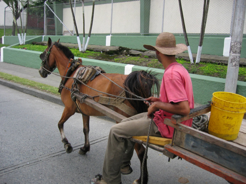
A Horse Cart in Traffic

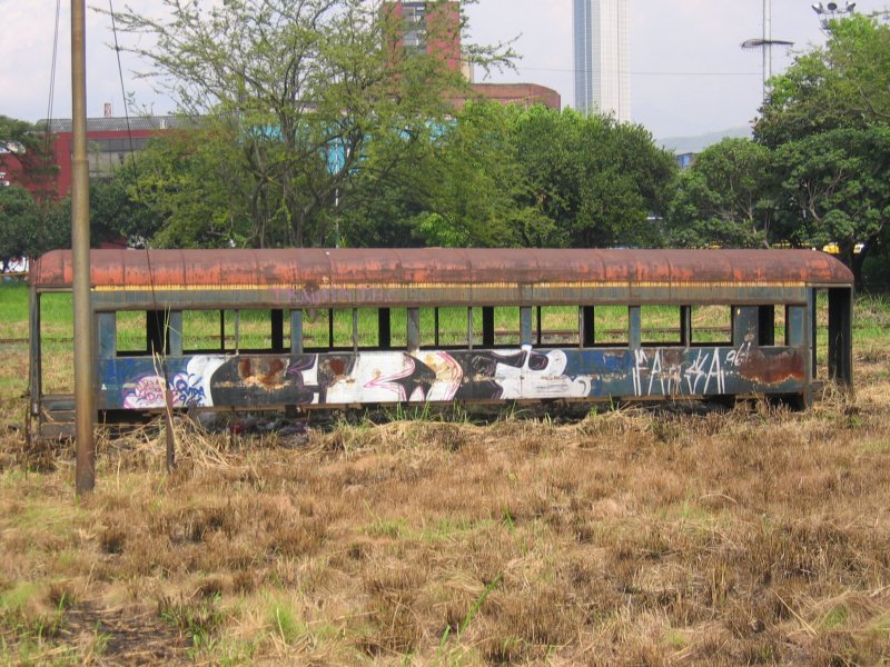
The Remains of the National Rail System
We are staying at the Plantation House, another backpacker place. This one is in a beautiful location, and our window overlooks the valley below. It is a typical backpacker place with a bunkhouse, a few single rooms, and a couple of doubles. The people staying here are from all over the world, budget travelers like us. The owner is nice and friendly. It is a little out of town, so no traffic noise or loud music from town. But it seems a little run down and not real clean, compared to the other places we've been staying. If we came back to Salento, we'd look for another place in the same price range. We have seen a few small hotels here, though Googling 'hostal Salento' doesn't bring up anything but references to this place.
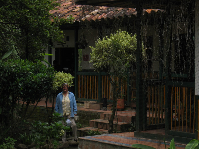
The Plantation House

The Courtyard

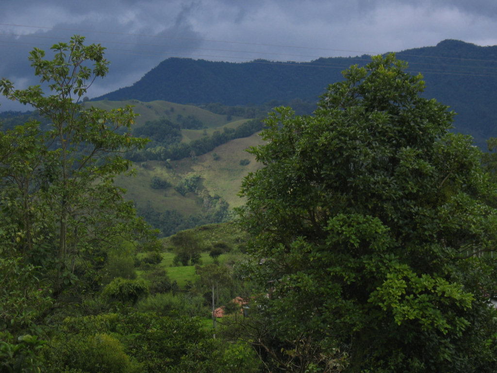
The Plantation House View
We had some time in the afternoon to walk around the small town of Salento. It is obvious that it is a tourist town... a whole street full of souvenier shops. The area is famous for its trout, and we saw lots of restaurants advertising trout for dinner, cooked about 20 different ways.
More Pictures
We took a bus from Popayan to Armenia, and then grabbed a local bus from Armenia to Salento. We were supposed to get the 'direct' bus from Popayan, that leaves at 8am and bypasses Cali. But we got to the bus station a little too early, and found ourselves hustled onto the ready-to-go 7:30 bus, which did pass through Cali. So the trip took a little longer. But it was on mostly good roads, and we weren't in a hurry.
We are staying at the Plantation House, another backpacker place. This one is in a beautiful location, and our window overlooks the valley below. It is a typical backpacker place with a bunkhouse, a few single rooms, and a couple of doubles. The people staying here are from all over the world, budget travelers like us. The owner is nice and friendly. It is a little out of town, so no traffic noise or loud music from town. But it seems a little run down and not real clean, compared to the other places we've been staying. If we came back to Salento, we'd look for another place in the same price range. We have seen a few small hotels here, though Googling 'hostal Salento' doesn't bring up anything but references to this place.

We had some time in the afternoon to walk around the small town of Salento. It is obvious that it is a tourist town... a whole street full of souvenier shops. The area is famous for its trout, and we saw lots of restaurants advertising trout for dinner, cooked about 20 different ways.
More Pictures
Subscribe to:
Posts (Atom)