Thursday, June 30, 2016

Waisai and the End of the Rally

June 17-21 (yes, I am way behind!)

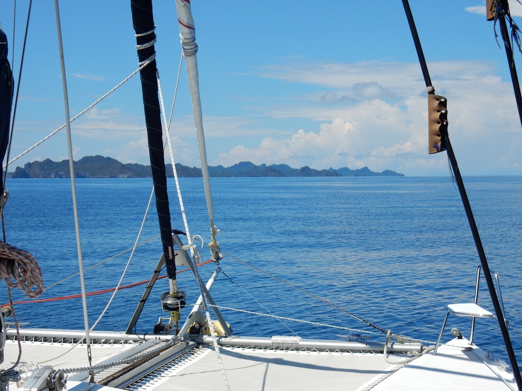
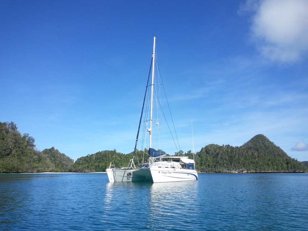
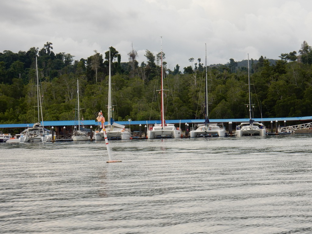
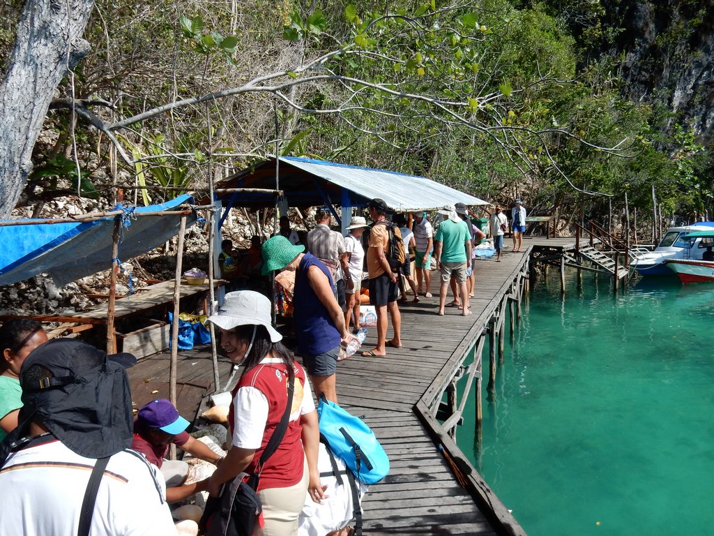
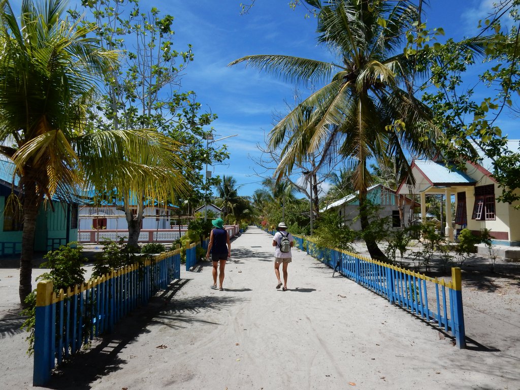
The last official stop on our Sail Samal 2 Raja Ampat Rally was Waisai. Waisai is a small tourist town on the south coast of Waigeo Island. It is the recently-constructed capital of Raja Ampat Regency. Every year as cruisers visit Waisai they find more infrastructure to support their booming dive/snorkel tourism business. One feature we were amazed to find, was a small marina that had been built for visiting yachts. It has a long floating pier with slips designed to accommodate big catamarans. The local tour boats and small island ferry boats also use it as the departure point for their tours and ferry trips. We were amazed that they could find room to fit 6 boats--5 cats over 40 feet, and a monohull, on their dock.

Our Little Rally Group at the Waisai Marina

We had been corresponding for a couple of weeks with the Waisai Tourism Office. Our contacts were two young Indonesian ladies named Husna and Sherly. They were both standing on the dock waiting for us, as our 5 boats converged on the marina. Because the marina is a little exposed to the SE winds, and the finger piers are a little short, Mike on Sirius advised us to Med-moor in our slip...approach the slip, do a 180 turn just outside the slip, drop an anchor off the bow, and back in to the slip. We have only Med-moored once or twice in our 9 years of cruising, and never in this boat.

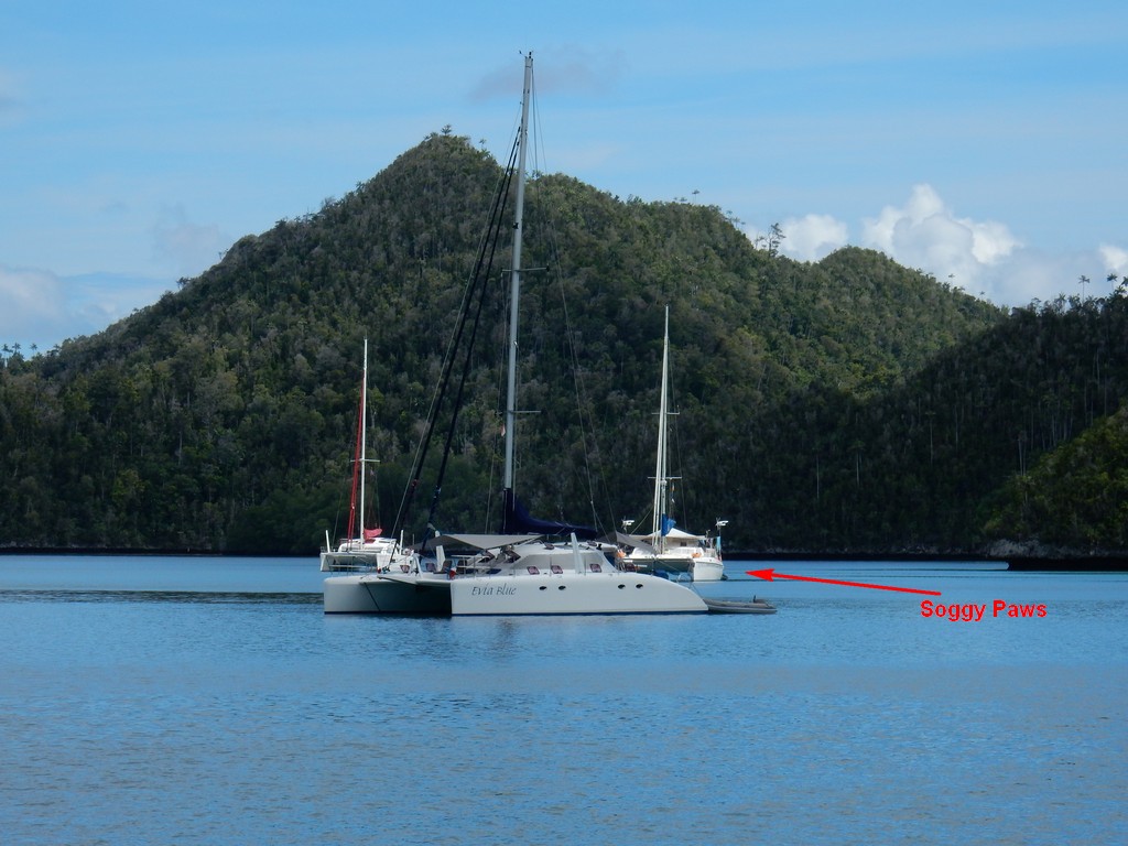
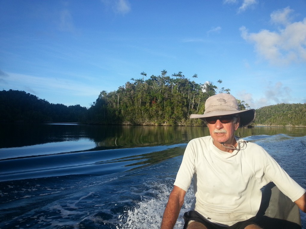
When Dave and I were discussing who was going to do what, he was surprised to find that I wanted to drive the boat rather than drop the anchor (I wouldn't have wanted to drive with the old Soggy Paws). Dave is much better at judging distances and angles than I am, so I felt he would be best on the bow deciding when to drop the anchor. With the maneuverability of the twin engines, I felt confident I could back her into the slip without problems. We were fortunate to have almost no wind, and we performed our pirouette, drop, and back flawlessly. I got compliments from the other cruisers, especially when they found out this was the first time I had ever docked the boat!!

By the time we finished tying everyone up, Sirius had already organized a dinner in town for that evening. We had also organized a "rental car" with Husna, to take us into town for money, groceries, and cell phone top-ups.

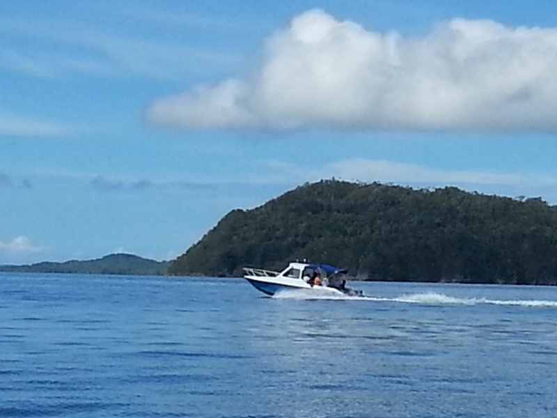
The next day, the Waisai Tourism Department organized a boat trip for the crew of all 6 boats (in 2 of the local tourist boats). The weather turned out great--sunny and not too windy.

One of the Two Boats for our Day Trip

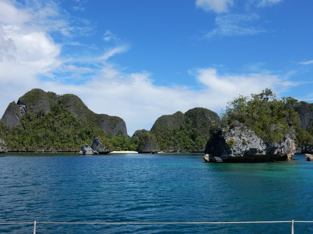
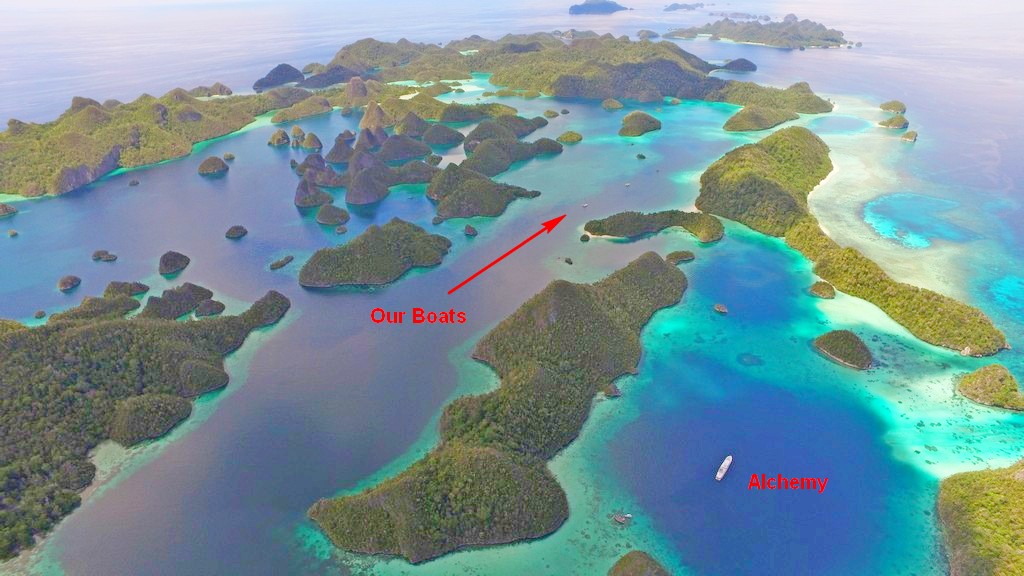
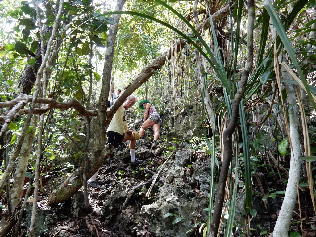
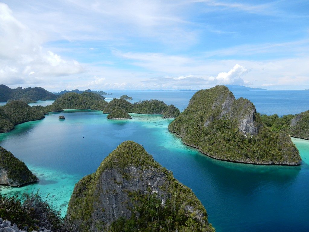
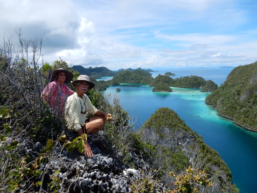
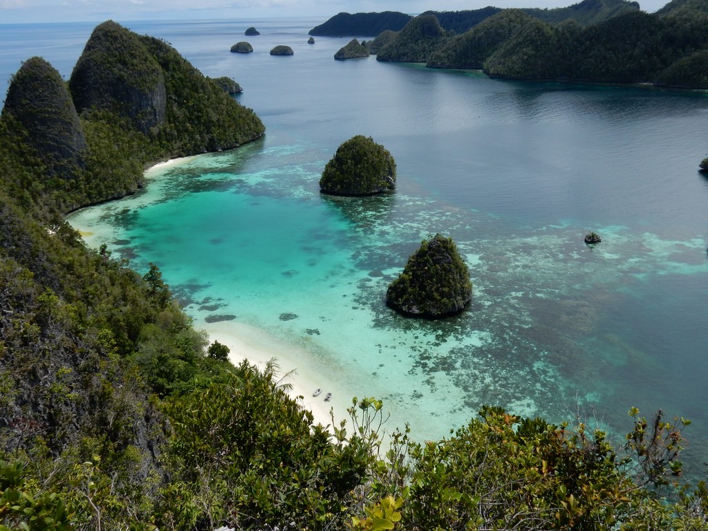
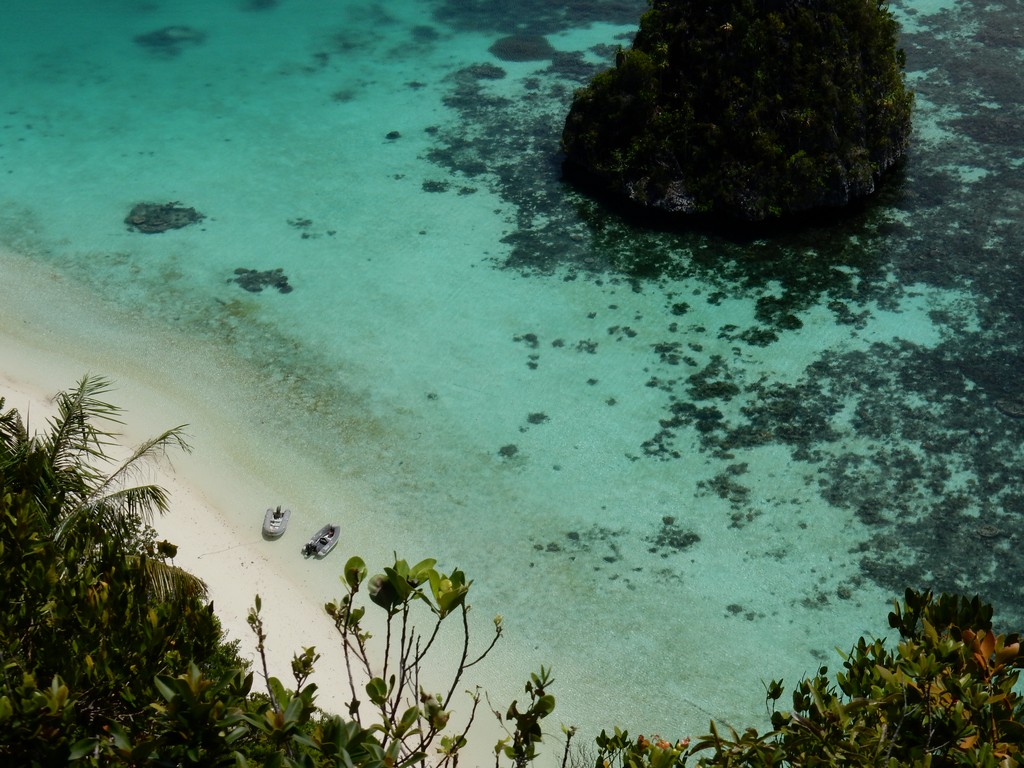
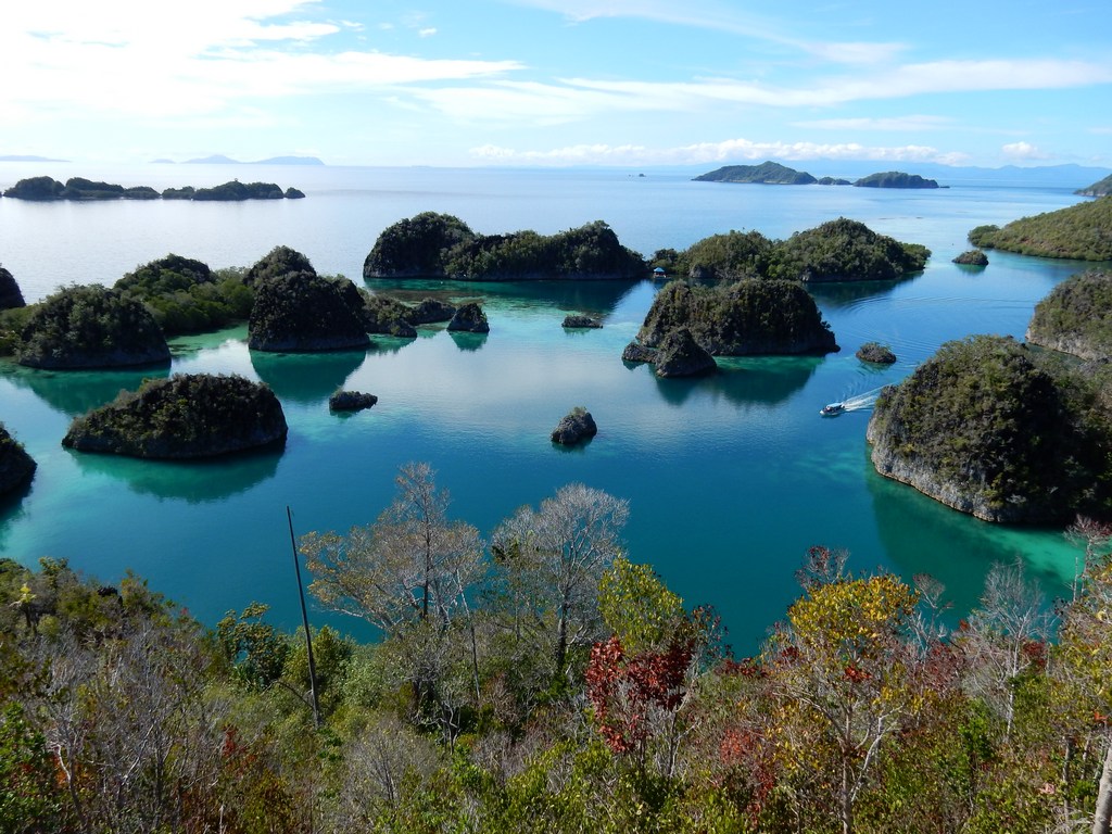
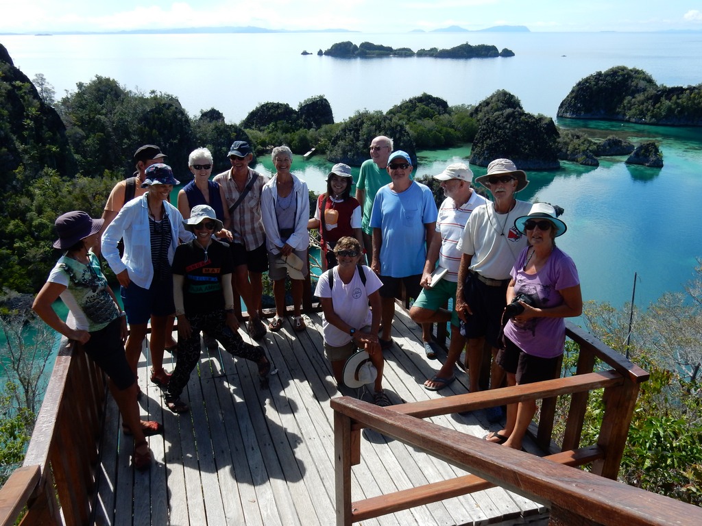
It took us about 2 hours to get to Fam Islands, where we went into a lagoon area similar to Wayag. Here, they had built a small tourist facility with a nice set of stairs leading to a viewpoint on the top of the hill. In 10 minutes of huffing and puffing, we were at the top. It was beautiful. And we could see a turtle swimming in the lagoon below.

Souveniers at the Penemu Dock

Local Fisherman--Note Twin Engines

The View from the Viewpoint

The 2016 Sail Samal 2 Raja Ampat Gang

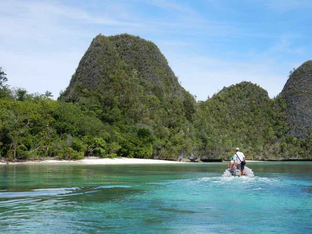
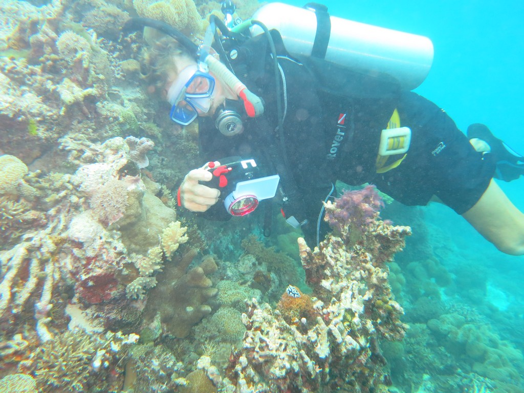
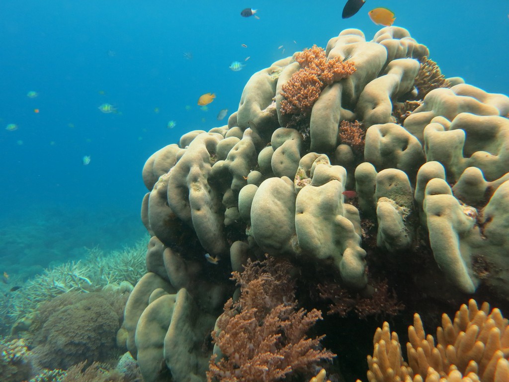
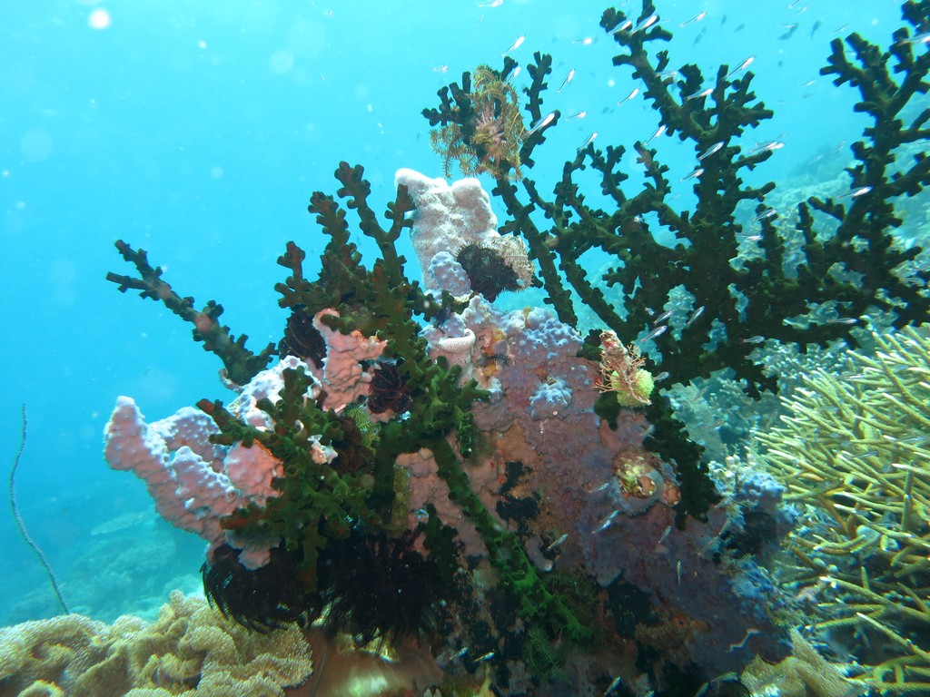
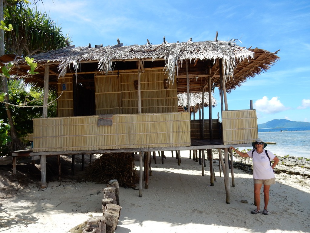
From Fam and Penemu, we went to Arborek, a small island with a very nice village. We'd been told by other cruisers to make sure we took our snorkel gear, because the snorkeling off the pier at Arborek was supposed to be great. (It was!). We had lunch and a snorkel and a nice (short) walk around town. I went looking for the bathroom and ended up in an outhouse with a squat toilet. But better than going in the bushes! (Someday I'll blog about my Indonesian and Malaysian toilet experiences).

The Pretty Little Village of Arborek

A Typical Raja Ampat Waterfront Homestay

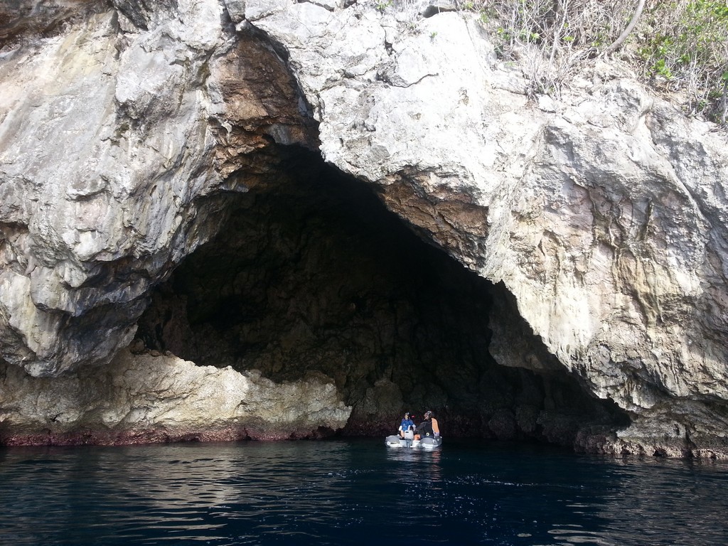
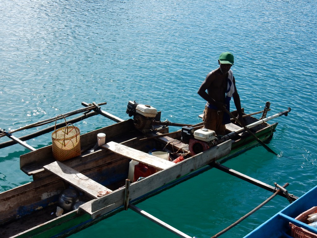
After lunch we loaded up in the boats again and stopped at the Manta Ray place (Manta Sandy). But alas, no mantas present (not the right time of year, we were told). Then we headed off along the north coast of Mansuar Island. When we got to the break between Mansuar and Kri, the guys poled the boats across the shallow area, and took us to a pier off a village on the east end of Mansuar. Our boat driver told us to go drift in whatever direction the current was going, and he'd pick us up. The current wasn't going, but we found a spectacular reef very lively with fish and turtles, etc. We all enjoyed that snorkel so much that we vowed we'd come back and do a dive there some time.

Finally they rounded all the snorkelers up and we headed back to Waisai. We had a beautiful time.

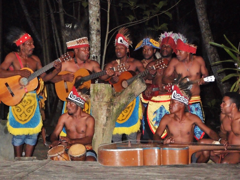
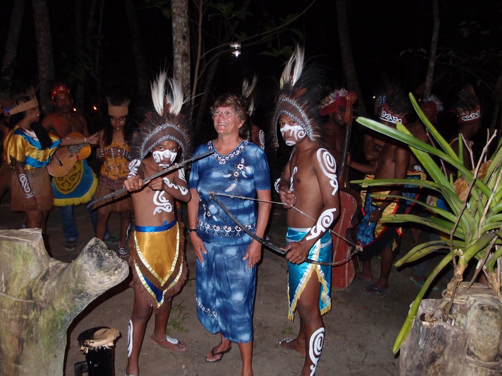
We had time for a nap and a bit of socializing before we were again rounded up to go to the official "Welcome Dinner". This was held at a nice local resort and included a couple of short speeches, some local entertainment, and a buffet dinner. At our Welcome Dinner in Morotai, they expected us to sing karaoke (which we did after some prodding). Fortunately, karaoke isn't a "thing" in Waisai, so we were able to avoid that. But we did want to reciprocate with a little entertainment (it's customary). Greg on Verite is pretty good on the guitar and had picked out a song he thought we could sing as a group, and even made song sheets for all of us. We did a credible job of "I Am Sailing" by Rod Stewart, and our efforts were much appreciated by the Indonesians.

A Musical Serenade by Local Musicians

Me in my Dress-Up Clothes at the Rally Dinner

Our Last Group Picture!

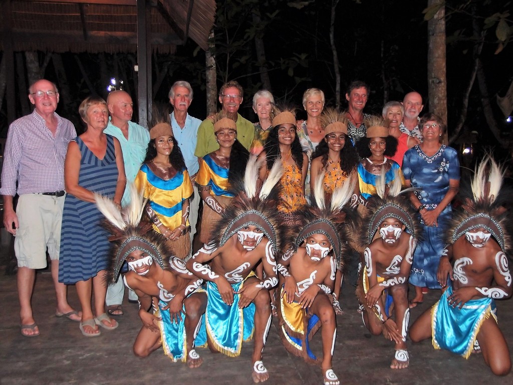
We had a great time, and enjoyed mixing a little bit with all the people (local dignitaries and English-speakers) who had been invited to the dinner. Again, all this was gratis, courtesy of the Waisai Tourism Department. THAT is the major benefit of doing these rallies in Indonesia. Tons of fun stuff, easily organized, and usually free or very reasonable cost.

This dinner officially concluded the rally entertainments. We stayed another day on the dock to finish our shopping and looking around town, and then we took off again to explore more of Raja Ampat.
-----
At 6/19/2016 2:49 AM (utc) our position was 00°26.00'S 130°48.41'E

Sunday, June 26, 2016

Kabui Bay

June 14-17 - Kabui Bay

After hearing someone else rave about snorkeling and diving in "The Passage", Dave was anxious to use our last remaining days before we had to be in Waisai on June 17, to get a look at Kabui Bay. This is a large bay formed between Gam Island and Waigeo Island, at the SE end, there is a wide opening to Dampier Straits (near Waisai). At the NW end is a very narrow passage, bounded by reefs on each end. Dave had been told of great snorkeling, interesting exploring, Nudibranchs, caves, etc.

So as soon as we recovered from our early morning birdwatching expedition, Soggy Paws, Evia Blue, and Sapphire headed up into Kabui Bay. As everywhere in this area, our CM93, Navionics, and Garmin charts are petty useless. They show large blobs, but not much useful small boat navigation info. So we are navigating on GoogleEarth charts (mostly made by Terry on Valhalla, and our friends on Mystic Rhythms). Unfortunately, GoogleEarth has very poor resolution photos in most of Indonesia. Terry has been successful in using SAS Planet (a Russian alternative to GoogleEarth) to get some other more detailed satellite pictures. But he only bothered to do it where he had an anchorage waypoint. So we were navigating on friends' tracks, and a not-very-good GoogleEarth picture.

Even our poor GoogleEarth picture showed a very interesting shoreline along the north coast of Gam Island--large fissures in the rock that go way back up inside, deep enough and wide enough for possibly navigating in the big boat, and certainly worth exploring in the dinghy. The entire bay is more reminiscent of the Pacific NW than of what one would imagine Indonesia looks like. Dave was itching to stop and explore the coast a bit more, but I urged him to carry on to our agreed anchor spot, on the inside end of "The Passage" (aka Kabui Pass), so we would have time to explore and snorkel the pass with good light in our dinghies.

So we carried on to the anchorage on the inside end of Kabui Pass, off Warikaf Homestay. (00-25.42 S / 130-34.19 E) As always, we had several anchor waypoints from friends' prior visits. We ended up anchoring in only 13 meters in a good spot. No internet though--we'd lost the cell phone signal as we turned the corner going up into the bay. (whimper) But a beautiful spot, and we had friends nearby to play with. Once we had lunch, we jumped into 2 dinghies and took off into the pass.

The currents in all of Raja Ampat run strong--average being 1-2 knots. But the Kabui Pass is a very narrow passage between two fairly large land masses, and emptying a fairly large bay. So the current in the pass can run 5-6 knots. As luck would have it, the current was almost slack when we started exploring. (but not for long). Once we sussed out which way the current was running, we jumped in with snorkel gear and the two dinghies on their respective leashes. We stayed on the Gam side of the pass, since that seemed to have more interesting profile and features. While running around in the dinghies, we had spotted two caves along the pass, and made a mental note to check them out once we were in the water.

The snorkel was very interesting--mostly in the quiet spots and eddies. Bright red feather stars clinging to one rock, funny looking fish hanging around inside the underwater cave, and Jan from Evia Blue even spotted our first Wobegong Shark. The current picked up to "very strong" out in the middle of the pass, but along the edges were eddies going the other direction (so we were having to drag the dinghies up-current sometimes), and some quiet water. We drifted all the way through the pass to the outside, before getting back in the dinghies and blasting back through. We had to offload John from Sapphire from our dinghy (which only has the 5hp motor on) into Evia Blue's dinghy, so we could make progress against the current.

There is a "homestay" here near where we anchored. Some other cruisers had dubbed it Kabui Bay Yacht Club, and we'd been looking forward to hanging out there. However, it looked abandoned when we first arrived. Late in the day, the owner or caretaker of the homestay, showed up and came out to us in his boat. He didn't speak any English at all, and he was not smiling or welcoming. He handed us a nicely-worded laminated sheet in English that explained that the Kabui Village was building a new fence for their church and a "voluntary donation" of 500,000 Rupia was required from each visiting boat. There is no church we have seen anywhere on our way in. I looked up the words for "where is" in Indonesia but just got a blank look when I said them. (the village turns out to be a couple of miles away on the outside of the pass).

A required voluntary donation? Seriously? This is about $40 USD, and we felt disinclined to pay. There are no goods or services offered for this fee, and it's not a park fee (we already know we will owe a 1,000,000 Rupia Park Fee once we get to Waisai) And we couldn't argue because the guy appeared not to speak a word of English. We finally decided to "donate" 50,000 Rupiah (about $4 US) to the cause. We signed his book with our name, date, and donation, and Sapphire and Evia Blue did the same. This is a new thing that was just implemented 1 May 2016. Boo hiss!!

The guy didn't spend the night at the homestay, but left just before sunset. We saw another local boat go into the dock just after that, and we could see with the binoculars that they were filling water jugs. As they came by us, they made motion that we could go in and get water too. So the next morning, we did so... loading our 7 empty jugs into our dinghy. There's a pipe conveniently located on the dock of the homestay, that is constantly running from a spring up the hill. I thought it was a bit cheeky of us after we turned down his donation request, but Dave said "other cruisers wrote about getting water there, and the guys last night told us we could." In the middle of filling our jugs, the guy showed up again. Again his expression was bland, not smiling, not angry, and no words. Dave said "Is OK?" and he shrugged and walked away. So we finished filling our jugs and then left.

While we were looking around the bay with the binoculars, we had seen a platform high on a hill adjacent to the homestay. So after filling the jugs, we went looking for the inevitable trail up to the peak. We found a place where someone had knocked together a small ladder from saplings to help scramble up the side of the bank from a boat, and a path leading away from there. So the next morning, us and Evia Blue gathered up a few gifts and went in to the homestay to ask permission to go up to the lookout. Again, no expression whatsoever. But he made it clear that he wanted a fee of 50,000 Rupiah per person to make the trek. Still mostly non-communicative, still no smile. Sheesh. It's not a lot of money...$4 per person. But the whole atmosphere creeped us out. We said "no thanks" and left. It started raining again anyway.

Dave proposed we move around to where he'd seen the labyrinth on the chart, and go exploring with the dinghies. So we moved a few miles to anchor just outside the labyrinth, which we've named Kabui Haven. (00-24.88 S / 130-36.66 E) We loaded up in our dinghy and spent 2 hours exploring around. I took my cell phone which has OpenCPN loaded on it, and we mapped the entire shoreline. We found a couple of good anchorages, one in about 10 feet sand which would easily accommodate 4-5 boats, and completely protected. (00-25.04 S / 130 36.86 E) It would be a great typhoon hole, if there were typhoons or cyclones here. Using my OpenCPN map, we found a fairly easy route out to our outside anchorage, with plenty of width and depth to get the big boat in. We got back to the boat about 5pm and Dave wanted to move to the inside anchorage, which we have named Kabui Hideaway. I nixed that idea. It's Happy Hour! Who wants to spend an hour up-anchoring from 23 meters and moving into an enclosed windless anchorage? We are leaving in the morning anyway, as we have to be in Waisai by midday. But I'm sure we'll be back.
----
At 6/17/2016 3:27 AM (utc) our position was 00°24.88'S 130°36.66'E
http://svsoggypaws.com/currentposition.htm

Sunday, June 19, 2016

Friwin, Cape Kri, and Birds of Paradise

After our great day at Penemu, we left Yangello early in the morning and motored about 15 miles east to the island of Friwin. We opted to go via the reefy route, past Arborek and the north coast of Mansuar to get a look at possible places to stop and dive. Boy there is a LOT of current in this area! The reefy route was easy, even in imperfect light. The water is either 100+ feet deep, or 2 feet deep. It's easy to see where to go and not to go.

We arrived in Friwin in the early afternoon--the last in our 5-boat fleet to arrive. Verite had arrived first and got the most picturesque spot off the pretty beach on the NW corner of the island, and everyone else was anchored around the north coast in about 60-70 ft. We found a nice spot off the eastern end of the north coast, with a direct line view to the island that has the cell phone towers on it, off Waisai. Not finding any shallower water a reasonable distance off the island, we anchored in 22 meters--about 70 ft. Better deeper and in sand than tangled in coral and destroying the beautiful coral. And a little offshore reduces bugs and increases breeze.

Since everyone was together again, we called everyone up on the VHF and invited them to Soggy Paws for Happy Hour. We ended up with 12 people in the cockpit (with a couple in chairs on the side deck). This was the biggest gathering so far on the new boat.

The next day, Greg and Wendy on Verite invited all the divers to go with them on Verite to do a dive off Cape Kri. This reputed to be one of the best dives in the area. Sirius and Verite had already dived it a couple of times, and had tides and best spots to go in and come out figured out. Greg put us in at the perfect spot, the current was barely moving down the coast, and we drifted down the wall marveling at all the fish. It just got better and better as we went down the wall. Toward the end of the dive we got to the confluence of the currents where all the big fish hang out. Amazing! This was definitely our best dive yet. And it was the most relaxed because we had someone manning the boat on the surface, ready to pick us up no matter where we ended up with the current.

A few days before, our friends on Sirius had made contact with Simon, the guy who does guided "Bird of Paradise" tours. They arranged for the people off their two boats to go one morning, and sent Simon over to talk with us about arranging for us to go the next morning.

Simon is a character. He doesn't speak much English, but he came with Nelly, who speaks good English. Nelly has a homestay on the south coast of Gam, just across from Friwen. We had heard that Simon could only take 2 people per trip in his small canoe. But since he's hooked up with Nelly, they have a boat that can accommodate 5 or 6 people. The price in previous years, dealing directly with Simon, was 100,000 Rp per person. But with the help and management of Nelly and her husband Martin (plus I think due to tourism inflation), this price had gone up to 300,000 (about $22 US) per person. Dave argued a little but Nelly pretended not to understand his question about why the big price increase, while Simon eyed our "yacht" and fingered one of our $300 dive outfits that was drying on the railing. So when Nelly threw in breakfast at her guesthouse, we agreed to pay the 300,000 Rp fee, and set up a pickup time for 5am (!!).

Several people had told us that Simon had showed up early--he showed up at Sirius the day before at 0420!! So we were ready by about 0445, and of course Simon didn't arrive until 0515!! But we were ready with sturdy shoes, a headlamp, and cameras and binoculars. We motored up the "river" in the dark. It's not actually a river but a saltwater lagoon in a river-like configuration, caused by the geographical upheavals common in this area. It was nearly low tide, and the boatman had to turn off the engine and pole us along a few times.

Finally we came to a rickety dock, where we clambered out onto the muddy bank. In following Simon up into the forest, we realized what some of that extra money went to--building handrails up through the forest, making it much easier to climb up the steep track. I am sure that when it was just Simon on his own, there were no such improvements. Simon did the whole climb barefoot, but I was glad of my Keen sandals with toe protection and good tread.

After about a 20 minute climb through the forest, Simon sat us down on his bench, pointed up at the bare limbs sticking up high over the forest, and started making bird calls. When nothing happened in the first 5-10 minutes, I was afraid we'd been too late, with a late start, the low tide impeding progress in the lagoon, and a bigger than normal group. But with patience, we finally got to see the drab female and fancy-feathered male do their dance. I took a couple of snaps with my cellphone, but others had better cameras and hopefully we have one or two good pics of the male Bird of Paradise's fancy costume (haven't had a chance to review all the pics we've been taking--with activities every day, amazing scenery, 2 smartphones, a dive camera and a land camera, our pics are numerous and scattered all over!).

We spent about a half an hour gazing upward, trying to see what the birds were doing behind the foliage. But every now and then, the female would jump into the clear spot, and a male would jump next to her and do his dance. Well worth $22 and getting up at 4am to see. And afterward, we had a nice time talking with Nelly and Martin. Nelly's coffee, tea, and breakfast cakes was a nice way to end the trip.

As soon as we got back to our boats, Verite and Sirius headed for Waisai to send off some guests, and us and Evia Blue and Sapphire motored up into Kabui Bay for a couple of days.
-----
At 6/12/2016 7:40 AM (utc) our position was 00°28.25'S 130°41.45'E
http://svsoggypaws.com/currentposition.htm

Thursday, June 16, 2016

Penemu Garden Dives

As I started to say in the last post, Sirius suggested we do the dives at Penemu as a day trip. But Dave was worried about leaving 2 boats unattended at Yangelo while we day-tripped in the 3rd boat. This worry was not founded on any news about problems leaving boats unattended, just normal caution. So we decided to take all 3 boats and spend the night at Penemu, on Sirius' "open roadstead" "sandspot on the end of a reef". However, Sapphire decided he'd stay in Yangelo and do boat maintenance and explore around in his dinghy a little, so it ended up being just us and Evia Blue hauling anchor in the early morning.

We had trouble getting our anchor up. We patiently motored the boat gently in every direction, trying to free the chain from whatever it was wrapped around, to no avail. I finally had to put on a dive tank and go down to 75-80 ft in the dark water to see what was up. Visibility turned out to be surprisingly good--the bottom was sand and coral, not the usual silty muck I expected. In the light and variable winds in our little hidey hole, we had managed to do a complete wrap around a low dead coral head. It took me only a minute to free us up, and with a wiggle of the anchor chain, I signaled Dave to pull it on up. Evia Blue, who had wisely tied their stern to a tree (keeping them from sailing around on anchor), had no problems getting their anchor up.

Since Evia Blue had a 20 minute head start, they anchored their boat on Sirius's waypoint, jumped in their dinghy with their dive/snorkel gear, and headed out to meet us. Because we were trying to time our arrival at the first dive site, Anita's Garden, for slack tide, we needed to hustle on up there (about 3 miles to the north end of the island). There was some current when we arrived, but not too much. Looks like our timing was good.

For this dive, rather than anchoring the big boat and diving with a dinghy trailing behind, we decided to try "live boating"--having everyone dive off a big boat, and have the big boat standing by to pick up the divers as they surface, wherever they end up. In high-current areas, its a much safer and easier way to dive. However, someone has to forgo a dive and drive the boat. Because I HATE trying to manage a dinghy while diving, I volunteered to be boat driver for this dive. Jan and Dave went down with scuba tanks and Monique snorkeled in among the islets around the dive site. Even though I wasn't able to dive, I had a good time on the surface hanging out on Soggy Paws, with one engine idling. I put one of our new plastic chairs on the top of our new hardtop, took an umbrella to keep the sun off, and sat and read and drifted in the current, watching for bubbles. Every now and then I'd have to climb down to maneuver the boat around to stay close. They had a very nice dive.

Once they were up, we loaded everyone back aboard, and motored slowly down the east coast of Penemu, checking for possible anchor spots. The problem as always was that the depths go from 40 meters to 18 inches in a boatlength. It's very hard to find anchorable depths in sand with no coral heads within the swinging radius. We found one or two spots that were possibilities under the current conditions (flat calm). If there was much wind blowing from any direction, these spots would probably be untenable.

We also sent a dinghy expedition inside the little enclosed lagoon we could see on Google Earth. Dave took soundings with the hand-held depth sounder on the way in, and we could have gotten in without much trouble. But there was a big sign on the inside that demanded payment of 500,000 Rupia for yachts and 300,000 for motor boats. Though the guy they saw didn't speak English, he made it clear that our fee would be 500,000. (This is about 40 USD). There is a walk to a lookout inside the lagoon.

While we ate lunch and explored around, we headed down the coast toward the 2nd dive spot--Melissa's Garden. By about 2:30, we were off Melissa's Garden. Dave was going to drive this time, and Jan and I were diving. But it wasn't slack current anymore. We could see the current was ripping, so we headed a little further up-current before going in. We quickly got swept down the side of pinnacle and spend our dive time in the lee of 2-3 little islands. There was lots to see there, but we used a lot of energy and air swimming around in full dive gear, across current.

Once we surfaced, we took a look at the time, and the weather, and decided to head back to the safety of the enclosed anchorage at Yangelo. There was a big black cloud moving toward us, and it didn't look like a good night to be out in an exposed anchorage tenuously hooked into a coral rubble pile. So we raced the sunset to get back to Yangelo before all the birds roosted for the night... And we spent another quiet night in lovely Yangelo.
-----
At 6/10/2016 12:31 AM (utc) our position was 00°30.72'S 130°27.23'E
http://svsoggypaws.com/currentposition.htm

Sunday, June 12, 2016

Yangelo - Bird Heaven

Yangelo (also called Yangefo in some places) was our next stop after Minyafuni. We were originally going to skip it, because of anchoring depth issues, but our friends Jules and Mike from Sirius said it was a "must do", and we would find plenty of room for 3 boats.

When we got here, we found 80-90 ft depths (as expected) and plenty of room to put 3 boats, in the light air conditions we have this time of year. Evia Blue anchored a little bit outside the normal cove, and tied stern-to a mangrove tree. John on Sapphire is in the middle, and after looking all over, we ended way far in on the west end. We found a 75 ft "hump" very close to the ringing coral reef and mangroves, dropped our 100-lb anchor, and backed like hell to make sure it was set. Dave put out 3:1 scope, but Sapphire and Evia Blue said they were on more like 1.5-2:1 scope. With max winds of about 10 knots, this seems to be sufficient.

The north entry channel into Yangelo is a world-class dive and snorkel spot called Citrus Ridge. So as soon as we got the boats settled on their anchors, we jumped in the dinghies and went out to explore Citrus Ridge. More superlatives... fish of all shapes and sizes, hard coral, soft coral, sea fans, etc etc, and a ripping current. So we put in up-current, where the current is still mild and manageable, and with dinghy painter in hand, drifted in around the corner. Where the current is strongest, it's difficult to enjoy snorkeling, because you are flying past all the sea life. But we found a giant eddy towards the mouth of the cut, that let you enjoy snorkeling, and even move back up-current to do the fast part again. We snorkeled both sides of the cut before we got tired and headed for Happy Hour.

The next day, Jan, Dave and I went out to dive the same area. This time, we put a dinghy at each end, so we wouldn't be having to manage a dinghy on a line while diving in the current. It was another great dive with lots to see. My "reef hook" from Palau came in handy. A reef hook allows you to hook in to a spot of dead coral and hold on in current, without doing as much damage to the reef as you would if trying to hold on with hands. And my reef hook has a snap shackle on the end, so I can snap it in to my BC, and be able to "fly" in the current, hands-free. It's a pretty awesome way to relax and enjoy the scenery in a high-current dive.

The part that no one told us about Yangelo is the bird life in the trees--especially at sunrise and sunset. We have enjoyed sitting out on deck with the binoculars trying to spot the birds making noises (and sometimes beautiful song) in the trees. We saw a hornbill yesterday evening, and there are several species of parrots flying around. We're not birders so can't identify most of the birds, but we enjoy watching and listening to them.

We hear one sound in the trees that sounds awfully much like howler monkeys, but really don't think there are monkeys here. It must be a bird, but we have no idea what would make that hoarse growling sound...

Last night, we were trying to decide whether to stay another day, go north around Gam to The Passage, or go south around Gam to the Manta Ray spot (and ultimately end up at Freiwin). Our friends on Sirius called us on the VHF and said "you should come here, to Penemu, and do the Garden dives while you are in the area." Again, our first question around here is always "Is there a spot to anchor?" Sirius assured us there was space for 2-3 boats. So that's our plan for tomorrow. Sirius suggested we should do it as a day trip
-----
At 6/10/2016 12:31 AM (utc) our position was 00°30.72'S 130°27.23'E
http://svsoggypaws.com/currentposition.htm

Friday, June 10, 2016

Crossing the Equator for the 5th Time

Yesterday, on our way from Urani to Minyafuni, we cross the equator into the southern hemisphere. I quickly ran down below to flush the toilet and see whether the water circles the bowl in the other direction (rumor has it that it is supposed to). I didn't notice any difference.

While crossing the equator, I got out a precious bottle of fine Philippine rum and shared a toast with King Neptune. No other silliness was necessary because we're already "shellbacks" 4 times over. But it's always good to give King Neptune his due.

The 25 mile trip south was strictly motoring, as what wind we had was pretty much on our nose. Fortunately, we had lucked out and managed to leave at the right time of the tide. We had at least a knot of following current, rather than on the nose. The currents here are something one has to pay attention to--both the prevailing ocean currents and the tidal currents. It makes planning a passage or a dive quite the exercise.

We only have one tidal point in this area, but it's good enough to get a feel for what the tides are doing.

On our motor south, in company with Evia Blue and Sapphire, we amused ourselves with fishing (once outside the park boundaries, it's permitted). Jan on Evia Blue's successes in the last couple of weeks has spurred Dave to make more effort, but so far we've only landed a barracuda, which we immediately released.

We have cruiser's notes, tracks, and waypoints from the last few years of cruisers exploring Raja Ampat, and I've incorporated them into my growing Indonesia Compendium (http://svsoggypaws.com/files). But pretty much all of the cruisers who have visited here have done so in the "winter" (Oct-Jan), and the cruising is quite different in June from what it is in December. So we took the time to explore a few possible anchorages that would be untenable in the northerly winds in winter, but good in the light southerly summer winds.

We arrived at Minyafuni at mid-afternoon, and anchored where our friends had anchored previously, about a half mile west of the tiny town. It was as reported, 15 meters in sand. Dave is worried about mozzies and no-see-ums, so we edged out into the middle of the area between Minyafuni proper and the little offshore island. John on Sapphire tried to find an anchorage right off the town, but only found deep water. He ended up anchoring in a shallow sand spot on a pinnacle off the end of the little island. (In 10 feet between 2 coral heads).

The current in the anchorage ripped through all afternoon. When I took my shower off the stern of the boat about sunset, I had to hold on when I jumped in the water, it was still flowing so fast. I wondered if the current was a prevailing ocean current, or whether it would ever reverse, but it seemed like it was never going to change. But at 3:30 am, I was awakened by a different motion of the boat. On investigating, we were hanging backwards to 10-15 knots of wind! Make another note in the tide log, and go back to bed!

Minyafuni was in the news a few months back--a Russian tourist was found dead and slightly mangled by a saltwater crocodile. He'd been snorkeling on his own in a mangrove area. We only ever heard the headline version of this gruesome news, and not any follow-up. So, we're wondering... did they get the crocodile? I read that the croc is a sacred animal in Western Papua, so maybe they didn't. We opted not to go snorkeling, but Jan on Evia Blue did (away from the mangroves).

One cruiser had said they found a small market in the town. John on Sapphire went looking to see what he could find. He said the only provisions available were bananas and eggs. He bought a big bunch of bananas and shared them with us.
-----
At 6/8/2016 10:58 PM (utc) our position was 00°19.52'S 130°12.17'E
http://svsoggypaws.com/currentposition.htm

Wednesday, June 8, 2016

And the Most Amazing Thing I Saw on My Snorkel Was...

We moved two days ago from Wayag to Urani, a trip of about 15 miles, anchor to anchor. The wind was light S-SW and we were headed mostly east, so we even got to sail a little bit...for nearly an hour with no engines!! Then a squall came up in the distance and conservative Dave wanted to reef well ahead of the wind. We ended up having to turn an engine back on to get in. As has been our experience everywhere here near the equator, the squalls are pretty benign--we never saw over about 17 kts. And, just a sprinkle of rain.

On the way, we passed a current "rip" and saw some Manta Rays feeding in the current. Once well offshore, we put out a fishing line, but only caught a barracuda which we released.

We had no information on our planned anchorage on the West side of Urani, until a few days ago. Our friends on Mystic Rhythms, mad keen divers, had anchored off the south coast in 100 ft of water (!!!), to do a couple of the dives, and we really weren't interested in doing that.

But the megayacht, Alchemy, that we met in Wayag, showed us a drone picture of them in the tiny cove on the west side of Urani. Their dive guide, Matt, told us there was plenty of space for 3 boats to anchor in that cove, and the depths were reasonable. We told our friends on Sirius, and they stopped in there overnight to do a dive. They managed to fit 2 50 ft catamarans comfortably in the outer part of the bay, and told us we should be able to get 3 smaller boats in there easily.

So our little "rally flotilla" headed for Urani. Evia Blue arrived first, and took the innermost spot. Jan quickly launched his dinghy and tied his stern to the innermost rock. Then we arrived, and Jan help us get tied to the next rock. We dropped the anchor in 30ft sand and backed toward the rock (yay for twin engines!!!--even I could get where we wanted to be). There were already ropes with loops in them, fastened to the rocks, so it was really easy. We used our 600 ft stern line (on a reel mounted on the stern) for the first time in 9 years of cruising. Then John on Sapphire, a single-hander followed about an hour later. We got him tied up to the outermost rock. The wind was blowing from S-SW the whole time we were there, and we were "snug as bug in a rug". After an afternoon snorkel, we liked it so much that we decided to stay an extra day.

The coral and sea life diversity was just amazing, even right off our boats. The wind was blowing enough out in the channel where the acclaimed dive sites were, that we just decided to dive in the anchorage. We did an hour long dive at 25 ft around one of these pinnacle islands, in the morning, and Dave and Jan did another dive in the afternoon. Jan is an enthusiastic "nudi photographer", and so is Dave. They spent 2 hrs underwater looking for and photographing nudibranchs, flatworms, and other tiny underwater life. It was a really nice calm, clear location for an easy dive with lots to see.

My favorite things I saw were (1) a "bait ball" only about 2 ft in diameter, made of of tiny half-inch black fish. It was so tight that when I first saw it, I thought it was a small black trash bag floating in the water. You could even insert your hand into the ball, and the fish stayed together (with a few nibbling cutely on your hand). We watched it and played with it for about 10 minutes. (2) 20 different types of soft and hard coral in any square meter of space. Many of the corals were soft with flower-like "petals" waving gently in the water. (3) 2 tiny nearly transparent cleaner shrimp in a large anemone.

In addition to the underwater life, we saw a number of different bird species, including an eagle of some kind and a flock of red and green parrots or parakeets.

We are sorry we didn't get to dive Magic Rock or Y Reef--maybe next year. But we loved the dives we did.

Tomorrow we head further south toward our ultimate goal of Waisai, on Waigeo island, on the 17th.
-----
Sherry & Dave
In Indonesia for the next few months
http://svsoggypaws.blogspot.com

At 6/6/2016 2:44 AM (utc) our position was 00°06.23'N 130°15.22'E
http://svsoggypaws.com/currentposition.htm

Friday, June 3, 2016

Wow Oh Wow, Wayag!

After watching our cruising friends blogs and Facebook postings about Wayag for the last 2 years, we had high expectations. And Wayag has met them in every way.

Our First Glimpse of Wayag

Wayag is similar to the karst islands of Vavau, Tonga, the Lau Group in Fiji, and the amazing rock islands of Palau. They are left over from volcanic activity many years ago. The water depth goes from 100 ft to 2 ft in the space of 10 ft, and then soars up to a pinnacle towering above us.

In to the Center of Wayag

Fortunately, the inner part of the lagoon has accumulated enough sand over the years to provide reasonable anchoring depths in good sand (not coral) and in a nice protected bay with a pretty sand beach. Other than a tiny "ranger station", it is completely uninhabited. We are here with only 3 boats (us, Sapphire, and Evia Blue, with Sirius and Verite on their way), so we have friends to play with, but plenty of room to get off on our own if we wish.

The Inner Anchorage at Wayag

Our Token Monohull

The Cat Pack Has Finally Arrived

A few days ago, a big yacht named Alchemy anchored up for a couple of days--we didn't even know they were there until we passed by a cut in the dinghy. They had snuggled up in their own private cove--there are many such places in the Wayag Archipelago. We stopped by to say hi, and they were very welcoming. We knew they were good guys when the crew were all sporting "Sea Shephard" T-shirts.

Alchemy's Drone Photo of Wayag

They invited all of us on the 3 yachts aboard for an evening of socializing. They were amazed at each of our stories of cruising the wold. And they shared the extensive knowledge of their dive guide, and diving experiences in Raja Ampat. There is an excellent printed guide to this area... Diving Guide to the Bird's Head Sea Scape, and everyone coming here should have a copy. The book has conservation info and has something like 50 dives listed in the next 50 miles of cruising...way too many to see them all. But Matt, the dive guide, shared a few highlight dives with us, and also gave us a little info on where to anchor. He also put Dave in contact with a WW2 resource here in the area.

We also got some great shots of Alchemy anchored up in the hot dive spots they told us about--they have a very nice drone with a competent operator. They even took some nice shots of our boats here in Wayag.

We have climbed Mt. Pindito, which is a "must do"... a half hour scramble straight up in extremely sharp rocks. Unfortunately, where our boats are anchored, we could only see the tip of one mast from the top. But Alchemy gave us a picture of our boats anchored up in our lagoon, taken by their drone!

Hiking Mt. Pindito

Climbing Straight Up on Sharp Rocks
(Gloves and Sturdy Shoes Recommended!)
The Stunning View is Worth the Work!

Definitely a Cover Photo!

Our Dinghies Far Below


We have been out every day on at least one snorkel or dive trip.

Another Dinghy Expedition

Out To Snorkel on An Outer Reef

Cave Exploration Too!

Jan on Evia Blue and John on Sapphire are also divers. The snorkeling inside the lagoon is a little disappointing... a bit silty, though there is lots of life to see. But just outside the lagoon the water is clear and the sea life is absolutely amazing. I've never seen so much live coral, or so many fishies, and so much diversity!!! Even us jaded old Pacific divers are seeing new fish and new coral.

Jan From Evia Blue Taking a Difficult Shot

Beautiful Live Coral Everywhere!


The huge amount of sea life is (a) because this is a nature preserve, a complete "no take" zone and (b) the karst islands are so severe (no soil, no natural water) that they don't seem to have ever been inhabited. (c) this is almost on the equator, at the convergence of several current streams, and full of plankton for everyone to feed off of. If you can brave the currents where the big fish are hanging out, you can see some really big fish in the wild. Or you can hang out in a protected cove and see more cute little fishies than we've ever seen in one place before.

Dave Getting Ready to Deploy the Compressor
on the Back Deck

We've been here 10 days, and are not yet talking of leaving... we are not due anywhere else until mid June. But we could easily spend a week or two cruising to our next stop (where we'll find gas for the dinghies and fresh fruits and veggies, and internet). So we ought to start thinking of leaving....
-----
At 5/26/2016 5:13 AM (utc) our position was 00°09.72'N 130°02.02'E
http://svsoggypaws.com/currentposition.htm