Sunday, November 5, 2017

Submitted!

We're in the USA from mid September to mid December, and one of the things at the top of my TO DO list is to renew my USCG 100 Ton Master's license. It's quite a process and includes having to document my "at sea" time over the last 5 years (and make sure it adds up to 360 days or more). Fortunately, I have remembered to make a photo backup of our logbook for each year. So I had all the info I needed at my fingertips. If you don't have enough sea time, you have to take a class instead. Fortunately, our roaming around SE Asia has produced enough sea time to qualify.

In addition to the 5-page application and the sea time documentation, I needed to get a physical and a drug test, pay the US Government $140, and explain why I didn't need a Transportation Worker ID Card. Quite a process. Anyway, today I emailed the whole package as a PDF file to one of the USCG's Regional Exam Centers. This starts the process.

Last time I renewed, my package was rejected for several reasons and it took me nearly a year and several submissions to get my license renewed. Hoping I did a better job of preparing the package this time.

Friday, August 25, 2017

Doing Fine - Back in the Philippines

I keep meaning to get on with the remaining blog posts on our time in SE Indonesia, but we are back in the boatyard in the Philippines with a long list of projects, so I haven't got around to it yet. Hopefully I will soon.

Our current location is Holiday Oceanview Marina, Samal Island, Davao del Norte, Mindanao, Philippines, and we are fine and healthy. We had a great time cruising Indonesia--they have made amazing progess in making it easier for small private yachts to cruise their beautiful islands. The new boat performed exceptionally, well even in the leg from Halmahera to Bitung, N Sulawesi, where we were close-hauled in 40 knots of wind with opposing current. The new Soggy Paws is a dream to sail, though much less rugged than our CSY.

Blog Posts I'm missing so far:

- Coast hopping from Triton Bay to Misool
- Misool back to Bitung
- Bitung to Samal Island, Philippines

Our original plan was to spend the summer in Raja Ampat again, but in June we discovered that the new seals that Dave put in the saildrives were leaking, and the leak got progressively worse. To fix the problem, we'd need to haul out somewhere, and there isn't a reasonably-priced haulout yard in Eastern Indonesia. And Samal was only about 800 miles downwind, plus we could get much better provisions in the Philippines than in Indonesia. So we spent late June and July coast-hopping back to Samal.

We emailed the Oceanview Marina yard in early June and requested a haulout as soon as they could accommodate us near the end of July. The yard is chock-a-block (though the marina is not), but they managed to juggle spots in the yard to haul us out a few days after we arrived. We have pulled the saildrives apart and are now trying to source parts.

There is a Yanmar dealer in the Philippines, but they mainly sell tractors and not small yacht engines/saildrives. So after 3 weeks of trying to get some technical questions answered, and get a quote and availability for our saildrive lower units, we gave up.
We got the quote with "If the parts ship from Singapore, they will take 10-12 working days to arrive, if they ship from Japan, they will take 15-20 days to arrive, but there are none in either Singapore or Japan." WTF? After finding they'd have to ship the parts we needed from the US, we have decided to buy the parts from a US dealer. Due to the fact that the Philippines don't acknowledge "yacht in transit" status for duty, they may well come back with us in a suitcase! Note: Primary reason we are contemplating replacing the whole Lower Housing Assembly (aka Lower Unit) is that the aluminum housings are pitted from galvanic corrosion. We tried to repair them on our last haulout, but the pitting is bad enough that the seals weren't sealing well. Since we like to do the "far from everywhere" cruising, we feel it's best to replace rather than keep dealing with the issue, and risk a major problem somewhere where we can't deal with it.

While back in the marina and hauled out, Dave also decided to get the excellent fiberglass workers in the yard to make a 1 ft extension on our sterns. This is primarily to raise the bottom step. With a little too much weight aboard, our bottom step on the sterns were always wet, and grew slippery green slime at an amazing rate, making the step very dangerous. We are raising the bottom step to the level of the next step up, plus adding a foot, which will hopefully add some buoyancy back there. And it will make large flat landing area--good for a dive platform. The yard guys are nearly done with the project. Pictures soon!

I am meanwhile working down the fairly extensive list of canvas repair items and upgrades (bleah! I hate patching old canvas) Plus sourcing parts, googling for troubleshooting tips (Raymarine Wind Inst and Seatalk / PC connector), making travel reservations, updating Compendiums, and keeping in touch with our wide world of friends at home and in the cruising community. It's a full time job!!

We head home to the US in mid-September for a 2 month visit, with plans to try to see all our family, and catch the SSCA Annapolis Gam, Annapolis Sailboat Show, and Melbourne SSCA Gam (by car).

For several reasons, we have also decided to alter our 2018 plans. We will put our PNG/Solomons trip off for another year, waiting for a compatible buddy boat to make their way east from Malaysia to go with us. And it seems a shame to blast away from the Philippines without having actually cruised here. After watching our friends on Mokisha work their way through the central Philippines (on Facebook), it rekindled our interest in cruising and diving there. Plus there is a lot of "inland touring" in SE Asia we still haven't done. So our loose plan is to try to see maybe a little of Australia, and some of Thailand, Laos, Cambodia, and Vietnam by land, and cruise central Philippines by sea.

Monday, July 17, 2017

Website Back Up!

Sorry everyone, my web host upgraded their servers and broke the web server that served the svsoggypaws.com website. The site was down for several days. It seems to be back up now. Thanks for those who let me know.

I am still trying to update the backlogged posts and organize pictures to add to the posts Ive already posted on our eastern Indonesian adventures in the past 5 months. We are currently in Ternate (actually anchored in the neighboring island of Tidore), and leaving this morning for an overnight passage to Bitung. We plan to check out of Bitung in a few days and head north back to the Philippines, where we'll leave Soggy Paws for a trip home this fall.

Sherry
Tidore, Halmahera, Indonesia

Saturday, July 15, 2017

Waterfall Bay, West Papua

We finally left Triton Bay, headed north, on June 29.

Waterfall by the Sea

Our first stop was "Waterfall Bay", 45 nm northwest of our jumping off point of Blumpot Bay in NW Adi Island. Friends had told us this was a very cool stop, because you can anchor right next to the waterfall that falls down into the ocean. Because it was SW monsoon season, this "off the waterfall" stop was probably not a viable overnight anchorage. But we had a potential anchor spot scouted by Ocelot, tucked up in the point near the waterfall.

We left early and made good time for about 3/4 of the way, but finally the wind died and we had to motor in. Fortunately, we arrived mid-afternoon and had plenty of time to look around. The potential anchor spot recommended by Ocelot was too constricted in our opinion--in a cut with fast flowing current in fairly shallow water. We backed out and started looking around. We ended up spending about 2 hours poking around. Everything we found was (typical in Indonesia), either too shallow or too deep, or too constricted by rocks/reefs. To complicate matters, there were a couple of fishing boats anchored around, and being by ourselves, we were a little leery of anchoring too close to them (security issues).

Indonesian Fishing Boats

We ended up anchoring at 03 55.27 S / 132 48.91 E in about 65 ft of water. There was some current here, but not too intimidating, and usually flowing out the cut, so we hung toward the west. We backed down hard because our stern was in about 10 ft, and there were a few coral heads nearby. But we had pretty good swinging room. The wind was pretty calm, so we felt pretty safe in these tight quarters. In NE wind season, anchoring outside, to the west of this spot, would be a better anchorage, as there's a big sand spot there. There is no cell phone signal in this bay. And the fishermen never bothered us--they seemed to anchor and sleep during the day and leave to go fishing at night.

All the Fish Around Our Boat, Teasing Me

There were tons of small fish swimming around our boat. I tried fishing for them with some shrimp on a small hook, but they always managed to steal the shrimp and not get hooked. But kept me entertained for awhile.

We spent the next two days enjoying the clear water and exploring around the bay. While Dave did maintenance, I scrubbed the bottom of the boat (something we didn't want to do in the potentially crocky river waters). We took Soggy Paws over to the waterfall and anchored in a beautiful sand spot just off the waterfall (03-53.45 S / 132-29.30 E), and then dinghied over to the waterfall and snorkeled around.

Waterfall Anchorage


We also explored in the dinghy along the wall SE of the waterfall, and found some nice snorkeling and some caves.

Exploring Caves


Then we picked up anchor and went looking for the "World War II Gun Emplacement" waypoint that someone had given us. We needed to make water, so slowly motored around the rim of the bay. Dave even took off in the dinghy for a half an hour while I motored around in racetrack mode waiting for him.

Alas, when we arrived at the bottom end of the bay, there was no gun emplacement there. We later discovered that this whole set of waypoints for the Misool area that a friend had given us was mostly inaccurate (whether deliberately, just sloppily done, or whether taken off an inaccurate chart, we don't know). After an hour of slowly poking around in Soggy Paws, we finally anchored the big boat and set out in the dinghy.

Bushwhacking Around, Looking for Gun Emplacements

After carefully combing the shoreline, and doing some bush-whacking, we finally found some remnants of a WWII gun, but only the carriages--looks like someone had carried off the barrels of the guns.

The Gun We Found

The Other Gun Carriage

This anchorage (03 57.32 S / 132 50.65 E) is in fairly shallow mud/sand and well protected from the E, S, and W. If you were expecting a big blow from the south, this would be a good hidey-hole.

Nice Protected Anchorage

But go in slowly, and not too far, as there is a very shallow hard-to-see reef in the very bottom of the bay. I think we were in about 10-15 feet. Even for a WWII buff, these "gun emplacements" were not very exciting. We almost spent the night here, but were a little worried about bugs and no wind, so we scurried back to our original anchorage.

The next morning, we headed further north.

Friday, June 30, 2017

West Papua River Adventures

1 May 13 - Tombona River, Triton Bay
2 June 5-7 - Lakahia River Basin (near Triton Bay)
3 June 22-24 - Karufa River, Kaimana Area
4 June 25-28 - Kamrau Bay River System, Kaimana Area

Our River Explorations in the Triton Bay Area


So far, we have been up 4 rivers in the West Papua region of Indonesia. West Papua is actually part of the large island of New Guinea, but the western half of New Guinea these days is owned by Indonesia.

The largest city in the area is the town of Kaimana, which should show up on any map reference you search for.

#1 - Tombona River

The first river we explored is listed on our CMap chart as the Tombona River. The river mouth is located at 03 45.76 S / 134 07.52 E, near the tiny town of Lobo. It is approximately 22 miles ESE of Kaimana, as the crow flies.

(Important note on place names in this part of the world... the lands here have changed hands several times over the past 500 years, and various cartographers have made charts of the area, many times not bothering to get the correct local name for the river/point/island, etc). And even if they did get the "correct" local name, the locals have their local dialect, and then there's the common "Bahasa Indonesia" language that is the official language of Indonesia. Many names are misspelled, or the same-sounding name is spelled 3 different way. So names on charts, for the same location, vary wildly from chart (ie CMap, vs Navionics, vs paper Indonesian, vs GoogleEarth). The names I am using are from our CMAP chart

The Tombona River exploration was an easy one for us. We were with our friends from s/v Ocelot, who had been up the river by dinghy 2 years previously. So we knew where to anchor the big boats to be near the mouth, and approximately how far up the river we could get by dinghy. We anchored at 03 45.733 S / 134 06.944 E during the day, to be near the river mouth, but then moved to 03 46.157 S / 134 06.028 E before nightfall, to get a little more protection from the southerly winds. First anchorage was in only about 10 feet, and you must approach by coming in toward the town of Lobo along the western side of the bay, and then heading east toward the waypoint. There is a huge shallow delta straight off the river. Our nighttime anchorage was fairly deep (60 ft) but more sheltered than the shallower water off Lobo.

Houses on the Tombona River

Our CMap chart shows only the mouth of the river, with no depths. And, like most of West Papua, the chart location is offset nearly 1 mile to the west (or east?) of where it actually is. Fortunately, between Ocelot and ourselves, we had good high-resolution GoogleEarth charts of the river (thanks to GE2KAP). I loaded a set of GE charts on my smartphone running OpenCPN, and we grabbed our hand-held depth sounder, and off we went in the dinghies.

The tide was pretty high at the time, so we had no troubles going in over "the bar". And in fact, we could have brought the big boats quite far up the river. The lowest depth we saw going over the bar at high tide was about 10 ft. On the way in, we saw a small settlement about a mile inside the river, with a new road being constructed, presumably going to the town of Lobo, nearby. There were a few huts placed on high spots along the river, and a few people watching the crazy "Bulay" (white people) going up the river in their funny boats. About 3 miles in, we finally reached the rapids that we had been told about. The water was high enough that we couldn't see any rocks, but we noticed some ripples on the water, and the current was running very fast against us. Sounding with the hand-held sounder revealed that we were in only 4 ft of water. We didn't attempt going higher up the river--the water was running so fast that we'd need to plane with the dinghy, and we didn't want to be going that fast with unknown depths. So we turned our engines off and floated down with the current.

Drifting Down the River in the Rain

We saw some kids hanging out on an over-water hut--but no one swimming--this is crocodile territory. At another spot in the river there were several trees with a few fruit bats hanging in the trees. Once we got down toward the mouth of the river, the current slowed down, so we fired up the outboards and sped back down the rest of the river and back to the boats.

#2 - Lakahia River

Once we explored this river, Dave was hot to see some other rivers. He queried Lisa from Triton Bay Divers about the big river to the east of Triton Bay. This is actually a system of rivers. We will call the whole river adventure the Lakahia River Basin, named for the Lakahia Bay which leads into the river system.

Andreas Grew Up on the Lakahia River System

Lisa told Dave that one of her boat drivers had grown up in that area, and she would ask him if he would guide us up the river. Well, Andreas said he would. However, Andreas's English was about as bad as our Indonesian, so we took Lisa along as interpreter for a several day trip up the river. We were fortunate that it was off-off season at Triton Bay Divers, and Lisa felt she could get away for a few days.

We could have spent a week or two gunkholing up in the Lakahia River System, but since Lisa and Andreas could only get away for 3 days, we did the whole trip in 3 days. Day 1 we made our way from Triton Bay Divers to the mouth of the river, where Andreas's family still lives.

Soggy Paws Anchored off Andreas' Village

A Pretty House In Andreas' Village

Curious Kids Meet Us On the Quay

Day 2 was up the river to the very end, and then back a little to anchor in a tributary off the main river. Day 3 was back out the river and back to Triton Bay Divers.

Headed Up the River

With Andreas assuring us that the river was deep enough, and providing guidance in a few places, we made it 35 miles up the river, to the very end. Andreas spent the whole night up looking for crocodiles when we anchored overnight in a tributary. Unfortunately we never saw a crocodile. But Andreas regaled us with a tale of a 27-ft crocodile that men from his village saw when he was growing up. (The official world record is 24 ft, but in order for it to be an official record, you have to measure the beast from tip to tail. Try doing that from a dugout canoe with a 27 foot crocodile!). We did see the White Dolphins that Andreas had told us about.

Navigating Up the River

Dave On Watch

We Finally Reach the End of the River

The Town at the End of the River

The Entire Town Turns Out to Say Hello

After we dropped Lisa and Andreas back at Triton Bay Divers, we said goodbye to all our friends at Triton Bay, and headed out for another visa renewal in Tual.

An Unusually Calm Sunset At Sea On Our Way to Tual


Blumpot Bay

On our return to the Triton Bay area, we first dropped anchor at the NW tip of Aiduma Island. This is a great late/night arrival bay, as most of the bay is free of coral reefs, and the water shallows slowly to a nice sandy bottom. Our favorite anchor spot was 04 09.694 S / 133 20.6412 E. There are two small fishing camps at either end of the bay, but in the three times we anchored there, we were never bothered by anyone.

#3 - Karufa River

The next day, we set out to see the 3rd river, the Karufa River. For some reason, other than a small village outside the mouth of the river, we saw no signs of habitation at all up this river. We spent 2 nights on the river, and went as far up the river as we could get.

Sherry Watching the River

The End of the River


We still had 8 ft of depth when we turned around, but the river was getting so narrow we feared we would have trouble turning around.

Fruit Bats in the Trees

Fruit Bats in the Trees

There wasn't much to see up this river except lots and lots of fruit bats. There was a half mile stretch of river in which both sides of the river was lined with trees that were black with bats. We could hear the bats before we saw them--screeching and chittering in the trees, and then flying off in a big cloud when we got close. We opted to make our way a little further down the river for our second overnight.

Thousands of Bats!

On the morning of our last day on the Karufa River, we were surprised to wake up to a heavy fog. We were anchored in a fairly narrow part of the river, but we could barely see the shore on either side. We had a long way to go that day, so we couldn't wait around for the fog to burn off. So we crept south down the river with a lookout on the bow. The fog soon burned off.

Picking Up the Anchor in the Fog


Kaimana

Once out of the river, we headed for Kaimana, just to see the place. I had an opportunity when we were hanging out off Triton Bay Divers, to go in to Kaimana with the TBD supply boat one day. But Dave had never been there. Our friends on Ocelot were not real fond of the place as a cruising stop. There is no real good place to put your dinghy--the locals use a very sharp rocky seawall, or a beach that slopes gradually for 100 yards at low tide. The town is really spread out, with the market a long way from the main part of town. But there is an ATM, a pretty good cell signal, and a fairly decent fresh market.

Anchored Off Kaimana

We couldn't figure out why there were so many fishing boats in port, until we realized that today (June 25) was Eid al-Fitr (aka Idul Fitri), the day that signals the end of Ramadan. Ramadan is the month of prayer and fasting for Muslims. Most Muslims in Indonesia fast from sunrise to sunset every day for the entire month of Ramadan. So the end of Ramadan, the end of getting up really early to eat and then starving yourself all day, is a BIG DEAL, with lots of feasting and partying.

With no good place to leave the dinghy, we enjoyed watching the end of Ramadan festivities from our cockpit. Fireworks, singing, and a parade of cars all decorated. Since we had just provisioned heavily in Tual less than a week before, we didn't really need anything ashore. So after catching up on email with the 4G data in Kaimana, the next day we left to see our 4th and final river.

#4 - Kamrau Bay River System

Again we're not sure of the proper local name for the river, and again it is complicated in that several rivers merge into one bay. Unlike the Karufa River, this bay had a number of villages indicated on the various charts we had, and visible on GoogleEarth. We also could see a road running from Kaimana along the east side of the river.

Sunset Happy Hour on the Foredeck

We spent 3 nights poking around in the lower half of the river. Finding a good anchorage was complicated by the great depths of the river, but also because of a fairly strong current. The first night we anchored, we did some exploring ashore along the road to Kaimana. We could see signs of a massive road construction project.

Massive Road Construction


We only got halfway up this river. We had planned to go further up the river than we did, but the increasing current as the river narrowed, plus the increasing signs of habitation, caused us to turn around before we reached the very end. As we slowly motored into the 3-4 knot current, we could see into the upper part of the river, and were shocked to see lots of boat traffic.

Fishing Boats on the Upper Kamrau River

Not an upriver wilderness adventure at all! So we turned around and shot back down the river with the current.

As we came out of the Kamrau, we for once had a good wind behind us, and made great time heading west. We made it all the way out to Blumpot Bay again, just before sunset. This positioned us in a good place to leave early the next morning for the long leg to our next destination--a waterfall you can anchor next to!

Thursday, June 29, 2017

5 Weeks in Triton Bay

We were diving in the Triton Bay area May 5-19, May 28-June 10, and June 22-28.

Triton Bay Dive Resort

Because of the need to renew our Indonesian visas every 30 days, we made two trips to Tual, 100 miles south in the Kai Islands, while we were in Triton Bay. We'll detail those passages, and our fun in Tual in another post. We also made explorations up 4 different rivers in West Papua, in the Triton Bay area. We'll detail those adventures in yet another post.

Tracks of Our Time in Triton Bay


The Diving

The diving is what we went to Triton Bay for. It is another of the four world-class diving areas detailed in the guide created by Conservation International, called Diving Indonesia's Bird's Head Seascape. CI's interest in publishing this book is to create a sustainable eco-tourism business in this thinly-populated area of Indonesia. The idea being that if the eco-tourism business is thriving, then the logging and mining interests will be held at bay, and this area will remain a pristine and protected area. They started something wonderful, as the Raja Ampat area we visited last year is really getting going, with more and more diving resorts and live-aboard dive boats, plus small village-based "home stays" for the adventurous budget traveler.

THE Raja Ampat Diving Guide

In Triton Bay, however, the development of the eco-tourism business has been MUCH slower. There is still only one dive resort, Triton Bay Divers, and no liveaboards dive boats are based there. A few liveaboards make stop in Triton Bay on repositioning cruises when the seasons change. For us, that's not a bad thing! That meant that we had all the great dive spots all to ourselves.

Once in Triton Bay, we finally met up with our friends on Gaia and Ocelot, who had already been in Triton Bay for a couple of months. Plus Ocelot had made two other visits to Triton Bay in prior years. It was Ocelot who encouraged us to hurry down from Bitung to catch the tail end of the diving season there. From June through August in southeastern Indonesia, the SE Tradewinds from northern Australia brew up big waves, and sometimes big winds. So the Triton Bay Divers resort shuts down from mid-June to mid-September.

We Had Fun Exploring Triton Bay with Ocelot


We arrived in the Triton Bay area on May 5, and spent the first few days dinghy-diving with Gaia and Ocelot. There is a lot of current in the Triton Bay area, and so diving has to be timed as much as possible for slack current, and sometimes it is still prudent to have a surface boat. In spots where we knew we would be diving in current, one of us would volunteer to stay with the dinghies on the surface, and be available to pick people up as they surfaced from the dive. Other times, we picked a spot to dive in that is out of the current, and could just anchor our dinghies and everyone could dive together.

Dinghy Diving with Ocelot and Gaia in Triton Bay

After a few days diving on our own, we and Ocelot moved and anchored in front of Triton Bay Divers. This anchorage is exposed to the SE, and if a big SE wind comes up, it's not a very comfortable anchorage. But for the nearly two weeks we spent there in May and June, it was mostly fine. The winds, if they come up in the afternoon, usually die out by nightfall. And it is only 2-3 miles back to our very protected anchorage if we felt we needed to escape. But in all the time we were there in May and June, the wind never got bad enough that we felt we needed to move.

The benefit of anchoring off the resort was first, a little internet--with few guests in May and June, the resort was willing to let us use their satellite-based wifi. (It's 40 miles to Kaimana town from Triton Bay, where the closest Telkomsel tower is). Another benefit was dinners ashore! Again, in the off season, we could ask if we could come in for dinner a day ahead of time, and if they had enough food to accommodate us, we could. Only once did we have to loan them a few veggies so they could make dinner for us! The TBD chef was an amazing cook, and a very charming young man, too. Finally, it made it easy to go diving with the resort. As in other spots, it being off season, we were able to negotiate a dive package of 20 dives at a good rate.

Soggy Paws Anchored off Triton Bay Divers

The dive boat would swing by our boat in the morning and pick us off the boat. We usually did 2 dives in the morning, and get dropped back off on our boat for lunch. The surface intervals between dives were always spent on a gorgeous white sand beach with palm trees. We left our gear in the boat, and the dive staff would rinse all the gear in their fresh water basins, and have it ready for us the next day. Pretty posh diving for us! In May, we were nearly always diving with 2 other divers staying at the resort. In June, we mostly had the boat, a boat driver and his helper and at least one dive guide to ourselves. Either way was good, as we enjoy interacting with other travelers and divers.

Dave on the Gorgeous Beach Between Dives

Dave got really hooked on "muck diving" in Lembeh strait--the search for tiny critters usually buried in bottom debris. So his favorite dives were the "critter" or "macro" dives.

A 2-Inch Long Cuttlefish

But Triton Bay has a number of "coral and fish" dives as well. But this time of year at least, the frequent rain and the nearby rivers kept visibility low. Taking good "coral and fish" pictures underwater in low-visibility situations is difficult. We'll post a few of our best pictures when we get a chance. (I'm writing this while motorsailing slowly NW on an expanse of open ocean, in almost no wind, getting ready to cross the equator again).

The Whale Sharks

On our last day before our first trip south to Tual to renew our visas, we scheduled a whale shark dive. The whale sharks congregate around fishing platforms scattered in the narrow stretch of water between Namatote Island and the mainland. The fishing platforms have nets draped underneath them, and shine big lights to attract the fish, then lift the nets. The whale sharks hang out around the platforms because the fishermen believe them to be good luck, and feed them handfuls of fish. People wanting to dive or snorkel with the whale sharks just need to find a platform that has a whale shark hanging about, buy a bucket of baitfish from the fishermen, and jump in. The pictures we've seen are amazing.

Alas, by the end of May, the whale sharks have headed for other waters. Our dive boat checked with every fishing platform (called bagans) in the strait, and no one had seen a whale shark that day (probably not for several days). Bummer! Well, another time, another place, perhaps. We did see some "wall paintings" left by ancient people on the sheer cliffs of the strait. With changes in water levels, the wall paintings are now 20-40 feet overhead. Pleasant boat ride, but not what we were hoping for!

Visa Renewals

Everyone's cruising schedule in Indonesia, after the first two months, is dictated by the need to do monthly visa renewals. Gaia's date was a week ahead of ours, and they were headed for Banda and then to Ambon to renew their visa, so they left in around the 10th of May. Ocelot's renewal date was only a few days ahead of ours, to they took off a few days early for Tual. We stayed and did a few more dives with Triton Bay Divers.

The Fabled Japanese Plane

Dave had heard rumours of a "Japanese Plane" sunk in the bay at the southern end of Aiduma Island. Ocelot said that they had snorkeled the area the year before and not found anything. On our first trip to Tual, we left on a day with no wind. That bay, which is normally exposed to the SE wind, was flat calm. We motored into the bay and looked around, but didn't find anything. But it piqued Dave's interest, and on our next visit to Triton Bay Divers, he kept pushing Lisa, the owner/manager, to find out more information from the locals about the plane. Finally, just before we left for our 2nd trip to Tual, the weather forecast looked good, and Lisa arranged for one of the local boat drivers to come show us exactly where (he claimed) he had seen the plane with his own eyes. We were sure we could use our plane searching techniques to do an organized search for the plane.

The conditions were perfect for a search--visibility was good and the waters relatively calm. But in two hours of criss-crossing the bay in an organized search pattern, we found no sign of debris anywhere. Even if the entire plane had been dragged away by the SE winds/waves, some debris should have remained (heavy engines, etc). The locals described the plane as being big, with the tail standing straight up in the air about 15 feet. We did a little search on the internet and found one account on PacificWrecks.com about some planes on a mission to bomb Kaimana being shot down, but no specifics. The locals told us that it was an Allied plane, only the pilot survived, and he was eventually handed over to the Japanese in Kaimana, and no one knows for certain what happened to him. We can only surmise, if the locals have the location right, that the plane, and ALL the associated debris has either been buried in the sand, or maybe was a wood and fabric plane, and it is just gone. (Still, we think we should have been able to find some fragments of engines and heavy metal parts...)

-----
Cruising West Papua, Indonesia, slowly headed northwest toward Bitung
At 7/11/2017 7:50 AM (utc) our position was 01°47.33'S 129°39.19'E
http://svsoggypaws.com/currentposition.htm

Tuesday, May 16, 2017

Banda to Triton Bay

May 2-4, 2017

We finally had a weather window that looked good to make the 2-3-day hop eastwards to Triton Bay. It had been nearly dead calm all the previous week, so we enjoyed Banda while waiting for a little wind to show up in the forecast. The forecast showed about 10 knots of wind from the SE for the next 2 days, with little rain. Just the forecast we were looking for, for an easy trip. Ha!

First, where is Triton Bay? It is on the south coast of the western end of the island of New Guinea. The western end of New Guinea is actually part of Indonesia, commonly called West Papua. It is/has also been called Irian Jaya. A few friends (Brick House) and future friends (Ocelot and Gaia) had made it all the way to Triton Bay for diving. It is about as out-of-the-way in Indonesia as you can get. It is part of the four areas of world-class diving outlined in the fantastic diving guide called Diving Indonesia's Bird's Head Seascape. (the western end of New Guinea looks sorta like a bird's head).

Triton Bay is best known for it's whale shark dives. Whale sharks are huge members of the shark family, but they eat only small baitfish, so they are fun, and awesome to dive with. Unfortunately, we found out that we arrived too late in the year to dive with them! But there is a lot of other fabulous diving in the Triton Bay area.

Our first day of the trip from Banda, my logbook says "We motored out in flat calm for several hours. A big ugly black cloud is to the south of us." Then, a few minutes later, I wrote, "Finally some wind! We had 15 kts for about 15 minutes, then 25-30 kts!" That pretty much summed up the whole 3-day trip. Rather than a peaceful sail in 10 knots, we either had almost no wind, or too much wind. And the direction was never a steady SE, but sometimes E and sometimes S. And we had current against us most of the way. At times we were making only 3.5 knots even with one engine on!

Because the wind would occasionally go to 25-30 kts, we had 2 reefs in the main on the first day, which meant that when the wind went to 10 kts, the mainsail was not doing much for us. And the wind shifts, when we did have wind, drove us crazy. We actually tacked a few times, on the wind shifts. Usually only to find that the shift was short-lived and we'd have to tack back.

On the second day, the wind spent more time at "less than 10 knots", and we actually shook all the reefs out of the main by mid-day. We put 1 reef back in the main at sunset, to make handling weather overnight with one person on watch more manageable. We always have big discussions on board about these "safety reefs". I want to keep enough sail up to make sure we can sail in the conditions we are in, Dave wants the sail small enough so that we don't have to reef down in the dark with the wind up, and would rather motor in the light air than worry about putting in a reef in the heavy air.

Thankfully Dave prevailed this time, as we went through a squall line about 8-9 pm, and the weather stayed nasty for several hours. The person on watch (me at the time) keeps a careful eye on the sky--at night you are looking for areas where the stars are blacked out, and/or flashes of lightning (rare in this area). Without lightning flashes, it's hard to tell at first, whether that black area in the sky is one small cloud up close, or a huge thunderhead, a bit further away.

Once we notice a black area in the sky that looks like it will get near us, we turn on the radar, which can "see" rain out to about 8 miles. Our radar is the old style-a 10 year old black and white Raymarine model. A black splotch on the radar could mean (a) another boat (b) an island, or breaking waves (c) rain. So you have to know where you are, and how to interpret the black splotches to guess what that black splotch represents. And then there's the task of figuring out which way the splotch is moving.

Traditionally, you used to have to set up a plotting board and plot the splotch's range (distance) and bearing (compass heading away from you), over the course of 10-20 minutes, to figure out where the splotch is heading. It's complicated by your boat's movement and any changes in direction as you get tossed around on the waves (and/or dodge other things, or tack). But our radar has a marvelous feature called MARPA, where you can denote a particular splotch with the cursor, and tell the computer in the radar to track signal and figure out what speed and direction a given splotch is moving. It works really well when the target is a ship, because the signal is usually strong and constant. It only works well on clouds when the clouds are really concentrated. Normally tropical squalls grow, morph, and die within about 20 minutes. So the MARPA feature struggles with figuring out where the center of the cloud actually is, and when the center has moved, is that really movement, or just the cloud morphing into a different shape.

Anyway, it's always a guessing game at night, even with the help of the radar, and you can't tell when that cloud is going to spin up a bunch of wind, or maybe just take all the wind away. And, as a cruising couple, we are trying NOT to wake the other person to deal with the situation. So, better to reef down at dusk and have to motor through the night if necessary. If we were too poor to buy fuel, or didn't have access to fuel, the argument might go another way. But for us, it's best to be conservative, and turn on an engine if the wind dies and we need a little more speed.

The squally weather persisted through the night, and dawn of the 3rd day found us motorsailing ENE, with the closest protected harbor 25 miles directly to windward. We were bucking some current too, so with the wind in our face, both engines on, and having to motor-tack, we weren't making a lot of progress. We were worried we might not be able to get to a protected harbor before dark. But finally we got close enough in to Adi Island, that we started to get protection from the waves and current, and some abatement in the wind.

We were talking daily on the radio with friends on another boat who had cruised the Triton Bay area twice before, and getting tips and information from them. We had their tracks and their anchor spots to use as a reference. But they had only cruised there during the north wind season, and we were in southerly season. So it turned out that most of their anchor spots were not useable in a southerly wind. To make matters more interesting, Eastern Indonesia is poorly charted, and what charts exist can be off by as much as a mile. But we had lots of good Google Earth charts to help us out.

We ended up anchoring in a beautiful bay in the NW corner of Adi Island. On our chart, the bay is not named, but the point next to it is called Blumpot Point, so we have called the bay Blumpot Bay. We found a beautiful long beach, lots of palm trees (it looked like a coconut plantation ashore), and good protection from North through East and South. We found the bottom sloping up slowly, and not much coral to foul the anchor. The bay is so easy to enter (no barrier reef to the west) that one could arrive or depart this bay in the dark easily. We used this anchorage several times over the next month for jumping off to other places. There are two sets of huts on either end of the beach, but we anchored in the middle and never had anyone hassle us. Anchor spot 04-09.68 S / 133-20.62 E

Miles this trip: 239, at an average speed of 4.7 knots.

Monday, May 15, 2017

A Week in Banda

April 23-May 2, 2017

Ever since I read Nathaniel's Nutmeg, a book about Europe's "Spice Race" to Indonesia in the early 1600's, I've wanted to visit Banda. The Dutch and English wrangled over exclusive access to nutmeg (primarily). During one of the plagues in Europe, some doctor declared that nutmeg would protect one from the plague... and the race was on.

Eventually the Dutch muscled out the English, and the peace settlement resulted in the British trading one of the Banda islands (the only one not already owned by the Dutch) for a scruffy little island that the Dutch owned in the New World (Manhattan).

So, arriving in Banda was like stepping into a history book--one I'd recently read.

As we wandered the narrow streets the first afternoon, we could see the relics left behind by the Dutch... Dutch architecture, cannons laying in the streets, and two old forts. We spent an hour or two in the so-so museum (Closed unless you ask for it to be opened, and the lightbulbs burned out over the exhibits, so we had to use the light from our cell phones to read the captions on the displays).

We spent the week stern tied to The Nutmeg Tree hotel & dive shop (just N of the big hotel on the water) in Banda. Reza has only been in business for 2 yrs, so he hasn't been mentioned by other cruisers. But we really enjoyed our stay. At one point during the week, we had 3 40'+ catamarans tied stern-to The Nutmeg Tree "wharf". Location: 04-31.38 S 129-53.86 E.

The Blue Motion dive shop mentioned by other cruisers has moved out of the big hotel and is one business north of The Nutmeg Tree, so there are two dive operations to chose from, side by side. We didn't really investigate Blue Motion--because we were tied to The Nutmeg Tree, we felt a little obligation to dive with them. Watching the busy Blue Motion Dive center, with it's gaggle of divers, we were happy with our choice. We all dove essentially the same sites, except we only dove with a couple of other people all week.

The Nutmeg Tree Dive Center is a small operation, but they had good reliable boats, and good rental dive equipment. We liked our dive guides, and the places they took us to also. Reza gave us a good price for diving--since we brought another boat in with us (since departed), he offered his standard rate less 20% (ends up being Rp400K per dive). We took our cell phone and got GPS waypoints and notes on the dive sites, but it would be difficult to do most of the sites on your own--on the walls you'd have to have a surface boat standing by, between currents and no place to anchor. It's been pretty good here. Not much macro but the coral is in great condition, and lots of fish, fantastic walls. There are a couple of nearby dives you could probably do from a dinghy (Lava Flow and the Lighthouse).

Reza was very welcoming and does not charge for yachts to tie up to his place (though, if you plan to stay there and not dive with him, you should consider some monetary arrangement so he continues to be welcoming to yachts). He has free wifi at his hotel which he will let you use, and will take your trash. One of his guys filled our diesel jugs for us (for a tip). You could probably get water from him too (but we had enough rain while there to keep us full). Reza speaks excellent English and several others at his place do too. And he will serve meals if you want a break from cooking. Everything in Banda is within easy walking distance of his place.

There is a fresh market, and a fish market, side-by-side in town, within close walking distance of The Nutmeg Tree. But only little shops for your other supplies, so don't expect to do a big provisioning here.

We ate out almost every night, including at The Nutmeg Tree, experiencing the buffet at the Cielu Bintang Resort (much-mentioned for their support to cruisers visiting during rallies), and the very nice but small restaurant on the corner--with signs and menus in English and a big No Smoking sign on the porch.

If you really MUST anchor, you CAN go around the south side of Banda Neira and anchor between Banda Neira and Banda Besar--the depths are reasonable there, and there are a number of fishing boats anchored in the area. But if approaching from the south, you cannot get into the harbor with your big boat--there is a power line strung across between Banda Neira and the other island immediately west of it, at the southern end. But if you want to anchor out vs be stern tied to the sea wall, the southern anchorage may be the best bet. The "4 moorings" inside the harbor were not to be found, and whatever moorings might be there were continuously occupied by 1-2 large local fishing boats. (They must kick those guys off the moorings when the rally comes through, and renew the moorings).

The only problem we had in Banda was with cash--the only ATM on the island (BRI) didn't like either of my Visa-backed debit cards from two different banks. Ended up using a Mastercard credit card which worked OK. The manager at Cielu Bintang will also do a cash advance on a credit card, for a 2% fee.

We loved Banda and could have easily spent more time there. As we found in Triton Bay, the area resorts go into "off season" mode from June-September. Friends who stopped in Banda in June found Reza gone and The Nutmeg Tree dive operation shut down. And the ferry schedule changes (few flights and ferries from Ambon).


-----
Sherry & Dave

Cruising West Papua, Indonesia. Due in Sorong for July 27th visa renewal
At 6/29/2017 8:30 AM (utc) our position was 03°55.27'S 132°48.91'E
http://svsoggypaws.com/currentposition.htm

Sunday, May 14, 2017

Ambon to Banda

April 22-23, 2017

The leg from Ambon to Banda is only 120 miles. You can shorten it to about 100 nm by motorsailing east along the south coast of Ambon to an anchorage east of Ambon City, which also gives you a slightly better angle on the wind. But that anchorage is exposed to the current SE winds, so we opted to go straight from the Amahusu moorings to Banda.

Our friends on Va'a Nui had finally completed their checkout late in the afternoon yesterday, and they left anyway, at dusk. We thought they were crazy, but with 4 people aboard, they didn't mind making it a 2-night trip, if they could sail more.

When we rounded the SW tip of Ambon Island around 8:30am, the conditions were typical Indonesia--glassy calm with current on the nose! According to the forecast, we were supposed to have more southerly winds during the day, switching to more easterly during the night. So we were planning a tack east on the southerly winds and a tack south on the easterly winds. Well, that was the theory anyway. The winds never got strong enough to actually sail. With the nearly 1 knot current against us, and light SE winds, tacking and trying to sail at 2-3 knots would take us forever to get there. So we ended up motorsailing the whole way.

(I was surprised to maintain data connectivity on Telkomsel for a couple of hours out of Ambon).

The afternoon was spent motoring and hoping for wind...and sailhandling... put the Code Zero up, take it down, etc. Between midnight and dawn, we had a number of black clouds come up, with accompanying wind. I spent the tail end of my watch motorsailing, tacking to avoid the blackest part of the clouds (using the radar to help pinpoint the actual centers of the clouds). Dave's watch was pretty much the same. At 0530 the clouds looked big and black enough that he woke me up to help put 2 reefs in the main. Generally the clouds only hold about 20-25 knots of wind, but you never know, and at night it's just safer and easier to be conservative.

By dawn we were about 15 miles north of the island group, with not much wind. So we decided we had enough time to see the islands of Run and Ai on our way into Banda Neira (the main island). As we approached Run, the westernmost island, we saw Va'a Nui there on a mooring outside the reef. They had arrived at midnight, and a fisherman had directed them to the mooring (which they ended up paying for).

We motored in close to Run and exchanged a few words with Va'a Nui. Then we motored close along the west coast of Run, around the northern tip, over to the west coast of Ai, around the northern tip, and into the north end of the harbor at Banda Neira.

Around 3pm, we motored past the big volcanic swath into the sea, from the 1988 eruption of Guning Apo (Fire Island). Pretty spectacular! (Later we dove the "Lava Flow").

We motored into the harbor, hoping to find an available mooring. There are supposedly 4 moorings set up for yachts in the very deep harbor. But where the moorings were supposed to be were 2 fishing boats, and no other moorings. The other option was to med-moor stern to the quay into one of the hotels, where our friends were last year. As we were milling around trying to decide what we were going to do, a guy on the seawall was motioning us in to his place. This turned out to be Reza, the owner of The Nutmeg Tree Hotel and Dive resort.

There was already one catamaran backed up to his place, tied on to a huge yellow mooring ball. So we tied in next to that catamaran and Dave took some lines ashore to The Nutmeg Tree, while it motored in reverse to keep us in place. I LOVE having two engines. We are so much more maneuverable that I don't mind driving the boat in tight places. (Before, I would make Dave drive into the tight spaces).

More on Banda and The Nutmeg Tree in the next post.
-----
At 4/23/2017 05:05 AM (utc) our position was 04°31.38'S 129°53.86'E

Saturday, May 13, 2017

A Week in Ambon

April 15-22, 2017

Ambon was just a stepping stone to our goal, Triton Bay, in the far SE end of Indonesia. But... since it was the end to the famous Darwin to Ambon Race, we were looking forward to seeing what it was about. It is also one of the ports in which one can renew a Social Visa.

It took us a lot longer to actual get into Ambon than we expected. We had both wind and current on the nose for the last 20 miles, and for a little while we were only making 2 knots toward the harbor! The wind, which had been less than 10 knots for the last 36 hrs, piped up to 20+ knots going around the point into Ambon Bay. So we ended up t-t-t-tacking. We kept the engines on, or we would have never made progress against the wind and current. We were anticipating a nice sail up the bay once we rounded the point, but of course, the wind died as soon as we rounded the point!

We had several waypoints for anchorages, and we chose to stop first at Amahusu, on the southern side of the bay about halfway in. The "inner anchorage" that several cruisers commented on, was another 2 hrs further up inside the bay. They had completed a bridge across the bay since the last cruiser report we had, and one cruiser in 2015 had commented that they had been chased out of the inner anchorage (but they didn't know why). So rather than go all the way up there, and maybe not be able to get in or to stay, we decided to stop at Amahusu. This turned out to be a pretty good decision. Later we were told that the bridge WAS high enough for average cruising boats to get in, and it was possible to anchor in there.

Approaching Amahusu, we could see black mooring balls, and saw one cruising boat on a mooring. But not knowing who's moorings they were or what they were made up of, we decided to anchor between the moorings. Just as we were getting ready to drop our anchor, a dinghy roared up to us, and told us we could pick up any one of the moorings. This turned out to be Bertie and Nico from the Amahusu Sailing Community. They are trying to revive the area as a sailing destination and to again be the endpoint for the Darwin to Ambon Race (scheduled for August this year). They offered to help us with whatever we needed, including advice, water, diesel, transportation, etc.

We arrived on Saturday of Easter Weekend, and so didn't expect much happening until Monday. But Nico invited us out to dinner at a friend's place on Sunday night. This turned out to be an informal "friends and family" gathering to celebrate a young boy's confirmation. We got to see a short jam session, including a guy with a Hawaiian ukelele. On the way back, Nico drove us through town and showed us the local fresh market, where the bemo (local route mini-busses) terminal was (Terminal Mardika), and what number bemo's we needed to take to get to Immigration, and back to Amahusa. A very helpful intro to Ambon!

We spent a couple of days doing the necessary things... groceries, money, and diesel fuel. Dave and I spent an afternoon seeing the local sights (museum and WWII cemetary) by bemo. Then we lined up a dive day with Blue Rose Divers. Their shop is on the water directly across the bay from Amahusu. We rounded up the crew of Va'a Nui, and the 6 of us went diving on a Blue Roase dive boat, outside the bay. The wall was so-so, and the guide was not that great. (At least compared to the great guides we had diving with Bastianos in Lembeh, Biodiversity Eco Resort in Raja Ampat, and Palau Dive Adventures in Palau...we've definitely been spoiled recently). To be fair, the best diving in Ambon is supposed to be "muck diving" inside the bay. But none of us was interested in diving in the trashy bay.

Getting fuel in Ambon was a real exercise. At first it seemed easy... hand our jugs to the Amahusu Sailing Community people (Bertie) and sit back and have it delivered. However, when they told us the price was going to be 14,000 per liter, we balked at that. The "unsubsidized" diesel price in Bitung had been 7,400 per liter, and we'd hired a guy with a truck hanging out near the port for Rp100,000 (and split that 3 ways). So 14,000 seemed like a real rip-off. It turns out that there was no profit in that number for the Amahusu guys... that's the price the Pertamina station would deliver it for. After whining a bit, Nico agreed to take us and our jugs personally in his car down to the only gas station in Ambon that sells unsubsidized fuel. Two of the 3 boats didn't have enough jugs to handle their needs in one trip, so Nico ended up having to make 2 trips. It's an hour round trip to the gas station!

It turned out that the unsubsidized diesel price at the Pertamina station in Ambon is 9,500 per liter, and the gas station manager tacked on a Rp10,000 per jug additional fee, jacking the price up by another 400 per liter. Plus we needed to compensate Nico for his time and the use of his car. That was another Rp150,000 per boat. Nico wasn't available for the first run until 9pm, so Dave was out decanting fuel into our tanks at midnight, to be ready for the next run the next day. We did eventually get our 100 liters of diesel, at about 11,400 per liter. So all our gyrations and effort saved us about Rp260,000, about $20 USD, for 100 liters.

There are Pertamina stations all over every Indonesian city we've been to, but only one that is set up with an extra pump to sell "unsubsidized" diesel. There is talk of de-regulating some or all of the fuel subsidies, which would make things much simpler for foreign vessels to get fuel. We have never seen a "fuel dock" in any part of Indonesia that we've sailed in, so all the fueling has to be done by jugs. It makes it tough--especially since in most of Indonesia, the average wind speed is about 5 knots.

We did go find the Immigration office, to ask if they would extend our visa early. (Directions: take an inward bemo towards Terminal Mardika and get off at Gareja Rehoboth (Rehoboth Church), cross the road and pick up a #12 bemo to go up the hill to Immigration. Sometimes your inward bemo will deviate from their route to drop you off at Immigration for a small fee. Most drivers know where Immigration is.) The young lady at the desk spoke excellent English, but said she couldn't extend our visa so early (we were asking for an extension 5 weeks early). She led us to her boss, who DIDN'T speak much English, who basically told us he could only extend 2 weeks early, and that we should be happy that we still have 5 weeks. We tried to explain that we were going somewhere for 2 months that had no immigration office, but he didn't understand. So, no extension. Our friends on Va'a Nui, who had less than 2 weeks left on their current visa, DID get an extension, and it was essentially ready the next day. The Ambon Immigration officials seemed very nice.

Groceries...besides the big open air market at Terminal Merdika, there are two Hypermarts in town. One is at the Maluku Mall, near the base of the big bridge. The other is further away from Amahusu, in the Passo area (near where the inner anchorage is). We stopped at both of them, and the Hypermart at Passo had better stock and fresher vegetables. But both had some Australian cheese, had both a frozen and fresh section, and sold Bintang beer in cans and bottles. Getting back from either mall, you had to cross the street to catch bemos going the other way, and keep asking for Terminal Merdika. We took a Tantui (#22) bemo both times and managed to find our way back to where the Amahusu bemos staged for departure.

The beach inside of the Amahusu moorings (between the hotel and the dock) was a safe place to leave our dinghy. The tide is a factor, so we would put our wheels down and haul the dinghy all the way up above the high tide line. If you anchored your dinghy off the beach, you'd find your dinghy a swimmable distance off the beach, or high and dry on the beach. The dock would be a better place to tie off, but there's no ladder to get you on and off the dock at low tide.

We ate both lunch and dinner at the restaurant (Tirta Kencana) at the hotel where the moorings are. It was a decent meal, but tourist prices as you would expect. The Bintang was cold.

Ambon would be a great stop, if there just wasn't so much trash in the water. As the tide comes and goes, long strings of trash float past the boat, so the water is trashy for 4-5 hours per day. It's very sad. I don't know if the inner harbor would be better or worse (probbly worse). As soon as we got the next weather window to head SE to Banda, we took it.

-----
At 4/16/2017 11:10 PM (utc) our position was 03°54.31'S 134°06.99'E
http://svsoggypaws.com/currentposition.htm

Saturday, April 15, 2017

Arriving Ambon Today

We're not quite there yet, but we're close enough that we're receiving a 3G signal! Hopefully we'll be anchored somewhere in Ambon later this afternoon. Still not sure exactly where we are going, but we'll figure it out.

Yesterday while motoring, we ran the watermaker and topped off both water tanks, and Sherry did about 3 loads of laundry, while Dave worked on fixing things. We finally have the Port Engine starter problem solved. After finally swapping in our "spare" starter, we found it didn't work. Taking both starters apart, Dave found that he had put the spring in wrong when he re-assembled the starter after doing some preventive maintenance while in Samal. The "spare" looked new, but the solenoid was bad. Dave took it apart and PM'd it (putting the spring in RIGHT this time), and so hopefully we have a good spare ready if we need it.

We spent last night motorsailing close-hauled trying to get out of the 2-3 knot current on our nose. At one point our speed was down to 1.9 knots!! We finally tacked east and managed to shake the current, but the wind was so light (and mostly on our nose) that we kept the engine on all night.

On approaching the pass between two islands on the NW side of Ceram around midnight, we could see a big tanker approaching the pass as well, on AIS. We called him several times, and did talk to him, but never did make him understand that we were ahead of him going into the pass and would stay close in to stay out of his way. He kept saying "OK, we pass green to green", meaning he apparently thought we were coming OUT of the pass. It was a little worrying. Obviously he didn't see US on AIS and didn't speak English. But we hugged the coastline and he slowed down, probably trying to figure out where we were (as we disappeared around the corner).

Just after we went through the slot, we saw a French-registered sailboat also approaching. It turned out to be Va'a Nui, whom we met in Bitung. They are headed for Ambon too. And they had just seen our friends on Java, who are also headed for Ambon in a day or two. Small cruising world here in big Indonesia!!
-----
At 4/15/2017 1:28 AM (utc) our position was 03°41.53'S 127°53.19'E
http://svsoggypaws.com/currentposition.htm

Friday, April 14, 2017

Still On Our Way to Ambon (Day 3)

We had a great first day, with the wind coming up earlier than forecast and stronger than forecast. It was mostly on the beam, and the seas were quite calm for awhile, so we had an exhilarating sail, with winds almost 15 knots NNE (that's a lot of wind for Indonesia near the equator). We did 6-7 knots all afternoon.

Fortunately, the winds quieted a little at sunset, and we had a beautiful night, still sailing with full main and full jib. The sunset was nice and the full moon rising an hour later was even nicer. Around 8pm we crossed the equator. This being our 6th or 7th crossing of the equator, I DIDN'T go flush the toilet to see if the water ran the other way :; I splashed a little rum in the sea to thank Neptune for another great crossing of the equator. Dave never woke up.

About 6am the wind died out completely, as forecast, and we reluctantly started the engine. 24 hrs later, we are still motoring, but the wind is finally starting to come back, a little. Only problem is, it's right on our nose! Fortunately, it's only 6-7 knots. We are motor sailing for now, but assuming the wind does as forecast, we hope to be able to sail on a close reach in light winds sometime today.

The other factor we're dealing with is current. There is a ripping (up to 3 knots) of current coming up through the slot between Halmahera and Sulawesi (the two big funny-looking islands in eastern Indonesia, that we are sailing between). So we have been using FastSeas.com's routing to try to balance the wind and the current. We have done pretty well so far, mostly staying out of the current, and sometimes having helping current. But at some point we're going to have to head out into it, and get across it. The tactic at that point will be similar to the Gulf Stream, cross it at 90 degree angle as fast as possible.

We are still 120 miles from Ambon, and with current issues and wind on the nose, we MAY make Ambon tomorrow sometime. But even so, we are having a pleasant passage, even if we are having to run one engine. We have enough fuel to motor all the way to Australia, if we had to (if we were going there!). Our consumption on one engine is a paltry 1.3 liters per hour. And we know we can get fuel in Ambon if we need it.
-----
Sherry & Dave

In Indonesia til at least September!
At 4/13/2017 11:50 PM (utc) our position was 02°30.30'S 126°50.83'E
http://svsoggypaws.com/currentposition.htm

Wednesday, April 12, 2017

Underway South from Bitung

Still have some posts to backfill, but let's talk about the Here and Now!

We have left Bitung, headed for Ambon, 385 miles SSE from here. We'll be crossing the equator again sometime today!

Port checkout yesterday was easy, because our friends on Ariel IV paved the way for us several days ago. Sequence is Immigration, Health/Quarantine (don't forget your Green Book!), and Port Captain. We hadn't checked IN with the Port Captain on our way in, but that didn't seem to matter. We gave them a copy of our Customs Port Clearance from Davao (I made an extra copy just for this, because we hadn't checked out with the Port Captain in Davao). I know that Noonsite says we shouldn't have to do this port clearance stuff for internal movements, but they sure seem to like doing the paperwork! Didn't cost a thing, just hours of messing around in town.

We had a nice last dinner at Bastianos Resort, and said goodbye to the manager, Thomas, last night.

We pulled anchor around 7:30 and set off south through the port. Garbage everywhere, as usual, so the helmsman had to be very vigilant. But once clear of Lembeh Strait the garbage had died down.

We had to motor the first couple of hours in no wind, but the wind has just come up and we're doing over 7 knots!! Wheee! I love sailing our catamaran!
-----
At 4/12/2017 4:13 AM (utc) our position was 01°08.60'N 125°15.05'E

Monday, April 10, 2017

Diving in Bitung / Lembeh Strait

A great resource for divers in N Sulawesi is this website:


Keep following the linked pages as there is a ton of information about the islands from Sangihe to Bitung, including Manado.

Another dive information resource I recommend is Wannadive.net.  They now have an app for your smartphone with all the dive site info on a map.  They had all the dive waypoints in Lembeh and Bunaken (and all the ones in Palau, too).

If you have your own equipment you CAN dive Lembeh Strait on your own.  There are two or three bays on the north/west side of the strait that have good sand plateaus to anchor in with the big boat, and from there, the dive sites are easily within dinghy distance.  (Check this one:  01 29.46N / 125 14.25 E).  Watch where the dive boats go.  In spring 2017, there was an Eco-Divers boat anchored off the south side of Serena Besar that would fill tanks for $3 a fill, so getting fills when anchored there is easy.

We ultimately opted to dive with Bastianos Dive Resort, as recommended by our friends on s/v Sirius. They had great guides and we got a package of dives, so the dives only cost about $35 USD per dive (with our own equipment).  We got so much more out of a guided dive than trying to do it on our own out of our dinghy.  So many times our guide pointed out something that looked like harbor trash only to find it’s a rare/weird fish/invertebrate.  We photographed a ton of new-to-us creatures in the 3 days of diving we did with Bastianos.  

If you’re new to “muck diving” I’d definitely do at least one dive day with a dive operation.  That said, diving in Lembeh isn’t for everyone.  If you’re looking for blue water or coral, go to Bunaken instead, on the other side of the peninsula.  But I’d definitely recommend a day or two of diving in Lembeh for any diver.  The creatures are amazing.


As a 10th Wedding Anniversary present to ourselves, we had Bastianos arrange a visit for us to dive at Bastianos Bunaken.  We got the transfer to and from Bastianos Lembeh to Bastianos Bunaken, 3 nights in a superior a/c room on the water, all meals, and 7 dives for two of us for around $1,500 USD.  It was a great short getaway for us.  Bunaken is the exact opposite of Lembeh…big coral walls, lots of (small) fish (some big), turtles, etc.  We enjoyed diving both places equally, for different reasons.

Photos to follow soon.

Monday, April 3, 2017

Bitung Check-in And Other Notes for Cruisers

Before you leave the Philippines, make sure you have a boat stamp. Customs especially reminded Dave 4 times yesterday when they were onboard to bring the stamp with him when he came to the office to collect the final signed, stamped piece of paper that signifies our Customs clearance (and substitutes for the CAIT). He couldn't find it in his backpack and thought he'd forgotten it, and he is sure that they would have made him go back to the boat to get it before they would have issued the paper. On the other hand, not having a proper rubber boat stamp last year, we used the one we had previously made for the old Soggy Paws, with the wrong hailing port and wrong registration number, and no one seemed to notice.

If you do not have a boat stamp, we had a nice self-inking one made in Davao, Philippines at Stamp Haus, a few doors toward the water from the Davao Famous Restaurant, I can't remember what it cost, but not much.

Here is what we did... not sure it was all exactly what we should have done, but this is it. There is another boat clearing in today that came directly from Palau who does not have a Social Visa (no Indo representative in Palau to procure one from). And I don’t think they even input their stuff in the Yachters site in advance. We will pass on their experiences later
.
We had our AIS on, and I am pretty sure we were listening on Channel 16 (which is very quiet here), when we arrived around 5:30pm. We did not call in though, and no one called us. (The big ships seem to go around Lembeh Island and approach Bitung from the south, and we came in from the north, through the strait).

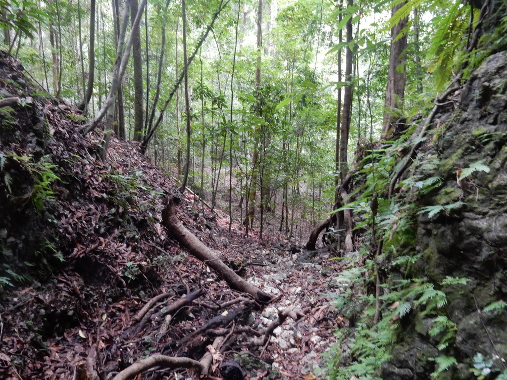
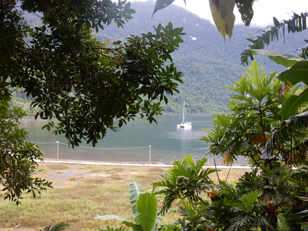
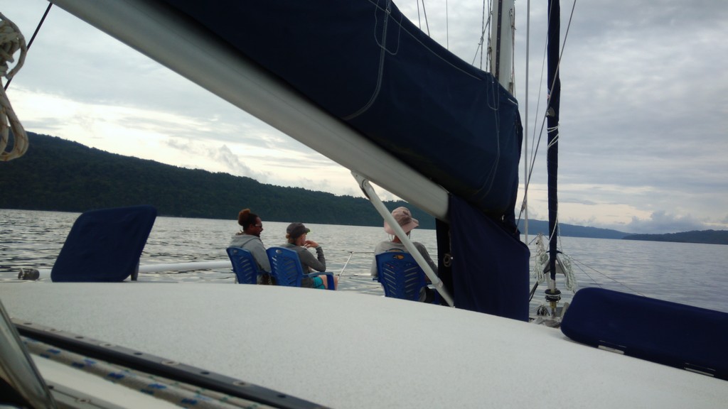
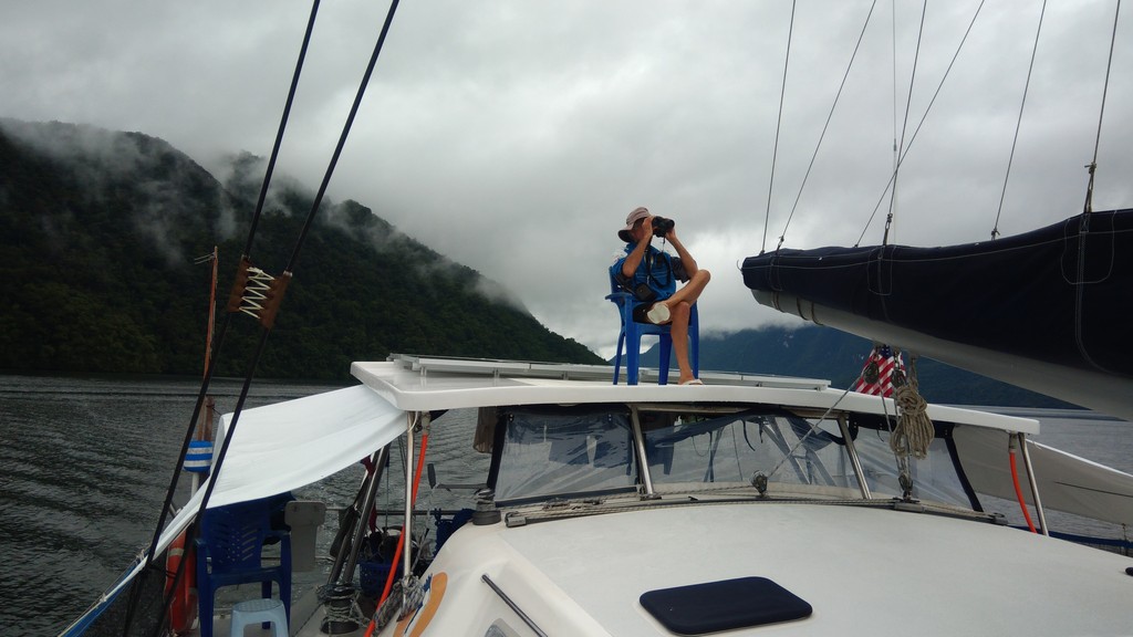
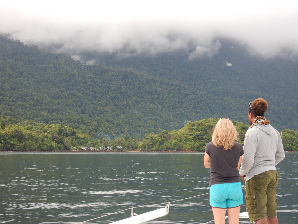
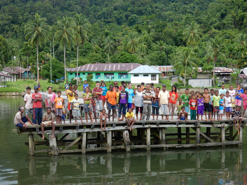
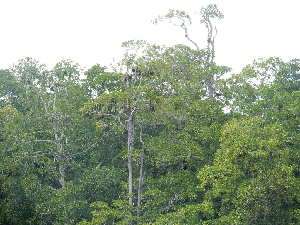
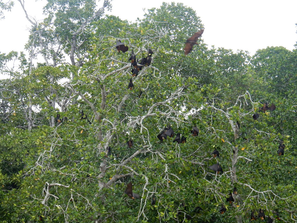
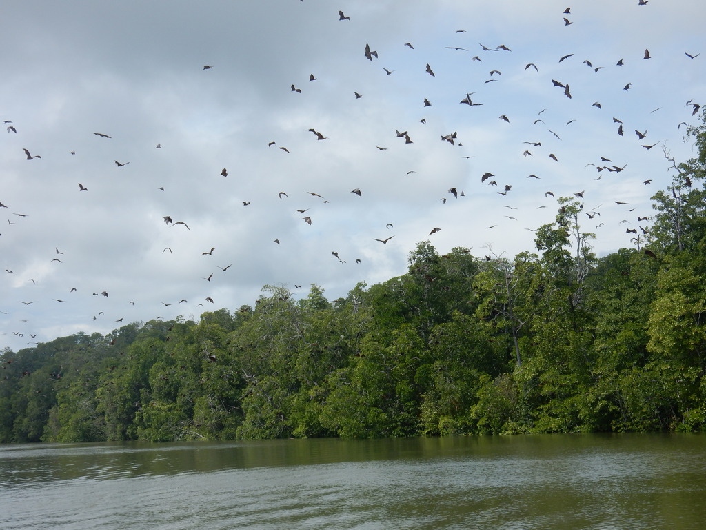
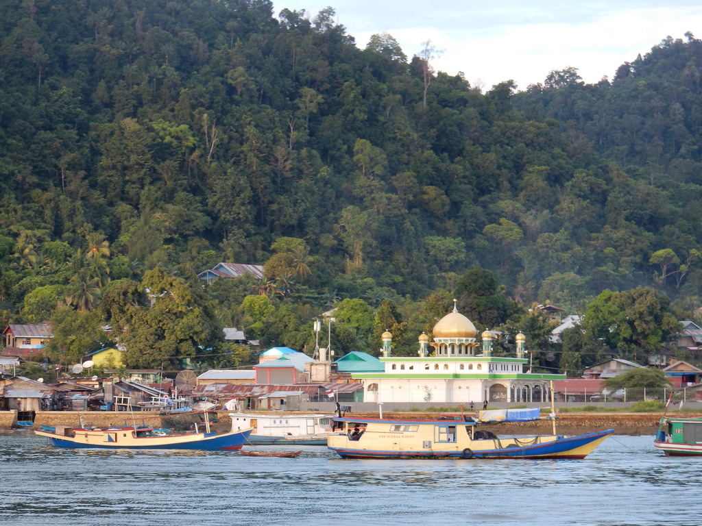
We came in the north entrance to Lembeh Strait and went direct to the Serena Besar anchorage (the little island in the middle of the strait at the north end of Bitung). There is a LOT of trash in Lembeh strait, including massive plastic accumulations and lots of logs / tree branches, etc. There are also scattered FADs. At dusk there are tons of fishing boats headed out. Best to try to time arrival during daylight.

There is space on the south side of Serena Besar in about 50-65 ft for at least 2-3 boats. It is a decent anchorage except quite a bit of current, and the fishing boats coming and going at all hours. It is swimmable at the right time of the tide. At the wrong time, the tidal debris is hanging about and would discourage going in the water. The water is clear enough to see the reefs in good light.

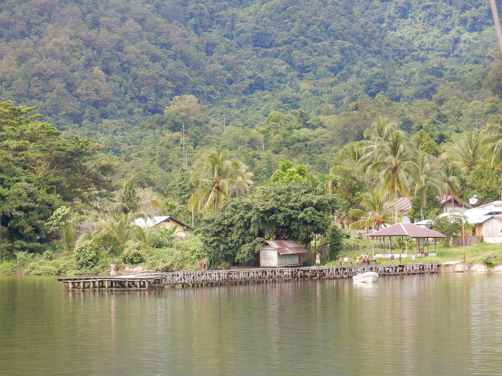
Dinghy 1: We went ashore the first day at the Water Police station that is on the mainland coast just a short dinghy ride almost due west of the Serena Besar anchorage (usually a big boat labeled Polisi there). We went around the end of the big boat and into the inner harbor, in the left hand corner there is a ramp, and you could either wheel your dinghy up the ramp, or put a stern anchor out and tie to shore. The police guys keep an eye on your dinghy. The tidal range here can be as much as 6 ft, so you need to consider tidal issues. We went in at nearly low tide, so coming back at high tide, one of us had to wade out to where the dinghies were. Bring a stern anchor!!

This is a short dinghy ride but a long taxi ride into town.

Transportation: We were told that from the Water Police station, you have to take a motorcycle (ojek) from there into town and once in town, the blue mini-vans (bemos) are shared route taxis and go all over. A route taxi costs between 3000-5000 rupiah in town, and maybe as much as 10000 on a longer haul. We were told different amounts by different people on the same route, so it's same as in the Philippines, once you know what it should cost, you try to have exact change and just hand it to the driver and walk away. That way you avoid the tourist markup.

In our case, however, we were fortunate on our first day to be offered a ride in to Immigration by one of the policemen. They were all very nice. It is quite a long way, so we gave the driver (unasked–for) 40,000 rupiah (about $3) for taking the 4 of us quite a long way into town. Later, we took a bonafide taxi (an English speaking guy hanging around the taxi area outside the port gate) and he asked us for 100,000 rupiah, but accepted 50,000, for the trip back which included picking us up at the grocery store and a short stop at a public market for veggies. (note about 13,300 Rupiah per dollar)

Dinghy 2: Later, on our other 2 trips in to finish the formalities, we opted to dinghy into the Fishing Pier (Perlabuhan Perikanan Aertembaga on Google Maps) (I will give a couple of lat/longs at the bottom). Here, we put our dinghy in a protected niche in the NW corner of the harbor, squeezed in between the small fishing boats, again with a stern line out and the bow line on a big bollard. We asked a couple of the fishermen working on nets nearby if this was OK. They said they’d keep an eye on it. (We ended up paying one guy when we came back, a “tip”—had planned on 4,000 but ended up giving him 10,000, less than $1, because we didn’t have change). This location is a longer, and usually wet, dinghy ride, but much easier with land transportation.

Transportation: From the fishing harbor, we walked out through the gate, and hung out in the shade at the intersection until a blue mini bus went by in the right direction (west). The guy took us to the end point for his route, which is at the corner of Jalan Sam Ratulangi and Jalan Sam Ratulangi/Jalan Desa Simalong. (this intersection is marked by the Summer Hotel on Maps.me, but Summer is located in a different place on Google Maps). I will call this intersection, the "main intersection", and use it as a reference point for the rest of the locations. A lady on the bus told us it was 4,000 per person. Later going back the other way, someone else told us to only pay 3,000.

Once at the main intersection, it is about a 5 minute walk west along that Sam Ratulangi street to Immigration. You could perhaps get your bemo to go the whole way, we saw some going past us as we walked, but our guy stopped at the main intersection and insisted we get out. Immigration is on the left hand (south) side of the road. You know you are going in the right direction if you soon pass a roundabout with an Eiffel Tower-like monument. In this stretch of street we saw several ATM's and cell phone stores. A Google Map search for Immigration came up with the correct place. Maps.me unfortunately has streets here but not much on information. So I recommend you pre-download the Google Map for the area and locate Immigration (or make your first stop a stop at a cell phone store, so you have a working Google Maps). I also recommend that you get the Google Translate app, and pre-download the Indonesian dictionary for offline use, before you leave leave internet for Indonesia. It is incredibly helpful, because no signs are in English. If you are online you can even point the camera at a sign or document, from within the app, and it will (usually) translate for you.

Immigration: (Kantor Imigrasi) We went inside, the lady at the Customer Service desk spoke good English, and told us to sit in the waiting area. About a minute later, we were called up to the desk, they took our passports and we showed them our visas. We waited about 5-10 minutes in a semi-air conditioned waiting room, and they gave us our passports back with a stamp in them, on the visa page, with that day’s date. I can’t remember if they asked for a crew list. No charge. We have 60 days (not 2 months) from that date. They told us clearly to begin the visa renewal process one week ahead of the end of the 60 days.

Customs: (Kantor Pabean) Walk back to the main intersection and turn right, heading south toward the water. At the end of that street is a gate area with a sleepy guard. Just inside that gate, to the left, is the Customs building. (remind me to say something about pre-arrival notices). Inside, we asked at the desk, and they directed us into an air-conditioned “waiting area”. This area includes a computer terminal to make adjustments to your Yachters Yacht Declaration.

The first problem we had was that the printed copy of our declaration had our only crew member (me) repeated 4 times). Apparently there was a bug in the system that when you edit some things, each time, it adds a duplicate of the crew member (I am told this is now fixed). At this point in time, the ONLY way to resolve this, I was told, was to delete the entire “yacht” from the system, and start with a new “yacht”, and go through the whole process again. There is no delete capability for the crew lines after a certain point in time. Fortunately the captain’s info is not deleted, but all the yacht info is (sorry Evan!). What a PITA!! Also, the photos of the yacht and the registration that I had uploaded were on my laptop, which I didn’t bring. So we agreed that I would go back to the boat and re-enter the information from my laptop, print a new copy there, and give them the printed copy when they came out to inspect the boat. This would only work for you if you had internet aboard, and had a printer.
Ariel IV (a) forgot to bring their printed copy and (b) and somehow there was NO crew on their crew list, though it had been there when they applied for their Visa! And they had entered the “Port of Origin” as their original location in Europe, not “Davao”, which had to be corrected. They got those corrected using the computer at the Customs office (don’t forget to bring your username and password, or maybe wise to bring your own laptop), and were able to print a copy for Ariel IV. We signed and stamped the respective printed copies of the Declaration form, waited a bit (for someone to look them over and make sure they were correct). And then we set up a time for the Customs inspection onboard. As we were in the office in the morning, they wanted to come that afternoon. Another boat that went in in the afternoon, had them come the next morning. They did show up more or less on time.
No charge at all for Customs, or Immigration.

Quarantine: The Quarantine office is in another building down the road toward the water from Customs. You have to go outside the Customs compound, turn left and down the road and turn left into the Quarantine compound. This is where you take the MARITIME DECLARATION OF HEALTH form you downloaded from the last page of your Yachters entry, which we had filled out, signed, and stamped.

There was a very nice lady in the first office who spoke English. She organized the whole procedure. Since we did not already have a “green book” (Ship’s Health Book), which we apparently require in Indonesia, we had to get one of those. (Though Noonsite.com’s updated regulations says this is no longer required). A few minutes waiting, and the lady brought us to a wall that had all the charges for Quarantine on it, indicating we had to pay 35,000 for one thing (our Certificate of Pratique) and $15,000 for the Green Book. (A total of about $4.50 per boat). After paying that, we waited a few more minutes and were presented with a Certificate of Pratique stapled inside our new Green Book. No boat visit required (we didn’t ask, they didn’t mention it).

The very last word the nice lady said to me was “You know that you have to return and get cleared out of Bitung before you leave for your next port.” (we didn’t know). It’s unknown whether you can get by without going to Quarantine at all. Had we not asked the question, nobody would have told us to do it. But you may run into problems down the way somewhere if you do not have the Certificate of Pratique. I know that in Sorong, clearing out of Indonesia last year, Quarantine was a mandatory stop in the clearing-out process. Customs would not give us our clearance document without it.
We didn’t ask if they would come to the boat…and they never mentioned it. So we got our paperwork without having to hassle with a visit from a Quarantine officer.

Port Captain: Nobody at Customs or Immigration or Quarantine mentioned the Port Captain. We should have gone there on check-in, but didn’t. On leaving Bitung, we did “check out” of the port, and basically did a check-in, check-out at the Port Captain at the same time. (Since we hadn’t checked out with the Port Captain in Davao, we made a copy of our Customs “Port Clearance” and gave that to the Port Captain in Bitung, which was accepted without question). Port Captain is on the main road that runs parallel to the waterfront, about a block back towards the Fishing Pier from Customs, next to a big mosque.

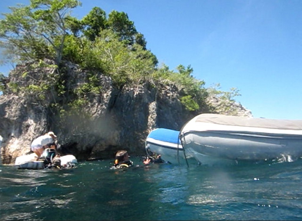
Customs Inspection: At the end of your visit to Customs ashore, you will negotiate with them for a time to have them visit your boat. This is absolutely mandatory in Indonesia both arriving and departing the country. We managed to put them off for a couple of hours so we could shop a little and get lunch. They came out in their own small launch with 4 or 5 young people (they were all still in, or just barely out of, Customs school). A couple of them spoke very good English, and the rest spoke a little. They circled the boat and took a couple of exterior pictures and then came aboard. They have a detailed checklist for the inspection, and they faithfully went down the list item by item asking if we have this, and if so, taking a picture of it. There were at least two guys with cameras (not sure how they split up who took pictures of what).

When asked about liquor, I showed them my 2 cases of beer and 4-5 open liquor bottles, which they faithfully photographed. When asked about drugs, I showed them our medicine cabinets and the prescription meds for blood pressure etc, and our prescription antibiotics (these were already listed in the “do you have drugs aboard” question. They photographed both cabinets. They wanted engine serial numbers, and they wanted to SEE them (we didn’t actually know where they were, so that took a little time). I had listed a gas generator on our list of equipment, they wanted to see that. Dive compressor (wanted to see and photograph). Dive tanks (we had 4 in the cockpit and 2 stowed, they took pics of the 4 in the cockpit). I had listed 2 personal computers and one nav computer. They took pictures of the Nav station. Finally, the AIS, he wanted to see the AIS Transmit screen… to prove that our AIS was actually transmitting. I said “you can see us on MarineTraffic.com, right?” but he still wanted to see the transmit screen on the AIS, and he took a picture of it. Our Vesper has an AIS Status screen that shows it’s transmitting. I guess they have gotten wise to the scam of having an AIS receiver only and using a cell phone app to post your position on AIS.

All in all, they were very pleasant, and professional, and thorough. I offered them some cold water and was declined. The whole visit took about 30 minutes per boat. After the visit, we then had to return to Customs the next morning to receive our clearance paperwork, and “make sure you bring your stamp”. Part of the Customs clearance paper is a half-page list of things the Captain is agreeing to, and the Captain has to sign and stamp that he agrees to this list.

Cell/Internet: We bought simPati Telkomsel sims with 12GB emblazoned on them for 85000 Rupiah (note, the 12GB is split into several different applications so it's not quite 12GB usable, but it only costs $6.30). Make sure you download the MyTelkomsel app, it's the best way to manage "loads" on the device and buy packages, because all the text messages and the sim card built-in menus are in Indonesian. Best to bring your device with you, so you get the right sized sim card and get it all activated. You will need to specify when buying whether you want a phone sim (phone/text only) or phone sim with data. The simPati is a phone sim with data. We got that one for both phones and for our wifi device. (Note, if you have a PH wifi device and want to use it here, I suggest you try to get it opened up in downtown Davao vs waiting til you get here to try to use it--to check whether you need it opened up, just put a different carrier's sim card in it). All my notes on simPati sims and recharging are in the Cell Phone section in the Indonesia Compendium (http://svsoggypaws.com/files/).

Cash / ATMs: There seem to be ATM’s all over the place. Max withdrawal at the ATMs has been 1,250,000 Rupiah (about $100) but you can do multiple w/d. ATM’s seemed to be everywhere. I found Mandiri worked best for me, but Ariel IV also used a different one (BRI, I think) that didn’t work for me. There is a Mandiri ATM at the big hospital building across the street from Immigration and back toward the main intersection a block or so. Mandiri sign out on the street.

Groceries: The largest supermarket that we have found is called Citi Mart (Citirumah Makanart Swalayan). It is on the road that the Customs gate is on (Jalan Yos Sudarso), about a 5 minute walk west of the Customs gate, on the north side of the street. They sell beer and some liquor there. Being well stocked, we didn’t even ask the prices of the liquor. The Bintang beer was 373,200 Rupiah ($28) for a case of 24 330ml bottles. They also had Bintang in cans by the 6-pack.  We also saw Heiniken there, probably a little more. Bintang is pretty good beer. They had a reasonable array of food, including potatoes and big onions. Some green veggies (the usual stuff), but I didn’t buy any because we were planning to stop at a market. Some sliced American cheese. I saw chicken products for sale (didn’t really look closely at the meat because my freezer is full). Boxed milk. Half of the building was a department store, and upstairs, a fried chicken restaurant with a menu in English.

There are several other smaller stores we saw in the taxi rides further out of town.

We went by taxi to the small veggie market (on our way back to the boat the first day). Probably can get there by blue bus, but can’t tell you how. I have a pushpin for it in Maps.me but no real location I can point to on Google Maps, the road layout doesn’t look identical.. Somewhere in the general vicinity of Pondok Café Three Putra (search for it on Google Maps) (due NW of the Fishing Pier, inland, several blocks up and several blocks west).

There is a much bigger market in the town of Girian to the west of Bitung along the coast road. The blue Bemo’s do go to Girian.

Fuel: We “hired” a bemo near the fishing pier to take us to the Pertamina gas station that sells un-subsidized fuel—We pooled our resources and sent 3 guys with about 10 fuel jugs. This is apparently the only station in town that will sell you (foreigners) fuel. And it's good clean fuel. It is west of the main area of Bitung on the coast road, about halfway to Girian. While 1 guy was filling fuel jugs at the pump, the other two took the bemo to the fresh market nearby in Girian. We paid the bemo driver 100,000 for the whole deal.

Though there are guys that will bring you fuel in their boat, the one cruiser who used a guy in Bitung ended up with TERRIBLE fuel (frothy emulsified stuff). Fortunately he looked at it before putting it in his tanks, and refused it. But the guy still wanted payment! Big argument ensued. So best to do the jug thing into town, or very carefully negotiate ahead of time with the “boat delivery” delears, and make them understand that you will refuse anything that is less than perfect fuel.
There is a fish market nearby the fishing pier—the big blue building. But at 10am there was no one there selling fish. The next day at 6:30 am there were tons of people buying and selling fish!

Boat Parts: Right near the “main intersection” is a wonderful store with an amazing array of boat stuff, including Icom and Garmin products (a few), stainless steel screws, etc etc. This would be the first stop if you were looking for something. The name of the store Ud Karya Mentari and it’s on Google Maps in approximately the right place. They will take a credit card with a surcharge. There are lots of smaller hardware stores on the street going away from the Fishing Pier. We also saw a big Yamaha sign somewhere when in the taxi.

Pre-Arrival Notification: Before we went ashore the first day, I was re-reading what I could find on my computer about completing the formalities in Indonesia. The newest Indonesia Guidebook says something about having your agent do the required pre-arrival notification. So I emailed Ruth, asking her how a yacht that didn’t have an agent would do the pre-arrival notification, and whether it was required. Her response was something along the lines of “your Yachters entry is your pre-arrival notification” but she had also texted Customs in Bitung that we had arrived. I again asked her if there was an email address to email to, and I never got a straight answer to that question. So I would make sure your Yachters arrival date is as accurate as possible. (I guessed right and we actually arrived on the day we said we would). But, if it were me, I would also try emailing or texting a pre-arrival notification. Here are some email addresses: pkcdt.btg@gmail.com and kppbca4_bitung@yahoo.co.id Cell # +62 0877 5165 6225

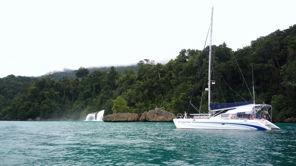
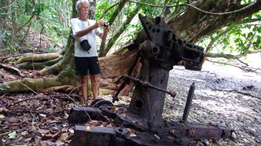
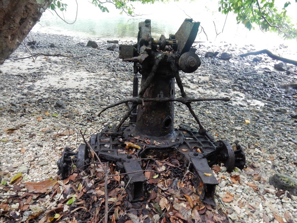
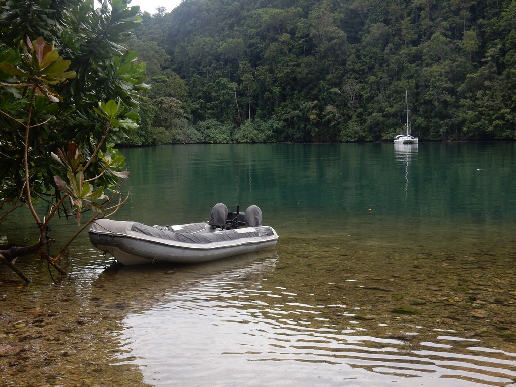
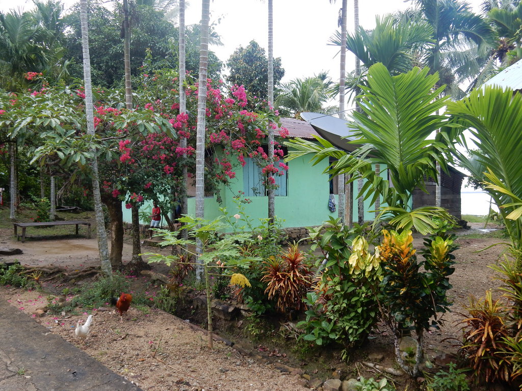
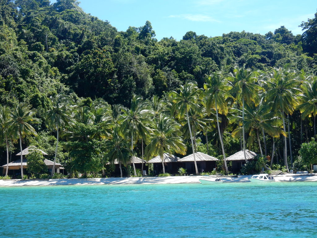
Bastianos Anchorages: While anchored at the Serena Besar anchorage, we went over by dinghy to Bastianos Dive Resort on Lembeh Island and saw that the anchorage area there would be much cleaner and quieter, plus less current. We talked to the manager (A Swiss guy named Thomas) and he was welcoming to us. So we moved over there. We had several waypoints from others, but ended up at 01-26.89N / 125-14.374 This was fairly deep (60-75 ft), but a much nicer anchorage (if you go further in the bay toward the east, it gets shallower).

We had several dinners ashore at the resort—-it is buffet style for Rp150,000. Their bar has a nice overlook to watch the sun go down and they serve beer and mixed drinks at typical resort prices. We also negotiated a group rate for 6 cruisers to go out diving in Lembeh Strait, and they were happy to come pick us up on the boat. They have a fairly attractive dive rate if you make 5 dives with them (about $35 per person per dive).

We ultimately left our boat for 3 days in front of Bastianos to go dive Bunaken (the other side of the N Sulawesi peninsula). The anchor waypoint right in front of Bastianos that Thomas wanted us to use (so his guards could keep an eye on the boat) is 01-26.79N / 125-14.25E. This was deep, about 75 ft, but Thomas didn’t want us in any closer/shallower because his “house reef” is just inshore of that.

Other Anchorages: If you have a small dinghy, or just want to be closer to town, you can anchor off the fishing pier. One boat we talked to spent a week anchored there with no problems while the captain went on a visa run. I also noticed that Screensaver went right down next to the main commercial pier and anchored for the day for clearance out.

Serena Besar anchorage: 01-27.545 / 125-13.862 E
Water Police Dock (approx.): 01 27.58 N / 125 13.30 E
Fishing Pier (approx.) 01 26.84 N / 125 12.57 E
Dinghy Tie Up (northerly sector winds): 01 26.80 N / 125 12.53 E
“Main Intersection” 01 26.66 N / 125 11.43 E
Small Fresh Market Near Fishing Pier: 01 27.00 N / 125 12.00 E
Citimart Supermarket: 01 26.58 N / 125 11.15 E

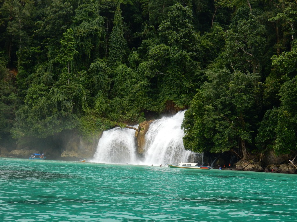
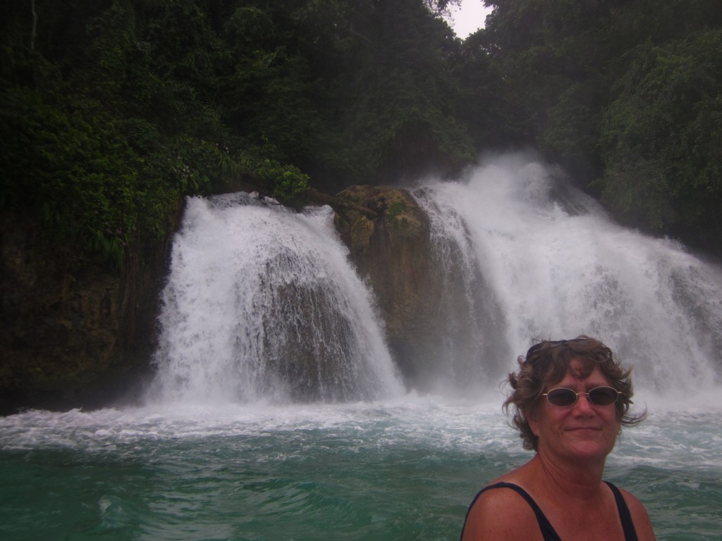
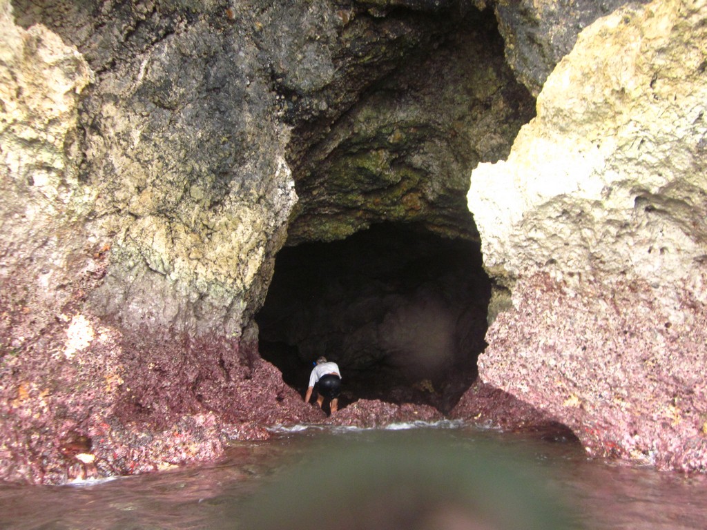
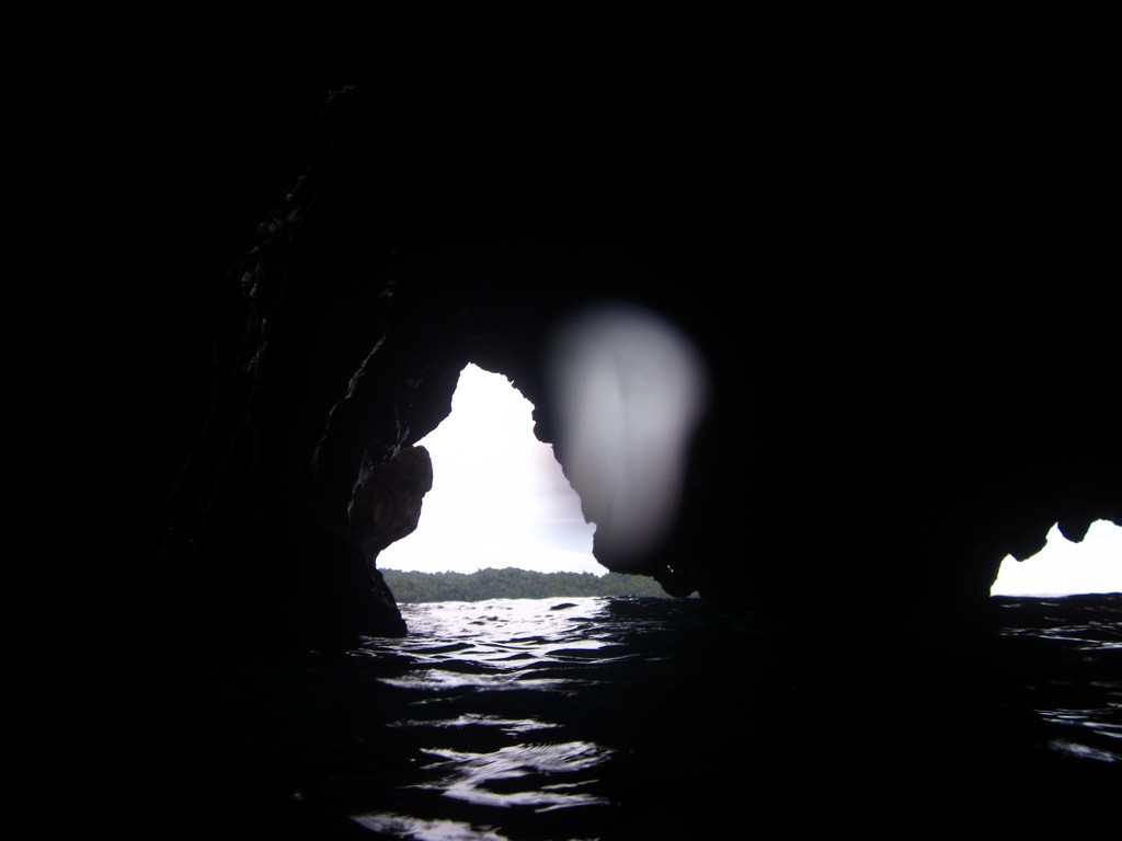
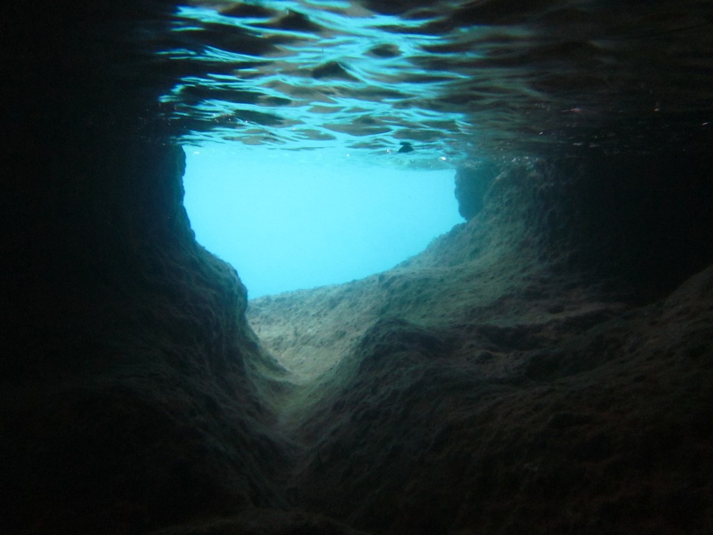
Sightseeing in the Bitung Area: We met a taxi driver in downtown Bitung that spoke good English. He offered to take us on a “tour” for Rp1M for the day. There are a number of taxi drivers hanging about in downtown and around the waterfront areas offering their services. One boat hired a driver with no English skills for 500,000 pesos for the day. We ended up going with Hamid, our English-speaking driver. We had scoured the Lonely Planet and Trip Advisor information and had a few specific places we wanted to see (lakes, mountains, and waterfalls). Hamid picked us up at the dock at 7am and drove us around all day in a nice car big enough for 4-6 people. We split the tour fee between two boats, and bought Hamid lunch. We thought it was a good tour for a good value. Hamid can be reached at 0812-4484-202. He has several businesses, but with a day or two notice could be hired to do pretty much anything you need (provisioning, etc).

Note:  all of this info has been put in the Indonesia Compendium, which can be downloaded here:  http://svsoggypaws.com/files/