We had a nice week in Maloelap. We spent most of the time around Taroa, where the Japanese had a major air base during World War II. The first thing that impressed us, was that the Japanese built their installations as if they were there to stay for a long time. This was no fly-by-night forward base. The concrete pier is massive and built of thick reinforced concrete. They built a massive generator facility on another small island a couple of miles away, and ran heavy-duty electrical cable between the two islands. If you're interested, check out this short tourist overview of the Japanese facilities:
A Virtual Tour of Taroa Airbase
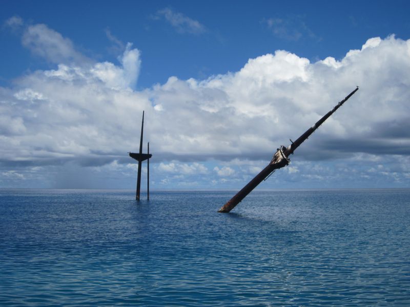
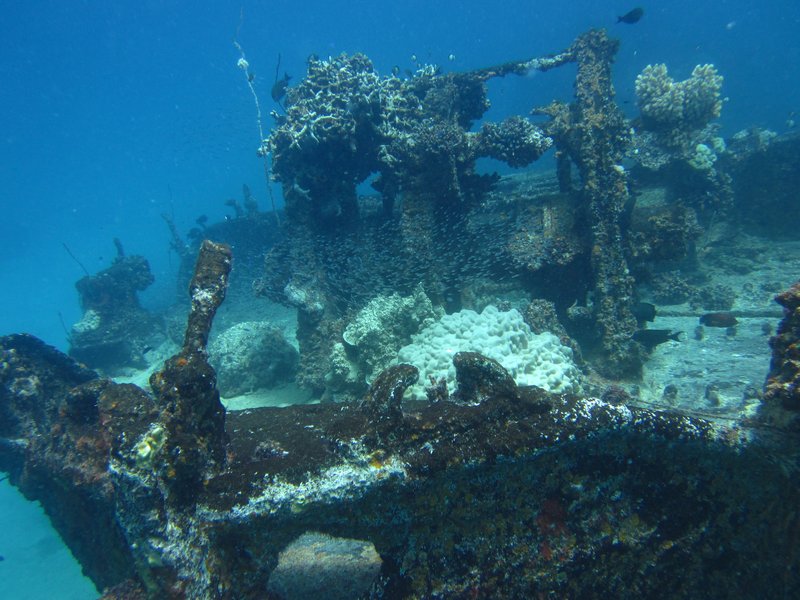
We knew there was a Japanese ship sunk in the bay--it's the first thing you notice as you pull in to the island--the ship lies in about 40 feet of water, and it's tall masts (for lifting cargo) stick 20-30 feet out of the water. We eventually did 2 dives on this ship.
 The Masts of the Sunken Japanese Wreck, Tarushima Maru
But the focus for our visit to Taroa was to search for the "missing" Corsair. The F4U Corsair were the primary USN fighters during World War II, and one was supposed to have been shot down over Taroa, landing in the water just off the pier.
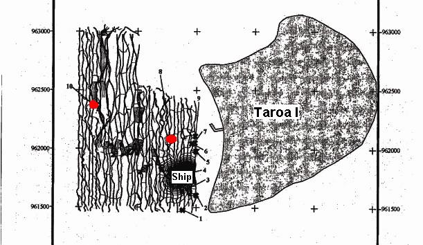
Our instructions from Matt Holly were to search "north of the pier and out beyond 60 feet". But in reading the past archaeological studies of the WWII stuff in Taroa, we saw that the University of Hawaii had done a magnetometer survey in the area off the pier, found some "hits", but had never gone and investigated them. So (geek that I am) I snatched the rough graphic of the search area out of the study PDF file, sucked it in to SeaClear (a charting program that you can use to create your own charts), used a couple of landmarks (the pier, the ship, and N and S points of the island) to "geo-reference" the magnetometer search area onto a chart. Then we took waypoints off of the two major anomalies that were in our search area, and went directly there to investigate them.
 The Output of the University of Hawaii
Magnetometer Survey of Taroa in 1999
Red dots are the two uninvestigated magnetic anomalies
that we checked out
I was amazed that we found something in both places! (ie my hairbrained idea wasn't so hairbrained). But, alas, they were definitely not "airplane debris". The #10 anomaly was a coil of what we think was the heavy generator cable, and the #8 anomaly was maybe ship debris, or something off the pier.
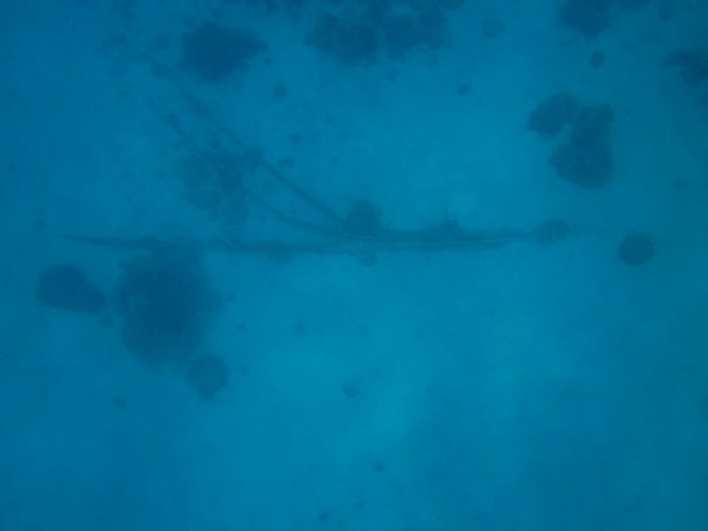
 The Debris We Found at the #8 Magnetometer Anomaly
What it did do was validate the now-georeferenced magnetometer survey. It also gave us a feel for the diving conditions. #10 was in about 100 feet of water and #8 was in about 60-70 feet of water. From the dinghy, with days of calm conditions behind us, in 60-70 feet of water, we could clearly make out shapes on the bottom in the sand. So we knew it would be feasible to tow behind the dinghy with a snorkeler and do a systematic search--at least until the water got too deep to see the bottom from the surface.
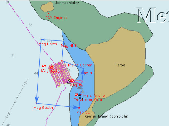
So I figured out how to use OpenCPN's Search and Rescue plug-in to have it lay out an organized search pattern in a "box" shape, with lanes 60 feet apart. We downloaded this as a route to our hand-held Garmin GPS, and set out to do a systematic search. The Garmin laid a "snail trail" showing where we went, and we then uploaded this back into the computer to keep a record of where we searched.
 Our Corsair Search off Taroa Island
The pinkish lines are our actual search path
The magnetometer survey is outlined with light blue arrows.
The westernmost dive flag is where the #10 anomaly was, in 100'
We laid out our search pattern to parallel the shore, so that we (hopefully) had even depths. We started in about 60 feet of water, and ended up in 80-90 feet of water. Unfortunately, the amazingly clear conditions did not stay with us. After the 3rd day, the visibility went down to 30 feet or less. And by then we were out in pretty deep water. Even snorkeling down to 20-30 feet (while being towed behind the dinghy at 2 knots), it was difficult to distinguish features on the bottom. We'd have to use SCUBA and be towed at about 60 feet to see anything on the bottom.
Dave made a 'diving plane' out of plywood that helped us control our depth--this worked well when snorkeling, to allow the towed person to dive deeper as he was being towed. (We forgot to take a picture of it, but
here's a YouTube Video from someone else. Ours is just an 14" x 24" board). This would also be useful if we had to resort to SCUBA. But we kept hoping the viz would improve so we could continue searching further out--out beyond the magnetometer survey borders. But it never did, even though the winds stayed calm. We suspect that the better-than-normal visibility we had when we first arrived may have been due to the fact that the tidal range went down to only about a foot. Normally the tidal range is 4-5 feet.
Jerry on Challenger was there with us the whole time, and helped us with the search. Dave and I and Jerry took turns, with one person being towed, one person driving the dinghy (watching the GPS very closely to stay in the "lane"), and the 3rd person checking depths and watching the person in the water.
While we were waiting for our friends on Westward II to show up, we took Soggy Paws and Challenger 5 miles north to check out Pigeeyatto (aka Bigat or Pigget) and Ollot islands. Pigeeyatto was where the generator facility was, and Ollot had a couple of sunken small Japanese freighters, and the remains of two Japaneze Zero airplanes.
The locals claim that one of the two sunken ships at Ollot was the ship that transported Louis Zamperini to Kwajalein. Zamperini is the downed US pilot who drifted in a liferaft for 46 days, only to drift into Japanese hands at Maloelap or Wotje (they're not sure which). He spent the rest of the war trying to survive in Japanese prisons in the islands and on mainland Japan. (see
Unbroken: A World War II Story of Survival, Resilience, and Redemption for this amazing story).
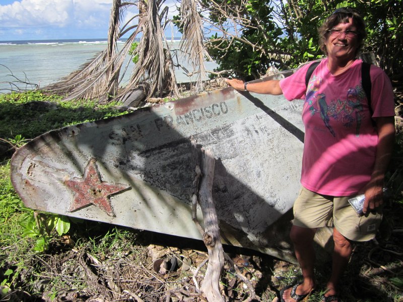
 The Wreck of the Ship that Transported Zamperini to Kwajelein
 Japanese Zero Wreckage on the Reef Near Ollot
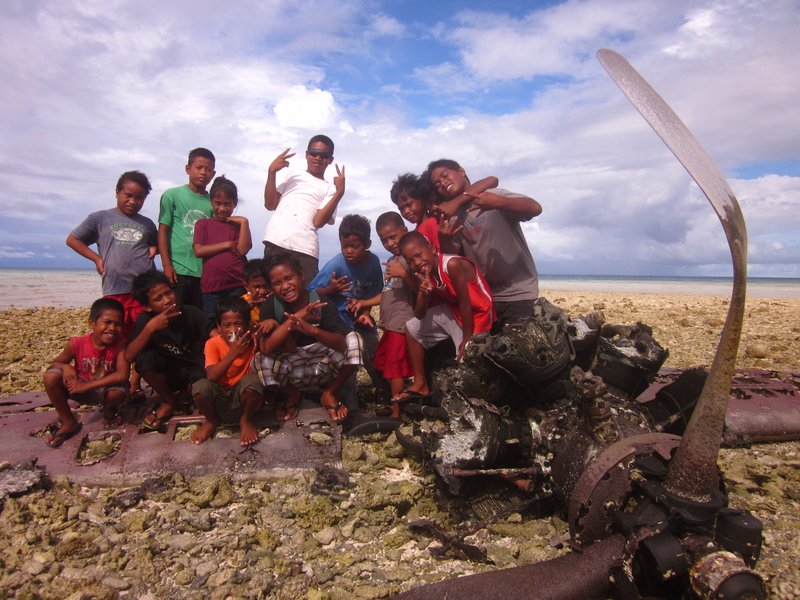
 Ollot Kids Who Came Out to See What We Were Looking At
 An Old Canoe Ashore at Pigeeyatto
 The Huge Generator Building at Pigeeyatto
 A Sailboat Wreck on Pigeeyatto
We also spent two afternoons tromping through the bush on Taroa looking at the extensive WWII debris--the remains of airplanes (bombed by American forces while on the ground), gun emplacements, runways, and buildings.
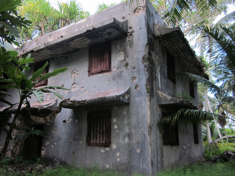
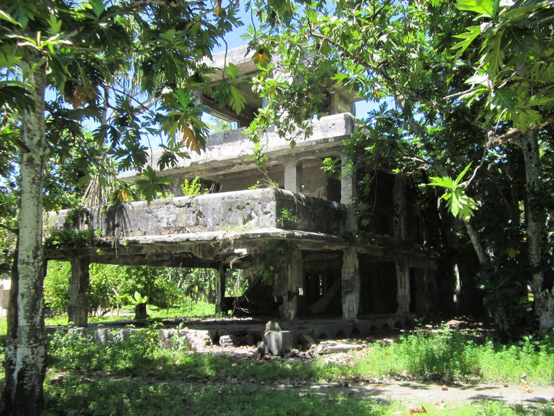
 The Bombed-Out Japanese Command Center on Taroa
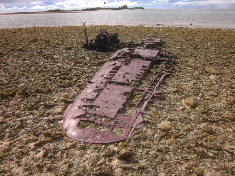
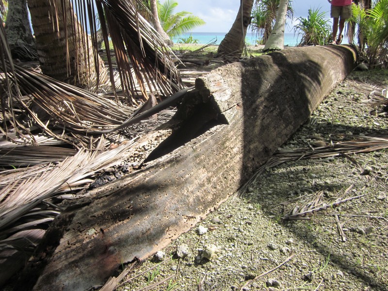
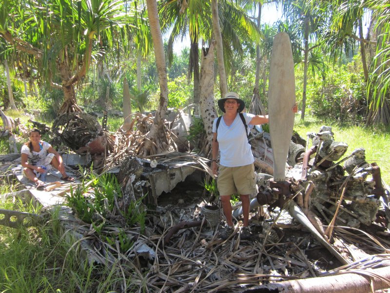
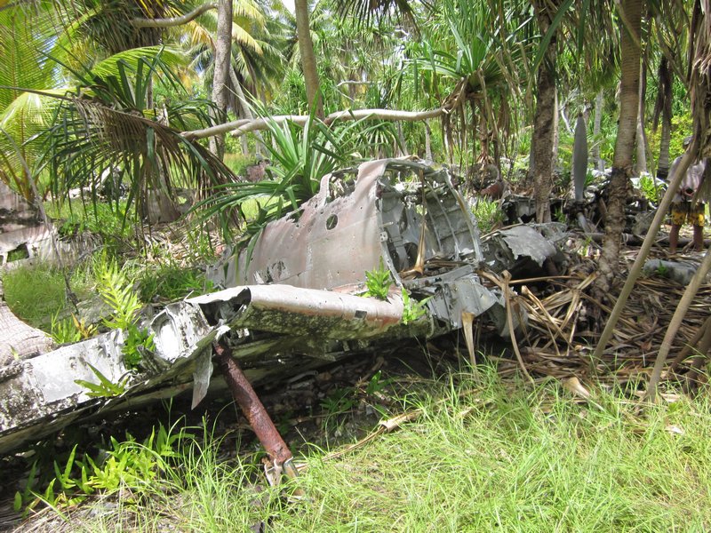
 The Airplane Graveyard at Taroa
 The Airplane Graveyard at Taroa
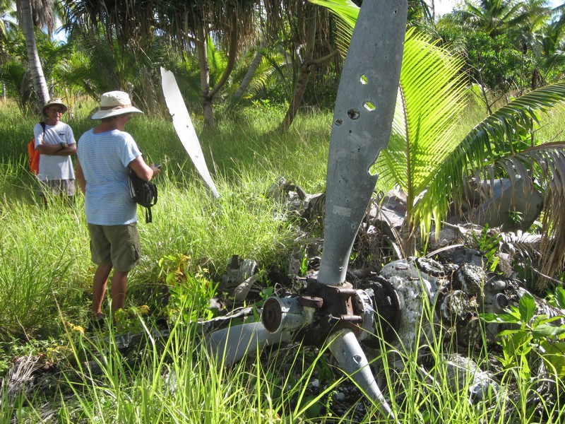
 Note Bullet Holes in the Propeller!
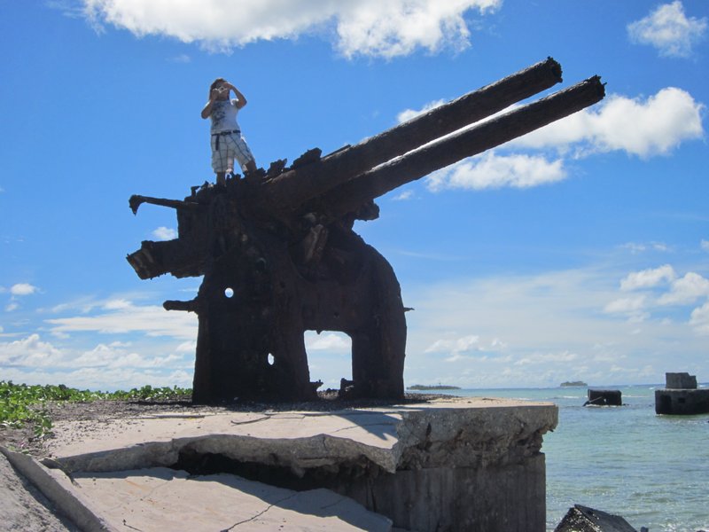
 Anti-Aircraft Guns on the Beach
 Ulyana on a 127 mm Gun Emplacement
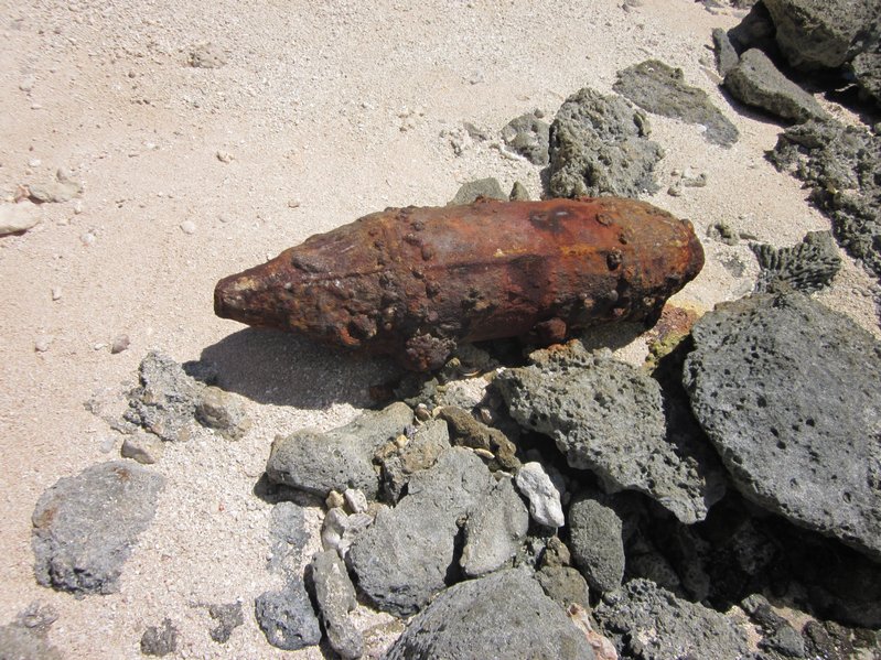
 Old Unexploded Bombs are Still All Over the Place
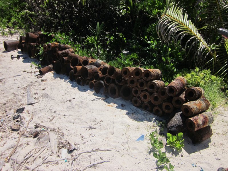
 These Old Bombs Have Been Cleared
by an Unexploded Ordnance Squad
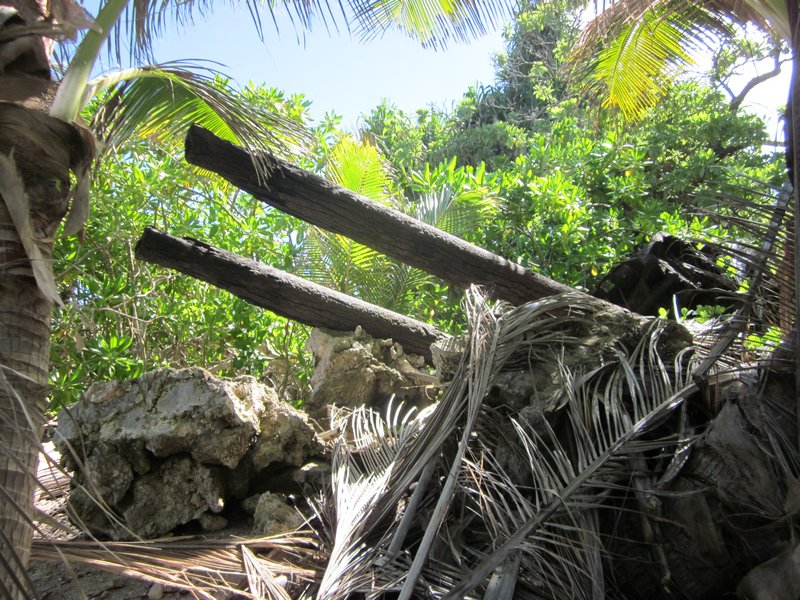
 Lots More Stuff Hard to Find in the Jungle
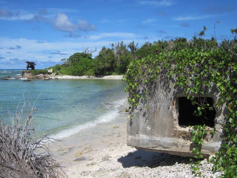
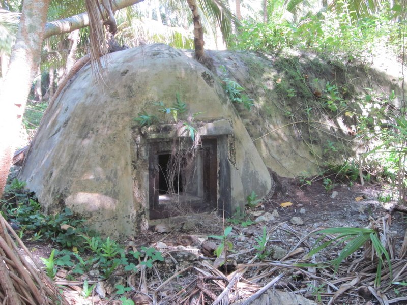
 An Ordnance Bunker?
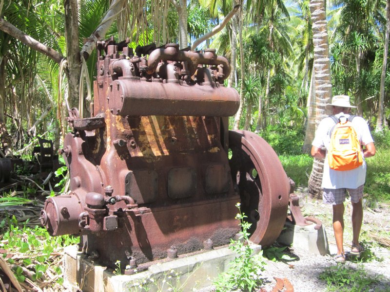
 Circa 1940 Yanmar Generator
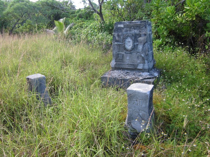
 A Memorial Erected by the Japanese to their Lost Soldiers
We never really did engage with the people of Maloelap on this trip. We were too busy in our "seeing WWII artifacts" mission. The people who live here don't really give a rat's ass about the "artifacts". They don't really understand the benefits of tourism, and the debris just gets in the way of farming the land. And of course it brings in these odd people who want to look at 70-year old war debris.
And we never did find the Corsair--but we did expand the area that we know where it's NOT. We handed over our search information to Matt Holly and the Marshall Islands Historical Preservation Office, so next group of interested people can pick up where we left off.
We are on a mission to fit in one more atoll (Jaluit) before we have to head to Kwajalein and park Soggy Paws for our annual trip back to the U.S. So we hurried off back to Majuro to reprovision, leaving Challenger and Westward II in Maloelap. They moved south to Airik Island (still in Maloelap Atoll), and spent a few days there "fixing things" for the locals. On the list: hooking up replacement batteries to their hospital solar system, diagnosing solar controller problems, fixing a chainsaw, looking at a strange VHF radio problem, and tinkering with a couple of outboard motor issues. In return, they were amply rewarded with local produce--papayas and limes, and lobster.
We are now back in Majuro, getting ready to head to Jaluit, another Japanese base in WWII, and then on to Kwajalein. We are scheduled to fly out to the U.S. on October 8, from Kwajalein.