Friday, February 29, 2008

Vivarillos and Cayos Cajones

We arrived in the Vivarillos on Monday after a 2-day motorsail. We spent Tuesday recovering from our overnighter, and exploring the Vivarillos a little.

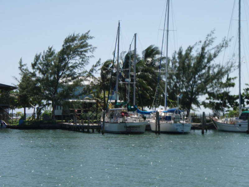
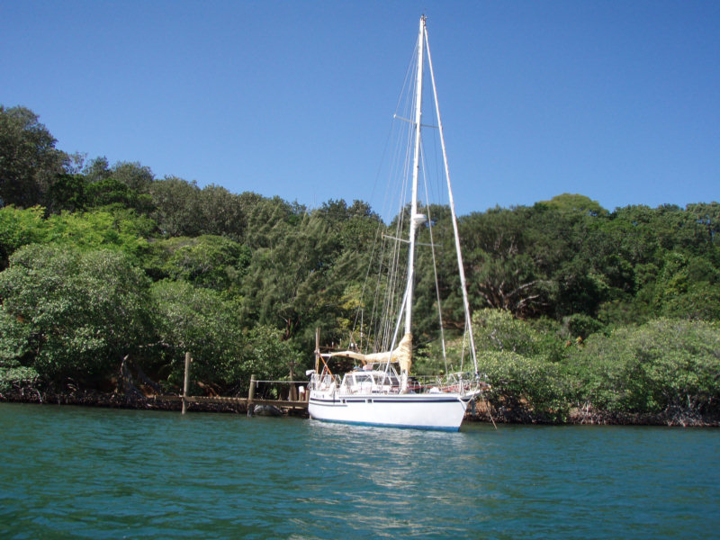
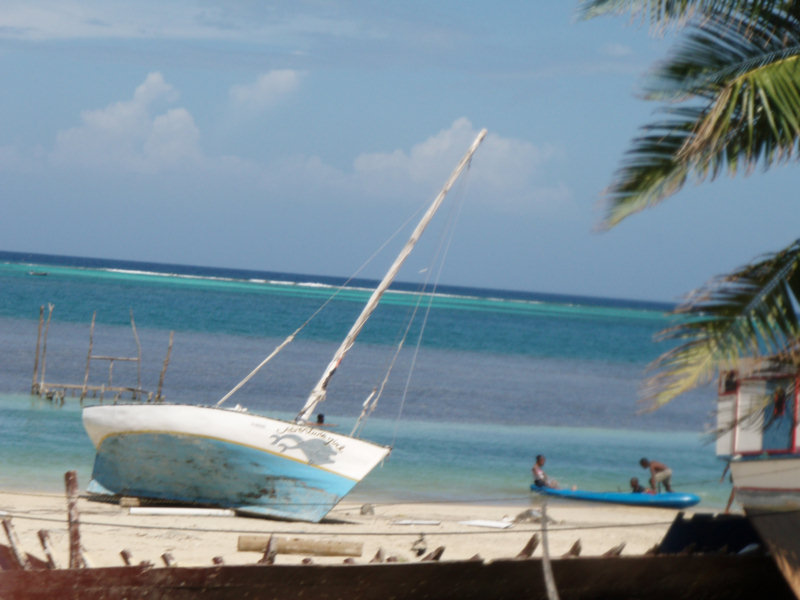
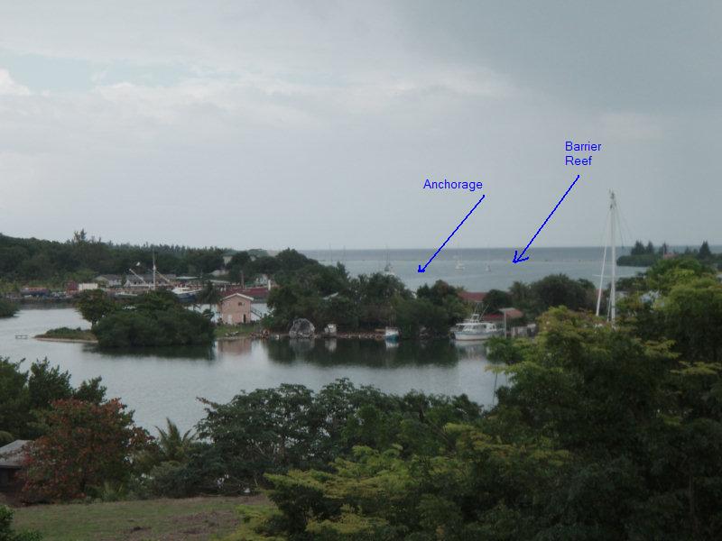
The approach we made to the Vivarillos from the west, at night, was to waypoint 15-50.46N 83-18.13W. It is clear to approach slowly from the west, and the depth shallowed to a minimum of 12 feet. At the waypoint, it is about 10-12 feet deep in good sand. It is possible to go another 100 yards further in at least, but you should probably do this during daylight. At this point, you are between the Grand Vivarillos island to the south and the Bird Island to the north, with a continuous reef out
in front. It is good protection in weather from NNE to SSE, but does get rolly if the wind goes too far north or south. It is possible to move around behind Grand Vivarillo in a westerly, but this is really not a good place to weather a strong frontal passage.

We have a fairly detailed chart of the Vivarillos in our raster electronic chart (and I think the CMAP chart is similarly detailed).

Yesterday, we opted to take advantage of the light wind and good sun conditions to go explore another reef area 16 miles NE of the Vivarillos. This area has 2 names, Cayos Cajones and The Hobbies. Our chart of the Hobbies is not very detailed. It looks to be just reef with no land. We were really not sure what we were going to find here. But friends had told us it was a 'not to be missed' place. We also weren't sure what the weather was going to do. There is a front approaching and we didn't
want to get caught in an unfamiliar area with stinky weather.

But the GRIB file was forecasting light winds and no westerly component, and the skies were clear. So we thought we'd leave early, go up and check it out, and if we didn't like it, we could go back to the Vivarillos anchorage before dark.

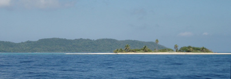
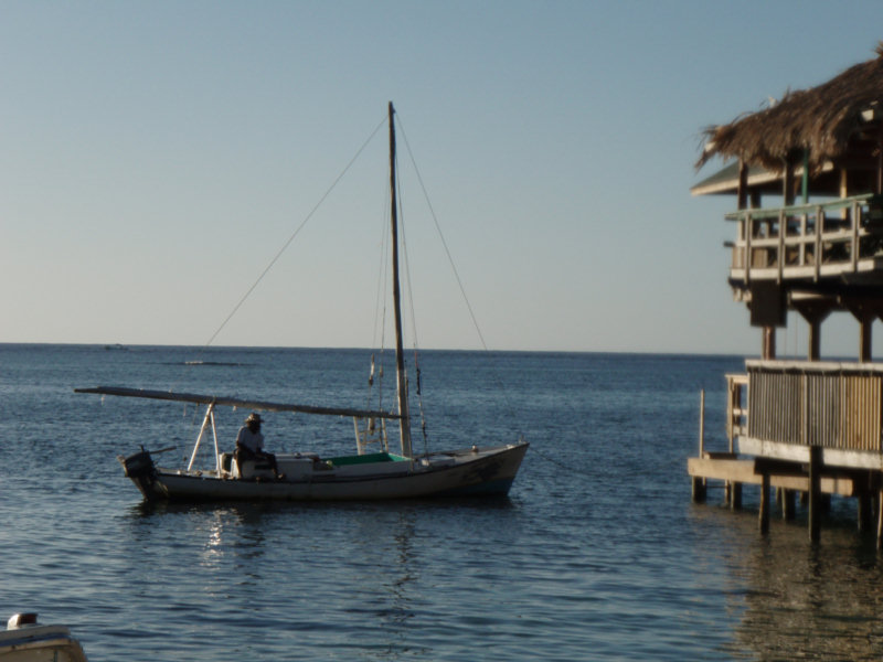
So yesterday, we motorsailed in about 5 knots of wind, up to the two waypoints our friends had given us. 16-01.829N 83-06.214W and 16-02.500N 83-06.320W. Once we got in close, we had to go on visual navigation, because the area is strewn with coral heads. But it was easy getting in, and after checking out both anchoring spots, we opted for the second waypoint. We were surprised to find 2 islands with vegetation, and several visible sand islands, since there is no land indicated on the chart at
all.

The first waypoint is right off the southern island and has good protection from the SW around to the East, if you tuck in close. The second waypoint is good from South, around to the East, and all the way on around to the NW. Both are good anchor spots in the normal ESE trades, but since we were expecting the wind to soon switch to the NNE, we opted for the second anchorage.

But all day yesterday, the wind remained very calm... less than 5 knots out of the SW. We checked the GRIB (wind prediction) forecast again and decided it would be OK to stay for the expected frontal passage.

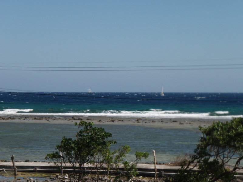
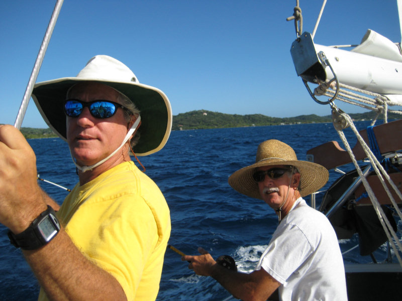
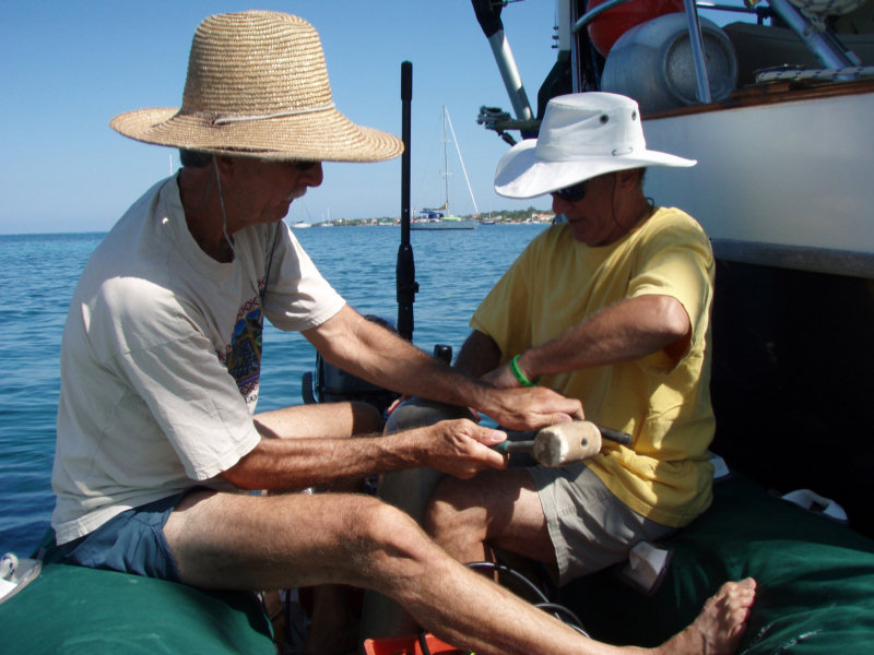
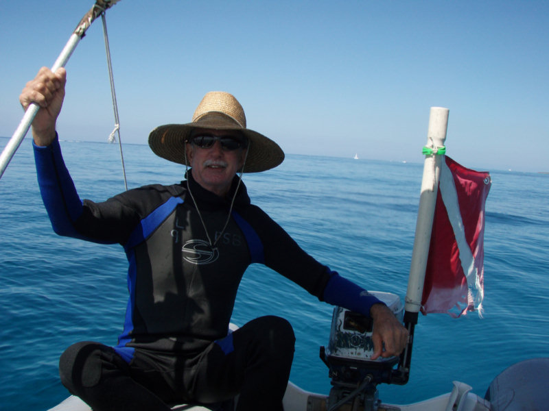
So we all (Dave and I, Mike, Laura, and Liz from s/v Gilana, and Sophie and Bernhardt from s/v Stella) jumped in the dinghies and went out to explore the reef. Dave and I quickly found a couple of spots inside the reef with good relief and some fish, we marked them with the GPS so we could come back later. But the water in the inner reef was kind of murky. So, we went further out to the outer reef. With the calm wind it was an excellent opportunity to explore the outer reef--which normally has
breaking waves over it.

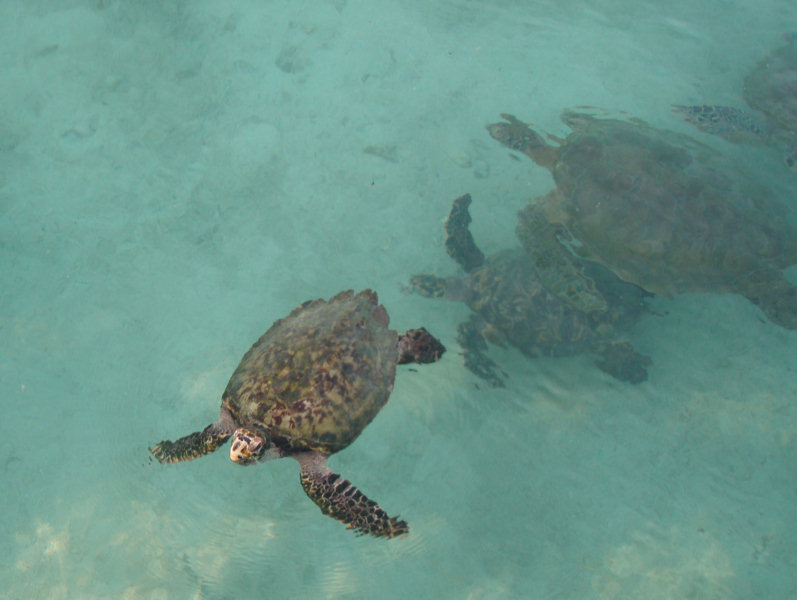
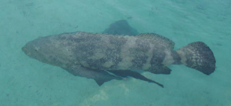
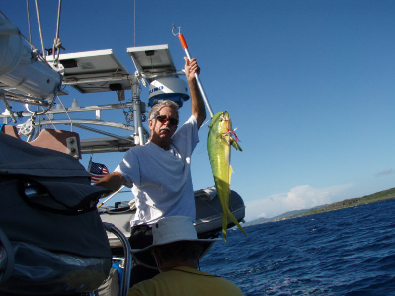
Gilana found a swim pass from inside the reef to outside, and we all went snorkeling through. There were lots of fish and at least one small Hawksbill turtle swimming around. After a bit of looking around, we found a big school of snapper, with several of them close to 2 feet long. Mike had brought his spear gun, and eventually picked out one of the biggest Red Snapper, and speared him. Then he loaned Dave his gun and Dave got a Cubera Snapper. Mike's fish was big enough that they shared half
with Stella, so everyone had fish for dinner.

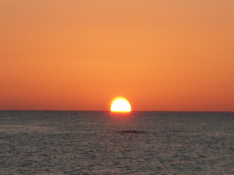
The sea was glassy in all directions at sunset and it made a spectacular sunset.

Tuesday, February 26, 2008

Arrive in the Vivarillos

After a long trip (159 miles, 32 hours), we arrived in the Vivarillos just after dark tonight.

Fortunately, we had some friends in the anchorage who turned on all their lights to help us get in after dark.

Monday, February 25, 2008

Moonlight Sail?

Well, there was moonlight for most of the night, and the sails were up, but I wouldn't call it sailing.

Fortunately, our coastal strategy has worked out and we had light winds, sometimes sailable, all night long. The seas are a little lumpy, but otherwise not bad.

We never did get the counter-current we hoped for, so our ETA is currently just after dark. I think we'll be OK making a cautious approach from the west. We have waypoints for the primary anchorage on the NW side of the big island.

If we pick up a little sailable wind today, we may make good enough time to make it before sunset.

Making Time to the East

Well, the trip has almost gone as planned today.

The only glitch was a squall we encountered about 4:30pm, with gusts to about 35kt. Fortunately we were ready for it. It was hairy and uncomfortable, but it has passed.

Our friends out at Vivarillos tonight said they had 7 knots of wind, so maybe the GRIB files really were right.

All is well aboard.

Sunday, February 24, 2008

Leaving Guanaja Today

We expect to leave this morning at 0900 CST from Guanaja, leaving via the Half Moon Cay Channel.

Once clear of Guanaja, we will cut into the coast of Honduras (tracking to a waypoint somewhat arbitrarily picked along the coast), heading initially about 150 degrees, for the first 30-35 miles. Once we get close to the coast, we plan to stay within 5 miles of the Honduran coast until about 0630 on Monday morning, when we should be approximately at Punta Patuka, then we'll head due east to the Vivarillos. We expect to be in the Vivarillos by about 4pm on Monday (Central Standard Time).

There are 4-5 other boats talking about leaving Guanaja today, headed for the Vivorillos. They each motor upwind at different speeds, so we don't expect to be side-by-side with anyone, but we should be within VHF range of other boats, at least for awhile.

We will be checking in on the Northwest Caribbean Net (0800 and 1745 CST on 6209 USB). And we plan to send position updates via Winlink every 6 hours or so. These should show up on our various position websites.

http://www.svsoggypaws.com/positions.htm

We do have an EPIRB aboard and an Iridium phone, plus we have a Honduran cell phone which may operate sporadically along the coast.

Our waypoints and expected ETA:

Santa Rosa 16-01N 85-37W 1500 02/24
Cabo Camarones 16-01N 85-01W 2115 02/24
Punta Patuka 15-53N 84-21W 0630 02/25
Vivorillos Appr 15-49N 83-18W 1600 02/25

We will not have any internet for the next couple of weeks.

Weather Window!!

We have been watching a weather window coming up Sun-Mon-Tue and getting ready to leave. We checked out of Guanaja yesterday, and did one last provisioning run.

Today, after nearly a week of 'blowing like stink', the wind calmed down to the 10 knot range and (for a little while) swung northeast. Tonight it's back up (as is normal in the evenings), but only 15-20 knots instead of 20-25.

The Oh-Holy-GRIB forecast for tomorrow is 15 knots and lightening up to the 5-15 knot range for the next couple of days. We need about 36 hours to get where we're going (the Vivarillos Cays, right off the 'knee' of the Honduras/Nicaragua border), and it looks like we'll get it.

Assuming we leave in the morning as planned, we'll be out of internet range for about 3 weeks. I'll still be sending position updates and blog entries via Winlink as we go along.

We'll wake up in the morning and see what it looks like, and pull in some weather, and if it looks good, off we go.

Friday, February 22, 2008

Lunar Eclipse in Guanaja

Alexander Cohn - Times Photo

Yahoo! It was a beautiful clear full moon night in Guanaja last night.

The eclipse started around 08:15pm local time and was fully eclipsed right around 9pm. Pretty neat.

Photo credit (the boat was moving too much for us to take a decent picture).

Thursday, February 21, 2008

Back at Josh's Cay, Waiting Weather

On Sunday we moved the ~3 miles back to Josh's Cay.

The no-see-ums are pretty bad in El Bight and they were driving Dave crazy.

Since then we have been working on boat projects and watching the wind blow, waiting for a good weather window. I've been doing some sewing, and Dave's still working on the watermaker (he's moved from 92% done to 98% done). He decided to move the membrane tubes out of the engine room and into the aft head (mounted vertically on the wall). He's been concerned about the effect of the high temps in the engine room on the longevity of the (very expensive) RO membranes.

It has not been all work and no play. We've found time for socializing with the other boats here. The food and the company ashore at Graham's Place are very nice and we've had dinner ashore 3 nights in a row!! (Reggie's Grilled Wahoo is very good!)

Our friends on Infini are leaving tomorrow to head back to Roatan. Their ship's batteries are almost shot, and Mike has ordered a new set of 8D's to be shipped down on the freight boat to French Harbor. The batteries are supposed to arrive this weekend. They also have a cousin flying in soon for a couple of weeks. I'm sure they'll catch up with us somewhere, but we are sad to say goodbye to them.

There are 2 other boats in the anchorage waiting with us to head east. The GRIB files show a promising lull Sun-Mon-Tue, so we will probably check out on Friday and be ready to go on Sunday or Monday.

Sunday, February 17, 2008

Minor Earthquake Offshore Honduras

Last night we were sitting in the cockpit and Dave says "What was that!?" We felt the boat shudder a little. Dave went up to check the anchor and look around. Everything seemed fine and the wind was relatively quiet, and we know our anchor is well set in a nice sandy bottom.

We paid attention for a few more minutes and felt 1 or 2 more shudders. Our guess at the time was maybe an earthquake somewhere nearby. (We felt a similar one in Guatemala).

This morning I confirmed via the Earthquake Reporting website.

Sure enough, there was a 4.5 earthquake a little north of Guanaja. Hopefully it didn't affect anyone on shore. Here's a screen shot of the report (in case the link is obsoleted later).

Saturday, February 16, 2008

Veggie Day in Bonacca Town

We picked up this morning at 8:30 and moved to El Bight (also called Sandy Bay by the locals). This is an anchorage in a protected bay next to the 'mainland' (of the island of Guanaja).

Friday mornings, the supply boat comes in from mainland Honduras, and everyone on Guanaja goes to Bonacca Town (also called The Cay by the locals, and Sheen Cay on the charts), to get fresh meat and veggies, and to pick up whatever supplies have been ordered.

The main town on Guanaja is not actually on the main island of Guanaja, but on a little tiny island. Even in the main town, there are no roads here, except what looks like sidewalks to us. Everyone gets everywhere they want to go here by boat.


It is a long, wet dinghy ride from Sandy Bay to Bonacca Town. (Longer and wetter than going across the sound from Georgetown, Bahamas to Hamburger Beach in strong wind conditions).

I'm not quite sure why, but the inhabitants of Guanaja have chosen to cram themselves onto the island at Bonacca Town, rather than spread out on the main island of Guanaja. I suspect it is because the no-see-ums are notoriously bad on the island.


We followed some other cruisers by dinghy to the Zapatos Store dock. Then we followed the foot traffic carrying parcels through the narrow 'streets' of town to where the Town Dock was.


We found 3-4 grocery stores of varying sizes and 3-4 veggie markets. We managed to get all the veggies we could carry, and they were better (fresher) than what we got anywhere in Roatan.

We had a nice lunch in town and then stashed our veggies at the restaurant and wandered the streets for an hour, just to look around some more. The town is really a maze of very narrow passageways of concrete and sometimes wood. We got lost several times. But everyone seemed friendly and were used to gringos wandering around getting lost.

The forecast is for continued brisk tradewinds through at least early next week. So we'll hang out and wait for things to change. Meanwhile, there's always Dave's project list to keep us busy.

Josh's Cay, Guanaja, Honduras

We are anchored off 'Graham's Place', which is a small resort on Josh's Cay in Guanaja.


Josh's Cay is one of the small islands on the barrier reef that surrounds Guanaja, the easternmost of the Bay Islands of Honduras. This is a good staging point for the big jump to the Vivarios (or Vivarillos as they are also called) 150 miles to the east. We are right behind the reef, so we can easily see waves out there and feel the wind, and get an accurate picture of the weather we'd be getting into if we set out.

We have heard about Graham's Place from other cruisers. The word we got was that they welcomed cruisers and have free water, free wifi, free ice, and free moorings. It just sounded too good to be true, so I didn't really believe it. But it really is true!


This is the first place in a year (other than Catamaran Marina in the Rio Dulce) that we have felt really welcomed. Usually we are tolerated for the dollars we spend. Most of the Guatemalans and Hondurans have no idea why we are here and what our priorities are... we are lumped in with all the other 'Gringos' (which include pretty much anyone from out of the area with white skin).

When we called on VHF Channel 06, on our approach, we were answered immediately by Reggie, who turns out to be Graham's most excellent chef. He directed us to the appropriate vacant moorings and welcomed us to come ashore.

The owner/proprietor, Graham, is originally from Grand Cayman, and he talks with a distinct Caribbean island accent. Over the past 12 years, he has built (and re-built, after Hurricane Mitch) this small resort, and still maintains it to American standards (ie the toilets flush, the lights work, the grounds are well-maintained, and the staff is knowledgeable and eager to please).

When we came ashore in our dinghies, he welcomed us on the dock, and encouraged us to come ashore and go whereever we wanted on his island. He showed us his ice machine and said to help ourselves if we needed some ice. He showed us the hose and said we could jerry-jug water if we needed it. We asked about coming in to eat at the restaurant and Reggie himself told us that he was open 24x7, and we didn't need reservations.

Larry the Bartender

Sherry 'Doing Wifi' at the Bar

(Later we discovered that if we moved a little closer in, we could pick up passable wifi on the boat, with the EUB-362 and the external antenna)

Graham put in 7 moorings for visiting yachts to use when they are here, though only 4 are currently there. The anchoring is actually not too bad here, in good sand, but the shelf is 5' deep and rapidly drops off to 35', so sometimes it is difficult to find a good spot. We picked up a mooring for the first night, but since the wind was supposed to get up to 20 knots last night, we dropped the mooring and set our anchor. (Though Graham's moorings look pretty well tricked out, we have a general policy not to trust our boat in high winds to anyone else's equipment).

Infini on a Mooring

At the dock, Graham keeps a few pets in pens, including turtles, nurse sharks, grouper, conch, and lobster. When you hop out of your dinghy, they all come over looking for a handout.


Yesterday was Valentine's Day, so we went ashore at sunset for a few drinks and dinner. The other two boats here were also ashore. One is Swedish and the other is Danish, and they have 3 pre-teen kids between the two boats.

One of the boats has just come up from Cartagena, so we got some recent information about the marinas there, and some good info about some inland travel within Colombia. Colombia has apparently become safe enough now for foreigners to travel outside of Cartagena. So now Dave has me researching a 6-day hike to see the 'Lost World' in Colombia.

I have finally gotten the correct position showing on our Findu/Shiptrack page. If you looked yesterday you would have seen our position as north of Roatan, 60 miles west of where we actually are. (Operator error in entering the position, one degree off). Now it is showing accurately and the Google satellite picture is amazingly accurate.

Today we plan to move a couple of miles south, closer to town. We heard the supply ship comes in from the mainland today, and it's the best time to get fresh veggies.

Thursday, February 14, 2008

Another Weather Window and we Move 30 Miles East

Yesterday the wind was screaming out of the east. Someone said they clocked 30 knots last night. But the GRIB files were showing light winds for today. I wouldn't have bet a dollar on that forecast last night. We were heeling a little at the dock from the wind on our mast.

But about 2am, it got really quiet and by 6:30 this morning it was looking pretty good.

Our original plan was to go 10 miles east to the Pigeon Cays, off Barbaretta on the east end of Roatan, and spend the night there, and move on to Guanaja tomorrow. But the forecast was a little iffy for tomorrow, and the weather today was made for making miles to the east. For awhile we actually had SW winds. So we decided to go right on into to Guanaja.

We Reluctantly Pass the Pigeon Cays


We had an easy motor... even though the wind was blowing our way, it was too light to sail.

Passing Infini, We Take Pics of Each Other


Because of the mild weather we decided to go direcctly to Josh's Cay, on the outer barrier reef. Some friends spent a month here at Josh's Cay waiting for weather to make the next big jump east.

Our next stop is 150 miles to windward, which is about a 36 hour run. So we'll hang out here til the next weather window.

More on Guanaja later...

Wednesday, February 13, 2008

Oak Ridge Marina, Roatan, Honduras

On Monday, we moved from Calabash Bight to Oak Ridge Marina (about a mile downwind from Calabash).

We went into the marina for 2 nights to take on water and do laundry. The marina has 5 or 6 total slips and only one is open right now. There is a second one available if your draft isn't too deep. In the one deeper slip, we had about 7ft at the dock.

Oak Ridge Marina

Entry into Oak Ridge is easy... it's actually marked. 2 red floating bouys (small) on the right, one green one on the left. The big concrete tower is to starboard. There is a shoal coming out from the left side, so carry your heading in til you are well past the barrier island.

Dockage is $7/night (regardless of length) and requires a 2 night minimum, if you plan to take on water. They have metered electricity, at 23 cents a kilowatt hour. (We spent $1 for electricity for 2 nights, without any A/C running). They have one washing machine in the house, it is $2.50 per load, and you can hang your wash on their line.

Sherry Doing Laundry

The marina grounds are Sandy (the owner's) front yard. You can hang out in one of the chairs on the front porch. It is very picturesque.

Oak Ridge Marina Grounds

The marina is on the barrier island, so you can easily see what the ocean is doing from the grounds.

View from the Marina (Harman Leaving Oak Ridge for Florida)

Oak Ridge Marina is just across from BJ's Backyard, a cruiser's bar. BJ's features cheap beer and a decent lunch, but no dinner.

We couldn't get any wifi sitting at the dock, and HF was terrible (lots of local noise, couldn't hear anything). But VHF worked much better there than Calabash... we could hear French Harbor well, as well as Calabash and Port Royal. BJ's has a computer and an internet hookup, but I don't think they have wifi.

Oak Ridge Marina is owned by Sandy, you can email ahead to see if there's room at oakridgemarina@yahoo.com, or call 433-2163 (the Honduras country code is 504)

Sunday, February 10, 2008

Maintenance Day

There is a weather window for going further east, but we feel the need to sit here for a few days and get some stuff done.

Yesterday Dave finished recommissioning the dive compressor, so we are ready for some remote diving opportunities.

Today he needs to finish trying to get the 15hp outboard working right. It has never really worked properly since we started using it (Dave bought it used in the Keys in 2006, but never really used it). He has had it apart 3-4 times while we were in the Rio, but nothing seemed to help. (The problem is... it runs fine at low speed, runs fine at high speed, but has trouble getting up on a plane and transitioning from low to high speed). It has always seemed like a carburetor problem, and he's had the carb apart 2-3 times, but has never really SOAKED it in carb cleaner. That's today's chore. Hopefully this will really solve the problem.

While he's working on mechanical issues, I need to haul out the sewing machine and do some repairs that I didn't get to while in the Rio Dulce. First on my list is overhauling the cover for the windlass (restitching, new chafe protection, new velcro). I have several projects like that on my work list.

Calabash Bight, Roatan, Honduras

We moved to Calabash Bight 2 days ago. It was only 7 miles directly upwind, but the wind had let up, so it wasn't too bad.

Dave's friend Harman came out in the dinghy and led us in through the cut in the reef, but the outer/inner waypoints from the Rhodes Honduras Guide (now out of print, but we have scanned in the waypoints pages from someone else's book), would have lined us up for a perfect entry. Usually there is a bouy on a rock that you keep close on your right side, but Harman said it's not there now. Inside, the bay opens up but there's one more sandbar/cut to navigate. There is a white bouy marking this that you put 10-15' on your right side. The bar and cut were easily visible in good light, and I wouldn't make this entry in other than good light.

At Harman's recommendation we anchored in about 15' right off the tan house with the red roof on the left (west) side of the bay. There is a little plateau here that makes anchoring easy. Right in front of Harman's place it is 40' deep (!!). But careful not to go too close in toward the shore as it quickly shallows to about 6'.

So we are sitting within sight of Harman's place right now. His 'place' is currently only a dock and some ideas in his head. But the dock is a big start and has only been finished this month. He sailed down here in late November from the Keys, and has to head back next week for his next Boy Scout charter season.

Harman's Boat and New Dock

Harman

Still Working on the Dock

We Take a Tour of the Estate

There is 110v power to Harman's dock, but not water. I'm not sure there are pipes to this area, as both Harman and the other family we met building a house here are using watermakers. The Oak Ridge Marina (a 5-boat marina one inlet west of here) has one open slip and water available, so we will probably go there and top off before we head further east.

Harman told us there was wifi here, so as soon as we got the boat settled in, I pulled up the wifi, and had a great signal on an open hotspot named 'TurtleGrass'. But when I pulled up Internet Explorer, I got a logon screen with rates and a cell phone number. Apparently Mark on Aeolus (the blue CSY just north of the tan house) has set up a first-class wifi hotspot, supported by a satellite link. He is selling wifi access to his neighbors and the occasional boater who drops by. We called him on the cell phone (you could also call Aeolus on ch 72, if they are there), and in a few minutes had an account set up for a week's access for $20. You can do less if only staying overnight (metered by the hour) or a monthly rate for $30.

We had a nice chat with Mark and his wife, who are also building here, a few lots down from Harman. As is typical, they built a dock and a small building first to use as a storage unit and a base of operations, while they build the larger house further up the hill. But Mark has already installed a big battery bank, a big bank of solar panels, and a big watermaker in his 'storage unit', as well as a ham shack and a WISP (wifi Internet Service Provider) center.

2010 Update: It's finished! See Mark's new Turtlegrass Marina webpage

Saturday, February 9, 2008

Fish On!

On our trip to Calabash Bight, Mike and Sue rode along with us. It was fun kinda cruising and socializing.

Mike and Dave Fishing

We were also blessed with our first fish in 2008. Dave caught us a nice dolphin.


It was delicious!

Thursday, February 7, 2008

Squandered Weather Windows

Well, apparently we squandered the very nice weather window we had last week, hanging around diving and socializing.

It has been blowing like stink for 3 days now.

Soggy Paws and new Riding Sail

We did get a chance to try out our new Riding Sail. It is supposed to minimize the yawing (swinging back and forth) that most monohulls do while at anchor. It seemed to work pretty well, but we took it down at dusk because it 'tacked' pretty loudly. We had this made up from an old staysail that Dave had. Mac at South Sails in the Melbourne area did a nice job on it.

There is a forecast 1 day lull today, and if it pans out, we'll move 7 miles further east to Calabash Bight, where Dave used to own property. His friend Harmon and a couple of associates bought 3 lots together (including Dave's) and are trying to make it into a small resort. Dave wants to see the place and give Harmon a 'boat tour' to show him all the neat stuff he's done aboard. It is forecast to blow for at least another few days before it opens up so we can go further east. So we'll probably hang out there a couple of days. Harman say's there's wifi there, so maybe I can add some pictures.

Mike and Sue on Infini are going to stay here for a few more days. But they are going to ride up with us on Soggy Paws today and see Calabash Bight, and then take the bus back to French Harbor.

Dave and I scoped the bus trip out a couple of days ago. It's about a dollar to ride from French Harbor to Oak Ridge (the bay next to Calabash), and then you can dinghy from there to either Jonesville, Bodden Bight, or Calabash Bight.

Nice Looking Roatan Buses


And it's a very scenic ride. The north side of the island has some fantastic looking reef. I'm really sorry we don't have time to stay and explore more.

The Road from French Harbor to...

View of the North Side Reef from Bus

Wednesday, February 6, 2008

French Harbor, Roatan, Honduras

We had a relatively easy passage upwind about 10 miles today from West End to French Harbor Roatan. We motored the whole way in about 12 knots of wind, with the mainsail up just as a steadying sail.

We had good light coming in to French Harbor and worked our way in among the boats anchored here to a nice spot behind the reef. The 'Windswept 42' waypoints were very nice to have to help us in.

View of Inner Harbor and Anchorage from FHYC

We went ashore to what used to be French Harbor Yacht Club, and is now Roatan Yacht Club. It has just changed hands again and is barely functioning, but mostly intact. There is water available here.

French Harbor Yacht Club


We walked a short block east to the supermarket and found a REALLY FANTASTIC supermarket--lots of name brand U.S. goods we haven't seen in awhile. We went sightseeing among the aisles and found all kinds of stuff we didn't know we needed, among the aisles. It was really like Christmas. It's hard to describe what it's like after a year of third-world 'tiendas', to see all the American goods on the shelves. Dave got another large thing of Cheerios, I got some good cereal of my own, some whole grain brown rice, a new package of Amoxycillen (for the next time I need antibotics on short notice), a package of Pretzels, etc.


We saw so much stuff there that we are staying over a day tomorrow to do a good shopping before we move on.

We couldn't pick up any free wifi in the anchorage in French Harbor. You can take the dink into Fantasy Island Resort (at the east end of the anchorage) and use the wifi in the bar there. The word around the anchorage is 'blend in with the divers'. The resort is big enough that unless you announce (verbally or otherwise) that you are using their free wifi, they don't care. There is also wifi up at French Harbor Yacht Club. But we can't get it on the boat from the outer anchorage.

The wind was mostly mild all day, but just at sunset started to pick up. Now it is blowing 20-25. Some boats came in while we were shopping and one anchored quite close in front of us. That's bad enough but he also doesn't feel the need for an anchor light. We have taken our 'weed burner' (big spotlight) up on the bow and flashed him a few times, in hopes that he will get the message and turn some lights on. He's French. Probably won't get the message. It's really rude, no matter how amp-deprived you are, to not show any anchor lights on a really draggy night.

So far everyone in the anchorage is holding OK (including us). We have our Garmin zoomed in to 80' view, and the anchor alarm on. It would really suck to drag tonight. It took us a half an hour to find a decent spot to drop the anchor (not too deep, not too shallow, sand spot, swinging room, right distance from other boats) in broad daylight and good light. I can't imaging trying to re-anchor tonight with the wind blowing 20-25. Fortunately we have an 80lb Delta anchor. Its pretty unlikely we'll drag.

Tuesday, February 5, 2008

Superbowl Sunday, Cruising Style

We made sure we had scoped out a place in West End to watch the Superbowl. By Sunday, we knew of several bars in West End that were promising to televise it.

We ended up going to the Buccaneer, a nice open-air (but covered) bar along the waterfront, with a big Ohio State flag hanging in the rafters. Bob and Annette on Tempest had originally set up reservations for 8, and then told everyone. By Sunday afternoon we took a head count among the cruisers and counted 20 people planning to go. Bob called in and upped his reservation a little.

We did our headcount in person, by dinghy, rather than over the air on the VHF. It's a good way to invite theives out to the boat... announce to the world that all the boats in the anchorage are going to be vacant for 3 hours. The boats that had been there a long time didn't think it would be an issue, but Dave and Mike were worried anyway. We left a number of lights on on Soggy Paws (to look lived-in), and Mike and Dave ran out in the dinghy at halftime to check on things. There were no problems reported. There is enough money flowing through West End that petty theft on the boats doesn't seem to be an issue there.

2 hours before the Superbowl, we stopped in at the Buccaneer to check on things and found the TV out. They said that the power was out in Sandy Bay where the TV Station was. A couple of the cruisers then ran down to Rick's to get a table there (they had Satellite). But 30 minutes before gametime, the situation was resolved, and we had a nice time at the Buccaneer.

The Cruisers Table at the Superbowl

Tom and Chrissie from s/v Rock n Roll

The people at the Bucanneer did an amazing job keeping up with food and drinks during the Superbowl. For a bar that might do dinner for 10-15 people in a night, they kept us supplied with pizzas and whatever else was ordered. And we weren't the only table there.

They even arranged for our own little halftime show... they had a local 'flame dancer' come do a short show for us. But we missed all the commercials at halftime :(

Halftime at the Buccaneer

I started out cheering for the Patriots (just wanted to see them complete their perfect season). By the end of the game, the Giants were playing with such heart (and success) that I switched to cheering for them. So my team won!

Sunday, February 3, 2008

Ground Hog Day, Cruising Style

The local weatherman for the Northwest Caribbean Net, Bob on s/v Tempest, has been announcing for a couple of weeks now that 'Paco the Weather Dog' was going to be our Ground Hog Day forecaster. We happen to be sharing the West End anchorage with them, so they invited everyone over at dawn today to watch Paco poke his head out the forehatch to see if he could see his shadow. But knowing that cruisers don't often get up at dawn for anything but an early departure, they invited us all over for a 'Ground Hog Day Reception' at 9am, complete with coffee and cinnamon bread.

Paco (a chihuahua) was appropriately dressed in a fancy Mexican sombrero and cape. He greeted all the visitors with a sharp little "arf!"

Paco the Ground Hog

We had a nice time visiting with the other boaters in the anchorage, including Mike and Sue from Infini, Karen and Mike from Beau Soleil, Mike and Robin from Sea Biscuit, and Tom and Crissie from Rock n Roll.

I somehow came down with Strep Throat a couple of days ago, so we haven't been diving for the last couple of days. Yesterday I was mostly 'out of it'... feeling really yucky, taking Tylenol for pain, and sleeping it off. Fortunately, Mike on Infini is a doctor and he confirmed (sort of) my self-diagnosis, and we had the appropriate meds on board.

So I started self-medicating yesterday about noon (when it became obvious that the throat issue was getting pretty severe, and wasn't just a normal cold-cycle sore throat). I could have taken a bus into 'the big city' on Roatan, Coxen Hole, and *maybe* found someone at the clinic, and then gotten the diagnosis that it's probably Strep and I should probably take antibiotics. But I've had Strep before and I was pretty certain that's what it was. When my friend the doc said "I can't tell by looking, without taking a throat culture." It seemed a good bet to go ahead and take the antibiotics. I felt much better this morning, and tonight I feel almost 100%. We've already planned a morning dive for tomorrow.

While I was sick yesterday, Dave spent the day doing lots of small projects, and crossed about 4 of them off his list. He was a happy camper last night, and even made dinner for us, so I didn't have to cook.

Friday, February 1, 2008

Relaxing and Enjoying Fine Weather

We are still hanging out and diving in West End. More pics to make you drool...

Fabulous Sunset
This picture doesn't do the sunsets we have been seeing justice

Soggy Paws at Anchor West End

West End, Roatan, Honduras, Day 2

We spent Tuesday afternoon ashore in West End, poking around and looking for dive shops, grocery stores, bars that will carry the Super Bowl, and the Marine Park Office.

West End's 'main drag' is a sandy 'dirt road' that is very bumpy, so auto traffic moves very slowly here. (Good for us pedestrians).

Mike, Sue & Dave on Main Street, West End

Like Utila, in West End there is a dive shop about every other business. Plus lots of bars and eateries. The composition here is 44% dive shops, 44% restaurant/bars, 10% real estate offices, and 2% everything else. There are several internet cafe's and several grocery stores with basic stuff. (Anyone who wants anything fancy takes a bus to the main city of Coxen Hole).

We stopped in the first 6 or so dive shops, asking about tank fills and dive trips. Prices are just about double here, compared to Utila. The standard price for a single 1-tank dive here is $35 (PLUS your gear rental, if necessary). You can get that down to $25 if you buy a package of 8 dives or more. Most dive shops tend to do 3 1-tank dives a day rather than 2 2-tank dives, so the quoted price is PER DIVE vs per trip. Fills universally seemed to be $5. We never did ask if we could reduce that by buying a package of fills. Dave has decided to break out our compressor and make sure it is working, while we're in a place to get spare parts.

Mike and Dave Working on Dive Equipment

Mike from Infini had bought some used dive equipment in Utila and was also trying to find a place to get his new (used) dive tank hydro'd. As well as buy a few more bits and pieces of dive gear to complete a one full set of dive equipment. There are more places here with dive equipment for sale, and also parts for compressors. We did finally find a shop (Sueno del Mar) that seemed to know what they are doing, and agreed to do some PM on Mike's regulator, and hydro the tank.

Fresh Fish for this Restaurant on the Water!

We found a couple of small grocery stores. In front of the main grocery store, there was also a guy selling veggies out of the back of his truck, and another guy selling frozen seafood (shrimp, lobster, crab). We didn't buy much, because we are still well stocked from Guatemala. But we are always on the lookout for the small 'specialty' stuff. "Oooh, look, they have Extra Crunchy Jif Peanut Butter!" (We did finally find Dave some Cheerios in Utila, which we've been looking for for 6 months!)

We also checked in at the Roatan Marine Park Office (roatanmarinepark.com) and bought dive tags for $10 each. We could probably slide by without this expense, but we feel that preservation of the marine environment is a very important cause, and we want to be 'good cruisers'. We also bought a nice color guide to the Roatan dive sites, complete with a description and color sketch of the dive profile for each dive, and GPS waypoints. Sherry spent some time yesterday entering the waypoints into her handheld GPS.


We really needed to do a few small maintenance projects yesterday, but opted to go diving instead. It was absolutely flat calm yesterday and the water was fantastically clear. Dave and I did 2 dives from the dinghy to 60-70'. It's only a 5 minute dinghy ride to the closest mooring bouys, and there are bouys that stretch from a couple miles south of us to a couple miles north of us.

Dave Hanging Out in the Dinghy Between Dives

I think we'll be staying here until the Super Bowl. Dave and Mike already scoped out a bar that will be televising the game.

Dive Compressor Comes Out of the Closet