Thursday, February 21, 2019

Kavieng Arrival and Check-In

Feb 21, Kavieng, Papua New Guinea
Google Maps Link to Kavieng


Our little fleet arrived in Kavieng a couple of days ago.

The Kavieng Anchorage
Nusa Island Retreat is Ahead of the Boats

Anchorage Waypoint: 02°35.13' S / 150°46.88' E
This is a large protected area in 20-40 feet mostly sand. Plenty of room for multiple boats. There are frequent water taxi's going to town from the resort, so anchoring further out is better for everyone.

First priority was to get checked in to PNG, get cash (Kina), sim cards/internet, and fresh food. Everyone was running out of everything, and we had been sharing the supplies between boats. And we had been off-grid internet wise for almost a month.

Advanced Formalities

There is no longer an Immigration officer in Kavieng. We understood from other cruiser's reports, that we could check in to Kavieng if we had obtained a visa in advance. We had gotten one in advance while we were in the USA, but two of our boats did not have advance visas. So we emailed our friend Jason from Scuba Ventures Kavieng asking if it was possible to clear in to Kavieng without a visa in advance.

After talking with authorities, Jase came back with this information: “Consider this information SPECIFIC to arriving in Kavieng as FIRST Port of Call. Kavieng does not have an immigration officer - Customs only. This is the process we've identified with Customs in Kavieng and Immigration in Rabaul/Kokopo to allow you to arrive in Kavieng and get an electronic visa on arrival.

Fill out the attached form and email Mr Dennis Badi, OIC Immigration Rabaul dbadi@immigration.gov.pg +675 7441 2713. He will enter you into the system as a free "electronic visa on arrival."

- Non-australians get sixty days and can extend for K100.
- Australians get 30 days and cannot extend - they must leave the country and re-enter.

Then sail into Kavieng and report to Kavieng Customs Office in town. Current (relieving until March) OIC is Daniel Wesley - wesleyd@customs.gov.pg +675 7986 9487. He will clear you into country for Customs and stamp/date your passport.

When you are clearing PNG for another country you are to email an updated copy of your form to Mr Dennis Badi again so he can clear you out of the system.

All the officers involved have been very helpful and are keen to make this all as smooth and painless as possible.”

The “attached form” is the same one we downloaded from the PNG Immigration website (immigration.gov.pg). Form4_Small_craft_electronic_manifest_v2.0_dbadi.xlsx or Form4_Cruise_Ships_and_Charters_electronic_manifest_v2.0_dbadi.xlsx (it appears to be the same form with a different name).

So we emailed our forms (one from each boat) as we left internet in Indonesia. We had to guess our date of arrival in Kavieng! (it would be better if you have the capability, to wait to email your form a few days ahead of time).

At least 48 hours ahead of arrival in Kavieng, we emailed another “notice of arrival” (one email for 4 boats with all the info from the Immigration form for each boat) to NCC@customs.gov.pg (NCC stands for National Command Center).

This email was then apparently forwarded to several people, including Cyril Pagol, the normal Customs guy at Kavieng (pagolc@customs.gov.pg).

From this, we got back an email from Mr Pagol “Your email is noted, and as advised, your visa matters must be sorted out with PNG Immigration as anticipated before arrival in Kavieng port. I again advise that, Customs does not issue visa on arrival into any PNG ports therefore your coordination with OIC Immigration Mr. Dennis Badi is very important so that you have the documents in order to avoid inconveniences.”

Late 2019 Update: Since our visit, PNG has enabled an Advance Visa application process via their website, which simplifies this process. Start here: https://ica.gov.pg/

When we cleared in with Kavieng Customs, they wanted a copy of our boat registration, a crew list, and a copy of our passports, plus the Customs clearance from Indonesia. We also had a printed copy of the Immigration form. They stamped our passports with date of arrival. No fee at Customs or Immigration. Later we finally found the Quarantine guy in his office, and got our Q clearance for $56 Kina per boat.

Leaving Kavieng, we re-visted Customs and received a port clearance to Rabaul.

First Stop--MONEY!

We were fortunate that our friends Jase and Jolene were living in Kavieng. Jase's help in advance made everything so much simpler. And Jolene was super helpful once we arrived, picking us all up in her van, and taking us first to an ATM, then a SIM card place, and then to Customs for check-in, plus driving us around and showing us the primary shopping spots in town. Though, Kavieng is a small town and everything is in close walking distance.

We spent the first full day doing all the necessities, before we started on the rudder repair (see the next blog post about the rudder caper).

Customs Is Conveniently Located Over the Grocery Store

Bird Flu Sign at Quarantine, in Pidgin

The Kavieng Town Beach

Results of our First Day in Kavieng

Kavieng Market - Men Selling Tobacco

PNG Staples

Happy to Find Fresh Greens

When we arrived in Kavieng, I was laid up with increasingly infected wounds on my foot and leg--originally caused by a scrape on my leg and a tiny nip from a dog who's tail I stepped on in the Ninigos weeks ago. It was clearing up and then got worse again after our river trip in New Hanover.

I was now running a fever of 101F and my leg was swollen and the sores oozing. We normally carry plenty of antibiotics but I had already run through what we had (and had given our excess to another guy in the Ninigos before mine got so bad). So Day 2 in Kavieng for me was spent waiting in line at the local clinic, and then going to the pharmacy to get my prescription filled. I was feeling so lousy at the clinic that I didn't take any pictures. I was laid up enough that most of the fun things everyone did in Kavieng, I missed out on. :(

Nusa Island Retreat: The resort was friendly and welcoming, but expensive. They welcomed us to bring our dinghies in to their beach and take one of their “banana boats” (water taxi) to Kavieng proper. They also welcomed us to come in to their bar and for their nightly buffet dinner, which cost about $28 USD per person. The total bill for 2 people with drinks and dinner was $67, (they accept credit cards). You need to tell them by 1pm if you are coming in for dinner. The buffet menu varies, but was always good.

Go in in your dinghy and check in with the office—they gave us a writeup specifically for visiting yachts. They use VHF 69 for their working channel, so stay off 69 unless you are communicating with them. With 4 boats and 8 people, we used their banana boat several times for trips to shore. The cost for us for the whole boat was K50 for a round trip—split across 4 boats, that was not too bad. They dropped us on the beach next to the market, and when we were ready to come back, we radioed them on 69 and they sent the boat to pick us up.

You can take a “local” banana boat (not from the resort) for around 1-3 Kina per person. In the mornings and late afternoons, these boats are PACKED with people coming and going from Kavieng to the island (literally standing room only). But like a shared taxi, in the middle of the day, you will wait around until the boat driver has enough people to make the trip worthwhile. On a slow day, this could take an hour.

It is also not too far to dinghy across to the market, though we felt that we needed to leave someone with the dinghies for security (not sure this was absolutely necessary).

Internet: I think Nusa Island Resort does have wifi in their bar, but it’s not reachable out in the harbor. We started picking up usable signals on our PNG Digicel phone about halfway across to Kavieng from New Hanover, and this is what we used. You can also buy sim cards in town. There are quirks about using Digicel, see the “Cell Phones and Internet” section of the Papua New Guinea Compendium (free PDF download from our website).

Provisioning: It had been a month or so since we had left Biak in Indonesia. Though we got fruits and veggies from several locations we stopped between Biak and Kavieng, we were all running low on certain things. You can find most of the basics in Kavieng, however they are out at the end of the supply line and everything is fairly expensive and sometimes they run out. For example, there was no cheese in Kavieng at any store when we arrived (a few days later, one store got a shipment that included cheese). Also, as we left, most of the stores were out of eggs, and the selection of frozen meats was pretty limited. Rabaul and Kokopo are much better for provisioning, so only get what you really need in Kavieng if you are headed for Rabaul.

There are a couple of hardware stores, but selection is limited, and again, there is the Kavieng markup. If you have time, almost anything you need can be shipped in. (our friends had 3 packages shipped to Kavieng via DHL, two were waiting in the DHL office in Kavieng, and 1 was stuck in Customs in Port Moresby awaiting payment of duties. After payment, the last parcel arrived within a couple of days).

Things to do: Nusa Island Resort caters to surfers and fishermen. We saw their boats going out around the islands in the early morning. If you want to go through them, they can probably arrange any activities you want. (their website has a few suggestions). There is a hike on the adjacent island to some WW2 wreckage. After getting specific directions from the resort, we did this on our own, paying a K5 fee to the person on the beach for access.

There is a “tour” possible down New Ireland’s east coast (see resort website for a description and their costs). With 4 boats traveling together, we may be able to arrange our own day trip by hiring a car.

Diving: After SE Asia, diving is shockingly expensive in Kavieng. There are two dive operators in the area—Scuba Ventures Kavieng in Kavieng town, and Lissenung Island Resort. Trying to get a “deal” we inquired of Scuba Ventures about a package for 5 of us diving with our own gear. They quoted us his “deal” rate of K350 (approx $100 USD) per 2-tank dive per person, and offered to knock a little off that rate if we commited to a 6-dive (or more) package, per person. We searched for a cheaper alternative and eventually found something more budget friendly. More about that in a later post.

Wednesday, February 20, 2019

WW2 Submarine and Airplane in New Hanover

One of the reasons we were keen to stop at Three Islands is a report of a Japanese sub-tender, and mini-submarine next to it, sunk right in the anchorage. We knew its approximate location from other cruisers' information, and we could see a white buoy marking something near where we thought it was. But being good cruisers, we asked Clem if we could dive "his" wreck, and in return, we got one of his guys to take us to the wreck.

It was a good thing we had a guide... the visible buoy marked the ship, but it was the sub we really wanted to see. Visibility wasn't great and it was not obvious where the submarine was in relation to the ship. We had swum out from the ship in the direction we thought it was and didn't find it. Finally we surfaced and asked the guide. It turned out to be just a bit farther north than we thought, alongside the subtender.

Our pictures aren't great... the visibility was so poor that we couldn't back up and take a whole picture of the sub.
The Bow of the Sub Showing 2 Empty Torpedo Tubes

The Conning Tower

The Stern View Showing Counter-Rotating Propellers

We didn't have a lot of details about this ship and sub when we were there, but later found details from the Pacific Wrecks website, here:
https://pacificwrecks.com/subs/HA-52.html

Also, here are some pictures of what it's supposed to look like when not covered with 60 years of sea growth.

Counter-Rotating Propellers on Japanese Mini-Sub HA-8
in a Museum
Full View of Japanese Mini-Sub HA-8 in a Museum

Our friends Craig and Pam on s/v Berzerker filmed the dive with their Go-Pro, and here's a short video Craig posted on YouTube.
Mini-Sub Dive at Dunung Island

Having been out in the boonies for over 3 weeks, we were all dying for a meal ashore--one that we didn't have to cook. We talked with Clem's wife Sophie about having her make a meal for our group. She said she could make us a pizza--if we could provide most of the ingredients. We managed to dig up some olives, tomato sauce, and Parmesan cheese from the depleted stores on our 4 boats. Sophie did a passable job of making the pizzas, and we enjoyed our meal on our last night ashore.

Pizza!

There are a few more Japanese shipwrecks around Three Islands, but we were keen to get going--both to get to the stores in Kavieng, and because the big picture...getting all the way to Vanuatu before the SE Trades set in...required us to keep moving.

Chartlet Showing Our Route from 3 Islands to Kavieng


But, not so fast--we had one more stop to make in New Hanover. On the eastern end, next to the small island of Anelaua, is a Japanese airplane in about 25 ft of water. We had a waypoint for the plane, but no information about an anchorage there. So we set out as a group on a daysail, hoping to find anchorable depths near the plane. The plan was to anchor overnight, do a quick dive on the plan in the morning, and get all the way to Kavieng on the same day.

We had a fairly pleasant sail east along the north coast of New Hanover. The PNG charts are not very good, but we had accurate satellite charts on OpenCPN, and so navigation was pretty easy. It took us awhile to survey the anchoring area and find reasonable depths and swinging room to fit all 4 boats. We again left the shallowest spot for our friends on Berzerker who had no anchor windlass.

After anchoring, a pile of teenagers gathered on shore waving at us, so we went in in the dinghy to say hello and ask about the airplane. It turns out that there's a high school just inland from our anchoring spot. The kids were friendly and enjoyed practicing their english on us.

The airplane was just around the corner of the island from our anchor spot. Dave and I went to find it and make sure we knew where it was, for a quick dive in the morning.

Come morning, all 4 boats launched dinghies to go see the wreck. Some diving, some snorkling. Visibility was pretty good, and it was in shallow enough water that even the snorklers could explore the wreck. After 10-15 minutes taking pictures, everyone had seen enough, so we returned to our boats.
The B5-N-2 "Kate" We found in New Hanover

By 10 am, we were all back aboard and hauling anchor to sail to Kavieng.

Anchorage waypoint: 02 34.9980 S / 150 29.3630 E 48 ft sand.

Tuesday, February 19, 2019

Exploring Three Islands, New Hanover

Feb 19, 2019

Once we finally made the big jump from the Hermit Islands, we were anxious to move on to Kavieng. We had been nearly 3 weeks out in the boonies with few supplies and no internet. But we had arrived in New Hanover on a Friday, and it would take a full day to sail to Kavieng, our planned check-in port for PNG, on neighboring New Ireland. We didn't want to arrive in Kavieng on a weekend and try to check in. So we decided to enjoy Clem's Place at Three Islands for the weekend. (Besides, there was some diving to do!)

Friday we spent mostly recovering from the 3 day 2 night passage... stowing sea stuff and launching the dinghy. We were visited throughout the day by a series of kids in canoes wanting to trade fruit and veggies for lollies and biscuits (Australian/PNG speak for candies and cookies).
Sue on Ocelot Trading with the Kids

In the afternoon, we went ashore on Dunung Island, the middle of the Three Islands. We walked around the island to find "Clem's Place". Clem is the head of one of the families on the island, and he and his wife Sophie have established a small backpacker type surf and fishing resort.

Clem asked us if we were interested in doing a "River Trip" the next day. The trip entailed motoring up the river in one of Clem's boats, and then rafting down the river. After ironing out the details for a trip the next day, we went back to our boats for happy hour and an early night.

The next morning, we were picked up in Clem's boat by Johnny, Batman, and Apolis, Clem's boatmen and guides. As gasoline is in scarce supply, we supplied the gasoline for the trip. We also took a few gifts for the village that we were going to visit...things like pencils, paper, crayons, and books for the school.
Our Crew Setting Out Up the River

We motored across the bay and into the shallow entrance to the river. The entrance was almost totally blocked by a bar of sand and river debris, and there was a pretty big chop where the river current met the incoming waves. But Johnny, our boat driver, skillfully found the channel and had us in the river in no time...with only a little bailing needed afterward.
The Mouth of the River

Bailing After Crossing the Bar

Once in the river, we motored upstream enjoying the sights.
There Was Lots to Take Pictures Of

Beautiful Overhanging Trees

A Stilt House at the Water's Edge

Curious Kids on the River Bank Watch Us Go By

A Lovely Family in the Family Car

We went as far up the river as we could in the heavy fiberglass boat with an outboard. Then we offloaded and hiked over a hill to the village.
Hiking to the Village

Village and River from the Top of the Hill

We were greeted by several of the villagers, and given a tour around the village.
The Village Church

The Village Church Inside

The Village School


Since we had only arranged with Clem to do the trip the afternoon before, the village had not been warned ahead of time about our visit. So they parked us in a cool place with someone who could speak English and answer our questions, while they got organized.
We waited on someone's porch

We always get asked "Where do you come from?", "How many children do you have?", "How old are they?" So it is fun to whip out the camera and show some pictures of our kids and our boats. They also LOVE to see pictures of themselves... it's a great icebreaker with the kids... take their picture then show them the picture. Then every kid in the village lines up for a picture.
Showing Pictures

After a long wait, they finally took us down to the shallow river next to the village and started building the rafts. The men went into the jungle with big machete's and brought back long bamboo logs, and some heavy vines. They laced the raft together with the vines. As it was only meant to be a short trip downriver in fairly calm water, they didn't use first quality materials. But they sufficed for our purposes.
Our Rafts Being Constructed from Natural Materials

The Finished Raft Looks Pretty Sturdy

And our rafts are finally complete, and we set out down the river, two to a raft. We are only slightly awash!
Our Rafts are Finally Complete and we Head Down the River
Good Bye, Friendly Village!

We poled our way down the river for about a half an hour, where we were met by our boat from Clem's Place. We had another wet ride over the river bar and arrived back on board in time for happy hour. The map below shows our anchorage and the grey line is our track up the river.

Map of Duning Island and our River Journey

Anchorage Waypoint: 02 22.25 S / 150 07.27 E Approx 20-25' sand. Room for 3-4 boats easy. No cell signal.

If you like watching videos, Pam and Craig on s/v Berzerker, part of our little group, made a cute video of our river adventure.
River Trip from Dunung Island on YouTube.

Saturday, February 16, 2019

Passage from the Hermit Islands to New Hanover

Feb 13-15, 2019

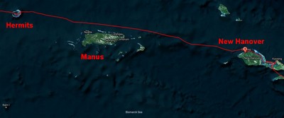
The next islands to the east of the Hermit Group is Manus Island and surrounding islands, a short overnight away (approx 92 miles). Another cruiser had anchored in a couple of spots along the north coast of Manus in 2017 and again in 2018 and didn't have any problems, but the people of Longan in the Ninigos told us vehemently to avoid it.

Overview of Our Trip

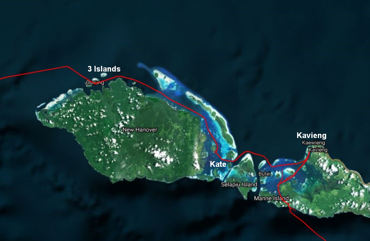
Apparently a boat of theirs had gone missing on the trip back from Manus and they felt it was due to piracy, not weather. In PNG, the "pirates" are called "rascals". Typically they are not pirates, but young drunk men looking for easy money or free beer. But in a few places there have been reports of armed gangs pillaging small towns. With a very ineffective and fairly poor and corrupt central government, not much is done when there is a report of such activity out in the outer islands of PNG. So cruisers are well advised to keep asking the question of the friendly locals as they move through the islands "Where is it safe for us to stop?" We had decided to give Manus a pass, and go straight to New Hanover, about 300 miles to the ESE.

On our CSY, we'd normally figure 120-130 miles per 24 hour day on passage. I think our record was around 145 miles, as we tended to reef early and jog along comfortably rather than pound along witl full sails up. On the catamaran, with a favorable wind, we can easily do 7 knots, making 170 nm per day if the wind stays steady.

The goal is to arrive in daylight. It's tricky, when you have unpredictable weather, and it's more difficult to guess arrival time, the longer the passage is. You have to do the math "If we make 5 knots, we'd arrive at X time, and if we make 7 knots, we'd arrive at X time." As we found on approaching the Ninigos, it's not easy to slow a catamaran down with the wind and current behind you.

Looking at the weather, which forecast 15-20 knots behind us, Indigo, who has a full complement of sails and tends to actually use them, thought they could make the 300 nm in 2 long days and one overnight, averaging around 8.5 knots. So their plan was to leave at "sparrow fart" (aka Oh-Dark-30) and press on as fast as possible. We reluctantly agreed to try, knowing that if we couldn't keep that speed up, we'd have to arrive in the dark. But we had good satellite pictures for the arrival harbor, and it looked pretty wide open to come in. And Indigo would presumably be there to help guide us in to a safe spot to anchor in the dark.

But at departure time the next morning, we had heavy rain, 100% overcast and squally weather. With the adage "You can't pick your weather on passage, but you CAN pick the weather you leave in," Soggy Paws and Ocelot decided to stay put for a day. Indigo chose to leave, as the wind was forecast to lighten up the next day. Berzerker, our token monohull, who has a slower top speed, decided to leave mid-day, after the worst of the rain cleared out, knowing that it would take them at least 2 nights, maybe 3, to make the 300 mile passage.

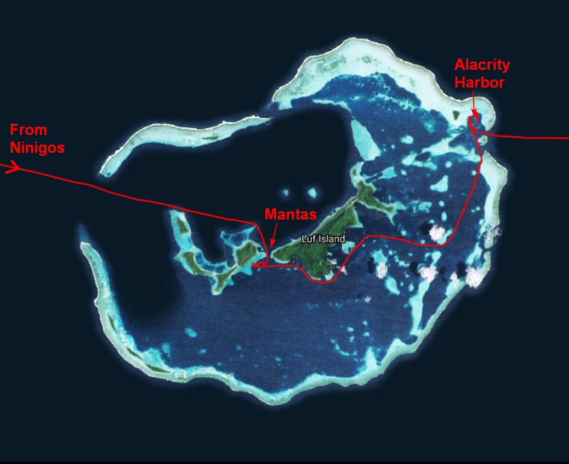
So Ocelot and Soggy Paws departed Alacrity Harbor together at 0630 am a day after Indigo did. We managed to get ourselves out of the 6ft deep anchorage and into deeper water with no problems. But somehow... as we were navigating around to an open space where we could put the sail up, a coral head jumped off the bottom and bumped us. It was one that didn't show up in our satellite imagery (or at least one I hadn't noticed). We would have seen it in daylight, but being dawn, we didn't see it. Fortunately, it was just a momentary bump on the keel, and no damage to the rudder or saildrive. Whew!

With the lighter winds on our passage, we averaged about 6 knots. We had to reef in a little bit to keep from running away from Ocelot, who is quite a bit heavier than we are.

Besides a few squalls, the biggest challenge--as usual--were lights in the night. On an open sea, in the dark, a small light could be a small light in a fishing boat 1/2 mile away, or a big light on a tanker 10 miles away. It's hard to tell. AIS helps a lot, but not every boat has AIS. Radar can help too, but mainly with the bigger ships, and those usually have AIS. On my watch, I could see a glow on the horizon, no AIS, and no radar signal. Hmmm, what the heck was that? It turned out to be a stationary (fishing?) platform beyond my radar horizon. It took several hours to pass, and I worried about the possibility of smaller boats out with nets. But never saw another light.

Sometime during the daylight hours on the 2nd day, we saw a signal on the AIS about 6 miles in front of us, going very slowly across our path. Hmmm, not a factor. But wait, he turned around, and now he's going the other way at 8 knots. Then he stopped almost right in our path. As we got closer, we could see he was a fishing boat. To make sure we stayed out of his way, we called him on VHF and asked him what his intentions were.

"I am chasing the fish," he said.

"Are you going to continue on your current course?"

"I am chasing the tuna. Where the tuna goes, I go."

He never would say that he was continuing on his current course, or what he was doing, except chasing a large school of tuna. He told us to maintain our course and we would be OK. Thankfully, the tuna must have headed NW away from us, because he soon ran off at 8 knots. So we avoided any close encounters with a tuna boat.

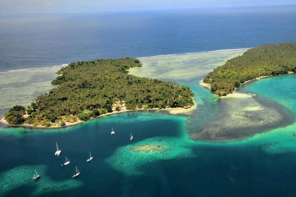
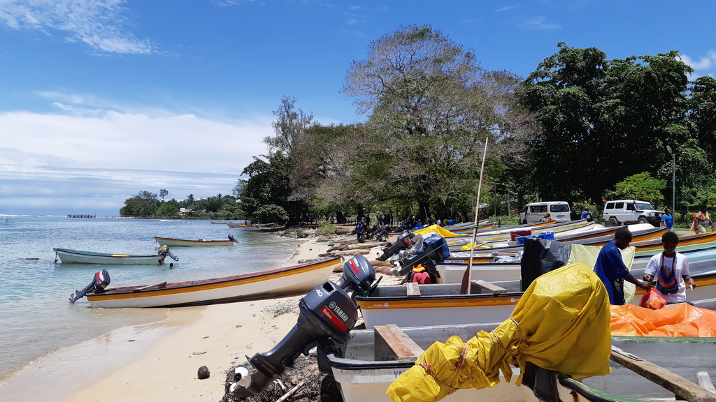
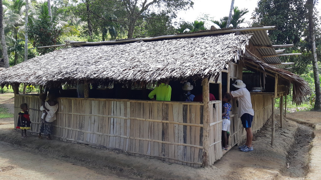
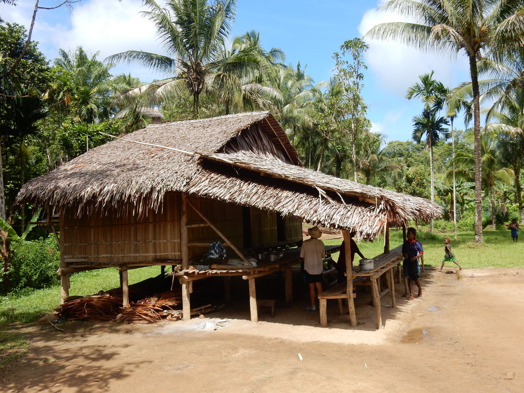
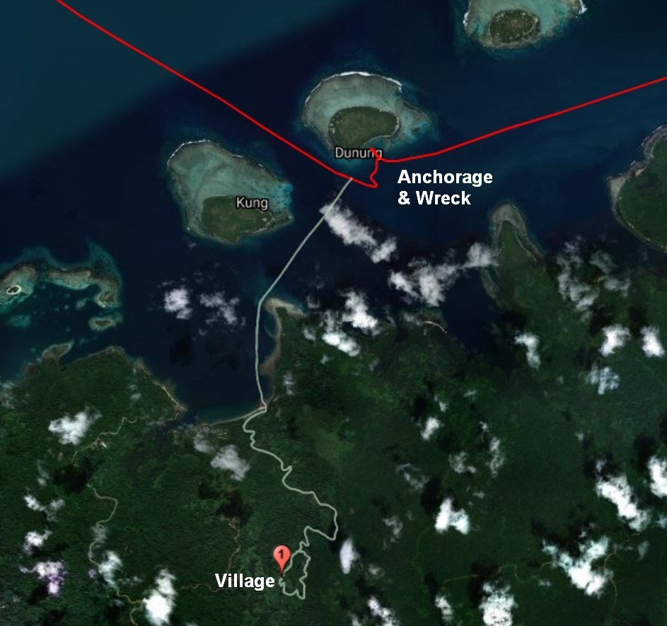
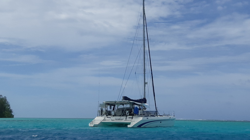
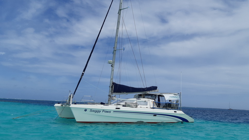
After a gentle second night, mostly going wing on wing, we arrived at Three Island Harbor, New Hanover, and anchored around 8:30am. This spot is also known as "Clem's Place" after the name of the most prominent person on the island. Clem and his wife run a backpacker surf resort on the island.
-----
At 2/15/2019 2:00 PM (utc) our position was 02°22.21'S 150°07.27'E

Thursday, February 14, 2019

The Hermit Islands of PNG

Feb 5 - 13

After hanging out at Longan in the Ninigos for 8 days with crappy weather and poor protection from the wind and waves, it was really nice to be in a calm, protected place (Manta Harbor), and we had sunshine!

Our Track through the Hermits

On the first morning we were there, a couple of our group dinghied across to Bob's place to see the Manta Rays. They said it was a great experience, with Bob actually in the water with them, guiding them to the cleaning station. Definitely worth a small fee to Bob to see the Mantas. Unfortunately, I was among the "walking wounded"--my small scratch from a branch, and a minor nip from a dog who's tail I stepped on, had turned into a raging tropical infection. I was on antibiotics and definitely staying out of the water. Craig on Berzerker was in the same state, and Chris on Indigo had a cold. We were all just happy to spend a couple of days resting up.

The View from the High School Road

The next day, a few of the healthier crew walked to the new high school that had just been built. In Longan they had told us it was not opening until April, but there were already teachers and kids attending the school. Rumor has it that eventually they will have cell service.

Some of the School Kids

School Buildings


Once we'd swum with the mantas and checked out the school, we were really interested in going up and checking out Alacrity Harbor, a shallow sand area in the NE corner of the atoll. Bob offered to come on board and guide us up there, but then what would we do with Bob? Bob insisted that the route to Alacrity was to go outside the eastern channel, and up the east side of the atoll, and into Alacrity Harbor from the channel there. But Jon on Ocelot and I both had very good satellite imagery and we determined that there was a fair chance we could go up on the inside.

So we did... The entire way was scattered with shallow reefs, but on a sunny day, with the satellite images to assist, it was not difficult to pick our way up there. The small passage on the south side of Alacrity, inside the reef, was the point that we were not sure we could get though. One catamaran that had done a lot of diving around the Hermits, had stopped short and anchored south of that passage. But with good light, we passed right through with 18 ft minimum depth. Easy peasy.

The next question was, could we find shallow enough anchoring in this basin, for 4 boats. It was hard to tell from the satellite imagery. We did! Indigo, who arrived first, tossed their anchor on a sandy ridge that was about 30 ft deep, with plenty of room on either side of them. But Dave was keen to explore the really shallow areas on the edge of the reef. We checked out two spots, one with a 6ft depth and one with an 8ft depth. The 8ft depth one probably had enough room for 2 boats. And, unlike Indonesia and the Philippines, the tidal range in the Ninigos and Hermits was only about 12". So the reef provides good protection even at high tide.

We spent one night anchored next to Indigo and Ocelot, and then moved up to the shallow 6' reef anchorage for a couple of nights. With the wind blowing NW-N at 15-20, there was some chop but no waves. Dave scrubbed the bottom of the boat in the shallow clear sand. Again, I was boat-bound due to my infected leg. (By now, I was on heavy antibiotics, and it was starting to look better, but I needed to stay out of the water).

Shallow Reef Anchorage at Alacrity Harbor

There is a little island on the west side of Alacrity with a nice beach. It looked like an ideal beach BBQ spot, but those that went ashore said it was buggy. I never got to step foot ashore.

Dave and Sue and Jon from Ocelot went for a snorkel out in the pass. Dave said it was mediocre.

We stayed a few days at Alacrity Harbor, doing chores and planning the next hop. Jon on Ocelot wanted to wait a few more days to get more moon for the 3 day passage, but we looked at the weather and decided it was time to go. With the wind that was forecast, Indigo even thought they could make it to Three Island Harbor, New Hanover, in 2 days. Ha!

Shallow Reef Anchorage at Alacrity Harbor


Hermit Islands waypoints:

West Pass, large opening: 01-30.53 S / 144-57.44 E
Our anchorage, Mantas: 01-32.51 S / 145-01.99 E Shallow!
Alacrity 18' Pass (inside): 01-29.76 S / 145-08.15 E
Alacrity 23' Anchorage: 01-28.72 S / 145-08.04 E
Alacrity 6' Anchorage: 01-28.55 S / 145-07.81 E Shallow!
Alacrity 8' Anchorage: 01-28.46 S / 145-07.99 E Shallow!
Alacrity 25' Pass (outside): 01-29.02 S / 145-08.29 E

-----
Sherry & Dave

Cruising SE to PNG, Solomons, Vanuatu
At 2/12/2019 7:00 AM (utc) our position was 01°28.55'S 145°07.81'E
http://svsoggypaws.com/currentposition.htm