Wednesday, February 25, 2009

Carnival, Bahia Style


This past weekend has been Carnival in Bahia. (aka Mardi Gras, the beginning of Lent). Being a mostly Catholic country, they celebrate Carnival as a 4-day weekend. We didn't participate much, but we enjoyed watching the Ecuadorians enjoy their weekend.

Bahia is a beach town. They say it's a favorite vacation destination for the upper class Quitenos (people from Quito). People in Bahia were afraid that attendance would be down this year, because the road between Quito and Bahia is impassable right now due to a huge mudslide a week ago.

But from what we could see, after a slow start, the beach was jam packed right up until Tuesday evening.

The Beach at High Tide as seen from Soggy Paws

We were out exploring the town and people-watching this weekend and got to see the start of 'the big parade' in Bahia. While we'd been walking around, we'd noticed people starting to sit down in the shade on the sidewalk of the main drag. We finally figured out there must be a parade somewhere. Though we decided not to wait for it, it ended up 'queuing up' right in front of Puerto Amistad.


They didn't have much music (except that which was emanating from various bars along the beach), but they did have an awesome drum section to accompany the parade.


At one point in the weekend, we were laying in our bunk with our portholes facing the beach... at 4am... and the music was still going strong from 2 different locations. Sigh... We closed our portholes and turned our fans on, and could still hear it booming over the water.

The other thing that has amazed us is the number of people they've been jamming on the car ferry. There are faster outboard motor-powered people ferries, with seats and all. But the car ferry lets people ride free. So it has been completely packed, in both directions, all weekend long.


Sunday, February 22, 2009

A Day in the Big City of Manta

Or... the 'great chain caper'.

Dave found out that there was a place in Manta, the big city nearby, that would do chain galvanizing. So he hustled around the anchorage and rounded up 2 other people interested in going together on a truck to take the chain in.

Then we started the big task of getting 3 boats worth of chain and anchors ashore.

Carlos and Evan Unload Our Chain from the Puerto Amistad Launch

Dave Pulls the Chain up the Seawall

At 0700, taxi driver Giovanni met us at the side lot of Puerto Amistad to load up the chain in his pickup truck. Then Peter, from Amigo, and his Ecuadorian girlfriend Joanna, and Dave and I loaded up for the trip into Manta.

The galvanizing place didn't look like much from the outside, but Dave went on an inspection tour and pronounced it a pretty impressive operation. They quoted us $1.30 per kilo (about $.60/pound) to sandblast, acid wash, galvanize, and clean up our chains and anchors.

Dave Negotiates the Price

The galvanizing place was only the first stop... both Peter and Dave had a list of things they were looking for in 'the big city'. Peter brought along the motor from his anchor windlass, which he'd burned out trying to winch himself up on the beach to paint the bottom of his boat. Peter was ecstatic that we found a guy that would rebuild his burnt out motor for only $30. He had envisioned having to replace his whole windlass for close to $1000.

The Motor Rebuild Guy

We also made stops at the Fish and Dive store (nice marine store/dive shop), the Setmabas liferaft repacking place, and several fishing stores, hardware stores and paint stores (looking for specific things). We went to the big mall for lunch at the food court. And the last stop was at the Supermaxi grocery store. Dave and I didn't buy much, but surveyed what was there, so we knew what we'd have available when it came time for our big provisioning. It was a big beautiful US-style grocery store.

The Manta Mall

The one thing on MY list was to try to find my blood pressure medicine. We'd struck out in Panama and Costa Rica and I was down to a few days supply. The drug store in the mall said they didn't have anything similar. But the drug store across from the grocery store had the exact Central American equivalent that I'd last found in Guatemala. I got a 60-day supply--enough to get me back to the States, where I have more waiting. No prescription required. Just write down what you need and purchase it. Only narcotics are regulated.

On our way out of Manta, we went by the port. Wow, what a HUGE number of fishing boats of all sizes. We also went past a 'carpenter's row' where they are building fishing boats by hand, the old fashioned way.

The Tuna Fleet

Boats Under Construction on the Beach

Wednesday, February 18, 2009

Arrival at Bahia de Caraquez


We made it to the 'Waiting Room' waypoint with plenty of time to spare. Notice the swell passing Soggy Paws just off our bow.

Conditions had moderated as the night wore on, so it was a very pleasant morning. We did quite a bit of motoring around while waiting for the pilot to show up, and saw pretty much steady depths of about 25' all around the waypoint.

We watched the fishermen setting nets while we waited for our pilot to show up.


We used these waypoints, from Puerto Amistad's website:

WP0 00º35.780S 080º28.300W Virtual Sea Buoy
WP1 00º35.805S 080º26.832W "Waiting Room" Anchorage

We also took the chartlet they had on their website and imported it into Sea Clear and geo-referenced it, as a backup in case we had to take ourselves in.

Fortunately, promptly at 8:40, Carlos from Puerto Amistad showed up in a lancha. He safely piloted us over the bar and around some pretty awesome rollers. It would have been pretty scary taking ourselves in. The $30 we paid to Carlos to guide us in was money well spent, we think.

Carlos, Our Pilot, Comes Aboard

Dave and Carlos taking Soggy Paws In

Breaking Waves!

We were never actually in breakers, but they were close abeam as we went in (much closer than this picture shows). We saw a minimum depth of about 8' (at high tide a few days after the full moon).

Vacation Condos on the Point

Inside the Bay

Approaching the Anchorage off Puerto Amistad


Carlos hustled off as soon as we were on the mooring, to round up the officials. The current procedure is for Puerto Amistad to call them and arrange for a taxi to bring them to the boat. And then Carlos ferries them out to the boat. It took a couple of hours for them to show up, but by about 4pm, we were done. Here's what we paid for the entry and check-in:

$30 Pilot Fee
$5 Health Inspection
$20 Immigration
$39 Port Captain
$30 Taxi fare (we split the $60 fare with another boat that was leaving)

Our Immigration is good for 90 days. The boat is supposedly good 'indefinitely'. Unlike the problems reported in Salinas/Puerto Lucia, where the Port Captain has been hassling boats about staying too long. The 90 day immigration won't be a problem for us because we plan several trips out of Ecuador in the next 9 months.

Tuesday, February 17, 2009

Racing for the Rendezvous Point


The wind came up so unexpectedly and so rapidly, and was unforecast, so we weren't sure it was going to hold. At 4pm it was flat dead calm, at 4:15 we had 7-8 knots, and at 4:30 we had 10-15 (and later, almost 20 knots). The forecast said we should expect almost nothing.

We sweated keeping our speed up all night, as we had to arrive at the 'Waiting Room' waypoint by 1 hour before high tide. We figured if we could average 5.5 knots, we could make it. So we kept more sail up than we would normally under the conditions. At one point we were doing 6-7 knots (and cheering) in about 20 knots of wind. I had to switch plans for dinner as I hadn't planned on such a boisterous sail--we ended up with 'augmented leftovers'.

Later in the wee hours of the morning, the wind eased some, and we eventually had to turn on the engine to keep our speed up.

Just when we thought we were going to make the required arrival time with no problem, we got a call on the radio. "Vessel 6 miles off my beam, this is the survey vessel... Scan (something)". We had seen the ship on AIS all night long (we picked it up from 25 miles away and it was only moving at 4 knots). The AIS said we'd pass clear astern by several miles, so we hadn't worried about it.

What we didn't know was that he was towing a 6 mile cable that we had to clear also. So we had to turn away from our waypoint and head south for about a half an hour, to get around his towed subseafloor survey device. Then, it was clear he was approaching shore and would have to turn... so then we (I, mainly) worried whether he'd cut us off again. When we told him we were headed for Bahia de Caraquez, he said "Where?" (it is not labeled on the chart). But he was moving so slowly, we managed to get inshore of him before he passed by again.

The one good thing about the survey vessel was that we were pretty sure we wouldn't run into any fishing nets during the night. The survey vessel had two 'outrider' boats that were running interference for him, to move boats that didn't have radios. And we could see them heading off fishing boats.

Nets in the night was another thing I was worrying about! One boat had said they got tangled up in nets 3 times in one night. It would have been a bad night to have to go over the side with a knife in your teeth to clear a net off your prop!

After all my worrying, we arrived at the 'Waiting Room' about an hour before the required time. So we ended up just motorsailing in a racetrack pattern to kill time. Dave didn't want to bother anchoring.

We were amazed at the number of fishermen in open boats in the bay ahead of us. There were nets and fishing boats all over. So we hung out just beyond the nets.

Crossed the Equator, Arriving Ecuador

A great wind on the beam came up (unforecast) yesterday afternoon. We made about 6 knots all night under sail, and are now approaching the Sea Bouy off Bahia de Caraquez.

We crossed the equator at 22:44 last night, and Dave initiated Sherry, following the proper rites, as a Shellback. She is a Pollywog no more.

Sherry Toasting Neptune

-----
At 2/16/2009 10:22 PM our position was 00°00.00'S 081°04.22'W

Enroute to Ecuador - Day 8

8am Position: 00 46.90N 81 48.60W
Progress in the last 24 hours: 52.1 nautical miles
Miles to Go: 115
Fuel left: Approx 20 gallons

We continue to make slow but steady progress towards Bahia de Caraquez. We have been in email contact with Tripp Martin at Puerto Amistad, and he is expecting us, and ready to arrange the 'bar pilot' we need to come in the Rio Chone.

It looks like now we won't arrive until late Tuesday (at our current speed of 3.5 knots motoring, that's what the GPS is saying). Since we've been averaging only 2.5 knots with our sail/motorsail arrangement, we'll target the Weds am high tide at about 10am.

Yesterday was an eventful day, for a zero-wind day. First, at just before dawn, still 180 miles offshore, we saw our first shipping contact in days. It was a single white light, and not really moving. When we finally got close enough, and the sun came up, we could see a large 'lancha' with a few guys and a pole with lights on it, sitting at the end of a net or longline (we could see the end of net marker, a black flag on it). We also saw a larger vessel rendezvous with this lancha for a few minutes.
Not sure what went back and forth, but both boats waved at us as we went by.

A couple of hours later, we approached another similar lancha (or maybe the same one..?), they were coming at us slowly and a guy was standing up pointing south. It was obvious they were trying to tell us something. (Dave got out the 'Bear Spray' and the Tazer, just in case). When we got close enough, they shouted 'Sur' (South) and made a 'follow us' motion. So we turned on the motor, rolled in the sail, and turned about 45 degrees right and slowly followed them. They must have wondered why
the heck this big fancy gringo sailboat was only going 3 knots!!!

They eventually led us about a half a mile, around the end of their net, marked by another black flag. This was 175 miles out at sea, in very very deep water. And they are 4 guys in an open lancha with no cover, and an outboard motor for power. I wonder if they have a GPS? VHF radio?? Brave men! Undoubtedly desperate to support their families.

Soon after that, I was napping below and heard Dave yell "Sherry, I need you now." The brand new 1/2" halyard on our Code Zero had chafed thru, and the sail was dragging in the water. Fortunately, "shrimping" (recovering a dragging sail) is not very hard when you're only going 2 knots and the sea is flat calm. We got it back aboard easily, and by late morning, had hauled Dave up the mast to re-run the halyard. We will have to watch for chafe very closely and try to figure out exactly where the
chafe point is. Dave had run the halyard over the spinnaker block and into the mast, and I suspect that's our chafe point. This time, the halyard is run outside the mast.

About the time we got the Code Zero back up, the wind died to nothing. Absolutely no wind, dead flat glassy calm. Zip, zilch, nada. Not a ripple on the water as far as the eye can see. So of course, the motor went back on (still only around 1100 RPM). We continued motoring with no wind until around 4:15pm when a slight breeze came up. Still fighting about a half a knot of current, so only making about 2.5 knots motoring at that speed.

During the calm, we were visited by a lively pod of porpoises. Several times a couple of them jumped 6' out of the water and did flips. Very cool. I stood on the bow with the camera and got several good (I hope) shots of one particular fellow who liked hanging out just ahead of the bow. But I missed the aerial acrobatics with the camera.

We continued to work on 'projects'... Dave working on the Workshop section of the website and Sherry hauled out the sewing machine to do a long-awaited repair on the mainsail cover.

Once the wind came up (to about 5-6 knots), it was one of the most beautiful evenings we have had at sea... a slight but steady wind, the motor's off and we're sailing along at about 2-3 knots. The sunset was gorgeous--we saw a 'green flash'. Sherry made 'Seared Tuna' from the last of the tuna Dave caught on our way to Cocos. This was our 4th try to imitate the 'seared tuna' you get in a good Japanese restaurant, and we finally got it perfect. great marinade from our Keys Cooking cookbook and
finally not cooked too much.

And we had enough wind to continue under sail all night.

The crew got lots of rest last night. We've been doing 3 hour watches during the night. That gives each of 2 3-our watches, providing about 5 hrs (total) good solid sleep, plus catnaps during our watches, and a nap if needed in the middle of the day. On easy nights (stable conditions, little ship traffic), we can manage to sleep in the cockpit 15 minutes at a time while we are on watch. Dave sleeps with a kitchen timer sitting on his chest. Sherry uses her Timex watch with a countdown timer.

At one point during my watch, we were visited by porpoises again. I could hear them surface alongside with a 'phoosh', and saw a couple of them streak away, leaving a trail of phosphorescence in their wake. Really cool (or 'awesome' for you younger folks).

So, though it is frustrating to be going so slow, and a little worrisome not having enough fuel to just motor in if the wind dies completely, and we're still not sure what the current will do to us... We ARE enjoying ourselves out here. It could be A LOT worse.
-----
At 2/16/2009 3:06 PM (utc) our position was 00°42.81'N 081°42.78'W

Sunday, February 15, 2009

Enroute to Ecuador - Day 7

8am Position: 01 15.23N 83 33.48W
Progress in the last 24 hours: 60.0 nautical miles
Miles to Go: 167
Fuel left: Approx 21 gallons

Yesterday turned out to be a pretty good day. The wind was still light--nonexistent for a few hours, but we did make quite a few miles under sail, in mostly the right direction. We are making slow but sure progress toward our destination, at very minimal fuel usage. The current seems to be slacking off... has been mostly on our beam, rather than our nose.

Our Valentines Dinner was beef stew. We've been trailing a fishing line, but other than the tuna we caught on our way to Cocos, we ave not caught any fish. We're moving a little slow for good trolling. Unfortunately, the only beef available in Golfito is suitable only for pressure cooking, so no medium rare steaks for us.

We cranked up the watermaker on one of our bouts of motoring, and made about 60 gallons of fresh water in an our and a half, topping our tanks off.

Looks like we won't make our Monday target arrival date... we are now hoping to make the 9:41 high tide on Tuesday.

Saturday, February 14, 2009

Enroute to Ecuador - Day 6

8am Position: 01 38.05N 83 32.07W
Progress in the last 24 hours: 53.5 nautical miles
Miles to Go: 223
Fuel left: Approx 26 gallons

Still very little wind. What wind there is looks like it is trying to fill in right on our nose.

We had a short burst of wind in the middle of the night that drove us crazy. I pulled out the Code Zero and we were smoking along at 5 knots. Then the wind seemed to be increasing, so I woke Dave to help pull in our light air sail and put out the Genoa. By the time we got all that done, the wind had died again. Couldnt even hold the Code Zero up.

The GRIB file I just pulled in shows wind under 8 knots from varying directions for the next 3 days. Sigh.
-----
At 2/14/2009 1:33 PM (utc) our position was 01°37.37'N 083°31.22'W

The Sea is Like a Washing Machine

We've been looking forward to having wind on Friday for days. But alas, the wind went somewhere else. It was light this morning and petered out to nothing by evening. We can't even keep the 3oz Code Zero up.

glassy seas and we are motoring again. What's worse, we have a nasty washing machine sea that makes it very uncomfortable, and slows us down. We can't figure out where its coming from, with no wind for days.

Could be lots worse, but we're ready for this learning experience to be over!!
-----
At 2/14/2009 6:07 AM (utc) our position was 01°44.14'N 083°43.11'W

----------
radio email processed by SailMail
for information see: http://www.sailmail.com

Henry is Steering

Most of Dave's spare time in the last couple of days has been focused on getting our Monitor Wind Vane set up to steer Soggy Paws.

Though "Janet", our CPT autopilot, has been doing a rock solid job at the cost of only a couple of amps, the long term plan has always been to have the Monitor steer on long passages with steady winds.

We finally got the Monitor all rigged up (rudder on, windvane on, steering lines and blocks rigged to the steering wheel), engaged it, and it is steering so effortlessly that we looked at each other and said "Is it working?" But Janet is definitely disengaged, and we are still on course after 10 minutes. When you have your sails properly balanced, the Monitor makes such tiny corrections that it's hard to see it working.

Everyone's autopilot MUST be named, as it is such an essential part of the crew. We have named our Monitor "Henry", in honor of Dave's ex-Father-in-Law, Henry Mikelait, who has been avidly following our progress on the internet. Henry Mikelait's own travels around the world have been inspiring Dave for years. Now it's our turn to travel, and we'll have the spirit of Henry Mikelait helping us around the world.

Dave has a little bit of info on our Monitor wind vane and CPT autopilot setups posted on the web at http://www.svsoggypaws.com/steering.htm I am sure more will be forthcoming... including new pictures of Henry in action.
-----
At 2/13/2009 8:37 PM (utc) our position was 01°53.44'N 084°00.43'W

Friday, February 13, 2009

Enroute to Ecuador - Day 5

8am Position: 02 05.23N 84 18.42W
Progress in the last 24 hours: 60.2 nautical miles
Miles to Go: 281
Fuel left: Approx 32 gallons

After 4 full days of traveling, we are still not quite half way there!!

However, our fuel conservation plan is working well... when the wind gets too light to control the boat under sail, we motorsail at very low RPM. We've managed to average 2.5 kts toward our destination, against 1-2 knots of current, and in only about 5 kts of wind.

The forecast has promised slightly more wind today for the next 36 hours, though we haven't seen it start to fill in yet.

The current has eased a little, but we think we still have about a knot against us, and expect to have that continue for another hundred miles or so.

Other than taking forever to get to Ecuador, the trip itself is very pleasant. Even when motoring, the RPM's are so low that it's not obnoxious. Dave's been getting small maintenance jobs done during the day, while Sherry's mainly been reading.

We have plenty of food, water, electricity, rum and books to read. So we are in no danger of running out of anything out here.

Sherry's current reading:
- Jimmy Cornell's autobiography "A Passion for the Sea"
- Lin Pardey's "Care and Feeding of the Sailing Crew"
- Clive Cussler's novel "Atlantis Found"

All 3 are really good books. We picked up a signed copy of the Jimmy Cornell book at SSCA, where Jimmy was the featured speaker. It cost a lot--we rarely ever buy a book new, but this one has been worth every penny--very informative and entertaining. The Lin Pardey book I got in nearly new condition at the cruiser swap meet in Golfito for $2. It, too, is an excellent cruising book, both entertaining and informative.

And the Clive Cussler came from Land n Sea Golfito's book exchange. It is a true Clive Cussler action adventure, and I make sure I don't pick it up unless I can afford to become absorbed in the book to the exclusion of everything else aboard!

Since we're in the throat of the famed Humboldt Current, we've been monitoring the water temp as we sailed south. When we left Cocos, the water temp was around 83 degrees F. In the last 24 hours, it has dropped steadily from 81 to 75 degrees. With the water temp at 75, the air temp has been noticeably cooler, and we've been wearing long sleeves on watch at night.
-----
At 2/13/2009 1:58 PM (utc) our position was 02°04.08'N 084°16.76'W

Thursday, February 12, 2009

Slowsest Passage Ever!

7:30am Position: 02 42.67N 85 06.96W
Progress in the last 24 hours: 60 nautical miles
Fuel left: Approx 36 gallons

We spent much of yesterday discussing options and carefully checking our fuel supply and consumption at various engine RPMs. There was not enough wind to pure sail and not go backwards. But we found that keeping the engine ticking over at 1000 RPM only used 1/2 gal diesel an hour, it kept air moving over the sail, we made 2 knots toward our destination, and the autopilot could handle the job. The logic for this was to keep us going comfortably until the forecast wind filled in on Friday.

We definitely underestimated the current on this trip. This has been like trying to cross the Gulfstream from Port Canaveral to the Bahamas, sailing, on a very light air day. We'd end up in Jacksonville!

We have had about 2 knots of current, mostly against us, for the last 2 days. Most of yesterday, we had a westerly component...we were steering 135 on the compass and tracking along about 180 degrees. Even if we had an unlimited fuel supply we'd be struggling.

We were blessed that at least some wind stayed with us all day. We made slow but measurable progress towards Bahia. Then we were surprised that it swung around to the South and strengthened up a couple of knots last night. Finally we had enough wind to adjust our course and sail directly towards our destination (crabbing into the current). We have made steady but slow progress all night, and the wind is still pretty good this morning.

The wind we have right now was NOT forecast, but we're glad the weather guessers got it right in our favor this time!

We are sailing thru the water at about 4.5-5kts, but only tracking 2.5 knots across the bottom (using the GPS). The difference is the effect of the current.

We still have 340 miles to go. So at this rate, we still have 5-6 days more to go! (if the wind holds). We hope at some point we will break free of the current and speed up, but who knows...?

We are under the ITCZ right now... The Tropical Forecast says that it's along 2 degrees north latitude. Up until late yesterday we've been sailing in sunny blue sky conditions. But about sunset, we entered an area that is fully overcast with scattered showers, and are still having those conditions this morning. But fortunately no gruesome squalls in the middle of the night... just a few light rain showers. (Except I just heard a thunder rumble in the distance!)

We realized yesterday that as we were drug off course by the current, we were closer to the Galapagos than to the mainland, by about 25 miles. I couldn't get Dave to consider diverting there--we already have our Chile trip planned for March and need to get into Bahia de Caraquez and get settled.

In the words Monty Python "We'll be right here when you get back."
-----
At 2/12/2009 1:05 PM (utc) our position was 02°41.73'N 085°06.10'W

Wednesday, February 11, 2009

Trying Not to Go Backwards

2am Position: 04 10.96N 83 34.17W

Are we having fun out here, or what???

We motored all day with a glassy sea. The forecast said we were supposed to have about 7 knots of wind out of the NE, but it was literally zero wind.

Finally around 4pm, a whisper of a wind came up. So we turned off the engine and pulled out the Code Zero.

For about the first hour, we were literally going backwards. Sailing SE through the water at about 1-2 knots, but tracking NW at about a knot, according to the GPS. That means we have a 2 knot current against us!!

The wind filled in a little until we were making about 2-3 knots through the water. There was enough wind that the autopilot could handle the steering. The current slacked off a little. We were finally moving in the right direction without running the engine.

We got 2 different forecasts this afternoon (the GFS and the WW3 models as GRIB files). Both told us that the forecast for wind in the area where we are is 0-5 knots for the next 2 days. Then the wind will pick up to about 10-15 on Friday.

We also spent a couple of hours this afternoon studying the pilot charts, trying to figure out if there's a route that we can take that will minimize the current. But I think it's all guesswork unless we have an accurate satellite picture of where the current ACTUALLY is, versus the average of where it has been historically. (I have seen an infrared analysis of the current here in the past, but couldn't find it on the web before we left).

After all that, we decided to just maintain the rhumb line, unless going in one direction or the other would give us more wind.

Tonight, we were having fun hand-steering by moonlight, trying to get the last wisp of speed out of what little wind we had. Between 4pm and 2am, we made 6 miles in the right direction, against the current and in spite of almost no wind!!

But the wind finally died on us a few minutes ago, so we're motoring again.
-----
At 2/11/2009 7:39 AM (utc) our position was 04°08.35'N 085°33.27'W

Enroute to Ecuador - Day 2

Current Position: 04-31.5N 85-52.0W

The winds are very light. We have mostly been motoring, but did attempt to sail for a few hours yesterday. The wind has been light--about 5 knots--and mostly on our nose. When we did sail, it was in the wrong direction, slowly--making only 1 knot toward our destination. We have about a knot of current on our nose, too!

But other than that, it as been a pleasant passage so far, with a beautiful moon and clear skies last night.

With these conditions, and not enough diesel aboard to motor the whole way, its hard to say when we will actually make it to Bahia de Caracaquez. But we have lots of food and water, so we will just keep plugging along until the wind picks up a little.
-----
At 2/10/2009 2:49 PM (utc) our position was 04°32.11'N 085°52.52'W

Monday, February 9, 2009

540 Nautical Miles to Ecuador

Late yesterday, we loaded the dinghy on the foredeck, took off the sail covers, and hoisted the Code Zero (our light air sail). Dave is going to dive into the deep locker this morning and get out the equipment to rig up our Monitor wind vane. We are going to practice with it on this trip, we hope.

The GRIB file this morning looks pretty good. A few more knots of wind would be better, but at least it's not too much wind. It looks like most of our passage will be a close reach. Our current winds seem about 5 knots out of the east

At 5 knots it would only take us 4.5 days, but we don't expect to average 5 knots. We will encounter some adverse current... we have to cross the Humboldt Current to get to coastal South America. We will be crossing the equator... going thru the dreaded 'doldrums'... an area of squally weather, and light and variable winds. We don't have enough fuel aboard to motor the whole way. So we may spend some time drifting along at 2-3 knots.

But we don't want to arrive on the weekend anyway, and 4.5 days would put us there late on Friday afternoon. And there is a 'bar' to cross on arrival. The most favorable time for us to cross will be next Monday morning, so we'll probably just target arrival for Monday morning, and try to sail as much as possible.

Our destination is Bahia de Caraquez in Ecuador, at approximately 00º35.8S 80º26.8W. You can read a little about the place here: http://puertoamistadecuador.com

Moonrise over Wafer Bay

We left Bahia Iglesia about mid-day yesterday. The wind had calmed and turned east, so we hoped that Wafer would be protected and not too swelly.

We still had to recover our 2 dive tanks that we had left with Jody our divemaster--he said he could fill them for us.

And we needed to run the watermaker, which requires the engine to run. So we set up for making water and pulled anchor and motored the 6 miles around to Wafer. It was wonderfully better than we last left it. Still some swell, but very gentle. And a nice breeze blowing up the valley, keeping our stern into the swell.

"Our" mooring was occupied, so they told us to anchor, but it must be in sand. It took several passes around the bay, and me jumping in with mask and fins, to find the sandy spot. Most of the bay is very rocky. I also found a wreck on the bottom (maybe 2). Dave wants to take a quick snorkel this morning to investigate. (and thanks Roger for sending the map).

Though the rangers had told us there was wifi/internet here, we'd not bothered to check it out before when conditions were so miserable. But I was pleasantly surprised to get a whiff of a signal from the boat. I did get connected, but tenuously. Dave and I finally loaded the laptop in the dinghy and dinghied to just outside the surf line. Dave holding the antenna while I read the signal (head under a t-shirt to block out the sun). It was pretty comical, but we did manage to get all our internet
mail...I am now up to date on the small boat facility plans at MYC, and what my 'favorite sellers' on EBay have to offer this week.

But the important part was that we got some weather downloads. It looks like mild weather from here to Ecuador. All the red feathers on the GRIB files are gone, and there aren't many blue feathers (no wind).

By the way, someone in Golfito showed me a new weather site that's pretty cool... http://www.passageweather.com

We got our tanks back, thanked Isaac and Jody for their hospitality, and said goodbye to the nice folks at Cocos Island.

We enjoyed a nice dinner last night (without having to clutch our plates to keep them from flying off the table), and watched the moon rise over Wafer Bay.

Sunday, February 8, 2009

Watching the Sun Rise in Bahia Iglesia

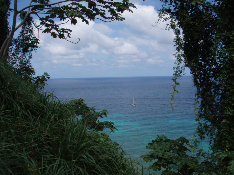
We enjoyed a nice, relatively tranquil day yesterday in Bahia Iglesia. There is still a relatively large swell that is wrapping its way all the way around the island into our little bay, but as long as the wind is blowing steadily out of the north, it keeps our stern into the swell, and the motion isn't too bad.

We saw northerly winds of up to 23 knots yesterday, but by sunset they seem to have slacked off some, and were somewhat light through the night. With light winds, we do go sideways sometimes to the swell, but it is still better than conditions in the other two bays.

We took the day to do maintenance tasks aboard. But in the afternoon, we decided to try to land the dinghy ashore and hike to the waterfall we can see up the valley a little ways. With the swell, the surf on the rocky shore is pretty impressive. I suggested swimming in, but Dave watched for awhile with the binoculars and said we could land the dinghy between sets of waves. We did manage to get landed with the dinghy only half swamped, but then with only 2 of us, had trouble hauling the dinghy
up the steep rocky shore to safety. We did finally manage to drag it over the hump into the little pool of water created by the stream coming down the valley. We tied the painter to a high tree and left the dinghy floating. We knew it was a falling tide, so it would be OK when we got back.

We scared some wild pigs on the beach as we pulled the dinghy up. They are one of the few non-native species the Park is trying to deal with. The early exploring ships would purposely land pairs of pigs as they discovered new islands... to be a ready source of meat when they came back to the island. There are formerly British pigs all across the Pacific Islands.

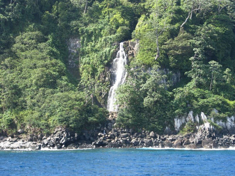
It only took us about a half hour scrambling up the stream to get to the waterfall. Wow, what a beautiful place. The waterfall comes out of a cliff about 500 feet above us. In its fall into the pool below, the force is amazing, and creates a big misty wind in the little valley. We had trouble getting pictures without the camera lens getting fogged up. We posed for pictures and Dave took a swim in the pool (I am not fond of swimming in cold dark water). It is dry season here. Though the island
boasts 261 inches of rainfall a year, we have hardly seen a drop in the week we've been here. I can't imagine what this waterfall would be like in the middle of rainy season!

On our return to the beach an hour and a half later, we found the dinghy still floating in the little stream, but the stream was much higher up from the ocean...there was no surface channel going out of the stream into the ocean. The fresh water just disappears into the rocks. So we had to 'dig' a channel by throwing the big rocks out of the way, to make somewhat of a lower path to drag the dinghy up and over the hump and back down to the beach. Fortunately, we only had our 5hp motor, and we took
the gas tank and anchor out while we dragged. It took us about a half an hour, but we finally managed to get close to the water again.

It was an exciting launch into the surf and paddling canoe-style out through the first couple of breakers. We were again half-swamped, meeting the first couple of breakers, half breaking, head on. But we finally managed to get to calmer waters and get the motor started. It was worth it for the hike to the gorgeous waterfall, but would have been a lot easier with another pair of hands to help out.

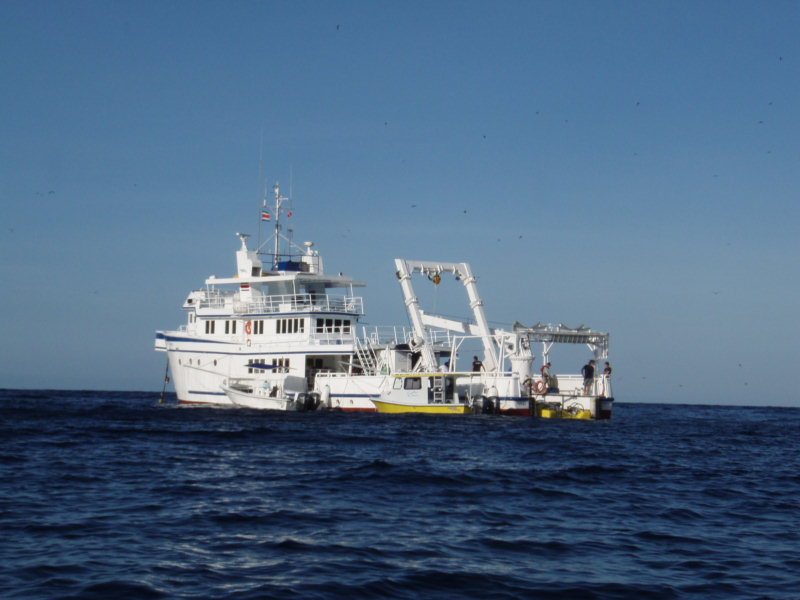
The dive boat, Akeonos Agressor, that was anchored behind us the night before, had left at dawn. When we saw them come back into the bay again at sunset yesterday, we called to talk to them. They said they had been all the way around the island, and conditions were still very bad at the other two bays. So Dave and I congratulated ourselves on having stayed put.

Communications with the park are difficult from here, however. There is no VHF contact, the island is too high between here and there. We know that the two ranger stations communicate with each other using SSB 8325, so we tried that a few times, but got no response. We even tried using our Iridium phone, calling the numbers for the ranger station that was in the pamphlet they gave us. We got the 'Please try again later' message on the phone, that could mean anything from 'you don't know how to
dial an international call, stupid' to 'wrong number', 'busy', or whatever.

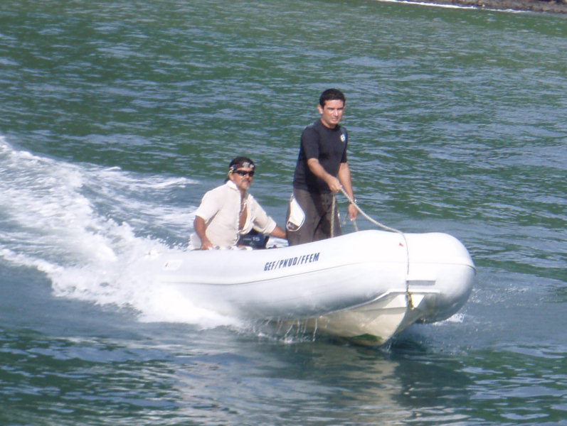
We did finally hear another conversation on the SSB, one side quite clearly, one of their patrol boats, we think. And though we couldn't hear the ranger station well at all, and we were speaking in Spanish, we think we got the message passed that we are in Iglesias Bay, we don't plan to try to go around Sunday to Wafer for the hike we had scheduled, and was there a way for us to get our 2 dive tanks back. (We hoped to have one of the patrol boats deliver them).

Dave, ever the optimist, thought after we shut the radio down, that it was settled that they would deliver the tanks. I wasn't quite sure.

So we sent an email to Isaac, the head Ranger's email address, to confirm. We did get a response back acknowledging our presense in Iglesia, telling us conditions were still bad in Wafer and Chatham, and not quite committing to sending our tanks back.

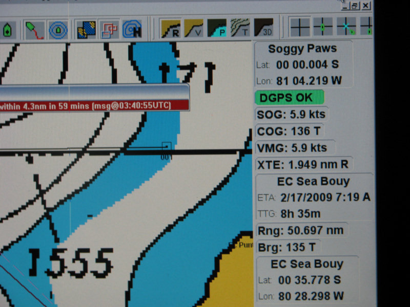
So we will wait here today, and if we don't see the patrol boat today, we will probably have to motor around to retrieve them tomorrow before we can leave. It is complicated because we do not have enough fuel to motor all the way to Ecuador, and it looks like we will have light and variable winds and a strong adverse current. (The Humboldt Current in this area is similar in strength to the Gulf Stream, in places, and we don't have a clear idea where it runs).

The conditions are forecast to moderate in the area starting today, and in a few days it will again be tranquil and very diveable. But we can't afford to wait, either time-wise or moneywise (remember, it costs $75/day to stay here).

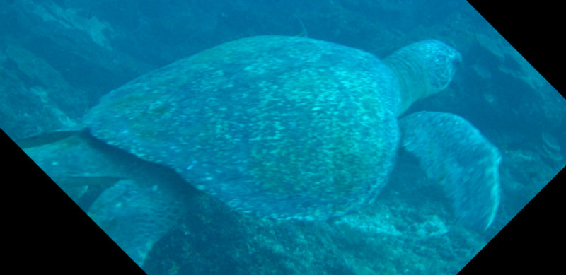
We feel we accomplished our objectives here, we got to do some dives, we saw the hammerheads. We did 2 hikes in really lush conditions. It is time to move on.

Saturday, February 7, 2009

Cocos Island - Day 4

Anchored in Iglesias Bay, Cocos Position: 05-30.61N 087-03.91W

About as soon as we crawled out of bed, it seemed that things moderated from the previous night's rocking and rolling. But really it hadn't. We had just got a little wind and lined up into the swell instead of sideways to it. We looked at the forecast for the next few days, and it looked like little would change.

So we decided we go take a look back at Chatham Bay, where we had anchored originally. Our dives for the day were supposed to be at Manuelita Island, the little island we'd snorkeled from the dinghy the first day. So we radio'd in to Wafer Bay and talked to Jody about going on around to Chatham in the big boat. He said OK, that they'd pick us up from our boat in Chatham.

Dave thought that Chatham Bay might be better. Even though the winds were out of the NE (totally exposed to the NE in Chatham), the swell was the thing that was killing us, and that seemed to be out of the NNW.

Well, needless to say, Chatham was no better... quite a different place than 3 days ago when we arrived. But we hooked to the mooring... it was rocking and rolling, but safe enough for the boat. And we went with Jody and Eduardo and did the dive at Manuelita.

It gets really dangerous getting in and out of the dinghy in conditions like that, with the boat and the dinghy bucking up and down 6 feet. We had left most of the dive gear in the dinghy, and just had to climb in with our wetsuits and BC's. But it was still hairy.

Today Jody and Eduardo had the bigger skiff, so we decided to take everything in their boat. (with the conditions the way they were, it would have been terrible for Eduardo to try to maneuver with 2 dinghies tied to together).

It was wild out by Manuelita, huge waves crashing into the wall and ricocheting back. We got fully geared up and rolled in over the side, while Eduardo maneuvered the skiff away from us. It wasn't bad down below... except visibilty was less than it should be. We started out at 90' and gradually traversed the island and rose to about 45'.

At the N end of Manuelita, we were finally rewarded with a sighting of about 10 hammerhead sharks, lazily swimming in circles (waiting for lunch!!). They ranged in size from about 7-10 feet... and they sure look menacing with their eyes in the side of their heads. Scared the heck out of me!!

We saw lots of other cool things... a turtle, and marbled rays, and fish who weren't afraid of us at all. Jody saw a yellow-bellied sea snake, but couldn't point it out to us before it disappeared.

After the dive, our plan was to move around to Iglesias Bay, on the South side of the island. Jody said he'd check when he got back, to see what the reported conditions were. A half hour later, we got a call that said that Iglesias was the same as Wafer and Chatham, and we should come back around to Wafer Bay.

Well, Dave and I both felt that Iglesias HAD to be better, being on the south side. We had heard the Okeanos Agressor (another liveaboard dive boat) call and request to stay there another day. So we told them we were going to go around the island and take a look at Iglesias for ourselves.

It was a nice motorsail... but boy were those waves big 'outside'. We hugged the island as much as possible. Though it was a little scary being in so close. We do have a chart (bought at the flea market in Golfito for $2), and I scanned it in to the computer, and though it's positioning was off on the GPS, we'd been able to more or less correctly geo-reference it with Sea Clear.

We could tell once we got around the back side of the island that things WERE much better. We could see the Okeanos with the binocs and they seemed to be anchored calmly. It turned out to be a little harder to find an anchorage than we thought. We didn't have any waypoints for this spot, and its DEEP here. We finally snuck really close in and dropped in 25 feet. But after snorkeling the anchor, we were in some coral, so while I stayed in the water to 'spot' the anchor, Dave re-anchored. We finally got a good spot in sand in about 30', with almost enough swinging room.

A few days, we would have called the conditions here 'lousy'. It is rolly and a little risky anchorage, but after 3 nights elsewhere in much worse conditions, it was positively lovely here.

And the scenery is fantastic. There is a rocky beach ashore (with waves crashing on it), some palm trees, and up the valley is a big waterfall. I'm sure Dave will want to swim in and try to hike to the waterfall on our own today.

We do plan to go back around to Wafer Bay early tomorrow morning, to go on a hike with the park volunteers, up to Cerro Iglesia. Hopefully conditions will have moderated some by then. (the forecast in the Gulfs of Tehantepec, Papagayo, and Panama all show easing conditions in the next 12-24 hours).

----------
radio email processed by SailMail
for information see: http://www.sailmail.com

Friday, February 6, 2009

Diving in Cocos (With Tanks)

We ended up making 2 dives yesterday with Jody, a Park diver, and Eduardo, the dinghy tender. (We are not sure what happened to the other guy...)

Jody and Eduardo

Because of the conditions, we stayed very close to Wafer Bay. We did one dive at Isla Pajaro and another dive at the little island just outside Wafer Bay. Both dives, the water was clear, fairly warm, and there were scads of sharks and lots of other marine life.

We went to a place that is supposed to be a 'cleaning station' for hammerheads, but there were no hammerheads there. Just lots and lots of White Tipped Sharks.


Dave got some good pictures of some of the other marine life we saw there. None of the marine life seemed afraid of us at all.


Today we are supposed to dive at Manuelita, the place where we saw a hammerhead when we were snorkeling.

Between the two dives yesterday, we got a pretty heavy downpour. We saw the brown water from the river come surging out toward the clear water, slowly spreading brown across the surface. But the fresh water seems to float on the surface of the salt water, and it didn't hurt the visibility on our second dive too much.

We took 2 dinghies to each of the dives, ours and one of the park's... Jody would get in the water and dive with us, and Eduardo would maneuver around in circles with the 2 dinghies until we surfaced. The land drops off straight from 500' above us to 100' deep not far from shore, so there is no practical place to keep a dinghy anchored.

Rockin and Rollin all Night Long

Late yesterday afternoon, after we were cleaning up from our dives, the swell coming in to the anchorage started getting bigger... much bigger. And the wind became 'light and variable'. Meaning that we were turning every which way. And there is a current factor in this bay that we haven't been able to figure out, which was mostly pulling us sideways to the swell.

So we spent the night very uncomfortably, with a 6-8' swell rolling us back and forth.

The wind here certainly shouldn't be producing this large a swell. We think it is from the Papagayo winds up north.

It seems a little better this morning, but we're still trying to decide what to do. Our anchoring options are pretty limited. 2 of the 3 bays are open to this swell, and the 3rd is on the other side of the island, out of reach of the park divers. And we're not sure THAT place wouldn't be pretty swelly too.

Thursday, February 5, 2009

Diving with the Sharks!

Well, we haven't actually scuba-dived with the sharks yet, but on our first snorkle, we saw at least 5 3-5-foot white-tipped sharks, a large hammerhead, and numerous small (about 3 feet long) sharks laying on the bottom. They were scattered all over among the coral heads.

The Argos, off Isla Manuelita, Launching their Sub

We did finally get our official park briefing and checkin. Isaac, the head ranger, and Walter, the Chatham Bay head ranger, stopped by yesterday moring to do the formalities. We paid them $415 for the priviledge of staying in the park 5 days and diving for 2 days. This breaks down to:

5 days for the boat at $25/day (more for a bigger boat)
5 days for 2 people at $25 per person per day
2 days of diving for 2 people at $10 per person per day

The diving fee doesn't cover the cost of anything except an impact fee, and the 'hassle factor' of arranging for a park-certified volunteer to escort us on the dive. We still have to provide all our own dive equipment, air, and a dinghy capable of safely reaching whatever our dive destination is.

Isaac also told us that if we were visiting on an INTERNAL zarpe (transit permission) from Costa and back to Costa Rica, we would have been required to have park permission to stop here. But on an INTERNATIONAL zarpe, between Costa Rica and another country, we didn't need prior permission. We told Isaac we had looked for, and asked about, permission information, and couldn't find anything on the internet. He showed me the info in the brochure, on how to contact the park administration to arrange
for a visit. I have put the contact information for obtaining permission at the bottom of this post.

We are not supposed to dive without a park escort. From what others have said, though, once we 'pass muster' we MAY be permitted to dive without an escort. They want to make sure that (a) you are a qualified diver and won't get yourself killed diving in their park (b) That you know how to control your bouyancy and won't be dragging yourself all over the coral (c) That you understand and respect the park rules (take only photographs, leave only bubbles, and don't harrass the wildlife). They
also strongly suggest that you dive with a tender on the surface (ie someone in the boat). There isn't really a practical way to anchor in any of the dive areas... they are all drift dives. So there is always a 'surface tender'. Dave and I think we can drag the dinghy along... we do it all the time while snorkeling. But we'll see if they'll let us dive on our own after we get checked out.

Tito is the current park diver. From what we know of him, he is a volunteer, and is dive-master certified. I think he is pretty new to the park. This past week he has been diving with the group from the Undersea Hunter, and getting his nitrox certification.

So we are set up for 2 days of diving with Tito (today and tomorrow). After that we will see what we are permitted to do.

We hauled all of our dive gear out of the dark storage (we haven't been diving since Honduras!!), and checked to make sure it works. 3 of our 6 tanks were empty. We had tried to get them filled in Panama City, but had run into a snag with the annual inspection and ran out of time. We took them over to the Undersea Hunter, one of the liveaboard dive boats, and asked if they would fill them (making sure it was a time when all the divers were away). A really nice guy named Raphael did the fills
in about 5 minutes, and refused any payment. How nice! We knew from research before we left Golfito, that there would be at least one liveaboard in the area the whole time we were going to be here.

Yesterday afternoon, just as we were about to lay out a stern anchor to keep us into the swell, the wind picked up and switched 90 degrees, setting us firmly sideways to the swell (too firmly to trust a stern anchor on short scope). So we abandoned that idea and instead moved around to Wafer Bay. This is protected from the east (where the wind is coming from in the next 2 days), and is a LITTLE better protected from the swell. We were able to have dinner last night without clutching our plates,
and slept together in the after cabin.

Cocos Island Marine Conservation Area
Apartado 11384, San Jose, Costa Rica
Fax: (506) 2258-7350 Ph: (506) 2258-7295
Email: islacocos@sinac.go.cr
Web: www.acmic/sinac.go.cr

Isaac says you can obtain all the permissions you need by fax, phone or email. You do NOT have to go to San Jose in person.

There is phone service and internet on the island. They list the phone number of the admin office as (506) 2223-6077.

Wednesday, February 4, 2009

Day 1 at Cocos


We were on the mooring in Chatham Bay by about 8am. The island is lush and green and we see waterfalls coming out of the steep sides of the island. Nearby, we see the Undersea Hunter, one of the liveaboard dive boats.


Soon after we arrived, one of the Park boats came by and said they wanted to schedule a time with us to do the park briefing. They suggested in the afternoon, like 2pm, to give us time to recover from the trip. But Dave was raring to go, and said we'd be ready in an hour.

The Chatham Bay Ranger Stations

So we piddled around cleaning things up on board and stowing sails, etc. They did not come back at 10.

A Booby Hangs Out on the Bow Pulpit

Finally at noon we called in on the VHF. When we asked if they spoke English, they said 'momentito' and a minute later a very young-sounding girl named Maria came on the radio. She is a park volunteer who speaks English.She didn't seem to have a definite time, but she was trying to be helpful. Apparently the main ranger station is around in Wafer Bay, and that's where the briefing is scheduled out of. She said we could come ashore and hike over to Wafer Bay, if we wanted to.

That seemed like a better option than sitting around the boat waiting for who-knows-when to get our official park briefing. So we got our hiking stuff together and went in in the dinghy. Maria and her boyfriend Daniel, who is also a volunteer at the Park, met us on the beach and helped us carry the dinghy up to the high water mark (we forgot to put on our expensive, heavy dinghy wheels).

Then Maria guided us up and over the mountain on the trail to Wafer Bay. It was a pretty strenuous hike for coming off a 3-day passage!! But the views of the bay from the top of the mountain were pretty spectacular.


The ranger station at Chatham Bay is very small and run-down looking. There is a group of volunteers here that are working on the beginnings of a plan to relocate the Chatham Bay station to a location higher up on the hill.

Chatham Bay Volunteers

But the Wafer Bay station is very well appointed, including a hydro-electric plant fed by a waterfall and dam. Maria told us they even had internet and wifi there.


One of the primary missions of the park is to keep it a fishing-free preserve. In this mission they seem to be succeeding. They patrol around the island out to 12 miles, and confiscate any fishing equipment and escort the fishermen out of the park. They showed us a warehouse of fishing line they have confiscated--huge rolls of 500-lb test shark line. They have taken some of it and have built an impressive-looking suspension bridge over the stream where the hydro plant is, completely out of confiscated fishing lines and floats.


The suspension bridge led over a stream to a Hydro Electric machinery building. We talked Maria into showing us inside.


When we finally met up with Isaac, the Ranger who was supposed to arrange the briefing, he said it would be much more convenient to do the briefing in the morning. Apparently the English-speaking ranger who was supposed to brief us, was off on a hike (we had passed her going the other way with a group of divers off the Sea Hunter dive boat, which is on another mooring near us in Chatham Bay). So now our briefing is scheduled for 8:30 this morning.

When we asked Isaac about diving, he said he wasn't sure he could arrange it!! The park rules require a park escort for any diving, and they only have one guy here now, (Tito), and it seemed like there might be some scheduling problem with Tito. So we will see what we can work out. I guess one of the most important rule is to have a surface escort, and with just Dave and I here, I'm not sure they'll let us dive without it. It would be a real bummer to come all this way to one of the best dive locations in the world, and not get to dive. So I'm sure we'll work something out.

Even just diving off our boat here in Chatham Bay would be interesting. The visibility is about 50' and on a quick snorkel to check the mooring, we saw lots of life--even a couple of small sharks.

The other problem we may have is the weather. From the best I can discern, winter cold fronts from the Caribbean spill over into the Pacific this time of year, creating some local wind events known as Papagayo winds. There is a big Papagayo forecast that may reach this far out, and change our wind direction to one that would make Chatham Bay untenable. So we need to get an updated weather forecast and make a plan for what to do when it comes. There are 2 other bays at the island we could anchor at, if needed, depending on which way the wind blows.

A third problem we are having is that Chatham Bay, at least right now, is open to a 4-5 foot ocean swell. It was bad enough when we were pointed into the swell yesterday, but last night about dusk, the wind switched around some and left us sitting most of the night sideways to the swell. We have been rolling like a b-tch all night--to the point where Dave opted to sleep in the salon. Even now, we are still sitting sideways and rolling nearly gunnel to gunnel.

All we need to do to fix this problem is set a stern anchor of some kind. But we're waiting to ask the Rangers what we're permitted to do (either hand set an anchor in sand, or take a long stern line back to the next mooring behind us.

Tuesday, February 3, 2009

Land Ho!


Our 1am position: 05-40N 86-49W

The last 24 hours have been both beautiful and frustrating.

Beautiful because the weather is fine and we're going through an area of abundant sea life. We've seen big sailfish skipping along on the surface, sea turtles, several kinds of porpoises, red footed boobies (birds) and big frigate birds. We caught a nice fat yellowfin tuna... had a few hunks raw as a snack with lunch, and then some nice 'seared tuna' for dinner.

Here Comes Supper!

The water is a blue blue blue color. The stars were awesome last night. And there's phosphorescence in the water, so our wake glows.

But it has also been incredibly frustrating, because there's been virtually no wind. We did try to put the Code Zero sail out at the change of watch in the middle of the night, but the wind died again just as we finally got it rigged, so we rolled it back in and motored all night.


Every day the forecast has been saying 'tomorrow there will be wind'. Finally about noon today, I convinced Dave that the wind had come up enough to try again. We ended had a nice (slow) sail all afternoon, except a few times when the wind died off and Janet, our autopilot got confused. We're both doing other things and letting Janet steer, and next thing we know it, the sail is collapsing and we're in a hard turn the wrong way. You can't tack this big sail (it would have to thread thru the other headsails, etc). So we just let it backwind and come on around. It takes about 10 minutes to do a 'loop-de-loo', a full 360 degree turn, and get it settled down back on course again. We did that 3 times this afternoon.


By dinnertime, the wind had died and veered, so that we were only going about 1.6 knots and headed about 45 degrees off our proper course. And Janet was having a really hard time holding course. We held off until we finished a nice a quiet dinner in the cockpit and a nice sunset. But after dinner, we took the sail down and turned the engine back on again. We didn't want to get too far off course, because the wind is SUPPOSED to come up tomorrow.

Of course, as soon as it was my turn to sleep, the wind came up again and it got a little rough. I couldn't figure out why I was having so much trouble sleeping, until I got up and realized how lumpy it was. At the change of watch, we rolled out the staysail and turned the engine off again. The staysail is a small sail--just the right size to keep us jogging along at about 2-3 knots, with a gentle motion. Our ETA at the island is now close to dawn.

We could see the island vaguely in the distance just before sunset (at about 25 miles) At 0100 we were 15 miles out. I can just see a hint of the island on radar, but don't see any lights.

The moon set about midnight, so it is now pitch dark. But the stars are just amazing. Billions and billions... Just seeing the stars so clearly is worth this whole trip. You just can't see them like this, with no light pollution, in the civilized world any more.

As soon as the sun came up, we could see Cocos ahead of us, green and lush.

Radio Communications

It is nice to get out of Golfito, which has a well-deserved reputation as a 'black hole', when it comes to talking on the radio. The only net we could reach while we were there was the Northwest Caribbean net.

But today we talked on the Panama Pacific Net (8143 USB at 1400UTC) and on 'Ben's Net'

The Pan Pacific Net is all cruisers between El Salvador and Ecuador on the Pacific side. It is 10% safety and Security, 10% weather, and 80% social and cruising information. We listen every day when we can ear them. But on our trip from Panama to Golfito, we lost them after we rounded Punta Mala, and have been unable to hear them since.

Ben's Net is a small group of cruising guys that meet together on the ham band at 14.261 Mhz at 2100UTC to talk about cruising and boats and stuff. I've been chatting with Ben, K3BC, since I was on Island Time in the Caribbean in 1993-1997. Today I talked with Ken KW9I up near Chicago (and freezing his butt off), Ben in the Chesapeake Bay area, and Jim KC4AZ, in Vero Beach. Because of the skip, sometimes they can't hear each other, but they could all hear me.

Ben gave us a short synopsis of the end of the Super Bowl, which we'd forgotten to ask about on the Pan Pacific net. Sounds like we missed a good one.

Sunday, February 1, 2009

Motoring Again

6am Position: 07-29.9N 84-24.9W

We had a nice sail yesterday afternoon, from about noon til 6pm. We rolled the new Code Zero sail out and were ghosting along in 10 knots of wind, making about 4 knots (about a fast walk, for you non-nautical people).

The Code Zero is our new sail we got to help us in these light air conditions... it is very large and made of very light fabric. Almost like a spinnaker, but with a flatter cut and made out of 3 ounce Dacron, and mounted on a roller furler.

But near sunset, when our speed dropped below 2 knots, we finally gave up and turned the motor on.

I took the first watch, from 8pm to midnight. I had a very nice watch... light winds, stars above, bright phosphorescence in the water. Just at the end of my watch, 2 ships sowed up on the AIS, and a rain squall came up. Dave spend his entire watch battling squalls and dodging ships. I was glad it wasn't my watch, but I didn't get much sleep, as I was up and down to help him out.

As soon as it was my turn again (at 4am), the ships were all one, and the rain went away too. But it was so hectic last night in the squalls that I cant find my watch! (Oh no, not another missing watch!!)

Our current ETA, if we keep motoring at 5 knots, is about midnight tomorrow, Feb 2. But since we are still almost 200 miles away, speeding up or slowing down by a half a knot will change our ETA drastically.

Motoring WSW in Flat Calm

We left Puerto Jiminez at 7am. It is glassy calm out here and we're motoring! Hopefully we'll get some wind out here, but the forecast is for 'light and variable' for the next 2 days. Current ETA at motoring speeds is the morning of Feb 2, but if we get any wind, we'll sail, and our speed will likely be less.