Saturday, March 16, 2019

Rabaul to English Cove, New Ireland

Mar 14-15

We checked out of PNG with the Rabaul Customs officer with next port listed as Gizo, Solomons. While in town, we all hit the stores and the market for one more round of provisioning. We bought some very expensive marine 2-part epoxy in one hardware store that had some marine supplies--so we could pay back the epoxy we had borrowed to make our rudder repairs (done in Kavieng), and have a small supply on hand in case we need it again.

We left Rabaul in the early morning, headed SSE to a pair of coves on the SW end of New Ireland, named Irish Cove and English Cove. As we motored out in the glassy conditions, we motored right past the smoking volcano that we had hiked a couple of days before.

Once the wind came up, we were able to sail most of the way with the NW wind mostly behind us. However, as we approached the coast of New Ireland at Lamassa Island, the wind switched 180 degrees and came strong on our nose (some weird land breeze).
One of Our Buddy Boats Captures a Great Picture
Photo credit: Sue on Ocelot

Dave wanted to see a cove that Rod Pearce (famed WWII airplane hunter in PNG) had said we could anchor, and from which we could scramble up on a ridge and find a downed Japanese plane. So we let the other boats go on to the anchorage in Irish/English Cove and we explored around a bit. We found that there was indeed an anchorage where Rod had pointed out, at approx 04 43.56 S / 152 48.08 E, in about 20-30 feet of sand/mud. This is probably only a one-boat anchorage.

There was a big thunderstorm building offshore and we still had at least an hour to go to get to the anchorage, so we didn't explore too much, but maybe we'll get a chance to go back on our way back north.

Being last in a 4 boat fleet into a tiny anchorage meant we got the outside spot. But fortunately our buddy boats had left enough room for us. We were wedged into tiny English Cove two-by-two, with Ocelot behind us hanging in 12 ft and we had to drop in about 40 ft.

Four Boats Squeezed into Tiny Anchorage
Wind and Swell Outside

It seemed like the cove was exposed to the prevailing westerly winds, but the outside reefs blocked the swell and we were fine in there. We had checked out Irish Cove and found it much deeper--we probably could not have fit all 4 boats in Irish Cove.

Ocelot Surrounded by Friendly Canoes

By the time we came in and anchored, our friends were surrounded by canoes. These were friendly curious people and it turned out that most of them were from Lambom Island nearby, where we could see a fairly large village on the satellite charts. Lambom does not have a water supply, so the villagers come daily to Irish Cove in their canoes to get water from the fresh water river that empties into the bay.

Only a few families actually live in this bay. Eventually the Lambom canoes departed as the sun started to set, and we met Passie (pronounced Posse, like the American west group that forms to hunt down the bad guys) and Joel, two of the men who live in English Cove. Both spoke really good Englsih, and neither chewed bettlenut (a mild drug from a local plant that leaves the chewers with red stained and broken teeth). So we had a nice chat with them. Passie told us we could come in to the river to get water or take a swim in their swimming hole. He also told us there was a waterfall a little ways upriver that he could guide us to if we wanted.

Passie's House

We had planned to depart for Buka the next morning, but we had a little happy hour conference and decided we'd stay for the day.

Passie guided us up the river to the small waterfall. It was more like a small rapids than an actual waterfall, but it was nice to get out and walk some (though a little of it was walking up the rocky river bank, and those with flip-flops struggled a bit). On the way back, we took a shortcut through some of the village's gardens. The birders in our group were happily spotting birds, too.

The Giant Waterfall

Swimming Hole and Changing Table

Frolicking in the Fresh Water

Back at the swimming hole, we had a nice time splashing around in the surprisingly cold clear water. Liz from Indigo brought her laundry in--the laundry she'd sent out in Rabaul came back no cleaner than when it left, and a little smelly because it never got properly dried.

The next morning we did an exhaustive look at the weather. The weather didn't look great for a long passage to Buka, but it didn't look great the next day either. So we collectively decided to go ahead and go, knowing that the forecast showed either light wind directly behind us, or light wind on the nose... we would be motoring most of the passage.

-----
At 3/14/2019 10:31 PM (utc) our position was 04°46.28'S 152°51.42'E
http://svsoggypaws.com/currentposition.htm

Thursday, March 14, 2019

Rabaul, Smoking Volcanos, and Lots of History

Mar 7-13, 2019

Rabaul... one of those exotic locations you have heard of but never quite figured out where it is. I first heard about Rabaul when watching Black Sheep Squadron reruns on TV as a kid. I loved that show, the flying, and Robert Conrad. I really knew and understood nothing about World War II, nor could I have put a finger on the map where Rabaul was. But after our visit to Rabaul, we saw all the sights.

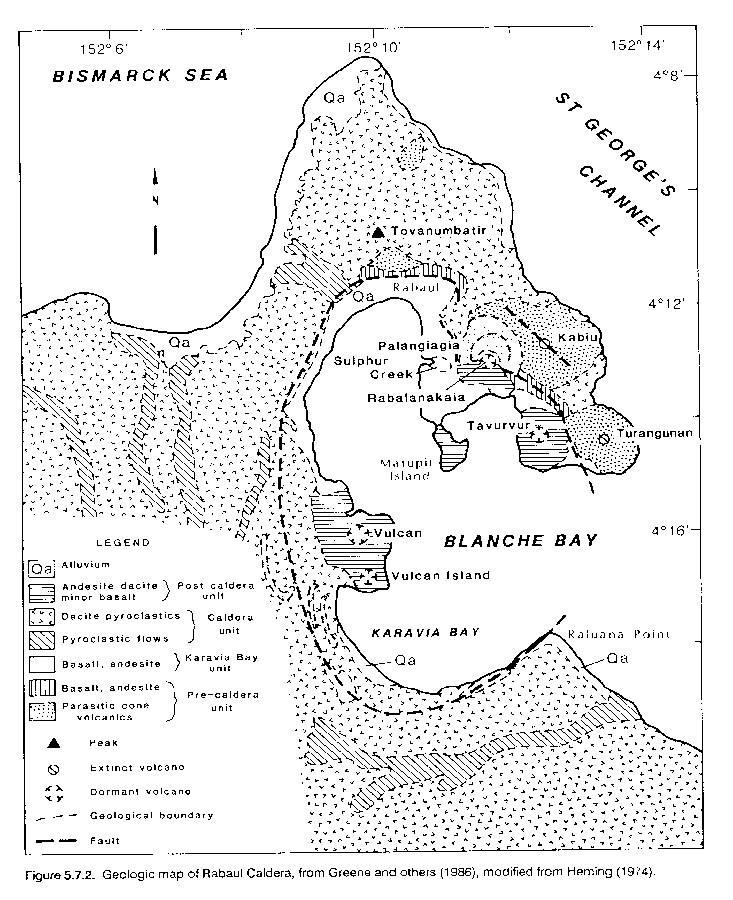
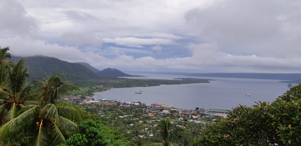
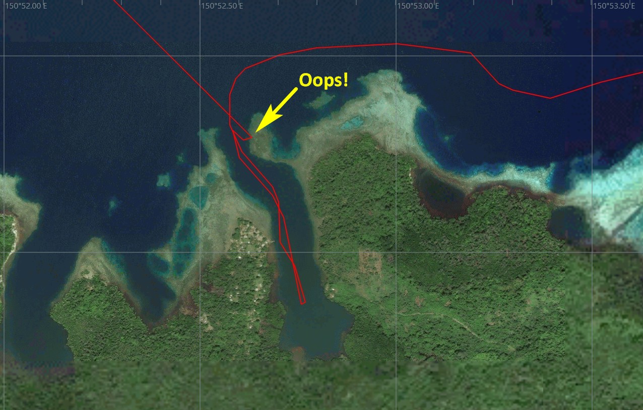
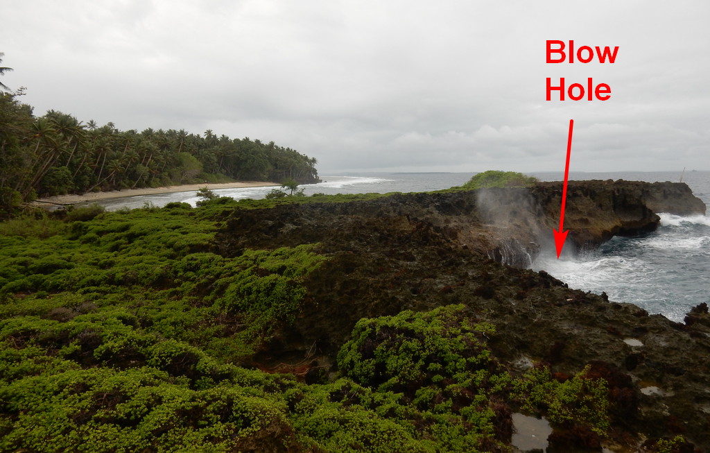
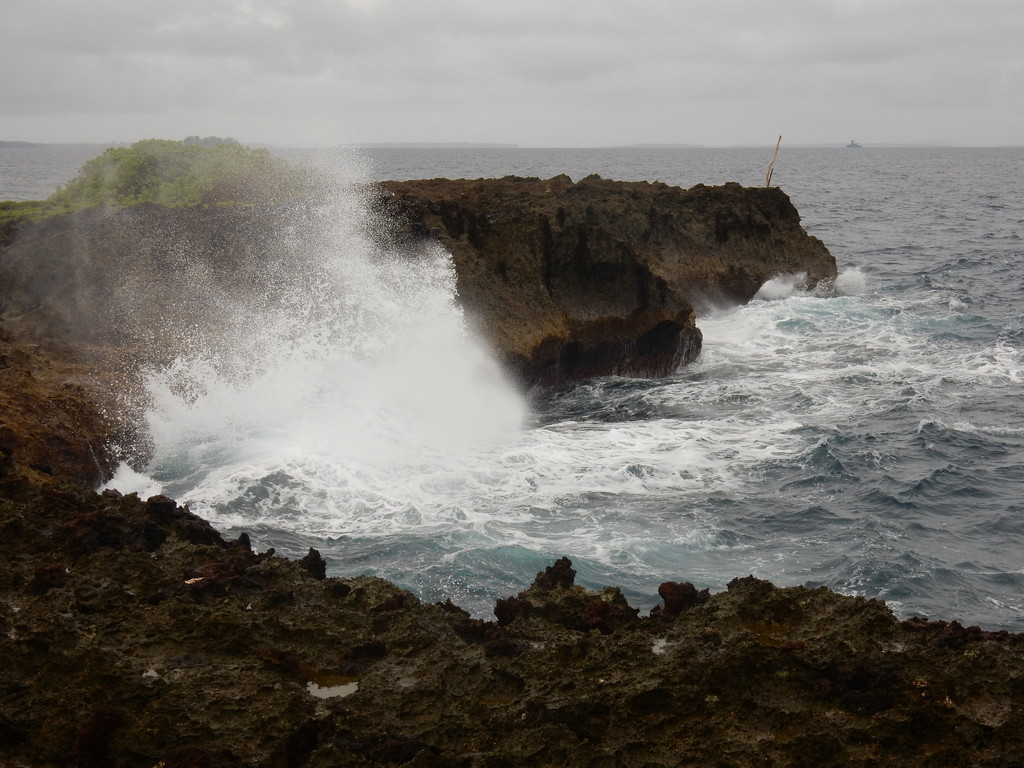
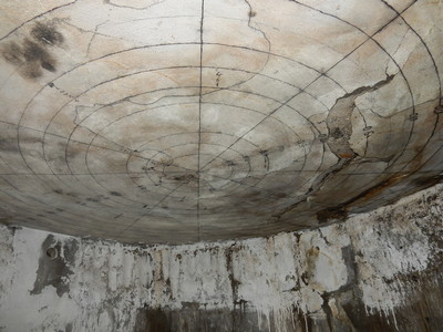
But Rabaul isn't just another World War II spot. Looking at a map, you can see that the entire Simpson Harbor is actually the caldera of an old volcano, which isn't dead yet. It is a very volcanic location that has experienced at least two devastating eruptions. The last one was in 1994 which pretty much destroyed the town. That volcano is still rumbling and smoking. And the town is still there.
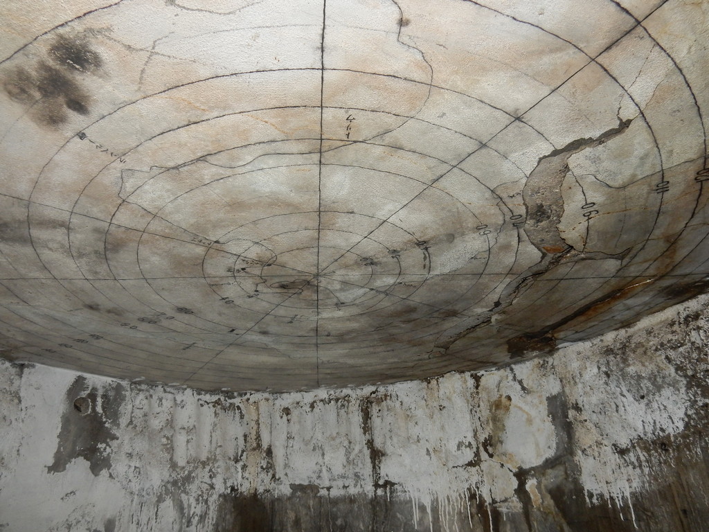
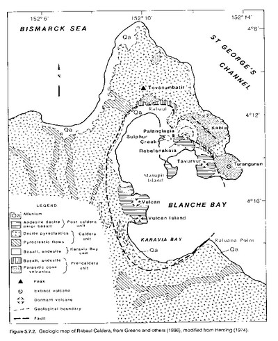
A Geological Sketch of Simpson Harbor (source)

Rabaul also has a long colonial history--the town was first established in 1884 by the Germans, and became the German New Guinea territorial headquarters in 1905. Rabaul was taken over by the British in World War I and became the British Territorial Headquarters for New Guinea until the first major eruption in 1937. But it continued to be a significant port in the western Pacific trade routes until World War II.

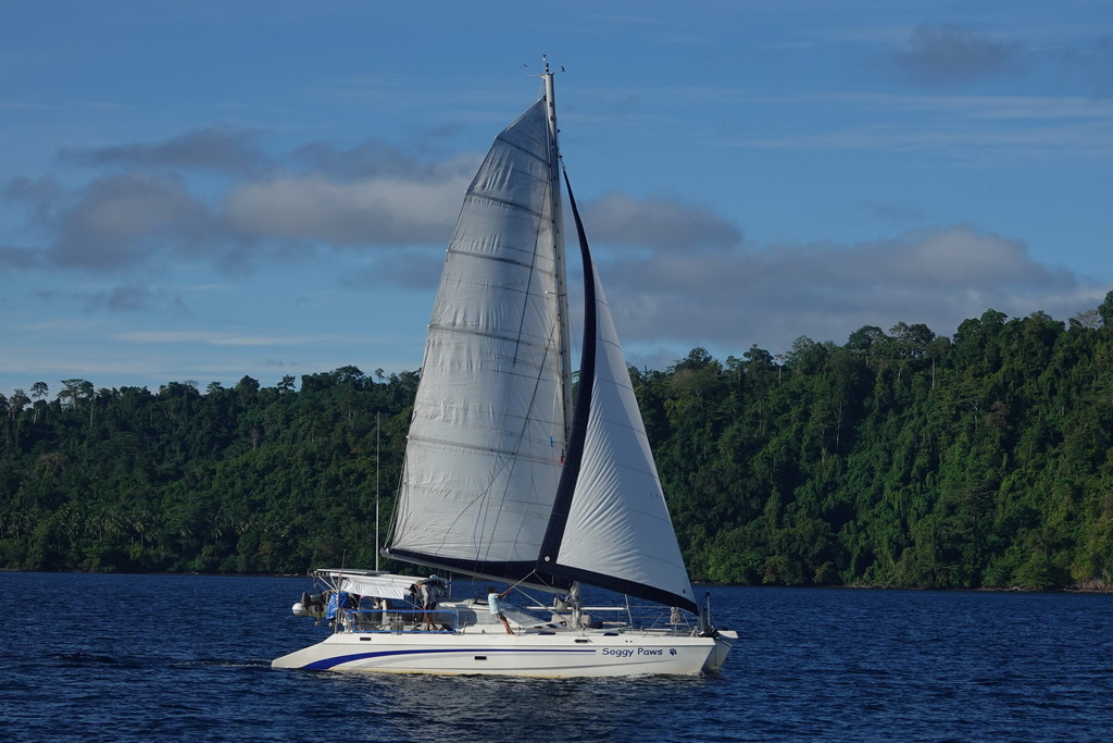
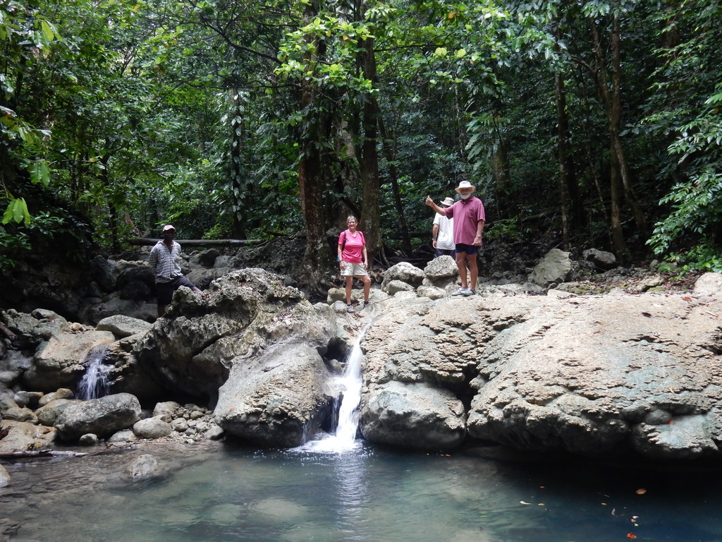
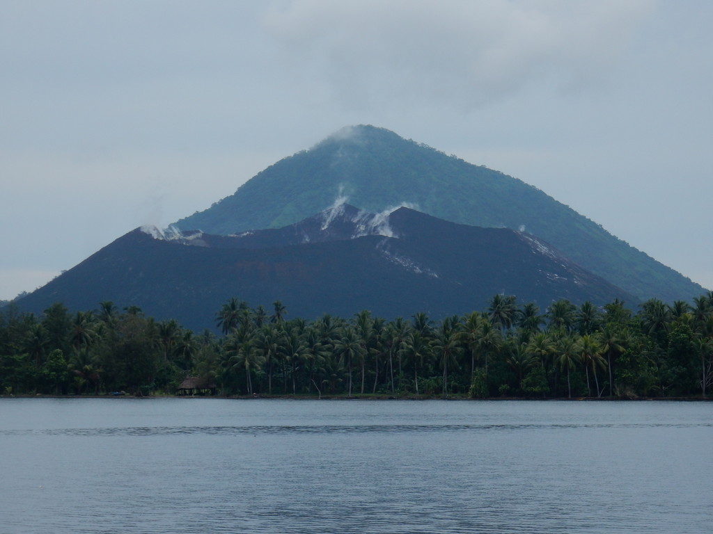
So we were really anticipating our visit to Rabaul. It was only a 20 mile sail from the Duke of Yorks. As you approach Rabaul, you can see the Tavurvir volcano's distinctive shape. Motoring into the harbor, you pass the still smoking volcano that blew its top in 1994. (Later we hiked out to see the volcano up close).

Our First View of the Tarvurvur Volcano

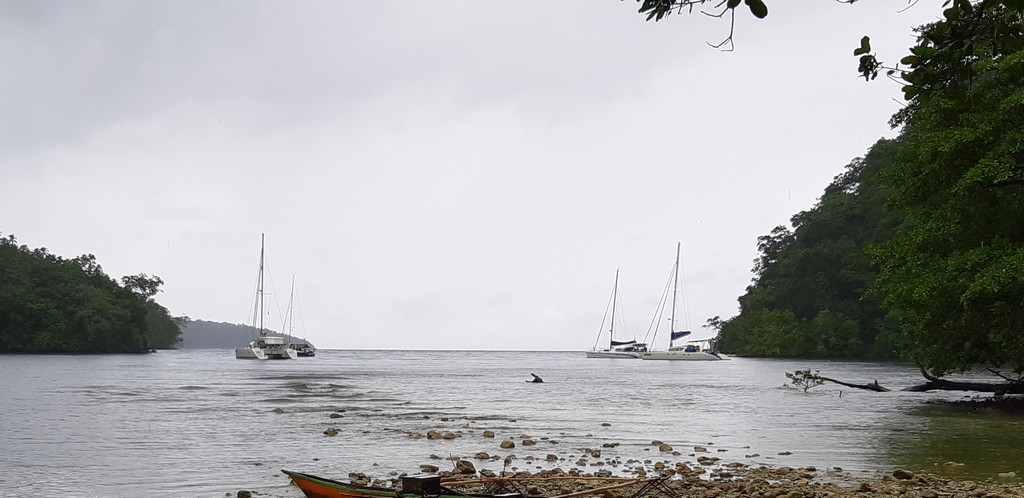
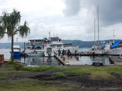
On arriving in the harbor, we picked up one of Rabaul Yacht Club's moorings at the direction of Rod Pearce, the official RYC greeter for visiting yachts. Rod is quite famous among wreck divers and World War II buffs, as he made a hobby out of finding World War II wrecks, both in the water and ashore. We were pretty excited to meet him.

You can read a little bit about Rod and his exploits here:
World War 2 Wreck Hunter Rod Pearce
and a more personal perspective here:
Wreck Hunter Rod Pearce

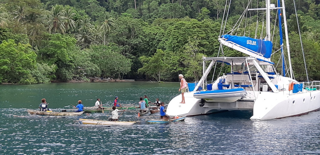
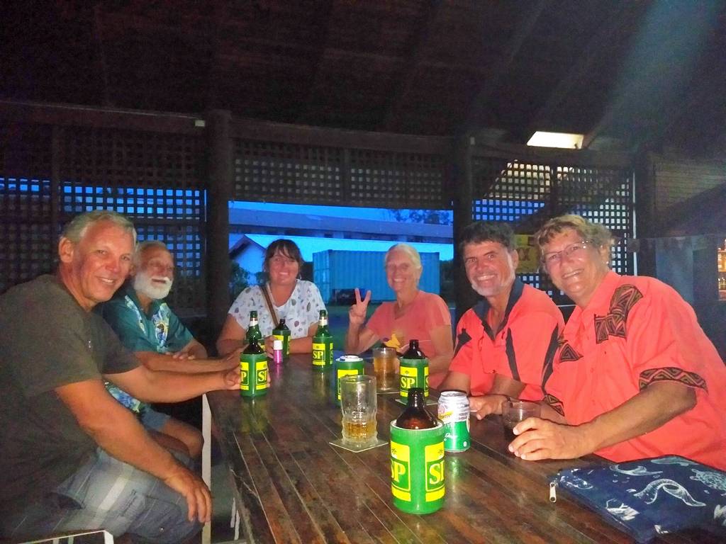
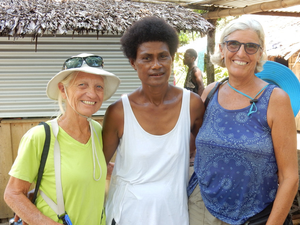
All our buddy boats arrived the next day, and it happened to be "steak night" at the yacht club. So we all went in for drinks and dinner.

Rabaul had a thriving ex-pat community (mostly Australians) until the 1994 eruption, and RYC was one of the cornerstones of the social scene. After the eruption, the whole section of town where the yacht club was was covered meters deep in volcanic ash. Rabaul Yacht Club was one of the few facilities that escaped being crushed by the ash. But it has never recovered its former glory. Almost all the old ex-pats have died or gone home.

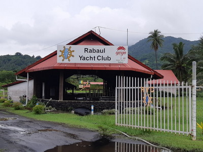
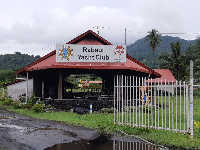
The Rabaul Yacht Club

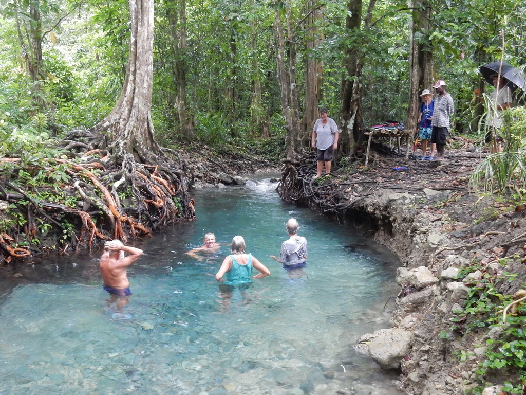
We spent a week there on the mooring at Rabaul Yacht Club. There is no fee for the mooring if you are staying a short while, but they expect you to come in and buy a few beers at the bar and come to their Friday night dinner (the only time they serve food at the yacht club). The dinner has good food for a reasonable price. You can leave your dinghy safely at the YC dock, there is wifi in the bar, and you can dispose of trash.

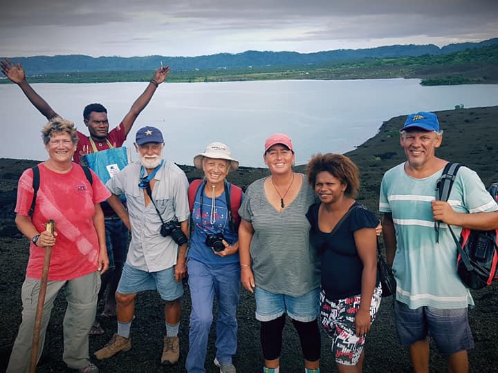
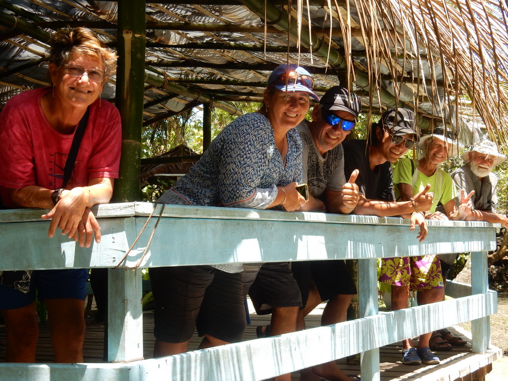
The Gang Enjoying A Round of Bevvies at the Rabaul YC

If you plan to spend some time in this area of PNG, they encourage you to pay a K200 “temporary membership fee”, which entitles you to membership at the Rabaul Yacht Club for a year. Since we were grateful for the mooring and the hospitality, and planned to come back later in the year, we opted to become a member at Rabaul Yacht Club for a year.

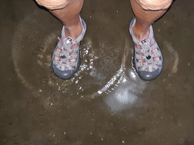
We were surprised to find the "dance floor" part of the yacht club 2 inches deep in water. The ash had piled up enough around the yacht club that if it rained hard, the water didn't drain through like it used to. It had been an extremely rainy preceeding week.

It's A Bit Damp In Here, Eh Wot?

We spent the first couple of days in Rabaul finishing our check-in to Papua New Guinea, and reprovisioning. We had done a provisional inward clearance at Customs in Kavieng, our first port. When we left Kavieng we got outward clearance for Rabaul (one piece of paper, no cost), which we gave to the Customs guy in Rabaul.

It was easy to catch a shared taxi (in 15-seat vans) into town, for K1 per person (about 30 cents), from the Yacht Club. Sometimes we had to walk out to the road to catch one, but several times, the van would come right down the yacht club driveway to check for passengers. These (route 7A vans) go right into town and drop you off at the market, and right across from one of the biggest grocery stores (SOHO), where there is also a BSP ATM.

Note: best to get to the ATM’s in Rabaul in the morning, as they often run out of cash by mid-day. SOHO supermarket would permit you to get cash back if you bought something from them, if the ATM is not working. Besides the BSP ATM at SOHO, there’s a BSP with 3 ATMs up the street a little way.
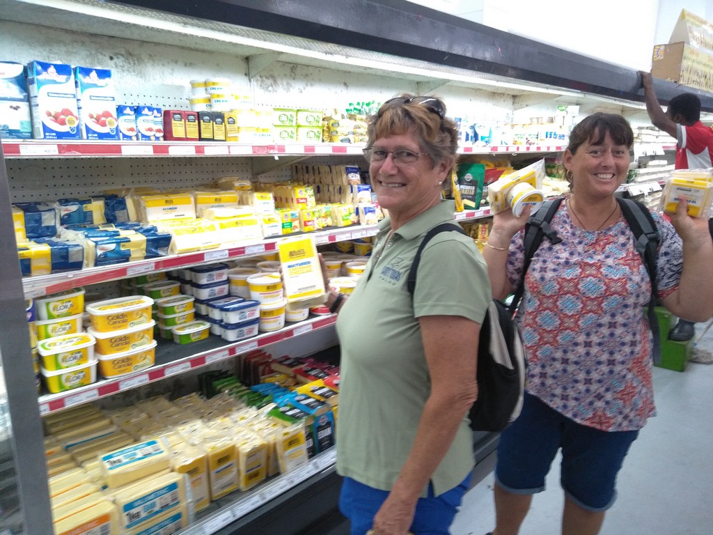
Well Stocked Anderson's Supermarket in Kokopo

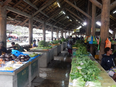
If you want better provisioning, Kokopo has a couple of stores that cater to western tastes, including a great selection of cheese. The fresh market was large and had a wide selection of local fruits and vegetables. The vans going back leave from the van loading area next to the market, just ask someone where the queue for the 7A PMV is. It is possible to take a van from Rabaul into Kokopo, I think it is 1A (but ask at the van area in Rabaul). Not sure the price. But the trip takes about 45 minutes.
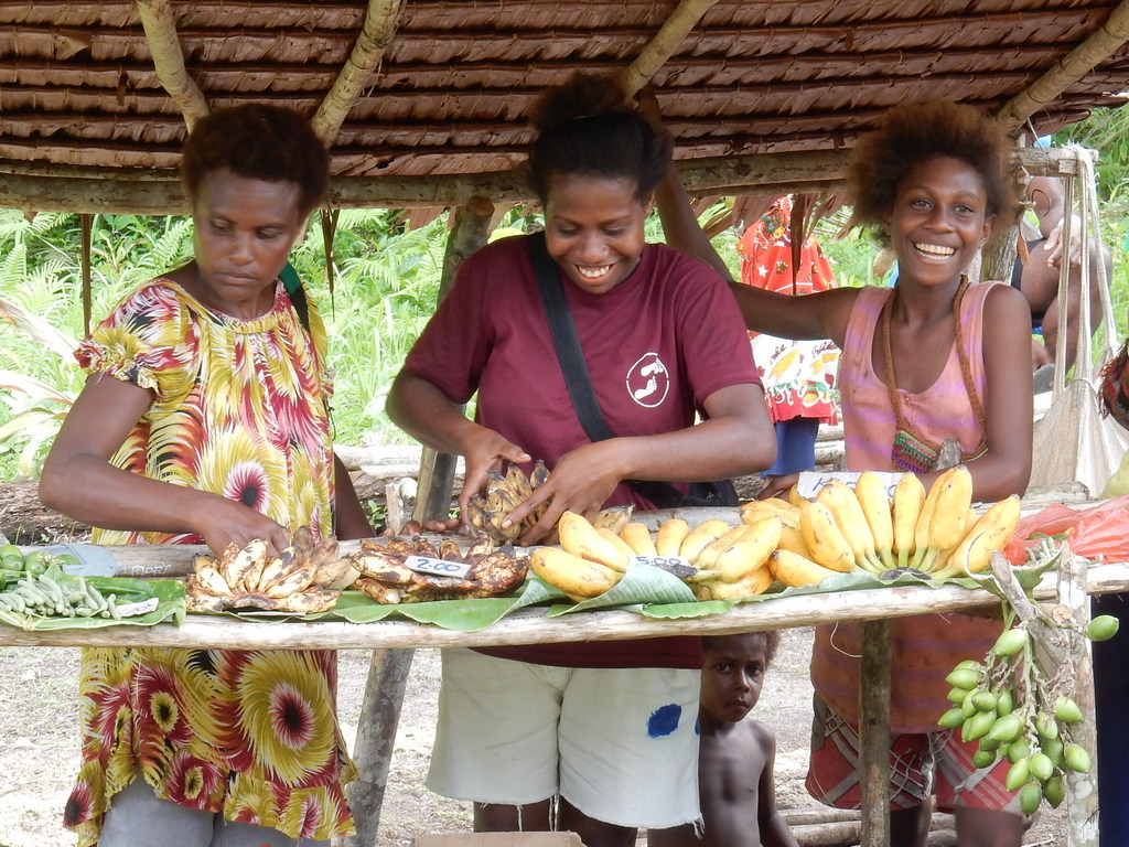
One Section of the Kokopo Market

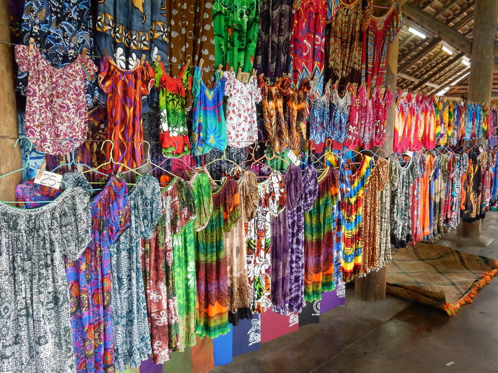
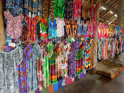
Handmade Dresses for Sale at the Kokopo Market

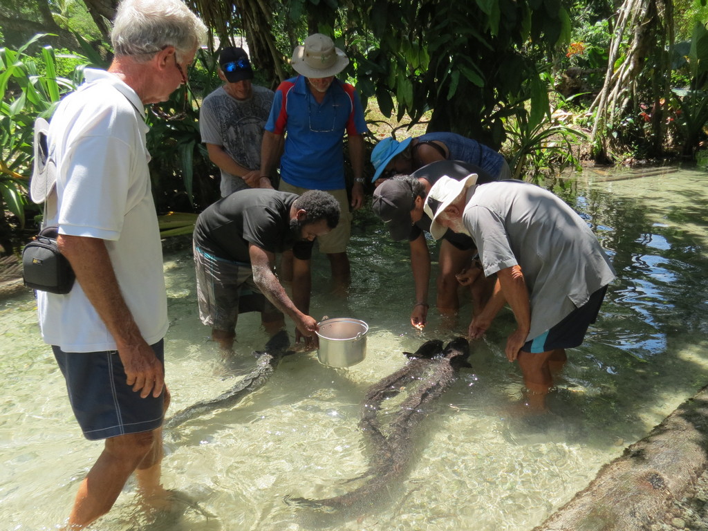
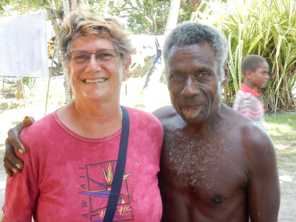
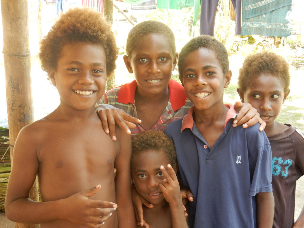
Everyone seemed friendly (locals and expats alike). But we did keep asking where it was safe for us to go on our own, and where it wasn’t. We followed their advice and had no problems, with either theft or ugly behavior.

Fuel: You can arrange for diesel to be delivered in 200L drums to the YC dock, and they will bring a small pump to pump it into your boat (rafted alongside the YC dock) or into your jugs. If you want smaller amounts, or want to see your fuel pumped directly from the pump, we hired a van for a half day to take 4 boats’ worth of jugs into MC Seeto for diesel and gasoline. It’s a little cheaper to buy diesel by the barrel, but some of us were gun-shy after bad experiences with delivered fuel in barrels in Indonesia.

You can get your propane bottles refilled at the depot in town (ask Rod what fittings they can accommodate).

We found epoxy and bottom paint (at fairly shocking prices) at MC Seeto, Barlow’s, and another store.

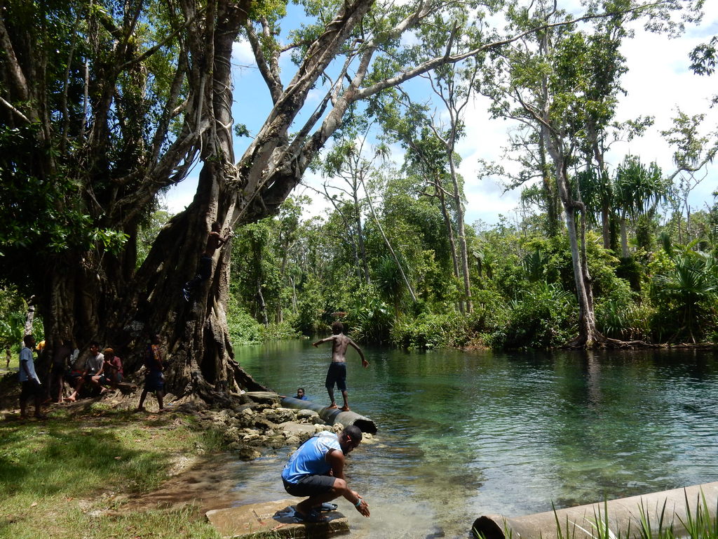
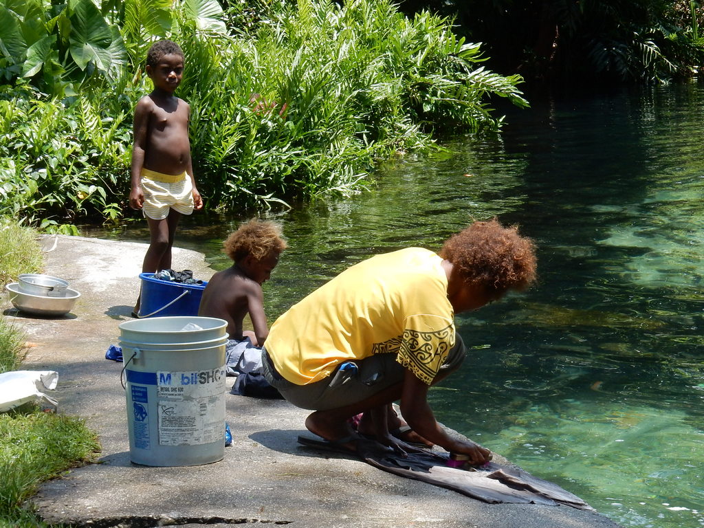
Once we got the necessities out of the way, we managed to fit in a couple of days of tourist activities--seeing the volcano and the World War II sites.

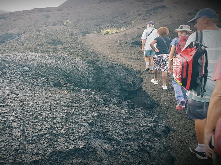
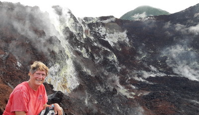
Volcano Hike: We went on a guided hike to see the Tarvurvur volcano, arranged by Liliane at the Rabaul Hotel. That cost K250 for the van and the guides (security) to take us up the mountain. It’s a 15-pax van, so it was perfect for 8 of us. We hiked right up to the rim of the smoking volcano.
The Early Morning Hike to the Volcano

We Made It!

In the Belly of the Volcano
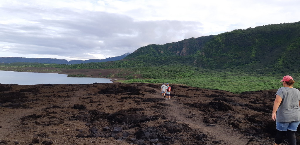
The Lava Wasteland

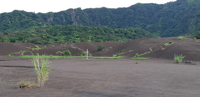
This Was Once a Thriving Part of Town

They recommend doing the hike first thing in the morning (we left at 5:30am). It is about a 15 minute walk across level ground and a half hour scramble up the hardened lava to get to the rim. Bring good shoes, a walking stick, and good knees.

Day Tour / Historical: We were referred to Suzie at the Rabaul Hotel to arrange a day tour, but her prices were “tourist prices” and we were looking for yachtie prices. We eventually arranged for a van for K200 for the day, and used one of the Rabaul Historical Society members as a tour guide, for another K200. Split 8 ways, this was reasonable for an all day tour, which took us all the way down to Kokopo with a number of stops, both historical and shopping, and up to the Volcano Monitoring Station, which is also a great view of the harbor. Contact Francis, the van owner at 7040 9265 and Rob Rawlinson the tour guide at 7254 3486 to make your own arrangements.

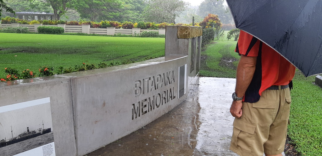
Our first stop was the Bitapaka War Memorial in the rain. We didn't wander around much because of the soggy ground, but it was a beautiful site honoring the Australians who died during World War II, either defending Rabaul when the Japanese first attacked, or during imprisonment during the war.
Bitapaka War Memorial

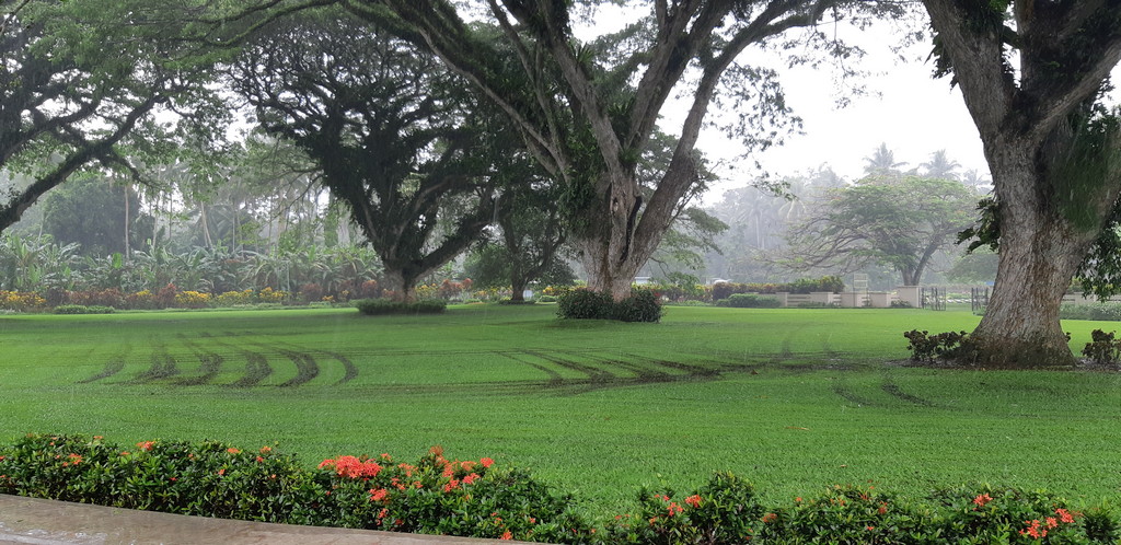
Beautiful Bitapaka War Memorial Grounds


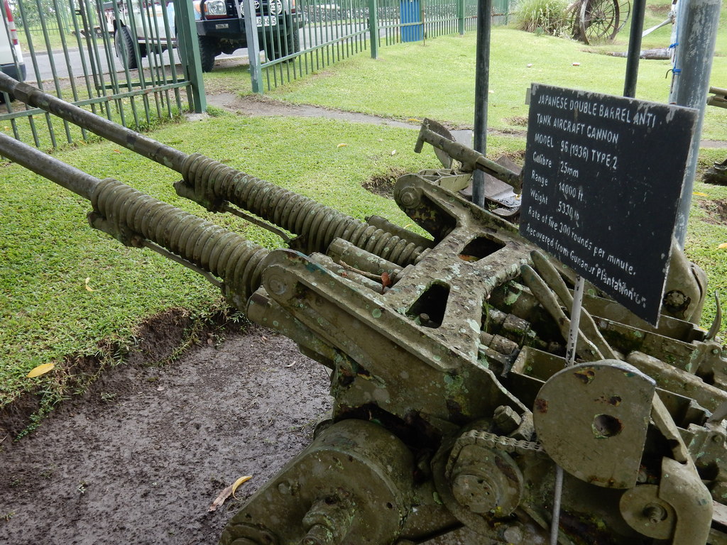
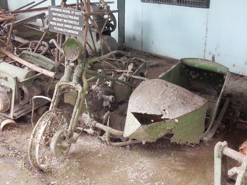
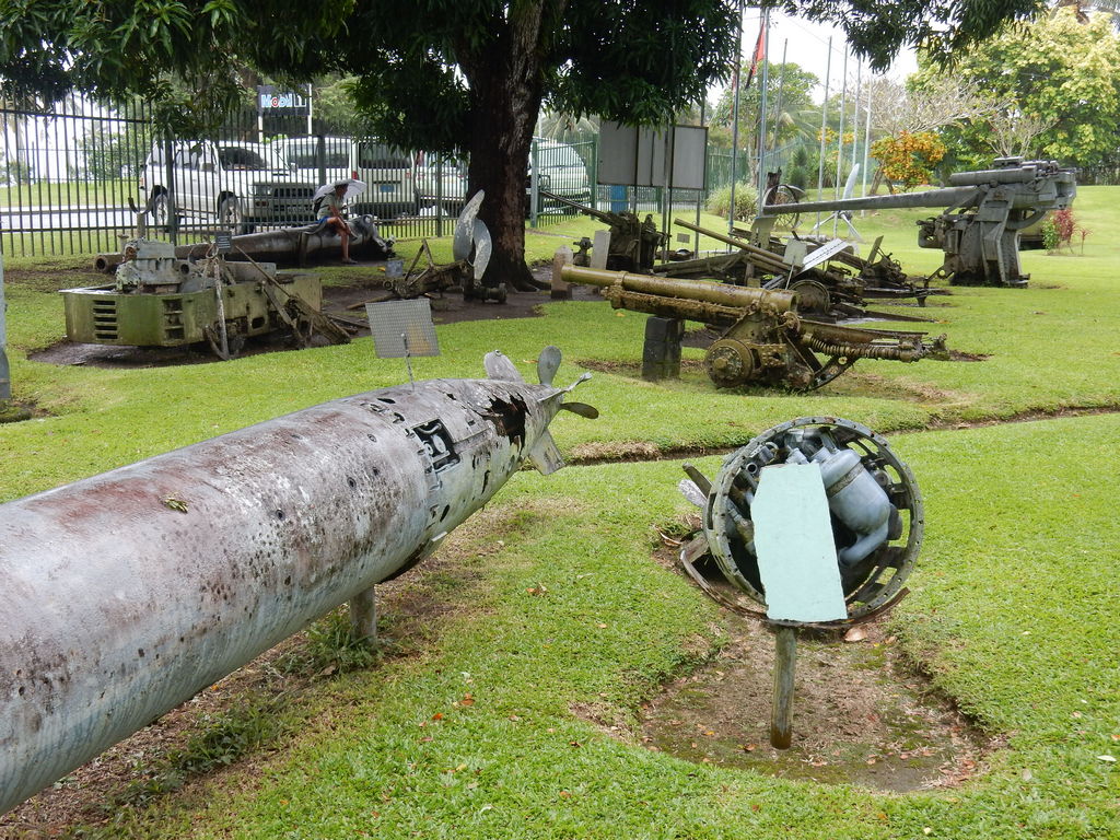
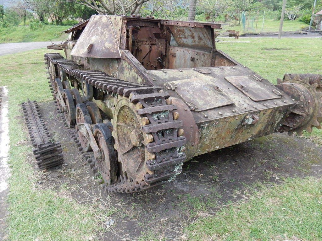
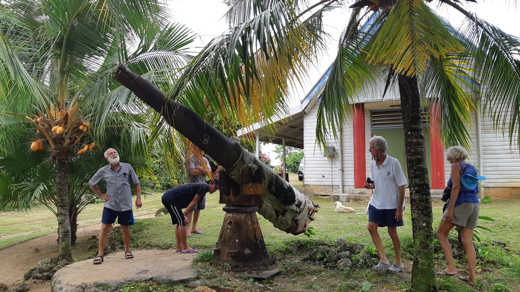
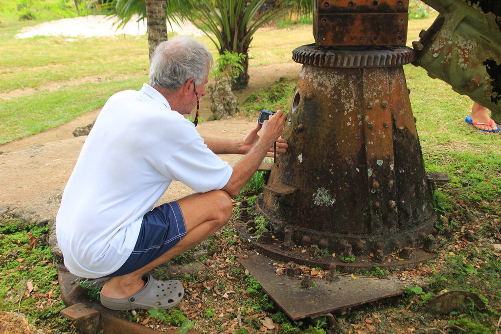
The next stop was the Kokopo Museum. It pained us to see the war relics sitting outside in the rain. A few pieces had descriptive plaques, most did not.

Kokopo World War II Museum

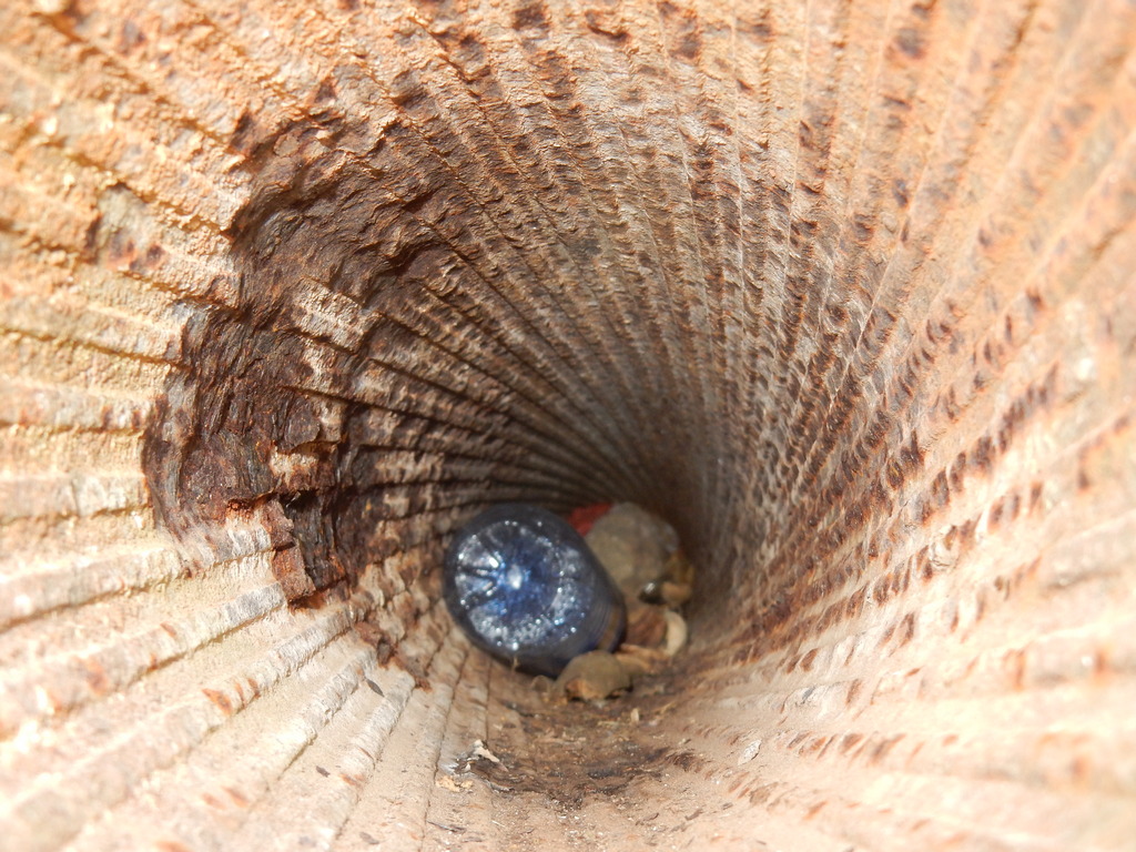
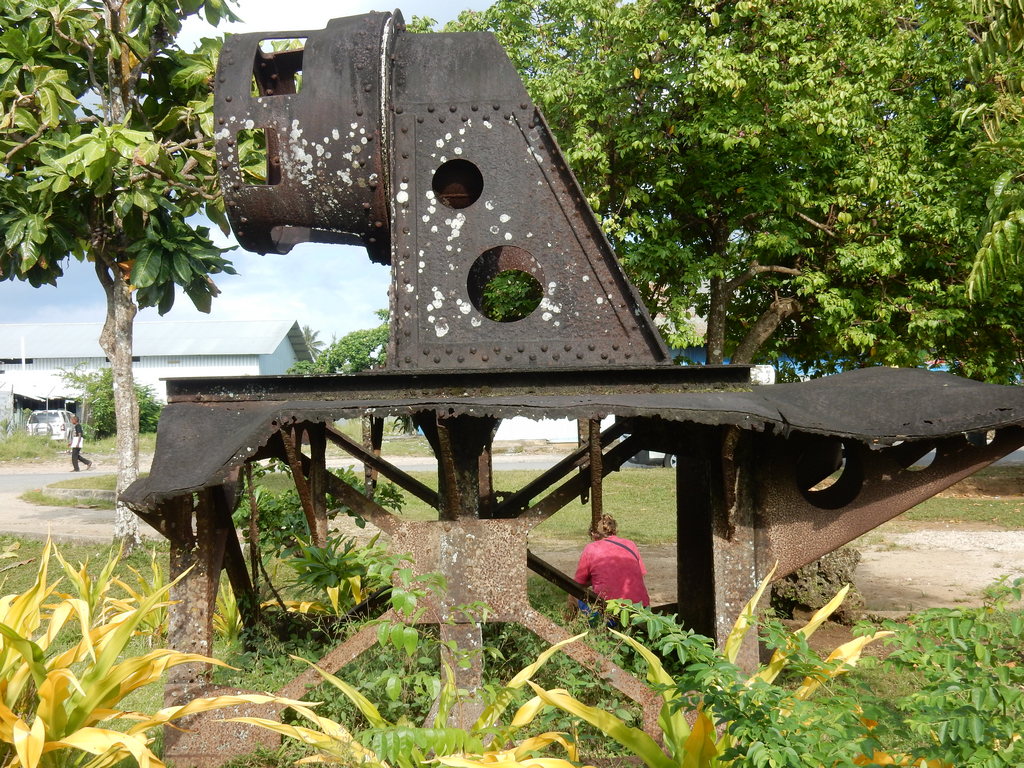
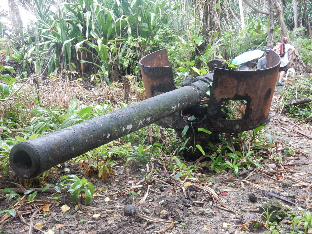
A World War II Tank Cannon

Japanese Motorcycle

Lots More Stuff


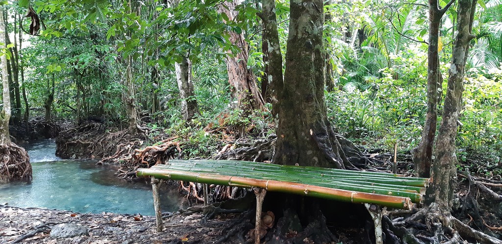
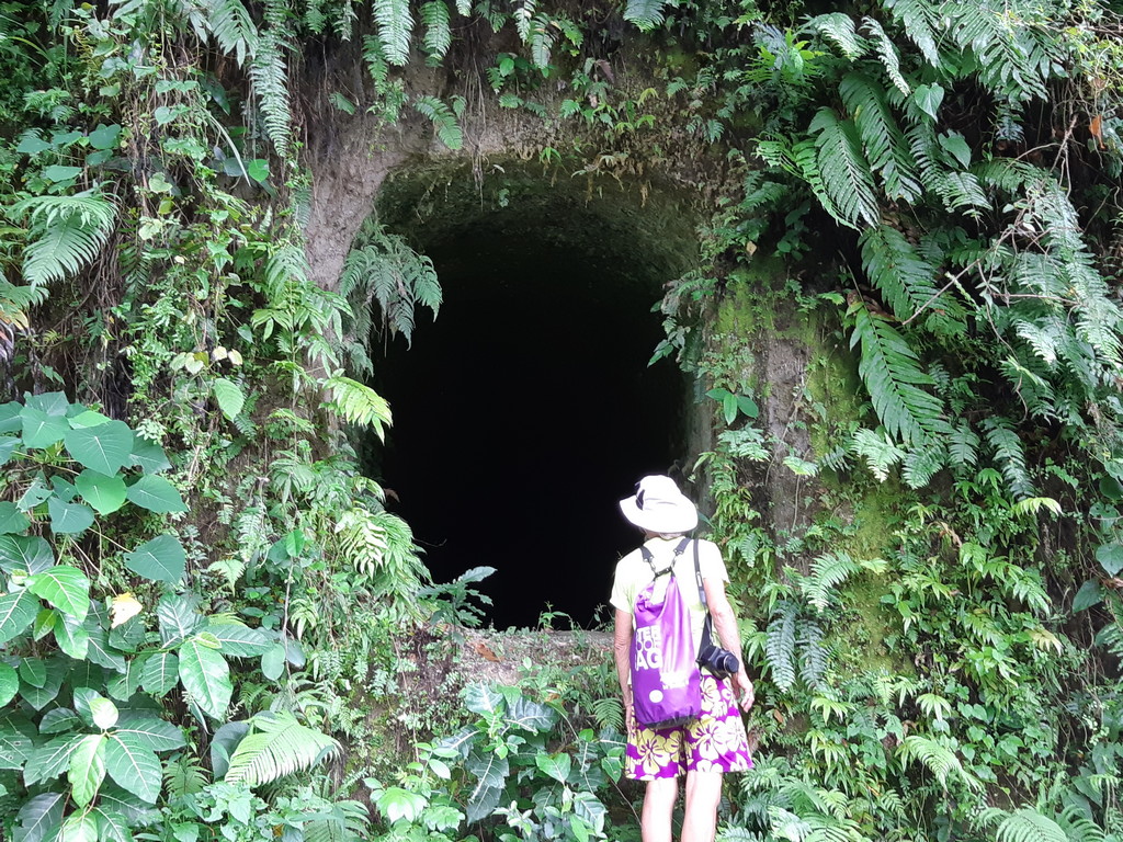
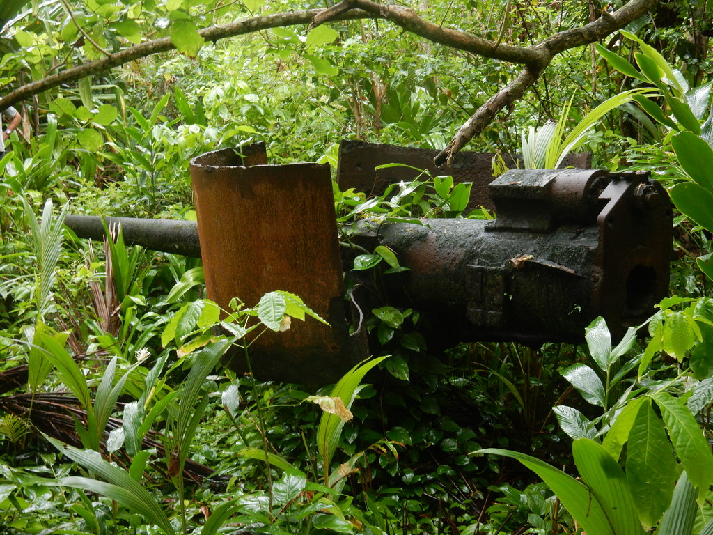
The next stop was at Tunnel Hill. Here was just a small portion of the miles of tunnels excavated by the Japanese in Rabaul during the war. These particular tunnels housed prisoners of war (Australians and New Guineans). They provided the slave labor to build buildings and excavate tunnels for the Japanese. We did not have time on this tour to also visit the Barge Tunnels, but we did see them on our return to Rabaul in October.

Liz Peers into the First Tunnel

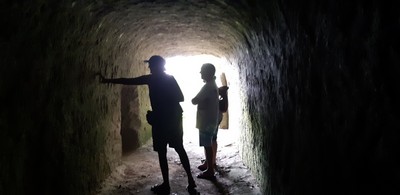
Sue and Craig Look at the Inscriptions on the Wall


Next was a stop at the Rabaul Volcanological Observatory. This provides a great view of the harbor and some of the volcanos. Plus we had a nice chat with one of the fellows there monitoring the volcanic activity in PNG.

The Great View of Rabaul


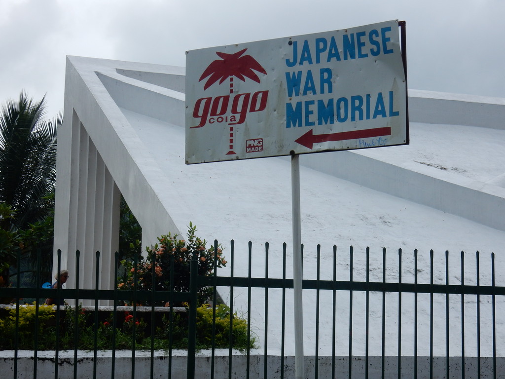
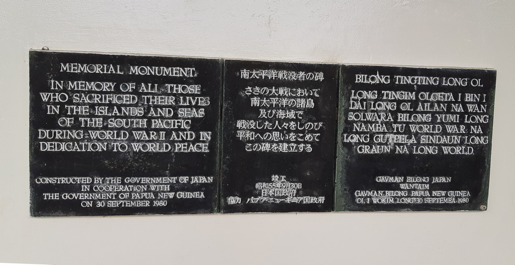
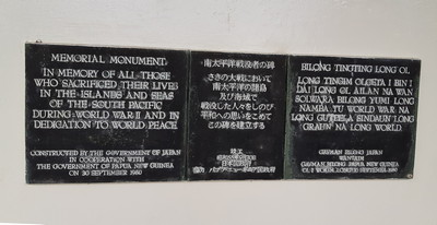
Next was the Japanese War Memorial, erected with Japanese funds.

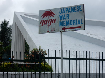
The Japanese War Memorial


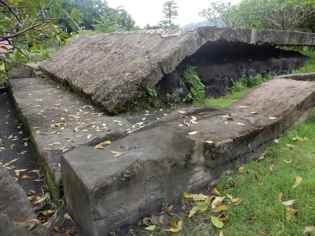
On another day, we arranged a visit to Admiral Yamamoto's Bunker, and the New Guinea Club and Museum. These are within walking distance of the yacht club, but you need to arrange for someone to let you in.

Admiral Yamamoto was the Japanese Admiral who conceived of and executed the surprise attack on Pearl Harbor. He directed the Japanese Naval Effort in the Pacific until his death at American hands while on an inspection tour in New Guinea and the Solomons.

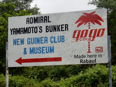
Yamamoto's Bunker is Close By

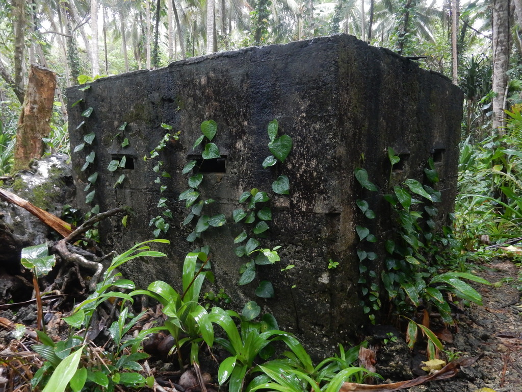
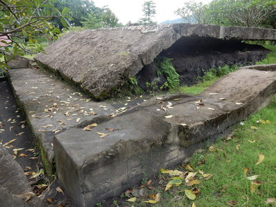
Massive Concrete Slabs Protect the Bunker

The Ground is So Wet, We Were Wading Into the Bunker

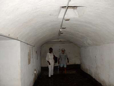
The Map Room of Yamamoto's Bunker


Next door was the New Guinea Club and Museum. The New Guinea Club is a social club, but also houses a bunch of historical items from World War II and the Colonial Past.

One of the Pieces of Armament on the Front Lawn

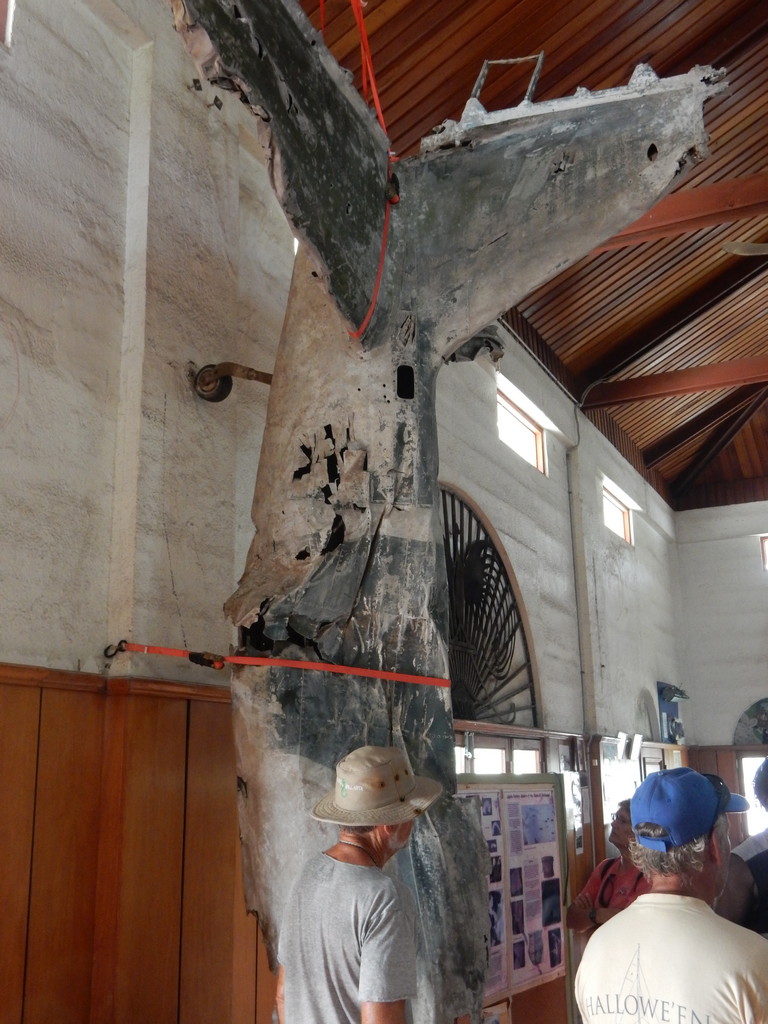
A Japanese Plane Hanging on the Wall
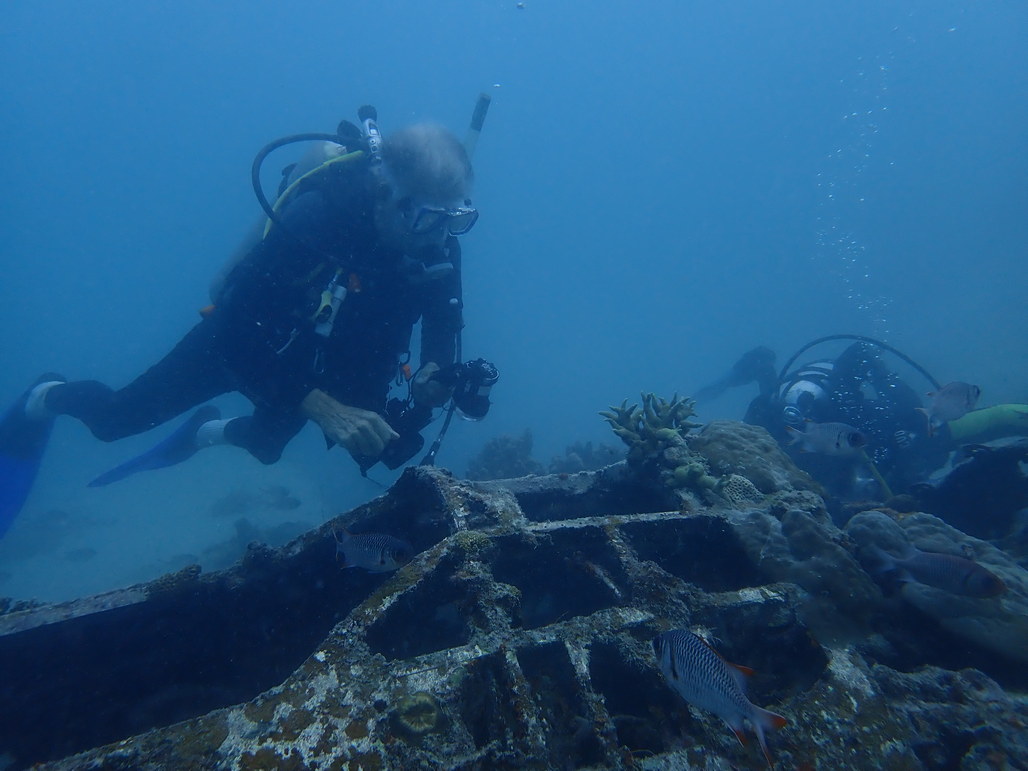
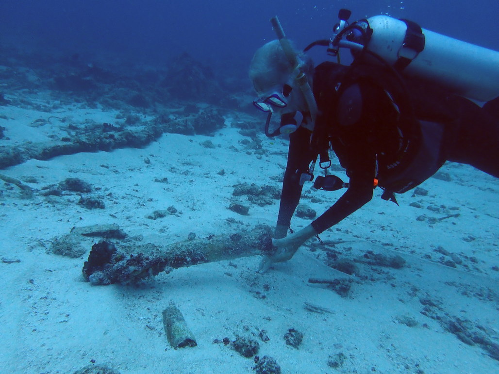

Diving: Rod Pearce gave us waypoints for the diveable wrecks in the harbor. He can fill tanks, but you need to supply your own gear. Sadly, between reprovisioning, touring, and the rain, we never got to dive any of the wrecks.

Eating Out: Besides Friday Night Dinner at Rabaul Yacht Club, we had lunch one day at the Rabaul Hotel, a 10-15 minute walk from RYC. It was good but a little pricey. They also offer dinner. There are many “Kaibar’s” in town. This is apparently the PNG version of a fast food place. We ate lunch a couple of times at the Kaibar at the Soho Grocery store. The lamb stew was OK and relatively cheap. You can also pick up cooked food at the market.

Clearance Out: On leaving Rabaul for the Solomons, we again visited the Customs officer in Rabaul, obtained a Customs clearance, and got our passports stamped out. The officials in both Rabaul and Kavieng were friendly, relaxed and accommodating. Not much paperwork, no boat visits, and a small cost only for Plant Quarantine on arrival in Kavieng. The Customs guy in Rabaul told us that Rabaul was the clearance port, not Kokopo.

Thursday, March 7, 2019

Kavieng to the Duke of York Islands

March 4-6, 2019

We pulled out of the Kavieng town anchorage on the afternoon of March 4th, after spending the morning provisioning and getting ready to move again. Late that afternoon we anchored at Albatross Channel, after motoring about 3 hours in a winding passage to position ourselves to go out the south entrance of the Kavieng area. There was another boat anchored in the spot we'd selected to anchor (looking at the satellite pic). It was dodgy getting all four of us anchored and comfortable in the area. But it was OK for an overnight.

The next morning we got underway around 0645, headed south and east toward Rabaul, with a planned stop at the Duke of York islands, just off Rabaul.

There wasn't a breath of wind...
Glassy Glassy Calm

The other boats motored straight for the Duke of Yorks, about 130 miles SE. But since it was so calm, Dave and I wanted to explore the north coast of Djaul Island, which was almost directly on the route. So we made a beeline for Bendeman Harbor (also known as Missionary Cove), on the north coast of Djaul. Our intent was to have a look in the harbor without going in. So I plotted our route to dog-leg down the coast just outside the harbor. As we approached, however, Dave wanted to take a few minutes to go in and check on anchoring depths.

Our charts are not that accurate in this area, so I went below to look at the satellite charts, and plot a route to download to the Garmin, so that we could safely go in the harbor. I left Dave on the helm and thought he understood not to go further in than where I had previously plotted the turn in the route.

I walked back out into the cockpit with the Garmin chip in my hand, and was horrified to find that Dave had proceeded on course straight past the waypoint. I didn't have time to react before BANG! BUMP! CRUNCH! GRIND! We had driven right into the reef guarding the entrance to the harbor! Dave didn't see the reef at all because it was glassy calm and a little overcast, so the reef wasn't visible at all.

Fortunately there was no wind, and no seas (and no one to witness our stupidity). We quickly dropped the mainsail, and Dave got in the water to assess the damage and see the best way to get ourselves off. We were relieved to find that (as designed), our saildrives were protected by the keels, and the keels had stopped us before the rudders hit anything substantial. The rudders were scraped but not damaged severely. After making sure we could run the engines in gear, Dave pushed from the bow and I motored in reverse, and we slid gently off the reef. Thank God!!

By then, a few villagers had gathered around in canoes, but we just smiled and waved, and motored into the harbor.

One of the Locals Who Came to Look at the Strange Boat

It was a long narrow harbor and would provide good protection in all but a howling north wind. And the reef we had run into provides some protection in NE.

Satellite View of the Harbor, Our Track in Red

There is a substantial concrete pier on the west side, and all the kids in the village were standing on the pier waving at us. We felt bad about leaving without stopping to socialize, but we were on a mission...

All The Kids in the Village Waving at Us

The bottom was smooth at 85 ft deep off the pier, and it slowly shallowed to about 60 ft about 2/3 the way in. So it would be an anchorable spot. 02-54.63 S / 150-52.76 E.

Continuing on, carefully avoiding the protuding reef, we hugged the N coast of Djaul, looking for other possible anchorages. We found a couple that were possibles. The whole island looks pretty keen on the satellite picture. If we weren't on a mission to get all the way to Vanuatu by May, it would be fun to stop and explore this island for a week. Probably some great diving here too.

By early afternoon, we had cleared the island and set a direct course to the west side of the Duke of York islands. The wind came up enough to give us a small boost in speed, but not enough to sail without using an engine, unless we wanted to make it a 2 night passage. So we puttered along on one engine at 4-5 knots, and eventually made it in my 1530 the next day.

During the night, we saw a bright light about 15 degrees to starboard. It never changed course, it wasn't flashing, there was nothing on radar, and nothing on AIS. We never did figure out what it was. (Our buddy boats were too far ahed of us by then for it to be them). We speculated it might have been a light from Rabaul--maybe the volcano center (high on a hill)--as we were then about 80-90 miles from Rabaul.

It may have also been a "FAD" put out by a Filipino fishing fleet. As we saw something similar from afar several times later in PNG.

A Filipino Fishing Boat, Very Far from Home

It was a fairly uneventful night other than that.

We take the fishing line(s) in at dusk, and put them out once Dave has had breakfast (can't catch a fish on an empty stomach!). On coming on to the bank where the Duke of York Islands are, we hooked a Black Marlin!! It was a good fight for an hour or so. We brought it in to take a picture (and get the hook out), and then released it.

The Exhausted Black Marlin, After an Hour of Fighting
Dave and the Marlin
Dave Gently Makes Sure the Marlin is Rested Before Releasing

We had barely dropped anchor in Mioko Harbor in the southern Duke of York Islands when a canoe approached us asking for an anchoring fee. A young man without much English paddled up to us and handed us an “invoice”, stamped and signed by a local woman. We refused to pay the fee without seeing paperwork proving the fee and the person collecting it was legitimate, and knowing what it was going toward. But our buddy boats all just went ahead and handed over money. One of our boats was actually first asked for a 500 Kina anchoring fee!! Apparently the local council has decided that passing yachts are a good source of income.

Later a guy in a canoe who said he was a teacher at the school, warned us not to pay (or donate) any fee that was supposedly going to the school, without seeing the ledger book that the school keeps. Apparently some unscrupulous people have solicited a donation for the school that never found its way to the school.

Just at sunset, the head of the council, who was aboard one of our buddy boats having a chat, suggested that two of us who had anchored further out in the bay, should move in closer to the village. He was concerned about boardings and theft during the night, and said his people would keep an eye on us.

The anchor spot where we first anchored was 04-13.68 S / 152-27.13 E, in 42 ft, scattered coral heads. We moved to 04-13.88 S / 152-27.12 E.

We left for Rabaul the next morning, but our buddy boats stayed another night. Apparently there is an opportunity to swim with dugongs (guided by a villager). They stayed to do so, but only saw one dugong from the surface. We just did not like the vibe there, and were anxious to get to Rabaul.

Tuesday, March 5, 2019

A Little Fun in Kavieng

Feb 19-Mar 4 Kavieng, Papua New Guinea
Google Maps Link to Kavieng


The rudder repair was not the only thing we did during our two weeks in Kavieng.

Dave was really keen to dive some of the World War II wrecks in Kavieng. We had planned to dive with Jase and Jolene who were temporarily running the primary dive operation in Kavieng (Scuba Ventures). We thought we could negotiate a multi-dive group rate as a package deal. Often dive operations will offer a "cruiser rate" as they know most of us are unemployed and on a tight budget. Plus most cruisers are experienced divers and usually have their own gear. It's a no-brainer in our opinion, if the dive boat has space and is already going out, adding another self-sufficient diver is almost "free money".

Dave and Craig in our Local Dive Boat

Jase sympathized but said he was limited in what he could do for us, discount-wise. And a couple of our divers were on a really tight budget. So we contacted Clem from Clem's Place in New Hanover (our previous stop) to see if he knew of a local dive guide in Kavieng. Everyone already had all their own gear, so we just needed a guy who knew where the dive spots were and boat big enough for 4 divers. It turned out that Clem was in Kavieng when we were--waiting on something to come into Kavieng, and he offered to round up a friend with a boat and take us diving.

Dave Checking out a Kate Torpedo Bomber

The first price we got from Clem was amazingly cheap and seemed too good to be true, and it turned out to be not quite a complete price. After we added the price for a few necessities (like a boat, fuel, dive gear for the guide, and tank fills) our cost per diver was about half what Dive Kavieng offered us as their best discount. Sue on Ocelot spent 3 days in fervent text message negotiations with Clem via WhatsApp, and ultimately got things nailed down.

Dave Inspecting an Empty Artillery Shell

So our divers (Dave, Craig from Berzerker, and Jon and Sue from Ocelot) were able to do a few days of discount diving in an open boat and a local dive guide who didn't speak much English. I'm sure our experience would have been MUCH better and easier with Scuba Ventures, but it was OK taking the budget approach, and more importantly met the budget restrictions of our friends. Tip: It's difficult buddy-boating with people who have different interests and budget than you do. We all managed to make it work--4 boats cruising in company for 3 1/2 months, but it was ticklish at times!

Another thing we managed to work out was a day trip down the coast of Kavieng on the Boluminski Highway to see a few sights. We were still waiting for the rudder to finish drying and wanted to see a little more of New Ireland (the PNG island that Kavieng is on). This trip I got to go on, as it didn't involve getting my leg wet, and I was starting to feel better. Liz on Indigo had gotten the number of a tourist van operator. With a little negotiation we managed to hire a nice van (but no aircon) with a driver and "tour guide" for the day that could take all of us. The normal tour cost for the day trip from the hotel was $100 USD per person, but we managed to go direct to the van operator and hire the van for the day for about $35 USD, no frills (ie we bring our own lunch, water, and pay our own admission, if required, to wherever we stopped). $35 USD pp is still a little high for a day trip, but we were to find the Kavieng prices were some of the highest in PNG, because they are so far out on the supply chain.

Our Little Tour Group

One of the big attractions on the Kavieng Day Trip is Cathy's Eel Farm at Lairabina Village. Sadly, Cathy had just passed away a couple of days before, and the village was preparing for the funeral (to be held the next day). Our guide called ahead and managed to get us an opportunity to see Cathy's eels, as our entry fee is what supports the village. We also got to see the women of the village preparing for the feast associated with a rather large funeral gathering.

The eels were really cool. They are in a clear freshwater stream that runs through the village. Tourists come in and buy the Eel Food (canned tuna, I think it was) and then you can feed it to the eels. You are standing in the stream with these 5-6 feet long and 4-5 inches in diameter eels slithering around your feet. With my infected sores, I didn't dare get in the water, so I was left to take pictures from a safe distance. I didn't get a very good picture, as everyone was standing in the way. But someone else got a good shot of the eels that I could share with you.

These Eels are HUGE!

Another stop we made was at the Treehouse Village Resort. Here is what Lonely Planet has to say about the place: "The Treehouse Village Resort has a series of traditional-style, fan-cooled bungalows on stilts overlooking the beach. Two units are perched up a 200-year-old Calophyllum tree, above the dining room." Sounds cool, but a coastal storm a few months ago kind of beat it up, and it wasn't open.

One of the Treehouse Resort Houses in a Tree

The people who lived in the Treehouse Resort Community were very friendly, and we spent quite some time talking (or attempting to talk) to them, and taking pictures all around.

The Friendly People at the Treehouse Resort Village


On the way back to Kavieng, we took a refreshing stop at a local swimming hole. Of course, I had to sit out and take pictures.

The Swimming Hole


We also made a quick stop at a fruit stand to buy Dave bananas. These ladies were very friendly.

A Road-Side Fruit Stand

Of course, on the way back into Kavieng, we had to stop and see what World War II relics there were.

A WWII Shore Gun in Front of the Methodist Church


Dave Examines and Documents For PacificWrecks.com


Checking out the Rifling (and the Trash) Inside the Barrel


And This is Me, Tired and Ready for a Cold Beer
"Just another rusty bit in the jungle..."

On another day, our crews dinghied over to Nusa Island, the island adjacent to (north of) Nusa Island Retreat and hiked to the blow holes and also saw some more World War II relics. There was a small per-person fee that goes to the owners of Nusa island. I was still healing, so did not go, but here are a few pictures from Dave's camera.

The Northern Tip of Nusa Island

A Small Sample of the "Blow" (Better at Some Tides)

One of the Guns Rusting in the Jungle

Another Big Gun

A Coconut Crab Living Inside the Barrel

A Command Center "Pillbox"

The Entrance--Made for Small Men!

For many more pictures of the exciting World War II relics we encountered during our travels in PNG and the Solomon Islands, check out Dave's presentation "Exploring the WWII Relics of Melanesia (New Guinea & Solomons)" on our Presentations Page.

For much more information on cruising in Papua New Guinea, download our free 285-page cruising guide, the Papua New Guinea Compendium, from here: http://svsoggypaws.com/files/#sw-pacific