Tuesday, January 29, 2019

Passage Maggawandi to The Ninigos

January 25-28, 2019

The Ninigos are a large atoll with a few surrounding small atolls, that lie roughly 140nm off the coast of New Guinea, just northeast of Vanimo, the westernmost city on the north coast of New Guinea. It is possible to day hop down the coast, along coastal Irian Jaya Indonesia and into coastal Papua New Guinea, to within a short overnight sail of the Ninigos. Both because the coast of New Guinea is considered dangerous (because of social issues) and because in NW season, any anchorage we could find would be swelly, we decided to do it as a direct shot of 460nm almost due west from the islands east of Biak.

The forecast looked like it would be a slow passage, with winds on our port quarter at 10 knots, plus a little helping current, we expected to have a nice drift and arrive in 4-5 days.

It started out that way, with sunny skies and 8-12 knots WNW. We all (4 boats--us and Ocelot, Indigo II, and Berzerker) had our anchors up by 9am. For the first hour we threaded our way through the last atoll, and then around 10am, we turned the engine off and were actually sailing! Everyone else had their big sails out, but just as we were finally getting around to thinking about putting up our Code Zero (a big light air jib on a furler), the wind came up a bit and we decided to stick with the working jib.

Everyone has AIS, so it was fun to keep track of who was where and how fast they were going. We managed to stay within a few miles of Indigo for the whole 460 miles, but Ocelot and Berzerker (a 37' mono) gradually fell far enough behind that we couldn't pick them up on radar.

By late afternoon, with 15-20 knots of wind, we put a reef in the main. With a 1 knot following current, we were still zipping along at 8-9 knots speed over ground (SOG)! Later that evening, I calculated that if we averaged more than 6.5 knots, we'd arrive in the middle of the night. (We'd been averaging about 7.5 knots all day). And we'd have to average 8.1 knots to arrive in the late afternoon--not happening. Fortunately, the wind started easing a little overnight.

Dave and I are still on 6 hour night watches. We have an early dinner, and then I take the watch from sunset to about 1am. Then Dave takes it from 1 am to about 7am. The time shifts a little based on when sunset and sunrise actually are, and whether Dave really gets off to be around 7pm. But we try to each get 6 hours off watch, so we can get a good deep sleep. When you are on watch, a 6 hour watch is a long time, especially in challenging weather on a dark night. But it's worth it to get a solid block of sleep. After trying 3 and 4 hour watch schedules, this is what we have stuck with for the last 10 years.

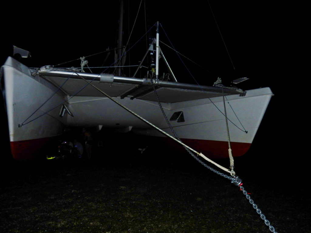
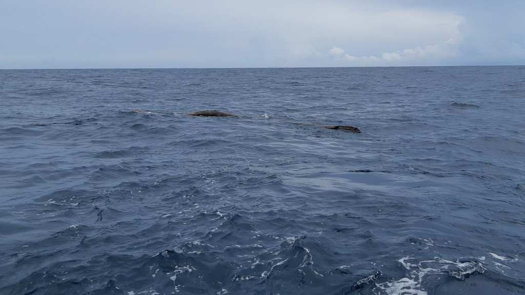
On Day 2, dawn showed overcast skies and light winds. Around 10am the wind was light and almost dead behind us, so we motored most of the middle of the day to keep moving. Around noon, with both of us below doing something, we felt a thud on the hull and then another. We had hit a 12" diameter log, 20 ft long, crosswise on the port hull. And it was stuck between our keel and our rudder.

The Log

Would Have Been Hard to See Even if We Were Watching!

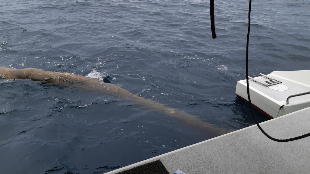
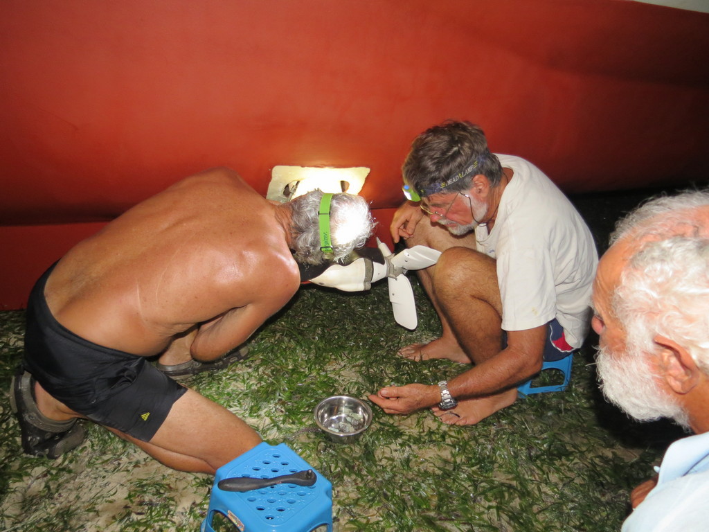
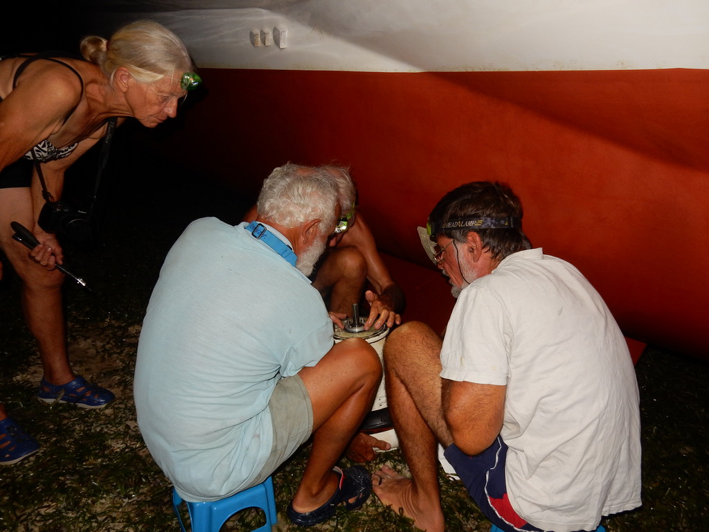
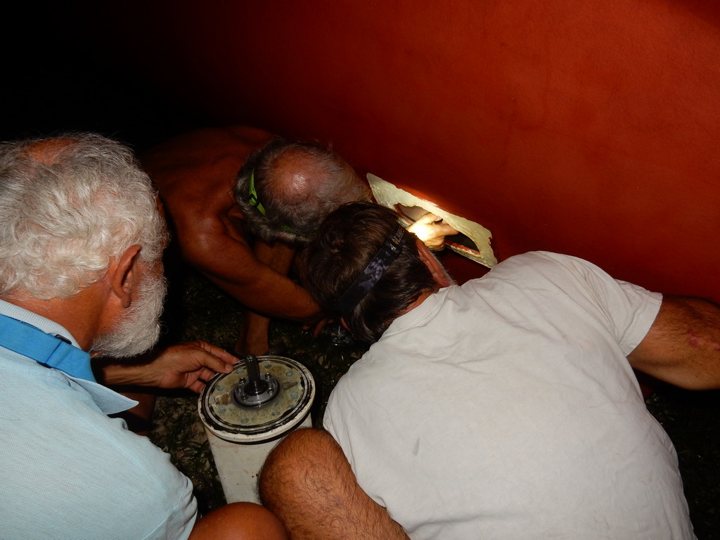
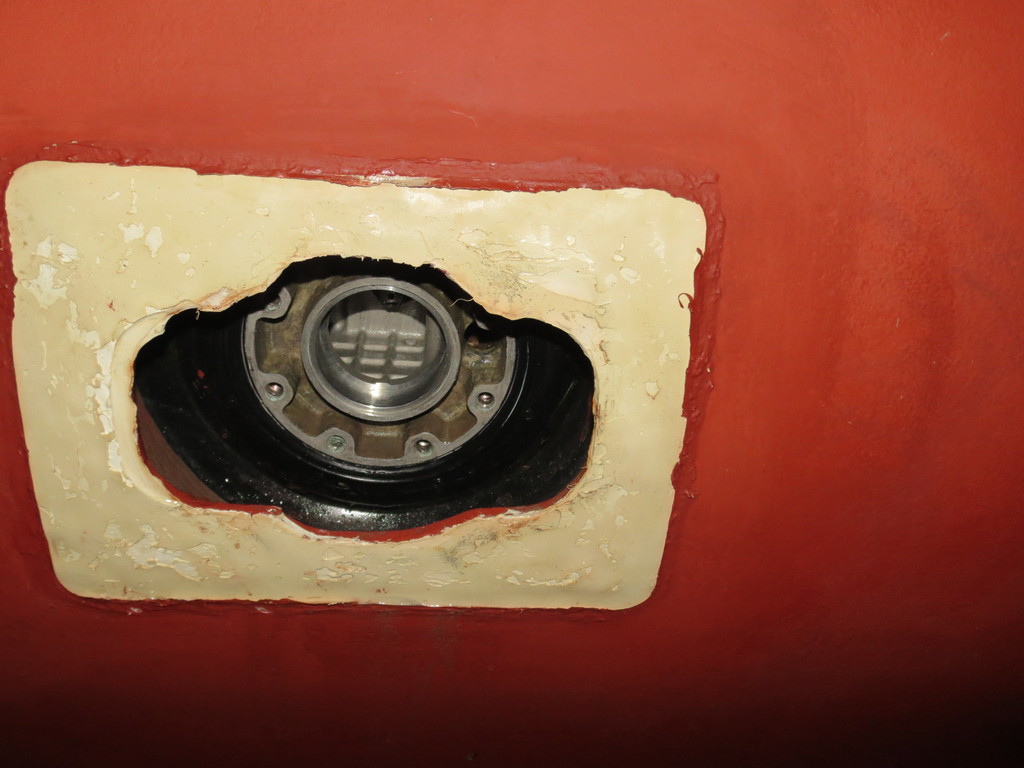
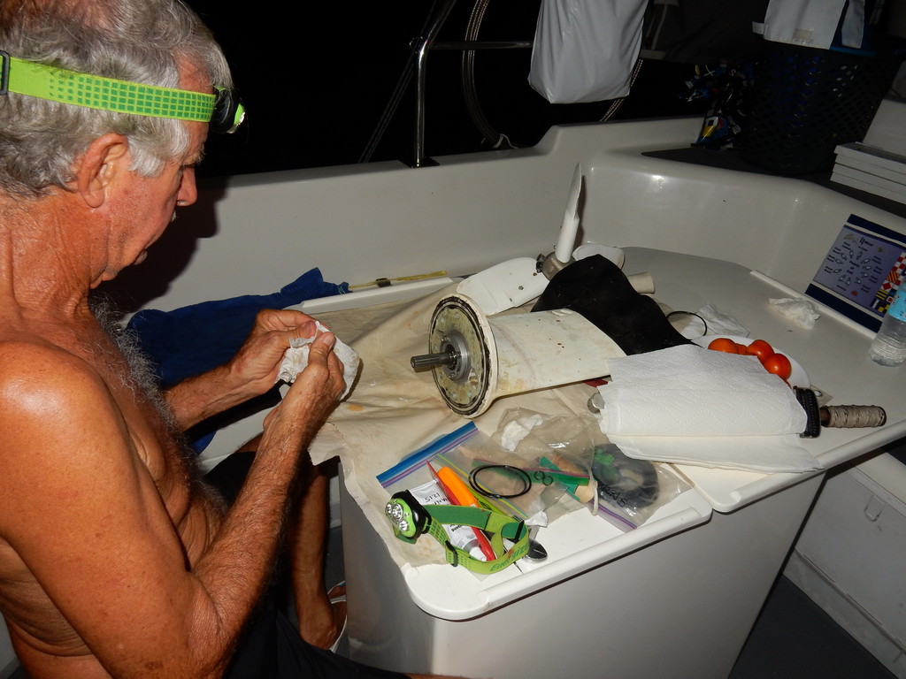
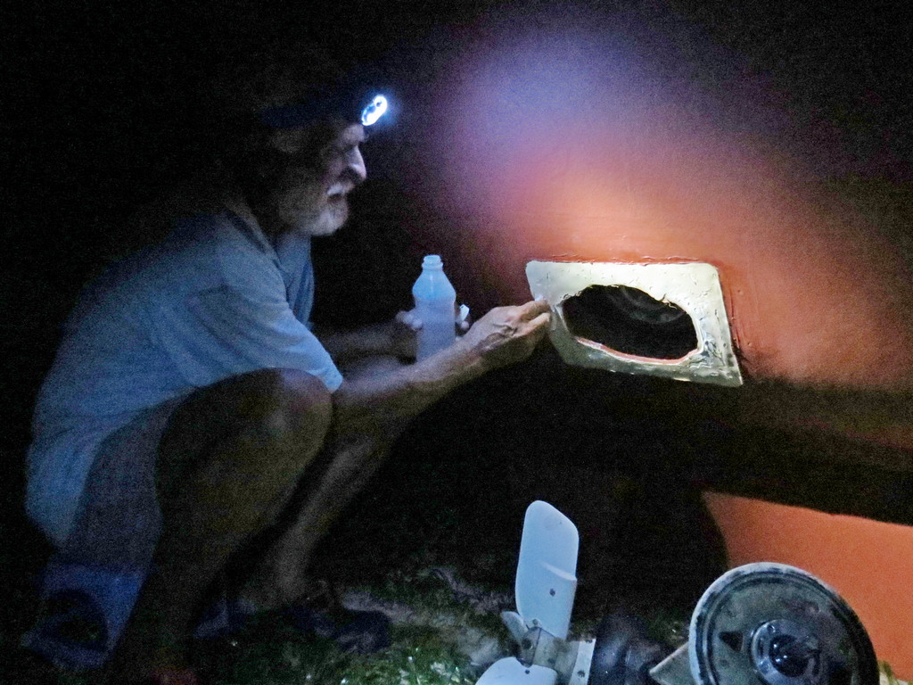
We pulled back the power immediately. We had been motoring on the port engine and feared for damage to our rather fragile saildrive. We were still moving enough to keep the log pinned to the forward side of our port rudder. Dave dumped the mainsail and I turned a little, and the log finally slid out. The engine seemed to be working OK, with no odd noises or vibrations. It was sloppy enough seas-wise that neither of us wanted to get in the water to take a look. So we powered up and kept on. (Note: at this point, Dave still hadn't resolved the cooling water issue on the starboard engine).

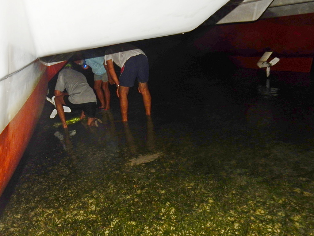
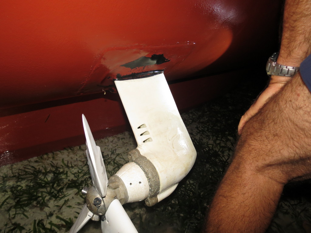
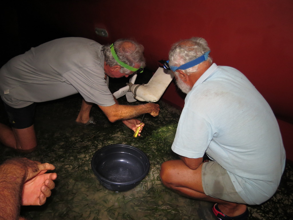
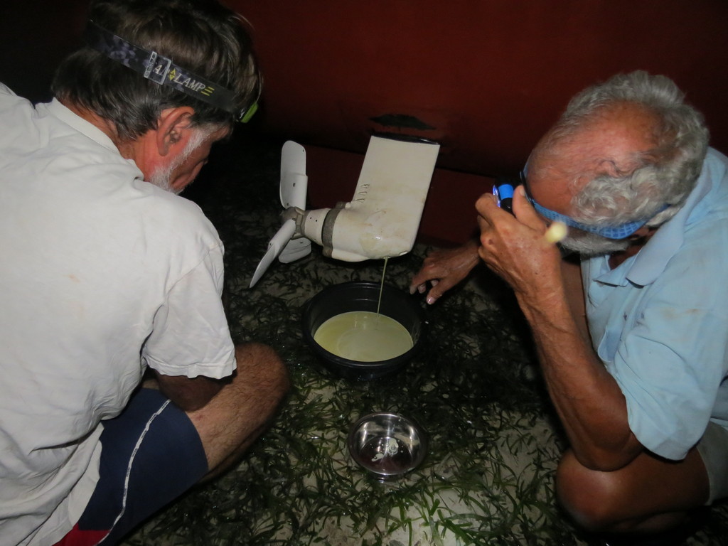
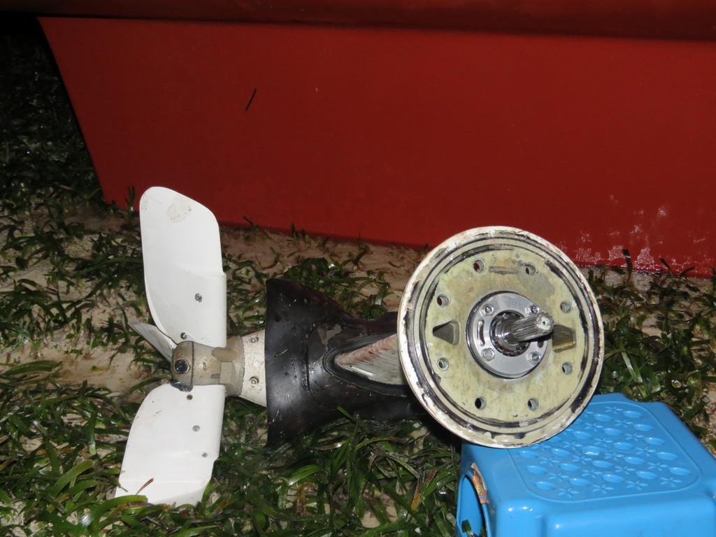
A few hours later, with the wind getting lighter and lighter, we went to put up the Code Zero. While we were messing about on the foredeck, I could hear what sounded like an odd-sounding whine coming from the port engine. With no sails up and the power back, and much calmer seas than earlier, I jumped in to take a look at things. Fortunately, the saildrive and prop looked untouched. The log must have bounced off the keel and totally missed the saildrive. The leading edge of the rudder was another matter. There was a softball sized dent in the leading edge of the rudder. Fortunately, the impact didn't seem to have hurt the rudder shaft.

Putting Up the Code Zero

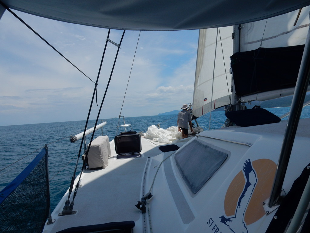
Once we finally got the Code Zero up, after sorting out things after our hurried takedown a few weeks earlier, the wind started rising immediately, so we took it right back down. We finally turned the engine off about 4pm, and at 5:30 put a nighttime reef in the main. We were still doing 6+ knots over the bottom, in part due to the 1.5 knot current behind us. Near midnight I logged that we were doing 8.5 knots, and that I heard a thunder rumble. But with no moon it was hard to tell what was happening weather-wise.

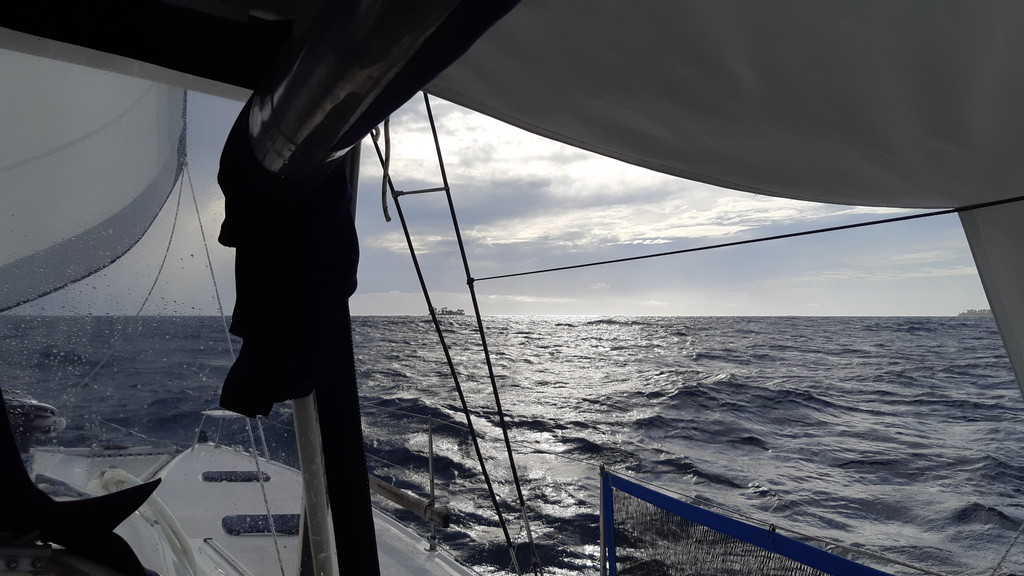
Day 3 was full of squalls with rain and wind to 30 knots (none of which was in the forecast). With two days of solid overcast, and the extra power requirements of the instruments and the autopilot, we were worrying about low batteries. I started managing the refrigeration systems, turning the thermostat up on the freezer, and turning the fridge off during the night hours. The fridge needed a good defrost anyway!

In the middle of the day, I logged that we had taken the main completely down, as the wind was dead behind us. And we only had 10 feet of the jib out, and we were still doing 7 knots. We spent the rest of Day 3 and overnight with just the jib out, using it to control our speed so we would arrive at the pass around 7:30 am. Once the wind died down, we were left with huge seas and not much wind, but with the current and a full jib, we could still make 5 knots easily, but it was uncomfortable sloshing around like that.

Talking with Our Buddy Boats

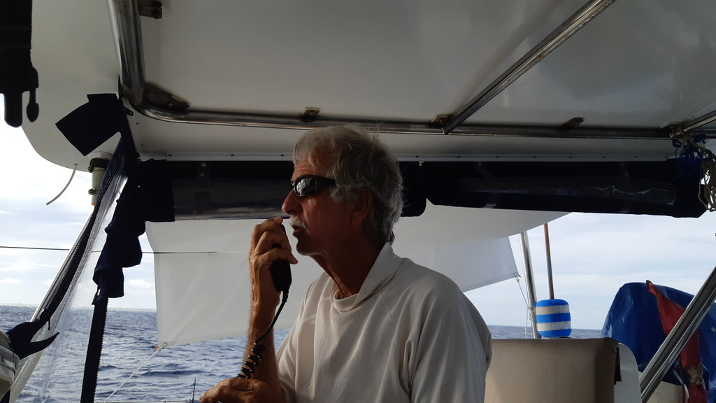
We were in VHF and HF contact with Ocelot, who was only 15 miles behind us. They could just reach Berzerker, who was another 25 miles behind them. So our little band carried on for a 3rd night. It was another squally night, with winds up and down, and some rain.

Land Ho!

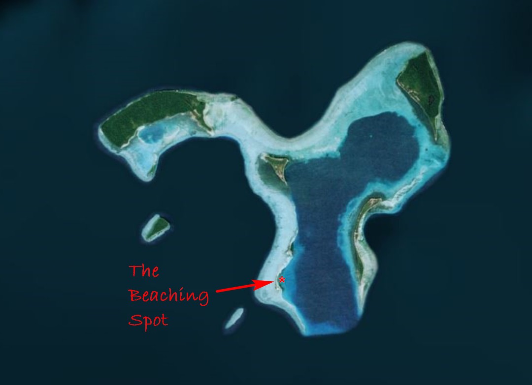
At 7:30 am, we were entering the SW pass at Ninigo, just behind Indigo. We saw a least depth of about 45 feet in the pass, and then it deepened up to 100-150 feet once inside the lagoon. The pass is well protected from the NW swell, so it was an easy entry, with little to no discernable current.

We had another 9 miles across the lagoon to make it up to Longan Island, on the NW corner of the atoll. Though this was the smallest village, this looked to be the best protected from the WNW-NW winds we were experiencing. The western side of the atoll was pretty open to the swell, so the anchorages inside the lagoon off the eastern islands would not be very good.

We had fairly rough conditions going NE to Longan, but thankfully we were squall-free during this time. We could see the scattered reefs and coral bommies on our satellite charts, but they were difficult to see visually in the overcast low-light conditions. Fortunately the GoogleEarth charts are spot on, and as long as we stayed on track, we stayed in depths over 100 ft deep.

At 0935 on Monday Jan 28, we anchored next to Indigo of Longan Island in 45 ft of nice sand, at 01-13.322S / 144-17.96E.
-----
At 1/28/2019 2:15 AM (utc) our position was 01°13.32'S 144°17.96'E
http://svsoggypaws.com/currentposition.htm

Friday, January 25, 2019

Repairing Leaky Saildrives

Jan 22-24, Padiado Islands, East of Biak, Irian Jaya, Indonesia - Another episode of repairing your boat in exotic places!

While we were hauled out in Samal, Dave had taken the saildrive legs out for some maintenance.

Once we got underway, Dave noticed that the port saildrive gear oil was looking kind of "milky". This is an indication that salt water has gotten into the gear oil. Not good. Since he had just re-done the seals in the lower unit, he was scratching his head about the cause. He thought maybe he had pinched an o-ring when he was putting it back together. The starboard saildrive looked better, but still showed a little milkiness. He did the best he could on the port drive to suck out all the bad oil and replace with good oil. A few days later it was looking very milky again.

So we continued on, using only the starboard engine. This is OK, we can make 5 knots under motor with no adverse winds, and maneuvering is a little tricky, but we managed. It required a haulout to look at the problem and try to fix it, and we knew that there weren't any convenient haulout facilities available in eastern Indonesia. So we started looking for a place to haul out on the beach. At first we thought about that perfect beach in Batanta (near Sorong) where we'd changed the zincs in July or August 2016 (see pictures by finding our blog entry about that "haulout").

But the tide cycle wasn't right--the big low tide was in the middle of the night, and all our buddy boats were just about to head east from Sorong. So we started looking for likely spots further east, for a few weeks hence where we might have a good daytime low tide. We found a lagoon 20 miles east of Biak that looked possible. There were a lot of beaches, it was protected from SW-N-SE, and the time we would be there coincided with the next bout of high tides. But... again the lowest tide, where we'd have plenty of time to work on the saildrives, was in the middle of the night. But as we proceeded further east beyond that, the tidal rhythms changed, and the tides are not as big. So it had to be Jan 23 or 24, or forget it til we found a proper haulout facility somewhere in Papua New Guinea or the Solomon Islands.


The Selected Beaching Spot

So that's why our time in Biak was so rushed--we needed to get out to the selected spot on the 22nd and scope things out--look for a place we could get into at high tide that would be a level spot at low tide. Once we got to Mios Weundi (Paidado Islands) late in the afternoon of Tuesday the 22nd, we were surprised to find that our haulout beach was occupied with some fishing families, complete with kids, dogs, chickens, etc. Hmmm...

The next morning we went in in the dinghy at high tide to check depths and just look at the spot. It turned out that our perfect beach (selected via GoogleEarth) was inaccessible because there was a ridge of sand blocking our access, even at high tide. Dinghying around in the curve of the island, we found another spot that looked good. The only drawback was that it was covered in a fine grass. Not as nice a work platform as nice sand, but in actuality, the grass was better because it held the sand together, and made a nice firm surface.

We met who appeared to be the headman. He spoke no English and we no Indonesian. But with signs Dave attempted to tell him that we planned to beach the boat there at 6pm. I am not sure he understood, but we got "bagus" (good) and an OK sign. We didn't--but should have--brought a gift in for him--a few cigarettes, a small bag of rice, something. At around 5pm, our buddy boats arrived from Biak (thank god, as we couldn't have managed without their help). Jon on Ocelot and Chris and Sue from Indigo II volunteered to (a) help us get the boat beached at sunset and (b) come in at midnight and help with the work on the saildrives. Both boats are catamarans and were keen to see how we did the project.

It was no big deal getting beached. Though high tide was not til around 8pm, we went in just before dark, and made sure we got secured in place when the tide was a little lower than the high the next morning. If we couldn't get ourselves off in the morning, we'd be stuck for about 2 weeks til the tides got higher again! We drove in slowly to the selected part of the beach, and when we stopped, I jumped off the back with the Fortress anchor, and walked it out 100 feet to secure our stern. Dave dropped the 100 lb Spade off the bow and Jon and Chris muscled it out ahead of us about 100 ft. Then we tightened it up and had happy hour.

Beached!

As soon as we got set, the wind uncharacteristically switched to the north (from WNW). A squall was passing south of us, and we were not very protected from the north. I worried for an hour or two but it all amounted to nothing. As the tide rose to its peak, a slight swell started moving us around, jerking us back and forth like a yo-yo between anchors. It seemed we'd never settle back down in the sand. But of course we did. (Dave took a nap, but I couldn't as I was fretting about the weather, the jerking, etc).

Finally Firmly Aground

Finally about 10pm we were firmly on the bottom, and by midnight, we could see wet seagrass under the boat. Before all the water went away, Dave went in our dinghy and collected our volunteer helpers, and they couldn't get the dinghy all the way back to the boat, so he tied the painter off to the stern anchor line. And they set to work.

Help Arriving

I was designated to stay on board to hand things down, and take things up so they could be worked on. Dave, Jon, Chris, and Liz were working on first the port saildrive and then the starboard. They drained the gear oil out and then took the lower units off.

The Crew Assesses the Situation

One of our Saildrives In Situ

Note Rubber Boot at Top of the Drive--glue isn't holding well. That rubber boot needs to be removed and re-glued after re-assembly.

Dave Removes the Gear Oil Plug

Ooooh! Note the Milky Oil

Putting the Waste Oil in a Disposal Container

After the oil was drained, they flushed each saildrive with a little bit of diesel, to make sure there was no salt water left in the drive.

Then they took the first drive apart, and Dave carefully inspected the situation, to try to determine why it was leaking.

Disassembling the Saildrive (Don't Lose Any Parts!)

Checking O-Rings and Seals

Checking O-Rings and Seals

The Bottom End of the Yanmar Engine Where the Saildrive Mates

One Saildrive Removed

The seals and o-rings looked OK, but Jon said the bolts on the port drive were very loose. He suspected that was the cause of our leak.

Dave Carefully Cleans and Preps the Drive for Re-Installing

Dave brought each lower unit up into the cockpit so he could look at the seals and o-rings and make sure the mating surface was clean. I spent some time cleaning all the bolts in diesel. Meanwhile the tide went out and out. Eventually we had a grassy spot behind out boat going out nearly 200 feet.

Dave couldn't find anything wrong looking with either the port or starboard lower units, so we had to conclude (hope) that the problem was that the bolts either didn't get tightened properly, or hadn't stayed tight. This time, instead of using a grease on the bolts, Dave used a threadlock, and with everyone looking on, torqued each of the bolts.

Chris Cleans the area where the Saildrive Boots Get Glued On

The final step was putting the rubber "boots" back around the saildrives. These are flat oval-shaped pieces of rubber that are slit on one side to fit around the saildrive. They are supposed to be glued onto the hull over the opening that the saildrive protrudes through. This is the 3rd iteration for us trying to get these boots on. The first time, we had someone else do it, and they stuck pretty well. Last year, we used truck mud flaps for the boot material, and Sikaflex for the "glue". They didn't hold very well. This time, Dave had bought proper Yanmar boots, and they were a soft flexible rubber. Again he used Sikaflex. And they were already starting to come off. So Chris on Indigo offered that he had had success using Super Glue, and offered a handful of small tubes of Super Glue. They prepped the surfaces of the rubber and the hull as best they could under the conditions, but really struggled getting the boot to stick. The soft rubber wasn't very conducive to getting stuck well, and the boots were a little warped already. They ran out of Super Glue trying to get the first one done, so we used Sikaflex again for the other drive, as the tide was starting to come back in.

Meanwhile as we'd been working, a big black storm built to the SE of us, and started to move in and blot out the moon. We could hear the wind howling in the trees ashore, and I was again worrying about being exposed and the weather. But when I switched on our wind instrument, we had only about 5 knots. Fortunately, we were well protected from this storm.

While Jon and Chris and Liz were working on the boots, Dave and I were filling the saildrives with gear oil. By 0430, everything was done, and there was nothing left to do but wait for the tide (and hope the wind died out). The last thing our weary helpers did was drag the heavy bow anchor back close enough where we could lift it easily when the tide came in.

When it was time to take our friends back to their boats, the tide was still out enough that he dinghy was still high and dry. But the slippery grass made it easy to drag the dinghy out to the water, still about 50 ft away. By the time he came back to Soggy Paws, the water was up enough that he could drag the dinghy close enough to secure it to the boat.

AT 0730, we felt the first bump, meaning the tide was starting to lift us off the sand/grass. About 0810 we were floating enough to kedge ourselves outward using the stern anchor, and by 0820 we were anchored back next to the other 2 boats. The Fortress was so dug in that we put a buoy on it and left it to retrieve with the dinghy. It took Dave a good 10 minutes of standing there and wiggling and digging around the flukes to get that anchor free.

We all planned to stay there for the day and rest up, get ready for passage-making, and wait for Berzerker to arrive from Biak. But about 1030, a boatload of locals, including the head man we had "talked" to, came by our boats asking for money. We felt that we had used their beach, and didn't mind giving them 100,000 Rp ($7 USD). The other two boats were reluctant, because once the locals receive money from one boat, they are going to expect it from everyone else who stops there. Reluctantly one boat gave them 20,000 Rp, and the 3rd boat refused, saying it's not customary to charge anchoring fees in Indonesia. The local men were happy with our 100K, but not happy with the other two boats, and the vibe wasn't good. So we collectively decided to pick up anchor and move to another anchorage, another atoll, 13 miles to the west.

Though we were all tired, we had a fairly pleasant sail and managed to find a good anchorage in NW conditions at Manggawandi. We were pleased to find that both saildrives seemed to be working OK, and no milky stuff in the gear oil. We had used both engines at idle speed to motor off the beach and out to the anchorage, and started out with just the port engine.

Once we started the starboard engine to motor in to our new anchorage, it shutdown on an overtemp after running at speed for about 10 minutes. Obviously we had a cooling water issue in that drive, from running the drives while we were hauled out (to circulate clean diesel in the lower unit, prior to refilling with gear oil, to flush the salt water out). We switched to the port engine and carried on in to the anchorage. Dave eventually spent half a day getting the starboard saildrive cooling water circulating again.

Manggawandi is a very large bay with a nice sand area in about 30 ft. One friendly person stopped by in a canoe and told us we were welcome, and did not ask for money. We could see and hear the surf breaking out on the reef, but the anchoring area was pretty good. 01-17.636S / 136-36.364 E

Berserker finally sailed in at sunset. We had a short happy hour on Indigo, and planned leaving for the Ninigos in the morning.
-----
At 1/28/2019 2:15 AM (utc) our position was 01°13.32'S 144°17.96'E

Wednesday, January 23, 2019

Checked out of Indonesia, Headed for PNG

We only stayed one full day in Wayag :( Our buddy boats that we were trying to meet up with were in Sorong and getting ready to go, so we agreed to hustle out of Wayag and meet them on the SE tip of Waigeo Island. It took two long days of motorsailing in almost no wind to make the 100 miles to the meeting place. Fortunately, most of the time we had some current helping us out.

A couple of hours after we dropped anchor in Momfasa Bay, Ocelot and Indigo II arrived from Sorong. The next day, Beserker arrived from Waisai town. We had one big potluck on Ocelot, and took off headed east for Biak, 300 miles away. Biak would be our last official port in Indonesia, and where we check out.

With 4 boats, we had 4 different thoughts about the best way to do this route. One big consideration was to avoid sailing at night, because of the constant problem of unlit fishing boats, FADs, and nets. Also, since we would be close in to a coast with many rivers, we were worried about running into big logs at night. So Ocelot and Soggy Paws decided to try to break the trip up into 50-mile day hops. This mostly worked...

The first hop was almost exactly 50 miles, and we managed to squeeze 4 boats into a narrow protected not-too-deep and not-too-shallow shelf at the SE corner of Mios Su (aka Pulau Su and Pulau Amsterdam). We choose our anchorages based on whatever waypoints and tracks we've been able to gather from other cruisers, and with the help of GoogleEarth / SasPlanet charts. The winds were light NW, and the swell about 1 m from the NE. This was an OK anchorage. The trip was long and hot, as we were pretty much going downwind.

The next morning we all pulled out together. Ocelot and Soggy Paws were aiming for a tiny little hook in the land 50 miles away, but Beserker and Indigo decided to go on ahead and get it all done in 2 overnights, hoping to sail some rather than having to motor to keep speed up to make the next anchorage.

Our next stop was a tiny hook in the coast that looked like we could tuck in far enough to get out of the swell. It mostly worked. At high tide it was a little swelly. Not too bad for a catamaran, but would have not been fun for a monohull.

Jon on Ocelot had picked the next night's stop, another 50 miles down the way. It looked protected from the NW winds, but the reef provided no protection from the NE swell. It was an even worse anchorage than the previous nights. But with light winds and only 1.5m swell offshore, as long as we stayed out in deep water it was just rolly, not dangerous breaking waves. I wouldn't anchor there again.

Ocelot planned to do 3 more anchorages before Biak, but we had a little wind in the forecast, plus bigger unpleasant wind in the following days forecast. Also, we were going to be further offshore, and we hadn't seen hardly any fishing activity along this coast. So I convinced Dave to make an overnight direct to Biak.

It actually turned out to be a beautiful sail. The wind stayed at 7-10 knots all night long, just aft of the beam. Since we were didn't HAVE to make 5 knots to make it in by dark, we could ghost along at 4 and enjoy the sailing. About midnight, the wind dropped off briefly and I went to start the starboard engine, and it stalled every time I put it in gear. Dave thought we probably had something wrapped around the prop. Neither one of us wanted to go swimming at night, so we just kept sailing. Fortunately the lull was temporary and we had a beautiful sail the rest of the night.

In the morning, we took the sails down and sent Dave over the side. We found a whole banana tree jacknifed around the saildrive, and part of the sinews wrapped in the prop. Once we cleared that, the engine was fine. (Note: the port engine is inop because we've found water in the saildrive gear oil--it still runs, but Dave doesn't want to use it except in an emergency).

We made it into Biak port around mid day on Friday, January 18.
-----
At 1/22/2019 8:08 AM (utc) our position was 01°18.71'S 136°22.75'E
http://svsoggypaws.com/currentposition.htm

Tuesday, January 22, 2019

A Few Days in Biak

January 18-21, Biak

So we arrived in Biak, the far eastern check-out port for Indonesia, on Friday mid morning. But we couldn't check out yet, as we hadn't checked in to Indonesia yet (had been coast hopping down from the Philippines in remote areas). So our first job was to get checked in.

We dropped anchor off the port, and were the 4th boat to be anchored there. It was deep, there wasn't much room left, and the conditions were not nice, with an onshore breeze opposing current, and the offshore reef not breaking much of the wave action. But we had been told that this was the designated anchorage for dealing with officials, and best for doing town business like groceries, fuel, and laundry.

We had a quick lunch aboard and beached our dinghy on Julius's beach (first small beach and houses northwest of the Ikan Pasar (Fish Market)). From here it's a short walk to Immigration and Customs, plus a gas station that will pump good diesel into your jugs (not always easy to find in Indonesia). Julius speaks pretty good English and is helpful. Look for the Dive Biak boats on the beach.

Immigration was easy--we didn't plan to stay in Indo for more than a few days, so the 30 day non-extendable "visa on arrival" worked for us. That is all you can get in Biak, unless you have previously arranged for a Social Visa (see procedure for doing that prior to your arrival in Indonesia, in the Indonesia section of our Files page).

Customs was easy also--we had (after 4-5 attempts) successfully completed our arrival information online on the Yachters website maintained by Indonesian Customs, just before we left the Philippines. We just had to confirm that info on their computer, and then have them come visit the boat for an arrival inspection. We made an appointment to pick them up off the Fish Market pier at 4pm.

Quarantine (Health) was a bit of a problem... they used to have an office at the Port, but now they are most of the time only found in their office out of town. Someone had told us to go to Quarantine (Plants) and they would call them for us, but ultimately we ran out of time to deal with Quarantine because of our approaching appointment with Customs.

It was getting rougher in the anchorage, and when the Customs and Immigration guys showed up, after the dinghy ride out, they were looking a little green. That enabled a quick inspection, with the Customs guys taking pictures of all the boat equipment listed on our arrival paperwork (they then are supposed to verify the equipment is still aboard when we leave, making sure we have not sold anything while in Indonesia).

Just at dusk, Dave ferried the guys back to the pier and we pulled anchor immediately to move to a more protected anchorage, 2 miles north of the town pier. Fortunately we had several cruiser's tracks and good satellite charts, so we had no trouble finding our way to the northern anchorage in the dwindling light. This anchorage was WAY better than the town anchorage.

Unfortunately, by morning, the wind had switched to W-SW, and the reef that protected us when the wind was NW was no longer protecting us, and the winds were up to 25 kts. It didn't take us long to search the satellite imagery and find a spot that looked better protected in west winds. We were the first to move, but our friends on Berserker and Indigo soon followed us as their anchorage got worse and ours was better. (Anchorage details are in the Indonesia Compendium, Biak section).

We had planned to head out first thing in the morning on a diesel run, but opted instead to hunker down and wait for the weather to get better. By late afternoon, things had calmed down enough that we decided it might be possible to drop people at the ferry pier just behind us. Indigo, avid "birders" had been talking to a recommended birding guide, and asked if he would taxi us in with our jugs to get diesel. I dropped Dave and Indigo on the pier with the jugs--they had to scrambled up to the high pier over the back of a (derelict?) fishing boat. On their return, I positioned the dinghy under the pier and they lowered the jugs down with a rope. Diesel-done! Dave also dropped our laundry off where Indigo was picking theirs up.

We had heard there was a WWII-era Catalina airplane that made a nice dive. Dave contacted Julius, the guy recommended to guide us, and arranged for a Sunday dive on the Catalina for 5 of us. Fortunately the weather was nice by Sunday morning, and Julius turned up on time with a fairly decent dive boat and 10 tanks. We had 2 nice dives (pictures to follow later).

When we were discussing logistics for Monday--we needed to go check out of Indonesia, and the others needed groceries and diesel--Julius offered to be a water taxi for us. So Monday morning, he picked us up at our boats (not so promptly on time), and brought us to his house. From there we started the rounds of officials... Quarantine, Immigration, and Customs.

We ended up having to hire a shared taxi to take us out to Quarantine, as the Q office on the docks were closed. Looking at the Google Map for their location, I mistakenly told the taxi driver "near the airport". Well, it's NEAR the airport but on a completely different road, and not near the main airport terminal. A half hour and 2 stops for direction discussions (in Indonesian, and we don't speak any), we finally got dropped off at the Quarantine (Health) office. We had 3 boats' worth of paperwork, all with different plans of when they were actually checking out, plus a fourth boat (Indigo, who was on their birding tour) who was planning to check out but wasn't there. So it took an hour to sort out all our paperwork. The end result was that Quarantine had to pay us a visit on the boat before they could process our paperwork. *sigh*

Immigration was again easy, as we had just checked in on Monday. All they had to do was stamp our passports and put another stamp on our crew list.

Customs--we visited our now good friend Noel in the Customs office, and he said they needed to visit the boat to check us out (they had just been there on Friday!!). So we arranged for Customs and Q to come out at 4pm for a boat visit. We convinced them that conditions up at the ferry pier at the north end of the reef were much better, and arranged for them to meet us there, rather than on the Fish Market pier.

Then we made a mad dash for the grocery store, picking up our laundry on the way. For cruisers familiar with Sorong, the grocery store, Hadi, is similar to Saga in Sorong, but not quite as well stocked. Imported fruits, frozen chickens, cases of beer, and typical Indonesian dry goods were what we were after.

Then we rushed back to Julius's place with all our stuff (3 boats' worth of shopping, laundry, and some diesel jugs), so we could be back aboard in time for Customs and Quarantine's visit.

It was an exhausting but productive day. Though, we found out when the officials visited, that their visit was not the end of our formalities. We needed to stop back in town the next day to get our final, signed paperwork before we could leave.

The next day, Soggy Paws left Biak. We had a date on a nearby beach at low tide to fix one of our saildrives.
-----
Sherry & Dave

Cruising SE to PNG, Solomons, Vanuatu
At 1/28/2019 2:15 AM (utc) our position was 01°13.32'S 144°17.96'E
http://svsoggypaws.com/currentposition.htm

Monday, January 14, 2019

Enroute to Biak

After a scant 1 day at Wayag, and 2 days motorsailing east along the north coast of Waigeo, we finally arrived at our rendezvous anchorage at the east end of Waigeo Island in Raja Ampat. 00-18.00S / 131-19.06E in about 25 feet of mud/sand.

Here, we were joined by our friends on Ocelot, Indigo II, and Berzerker. Sadly, Songbird is still in Samal waiting for their new LiPO4 batteries to clear Customs in Manila. (We hope our Songbirds will eventually catch up).

We all spent yesterday prepping for the next hop--275 miles to Biak, an island in the middle of Cenderwasih Bay. The route takes us along the top of the "bird's head" that sits at the western end of West Papua, Indonesia.

On Soggy Paws, Dave discovered milky oil in the Port saildrive. This means we've got salt water mixed with the gear oil. Not a great situation. Dave thinks they may have pinched an o-ring when they re-assembled the saildrive. Ideally, we'd need a haulout to remedy the problem, but Dave thinks he can do it on a beach with a good high tide. Right now the tides aren't right, or we'd head down to Batanta where put Soggy Paws on the beach in 2016 to change the oil. Looks like the 23rd has the right tides, so we'll be looking for a beach near Biak. Meanwhile, he sucked as much of the milky oil out and replaced it with new oil, and we'll try not to use the Port engine unless we have to.

We all left the anchorage this morning around 7:30, heading east. The wind is light NW and the seas are slight, so it's not an unpleasant motorsail. There's a high overcast so it's not too hot.

If we went direct, it would take 2 1/2 days at around 5 knots. But I think we'll stop tonight at a tiny island called Pulau Amsterdam (aka Mios Su). We are worried about motoring at night with big logs in the water--washed out to sea by the rains. Stopping tonight means we'll cover more of the coast near the rivers in the daylight.
-----
Sherry & Dave

Cruising SE to PNG, Solomons, Vanuatu
At 1/11/2019 4:30 AM (utc) our position was 00°18.00'S 131°19.06'E
http://svsoggypaws.com/currentposition.htm

Tuesday, January 8, 2019

Oh Lovely Wayag, Again!

We left the marina on Samal on New Year's Day, and anchored overnight in a lovely bay on the SE corner of Samal Island. From there we left early the next morning, and motored south for Indonesia, 186 miles away.

The Gulf of Davao is almost always calm in the morning and we motorsailed all day in light winds. Our GRIB files promised a fair wind from the mouth of the bay all the way to Talaud, and that is what we got. We had a fast sail with following current, overnight to Talaud Island. As per normal, my watch was busy--winds up and down and light squalls required constant sail trimming. At one point I logged "Crazy hour! Wind shifted to the nose and died, engine on for 10 minutes. The wind is back but way east and now we are hard on the wind!" Dave's watch was not much different. In all, it was a good overnight--no fishing boats to dodge and only one ship on AIS.

We arrived at Talaud in another squall. The anchorage someone else had given us looked too exposed to the current wind, so we went further in to the south coast and found a nice protected spot. 04-00.00N / 126-41.71E in 45 ft sand. It rained all afternoon and evening, but was nice in the morning.

The next hop was another overnight, 140 miles to Rau Island, Morotai, N Halmahera. Our friends on Java were there, and had procured an Indonesian sim card for us, so we could have internet as we coast-hop through NE Indonesia. We first met Java in Ecuador in 2009! Rau is a surfer spot, and there's some nice NE swell in this area right now. So there were a couple of other boats, all surfers. We anchored next to Java at 02-17.41N / 128-10.39E in about 40 ft of sand. This was a pretty anchorage with a nice beach. The new Telkomsel tower on the SW corner or Morotai was serving up 4G internet at times (and 1G at other times!).

From our previous experience going from Morotai to Wayag, we knew we couldn't make it in one overnight. Java had recently stopped at an anchorage on the NE tip of Halmahera, and said it would be a good one in the current conditions (northerly winds and a big swell). The only downside is that it was 67 miles away--a long day even for a catamaran. We hauled anchor at the crack of dawn and kept pushing all day, sweating arriving in an unfamiliar anchorage after dark. Fortunately, we got more breeze than forecast, and we had a fast sail across the north coast of Halmahera, and made it into the anchorage just before dark.

The next hop was 130 or so miles to Wayag. The only tricky part of this one is a ripping northbound current. The weather routing from FastSeas.com, produced a route that went down the east coast of Halmahera for awhile before cutting across to Wayag. This added about 15 miles to the direct line route. When we rounded the first point and headed south, we were already bucking a 2 knot current. So we ended up doing a modified version of what FastSeas recommended (a dogleg SSE and then ESE), and did end up with low current for quite awhile, but later had about 2 knots of current on our nose for a number of hours during the night. It was a typical tropical passage with a few rain showers, squalls and calms. The only other exciting part was (finally) noticing the small notice on the chart indicating "for 35 miles surrounding this point, volcanic activity has been reported and sounding are not reliable." It was dark by then, and there was nothing to do but to trust the Garmin soundings (which looked much more accurate than was was on our OpenCPN CMAP chart). We were not that worried about running on a new volcano, but the swift current combined with underwater pinnacles makes a rough ride.

We had put up our Code Zero, a light air sail on a light furler on a removable bowsprit, in anticipation of all the light air sailing we had expected. But reality didn't match the forecast...during the day we had too much wind to use the Code Zero. In fact we ended up on my watch with a double-reefed main and jib and still doing about 7 knots with an ETA of 3:30am!! By the time the wind lightened up, the wind was too far aft for the Code Zero to do us any good (and I wouldn't be happy about flying that big sail on a moonless night with a few squalls around, anyway). At one point, even with the engine on, and a little wind behind us, we were doing only 3 knots over the bottom.

Then, just after dawn, bang! a fitting on the bowsprit broke and we had to do an emergency takedown of the (thankfully furled) Code Zero. The winds were now 20-25 kts and it was raining. I went from a deep sleep to dancing with the sail on the foredeck in my underwear in about 30 seconds. Nothing went over the side, and fortunately, Dave thinks the broken part is fixable.

Having been into Wayag before, we had tracks and waypoints, so entering on an overcast day was not a problem. We wove our way into the inner bay with ease. We were a little surprised to find 3 cruising boats already here, but it's a big area and there's plenty of room. We're having happy hour on Soggy Paws tonight!!

The clouds are clearing and it's time for a swim...
------------
Cruising SE to PNG, Solomons, Vanuatu
At 1/8/2019 1:10 AM (utc) our position was 00°09.68'N 130°02.03'E
http://svsoggypaws.com/currentposition.htm

Sunday, January 6, 2019

Underway! New Year, New Cruising Grounds

We left our friendly Holiday Oceanview Marina on Samal Island, Mindanao, Philippines on New Years Day to set out on a new adventure--seeing Papua New Guinea, the Solomon Islands, and Vanuatu.

We will be hurrying south and east until June, when we hope to be all the way down south to Vanuatu. Then we'll turn around and cruise back. We are "making time" to the east along the offshore islands of the north coast of Papua New Guinea while the NW winds are blowing. Then we have to get south to Vanuatu before the strong SE trades kick in in June in Vanuatu.

Right now we've made about 400 miles toward the SE in 2 long hops... Samal to Talaud, and then Talaud to Morotai. We are underway leaving Morotai to hopefully go overnight all the way to Wayag in northern Raja Ampat. But we won't linger there, and plan to continue east to the major Indonesian port of Biak, where we plan to check in, refuel and reprovision, and check out for PNG.

I swear I'm going to blog regularly this year! So stay tuned--many adventures ahead.


-----
Sherry & Dave

Cruising SE to PNG, Solomons, Vanuatu
At 1/3/2019 4:54 AM (utc) our position was 03°59.98'N 126°41.70'E
http://svsoggypaws.com/currentposition.htm