Tuesday, December 28, 2010

Christmas in Far Away Places

We had a fairly quiet Christmas Day. We did a nice "Sunday Breakfast", and spent the morning playing with making gifts for each other. Dave finally got around to mounting two of the black pearls we got in Tuamotus on a necklace. He first practiced on a slightly flawed pearl that we traded a box of wine for. Then he did the really fine one we bought in the Gambiers.

My 'Nice' Pearl Necklace and My 'Everyday' Pearl Necklace

Note Flaw at Bottom of Pearl

And I'm working on an iron-on logo for Soggy Paws.

CSY 44 Walkthrough Line Drawing for T-Shirt

Our friends across the dock were away with family, but Richard down the dock organized a mid-day dock party with chili.

Christmas Day on C Dock

I contributed a big pot of my best chili recipe (courtesy of Larry Rutledge of s/v Brisa del Mar, lo these many years ago).

Late in the afternoon, we got cleaned up and drove across the island to Dave's friend's house for Christmas Dinner with them. We had a some good food and enjoyed watching Mark's pet turtle do laps around the yard.

Mr T

This turtle is an African Spurred Tortoise, and it's nearly the size of a Galapagos Tortoise. Friend of theirs got Mr T when he was small, but when he grew bigger, they couldn't keep him in an apartment, and Mark and Bing inherited him. He lives in their back yard, and they have 'turtle bars' to keep him out of the house. He's so big it would knock over furniture if it were allowed to roam inside. Dave tried to stop him moving forward (so he could take a picture), and Mr T just kept right on trucking, no matter how hard Dave pushed back.

Saturday, December 25, 2010

Merry Christmas!


We are sitting here in sunny Honolulu, and it's 80 degrees and doesn't feel much like Christmas. We are missing our families and that little nip in the air today!

Hope everyone has a wonderful Christmas, wherever you are!

Mele Kalikimaka me ka Hau'oli Makahiki Hou
(Merry Christmas and Happy New Year)

Getting Ready for 2011


If you've landed here looking for Sherry & Dave's blog about sailing around the world on s/v Soggy Paws, you're in the right place.

I'm trying to consolidate my blogs into one, so have started a new one with no date in the title. I have successfully merged all posts from 2006 to 2009 here, and am working on 2010.

Christmas Presents!


Well, after a long voyage (Maryland to Florida to Hawaii) our new Frigoboat units have arrived. Great experience with H2OLogistics in shipping big stuff from anywhere in the US to Hawaii.

Wednesday, December 22, 2010

No Lunar Eclipse in Honolulu

Bummer. We didn't get to see the eclipse last night. It's been overcast and rainy here in Pearl Harbor for the last 3 days. We have a front and a low kind of stalled over us. One day it rained so hard and so much that there was a Flash Flood Watch.

Gloomy Skies Over the Marina

I am ready for some sunshine!! (However, at least it is still 78 degrees here)

Saturday, December 18, 2010

Back in Hawaii

After a very busy last week in Florida... wrapping up our affairs... a couple more doctor visits... a few more social visits... a few maintenance items on the rental properties... paperwork associated with the accident... etc etc, we fled chilly Florida for a very warm and inviting Hawaii.

Welcome to Hawaii Sign at Honolulu Airport

The cold front the last week were there was a nice reminder of how good we've got it. In Melbourne it was in the low 30's and even driving south to Miami, it was still awfully cold for this Florida girl.

It was a looooong flight back... we got up at 4:30am for a 7am flight from Miami airport, and then went via stops in Orlando, Chicago, and LA, before landing in Honolulu about 8:30pm (it was a cheap flight!). That's about 20 hours of traveling. But nice to have stops in between so we could stretch our legs. Chicago had been a mess from the big front passing through a couple of days earlier, and we were worried it would snarl us up too. But by the time we got there, it was fine.

Sunrise in Miami on the Plane

John from Nakia, to whom Mike and Sue on Infini had passed our car to when they left, picked us up curbside at the Baggage Claim area, so we didn't need to mess with anything else. All our luggage made it. Nothing broken or missing. And we weighed in as usual at 49.9 lbs with 4 bags full of 'stuff' (plus sent a couple of shipments from Florida to Hawaii via USPS and freight).

The weather in Honolulu is just gorgeous! About 78-80 during the day and 68-70 at night. Perfect working and sleeping temps. And we have a new dock neighbor living aboard for the winter right next to us. So we don't feel quite so isolated out at the end of the dock (with all our cruising friends 20 minutes away in the downtown marinas). Our new neighbors are retired like us, and spend most of the year in their RV, and then come visit their boat in Hawaii for 3 months in the wintertime. They bring their lawn chairs out on the dock for sunset and are very sociable, so we've actually been stopping boat work 'early' to have a sunset happy hour and socialize.

Sunday, December 5, 2010

Dave Wrecks the Kia

First, the important part: It wasn't his fault and he's just fine.


Dave was only 2 blocks from Cousin Bryan's house in Largo FL, when some distracted woman pulled right out off the side of the road into him, as he was passing by. She hit him hard enough that it rolled our poor little Kia on its side, and slid about 20 feet.

Fortunately, Dave had his seatbelt on, and he was fine. He had to kick his way out the front window, though, because both doors were jammed. Worrying about fire...

He ended up with a few cuts on his shins, from crawling out, but that was the worst of his injuries.


The lady who hit him admitted responsibility immediately and is covered by good insurance, so they are handling the whole thing. We got a rental car for the rest of our stay, courtesy of State Farm. She was the one who took these awesome pictures of Dave's car, and emailed them to us.

We were talking about buying a better car next year anyway--we spend so much time in the car when we're back visiting, that it's worth it to move up on car class for a little more added comfort (cruise control, smoother ride, noise reduction, etc). So we already have one thing on our "To Do" list for next fall...

Friday, December 3, 2010

I got my Driver's License Renewed!!

I'd been dreading the whole process... sure that I'd take my whole stack of paperwork in, wait in line for hours, and then find I was lacking something. A friend told me it took 3 visits to get his done.

But what a nice surprise. Only a 2 minute wait (Indian Harbor Beach DMV Office), pleasant guy, only needed half of the paper I brought with me, passed the eye test, picture taken, new license in hand--done in 10 minutes. "Only" $53 (ouch!)

Lousy picture, though. I didn't really expect to complete the process in only one visit, so didn't bother looking in the mirror. Next thing I knew, I was in front of the camera. Another typical DL mug shot, but this time with my hair messed up--and it's good til 2018!!

I also now have "Safe Driver" on my driver's license (no driving=no tickets).

Wednesday, November 24, 2010

Catching Up A Little (Whew!!)

When we last talked to our hero (that's me), she was gamely battling evil forces trying to mire her in mounds of paperwork.

Well, I'm still there. Big "shout out" to our friends from s/v Windy City in Hawaii watching over Soggy Paws. They went onboard and got all the docs I need (I hope) to prove to the State of Florida that aliens haven't taken over my identity. I can't seem to make an appointment online for a Driver's License. So after Thanksgiving I'll just have to go stand in line, and see if I have enough paper to satisfy them that I am still who I have always been as a full-time bona fide voting and driver's license-carrying resident of Florida since 1970.

Well, we have been doing our usual "visit home" crazy schedule--trying to fit in a year's worth of catching up with friends and family, getting medical checks, and acquiring needed boat things and tech toys to carry on for another year of round-the-world voyaging.

The first step on arrival was to go retrieve our car, which has been stored for the last year at my brother's house in Hawthorne (3 hours north of Melbourne). That's pretty much an all-day trip.

CSY Breakfast at the SSCA Gam 2010

Then we had one day of rest before we launched in the Seven Seas Cruising Association Gam activities. It was another great 'Gam' and we got to see lots of old friends, and meet some new ones. We organized another "CSY Breakfast" where we got to meet a bunch of new CSY owners. What a group!

We also enjoyed a few seminars and the vendor area at the Gam. But our favorite is always the flea market, and this year didn't disappoint. We got a few things we needed at really good prices, that I know the sellers were happy to part with. Dave and I had a good time sharing our experiences at the 'Round Tables' sessions on Sunday morning. Dave handled the 'Eastern Pacific' round table, I handled the 'Western Caribbean', and our friend Gwen on Tackless II covered the 'Western Pacific'. (Wish we could have attended Gwen's, but she gave us a private briefing later).

Then we rushed off to catch the last of the Waterway Net get together in Wickham Park. More reunions with many old friends.

The week after SSCA should have been a 'recovery' week, but I had promised Melbourne Yacht Club that I'd do a slide show on this year's cruising adventures... which I hadn't started yet. I "crammed" all week... trying to fit 10 months of intensive adventure, photographed by multiple photographers, into a 1 hour presentation. It turned out to be an impossible task. I ran out of prep time at 5:45pm the day of the presentation, and was already up to about 240 slides. So I just said "The End... More to Follow" after I covered the first half of the Tuamotus. *sigh* It ended up taking about 1 hour and 30 minutes, and was just about the right length. It was well-received, and a few people asked "Well, when is the 2nd half?" Not this week!!

The next day we left for the west coast of Florida, where we visited Dave's cousin Bryan and Aunt Eva Nell, and 2 different CSY's that we hadn't seen before... owned by new people we hadn't met. We always get new ideas for doing stuff when we see another boat like ours. And we're still "paying forward" all the help we got from other CSY owners over the years as we were working on Soggy Paws. We had a great round of golf with Bryan, and then a nice visit with Don and Gwen, formerly of Tackless II (now happily in a house and w-w-w-working).

After a few stops on the way back from the west coast, we have just enough time to regroup, do laundry, and repack for our Thanksgiving 'tour' to see family and friends in Georgia and North Carolina!!

More to follow... and hopefully pictures *some day*

Friday, November 12, 2010

Driver's License Renewal Woes

This country has gone crazy!!

My driver's license is coming due for renewal in 2 weeks. Last time I renewed it, I did it online and they mailed it to me. No such luck this time. I went online and they said they needed to see me in person. So I made an appointment online. No big deal. I didn't pay any attention to the 'Documents You Need' link on the appointment page... I'm RENEWING an EXISTING a driver's license in the state I've been living in, and had one continuously in, for 40 years for heaven's sake!!!

However, we just got our stack of mail that's been piling up at home, and going through it today, I noticed a postcard from the State of Florida telling me that in order to renew, I need a passport or birth certificate, and some other forms of ID. Well, we left our passports onboard. Dave, when he was gathering up stuff to leave, decided not to take our passports--we're not crossing any borders, they are safer staying on the boat.

No problem, I can get a birth certificate... maybe? I was born in California... that might be hard (in the time frame we have to work with). It has to be certified, and it can't be the one the hospital issued. And... the name on that birth certificate doesn't match my current name. In fact I've had 2 name changes. So even if I CAN get my California birth certificate (I just MIGHT have a certified copy in my file cabinet here in Florida), I still have to get copies of EACH of my 'proof of name change' documents (Marriage Licenses). My first marriage was almost 30 years ago!!

Then, in addition, I need my Social Security Card. Well, guess where that is??? Yep, the Social Security Administration recommends you not carry it with you. So mine is tucked safely away in a filing cabinet on the boat.

Maybe I can go to the local SSA office and apply for a duplicate. But you need proof of id... what do they say I can use?? My DRIVER'S LICENSE!!! (and it takes '10 to 14 days').

Alternate documents that can be used in place of a Social Security Card are ORIGINAL W-2 forms, pay checks, or 1099's showing my complete Social Security Number and my current name. Well, I'm not working, and guess where all my tax records are???

And one final thing I noticed... the card says "You must pass a vision exam and MAY be required to pass written and road skills test." MAY?? Do I or don't I? This card has my name on it and my date of birth, surely they can tell me whether I do or don't need to take any tests...

I've had to cancel my renewal appointment, which was for Tuesday--there's no way I can get all this gathered up in the next 2 working days. And when I tried to reschedule for December (just before we leave to return to Hawaii), there are no appointments available. (but I can still go as a 'walk in')

Sheesh, this wouldn't be a big deal for anyone with a normal life, but for me, it might mean I can't renew my driver's license before we return to Hawaii (and/or I spend all day running around trying to document myself).

It's just crazy.

Tuesday, November 9, 2010

Heading for Florida

We've been too busy all day to blog. But we are sitting at the Honolulu airport waiting for our flight to Florida, via Chicago. We land in Chicago at something like 5:30am Chicago time, and finally get into Miami at 1pm ET. Not looking forward to the flight.

Am sitting at the airport with no free wifi, so not sure if we'll get this posted before we take off. We loaned our Mobi Hele wireless data stick (which only works in Hawaii) to our friends on Infini. I already miss it.

As usual, we have a very ambitious schedule... something planned every day between now and December 14th, and sometimes 2 or 3 things planned in one day. We will be trying to fit a whole year of socializing into a 5 week trip, including visiting family in Largo, Atlanta, and North Carolina. Fortunately, the 'shopping' part of the trip is not as significant. We can get almost everything we need in Hawaii, and therefore won't have to concentrate on that so much.
-----
Sherry & Dave
in Honolulu, Hawaii for the winter
At 11/5/2010 6:06 PM (utc) our position was 21°22.26'N 157°56.27'W

Sunday, November 7, 2010

Sonar Attack!

Early this evening we started hearing a beeping onboard. We are pretty familiar with all the beeps that can happen on our boat--bilge alarms, fume alarms, watches, cell phones with low batteries, reminder alarms, errant air conditioners, etc. But this beeping really stumped us. We spent about 10 minutes trying to localize it... was it down below? In the bow? In the stern? In the engine room? It is REALLY hard to tell where it is coming from.

We were pretty convinced it wasn't onboard, but when we went outside to see who else's boat was beeping, it was not as loud as it was down below. Hmmm...

We finally came to the conclusion that it must be Sonar signals coming through the water. A chat with a neighbor on the dock confirmed that occasionally a ship in Pearl Harbor is testing their sonar. She said sometimes it lasts for 24 hrs or more. Ooooohh nooooooo!

I'm a light sleeper. It's nearly 11pm and still beeping loudly. I think it's going to be a long night!!

But... it seems to change tone every now and then... almost like it's moving around. Do we have a mini-sub playing in our harbor??
-----
Sherry & Dave
in Honolulu, Hawaii for the winter
At 11/5/2010 6:06 PM (utc) our position was 21°22.26'N 157°56.27'W

Getting Soggy Paws Cleaned Up

The "mostly boring stuff" we've been doing is cleaning up Soggy Paws and getting ready to head to Florida for a month.

Dave Washing Our Genoa

We have taken down our genoa and staysail, washed them, and inspected them carefully for places that need some repair.

They both look in pretty good shape after 3 years and 15,000 miles. But they do need a restitching in a few spots. The old adage "A stitch in time saves nine" really applies. It is so much easier to restitch something that is still hanging together than try to put it all back together once you've let it fall completely apart.

We have also taken down all the halyards--running up 'sacrificial' halyards--really cheap line we buy at Home Depot.

We put up our foredeck awning to protect the dinghy, which is still stored on the foredeck.

We are trying to offload some stuff that we haven't been using, or are upgrading. There's a marine flea market at the downtown marina area tomorrow, so we've been hauling all our stuff out to sell.

We have spent a lot of time online researching the new things we plan to buy in Hawaii, placing orders, and getting ready for some major refit activity. And planning our activities in Florida.

We are still learning our way around Hawaii... Dave let me take the car out by myself for the first time yesterday. Just down to Hickham AFB Exchange, where we had to return something we bought last week. I made it there and back successfully without getting lost.

Saturday, November 6, 2010

3 Shoes to the Wind

Well, we were dismayed to find yesterday that the Wind God took our shoes. We leave our shoes on the dock, and it was a really gusty morning. Dave stepped on to the dock and went to put his shoes on, and only found one shoe left from 2 pairs.

The Orphan Shoe

This, of course, is not a disaster, but we LIKED those shoes, and we miss them! We are left with one half of a pair of well-used imitation Crocs (from a city market in Peru) and I had to dig out my old Crocs (boatyard-stained and also very well used).


Dave has temporarilty reverted to his '2 left feet' sandals (which I find a little embarrasing). Back to Walmart we go!!

Dave's Temporary Shore Shoes

-----
Sherry & Dave
in Honolulu, Hawaii for the winter

Monday, November 1, 2010

Univeristy of Hawaii Football Game

Well, we've been doing lots, but it's mostly boring stuff (boat maintenance).


But last night we went to a University of Hawaii football game at Aloha Stadium. We happen to be docked right in the middle of the 'Tailgate Zone' for Aloha Stadium. Our parking lot, which is normally a pretty sleepy place, turns into party city before the UH home games.

We saw that there was a home game (at Aloha Stadium, which is within walking distance), and went online and bought tickets. It is their Homecoming game, so we figured it would be hard to find tickets. But the stadium was only 2/3 full. We probably could have 'scalped' some tickets for less if we'd been patient. We tailgated a little with some other people on the dock, and then walked to the stadium. We are closer to the stadium here on the boat, than the parking lot we normally park in for Gator games.


But it was a great game--a lot more laid back than a Gator game (with 3x as many people and a lot more pressure due to 'standings'). The fans were just as fanatic (and a few just as drunk and rowdy). The UH Warriors totally wiped out the Idaho team, so it was fun watching the game. Lots of opportunities to cheer for 'our' team.

And, earlier in the day, we watched the Florida-Georgia game on TV. A great game that went into overtime, with the Gators winning in the end.

Sunday, October 24, 2010

Getting Settled in Honolulu

We arrived in Pearl Harbor on October 19.

The Pearl Harbor Shipyard Area

We (snif) had to split up with our cruising mates on s/v Infini... we went into the Rainbow Bay Marina, in Pearl Harbor, and Infini went into the Hawaii Yacht Club in the Ala Wai Yacht Basin. Only military (retired or otherwise) can get into Pearl Harbor.

Rainbow Bay Marina in Pearl Harbor


We spent the next several days running around with our new friends on s/v Windy City, who have been here at Rainbow Bay for about the last year. They have a car, and graciously offered to chauffeur us around to help us get settled. Our primary job was to find a car for ourselves. We started at the "Lemon Lot" at Hickham Air Force Base and worked our way through a few used car dealers nearby and some possibilities we found on Craigslist.com.

Our New Car

After 2 days of looking, we had a pretty good idea of current values in the "under $3000" range. We settled on a nice looking but fairly old/high mileage Toyota SUV Rav/4 L, for $2800, no sales tax, and $25 registration/inspection fees. Not too bad. It has 4 doors, 2WD, a roof rack, and cold air. We think we can easily resell it for about what we paid for it when we leave in 5 months.

The marina here has recently had a drastic personnel turnover, and the new manager, who didn't get any coaching from the old one, is struggling with simple issues. It took us 3 days to get a mailbox, and we're still not in a permanent parking space. But it's otherwise a really nice place, with decent showers, laundry, book swap, and a hanging out place for residents. And very secure. But not so secure that friends can't visit--it is Navy property but not within the gates of the base, so anyone can come visit without any hassle.

Today is College Football Day on Soggy Paws. One of the few things we miss about being in the U.S. is watching college football on TV. We are using our spiffy HVR-950Q WinTV receiver on our laptop to watch TV. With the tiny supplied antenna we are getting about 6 channels, and contemplating a better antenna that can be mounted higher.
-----
At 10/20/2010 7:32 PM (utc) our position was 21°22.26'N 157°56.27'W

Wednesday, October 20, 2010

Three Days in Maui

Three days in Maui is certainly NOT enough!!

First, arrival... We got across the Alenuihaha Channel by 11am--before the wind in the channel got too bad. We decided that since we were making good time and it was a nice day, that we'd stop at the small island of Molokini for lunch. This is a popular snorkeler's day trip from Maui and we could see the tourist boats coming and going as we approached. Fortunately, we got there at about 11:30am, just when the morning trip boats were leaving. By 11:45am, ALL of the tourist boats had left, and it was just us and another outboard boat with a family aboard. We grabbed a vacant mooring over near the tip of the western arm of the "U" that is Molokini. The moorings here are not on the surface--the mooring ball is about 8' below the surface of the water, easily visible when you get close, in the clear water. The mooring has a tag line that hangs down. The tag line is long enough to hook into with the typical mooring line from your bow. But someone has to jump in the water and get the tag line. Dave assigned the "ship's diver" (me) to this job.

We just stopped for lunch and a quick snorkel. This is one of the 'premier' snorkeling destinations for Maui, but it was a real yawner for us, after French Polynesia. Very nice clear water, and surprisingly warm, but not a lot of coral and not much fish life. (The water in Hilo Harbor, when I jumped in to clean the prop was, by contrast, 'freezing'). We located a dive buoy further out near the west arm of Molokini--it looked like a great place to stage for a dive on the wall that faces west (outside of the "U") there. But there was a pretty strong current running out over the reef towards the wall, so I didn't want to go too far to check out the wall.

By 12:30, we were underway again, motorsailing in light air, toward Lahaina. We arrived in Lahaina about mid-afternoon, and easily picked up a Lahaina Yacht Club mooring, located west of the channel, toward the end of the row of (mostly commercial) boats. There is a completely protected harbor here, but there is NO CHANCE to get a slip. Someone at Lahaina Yacht Club said that they had just gotten a slip there, after being on a waiting list for 15 years (!!!). But the moorings suited us better anyway.

The LYC moorings are well-maintained (I dove down and checked ours out--strong and in good shape), and cheap. Can't beat 'no cost'! There doesn't seem to be a time limit for staying there--as long as there were moorings available they said we could stay, and seemed disappointed that we were just passing through. We had a beer at the bar and talked to some members and they were wow-ed when we told them we'd come all the way from Florida.

Once you've hooked up to a mooring marked LYC, make a note of the mooring number and take your dinghy into the dinghy dock in the harbor. It's a little hard to find the Lahaina Yacht Club in this Key West-like tourist town, but it's about 3 blocks west of the harbor along the waterfront--keep your eyes open, it's easy to walk past the alley-like door on the water side of the street, just past 'Cheeseburger in Paradise' bar. Tell them what mooring you are on, fill out a 'we won't sue' set of paperwork, and they will issue you a temporary membership card. After that you are free to use their facilities, beer is about $3.25 on special, and lunches run $6-10 and dinners $9-25. Showers are upstairs over the bar.

For the next 2 days, we rented a car with our friends on Infini, and toured the two major tourist destinations. (Note: Book your rental car ahead... they have just added 3 new flights into Maui and all the rental car companies were out of cars when we rented ours--we booked ahead and got a comfortable van for $75/day). There is a bus that goes around, but I don't think you can get to the 2 places we went (below) by bus.

The first was the Haleakala National Park--on the (non-active) Haleakela volcano. On the way there, we covered a lot of what else there is to see in Maui. One notable place was the windsurfer beach at Kanaha Beach Park in Kahului Bay. There were literally over a hundred windsurfers and kiteboarders out there having a blast in the good winds and surf conditions. Almost every place we stopped, one could easily spend a day just hanging out. But we were on a mission to see everything we could in 2 days, so only stayed for 15 minutes. :(

On the second day, we did what is known as 'the Hana road'. It is a narrow, winding road along Maui's north coast, with lots of stops for beautiful breathtaking scenery and waterfalls, and lush tropical foliage. At the very 'end' of the road is the lower end of the Haleakela National Park, a place called 'The Seven Pools' where there is a 2 mile hike through an amazing bamboo forest to a 200' waterfall, which feeds a chain of waterfalls and pools. We had time to stand in the waterfall for pics for a few minutes, and then head back down. Again, we could have spent a whole day just at that one location!! If we did it again, we'd stay overnight someplace between Hana and the park, and devote a whole day to that area. We saw tents in the Waianapanapa State Park just before, so I know camping is possible there, for people on a budget. I'm not sure about lower Haleakela National Park.

On the last day, we turned the car in and hitched a ride on the Budget shuttle to the Whaler's Mall. This is a very upscale mall near all the resorts on the west coast of Maui. Fun window-shopping, but out of our price range. Lots of $20-40% off signs in the windows, but 20% off a $150 outfit is still well above Walmart prices. We mainly went there for the Whaling Museum. This is a small, but nicely done free musuem. From there we caught the $1 bus back to Lahaina where we 'power shopped' at Ace Hardware and a big grocery store across the street, within easy walking distance of the harbor. We bought sandwiches in the grocery store and took them to the park by the harbor to eat and people-watch.

In the afternoon, we visited with our friends from (formerly) Peace and Aloha, who live on Maui. They are in the 3rd year of building a gorgeous home overlooking the south coast of Maui (David and son Eric are doing ALL the work themselves). We had a nice evening socializing in their rental condo in the Napili point area. (See their rental condos on VRBO.com Listing #305703).

Again, we should have spent AT LEAST a week in Maui, and more would have been better. Allocating two weeks would not have been too much.
-----
At 10/18/2010 6:16 PM (utc) our position was 20°56.52'N 156°46.41'W

Tuesday, October 19, 2010

Underway for Molokai

Too busy having fun to write up our Maui experiences, but it was fun and we could easily have stayed 2-3 weeks and not gotten bored. 3 days was way too short to do it justice. We're coming back in the Spring! I promise to write it up and post some pictures as soon as we slow down!!! (not sure when that will be as long as I stay married to Dave :)

We are currently motorsailing in very light winds for a harbor on the south side of Molokai called Lono Harbor. It is a disused commercial harbor where we can supposedly anchor over night in sheltered water before moving on to Honolulu tomorrow.
-----
At 10/18/2010 6:09 PM (utc) our position was 20°56.04'N 156°45.85'W

Friday, October 15, 2010

Crossing the Alenuihaha Channel

We motorsailed all day yesterday, reaching Upolo Point on the NW tip of the Big Island around 4:30pm. Then we turned left down into the Alenuihaha Channel to Nishimura Bay, where we anchored for the night just as the sun went down. On the last leg, we were in the lee of the island, and in the stronger winds, sailing along at 8 knots. It was fun.

Our friends on Infini opted to sail the whole way, planned to cross the channel during the night, and carry on to Lahaina, on Maui.

We had a nice dinner and got to bed early for our 4am reville. The Alenuihaha Channel can be extremely rough in prevailing winds--bounded by two high islands (Hawaii and Maui), the wind whistles down through the channel at 10-15 knots higher than prevailing winds. So the trick is to scuttle across as fast as possible in the wee hours of the morning, before the sea breeze picks up.

We were underway by 4:45am this morning, and are now enjoying a not-too-boisterous motorsail across the channel. Our ETA for the other side is about 10:45 am, and for Lahaina, about 2pm.

We plan to stay in Maui for a couple of days. We've reserved a car for 2 days, so we can see the island and also visit our friends formerly of s/v Peace and Aloha. Dave met P&A in the San Blas in 2000, and they have since completed a circumnavigation, sold their boat, and are now building a house on Maui.

After Maui, we plan to stop overnight on Monday night at Moloka'i and then go on into Pearl Harbor on Tuesday. We have already obtained a security permit to enter Pearl Harbor (by faxing our boat documents, including a completed Coast Guard Safety Inspection Report, to the appropriate authorities), and confirmed our reservations one more time at Rainbow Bay Marina--the Navy Marina in Pearl Harbor. Pearl Harbor will be our base of operations for the next 4-5 months.
-----
At 10/14/2010 5:38 PM (utc) our position was 20°23.24'N 156°09.89'W

Thursday, October 14, 2010

Underway for Maui

Yes, I know, I haven't even finished posting our Big Island adventures, and here we go again. But, what the hey...

We left Radio Bay (Hilo) early this morning, bound for tiny Nishimura Bay on the NW corner of the Big Island. We'll anchor overnight there, and (assuming conditions are OK) will get up at 04:30am tomorrow to cross the trecherous Alenuihaha Channel between the Big Island and Maui, in the nighttime calm.
-----
At 10/13/2010 5:41 PM (utc) our position was 19°48.05'N 155°04.29'W

Tuesday, October 12, 2010

Is an e-Reader in our future?

We have been envious of a few cruisers who have had Kindles on board, and are seriously contemplating buying one or two e-readers while we're back in the Land of Stuff. Not just for the downloadable books, but also because we now have many manuals and cruising guides in PDF form.


I knew about the Kindle and the iPad, but didn't realize that there are now about 20 other brands of similar devices. Uh-oh, choices!! Now just trying to sort out price vs. functionality, etc.

Someone told us 'definitely the iPad is the best', but then I looked at the iPad starting price and had a heart attack. Another friend highly recommended the Kindle 3 over the iPad--better daylight readable, better battery, and a significantly better price. At $139 for a new Kindle 3, we could actually afford to buy 2.

Thursday, October 7, 2010

On the Air on the Big Island

Our final stop on our first day of touring Hawaii was the Leilani Bed and Breakfast. This is the home of Lynn and Randy VanLeeuwen, in the South Point area of Hawaii.

Randy and Sherry in Randy's Radio Shack

Randy is KH6RC, one of of the main Pacific Seafarer's Net net controllers. We have been talking with Randy for the past year on the radio, and really wanted to meet him face to face.

We had a delightful evening getting to know Lynn and Randy better. And their B&B was a delightful experience.

But the highlight of the evening, for me, was being guest 'Net Control' of the Pacific Seafarer's Net. I got to use Randy's radio and fancy beam antenna to run the Pacific Seafarer's Net. I talked to Net Relay stations scattered from Florida to Pitcairn Island to New Zealand and Australia, and took position reports on 9 boats that were underway to various locations in the Pacific Ocean. It was fun.

Randy's Big Beam Antenna

And all the Radio Equipment!

Sherry On the Air as Pacsea Net Control

KE4BKF, KN4TH, and KH6RC

Touring the Big Island - Day 1

We finally took a break from shopping to make plans for a quickie tour of The Big Island.

Touring the Wet Side of the Big Island

Our next door neighbors in Radio Bay had rented a car for about $40/day, and that seemed pretty reasonable, especially when split between two boats. But when we went in to their rental company to book a car for a few days, they told us that all the prices were higher now. Apparently there's an Ironman Triathlon going on this weekend in Kona (on the west coast of Hawaii), and all the cars were booked.

So I went online to try to book a car with our USAA discount. The first 2 big companies I tried--Avis and Budget--were all sold out. So when Hertz came up with a car for 'only' $49, we grabbed it. And for only $7 more, Dave upgraded us to a nice mini-van, when he picked up the car.

Dave and Sue

Our first stop was the Hawaii Volcanoes National Park. It was raining when we left Hilo, and still raining when we got to the Park. And still raining when we left the park. We saw a nice volcano video, and drove the crater rim road. There is no active lava there now, but lots of old lava, live steam vents, and lava tubes. We also stopped at the Jagger Museum in the park, with more displays, and some active Seismometers.

Hawaii Volcanoes National Park

Steam Vents

Lava Tubes

The Kiluaea Crater

Monitoring Seismic Activity

The next stop was the Punalu'u Black Sand Beach. The big attraction here was... black sand. But also, something I've never seen before, green sea turtles sleeping on the beach in broad daylight. Apparently they come up onto the nice warm black sand to warm up. They were sleeping so soundly they looked dead, but we did see them blink once or twice.

The Black Sand Beach


Hawaiian Green Turtles on the Beach

Monday, October 4, 2010

Power-Shopping in Walmart

Well, we made up for yesterday's frugal day by blowing $350 in Walmart in about 1 hour.

Our friends on Infini came in this morning about 9am (trailed by a USCG launch--they got 'practiced on' by the local Coast Guard cutter as they were crossing the harbor). They stuck it out through the light winds and sailed right up until about 10 miles out when the wind dropped off to nothing. They were luck and got cleared through Customs in about an hour--having told Customs (via us) that they were coming today, there was a guy in waiting for them. No overtime fees either.

As soon as they got cleared, we arranged a taxi to the Mall and Walmart. The free bus doesn't run on Sundays, but 5 of us splitting the $11 taxi ride to the Mall wasn't too bad.

Dave and I were on a mission--to buy 2 bicycles. But we also hit the mall (where I bought a new pair of adventure shoes), and showed the Infini crew where everything was in the Mall/Walmart area. We had lunch at the Oriental Food Court next to Office Max, and then went back to Walmart.

Walmart had some nice 'priced right' mountain bikes for $92. Another cruiser who wrote a little 10-page cruising guide to Hawaii, really recommended you buy bikes when you hit Hilo. Great idea, and thanks a bunch for all the advice, Mita Kuulu!

We plan to use the bikes while in Hawaii over the next 6 months, and then sell them at a discount to someone else (we hope) when we leave. But if we use these bikes enough, we might spring for some good quality marine folding bikes before we leave Hawaii in the Spring. We bought a few accessories (locks, luggage rack for the back, cover for the bikes, etc) and spent an hour in Walmart trying to assemble this stuff, so we could ride our bikes and our other stuff back to the boat. It was a success. We had a nice ride back, and are looking forward to exploring some more of Hilo on the bikes later.

I also bought 2 bathing suits--mine from 3 years ago are in tatters. I hate to shop, in general, but I love 'power shopping' in Walmart.

We have arranged a 3-day car rental for Tuesday morning. It was a bit of a struggle--there is an Ironman Triathlon going on in Kona (also on the Big Island) starting in a few days, and all the rental cars are getting sold out. For the same car our friends rented for $40 a day this past week, Enterprise wanted $70/day for this week, but told us they didn't have any cars. I finally went online last night and found a Hertz car for 'only' $50 a day. This was after checking Budget and Avis and finding no cars available.

We are going to cram 5 of us in the rental and split it with Infini, so it will end up being pretty reasonable. We figured we can get the highlights of the Big Island in 2-3 days, leaving Hilo (where we are) for more leisurely exploration using the bikes and the free local bus transportation.

Tourist magazines are in racks on every corner, with maps and ads and recommendations for what to do. There are lots of guided tours available that all sound really interesting and fun, but they start at $100-$150 per person for a half day tour. Forget it! These range from horseback riding, ATV adventures, lava viewing trips, hiking, biking, etc. Cool stuff but pricey. (We got so spoiled by South America). With the rental car and a Lonely Planet, we'll do 'self tours'.
-----
At 10/2/2010 4:00 AM (utc) our position was 19°43.88'N 155°03.16'W

Sunday, October 3, 2010

Safe and Sound in Hilo

We dropped anchor and pulled Med-moor style into the sea wall in Radio Bay. It wasn't what I expected. Instead of dancing girls in hula skirts, we got a container terminal. But the price is right, and there's a free bus route to the mall from the front gate of the terminal.

We got checked in through Customs by the friendliest US Customs agent I've EVER EVER encountered, this morning. And made it to the mall (and Walmart, Office Max) by 10am. Didn't buy much, but sure enjoyed sight-seeing.
-----
At 10/2/2010 1:08 AM (utc) our position was 19°39.49'N 154°54.70'W

Saturday, October 2, 2010

Land Ho!

We sighted the Big Island of Hawaii at about 7am, and have been motorsailing toward the port of Hilo, on the NE coast. We expect to be anchored in Radio Bay before (JUST before) sunset.
-----
At 10/2/2010 12:52 AM (utc) our position was 19°38.38'N 154°53.33'W

Friday, October 1, 2010

Enroute to Hawaii - Final Day

Only 75 miles to go!!

The wind got really light about 6am yesterday--just as had been forecast for nearly a week. I'm not familiar enough with the North Pacific weather patterns to know exactly what caused this big 'hole' in the tradewinds, but it's here. I do know there's an early cold front stalled out just above Hawaii. In a few days it will be back to 15-20 knots where we are, but right now it's like a lake.

So we reluctantly started our engine and started motoring in. We have now been motorsailing for almost 24 hours, at moderate RPM. Other than the sound of the engine, it waw a pleasant day... very sunny skies and smooth seas. We have a big long slow swell that means the surfers are going to be happy this weekend, and as we go over each one, it feels like Soggy Paws is having to climb a hill.

We put the fishing lines out yesterday morning after breakfast, and 10 minute later got a hit. It was about a 5' Marlin. He was pulling the line out like crazy--Dave thought he'd lose it all before he got him stopped. So we were a little relieved that he got off. We saw him jump a couple of times, but he cut the line and was gone. Dave re-rigged the lines but we have yet to get another strike.

Of the other two boats we've been traveling with, Apple, the Jeanneau 44, arrived in Hilo yesterday sometime. Infini is about 160 miles behind us, and as of yesterday afternoon, was still trying to sail, and making about 3 knots. Infini has a leaky injection pump and wants to minimize use of their engine.

We could have sailed a few hours more, but Dave got severe 'horse headed for the barn' syndrome, and just wanted to get in. He got it in his head that we're going to watch the Gators beat Alabama on Saturday, and that was that.

Fortunately, we have made very good time since cranking up Mr. Perkins. Motoring at moderate RPM, with the sails still up, we've been able to average about 6.3 knots. Our ETA is now Friday afternoon about 5pm local time.

We understand the Agriculture people confiscate any fresh produce you have left, so we've been having a bonanza--trying to eat everything up. As we ate down our fridge, we discovered a few bags of tomatoes and green peppers that we didn't know were there, and we still have lots of onions, potatoes, cabbage, and carrots. We tossed the last of the bananas a few days ago, and ate our last Pamplemousse (French Polynesian grapefruit) yesterday. We have one apple left.

So we will anchor up in Radio Bay around sunset. Radio Bay is in the Hilo harbor, at the NE tip of "the Big Island" of Hawaii. We'll have a good dinner, get a full night's sleep, and check in with Customs tomorrow morning. Then we understand there's a bar nearby with good fast wifi, and hopefully a TV or two with college football on.
-----
At 10/1/2010 2:22 PM (utc) our position was 18°59.84'N 154°07.14'W

Sunrise at Sea

I am a morning person, and I've always loved to go for an early morning walk on the beach and watch the sunrise.

For most of the last year, we've had a watch system of 3 hours on and 3 hours off, and the way it worked out best gave Dave the sunrise. But we've been fiddling with our watch system over the last couple of passages, and this time, I get the sunrise. I'd almost forgotten why I love that dawn watch so much. I love watching the light slowly creep into the sky. Starting about an hour before sunrise, there is a barely perceptible easing of the darkness in the East. Then gradually, the light gets brighter, and most days, I am rewarded with some beautiful colors just before the sun pops up over the horizon.

Today is another gorgeous morning. We are STILL sailing, though the wind is down to about 8 knots. I can't believe this fat tub (don't let Dave hear me say that), can still be moving along at 5 knots in only 8 knots of wind. But we have managed to keep eeking out 5 miles every hour through the night.

The forecast is for the wind to continue dropping. We have done so well over the last 36 hours that Dave has gotten it in his head that we can make Radio Bay (the anchorage in Hilo) by Friday night. We will likely get in after dark, and will soon have to crank up Mr. Perkins. But we're both so looking forward to a good night's sleep.

The approach and entry into the Hilo harbor area, and Radio Bay, is well charted and well bouyed with lighted bouys. So we will likely go in anyway, even if we arrive after dark.

209 Miles to anchor down in Radio Bay!!
-----
At 9/30/2010 4:13 PM (utc) our position was 17°18.24'N 152°33.90'W

Wednesday, September 29, 2010

North Pacific Shipping Routes

Boy, we saw more ships at sea today than we've seen in the previous 6 months! (3) Must be getting close to civilization. The last ship that passed us, near sunset, passed within about 300 yards. That's really close.

We saw him on AIS about 13 miles away, he was coming up behind us and slightly to starboard, on a converging course. The AIS indicated he was bound for Taiwan, probably from the Panama Canal, and we could see that he was tracking right along 15 N latitude, going straight west.

For the longest time the AIS was saying that the CPA (closest point of approach) would be .25 miles. So we finally called him on the VHF and told him where we were in relation to him. After a bit of conversation, he finally said he saw us on his radar (about 6.5 miles away).

We could see on the AIS information that he had changed course a tiny bit to starboard after we talked to him, to pass in front of us. But visually, he was still coming right at us, and the CPA kept showing that he would come very close (.015 NM). I was pretty nervous, but Dave said "He sees us and he won't run us down". When he finally drew abreast of us, he sounded his big air horn, and we could see someone out on the bridge deck waving at us. I got a great picture of them crossing in front of us.

Another ship we saw today was bound for Valparaiso, Chile. This is the second ship we've seen coming down that same course line from Hawaii toward South America. He didn't answer our hail on VHF, but we were well away from him. Dave says he was probably carrying pineapple from Hawaii to South America. If you draw a route in Maxsea (our charting program), from Hawaii to Valpariaso, the Great Circle route goes right past where we were.

We have had another 24 hours of nice sailing, and we anticipate tomorrow to be nice as well--though the wind is forecast to start slacking off.

394 miles to Hilo, we expect to be in on Saturday morning.
-----
At 9/29/2010 5:35 AM (utc) our position was 15°07.59'N 150°09.64'W

Enroute to Hawaii - Day 13

We had a quiet night, the night before last, and a good sail yesterday. But as predicted, the winds are starting to relax.

We got down to about 4 knots of boat speed in the middle of the night last night, with the sails slapping, and finally relented and turned on the engine. 4 knots would be do-able if it weren't for the fairly large swell that rolls us around.

We motorsailed for a few hours, charging batteries and running the refridge.

Fortunately, the wind has come back to 12-13 knots this morning, and we are under sail again.

We called the Hilo Harbormaster on the Iridium phone yesterday, to ask a bunch of questions about arriving on a Saturday. He seems like a nice guy. Usually we would be trying NOT to clear in on Saturday (just sit on the boat and wait til Monday), to avoid overtime fees. But Dave has got it in his mind that he wants to watch some football games on Saturday afternoon.

We are still trying to get ahold of the Hilo Customs office--they were not answering their phone yesterday. The Harbormaster said there were 2 cruise ships in Hilo, that's probably why.

The forecast is for the winds to stay in the sailable range today, though getting progressively lighter, and start dropping off to 'too light to sail' tomorrow. We are hoping to sail as long as possible. It looks like we may have to motor the last 36-48 hours (or sit and roll and slap for 2 days til the wind comes back).

We are 465 miles from Hilo, and should be able to easily make port by Saturday morning.
-----
At 9/28/2010 4:59 PM (utc) our position was 14°30.99'N 149°04.29'W

Monday, September 27, 2010

Enroute to Hawaii - Day 11

<yawn> Another long day on the high seas.

We had a very quiet night last night--the wind was light and we ghosted along, averaging only 4 knots. But we were able to keep sailing in mostly the right direction. I had to talk Dave out of turning on the engine several times, but fortunately every time the wind dropped off to the 'too light to sail comfortably' range, it would pick back up just enough to convince Dave to keep sailing.

For a few hours this morning we had some really nice wind--close to 15 knots, but it soon eased off again to the 10 kt range. We still were able to average 5 knots for most of the day. Our noon-to-noon mileage was 121 miles--the lowest so far this trip.

But it was a nice sunny day, and really a beautiful sail. However, we've been at sea for 11 days, and we are ready to "get there".

All 4 boats we've been tracking on this trip are now out of the ITCZ, and though we all suffered through about 36-48 hours of drizzle and shifty winds, no one clocked over about 22 knots, and no one saw any lightning. Pretty different than we expected. Hope we get as lucky on our return trip in April next year.

We have seen only 2 ships so far in 1300 miles of sailing. One was a freighter who crossed our in the middle of the ITCZ. It was enroute from Los Angeles to New Zealand. We 'saw' him on the AIS and the radar, and talked to him on the radio, but never actually saw him--even though he passed within 2 miles of us. The constant drizzle obscured him completely. Usually a freighter of that size is lit up like a Christmas tree, and you can see them 10 miles away. Another ship just passed us a couple of miles away. Again, we saw him first on the AIS, then went out and looked for him.

For the non-boaters, AIS stands for Automated Identification System. It is a new gadget that big ships are required to have that broadcasts a digital signal over the VHF radio (receivable about 25 miles away), with the ship info, location, speed, and direction. We have a receiver aboard that receives that signal, and plots it on our computerized charting system. It's pretty cool. Way better than radar. The ship's info includes the name of the ship, what kind it is (freighter, tanker, etc), how big it is, and its destination. I think we'll be upgrading our AIS receiver to a transmitter when we get to Hawaii. That way THEY can see US too.

658 Miles--about 5 more days--to Hilo, Hawaii.
-----
At 9/27/2010 7:14 AM (utc) our position was 12°41.29'N 146°17.14'W

Sunday, September 26, 2010

Welcome to the NE Trades

We are happy to report that we are finally clear of the ITCZ. We ended up turning on the engine last night about midnight, after I spent a frustrating 4 hours trying to keep us going in the squally conditions and shifty wind and really confused seas. When Dave took over, he said "That's it, I'm turning on the engine.". It was a good decision--the GRIB files showed stuff brewing up in the ITCZ and we just wanted to get clear.

By 6am this morning, we were at 10-10N, with some sunshine and fluffy white clouds, instead of the low gray clouds we'd had for the past 2 days. The wind filled in nicely from the NE, and we turned off the engine, rolled out the genoa, and have been sailing all day.

We had a fabulous sunset this evening--complete with a green flash, and then some great after-effects with the clouds. And we were visited by porpoises today as well.

Unfortunately, the normally-strong tradewinds are forecast to get lighter and lighter, and then totally die in a couple of days. I'm not exactly sure what's causing it, but it looks like we'll have to motor in to Hilo the last 48 hours. I keep hoping the GRIB files will change, but so far that has been steadily predicted for the last few days.

778 Miles to Hilo. ETA probably sometime Saturday, Oct 2.

We understand the Florida Gators beat Kentucky today. Go Gators! We'll be rooting for them to knock off #1 Alabama next weekend--maye we'll get in soon enough to even watch the game on TV!
-----
At 9/26/2010 6:05 AM (utc) our position was 11°11.94'N 144°47.72'W

Saturday, September 25, 2010

It Was A Dark and Stormy Night

Picture Snoopy sitting on his dog house with his typewriter...

Yes, we have a dark and stormy night. We have been making our way NW through the worst of the ITCZ today. We motored all night in light winds and rain. In the morning, there was enough wind to turn the engine off and put the sails out. But we've had squally weather and shifty winds all day. We've made about 10 sail changes today--genoa in and out, staysail in and out, pole up and down twice. The wind has gone from SW to NE--and all points in between, and between 0 and 20 knots. So far, nothing even approaching a Florida thunderstorm--no lightning and no wind over about 20 knots.

We celebrated passing 9°N at 4pm today with another black squall line ahead of us. And 3 hrs later, we are still in the rain, and hard on the wind with the wind out of the NE.

Well, maybe 10°N will bring us clear weather and steady winds--hopefully dawn will bring us 10°N and sunshine.

We are now well past the halfway point. Only 924 miles to go (about 7-8 days of this).
-----
At 9/25/2010 5:33 AM (utc) our position was 09°17.78'N 143°18.55'W

Friday, September 24, 2010

Greetings from the ITCZ!

We sailed all night last night and most of the day today, wing on wing. It's a nice rig--genoa poled out to windward, main vanged to leeward, and the staysail sheeted on the centerline. Very stable and pretty fast even in light air. We can tolerate course variations of up to 60 degrees (briefly), so the autopilot can handle the steering.

If we get a squall, we roll the genoa up and leave the pole set.

About 3pm, the wind came up and seemed to be shifting SW (as forecast). This was good, so we dropped the pole and gybed the genoa, expecting to have a nice broad reach up our course line. However, an hour later, we were in rain, and the wind went back SE, and then very light. So we reluctantly started the engine. We are now motorsailing with main and staysail sheeted tight to stop the roll. Even though there is only about 5 knots of wind, the seas are still big enough to be uncomfortable.

We had a nice civilized dinner tonight, with the table up and everything. Lamb chops, fresh mashed potatoes, and cucumber salad. Crew morale is good. We are looking forward to getting through the ITCZ within 48 hours. We are holding our breath that nothing major will spin up near us while we're crossing through.

Geek alert: With the Iridium phone hooked up to Sailmail, I can download a very small IR satellite picture from NOAA Honolulu's website. It has all the active storm cells along the ITCZ highlighted. I then pulled it into Sea Clear (a shareware charting program that lets you create your own charts), added some reference points, and voila, I can see our boat moving across the satellite picture. Pretty cool, and really helps in trying to pick our way through the hot spots in the ITCZ.

Only 1044 nautical miles to go to Hilo. We are about halfway. ETA probably sometime Saturday, Oct 2.
-----
At 9/24/2010 5:30 AM (utc) our position was 07°12.20'N 142°38.98'W

Thursday, September 23, 2010

Beam Me Up, Scotty!

Enroute from Marquesas to Hawaii, Day 7.

We are not quite halfway to Hawaii. The fun sailing is over and now what's left is over 1,000 miles in light and variable winds, interspersed with scattered squalls, and a few low pressure areas. Even the tradewinds that should normally give us a booming sail on the last leg to Hawaii, seem to be shutting down. At least that's the current long range forecast.

So we're at the inevitable 'beam me up' phase of the trip, where we are tired of all the 'fun', and just want to get it over with. Unfortunately, the warp drive is down and so we're just going to have to continue sailing slowly along at 5 knots.

Today's big THANK YOU goes to our friends: Winnie, Jim Yates and Barbara Emmons of s/v Carisma, and John and Linda on Nakia. Thanks for all the help and info you have sent our way!!
-----
At 9/23/2010 5:32 AM (utc) our position was 05°05.22'N 141°56.26'W

Tuesday, September 21, 2010

Back in the Northern Hemisphere

We crossed the Equator at about 11am today. It's nice to be back where the High Pressure areas rotate clockwise, and the cold weather comes from the North, like we are used to. I can stop looking at weather maps standing on my head.

We are still sailing almost due north--heading for a waypoint somewhere near 10N 142W, where we'll 'fall off' (change course) for Hawaii.

About 1,380 miles to go to Hilo, on the Big Island of Hawaii.
-----
At 9/21/2010 5:53 AM (utc) our position was 00°48.28'N 141°38.61'W

Monday, September 20, 2010

Enroute to Hawaii - Day 4

I hate to sound redundant, but we're still having a fantastic sail. 1,496 miles to go, as the seagull flies. All systems aboard are working well, and the crew are doing great. Nice meal of pork chops, baked potatoes and green beans for dinner tonight.

Dave's cousin Bryan reports that the Gators whupped the Tennessee Vols yesterday... sorry, Sally. Go Gators!!
-----
At 9/20/2010 6:26 AM (utc) our position was 01°22.76'S 141°33.68'W


p.s. PLEASE, if you want to respond to our emails (and we always look forward to hearing from you), do NOT send our original message back to us along with your message--we receive this email via HF radio, and every extra byte counts. Attachments and pics get automatically stripped from incoming emails, so pls send those to our svsoggypaws email address instead.

Sunday, September 19, 2010

Enroute to Hawaii - Day 3

Wow, what FANTASTIC sailing. We made 150 nautical miles in our first 24 hours--that's the best 24 hour run we've ever had.

Now the winds have moderated some, but it's still really nice sailing weather--10-14 knots on the beam, with moderate seas, and sunny skies. The moon is nearly full at night, so we've got nice shiny nights, too.

So far, the forecast for our passage through the Inter Tropical Convergence Zone (ITCZ) (still 5 or 6 days ahead) looks like it is going to be pretty easy. We are prepared for a day or two of motoring to get through it, but not anticipating any nasty weather.

"Only" 1,660 miles (as the seagull flies) to Hilo... Current ETA probably 2nd or 3rd of October.

Of course, the troubles from home even follow us out into the middle of the Pacific Ocean. I got an email from Capital One about a suspected fraudulent charge on our credit card. It was only $12, but after 3 satellite phone calls (one to my daughter to make sure she hadn't done anything unusual), they refused the charge and canceled the card. But now I'm left wondering what 'automatic' payments I have on that card that might bounce in the next 2 weeks. (Since we had to cancel some cards and re-arrange finances after our 'swim' in Easter Island, I've lost track of what thing is on what card).

And my daughter moves out of our condo in Satellite Beach in 2 weeks, for a new job with GE in Cincinnati, and we still don't have a renter lined up for the house. Sigh. But we just might get to stay in our own home when we go home in November!!

We are in radio contact twice a day with the other 2 boats out here... Infini is 50 miles east of us and Apple is about 35 miles north of us. Both too far away for VHF, so we have an SSB schedule. And we are still able to check in every morning on the French Polynesia Breakfast Net (1730z 8164 USB), which our friend John on Nakia is now running single-handed, since we have left French Poly. We are also doing an evening check-in on the Pacific Seafarer's Ham net (0300z 14300 USB).

In between all these things, we're reading, sleeping, eating, and trying to keep "Henry", our steering vane, on track. This is the first passage that we've actually used Henry for any period of time. Using the windvane saves energy (about 30ah per day), but the sails have to be "balanced" for it to work properly. It's a real learning experience, but I think we've finally figured out how to balance Soggy Paws--at least in these winds.

No fish so far, but the fishing line has only been out for about 4 hours. We don't put the fishing line out unless the seas are really low and/or we'll be in port soon (We don't want Dave cleaning a fish on the back deck in boisterous conditions).
-----
At 9/18/2010 7:16 PM (utc) our position was 04°45.20'S 141°30.63'W

----------
radio email processed by SailMail
for information see: http://www.sailmail.com

Friday, September 17, 2010

On Our Way to Hawaii

Well, we finally made it out of Anaho Bay at noon today. The winds eased off overnight last night to a nice 15 knots, and the skies cleared by mid morning. We got our final preps done--dinghy loaded, sail covers off, engine checks done, computers and GPS's programmed, living spaces stowed, etc. The anchor came up without any problems right at noon.

Since then, we have been having a great sail--15 knots on the beam--all afternoon. Just like when we used to go sailing for fun!! We averaged 7 knots for 3 hours!!. Now the moon is up, and the wind has eased to a nice 12 kts. We're going a little bit slower, but the motion is easier, too. I could do THIS for 2 weeks, easily.

Our friends on s/v Infini left about 2 hours ahead of us, and they are heading for a slightly different waypoint to go through the small islands and seamounts NW of Nuku Hiva, so they are about 10 miles NE of us right now, on a more northerly course. Another boat, Apple, left at the same time we did, and they are about 3-4 miles NW of us. We are all still in VHF contact, but by morning will likely be too far apart for VHF. We have an SSB schedule planned to chat every morning and evening, swap positions, and share weather information

"Only" 1,854 miles to go! At our historical average speed of 135 miles per day, we should be in Hilo Hawaii on Sep 30 or Oct 1. (but don't book your tickets yet!). The big unknown, speed-wise, is the ITCZ (formerly known as "The Doldrums"). This is an area of variable winds and squally weather. Historically boats could take weeks drifting around before they managed to break through an area like this. Fortunately, we have an engine in great shape and aren't afraid to use it. So the minute the wind dies off, we'll crank up Mr. Perkins and motor on through it.

We're not exactly sure what route we'll end up taking. Historically, people have headed north out of the Marquesas and set up to cross the ITCZ at around 140 west longitude, and then fall off for Hawaii. But we've been playing with the routing optimization software in the Maxsea charting program, and are going to follow its advice (until we decide not to). It takes in the GRIB files (weather predictions) and your boat's Polars (a table indicating what speed you can make in various wind conditions) and optimizes your route. Theoretically...

Sometimes Maxsea can come up with some pretty whacky results. But for now, I agree with what the optimization suggests. So we are headed 340 degrees (NNW) til tomorrow morning at least. This is almost directly on the rhumb line (the straight line course to Hawaii).
-----
At 9/17/2010 5:24 AM (utc) our position was 08°04.90'S 140°20.09'W

Preparing for the Sail to Hawaii

Current Location: Anaho Bay, Nuku Hiva, Marquesas, French Polynesia 08°49.35'S / 140°03.89'W

Beautiful Anaho Bay
Photo By Simon Scott

Our main focus while here in Anaho Bay has been getting ready for the two-week, 2100-mile sail to Hawaii. In between hikes and snorkeling expeditions, both us and our friends on Infini have been working on boat maintenance issues--bottom scrubbing, rigging checks, leak fixing, etc etc.

I have also pre-cooked about a week's worth of meals, so all I'll have to do is pull something out of the freezer and heat it up.

Plus I've spent a lot of time over the last month collecting weather information about the trip. Mainly just watching weather patterns so we know what to expect. It should be a pretty decent trip. We are starting on a good weather window--wind today should be just aft of the beam at 15 knots. We'll sail N-NNW for the first week or so, until we get across the ITCZ (motoring if the wind gets too light), and then fall off in the northeast trades for our destination of Hilo Hawaii.

Though Sailmail gives us great access to many bits of weather information, we have enlisted our friend Winnie, a professional meteorologist based in Florida, to keep an eye on the 'big picture' for us. We are also getting advice from a Danish guy named Karsten who has been doing Pacific weather for cruisers out of Panama for awhile.

We will be in company with 2 other boats--Infini and another boat here headed for Hawaii called Apple. Apple is a Jeanneau 44, and is likely to go faster than us--though he swears he'll try to slow down and stick with us.

s/v Apple in Anaho Bay

We expect to make landfall in Hilo, Hawaii sometime the first week in October. The direct-line course from here is about 2100 miles, but because of the way the winds go between here and there, we may dog-leg east a little bit from a direct course.

In the last couple of months, we have finally gotten around to doing some of the less important tasks on our list--things like hooking our GPS to our EPIRB, so our emergency beacon will broadcast an accurate position if we sink. Though somewhat important, it never made it high enough on the list before our long trip to Easter Island. So we are more prepared for this trip than we ever have been. And the crew is ready...with over 6,000 miles under our belt already this year, we feel pretty seasoned!!

We plan to do a blog post and update our position at least daily. The easiest and quickest way to see where we currently are is via the Findu link:

http://www.findu.com/cgi-bin/find.cgi?call=KN4TH

But there are several other ways--check our Positions page on the website: svsoggypaws.com/positions.htm

Anaho Bay

Current Location: Anaho Bay, Nuku Hiva, Marquesas, French Polynesia 08°49.35'S / 140°03.89'W

We arrived in Anaho Bay, on the NE corner of Nuku Hiva, the northeastern-most of the inhabited islands in French Polynesia, about a week ago. It is the best anchorage we've been in so far in all of the Marquesas (except maybe Hanamoenoe in Tahuata).

This time of year, there is a large SE swell that makes all the anchorages on the south coast of Nuku Hiva really uncomfortable. And Taiohae, the main harbor, is particularly crappy, both because of the large swell and because of the 'williwaws' (wind gusts) that come from every direction. Daniel's Bay is better, but a little cramped, and still a little rolly. Anaho is flat calm and beautiful, and the wind blows from a constant direction at a reasonable speed.

It is a large bay with a series of pretty beaches interspersed with coconut-dotted rocky points. As everywhere on Nuku Hiva, there are signs here of a large population in the past. There are walls and tumbled-down rock structures buried all over in the foliage--all that remain of the 10's of thousands of Polynesians who lived here when the Europeans first made landfall.

There are only a few families living here now, but they keep the grounds pretty well-tended. There are the usual large coconut plantation areas, which they tend by piling all the fronds and husks into piles and burning. The coconuts get piled up and left to dry, then they are opened, and the meat extracted for 'copra'. This is eventually shipped to Tahiti and becomes coconut oil and other byproducts.

They also have the typical Marquesan gardens filled with fruit-bearing plants. We have been able to trade a few things for all the fruit we needed--especially bananas, mangoes, and limes. We got rid of the last of our 22 shells and a pack of old cigarettes for a huge stalk of bananas and some mangoes.

We were also able to trade for some pearls. There is a French boat anchored here who has spent 18 months in French Polynesia. He's a diver and spent a season helping a pearl farmer in the Tuamotus, and he was paid in pearls. So he came to us offering to trade some pearls for any leftover wine and other food we could spare. So we had a nice happy hour session with us and Infini and Florent, trading for pearls and going over all his favorite dive spots in the Tuamotus. We all came away from the trading session happy--we got a few 'quality' pearls, a few 'B' grade pearls, and a handfull of less than perfect pearls, but ones which family and friends will enjoy having as a small memento of our travels (we hope).

We have done 2 of the possible hikes in this beautiful setting. There is a lot more hiking to be done, but we're ready to head north soon. One beautiful afternoon, we hiked east over the low peninsula to the windward beach. We were warned that the beach would be buggy with no-no's (tiny biting flies much worse than mosquitos), so we went in socks and long pants and long-sleeved shirt. But it was pretty windy and I think that much coverup was overkill on that day--it was really hot hiking in all that clothing on a sunny day out of the wind!! We found a pretty beach, some semi-wild horses, some possible remains of an old habitation and not much else. We never did find the little farm back in the trees where friends had gotten fruit.

We also hiked over to the town of Hatieu, to the west. This was a little harder hike--up over a pretty high hill and down into the next bay. But it was mostly wooded and we picked an overcast day, so it wasn't too hot. The whole trail was lined with old mango trees. But some of the mangoes we collected on the ground--ven ripe ones--tasted very very tart--almost like a lemon--certainly not like any mango we ever tasted. In Hatieu, we visited the grocery store where an ice cold Tahitian beer was waiting for us. And also, of course, onions, cucumbers, potatoes, chips, and frozen baguettes. We ate lunch at Chez Yvonne on the water (we had called ahead on the cell phone for reservations, but may not be necessary). It was a yummy big lunch--most of their meals were in the $2000 CFP range (a little over $20). Between the 5 of us we had curried goat, curried shrimp, poisson cru, and goat in coconut milk. It was all good, and large portions. Even Dave was stuffed when we finished. Hatieu is a pretty little town anchored by a fairly large, fairly new catholic church. The caretaker of the church let us in for a quick look--it is only 5 years old, so pretty modern in design--'airy' is the best word to describe it. Probably built on the ancient foundations of a Marquesan marae (sp?) platform.

As everywhere in French Polynesia, we could easily spend 2-3 times the time we have spent here, and not be bored. Too bad the French insist on limiting our time here!! A 2 year cruise in just French Polynesia would not be too long, in my opinion. We have only touched on half of what's here, in the 6 months we've been here.
-----
At 9/15/2010 2:35 AM (utc) our position was 08°49.35'S 140°03.89'W

Thursday, September 16, 2010

Cruising the North and West Coast of Nuku Hiva

Current Location: Anaho Bay, Nuku Hiva, Marquesas

From the main town of Taiohae, on the south coast, to Anaho Bay, on the NE corner, it is clearly best to go 'eastabout' to get to Anaho Bay... shorter and less windward work. But leaving from Daniel's Bay, on the SW corner, the choice was not so clear. It was slightly shorter to go eastabout, but with an ESE wind, it should be much calmer going westabout.

After flip-flopping several times, we finally decided to go around the west coast. It would give us smoother water (for awhile), a chance to see part of the coast that most people don't go, and a chance to make water with our engine-driven watermaker. (It's a little dicey making water in the anchorages due to the amount of particulate in the water).

We also opted to break the trip into two parts, stopping overnight at what's known as the 'airport anchorage'--Baie Haahopu at the NW corner of Nuku Hiva.

Exploring the west coast--motorsailing slowly north and ducking into every little bay we saw to check it out--was fun. We hadn't done that type of gunkholing in awhile. Though the guidebooks only mention one or two anchorages on the west coast, we found a total of 7 bays 'possible', with reasonable protection and anchorable depths. As follows, N to S:

- Baie Marquisienne
- Anse Haatapuna
- Anse Tataia
- Anse Tapueahu
- Anse Haatuatua
- the unnamed bay just N of Pt Matatekouehi
- Baie Haahopu

A couple of these had signs of habitation--one house and a small skiff. But most were completely deserted. Some had rocky beaches, but as we got further north, more of them had sand beaches. Baie Haahopu had a pretty sand beach, but an ugly concrete dock and a building (uninhabited).

Once we got around Cap Motumano, the waves started settling down, and after rounding Pt Matateteiko, it was flat calm for the rest of the way.

The west coast of Nuku Hiva is arid and dry, so with little runoff, the diving ought to be clearer. We could easily see the bottom in 25' in Haahopu. We found another cruising boat there when we arrived, and we anchored just inside of him in at 08-49.5S / 140-14.94W in sand. There are some coral heads around, but lots of sand, so try to pick a spot in sand. From here it is possible to dinghy a crewmember into a cement dock and (hopefully) hitch a ride to the airport (but we didn't do this, so don't know the logistics). Most people opt to taxi over from Taiohae.

The winds were kind of weird on the west coast in the afternoon--we had a good 12-15 knots blowing from the WEST (against the trades). Obviously a 'sea breeze'. It died down at night and switch to the east.

The next morning we left early to head east along the north coast of Nuku Hiva. With the wind south of east, we had hoped to find some lee by staying close in along the coast. We did, but it wasn't as much lee as we had hoped. It was really wild going around the NW corner--big steep waves, lots of wind, and a couple of knots of current against us. But that didn't last long (the current died and the waves lengthened). We short tacked along the coast, staying in as close as we dared to get a little shelter behind small headlands.

It took us about 4 hours to go the 12 miles to Anaho Bay, but we did duck in and explore 2 bays on the way. Baie Hakaehu, where the town of Pua is, and Baie Hatiheu, where the town of Hatiheu is, are both possible anchorages, but not nearly as nice as Anaho. There are other possible anchorages, I think, along the N coast that we didn't explore--we just got tired of bashing to windward and wanted to get it over with.

When we arrived in Anaho Bay, we found 3 other boats. Our friends on Infini were here, and a French boat and a Belgian boat. These other 2 boats, being EU citizens, have the luxury of just hanging out in French Poly--the French boat had been all over all of French Polynesia, diving, for the last 18 months. We have a nice anchorage here in 35' sand in a beautiful bay.
-----
At 9/15/2010 2:35 AM (utc) our position was 08°49.35'S 140°03.89'W

Monday, September 13, 2010

Daniel's Bay

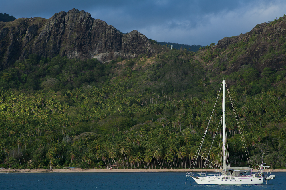
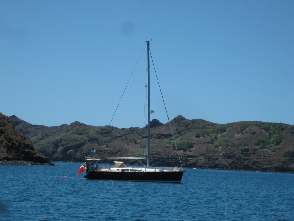
Location: Daniel's Bay (Hakatea), Nuku Hiva, Marquesas 08-56.62S / 140-09.80W

We actually made 2 visits to Daniel's Bay, staying a total of a week there. The proper name for Daniel's Bay is Anse Hakatea, but among cruisers, it is known as Daniel's Bay. For many many years, the bay was home to a man named Daniel who was very welcoming to cruisers. He even went to the trouble of piping fresh water out to a bouy in the anchorage, so cruisers could easily take on fresh water from his water supply.

Unfortunately, the popular series 'Survivor' came to Hakatea one day and persuaded a very old Daniel to move to town, so they could use his isolated bay to film a Survivor series. Daniel passed away soon after, and his bay is now uninhabited.

However, there is still a small friendly village in the adjacent bay, within easy walking or dinghy distance. And there is still the '3rd highest waterfall in the world', only a 2 hour hike away. And it is still a better anchorage than the rolly gusty anchorage at the main town of Taiohae.

We made our first hike to the waterfall with our friends on Infini, who had already visited Daniel's Bay before. They knew the way, and so we had an easy hike on a nice sunny (dry) day.

The hike starts in the tiny village of Hakaui--really just 4 or 5 houses, surrounded by carefully tended gardens. There is a tiny church, no post office, no central electricity, and no cell phone signal. We understand that most people nowadays don't live full time in this village. Their main house is in Taiohae, and they visit their home in Hakaui on weekends--leaving a caretaker or one part of the family to stay in the house and tend the gardens.

The 'gardens' are a combination of flowers, ornamental shrubbery, and fruits and vegetables... including bananas, mangos, papaya, citrus, guava, manioc, breadfruit.

There is a fresh water stream that runs through the village and out into the bay. At high tide, it's possible to get a small outboard over the 'bar' and into the stream. It's a bit of a challenge--the bay is swelly and usually has some waves breaking on the rocky beach and across the river mouth. So you have to time the passage through the waves, and hope you don't miss the deep part of the small stream... grounding at the entrance is a good way to get swamped by the waves, which we did once. At low tide, it's still possible to get an inflatable dinghy with a light outboard in--you just have to be prepared to have everyone hop out of the dinghy and drag it in through what's left of the stream to the deeper water.

The alternative to surfing in over the bar is to haul your dinghy up very high on the beach in Daniel's Bay, and walk along the beach to the left to the start of the path that goes over into the village in the next bay.

The hike to the waterfall follows an old 'road', up through the valley along the stream. If you pay attention as you are walking, you can see that the path was once improved--in the low spots, there is a 2-3' high wall of fitted stones on either side, with earth filled in between. This keeps the path dry even when it rains. The path is still lined with ornamental shrubs in many places. On either side of the path, set back into the woods and nearly covered with jungle, you can see old massive stone platforms, usually surrounded by fruit trees...the only thing left from what was once a flourishing community of Marquesans in a spectactular setting.

The problem with the waterfall is that it is set in a 'fold' in the mountain, and when you are at the base of the falls, you cannot see the top of the falls at all... only the last 100 feet of the falls are visible. But, halfway there, at a wide spot on the path, there is a great view off to the left, over the jungle, over the stream, to the waterfall. (See picture, to be posted sometime when we have internet). This is also a spot where there is another massive stone platform that probably had a good view of the falls and most of the valley.

At the falls, there are some giant rocks (15 feet high) and a small pool. We swam across the pool and between the rocks to actually sit under the base of the falls. When we were there, the water was running pretty good, the falls were too strong to stand under, and there was a really wet and cold downdraft in the little cave area where the water comes down. We didn't stay long there.

We also found some fresh water eels and small shrimp in the pool. One of these eels was quite big--similar in size to a big green moray eel--and lurked just off the 'beach' waiting for handouts. We had fun feeding the eels and shrimp bits of our lunch.

After the hike, Mike and Sue took us to Ma'i and Maria's house, back in the village, facing the bay, on the far left (west) side of the rocky beach. Maria's family has been prominent in the village for generations, and she and her husband and young son are now the latest 'caretakers' of this prime family property on the beach. In addition to her native Marquesan, Maria speaks fluent French and pretty good English. Since Daniel's demise, and because she speaks both French and English well, Maria has been host to many cruisers. We traded some 22 shells and shotgun shells for a nice lunch of traditional Marquesan fare, including 'poisson cru', goat in coconut milk, and breadfruit prepared 2 ways. (They use the ammunition to go up into the hills and hunt the wild goat and wild pigs that roam the island).

Over lunch, Ma'i offered to take us goat hunting and pig hunting, if we were interested. So we set up and expedition for the next day, to scramble up the rocky, arid face of the mountain west of Daniel's Bay, in search of wild goat. By the next morning, however, it turned out that Ma'i had hurt his knee, and Maria ended up being the one who guided us up the mountain (without the gun). It was a tough climb, most of the way up a rocky stream bed. But once at the top, we had a spectacular view of the bay below us, the south coast of Nuku Hiva, and much of the western side of Nuku Hiva.

There is a big dry grassy plain at the top. We hiked along the ridge to the highest point and saw many wild horses and lots of wild goats. Since the locals usually come up here on a hunting expedition, the goats were fleeing in small herds ahead of us, across the rocky face of the mountain. We marveled at how fast they could run in the loose dirt and rock that we had to walk very carefully in.

The wind at the top of the mountain, facing east, was blowing about 30 knots, a welcome relief after the hot climb. We sat and enjoyed the view and the wind, and ate our lunch, and listened to the goats bleating (still fleeing). On a later expedition, when his knee had healed, Ma'i bagged 2 goats, and he and Maria's father each carried one down the mountain on their shoulders.

On our second visit to Daniel's Bay, Ma'i also took us on a pig hunting expedition. 2/3 of the way to the waterfall, we turned right, and scrambled up the mountain through a muddy swamp to where the pigs hang out. We saw lots of pig sign--pig poo and where they'd been rooting around and some pig wallows, but unfortunately we never saw a pig. We had 10 people on that trek and I think they heard us coming from miles away. This expedition was also to show us a 'cave' that Ma'i had told Dave about (Dave is nuts about caves).

We found not exactly a cave, but a 5-story high rock with a big overhang. Along the base of the rock, past inhabitants of the area had created burial sites by 'bricking in' (with rock) hollows at the base of the rock. Ma'i showed us one hidden in a cleft of rock that still had bones and the remains of a wooden canoe. After climbing a tree and scrambling to the top of the rock, we had another incredible vista of the valley.

You could easily spend a month (or more) in Daniel's Bay, hiking and hanging out and trading with the friendly Marquesans who live there. But alas... we had to get moving. On our second visit, we had already checked out of French Polynesia (our visa expired 1 Sep), so we couldn't stay forever. We bid tearful goodbyes to Maria and Ma'i promising to come back and visit (but knowing we probably wouldn't get there next year).

Next installment--still catching up--we cruise the west and north coasts of Nuku Hiva to Anaho Bay (where we are now staging for our trip to Hawaii).
-----
At 9/12/2010 12:20 AM (utc) our position was 08°49.35'S 140°03.89'W