By the time we got out of the river, it was close to 2pm. We made a quick stop at the house of the guy who helped Dave with the dinghy in the morning, to drop off a few presents (fishing lures, and a stuffed animal and alphabet book for his son), and then picked up anchor. We really didn't want to spend another night in the wind tunnel.
Our friends on Endorfin were anchored 5 miles away off the Marae Taputapuatea (Polynesia religious platform). They said they were in a 15' foot deep sand spot and the conditions were OK. They said there was another sand spot that looked good just next to them. So we headed out there. It turned out there were 3 of these 'sand spots'. Another boat had taken the bigger one next to them, and there wasn't room for us to anchor there too.
So we went to the 3rd spot and looked it over. The depths went from 100' to 65' to 15' in about the length of Soggy Paws. The water was very clear and we could see everything on the top. It looked like good sand with only one low coral head. So we dropped the anchor somewhat toward the windward side of the sand spot, in the middle (left and right-wise). We backed down hard, and it seemed to be holding fine. So I donned mask and snorkel and went to look at the set. If we dragged off the pinnacle, there would be no-resetting.
Nope--that 'sand' was NOT sand, but white-colored sheet rock. We had only about an inch of the point on our 88 pound Delta anchor in a small hole. Definitely not good enough. I criss-crossed the top of the pinnacle and there wasn't 10 grains of sand on the whole thing. But, there was a very nice ledge, that, if I could... just... drag... the... anchor... Nope--I could easily drag Island Time's 60 lb anchor and 50' of chain around, but this beast (with 150' of chain out) I couldn't budge.
So I swam back and told Dave we had to move the anchor about a boat-length further to windward, and drop it just off the edge of the pinnacle. That sounds easy--clear water, and we're hardly moving it, but with the 20 knot winds, it was hard getting into just the right place. The next time we dropped, we were just literally 2 feet short, and the next time only about a foot short (Dave didn't want to drop it over the abyss, so he was a little short each time). Each time, I had to jump in the water and go visually check the anchor. Finally on the 5th time, we got it over the ledge and the point and the whole fluke area were set well into a nook. And honestly we weren't screaming at each other. We both knew how important it was to get it right, and how difficult a thing we were trying to do. Fortunately, with our big strong electric windlass, it wasn't too much of a chore.
We still spent a somewhat uneasy night, with the wind still blowing 20-25 knots (but fortunately not gusting to 40 like the previous night). We have our old Garmin GPSMap 76 hand-held GPS mounted in our cabin, and had it on and zoomed in, and the anchor alarm set. I could sit up, turn on the backlight, and verify we were still in the right spot, without hardly waking up.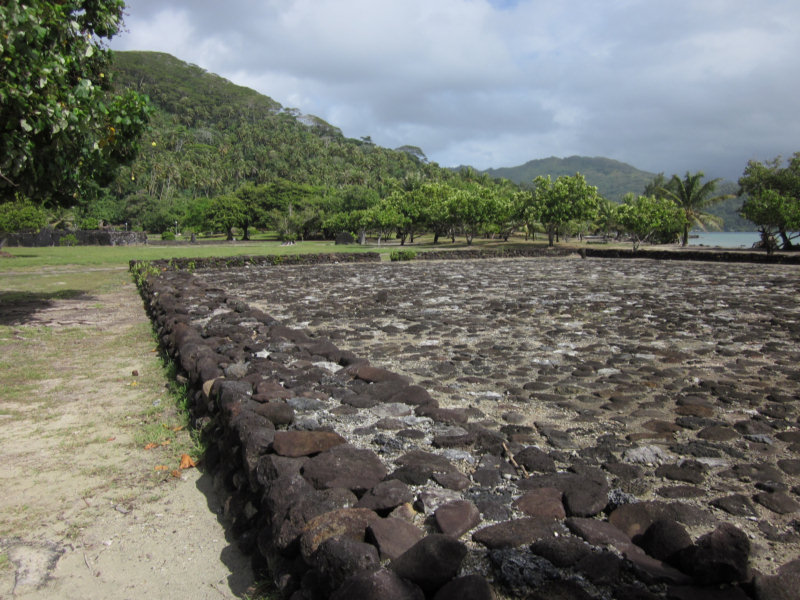
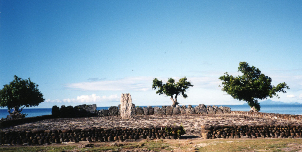
In the morning, we felt comfortable enough with our set that we dinghied ashore and walked around the Marea for an hour or so. This is an extensive group of stone platforms--the largest and most sacred in the Society Islands. There were some nice plaques in English, with illustrations, describing the marae, their purpose and construction, and a little about the social structure in the Societies. Because the Polynesians never had a written language, most of what we know of their history comes from the detailed accounts from the first explorers, especially Captain James Cook, who made 3 trips to French Polynesia. It was interesting to note the footnotes on the sketches on the plaques--one was drawn by Captain William Bligh, and most were done by Webber, one of Captain Cook's 'resident artists', who were carried on board just for such documentation of culture, plants, and animals they discovered.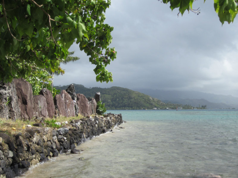
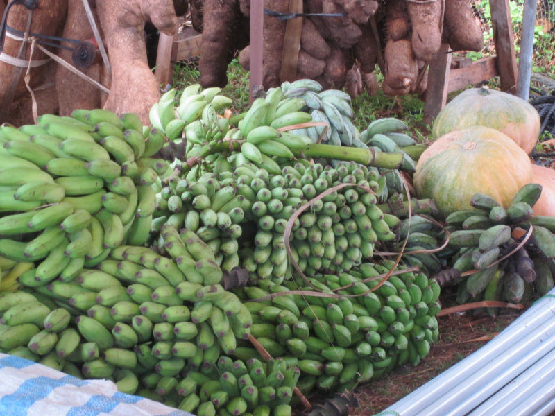
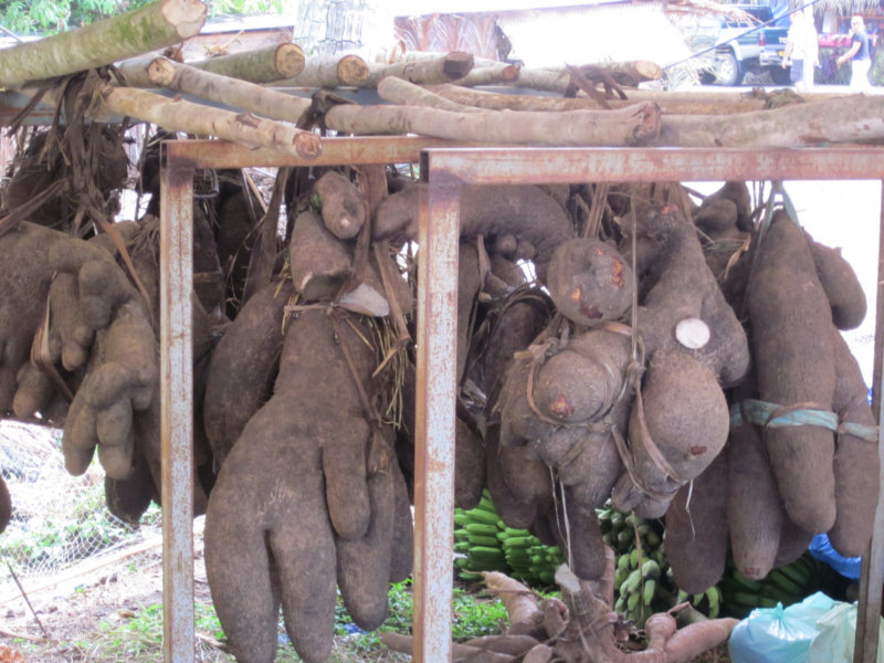
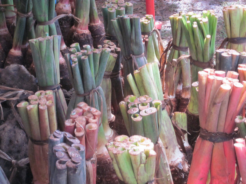
Also in the Taputapuatea area, they were holding an Agricultural Fair. We took some pictures of the strange stuff they had on display.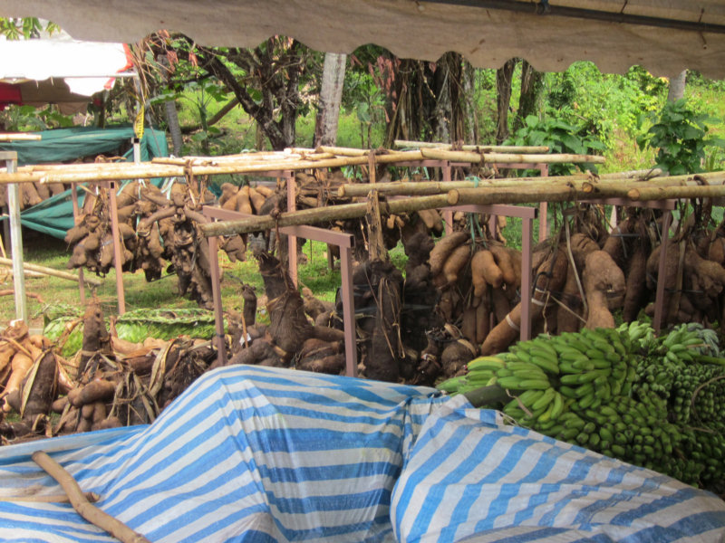
At 7/18/2011 3:27 AM (utc) our position was 16°49.77'S 151°21.59'W
http://svsoggypaws.com/currentposition.htm
No comments:
Post a Comment