We checked out of PNG with the Rabaul Customs officer with next port listed as Gizo, Solomons. While in town, we all hit the stores and the market for one more round of provisioning. We bought some very expensive marine 2-part epoxy in one hardware store that had some marine supplies--so we could pay back the epoxy we had borrowed to make our rudder repairs (done in Kavieng), and have a small supply on hand in case we need it again.
We left Rabaul in the early morning, headed SSE to a pair of coves on the SW end of New Ireland, named Irish Cove and English Cove. As we motored out in the glassy conditions, we motored right past the smoking volcano that we had hiked a couple of days before.
Once the wind came up, we were able to sail most of the way with the NW wind mostly behind us. However, as we approached the coast of New Ireland at Lamassa Island, the wind switched 180 degrees and came strong on our nose (some weird land breeze).
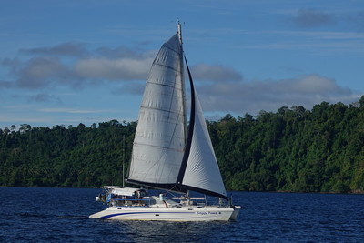
Dave wanted to see a cove that Rod Pearce (famed WWII airplane hunter in PNG) had said we could anchor, and from which we could scramble up on a ridge and find a downed Japanese plane. So we let the other boats go on to the anchorage in Irish/English Cove and we explored around a bit. We found that there was indeed an anchorage where Rod had pointed out, at approx 04 43.56 S / 152 48.08 E, in about 20-30 feet of sand/mud. This is probably only a one-boat anchorage.
There was a big thunderstorm building offshore and we still had at least an hour to go to get to the anchorage, so we didn't explore too much, but maybe we'll get a chance to go back on our way back north.
Being last in a 4 boat fleet into a tiny anchorage meant we got the outside spot. But fortunately our buddy boats had left enough room for us. We were wedged into tiny English Cove two-by-two, with Ocelot behind us hanging in 12 ft and we had to drop in about 40 ft.
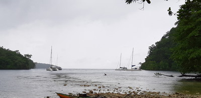
Wind and Swell Outside
It seemed like the cove was exposed to the prevailing westerly winds, but the outside reefs blocked the swell and we were fine in there. We had checked out Irish Cove and found it much deeper--we probably could not have fit all 4 boats in Irish Cove.
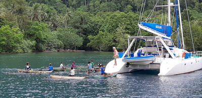
By the time we came in and anchored, our friends were surrounded by canoes. These were friendly curious people and it turned out that most of them were from Lambom Island nearby, where we could see a fairly large village on the satellite charts. Lambom does not have a water supply, so the villagers come daily to Irish Cove in their canoes to get water from the fresh water river that empties into the bay.
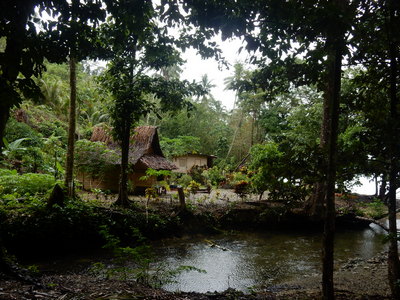
Only a few families actually live in this bay. Eventually the Lambom canoes departed as the sun started to set, and we met Passie (pronounced Posse, like the American west group that forms to hunt down the bad guys) and Joel, two of the men who live in English Cove. Both spoke really good Englsih, and neither chewed bettlenut (a mild drug from a local plant that leaves the chewers with red stained and broken teeth). So we had a nice chat with them. Passie told us we could come in to the river to get water or take a swim in their swimming hole. He also told us there was a waterfall a little ways upriver that he could guide us to if we wanted.
We had planned to depart for Buka the next morning, but we had a little happy hour conference and decided we'd stay for the day.
Passie guided us up the river to the small waterfall. It was more like a small rapids than an actual waterfall, but it was nice to get out and walk some (though a little of it was walking up the rocky river bank, and those with flip-flops struggled a bit). On the way back, we took a shortcut through some of the village's gardens. The birders in our group were happily spotting birds, too.
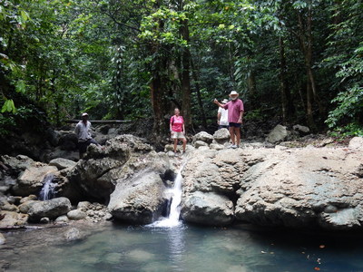
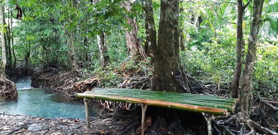
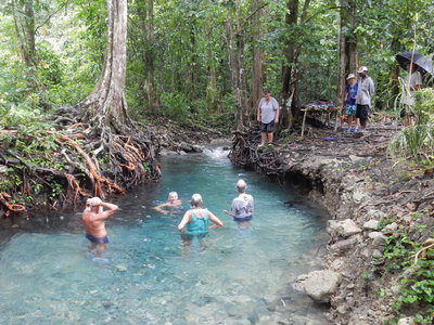
Back at the swimming hole, we had a nice time splashing around in the surprisingly cold clear water. Liz from Indigo brought her laundry in--the laundry she'd sent out in Rabaul came back no cleaner than when it left, and a little smelly because it never got properly dried.
The next morning we did an exhaustive look at the weather. The weather didn't look great for a long passage to Buka, but it didn't look great the next day either. So we collectively decided to go ahead and go, knowing that the forecast showed either light wind directly behind us, or light wind on the nose... we would be motoring most of the passage.
-----
At 3/14/2019 10:31 PM (utc) our position was 04°46.28'S 152°51.42'E
http://svsoggypaws.com/currentposition.htm
No comments:
Post a Comment