Friday, February 29, 2008

Vivarillos and Cayos Cajones

We arrived in the Vivarillos on Monday after a 2-day motorsail. We spent Tuesday recovering from our overnighter, and exploring the Vivarillos a little.

The approach we made to the Vivarillos from the west, at night, was to waypoint 15-50.46N 83-18.13W. It is clear to approach slowly from the west, and the depth shallowed to a minimum of 12 feet. At the waypoint, it is about 10-12 feet deep in good sand. It is possible to go another 100 yards further in at least, but you should probably do this during daylight. At this point, you are between the Grand Vivarillos island to the south and the Bird Island to the north, with a continuous reef out
in front. It is good protection in weather from NNE to SSE, but does get rolly if the wind goes too far north or south. It is possible to move around behind Grand Vivarillo in a westerly, but this is really not a good place to weather a strong frontal passage.

We have a fairly detailed chart of the Vivarillos in our raster electronic chart (and I think the CMAP chart is similarly detailed).

Yesterday, we opted to take advantage of the light wind and good sun conditions to go explore another reef area 16 miles NE of the Vivarillos. This area has 2 names, Cayos Cajones and The Hobbies. Our chart of the Hobbies is not very detailed. It looks to be just reef with no land. We were really not sure what we were going to find here. But friends had told us it was a 'not to be missed' place. We also weren't sure what the weather was going to do. There is a front approaching and we didn't
want to get caught in an unfamiliar area with stinky weather.

But the GRIB file was forecasting light winds and no westerly component, and the skies were clear. So we thought we'd leave early, go up and check it out, and if we didn't like it, we could go back to the Vivarillos anchorage before dark.

So yesterday, we motorsailed in about 5 knots of wind, up to the two waypoints our friends had given us. 16-01.829N 83-06.214W and 16-02.500N 83-06.320W. Once we got in close, we had to go on visual navigation, because the area is strewn with coral heads. But it was easy getting in, and after checking out both anchoring spots, we opted for the second waypoint. We were surprised to find 2 islands with vegetation, and several visible sand islands, since there is no land indicated on the chart at
all.

The first waypoint is right off the southern island and has good protection from the SW around to the East, if you tuck in close. The second waypoint is good from South, around to the East, and all the way on around to the NW. Both are good anchor spots in the normal ESE trades, but since we were expecting the wind to soon switch to the NNE, we opted for the second anchorage.

But all day yesterday, the wind remained very calm... less than 5 knots out of the SW. We checked the GRIB (wind prediction) forecast again and decided it would be OK to stay for the expected frontal passage.

So we all (Dave and I, Mike, Laura, and Liz from s/v Gilana, and Sophie and Bernhardt from s/v Stella) jumped in the dinghies and went out to explore the reef. Dave and I quickly found a couple of spots inside the reef with good relief and some fish, we marked them with the GPS so we could come back later. But the water in the inner reef was kind of murky. So, we went further out to the outer reef. With the calm wind it was an excellent opportunity to explore the outer reef--which normally has
breaking waves over it.

Gilana found a swim pass from inside the reef to outside, and we all went snorkeling through. There were lots of fish and at least one small Hawksbill turtle swimming around. After a bit of looking around, we found a big school of snapper, with several of them close to 2 feet long. Mike had brought his spear gun, and eventually picked out one of the biggest Red Snapper, and speared him. Then he loaned Dave his gun and Dave got a Cubera Snapper. Mike's fish was big enough that they shared half
with Stella, so everyone had fish for dinner.

The sea was glassy in all directions at sunset and it made a spectacular sunset.

Tuesday, February 26, 2008

Arrive in the Vivarillos

After a long trip (159 miles, 32 hours), we arrived in the Vivarillos just after dark tonight.

Fortunately, we had some friends in the anchorage who turned on all their lights to help us get in after dark.

Monday, February 25, 2008

Moonlight Sail?

Well, there was moonlight for most of the night, and the sails were up, but I wouldn't call it sailing.

Fortunately, our coastal strategy has worked out and we had light winds, sometimes sailable, all night long. The seas are a little lumpy, but otherwise not bad.

We never did get the counter-current we hoped for, so our ETA is currently just after dark. I think we'll be OK making a cautious approach from the west. We have waypoints for the primary anchorage on the NW side of the big island.

If we pick up a little sailable wind today, we may make good enough time to make it before sunset.

Making Time to the East

Well, the trip has almost gone as planned today.

The only glitch was a squall we encountered about 4:30pm, with gusts to about 35kt. Fortunately we were ready for it. It was hairy and uncomfortable, but it has passed.

Our friends out at Vivarillos tonight said they had 7 knots of wind, so maybe the GRIB files really were right.

All is well aboard.

Sunday, February 24, 2008

Leaving Guanaja Today

We expect to leave this morning at 0900 CST from Guanaja, leaving via the Half Moon Cay Channel.

Once clear of Guanaja, we will cut into the coast of Honduras (tracking to a waypoint somewhat arbitrarily picked along the coast), heading initially about 150 degrees, for the first 30-35 miles. Once we get close to the coast, we plan to stay within 5 miles of the Honduran coast until about 0630 on Monday morning, when we should be approximately at Punta Patuka, then we'll head due east to the Vivarillos. We expect to be in the Vivarillos by about 4pm on Monday (Central Standard Time).

There are 4-5 other boats talking about leaving Guanaja today, headed for the Vivorillos. They each motor upwind at different speeds, so we don't expect to be side-by-side with anyone, but we should be within VHF range of other boats, at least for awhile.

We will be checking in on the Northwest Caribbean Net (0800 and 1745 CST on 6209 USB). And we plan to send position updates via Winlink every 6 hours or so. These should show up on our various position websites.

http://www.svsoggypaws.com/positions.htm

We do have an EPIRB aboard and an Iridium phone, plus we have a Honduran cell phone which may operate sporadically along the coast.

Our waypoints and expected ETA:

Santa Rosa 16-01N 85-37W 1500 02/24
Cabo Camarones 16-01N 85-01W 2115 02/24
Punta Patuka 15-53N 84-21W 0630 02/25
Vivorillos Appr 15-49N 83-18W 1600 02/25

We will not have any internet for the next couple of weeks.

Weather Window!!

We have been watching a weather window coming up Sun-Mon-Tue and getting ready to leave. We checked out of Guanaja yesterday, and did one last provisioning run.

Today, after nearly a week of 'blowing like stink', the wind calmed down to the 10 knot range and (for a little while) swung northeast. Tonight it's back up (as is normal in the evenings), but only 15-20 knots instead of 20-25.

The Oh-Holy-GRIB forecast for tomorrow is 15 knots and lightening up to the 5-15 knot range for the next couple of days. We need about 36 hours to get where we're going (the Vivarillos Cays, right off the 'knee' of the Honduras/Nicaragua border), and it looks like we'll get it.

Assuming we leave in the morning as planned, we'll be out of internet range for about 3 weeks. I'll still be sending position updates and blog entries via Winlink as we go along.

We'll wake up in the morning and see what it looks like, and pull in some weather, and if it looks good, off we go.

Thursday, February 21, 2008

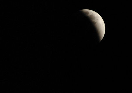
Lunar Eclipse in Guanaja

Alexander Cohn - Times Photo

Yahoo! It was a beautiful clear full moon night in Guanaja last night.

The eclipse started around 08:15pm local time and was fully eclipsed right around 9pm. Pretty neat.

Photo credit (the boat was moving too much for us to take a decent picture).

Back at Josh's Cay, Waiting Weather

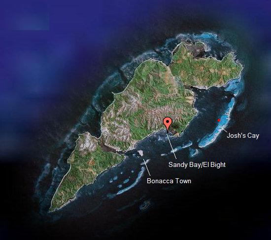
On Sunday we moved the ~3 miles back to Josh's Cay.

The no-see-ums are pretty bad in El Bight and they were driving Dave crazy.

Since then we have been working on boat projects and watching the wind blow, waiting for a good weather window. I've been doing some sewing, and Dave's still working on the watermaker (he's moved from 92% done to 98% done). He decided to move the membrane tubes out of the engine room and into the aft head (mounted vertically on the wall). He's been concerned about the effect of the high temps in the engine room on the longevity of the (very expensive) RO membranes.

It has not been all work and no play. We've found time for socializing with the other boats here. The food and the company ashore at Graham's Place are very nice and we've had dinner ashore 3 nights in a row!! (Reggie's Grilled Wahoo is very good!)

Our friends on Infini are leaving tomorrow to head back to Roatan. Their ship's batteries are almost shot, and Mike has ordered a new set of 8D's to be shipped down on the freight boat to French Harbor. The batteries are supposed to arrive this weekend. They also have a cousin flying in soon for a couple of weeks. I'm sure they'll catch up with us somewhere, but we are sad to say goodbye to them.

There are 2 other boats in the anchorage waiting with us to head east. The GRIB files show a promising lull Sun-Mon-Tue, so we will probably check out on Friday and be ready to go on Sunday or Monday.

Sunday, February 17, 2008

Minor Earthquake Offshore Honduras

Last night we were sitting in the cockpit and Dave says "What was that!?" We felt the boat shudder a little. Dave went up to check the anchor and look around. Everything seemed fine and the wind was relatively quiet, and we know our anchor is well set in a nice sandy bottom.

We paid attention for a few more minutes and felt 1 or 2 more shudders. Our guess at the time was maybe an earthquake somewhere nearby. (We felt a similar one in Guatemala).

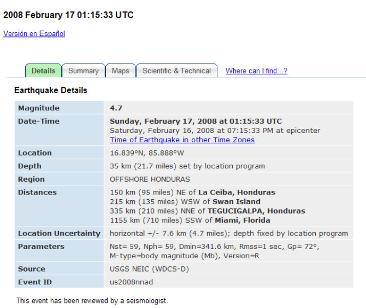
This morning I confirmed via the Earthquake Reporting website.

Sure enough, there was a 4.5 earthquake a little north of Guanaja. Hopefully it didn't affect anyone on shore. Here's a screen shot of the report (in case the link is obsoleted later).

Saturday, February 16, 2008

Veggie Day in Bonacca Town

We picked up this morning at 8:30 and moved to El Bight (also called Sandy Bay by the locals). This is an anchorage in a protected bay next to the 'mainland' (of the island of Guanaja).

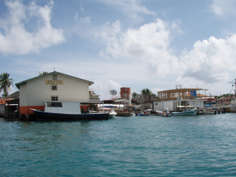
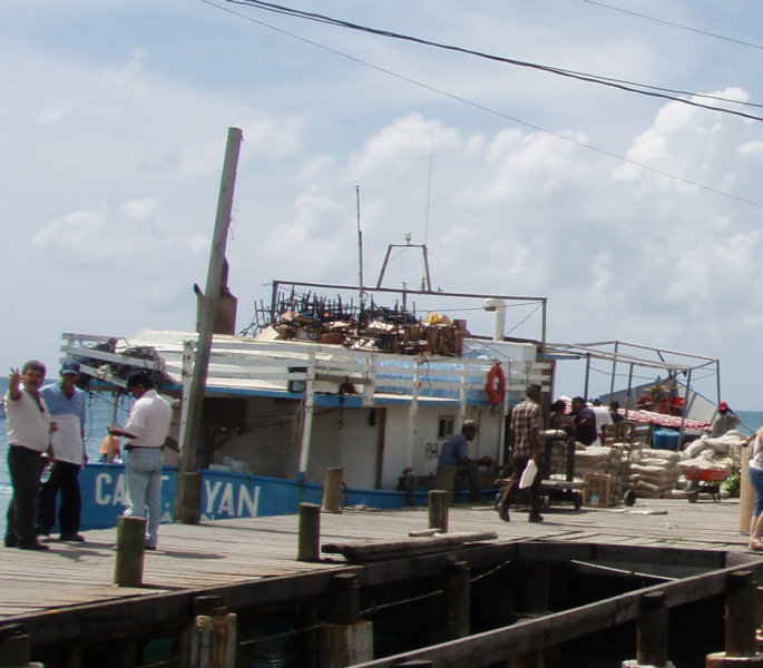
Friday mornings, the supply boat comes in from mainland Honduras, and everyone on Guanaja goes to Bonacca Town (also called The Cay by the locals, and Sheen Cay on the charts), to get fresh meat and veggies, and to pick up whatever supplies have been ordered.

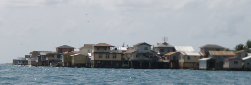
The main town on Guanaja is not actually on the main island of Guanaja, but on a little tiny island. Even in the main town, there are no roads here, except what looks like sidewalks to us. Everyone gets everywhere they want to go here by boat.


It is a long, wet dinghy ride from Sandy Bay to Bonacca Town. (Longer and wetter than going across the sound from Georgetown, Bahamas to Hamburger Beach in strong wind conditions).

I'm not quite sure why, but the inhabitants of Guanaja have chosen to cram themselves onto the island at Bonacca Town, rather than spread out on the main island of Guanaja. I suspect it is because the no-see-ums are notoriously bad on the island.


We followed some other cruisers by dinghy to the Zapatos Store dock. Then we followed the foot traffic carrying parcels through the narrow 'streets' of town to where the Town Dock was.


We found 3-4 grocery stores of varying sizes and 3-4 veggie markets. We managed to get all the veggies we could carry, and they were better (fresher) than what we got anywhere in Roatan.

We had a nice lunch in town and then stashed our veggies at the restaurant and wandered the streets for an hour, just to look around some more. The town is really a maze of very narrow passageways of concrete and sometimes wood. We got lost several times. But everyone seemed friendly and were used to gringos wandering around getting lost.

The forecast is for continued brisk tradewinds through at least early next week. So we'll hang out and wait for things to change. Meanwhile, there's always Dave's project list to keep us busy.