Sunday, May 18, 2008

Puerto Escoses, San Blas Islands, Panama

lAnchorage: 08-50.142N 77-38.26W May 13-14, 2008

After picking our friend Jim Yates up at the Mulutupu airstrip at 7:30am, we had a quick breakfast and headed further south.

Our original plan was to go nearly all the way to the Panama/Colombia border the first day, and then dawdle on the way back to fly Jim out of Mulutupu in a week. This is only a total of 60 miles round trip, so entirely doable in a week's 'cruise'. But we heard some other boats talking on the VHF--the first we'd heard in about a week--and decided to stop off and join them at Puerto Escoses.

Puerto Escoses is the site of the Scottish Settlement, originally called New Edinburgh. 5 ships and 2400 people landed to make a settlement in 1698. A year later, one ship with 300 people limped home, the settlement a failure, most of the settlers dead of malnutrition, yellow fever, malaria, and various other tropical diseases. The expedition organizers had sold shares in the 'company' they organized, and a great deal of common and wealthy Scots had invested in the project. Its failure made a
significant dent in Scottish finances for a long time.

Stopping there on this day turned out to be a really good idea. We met up with the other boats, Akka and Raven. Both had recently left Cartagena, headed for the San Blas. Akka had already made friends with "Mr. Green", a Kuna on the small island near the anchorage. Mr. Green is trying to learn English, and seeing their American flag flying, had come by to practice his English (and sell the gringos 'pulpa' (octopus)). Akka asked Mr. Green if he would guide us to the ruins, if we couldn't find
them ourselves.

We first went 'bushwacking' on our own, starting from the beach just in from the anchorage. There was a clear path leading off to where we believed Fort Saint Andrews to have once been. After we wandered around following several paths in the swampy area for an hour or two, finding nothing that looked like remains of civilization, we gave up.

The next day, Mr. Green came by with his buddy in a ulu, and we followed them to the ruins. The first place he took us was where the Scots had cut a canal into the rock, and the remains of the moat around the fort. The canal was impressive, about 10' wide and 25' long, cut into the rock. Since it was done in 1698, it was probably mostly cut by hand. The 'moat' was still discernable in the thick vegetation. But we saw nothing else that looked fort-like.

Next they took us to the spot where the Kit Kap expedition left a concrete marker in the early 1970's. There was some barely discernable writing on the marker that identified it.

Finally, they took us to a site where a Doctor Anderson did some archeological digging. Our guide told us that they found musket balls, cannon balls, small coins, pottery, etc. They said they had dug 3-4 exploratory holes. He only took us to one of the dig sites, as the others were in the muddy area.

At one point when we were walking, he indicated that we were passing the place where the dead were buried. But he didn't stop, and we never saw any physical evidence of it.

I did take my GPS so we could document where the stuff was we found.

Start of canal: 08-50.485N 77-38.251W
End of canal: 08-50.475N 77-38.238W
Small Beach: 08-50.351N 77-38.301W
Monument: 08-50.350N 77-38.357W
Cemetary Area: 08-50.351N 77-38.349W
Excavation: 08-50.408N 77-38.316W

After visiting the canal by dinghy, we dinghied to the 'small beach', left our dinghies there, and then literally bushwhacked to the Monument, thru the Cemetary Area, and to the Excavation. Mr. Green and his buddy both had machetes, and did quite a bit of whacking to make a trail for us. Otherwise we'd have never found it.

Mr. Green also told us that recently the British Ambassador to Panama had visited, and there were discussions about making the site into a park or monument.

Mr. Green's first name is Plaxadis, and he normally lives in the Kuna town of Mulutupu, or on the little island just south of the anchorage in Puerto Escoses. He is the son of a saila (chief) in Mulutupu. He said if anyone else wanted to be guided to the ruins, they should ask for him in Mulutupu or at the island. Apparently he spends 3 weeks on, 3 weeks off, alternating between Mulutupu and farming in Puerto Escoses.

Friday, May 16, 2008

Isla Pinos, San Blas, Panama

Anchorage: 08-59.924N 077-45.661W

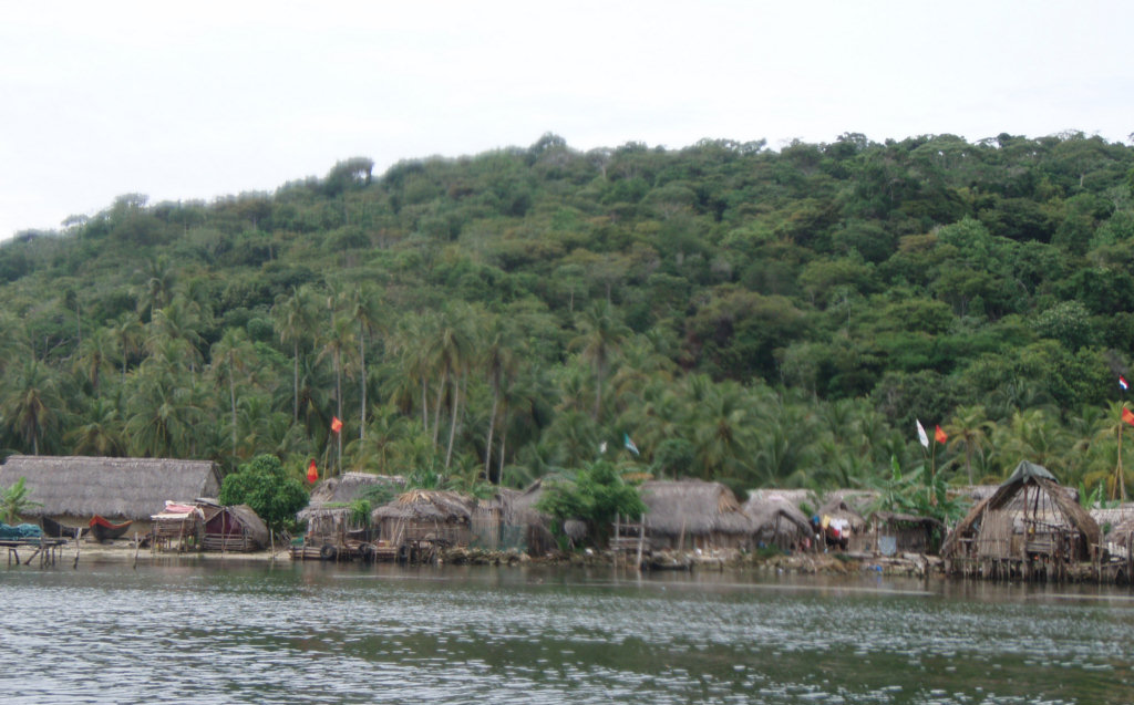
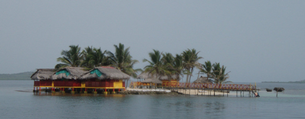
The Kuna Village at Isla Pinos

We anchored a little further out from where the guidebook showed the anchor. Dave was worried having no wind and bugs closer in. Though there was a nice little sand bottom spot where it looked the normal anchorage was, ours was pretty good, too, and we had nice wind.

While motoring around looking for an anchor spot, we found a reefy mound in about 7' of water. We ended up anchoring about 250' away from that spot, so when we jumped in to check the anchor, we also snorkeled over to look at the reef. After looking it over pretty good, Dave noticed that some of the rocks looked very much like 'ballast stones'. And the mound looked about right for the length and breadth of an old ballast pile. The 'wreck' looked pretty old, and there were no tell-tale pieces to help date it... we found no anchors, canon, engine, or anything, just a ship-sized pile of ballast stones. We speculate that it may have been stripped and scuttled there...the old wooden ships would eventually become too wormy and leaky, and would just be abandoned.

We spent all of the next day in the same spot. Our friend Jim Yates was arriving the next day via airplane, and we needed to do some cleaning and re-arranging to accommodate him. I did laundry, made bread, and sewed 'door drops' (privacy curtains between the forward and main cabin, and between the aft and main cabin). We had removed the heavy oak doors and left them in Satellite Beach, and I hadn't yet gotten around to doing that 'project'. (aha! another one off my list). Dave re-arranged the 'project tubs' in the V-berth, so Jim had some place to sleep.

We were visited by the saila (village chief)'s representative and given a receipt for the $8 fee. Dave said we'd be back in 2 months and asked if it would still cover us then. He said "si, si" (yes yes), but I'm not sure he really understood the question.

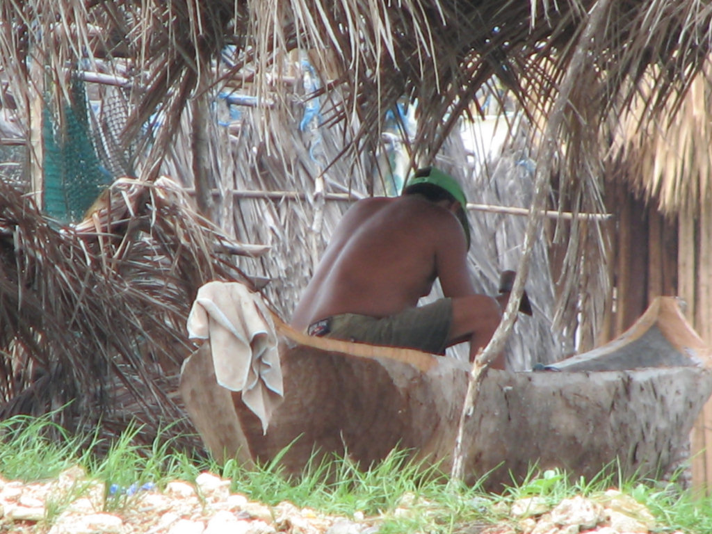
A Kuna in the Village Making a New Ulu

Because we'd already paid the fee at Pinos, we opted to stay a second night there, rather than moving on to Mulutupu, right by the airport. We heard the Mulutupu fee was $15, and didn't want to pay that too.

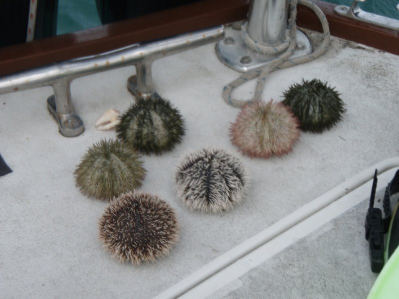
We had seen the French boat anchored near us gathering sea urchins and opening them. Sherry remembered having 'sea urchin roe' in high school (the Marine Biology teacher). So she gathered a few to try it out. Each sea urchin rendered about a half a teaspoon of stuff. It tasted fishy and salty. Yum!?

Sea Urchins


So the next morning we got up at 5:30am, and motored down to just off the airstrip in Mulutupu.

Jim arrived right on schedule at 7:30am, after flying in to the international airport at Panama City on Spirit Air at 1am the night before. I had jokingly told him if he ran into a vegetable stand between his arrival at 1am and his departure at 6am, to please buy us green veggies. Neither of us knew that the puddle-jumper airplane left out of a different airport, and the little airport was locked up at night. So Jim ended up hanging out in an all night "Super Rey" (the largest grocery store in Panama). He arrived with an armful of veggies...broccoli, lettuce, celery, and cucumbers. Damn! I should have also told him that I was dying for a steak, too. But whoda thunk that he'd be in the all-night grocery store!

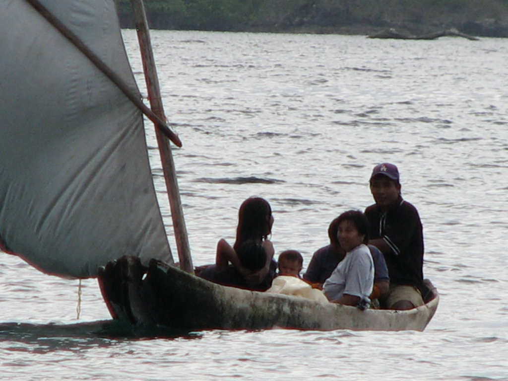
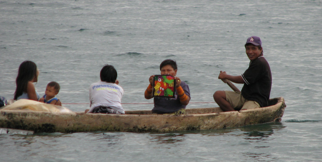
We spent Jim's next to last night aboard at Pinos, and went in to the village to let Jim have a 'mola' experience. Jim took some great pictures of the village (above and below).

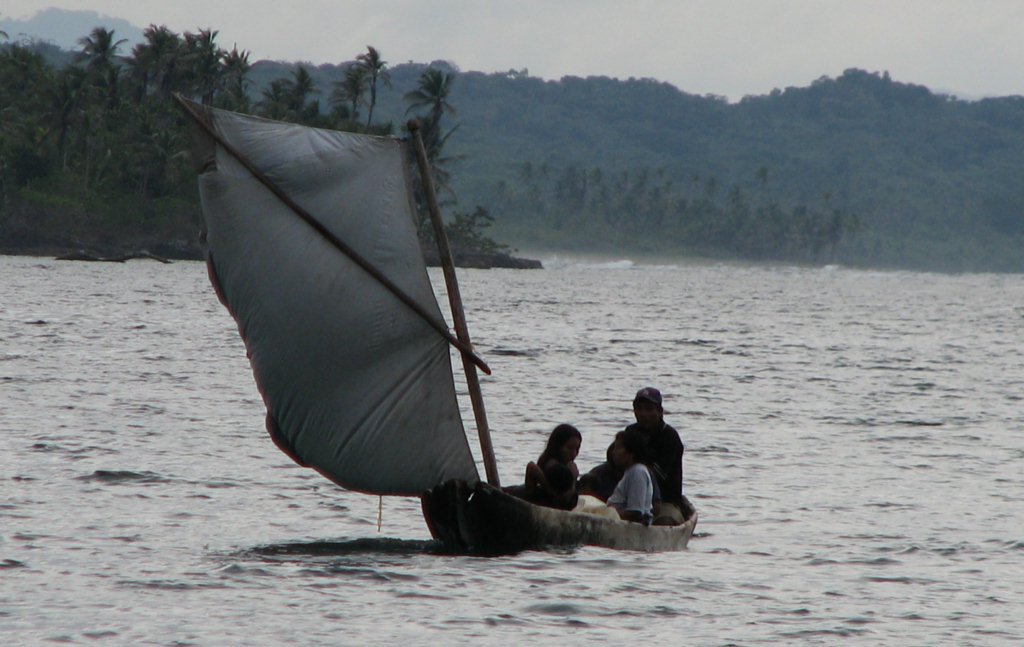
A Kuna Family Goes Visiting


The Typical Kuna Bathroom

Tuesday, May 13, 2008

Ustupu, San Blas Islands, Panama

Position: 09-07.74N 77-55.763

I think we are further south than I have ever been in my life. We are continuing another 30 miles south before we start heading back north.

The trip to Ustupu was another easy one... very little wind, just a large easy swell. Because it was only 5 miles, and part of that was protected by an outer reef, we opted not to put up the main and super-secure the dinghy, which of course we regretted later.

The town on Ustupu is on a small flat island and is just offshore. The anchorage is between the mainland and the island, in very protected water.

We anchored in 20' in very soft mud. We did our normal backing on the anchor, an 88-lb Delta, and it just kind of oozed along. We opted to leave it as is, and hope we didn't get any big winds during the night. The other option would be to retrieve the muddy anchor and switch out for a Danforth, which works better in the mud. A hot and muddy job. Since we haven't seen more than about 10 knots of wind in 2 months along the coast of Panama, it seemed a safe bet to just leave it as is.

There were 2 Colombian trading boats tied to the dock, so Dave went over and asked about buying diesel. They were more than happy to sell him 40 gallons for $3.75/gallon. (The going price when we left Bocas del Toro 2 months ago was $3.85). With an extra 40 gallons, we now have enough to motor everywhere we go (which it looks like we will have to do), and not sweat running dry before we make it to Cartagena.

We had a nice cool night, contrasted with the very hot night we'd spent the night before in Achutupu. We are not sure if the coolness was due to the small mountains just inland, or the big thunderstorms that threatened out at sea. But it was pleasant nonetheless.

At 5am thunder and lightning awakened us. Uh-oh, anchor not set well... thunderstorm... not good. But I quit worrying when the dim dawn light showed that the Utupuians were all setting out in their ulu's (dugout canoes) for the days work. If they had been expecting a 40-50kt thunderstorm, I'm sure they wouldn't be heading offshore fishing in a low leaky dugout. It did rain hard for a few minutes, but thankfully we got no wind.

In the morning, we went ashore to the town to try to buy some groceries. Ustupu is supposed to be the largest Kuna town, with about 8,000 people and an airstrip, so we were hopeful that we could find a largish store with some fresh goods. But it was weird. When we'd ask someone for a tienda to buy food, they didn't seem to understand us. It may be that here in this large town of Kunas, not many speak Spanish. We did get eventually directed to about 4 different very small stores, and 3 restaurants.
We were looking for bread (of any kind), fresh veggies (of any kind), potato chips, and eggs. We eventually were able to locate potato chips in small bags, at a restaurant. That was it.

If we had wanted to, we could have bought rice, canned sardines, powdered milk, and saltine crackers. But we have all of those. We probably could have bought fish and lobster. But we didn't need any of the former and won't buy any of the latter.

In addition, because we went ashore, we had to pay an $8 'anchoring fee'. We also opted to pay an optional $3 'water fee', so we could jug some water.

Yes, I know. We JUST commissioned the water maker. The last time we ran it, about 5 gallons into the run, the high pressure brine water suddenly dropped pressure. Worried about damaging something, Dave shut it down without trying to fully diagnose the problem... we had only planned a short run because we had to get moving while the light was good. The backflush (rinsing the RO membranes with fresh water to deter bacteria growth) took the 5 gallons we made, so our net was zero. The next 2 days
we anchored in places too close to town or a muddy river (so the sea water wasn't clean enough to run it). So our choice was to jug water while we had the opportunity, or HOPE the watermaker problem is a minor one that Dave can fix. Dave spent 3 hours doing 4 runs with out 20-gallons worth of jugs...

There is a largish-looking river on the mainland just in from the town. There was a lot of traffic in ulus back and forth from town to the river. We never got a chance to go explore the river.

Monday, May 12, 2008

Achutupu, San Blas, Panama

We anchored yesterday off the Kuna town of Achutupu, only about 4 miles south of Islandia. It took us 3 tries to get anchored. The water is either 40 feet deep or 4 feet deep, and we had trouble finding a spot in between that the anchor would hold well. As we get farther south and east, the bottom is less sandy and more muddy (the islands are closer in shore and there are many rivers nearby). We finally found a sand and grass mound that was about 8 feet and got the anchor well set.

Soon after anchoring, 3 boat loads of small children paddled up in ulu's (heavy wooden dugout canoes with wooden paddles). They wanted to know if we wanted molas (No gracias, yo ya tengo muchas molas). I chatted with them for a few minutes in Spanish. My 'small talk' skills are not very good even in English, and it's much more difficult with the language barrier. I can hold long conversations in my head when no one is around, but when I'm sitting there trying to think of something to say, I can't
remember a single word of Spanish. But I did learn that their mother was in the town and their father worked in Panama City. We exchanged names, but most of their names are nearly unpronounceable and I have trouble remembering 'Jane' 5 minutes later.

The porthole for our galley is right at eye-level for a person in an ulu, so they all got a kick out of looking in the window, giggling, pointing, and talking to each other in Kuna.

Finally, they asked if I had any sweets. Fortunately we keep a small jar for just this kind of situation. I gave them each a sugar free chocolate candy, and told them not to tell the other kids in town.

We also had 2-3 ulus come by trying to sell us lobster. Dave is getting pretty irritated that none of them know (or care) that it is closed season. He's given up trying to explain in his broken Spanish the complicated concept of conservation and why it is important that they follow the rules laid down by the Kuna Congreso. But we won't buy any. Especially the small ones, and they are almost always small these days. A cruising friend of ours confessed to buying lobster if they were still alive,
and 'liberating' them.

We found the '4-star Kuna Resort' described in the cruising guide (The Dolphin Lodge) and made reservations for dinner. At dinnertime, there were 10 guests of the hotel, in addition to us. We met a nice young Portugese woman who is staying at the lodge for 3 months as an internship for her degree in tourism (the teacher musta really LOVED her to exile her to Achutupu for 3 months!). She is not getting paid, but gets free room and board. She is the only one at the resort who speaks English, so
she was playing hostess at dinner. The guests were a couple of Germans, an American couple who said they were 'birders', and 3 youngish women who were European.

We had a nice dinner (though expensive for Panama)... it was complete with dessert and coffee/tea for $15pp. They offered lobster, crab, or fresh water lobster. I had the fresh water lobster, which were very much like crayfish but a little bigger than the normal crayfish size.

After dinner we were treated to a little bit of Kuna native dance, with 4 men and 4 women. The women (as is normal) were dressed in traditional dress, with a light wraparound skirt, a sash, a mola blouse, and a scarf on the head. The men were in baggy western-style shorts and shirtless. It was interesting, but somewhat amateurish. And narrated by a Portugese girl who didn't understand the dance, in poor English. But we enjoyed the whole thing.

Returning to the boat, we ended up having a little night from hell... no-see-ums, no wind, and a slight roll. We had left the boat closed up when we went in for dinner--both because of possible rain and possible intruders. So it was hot inside to begin with. It was almost too hot to sleep, and too buggy to go sleep in the cockpit. Fortunately we have good fans over the bed, and after lighting up a mosquito coil and spraying the screens with bug spray, and rolling up in our sheets, we were able
to get to sleep.

We were amazed to find here not one, but two airstrips. The two small airstrips are only about a mile apart, and each equipped with a building and a wind sock. When we asked why they had two airports, they told us that one was for the village of Achutupu and the other for Mamitupu, the village just to the south of Achutupu. Apparently the chiefs do not want the inhabitants of the two small towns to mix...maybe years ago there was bad blood between the villages, though it's hard to imagine the
sweet and quiet Kuna ever making war on anyone.

Saturday, May 10, 2008

Islandia, San Blas Islands, Panama


Late yesterday, we moved to Islandia, about a mile away from Aligandi, out by the reef. 09-13.47N 078-00.60W

It is a nice anchorage, pretty protected, and away from the town. It is also the former home of WWI pilot Johnnie Golf, who once worked for Al Capone. He spent his last years here hiding out from the Feds. We swam ashore on the island and found a few bricks, a concrete pad, and a rusted-out large tank that probably held water or fuel.

We were looking forward to dinner at one of the two hotels out here, but neither one has any guests right now. One offered to feed us, but the menu was expensive for Panama, and Dave said the restaurant was mostly enclosed and hot and airless. We're going to move to Achutupu today, where there is supposedly a 'five star hotel', so Dave can take me out to dinner. (Dave's getting tired of doing dishes. :)

Islandia Lodge

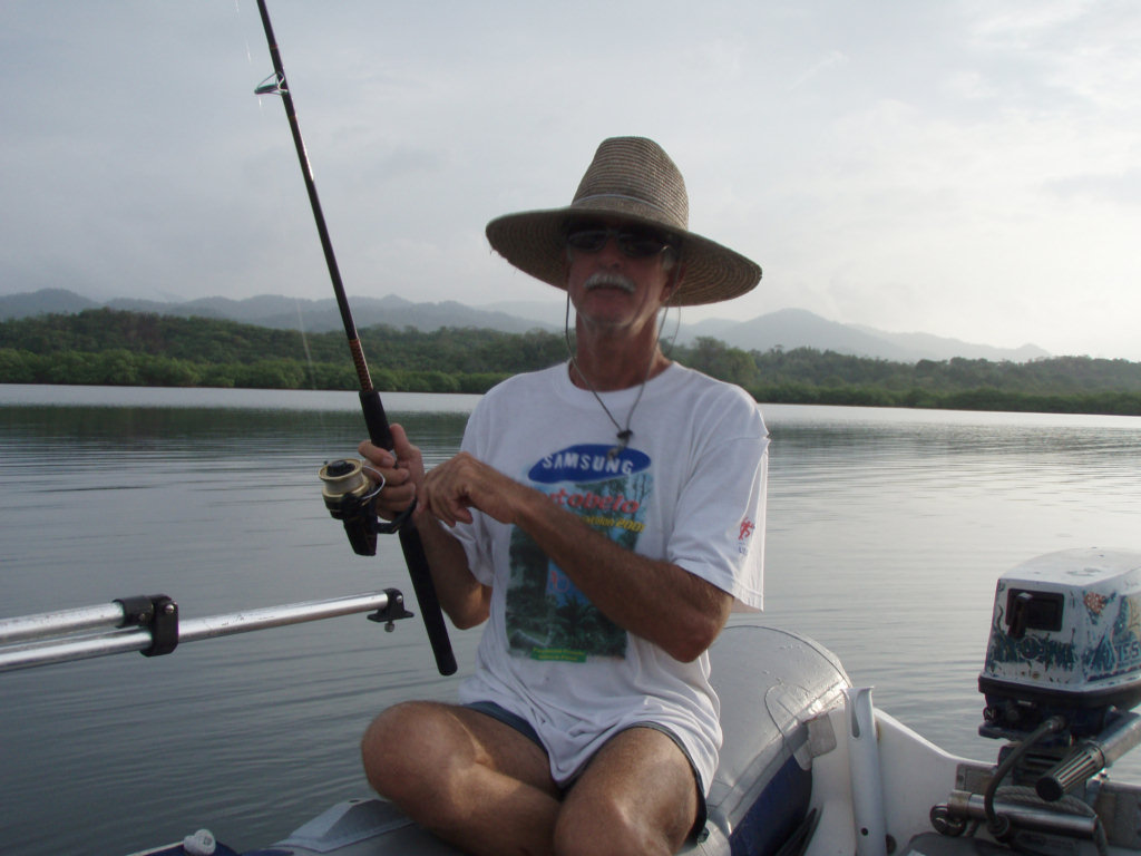
Near the end of the day we dinghied over to a small lagoon, Golandrina, on the mainland to do some tarpon fishing and have happy hour. The Bauhaus guide says that there are "big tarpon fish" here. Dave was anxious to hook a tarpon. Well we can tell you that after an hour of fishing there are no tarpon here. Not even a ripple on the water and no strikes. Maybe it is the wrong time of year for tarpon in Panama. Sherry participated in fishing by reading her book.


Last night we had our first ITCZ storm. The Inter Tropical Convergence Zone, a windless band of thunderstorms that sits roughly along the equator, moves a little north about this time of year (along with the sun), and I think we are right underneath it right now. Last night we had lightning all over, but fortunately very little wind. We did about 2 360's during the night, but never with more than about 5 knots of wind.

We are remote enough now that we've only seen one other cruising boat in 3 days. Most boats go direct from the western San Blas to Cartagena. The boat we saw passed by yesterday out in the channel. We tried hailing them on VHF but never raised them. Couldn't see the name or flag.

We do have some other cruising contact on the SSB nets... We actually listen in on 3-4 nets every morning, from 8am to 9:30am, including the Central American Breakfast Club, a ham net on 7083; the SW Caribbean Net on 6209 (mainly Bocas cruisers); the Panama Connection Net on 8107 (mainly San Blas cruisers); and the NW Caribbean Net on 6209 (NW Caribbean and offshore islands). We also sometimes check in on Ben's Net, a ham net on 14261 in the late afternoon. This schedule keeps us pretty busy!

Aligandi, San Blas Islands, Panama

We traveled another 15 miles south and east to the village of Aligandi. We are anchored in 15 feet, right off the 'town dock', on the west side of the island (right where the anchor in the guidebook is placed). 09-13.57N 078-01.75W

We tried to sail, but the wind is so light and the seas so large, that the sails were just flogging as we rolled. So we took in the genoa and sheeted the main in tight on the centerline, and motored on. We were able to sail for a couple of miles when our course took us behind a reef and the seas were flat.

Looking at the GRIB files for the next week, I don't think we'll be doing much sailing (light and variable wind, and not much behind-the-reef on the rest of the trip SE to the border).

We dinghied into the village late yesterday to look around and try to find some groceries. The building ashore that looks like a school, turns out to be the hospital, which at this time has no patients, according to our guide. We were met at the dock by Duke (pronounced doo-kay), the local outboard motor mechanic, who offered to show us around. We told him we were looking for meat, vegetables, and potato chips. For the meat, he took us to a local Kuna restaurant, where we bought two more 'chicken
entero' for $6.75 each. They assured us they were alive this morning. Then to three different 'tiendas'. All had all the basics... flour, rice, canned sardines, powdered milk, etc. But no veggies and no potato chips. We were able to buy some bananas and plantains and great home made Kuna bread.

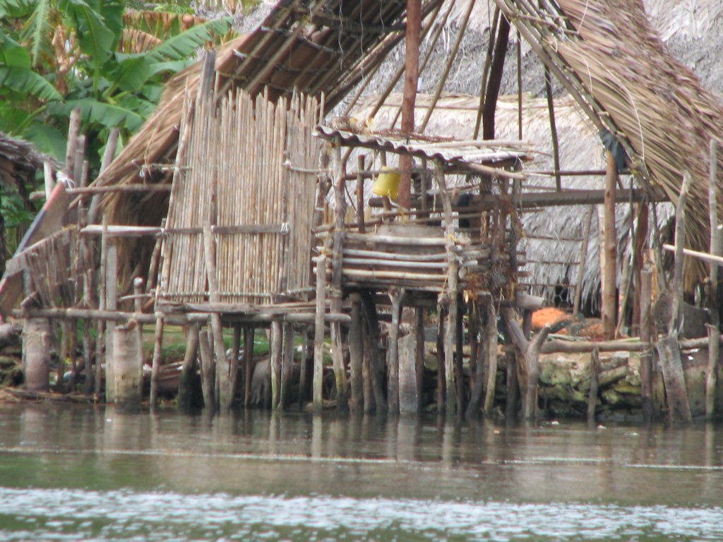
There are a few concrete structures on the island, but most are the typical wood stake and thatched roof huts. Duke told us that the generator runs between 6pm and 10pm, and even then, we only saw one or two lights on the island, other than the hospital complex. The hospital also had a big water pipe coming in from the mainland, to a big black plastic water storage tank. I don't think that the town has any plumbing, even the restaurant was using a 5-gal bucket of water for its water supply (this
is typical).

About halfway through the tour of the village, we were joined by a couple of small girls. They were very friendly and smiled up at us saying "'Mericans". Before I knew it, two of them had slipped their small hands in mine, and they insisted on holding my hand as we walked thru the town. It was pretty cute. They were at the toothless age, about 5 years old or so. Dave went off with the guide to pick up the chickens we had bought, and the girls and I played the game of 'what do you call that in
English'. They laughed at my Spanish and I laughed at their attempts to pronounce the unfamiliar English words.

We also played the game of 'take my picture'. I ended up with 4 or 5 kids standing and smiling for me, in various groupings. They would have me take the picture and then rush up to view it in the viewfinder.

I was really sorry that I didn't have a couple of candies in my pocket.

We have been using the Bauhaus Panama Cruising Guide waypoints for our trip, and they have been very good. Our regular chart has no detail for the area we will be traveling east of here, until we get more north along the coast of Colombia. So the guidebooks are invaluable. For the Bauhaus Guide, the author actually used satellite photos to chart the areas where the conventional charts do not cover. We use the Sea Clear navigation program with scanned in Bauhaus charts to keep track of where we
are on the computer. It is amazingly accurate.

In the morning, we took the dinghy up the river inshore of Aligandi. Usually this is a nice way to get a fresh water bath, do laundry, and see some animal life. We went all the way up the river as far as we could drag or paddle the dinghy, and never found any completely fresh water. It is the end of dry season, so maybe a little rain will produce a fresher river. We were able to collect some mangoes, floating in the river. All the huge mango trees are in full fruit right now, and dropping ripe
fruit into the river.

While going upriver, there was a lot of traffic in dugout canoes, going to and from their 'farms' up the river. We also saw several grave sites (little houses shading a grave). One site had so many graves that it looked like a little village.

Friday, May 9, 2008

Snug Harbor, Headed Slowly for Colombia

Anchorage: 09-19.617N 078-15.127W

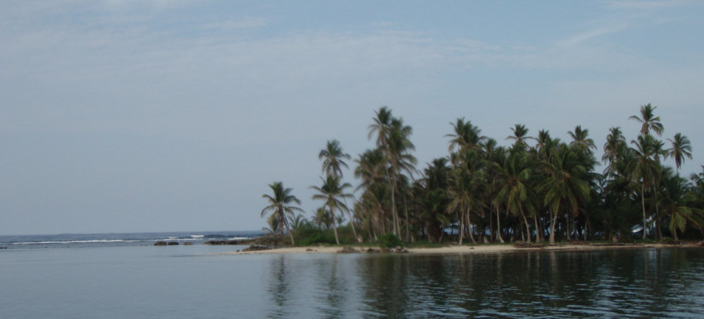
We left the 'comfort zone' of the Western San Blas yesterday and mostly sailed the 27 miles east and south to Snug Harbor. There is a Kuna town within sight, but the anchorage is several miles away from the town. We are anchored right next to another really cute little sandy island studded with palm trees.

As we move further east, the mainland gets more mountainous and rugged. There no roads out here. The only habitation is on the islands just offshore. The Kuna live on the islands, but have 'farms' on the mainland up the numerous small rivers. A farm will be roughly an acre plot with mango and avocado trees, occasionally a breadfruit tree, some corn, bananas, and a variety of veggies, etc. Sometimes coconuts. It is shared by a family or two, and someone paddles up the river daily to tend the
plot, and harvest what's ripening.

Several of the larger villages out here have airstrips left over from WW2, when the US had a presence here protecting the Canal. There is a daily early morning airplane flight that leaves from Panama City at 6am, and stops where ever there's an airstrip that someone wants to get to. I just saw the Air Panama plane headed back toward Panama City (at 7:30am).

Other than the airstrips, Colombian trading boats stop by, bringing diesel and gas, and Colombian goods, and going back with lobster (during the open season) and molas.

It is getting kind of expensive to cruise the San Blas, because every island charges an 'anchoring fee'. It wasn't too bad when the fee was $2-$5, but we were just this morning charged $10 for the privilege of anchoring overnight here.

An old Kuna guy paddled up in his 'ulu'. He didn't seem to speak much Spanish (and certainly not English). But he had a typed piece of paper in Spanish, with a stamped seal and a signature that authorizes him to collect the $10 anchoring fee for visiting yachts. I think they collect a similar fee from people flying in, also. He handed me a hand-written receipt. Typically the fee is good for all the islands and anchorages in the area covered by the town (sometimes hard to figure out), for a month.
I might have been able to negotiate him down a little for only 'just passing thru', but we didn't seem to be communicating very well at all, and I'm not a good negotiator. (Dave is still asleep).

As we move further east and south, the outlying barrier reef drops away, and our passages are pretty much 'open ocean' conditions. But there are a few islands and reefy areas closer to the coast, and those we can pass behind, we do. But the water is not as clear in close to the coast... too many rivers dumping muddy water into the ocean. So it's a bit nerve-wracking to be navigating reefy areas in less than perfect conditions. Especially with very poor charts.

We have improved our e-Navigation here immeasurably by taking advantage of a shareware program called Sea Clear. This program was written by a cruiser who just didn't want to shell out the big bucks for a commercial program. And it allows you to scan in any paper chart or chartlet, add navigation reference points, and then navigate with it. Our friends on Gilana then took the most popular cruising guide, by Eric Bauhaus, and scanned in all the chartlets for San Blas. This is what we've been navigating
with, and it is 98% spot-on. Sea Clear also supports AIS input, and we plan to add AIS to Soggy Paws when we fly back to Florida for a brief visit in June.

We also got a more accurate version of the raster charts from another cruiser. What we were using were dated from a 1982 survey and had us sailing over islands and reefs all the time (on the electronic chart, not physically). What we got was a 2001 version that is much more accurate out in the Western San Blas, but still fairly inaccurate in the lesser-traveled Eastern San Blas.

I have been using a program called Franson GPSGate to 'pipe' the one physical GPS input into my computer into 3 different programs, so I can run them all at the same time, to compare their navigation accuracy, and/or to take advantage of different features of the programs. So we regularly run the Nobeltec Visual Navigation Suite program and Sea Clear at the same time. Sea Clear, because of the guidebook charts, is best for the close in work, and Nobeltec is easier to see the bigger picture and
do the longer range navigation. Though I was leery to add a program that might de-stabilize my rock-solid primary navigation computer, Franson GPSGate is rock-solid too, and I have had no problems with it.

Tuesday, May 6, 2008

East Holandes Snorkeling

We had about a week sitting at the East Holandes "Swimming Pool" anchorage, in which we worked on various projects in the morning and went snorkeling in the afternoon.

The highlight of the snorkeling we did was definitely the "Grottoes" or "Caves". Our friends on Gilana had told us about them, showed us pictures, and sketched a chart in our logbook on how to find them. But the chart was not specific enough for us to figure out where they were. We finally asked around the anchorage, and Deb on Runner said she couldn't describe to us specifically enough how to find them, but she volunteered to lead us out there the next day.

Deb knows the area really well. They are semi-permanent residents of the Swimming Pool, and while here, she sets up 2 or 3 aquariums on board. So she spends her days snorkeling around looking for interesting additions to her aquariums, and for food to feed her current population. Most of the things she catches end up going back into the water after a few days of study/amusement. I think she must release all of them before Runner heads to Cartagena for a few months in the winter.

Anyway, Deb led us in our dinghy out to the Grottoes. And we took our handheld GPS along to mark the position, so it could be shared with others, if Deb doesn't happen to be around.

The Grottoes are a series of deep pools and caves on the back side of the reef about a mile NW of the Swimming Pool anchorage. The caves are linked together and it's possible to swim from cave to cave underwater, with one passage almost 100 feet long. We did a cursory exploration, to locate them all. We plan to come back and maybe dive them when we re-visit the San Blas this summer. (Though word of mouth from other cruisers has told us that

The dinghy route to get there is listed below. The "shallows" are very shallow, and the passage out to the reef should therefore be done as close to high tide as possible. At high tide, it was possible to motor the dinghy carefully through the shallows. At a lower tide we would have had to get out and walk and drag the dinghy. You should also pick a day that is fairly calm, as the swim-thrus would be difficult in rough weather.

The other interesting place we went in the calm weather was out through the cut to a wreck of a freighter in shallow water. This was challenging even in fairly calm conditions, and would be untenable in rough conditions. It was an interesting snorkel.

Other days, we just picked some likely-looking coral heads inside the reef to explore, and 'counted coup' on the lobster and conch we found. It is 'closed season' on conch, lobster, crab, and octopus, so we can't take them, but it is fun to find them and say "Pow, you're dead". We are amazed at how few lobster we have found, and only one we found was 'legal' size (by US standards). The Kuna and the cruisers have nearly cleaned out all the edible reef creatures in the San Blas. (Though the cruisers
seem to take the 'closed season' much more seriously than the Kuna).

But there are lots of little fish and beautiful live corals and invertebrates, and we seem to never get tired of poking around in the clear water. Occasionally we stumble across something really interesting like a sleeping Nurse Shark, or a large Spotted Eagle Ray.

Grotto Waypoints
----------------
NW of Swimming Pool anchorage about a mile. Stunning caves with swim-thrus. Recommend near high tide and fairly calm conditions.

#1 09-35.44N 78-40.72W West of anchorage
#2 09-35.82N 78-40.79W Start of shallows
#3 09-35.95N 78-40.79W End of shallows
#4 09-36.02N 78-41.02W Beginning of Grottoes area
#5 09-36.04N 78-44.13W End of Grottoes area

Wreck in Cut N of Swimming Pool
-------------------------------
#1 09-35.827N 78-40.283W Small dinghy cut to get outside reef
(anchor just inside)
#2 09-35.867N 78-40.286W Reef side of wreck

Monday, April 28, 2008

Chicken Entero


We had a visit today from the 'Tienda Eide' launcha. They come out every couple of weeks to deliver a standing order from Runner (a boat hanging out here). And they bring some extra stuff for others, and make the rounds of the anchorage.

We had called them yesterday on the VHF and asked them to bring us some stuff. About half of what we asked for they said "No Hay" (we don't have it). Dave was bummed that they had no potato chips. We are completely out, including the stale chicken-flavored ones that neither of us wanted to eat.

One of the things we thought we'd ordered was chicken leg quarters. Later we realized that Dave was out of chicken breasts for lunch meat. So when they came by, we asked for 'pollo piernas y pechugas' (chicken thighs and breasts). They said 'no, solo entero' (only whole). So, well, yep, I guess we'll take it whole, if that's all you've got.

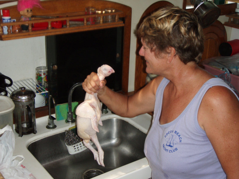
Well, 'whole' was correct...this chicken still had it's feet and head! When we bought whole chickens in Trinidad, they came with the head and feet cut off, stuck in the body cavity (which was, fortunately, empty). But this whole chicken still had his head AND his feet! Oh my god! I hope I don't have to gut it, too!!

Fortunately, they had gutted it at least (that's a health issue, I imagine).

Hmmm, wonder if any of my cruising books talk about how to cut up a whole chicken?

I set to work with a knife and was able to make some 'pechugas sin huesos' (boneless chicken breast) for Dave. And the leg quarters didn't look too bad--they went into a ziplock and into the freezer for a future meal. The rest of the pieces parts, neck, feet, wings, spine, etc, went into another bag for 'chicken stew'. I did throw the head and a lot of skin and fat overboard. So, my friends, next time you swoop into Publix for 5 minutes and buy a nice shrink-wrapped package of boneless chicken breast, think of us poor folks down here in the San Blas.

We'll let you know how the 'chicken feet stew' turns out.

We were also delighted to also find a couple of boxes of white wine in the launcha. We thought that $3 liter for boxed Chilean table wine is still a pretty good buy. No wonder some boats in our anchorage have become semi-perminent residents here.

Watermaker Project, Installment #57

We finally said goodbye to our friends on Caliente last week. They left to head north for the Rio Dulce.

So now, no more excuses, and starting to get low on water. Dave's first priority was to get the long-awaited water maker running.

We picked a good anchorage with few distractions, and anchored away from the crowd. But within cell phone coverage, in case he needed to call someone for parts or information. (In the 'back of the Swimming Pool' in East Holandes).

Dave told me he had 'only another 2 hours' to get the water maker running. 2 days later, we finally cranked it up. Dave spent nearly half a day, just re-reading his notes and making a checklist for commissioning the thing... to make sure we didn't make a mistake that would break something (like we did in Providencia).

When we finally fired it up, we were very glad to find that it was working just as expected. It started producing fresh water within about 5 minutes, and amazingly had no significant leaks (you wouldn't believe the number of hoses, valves, and connections that all have the potential to leak).

We had to let it run for an hour to get the preservative out of the membranes. In the last half of the hour, I started catching it in a bucket to do laundry with. But, at a flow rate of 35 gallons per hour, I ran out of buckets pretty fast.

The next day, we ran it for another hour to really make water. It is really good water and we are really pleased. Way better than the rusty crap we got from Guanaja, the cistern water we got from Bocas, and the river water we got from Portobelo.

Now we are just fine-tuning things. Dave is not quite sure what flow rate we can push it to without overtaxing the membranes (we have a few questions out via email to our water maker gurus). I am making a 'user's guide' on the computer, with startup and shutdown checklists, and pictures showing where the valves are. Once you understand the system, it's not that difficult. And Dave has all the valves labeled pretty clearly. But my memory isn't that great, and if Dave became incapacitated, I'd
need something to remind me what to do.