Because of pass issues, only 11 hours of daylight, and the 49 mile passage to windward, we opted to do this as an overnight passage. We went out the S Fakarava pass at slack tide at 3pm, and motorsailed as reasonably fast as we could on port tack, until about midnight, when the wind direction went, as forecast, more east. At low RPMS with only the reefed main up, we made 4.5 knots right on course.
Then when only 20 miles from the Tahanea pass, we turned off the engine and tacked comfortably in the light air til dawn (somewhat ineffectually, but making about 1.5 to 2kts toward our Tahanea waypoint). We went through the middle pass at Tahanea at 0830 with 2-3 knots of incoming current, but only 10 knots of E wind, so pass conditions were not bad.
There were 3 boats anchored west of the middle pass when we entered at 8:30am, but no one responded to our VHF call. We recognized Tao 8 from a distance, but they're not close enough friends to bother with--we had only met them in passing in one anchorage in Western Panama 2 years ago. We certainly weren't interested in either anchoring there near them, or even trying to entice them down to our private spot.
From the pass, we proceeded directly east to the waypoint that John on Nakia had given us, where he lost his nice Stainless Steel chainhook (plus the attached snubber line) in 50' of water, the night that we had the bad storm there in May. While anchored together in Anse Amyot, over John's delicious Chicken Enchiladas, we had traded our spare non-SS chainhook for his waypoint. His waypoint was located just W of the big coral reef inside the NE corner of Tahanea, that we had snorkeled on the day before the storm.
A chainhook, for the non-sailor, is a hefty hook that is designed to hook around anchor chain. You attach a strong stretchy line to the hook, and hook the hook around your chain about 10 feet off the bow of the boat. The line comes back to a cleat (attachment point) on the bow. The stretchy line is designed to take the strain of the anchor as the boat moves around, instead of putting the strain on the non-stretchy anchor chain and expensive windlass (machine that helps you roll in and out the heavy chain and anchor). In rough weather, without a 'snubber', as the hook and line arrangement is called, it is common to snap even very hefty chain, and/or your bow roller or windlass. There are several wrecked sailboats in the Tuamotus caused by snapped chains in rough weather.

It is not unusual in very rough weather to break the line on the snubber, which is what happened to Nakia in the middle of the storm. Most boats in rough weather will have a backup snubber as well as the primary, which Nakia had. In the wild weather we had in Tahanea 2 months ago, their primary snubber snapped and the chainhook dropped off into the deep water. Just for referece, this chainhook probably cost about $30.
Back to the salvage operation... we tried to drop our anchor just ahead of the waypoint, trying to position Soggy Paws' stern right over the spot. We didn't want to mess up the situation with our anchor and chain dragging around. But I missed the spot a little, so we ended up with the waypoint between our anchor and the boat (90' from the GPS in the cockpit, ahead, and slightly port).
We were sitting in 55', so I personally didn't have much hope of locating it from the surface, and the idea of coming back to a waypoint 2 months later and finding something that small was a little ridiculous. However, Dave wanted to look for it, so there we were.
We lucked out and managed to arrive there toward the end of the incoming tide, in fairly settled weather, so the water was about as clear as it gets inside an atoll. Though the water is crystal clear outside, inside the atolls, the water is often only 10-20 foot visibility.
We could see things on the bottom from the surface, and only had to snorkel down about 10 feet to have a pretty good look at the bottom. Dave and I jumped in the water with only snorkel gear and snorkeled up either side of the boat as far as the anchor. Within 5 minutes Dave had located the hook and attached line, about 20' from our bow. Ain't non-dithered GPS AMAZING?! Dave had to point it out to me twice at the surface before I managed to see it, so he's got a pretty good eye for it. It was a 3" chainhook with about 15' of 1/2 inch line attached. He says "That's why I'm a Navy salvage diver."
At 55 feet, it was too deep for Dave to snorkel down and recover (he had already tried twice by the time I got there). But I made one attempt at it, and managed to reach the bottom, grab the line, and head for the surface. It was tough, but much easier than hauling out our tanks, etc. So now we have a nice shiny SS chain hook to add to our collection.
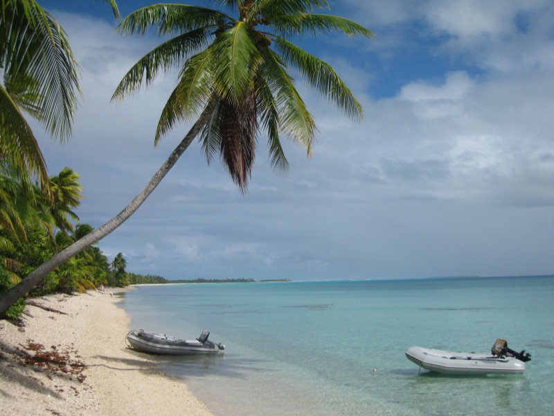
We then proceeded directly to our old anchor spot in the SE corner. See 'Lovely Lovely Tahanea' in May 2010.
After weeks of anchoring in groups of cruisers and lots of socializing, we are very very happy to be Alone At Last. I'm sure within a couple of days we'll be lonely and will be back on the net trying to get someone to stop in here and keep us company, but for now we are happy.
We plan to stay here until the eclipse on July 11th, and then take the first weather window after that to Makemo for supplies (hopefully in time for Bastille Day on July 14). We are still targeting arrival in the Marquesas for about Aug 1.
-----
At 7/6/2010 6:48 PM (utc) our position was 16°57.22'S 144°34.83'W
No comments:
Post a Comment