Showing posts with label Weather. Show all posts

Sunday, November 13, 2016

On Passage Again - Palau to Philippines

We are (so far... knock, knock, knock) having a great passage.

November is "transition season" where the summer monsoon transitions back to the winter northeast trades. It's this seasonal wind shift that makes the triangle we are about to complete--Davao to Raja Ampat to Palau and back to Davao--such an easy run, if you time it right.

November and December is also the time of year where the budding typhoons that normally sweep NW into the northern Philippines and Taiwan and Japan, sometimes get depressed by cold fronts and plow right through Palau, and into the middle Philippines. Instead of being a pretty safe season for hanging in Palau, and passaging westward to the Philippines, this can be a fairly hazardous time of year. We've had a series of developing lows marching west from the western Marshall Islands for the last month.

The November 1 Satellite Picture
(Red=Heavy Rain/Convection)

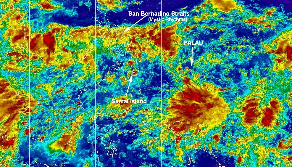
Our friends on Mystic Rhthms made the dash from Palau to the northern Philippines about 10 days ago, and we agreed to be their "eye in the sky" during their passage. About the only weather you can't get by Sailmail is a good satellite picture. But in the tropics, the satellite picture IS the weather. We had helped them find a weather window that would be able to sail most of the way. I was using the marvelous FastSeas.com website to check on the trip weather for about a week before we saw a likely window coming up. But we were so focused on the wind aspect that we forgot to pay attention to the "unsettled weather" aspect. Mystic Rhythms had wind all right...

Halfway through their 5-6 day passage the satellite picture was so convective that you almost couldn't see the ocean underneath the squally looking clouds. Richard said they had squalls almost the whole trip, with gusts to 40 knots. But they didn't have to motor!!

One of the old hands at the Bottom Time Bar at Sam's Tours in Palau was looking over my shoulder at the satellite picture and said "We're going to have a typhoon soon." And he was right--a day or so later, one of the passing Lows spun up into a full blown typhoon. Even though it passed well north of Palau, it brought some terrible weather for a week or so. The only direction that the protected Sam's Tour's mooring field ISN'T protected is from the southwest. This typhoon dragged a long monsoon trough behind it that brought 30-40 knot squalls from the SW for several days. Fortunately, we'd decided to go out for a last trip into the Rock Islands, so we were in a protected hurricane hole when the worst of it came through.

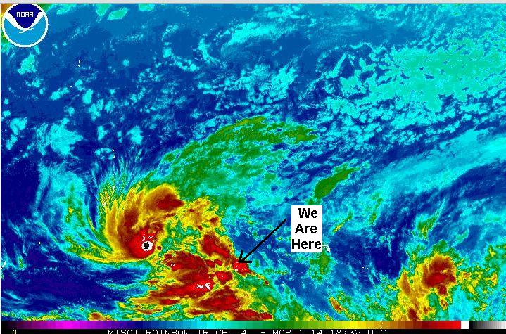
Anyway, we had decided several months before that we'd start looking for a weather window to head back to Samal around the 1st of November. The historical data (OpenCPN Climatology plugin) showed a good chance of NE winds after about the 10th of November. So we watched and waited, and as soon as the typhoon cleared away to the north of us, we decided to go. But wait... another Low popped up between Mindanao and Palau...hmm... which way was it going and was it going to develop??

Bottom line was, it looked like the Low was going to inch northward, and NOT develop. If we got going, we could scoot south of it and avoid the worst of the squally weather. We delayed our departure a day to let it drift a little north, and to let the big seas kicked up by the passing typhoon subside. And then we left...

With all that said... the unsettled weather season, more Lows building into typhoons behind us, etc etc, we have had a GREAT passage. We left with SW winds (which would be right on our nose), but the FastSeas.com weather routing algorithm routed us NW out of Palau, to go up and over an adverse current stream, and then had us motor through the light air in the wake of the Low, and after that it would be smooth sailing. And that's exactly what happened. The first day we tacked once to avoid a squally looking bunch of clouds, but after that we've had sunny skies and smooth sailing. We motored about 7 hrs in light headwinds, and then right on schedule, the wind switched to the NW and we could sail again. We have had one light sprinkle of rain that lasted just long enough to close down all the hatches, but no squally weather.

We are now smoking along with wind aft of the beam, and a 1-knot following current.

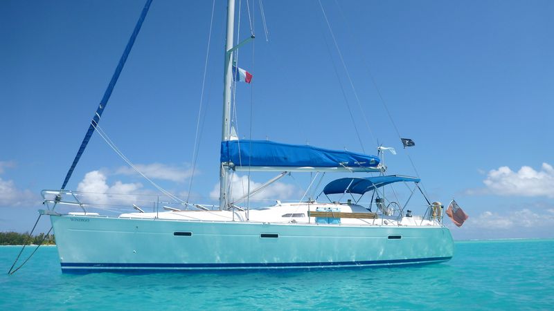
Our new Soggy Paws loves to sail in light winds. We've had nothing over 15 knots, and most of it has been in the 10-12 knot range. She's fast and comfortable on just about any point of sail.
-----
At 11/12/2016 11:45 PM (utc) our position was 06°30.35'N 126°37.66'E

Sunday, March 2, 2014

Waiting for Weather

TROPICAL STORM (TS) 03W (FAXAI) HAS TRACKED NORTHWARD AT 05 KNOTS OVER THE PAST SIX HOURS. ANIMATED ENHANCED INFRARED IMAGERY DEPICTS A CONSOLIDATING LOW-LEVEL CIRCULATION CENTER (LLCC) WITH IMPROVED DEEP CONVECTIVE BANDING WRAPPING INTO THE LLCC. A COMPOSITE IMAGE DEPICTS A MICROWAVE EYE FEATURE WITH MULTIPLE DEEP CONVECTIVE BANDS, PRIMARILY OVER THE NORTHERN SEMI-CIRCLE, WRAPPING INTO THE CENTER. THERE IS HIGH CONFIDENCE IN THE CURRENT POSITION.

Typhoon Faxai Brewing Up


TS 03W REMAINS UNDER COMPETING STEERING INFLUENCES, NAMELY, THE WEAK SUBTROPICAL RIDGE (STR) POSITIONED TO THE NORTHEAST AND THE NEAR-EQUATORIAL RIDGE (NER) POSITIONED TO THE SOUTH. THEREFORE, THE SYSTEM IS TRACKING SLOWLY.

NUMERIC MODEL GUIDANCE IS IN FAIR AGREEMENT, HOWEVER, FORECAST CONFIDENCE REMAINS LOW DUE TO UNCERTAINTY IN THE SHORT-TERM MOTION.

We originally planned to check out of Pohnpei Friday, stay the weekend at Ant Atoll (25 mi SW of here) again, and then leave when this weather moved off. We are headed 270 miles SW of Pohnpei to a tiny atoll called Lukunor or Lekinioch.

Well that half-formed tropical system has been sitting just west of us for over a week. At first, every day's new Grib file would show it organizing, picking up speed and intensity, and moving off toward the NW the next day. But it's now a week later and it is still sitting in almost the same place. A big cold front swooped down and blocked it from moving NW. But now the cold front has gone and it's still sitting there.

But they did name it (a weird name--Faxai) yesterday, and the Joint Typhoon Warning Center has gotten involved in the forecasting. So we are hoping Faxai will really move off tomorrow so we can get out of here!

Here's a link if you want to keep track of what's happening via satellite photo:
http://www.ssd.noaa.gov/mtsat/wcpac/flash-rb.html

(of course, if you are reading this next week, this won't show the typhoon, but our CURRENT weather! However, a still shot is above.

The only problem is, as soon as Faxai moves safely away, there won't be any wind left :P

If you want to read about the area we'll be cruising in in the next couple of months, we have published a fairly complete Micronesia Compendium (a PDF file), gathered from internet research and from inputs from other cruisers ahead of us--there is no cruising guide out here. You can download a free copy from here:

http://svsoggypaws.com/files/index.htm#north-pacific
-----
At 03/01/2014 7:20 PM (utc) our position was 06°57.75'N 158°12.06'E

Saturday, December 15, 2012

No-Surprise Cyclone Evan

For almost a week now--ever since our friend Curly in Savusavu sent us an email warning about a possible Cyclone developing near Fiji--we have been watching what is now Tropical Cyclone Evan develop.

Tropical Cyclone Evan Over Samoa, Heading for Fiji
Forecast Map Courtesy the US Navy Joint Typhoon Warning Center

In the map above, the black line is where Evan has already been, and the magenta line is the forecast track.

Originally, Evan was heading NE, away from us, and toward American Samoa (see Pago Pago on the map). But the GRIB files (the only thing forecasting the development a week ago) showed it turning around over Samoa and heading right back toward Fiji. Originally, the forecast had Evan passing well to the east and south of Savusavu, where Soggy Paws is. So we were watching Evan develop, but were not too worried. However, yesterday's forecast picture showed TC Evan going right over where Soggy Paws is, at nearly 100 knots!

Current IR Satellite Picture of Evan Over the Samoan Islands
Courtesy the NOAA Satellite Information Service

Fortunately, this morning's forecast has moved the track further north still, and it looks like it will pass far enough away that it will be an "exciting event" rather than a total disaster for Fiji (and Soggy Paws).

Now that we're not totally scared about what might happen, all we have to do is figure out how to get back to Soggy Paws most efficiently. Our existing reservations take us from Atlanta to LA on Saturday afternoon, and then overnight from LA to Fiji, arriving just about the same time as Evan!! (We cross the dateline going back, so after much head-scratching, we have figured out that we will be landing in Fiji Dec 17 at 0600 local Fiji time, which is the same as Dec 16th at 1800 UTC).

So the question is... do we hang in Atlanta til the coast is clear?? We are with family (who we haven't spent enough time with anyway), we have a nice place to stay, and we have a car. But it means changing our discount airfare at a huge expense. (The LA leg is not with the same carrier as the Fiji leg, so it would cost double to change our whole reservation). Do we go ahead and get to LA, and then HOPE that the Fiji flight is going to go--getting stuck in LA could be as expensive as changing tickets!

Air Pacific said they would notify us about 24 hours in advance whether they planned to go on schedule or not. If THEY cancel, then we don't have to pay a ticket-change fee for their flight. Also, a good cruising friend (Bill on Solstice) emailed us and offered a place to stay in LA near the airport.

Ha ha, this is why I LOVE cruising. I don't even know Bill's last name. But, we have been cruising together, talking on nets, sharing information, sometimes sharing anchorages, etc. for the last 2-3 years. We now consider him a good friend, and he obviously feels the same way. And the place to stay he is offering doesn't even belong to him, but is a boat owned by someone else (where HE is staying in LA right now). So Bill has gone to bat for us with his friend.

Anyway, I think our current plan is to go ahead and go to LA, unless Evan takes an unexpected turn toward Fiji. It looks like there is now a reasonable chance that our Air Pacific flight WILL go on Saturday night as scheduled, and we'll beat the storm into Nadi airport in Fiji.

Then our second challenge is actually getting to Soggy Paws. The international airport is on Viti Levu (the lower left island in the picture above). Soggy Paws is in Savusavu on Vanua Levu (the elongated island where the big red arrow is pointing). It's a $150 airplane flight or a $70 overnight ferry ride to get from Nadi to Savusavu. We have reservations on the ferry going the same night we arrive. But now it looks like the water will be too stormy to risk going in even the newest ferry that Fiji has to offer. So we'll have to figure out where to stay in Viti Levu for a night or two until the sea calms down enough to make the ferry ride comfortable and safe.

Here is where yet another 'I love cruising' comes in. We have another friend, who is staying on yet another friend's boat in Vuda Point Marina on the west side of Viti Levu. She has offered us a place to stay for a couple of nights if we need it.

And we haven't even bothered (yet) checking up on the possible available resources like the SSCA Cruising Stations for LA and Fiji.

And finally, we are not too too worried about Soggy Paws in Savusavu (especially not now that we don't expect to get a direct hit), because another cruising friend, Jerry on Challenger, is on the mooring next to us. We have been talking daily with Jerry via Skype, and Jerry is watching out for us. We prepped Soggy Paws pretty well before we left, but there are still a few things that need doing before we get high winds. Jerry has been making sure the 2nd mooring line is properly hooked up, hatches dogged, solar panels secured, the last bit of canvas down, etc. (He is paying back what we "paid forward" looking after his boat in Fulaga a few months ago).

We are in Atlanta, mostly packed, and leaving tomorrow. I CAN'T WAIT to get back to the boat!

Wednesday, November 28, 2012

Where's Windigo?

We were recently contacted by the owners of the vessel s/v Windigo.

Windigo, Abandoned at Sea
Last seen at 24-49.3S / 179-49.2E

I don't have full details, but Windigo was abandonded at sea a few weeks ago in a bad storm on the way from Tonga to New Zealand. The crew were injured in the knockdown, and were ultimately rescued by a passing freighter. But it seems that Windigo is still floating. Here is the email we have received:

Recently Steve & I (Tania) were on passage between Tonga and New Zealand and we were hit by a severe storm and rolled, we sustained a fair amount of damage to our home of the last 3yrs. She has no steering (possibly), no bilge, no battery (possibly..as we left the motor running) no lights, and a broken starboard hatch. SHE CAN SAIL all rigging and sails in excellent condition.

We are uninsured (unfortunately) and would love to see her again!!!

Windigo was last spotted on 17 November 2012

Position
24 degrees, 49.3min South
179 degrees, 49.2min East

SSR 141391 ON STERN

Windigo has a British flag and she has her dingy and motor still on board
Her Dodger is gone but the frame is half there.

Her HATCH needs to be closed, if anyone gets close enough to her.

Our bilge pump broke down during storm, so we are worried about more flooding.

If anyone spots her, please email us on sywindigo@hotmail.com

Steve & Tania are now in Auckland, heading to Opua Northland, to THANK the most amazing people Bruce & Marcelle on sailing yacht ADVENTURE BOUND who came to our side risking their own lives, we will be forever grateful. And of course Orion NZ Rescue Airforce,The NZ Navy and CAPT Norman Mc Nee, who all played a vital part in our continued future.

Thank you
Tania & Steve
s/v Windigo
sywindigo@hotmail.com

Windigo, Abandoned at Sea

Tania & Steve from s/v Windigo


You can read a little more on the incident on this BBC online account

In googling for some background on the incident, it seems that the "looking for our boat" has already been widely reported in the sailing news circles (Noonsite, Cruiser's Forum, etc).

Saturday, April 28, 2012

Rag of the Air Net - 8173 at 1900z

For those of you getting ready to get underway from various locations in the SW Pacific, don't forget about the Rag of the Air Net, on SSB at 8173 USB at 1900z (7 or 8am local time in Tonga/Fiji/Samoa/NZ). We're on this net every day, and would be happy to assist with weather info, shore communications, etc. Normally, we take check-ins around 8-8:15, and then we do the weather in the SW Pacific.

The net control is Jim on Also Island, on the northern coast of Vanua Levu in Fiji. He is sometimes light and difficult to hear, but there are boats in NZ and Tonga/Fiji who can help relay for you.

If you are getting ready to go on passage, Jim would prefer that you send an email to him to give him your boat name and info, crew info, and passage plan. That way when you check in, there are fewer questions. But if you've not done this, please check in anyway. Jim's email address is WDC7994 at Sailmail dot com.

Tuesday, April 3, 2012

Dodged Daphne

Out of the messy 'South Pacific Convergence Zone' that has been hanging over us for about 10 days (ever since the MJO arrived), has finally emerged a 'named tropical storm'--Cyclone Daphne.

Daphne Headed South, Away from Us

The funny thing is that OUR weather has been pretty nice the last few days. Daphne and the low that preceded her have been hanging out over our friends from Zephyr, in western Fiji..about 500 miles to the west of us. They have been inundated with rain, and Fiji has some really hard-hit flooding areas.

Right now our wx is beautiful... light winds and sunny skies. And Daphne is headed southeast, headed for our friends in NZ now!!

I watched another beautiful sunrise in the cockpit this morning, and thanked my lucky stars... for good weather... for a good life... for good health... for a good husband... for good friends, etc. It doesn't get much better than this! (and for you too, Bryan)

Sunday, March 25, 2012

Uh Oh, here comes the next MJO!

We have learned a new weather buzzword sitting here in Tonga during cyclone season... the MJO. We're not sure why we've never heard of this phenomenon, because it does appear to have a big effect on tropical systems brewing up, and it does seem global. From what we understand, the Madden-Julian Oscillation is an area of 'disturbed' weather that slowly circles the globe, around the equator. It comes around about every 40 days or so. I am sure our Florida Hurricane forecasters are watching it during Hurricane Season, but are probably calling it by another name. In the SW Pacific, they call it the MJO.

The last time the MJO was in our area was when Cyclone Cyril popped up overnight, and then was followed a few days later by very strong Cyclone Jasmine. We've been watching the MJO forecast as the wave of wet weather has circled the globe, and knew it was due in our area again soon. Some links are provided below.

A 15-Day GFS Version of the MJO Forecast

One version of the forecast is a series of strip charts. Each chart is a (very small) flat graphic of the world. The top one is the current status. The succeeding ones are forecasts, advancing every 5 days. The green areas of the chart shows the 'rainy weather' that helps brew up the cyclones. It probably causes less than fine weather in the tropics whenever it passes over, and helps spawn cyclones/hurricanes during the Season. The brown areas show dry weather, where it's likely to be more stable weather. It could be a good long-range planning tool for the sailor in the tropics!

Well, the MJO is almost here in the SW Pacific. Today's 10-day GFS forecast (aka GRIB file) shows no less than 4 1000-MB or less Low Pressure areas forming north and west of us, and heading our way. One, spinning up near Vanuatu (off the East coast of Australia), on April 3rd, is down to 975 Mb. That's a pretty deep low. So we're on high alert. We probably won't be doing much diving in the next 10 days!

The more I research this issue, the less I understand! The Weather Guessers are still trying to figure out how to forecast this phenomenon, so all of this is experimental. Below are some helpful links I have found.

40-Day EWP Version of the MJO Forecast

15-Day GFS Version of the MJO Forecast

(note that the 2 above forecasts do not agree)

Australia's MJO Page

Global Tropical Hazards Outlook - This one is my favorite because I understand the graphics and it tries to take into consideration all the wx factors (ENSO, MJO, SOI, La Nina, El Nino, etc)
-----
Hanging out in Tonga for cyclone season!
At 03/24/2012 8:12 PM (utc) our position was 18°42.83'S 174°02.52'W
http://svsoggypaws.com/currentposition.htm