Showing posts with label Raiatea Tahaa. Show all posts

Thursday, July 21, 2011

Motu Nao Nao, Raiatea

After a quick jaunt in to see the marae, we picked up anchor from our 'pinnacle' and motored SE around Raiatea. It was a beautiful sunny day with light wind. We hooked up the watermaker and made water all the way to our next stop--Motu Nao Nao on the southern tip of Raiatea.

The West End of Motu Nao Nao

We had heard from others that this was a nice spot, and we were glad to find it was even better than expected. You would think that by now, anchorage off a nice beach would be pretty ho-hum. But really, it is not. Though French Polynesia is beautiful, it really is lacking in nice sand beaches. Many that look sandy in the pictures really are crushed coral and not so nice to walk on.

The West End of Motu Nao Nao

But, my was it shallow in the anchor spot we had from our friends on s/v Nakia! But Nakia has a slightly deeper draft than we do, so we knew that if they got in there, we could too. We had to stall a bit out in deep water until we got full sun to see our way in. We could tell visually that the water went from 'very deep' (over 100 feet) to 'very shallow sand' (under 10 feet) in the space of a boat length.

As an aside, our depth sounder has been acting wonky lately--we're still trying to figure out what happened to it. It reads OK in depths from 10 feet to 90 feet, but gets messed up in shallower or deeper water. We can live without the deeper water readings, but not having an accurate sounding in shallow water is nerve-wracking.

So we edged slowly up to the sand bank, with Dave on the bow with his polarized sunglasses on, and me in cockpit reading off depths. Once we got on the bank, the depth sounder was flashing again (grrr!). But occasionally it would stop flashing and display around 8 feet. So we were on, not aground, and it looked like the sand was about the same depth around us. So we threw the anchor out in the lee of the little motu, just off the nice sandy beach, and I jumped in to sound the water around us. Feet on the bottom, hand in the air--if my hand is under water, it is over 7' deep. Fins outstretched adds another 18 inches. So we were in 8-10' of water--plenty of depth for Soggy Paws' 5.5 foot draft.

Ahhh!! Beautiful! Unfortunately, this spot is on the charter boat circuit, so later in the day, two other boats came in and dropped anchor near us. But we knew they would only stay overnight. Though we only planned to stay a day there, we ended up staying two. That meant we would have skip a spot on the west coast of Raiatea for the next anchorage (to stay on the rough schedule we had worked out). But it was worth it just to rest for a day and catch up on laundry and small chores.

The wind was still blowing in the 20 knot range, and forecast to continue to do so for a couple more days. But west of Motu Nao Nao, all was tranquil. We were out of the wind, out of the chop, and anchored in deep sand. We felt fortunate that we were in such a comfortable spot, when we heard our friends on the radio talking about the conditions in their anchorages.

The snorkeling on the coral heads out behind the boat, and ahead to the right, was pretty darned good for this part of French Polynesia--the best we have seen since we left the Tuamotus.
-----
At 7/20/2011 6:29 AM (utc) our position was 16°55.15'S 151°25.91'W
http://svsoggypaws.com/currentposition.htm

Wednesday, July 20, 2011

Anchored on a Coral Pinnacle

July 18 - Marae Taputapuatea, Raiatea

Marae Taputapuatea

By the time we got out of the river, it was close to 2pm. We made a quick stop at the house of the guy who helped Dave with the dinghy in the morning, to drop off a few presents (fishing lures, and a stuffed animal and alphabet book for his son), and then picked up anchor. We really didn't want to spend another night in the wind tunnel.

Our friends on Endorfin were anchored 5 miles away off the Marae Taputapuatea (Polynesia religious platform). They said they were in a 15' foot deep sand spot and the conditions were OK. They said there was another sand spot that looked good just next to them. So we headed out there. It turned out there were 3 of these 'sand spots'. Another boat had taken the bigger one next to them, and there wasn't room for us to anchor there too.

So we went to the 3rd spot and looked it over. The depths went from 100' to 65' to 15' in about the length of Soggy Paws. The water was very clear and we could see everything on the top. It looked like good sand with only one low coral head. So we dropped the anchor somewhat toward the windward side of the sand spot, in the middle (left and right-wise). We backed down hard, and it seemed to be holding fine. So I donned mask and snorkel and went to look at the set. If we dragged off the pinnacle, there would be no-resetting.

Nope--that 'sand' was NOT sand, but white-colored sheet rock. We had only about an inch of the point on our 88 pound Delta anchor in a small hole. Definitely not good enough. I criss-crossed the top of the pinnacle and there wasn't 10 grains of sand on the whole thing. But, there was a very nice ledge, that, if I could... just... drag... the... anchor... Nope--I could easily drag Island Time's 60 lb anchor and 50' of chain around, but this beast (with 150' of chain out) I couldn't budge.

So I swam back and told Dave we had to move the anchor about a boat-length further to windward, and drop it just off the edge of the pinnacle. That sounds easy--clear water, and we're hardly moving it, but with the 20 knot winds, it was hard getting into just the right place. The next time we dropped, we were just literally 2 feet short, and the next time only about a foot short (Dave didn't want to drop it over the abyss, so he was a little short each time). Each time, I had to jump in the water and go visually check the anchor. Finally on the 5th time, we got it over the ledge and the point and the whole fluke area were set well into a nook. And honestly we weren't screaming at each other. We both knew how important it was to get it right, and how difficult a thing we were trying to do. Fortunately, with our big strong electric windlass, it wasn't too much of a chore.

We still spent a somewhat uneasy night, with the wind still blowing 20-25 knots (but fortunately not gusting to 40 like the previous night). We have our old Garmin GPSMap 76 hand-held GPS mounted in our cabin, and had it on and zoomed in, and the anchor alarm set. I could sit up, turn on the backlight, and verify we were still in the right spot, without hardly waking up.


In the morning, we felt comfortable enough with our set that we dinghied ashore and walked around the Marea for an hour or so. This is an extensive group of stone platforms--the largest and most sacred in the Society Islands. There were some nice plaques in English, with illustrations, describing the marae, their purpose and construction, and a little about the social structure in the Societies. Because the Polynesians never had a written language, most of what we know of their history comes from the detailed accounts from the first explorers, especially Captain James Cook, who made 3 trips to French Polynesia. It was interesting to note the footnotes on the sketches on the plaques--one was drawn by Captain William Bligh, and most were done by Webber, one of Captain Cook's 'resident artists', who were carried on board just for such documentation of culture, plants, and animals they discovered.


Also in the Taputapuatea area, they were holding an Agricultural Fair. We took some pictures of the strange stuff they had on display.


At 7/18/2011 3:27 AM (utc) our position was 16°49.77'S 151°21.59'W
http://svsoggypaws.com/currentposition.htm

The Faaroa River Trip, Raiatea

We did finally do the Faaroa River trip. Some friends who had met James, the guy who gives the free 'Botanical Gardens Tour' by kayak, the day before, had told him we were coming.

At the Botanical Gardens

So he paddled out to our boat to let us know he was there. We told him we were coming in soon. He said he'd go back inside (it was still blowing 20-25 kts out in the bay), but he made sure that we knew the way in over the river bar... between the two sticks and then to the left of all the dead tree trunks.

Following James in the River

On the way in, we kicked our motor up partway, and I sat on the bow of the dinghy dipping with the oar. It got down to about 2 feet at one point, but deepened quickly again after we were over the bar. Once in the river, the water clarity was good enough that we could see the shallow spots.

Another Dinghy Adventure

James met us just inside the river and motioned for us to follow him. We never did quite figure out James' role in the river and the 'Botanical Gardens'. His command of English is limited, so we had a hard time asking him questions other than about the plants. And sometimes the answers to THOSE questions were only partially understandable. But nonetheless, he made sure we stayed in the deep part of the river, and took us all the way to the end. Then we backtracked a little to a small side canal, where we parked the dinghy and went walking through the 'gardens' with him.

Cat's Whiskers

It was a fantastic array of native tropical plants, from vanilla beans to star fruit, and including things like baslil, tiny Polynesia chili peppers, citrus trees, taro, coconuts, and many flowering plants. For each plant, he stopped and gave us the Polynesian name as well as the common English name, and then explained what its uses were in the islands.

Ginger?

Many of the flowers and variegated plants were in the garden because they looked good on Polynesian dancers, or smelled good, or made baskets, or...

James Gets Us a Coconut

At the end, James cut us down a stalk of bananas and climbed a coconut tree Polynesian style and threw us down a couple of coconuts. If we had wanted (according to other cruisers) we could have purchased from one of the local farms, fruits and veggies as a very reasonable price. But we had just stocked up, and were only lacking bananas.

Sherry & James

We gave James a 'gratuity' of 1000 CFP (about $10) for his time and the bananas, and felt it was well worth the time and money.

At 7/18/2011 3:10 AM (utc) our position was 16°49.07'S 151°24.87'W
http://svsoggypaws.com/currentposition.htm

Tuesday, July 19, 2011

The Amazing Flying Dinghy

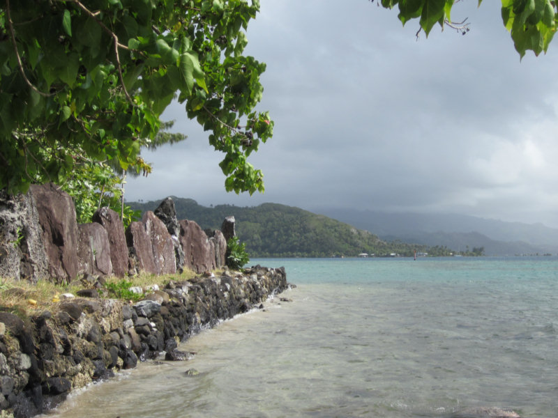
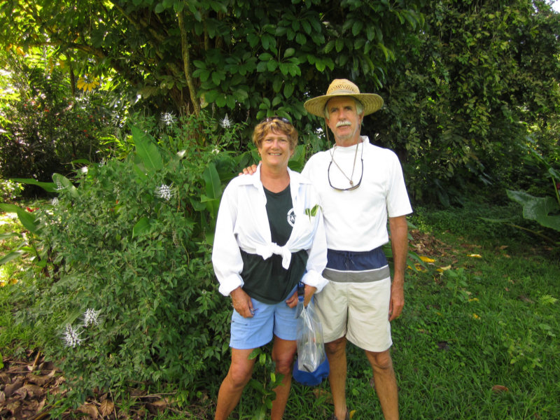
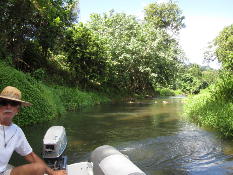
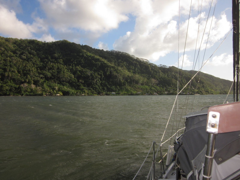
We are on the 10 day plan for Raiatea/Tahaa. Dave has read all the guidebooks and wants to do 'everything'. The first stop was the bay of Faaroa, a long narrow bay directly shoreward from the Passe Iriru Ou Maire. The attraction here is a trip up the only dinghy-able river in French Polynesia. Previous cruisers have written about making this dinghy trip and receiving a 'botanical gardens tour' and copious fruits and vegetables, while up the river.

I wasn't so sure this was a good idea. With a NE wind blowing 20 knots into a NE facing bay, opposite a break in the reef... and the bay goes from 100' deep to 60' deep to 25' to 5' in the space of 100 yards. Didn't sound that good to me, but Dave really wanted to do this river trip, so in we went.

It took us twice to get properly anchored. The first time we congratulated ourselves on finding a 25' spot to drop the anchor. But once things settled out, with the proper amount of scope out, we were just touching the 5' (or less) spot. I could feel our rudder bump on something occasionally.

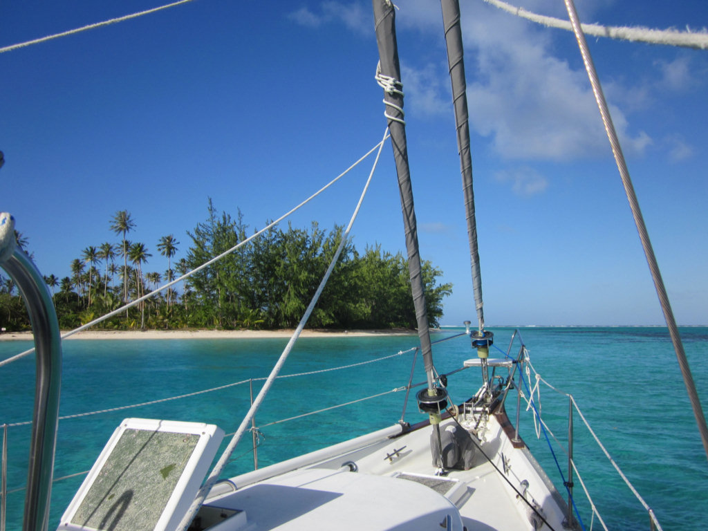
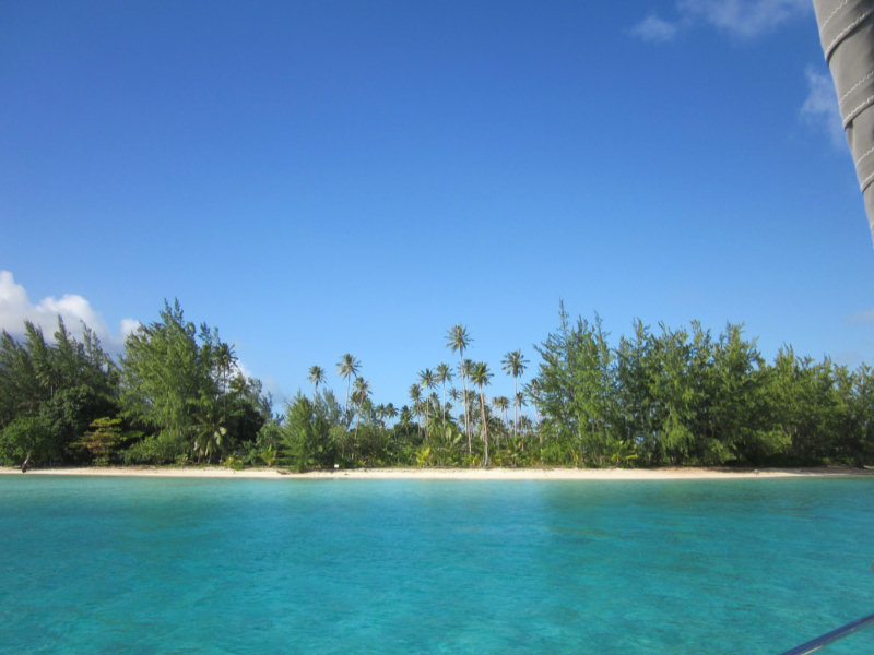
Our Windy Lee-Shore Anchorage

So we pulled it all in, and re-anchored further out. But with such a steep slope, and the need for appropriate scope, we ended up having to drop the hook in 60' of water... and still were only a couple of boatlengths away from the 5' shelf. But we backed down hard, and knew we were hooked up well. We set our anchor alarm (an old Garmin GPS mounted in our bunk where we can hear it), and went to sleep.

The wind increased during the night from 20 kts to 25 with gusts. We kept a close eye on the GPS but felt we were securely anchored, and were mostly sleeping. Then at 4am, I heard this 'whump' sound. Hmmm, wonder what the heck that was? I looked out our porthole on the side of the bunk and there was our dinghy floating past, shining bright in the moonlight. "Dave, there goes our dinghy!" And he says "Oh shoot, I untied it yesterday afternoon, thinking we were going to launch it right away." The 40 knot gust had somehow gotten under our dinghy, which was stowed for sea upside down on the foredeck, and flew it completely free of our boat, almost without touching anything else onboard, and landed it upright in the water with a "Whump". Wow! The power of the wind!

We scrambled out of bed and went up in the cockpit to watch our dinghy sailing away downwind in the moonlight. We didn't even need a spotlight to watch it go! The wind was blowing really hard, so thoughts of jumping in after it only lasted a microsecond before sanity took over. Fortunately, fortunately, we are in this nice cul de sac, and we were fairly certain that the dinghy wasn't going very far. What more could we do but go back to bed and wrestle with dinghy rescue plans in our sleep? (And, of course, Dave spent the rest of the night kicking himself for not at least clipping the bowline to the lifeline). (We both were thanking our lucky stars that we didn't have 2,000 miles of open ocean behind us that night).

The big problem was, for recovering it, that the wind forecast was not good--we expected 20-25 knots for the next 3 days. We have kayaks aboard, but they are really lightweight inflatables--not suitable for going anywhere in 20 knots. They are barely usable in 5 knots. And, in only the second anchorage since we left Hawaii in April, there were no other cruisers in the anchorage with us.

As soon as it got light enough, I went out with the binoculars to scan the shoreline. I expected to be able to see it easily behind us, but no sign of the dinghy!! Our white RIB should show up against the trees like a neon sign. I finally roused Dave. He didn't see it either. So we discussed search and rescue options. We finally settled on digging the inflatable kayaks out of deep storage under the V-Berth, and sending Dave out in one kayak and a handheld, to look for the dinghy. Since we were in a cul de sac, the worst thing that could happen was that he'd get blown ashore and have to swim back out.

Dave Sets Out in the Kayak

I was to stay aboard and try to contact friends on the HF radio, in case we needed help, but also stand by with the VHF and the second kayak in case Dave needed help.

Before he launched out in the kayak, Dave took one last look with the binocs, and thought he saw the dinghy under the trees behind us, at the water's edge. We felt that even though he couldn't tow the dinghy back with the kayak, he should be able to walk along the shore with it, to some houses off our beam, and either row back from there, or get help from people on shore.

So Dave set out in our very light blow-up kayak in 20-25 knots of wind. (Unfortunately, I forgot to take a picture until he was too far away). Meanwhile, it was time for the SSB net, and I got on and made contact with our friends on Endorfin, only 5 miles south of us. We confirmed that we were close enough for VHF contact, and they volunteered to come help, if we needed it. But I told them to hang out for awhile--I thought we could handle the rescue ourselves.

And sure enough, within a few minutes, Dave had extricated the dinghy from the swampy area under the trees, loaded the kayak in the dinghy, and was wading alongshore towing the dinghy. He got to a point 200 yards abeam of Soggy Paws, at someone's house with a small dock. While he was tying it off, a woman came out, and I could see him trying to explain, in Polynesian, how the dinghy flew off in the night, and that the wind was blowing too hard to row the dinghy back to the boat. A few minutes later, she came back with her brother who at first offered to help Dave paddle out. Then as they stood there and watched the wind blow, the final solution was to get a motor boat and tow Dave, the dinghy, and the kayak out to Soggy Paws.

This they did, and by 8:45 am, Dave was back safe and sound with the dinghy. YES! The only thing we lost permanently was our dinghy bimini, which had been resting on top of the dinghy. A pretty cheap price to pay for another new lesson. (Tie the dinghy down, mate!).

The ironic thing was that we'd had dinner a few nights ago with our friends on Dreamaway, who were celebrating recovering their old tiny Avon, which had blown off THEIR deck in the Marquesas. It had finally turned up at a Gendarmerie a few weeks later (after they'd left the Marquesas for the Tuamotus), and friends had loaded it up, and it had only just arrived in Papeete a few days before. We wondered how anyone could be so stupid as to let their dinghy blow off their deck...

At 7/18/2011 4:18 AM (utc) our position was 16°49.07'S 151°24.87'W
http://svsoggypaws.com/currentposition.htm