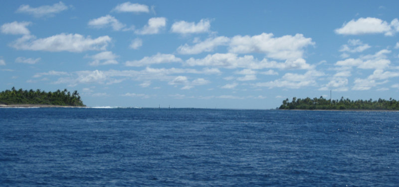
Our plotted course from Tahanea to Fakarava hugged the atolls as much as possible, trying to take advantage of the protection from the ever-present swell. (Light wind + large swell = hell). This course took us close along the coast of Faaite, another small atoll. We had about 5 miles of 'open ocean' between the west end of Tahanea and the east end of Faaite, which we crossed easily just at sunset. The wind was still OK, and we let the genoa out full, and we didn't roll very much.
When we got to Faaite, we stayed close (a little scary in the dark, but we were trusting our accurate charts, and checked occasionally our distance off with radar). We had just enough sail out to make 2.5-3kts. The plan was to lurk along the N coast of Faaite until we could bear off NW to Fakarava (11 miles away) and just make the slack current at daybreak at 6am. We were sailing in company with John and Linda on Nakia (svnakia.blogspot.com). (Pronounced Na-KEE-ah)
We met up with them in Tahanea and have enjoyed their company. We tracked their trip from Marquesas to Hawaii last fall, and their sail back to the Marquesas this spring, via the Pacsea Net. So we were glad to finally meet them in person, and have been able to talk extensively about their experiences wintering in Hawaii last year.
On my watch, it a pleasant sail and I enjoyed playing with the sails to try to match speed with Nakia. And keep from running into them--since we each only had a single light showing, it was sometimes hard to see when we were getting close together!!
Just at the time I turned it over to Dave, the wind died completely. We still had 15 miles to go and 7 hours til daylight and slack tide. And we were still in the lee of Faaite. So Dave rolled in the Genoa and lashed the wheel on centerline, and we just drifted west at about half a knot under the triple-reefed main. (The sailors are asking... "Why do you have a triple-reefed main in 10 knots of wind?" Our power sail is the genoa, and it's much easier to handle when sailing off the wind, and to change sail area. We knew we would be stalling, so we just left the triple reef in the main when we raised it.
At 3am when Dave turned the watch over to me, I turned on the engine and headed straight for our waypoint outside the pass, timing our arrival for 5:45am. The wave action wasn't as bad as we'd feared, considering that the big blow we had a couple of days ago was still blowing further south. It had turned into a long swell. We rolled a little, but not bad.
On arrival at our waypoint, it was just starting to get light enough to see. We circled once and wait for the sun to actually come up, and then went in close to have a look at the pass. Dave opted to circle again to give us better light for actually entering the pass. It was a little scary looking from outside, because the big swell was crashing on the beach on both sides. Dave could see enough to tell that it was NOT crashing in the middle. At about 6am we finally got the courage to enter the pass--we thought it was on the last of the incoming tide. Once we got fully IN the pass, we could tell the tide had turned and we had a little current against us (which turned into 2.5 against us by the time we got to the narrowest portion of the pass).
The trickiest part of the whole entry was trying to figure out where to go inside the pass. There is a range that you use to stay lined up while coming in. The range, when you get close, turned into red channel marks, which you put on your port side, and there are 2 green sticks ahead, which you put on your starboard side (passing between the range and the green marks). The pass splits then after the green marks. We had tracks from another boat that went left, but we knew that Visions was anchored to the right, so we went right.
Photos by Bill Strassberg s/v Visions of Johanna, from the Rigging
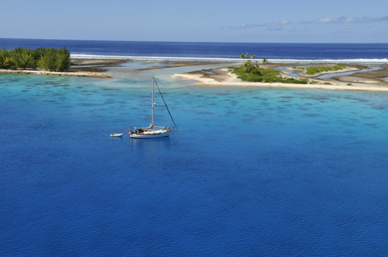
Though it is a lovely area, the north side anchorage turns out to be a pretty crummy anchorage. It is very very corally. When we circled around a couple of boats anchored in 25-35' ahead of Visions, we could see the bottom profile on our fishfinder was very erratic--lots of high-profile coral. Out further, in 50', there was less profile, and we could see small patches of sand. So we finally dropped anchor in 50', and did NOT set the anchor. I went down later with the tail end of one of our used SCUBA tanks to survey the situation, and was able to pull the anchor into a sand spot, and unwrap the chain from the worst of the coral. (old dead coral) Dave buoyed the last 100' of chain by putting a pair of buoys about 50' from the bow. It's not perfect, but it will hold if we need it to. We may have to dive to free the anchor, though, when we try to leave.
We're keeping a close eye on the weather, but for now, the forecast is for less than 10 knots for the next 4 days. (Of course, this was also the forecast just before the big blow we had a week ago).
We managed a drift dive in the south pass on the mid-day slack. (more on diving in another blog post).
-----
At 5/19/2010 7:36 PM (utc) our position was 16°30.28'S 145°27.36'W
Great stuff! Thanks for sharing! So latter did yoy find a nice anchorage close to Tetamanu? Or this is it? 50 feet over coral... I am planning to go there next year and I was wondering how challenging this anchorage is...
ReplyDelete