Thursday, March 10, 2022

Messing Around in Raja Ampat

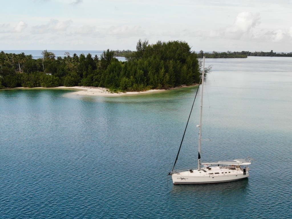
We made it to Raja Ampat, our 4th visit here since 2016.

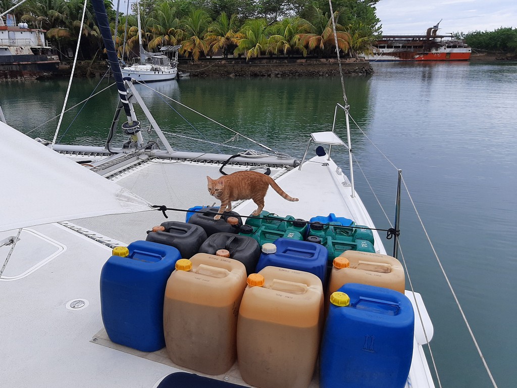
After 3 weeks in the boonies, the first order of business was getting re-stocked with food and fuel. So we decided to pull into the marina.

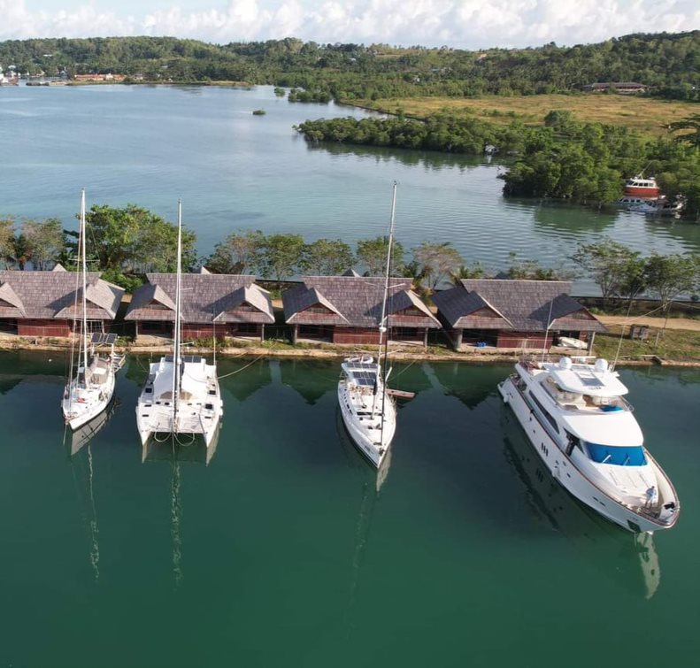
Early March: A Few Days at Tampa Garam:  We opted to go into Wick's Tampa Garam "Marina" on Feb 28.  We had been in there on our trip back from Papua New Guinea in 2019, and so knew what to expect.  This marina had been built as part of a resort complex that was no longer operating.

The Narrow Entrance to Tampa Garam Marina, Sorong

There are a few permanently based boats in the marina basin, but not much in the way of a real marina.  An ex-pat Australian named Wick (Warwick Alliston) who has 5 or 6 businesses in Sorong (the primary city in Raja Ampat) leased the space to accommodate visiting yachts.

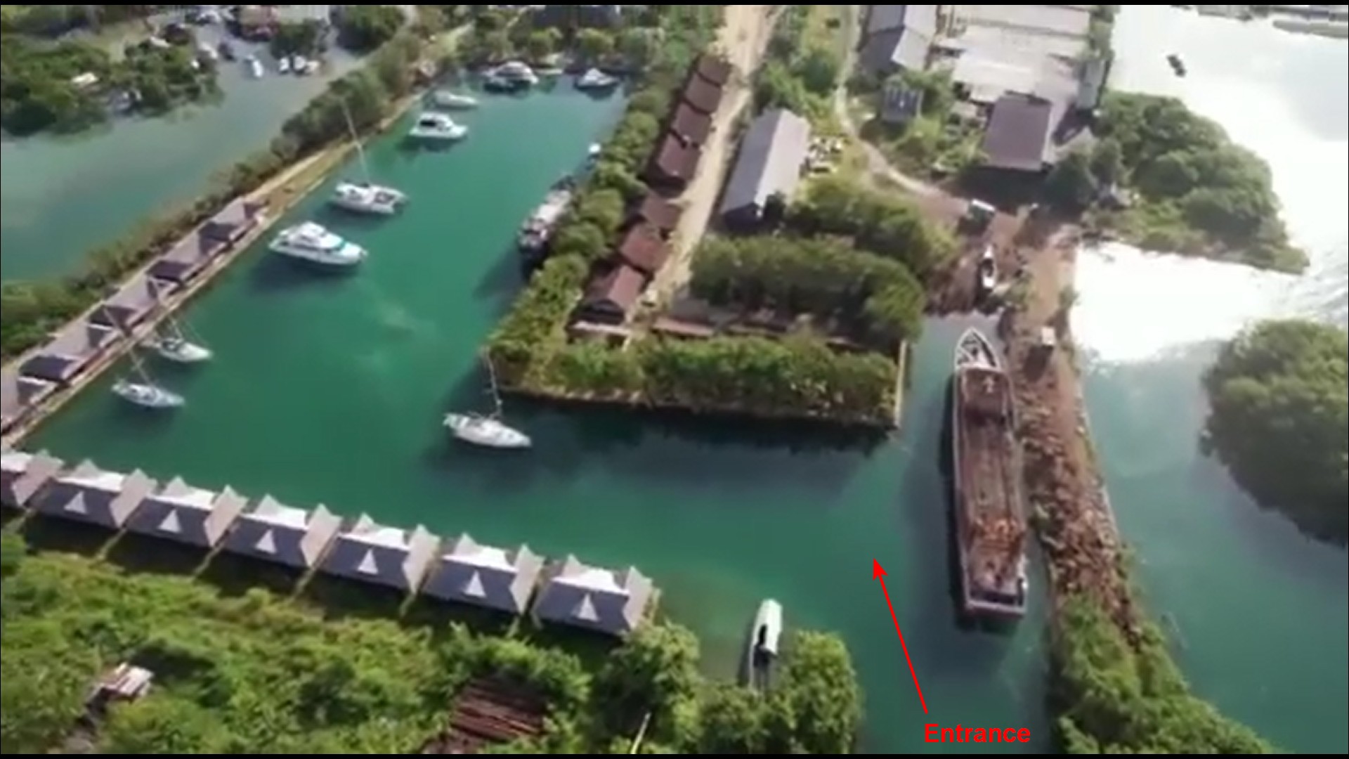
The entry is narrow and has a half-sunk ferry and a controlling depth of about 10 feet at high tide.  But Screensaver, with a 2.1m draft, got in with no issues at half tide. Contact Wick by Whatsapp, and he will arrange for someone to guide you in.  Ourselves, with a 1.1m draft, and having been in before, we went in on our own.


Wick's Contact Information

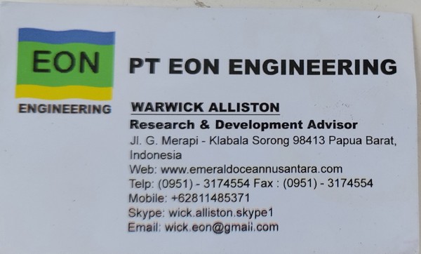
In addition to managing 2 marinas, Wick also does a lot preventive maintenance for the huge diving industry in Raja Ampat. Tanks, compressors, etc. Plus he knows every tradesman in Sorong, so can be a great source of who to go to if you have a boat problem.

All Settled, Mediterranean Style, in the Marina

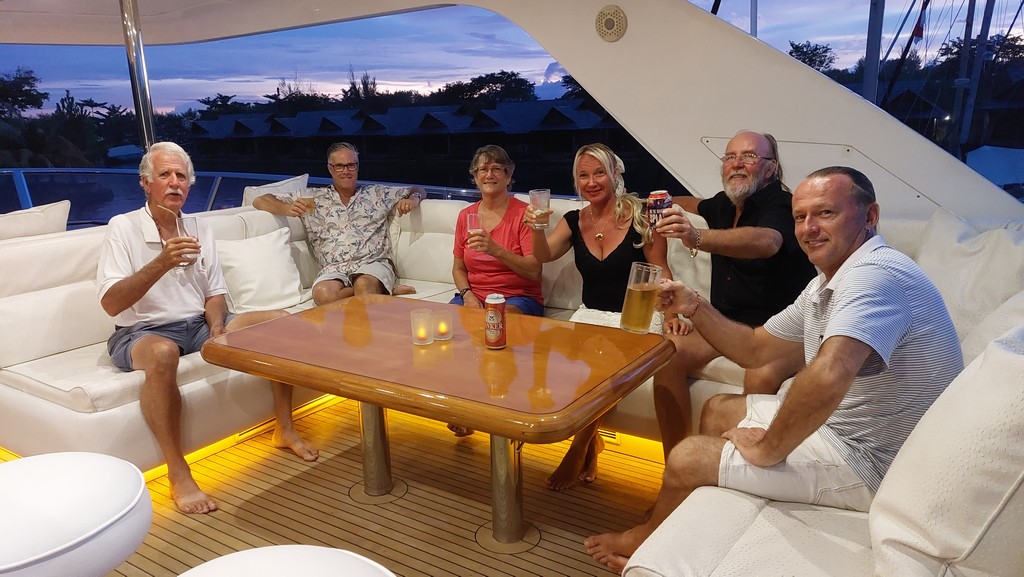
We were surprised to see a big motor yacht in at the marina. It turned out to be a guy I had been chatting with on FB Messenger--exchanging information on anchorages, etc. in Raja Ampat. He was appreciative of the extensive information we post on our website, and so invited all the cruisers (all 3 boats) aboard his beautiful yacht for dinner. Very nice guy, great staff, great dinner. They were on their way from the Philippines to take the boat home to Australia. We enjoyed hanging out with them for a few days.

An Evening Aboard the Yacht

There are no piers in the marina, just a nasty concrete wall with some tie-points.  So you have to med-moor... drop your anchor in the middle of the basin and gently ease backwards and toss your lines to someone on shore.  With our twin engines (and a dinghy or two standing by) it was no big deal.

The tide is about 6 ft in range, and the wall you are tying to is pretty broken, so everyone stands off a good 6-10 feet, and uses the dinghy to go ashore.  We didn't like tying our rubber dinghy to the nasty wall, so usually left it at the head of the basin on a small dock (careful not to obstruct others' use of the dock).

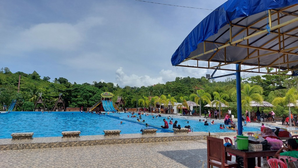
We arrived on a holiday weekend and the pool associated with the resort (which, unlike the resort, is open) was jam packed. We went one time, but never went back.

The Nice Pool at Tampa Garam

This marina isn't very convenient to the main part of Sorong--the route minibuses don't come all the way out to the marina.  The only solution is to take an Ojek--a motorcycle--to where the route minibuses turn around.  Or get Wick to arrange a taxi.  Air conditioned taxi rate about US $10 per hour.

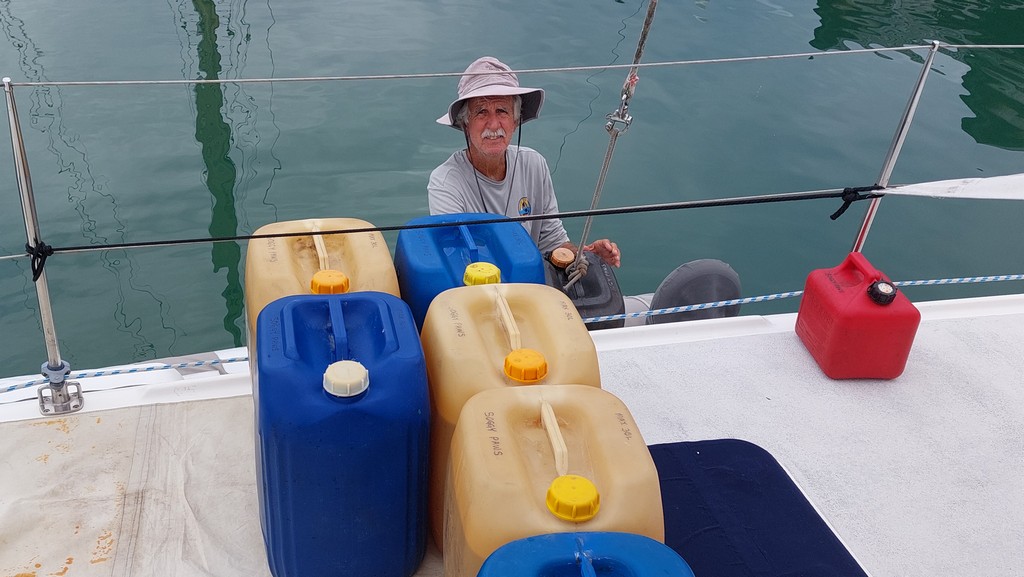
We organized a trip via taxi to drop me at the grocery store, and Dave take the diesel jugs to the gas station, and then pick me back up at the grocery store.

Jugging Diesel...Car to Dinghy to Foredeck!

Cats Supervising, of course

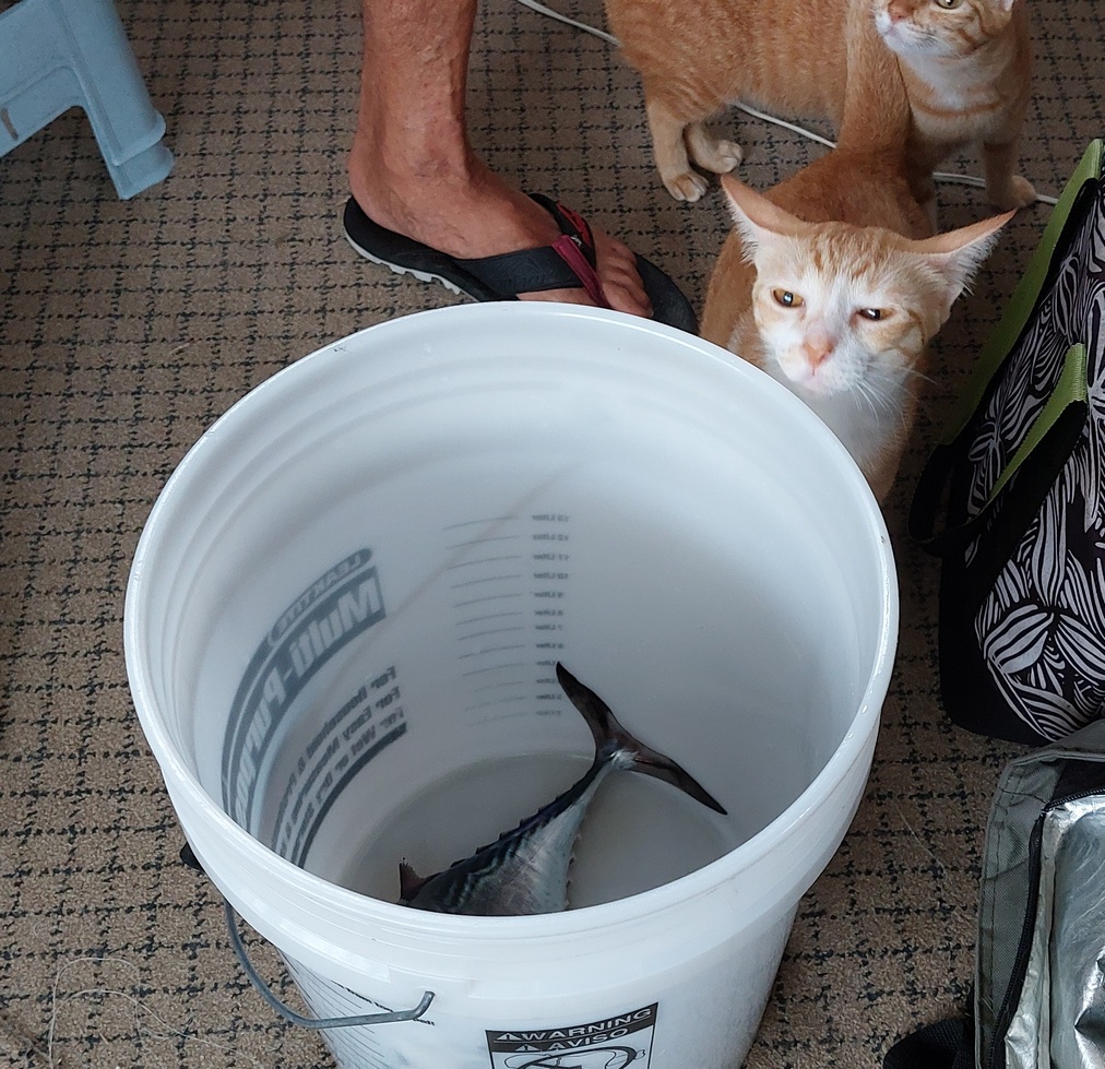
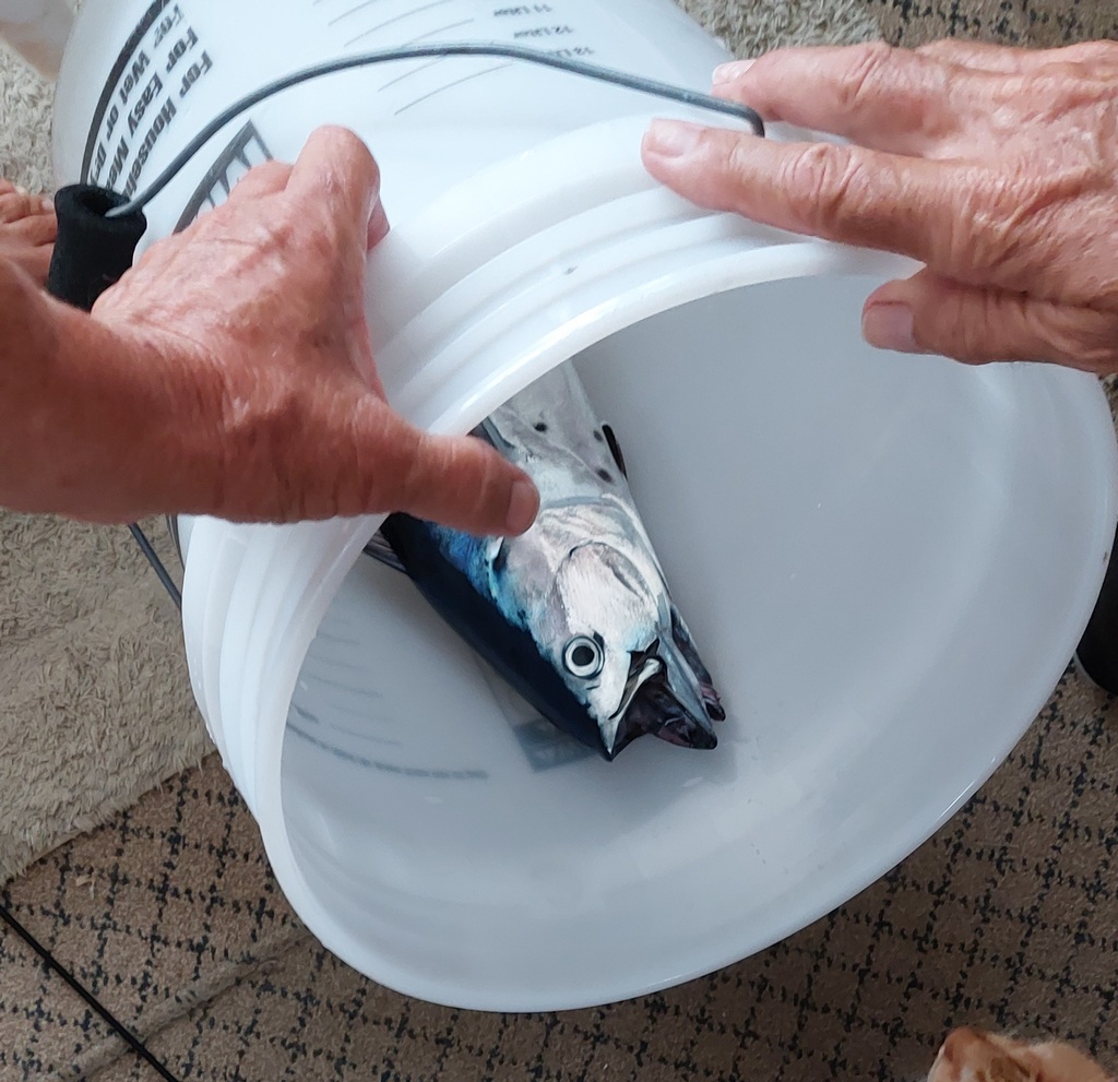
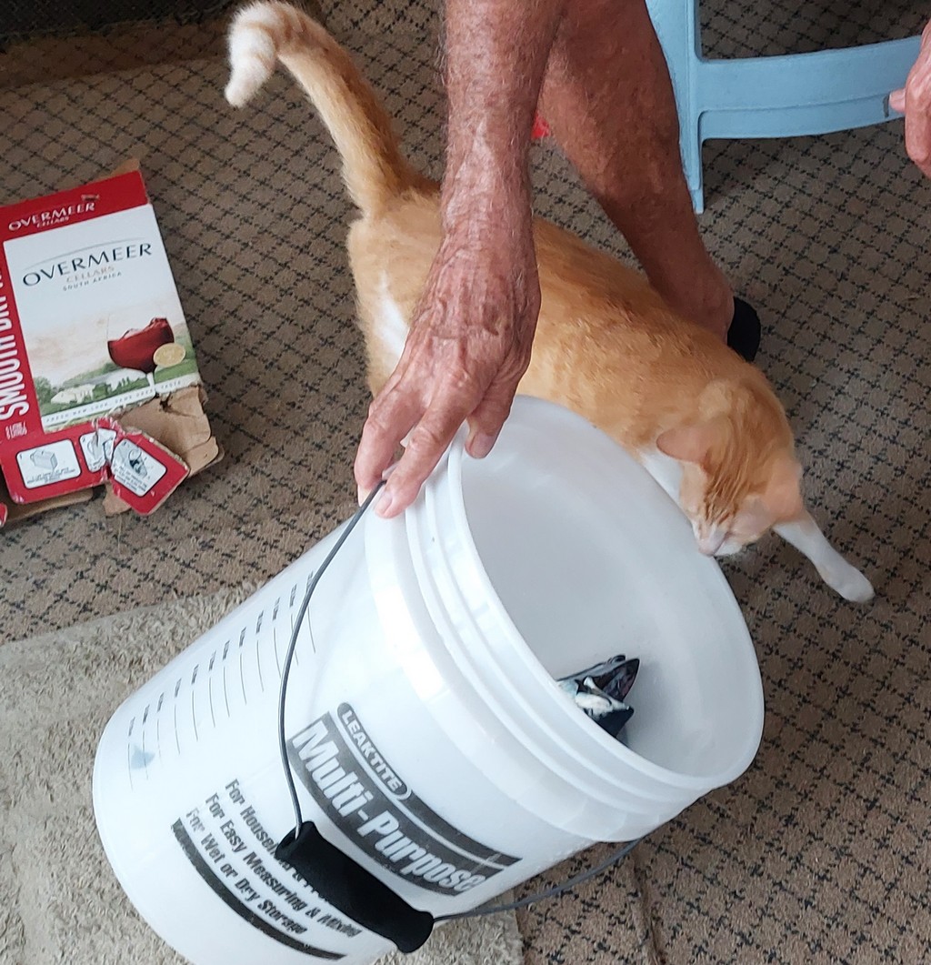
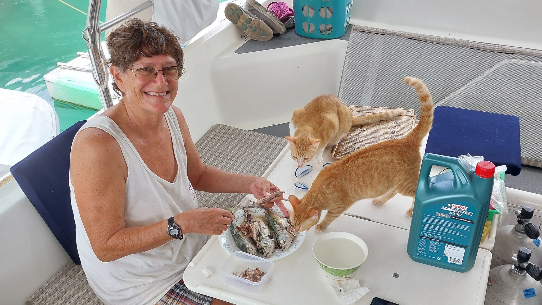
Cat food is scarce out here. Especially cat food the cats will actually eat. All during our cruise thru the Philippines last year I was trying them on different varieties of canned cat food, and they absolutely refused to eat it, no matter what the flavor. So, I kept doing what I had been doing--buying small "Tongkol" (very close relation to Little Tunny in the Atlantic) at the fish market, cooking them, and cleaning them. Here I am having fun again cleaning Tongkol. The cats, of course, are making sure Mom is doing it right.

Sherry Making Cat Food

Diving in Raja Ampat: Since we had to come back to Sorong to renew our visas in a couple of weeks, we didn't spend too much time in the marina. We soon blasted off to go diving with Biodiversity Eco Resort We did a bunch of diving with them in 2016, during their off season. Now, with barely any tourists in Indonesia, they weren't really fully open, but said they could accommodate a few diving days, and we were trying to negotiate a good deal for all of us to dive.

The Gorgeous Beach at Biodiversity

The whole dive negotiation got a little messy, though. Rather than diving as a group together, Yanina off Screensaver declared that she wanted her very own dive guide--to stay with her, at her side, the whole dive. She had had a couple of scares while diving recently, but desperately wanted to see what everyone was raving about under the surface in Raja Ampat, but she was also scared. Dave, on the other hand, wanted a guide that would range around and find critters for him to take pictures of. And Biodiversity only had one guide at that time. So we ended up splitting into 2 groups, diving separately, and couldn't negotiate much of a deal on price. So we didn't dive as much as we wanted to. But we did get a few dive days in.

Lounging on the beach during a Surface Interval
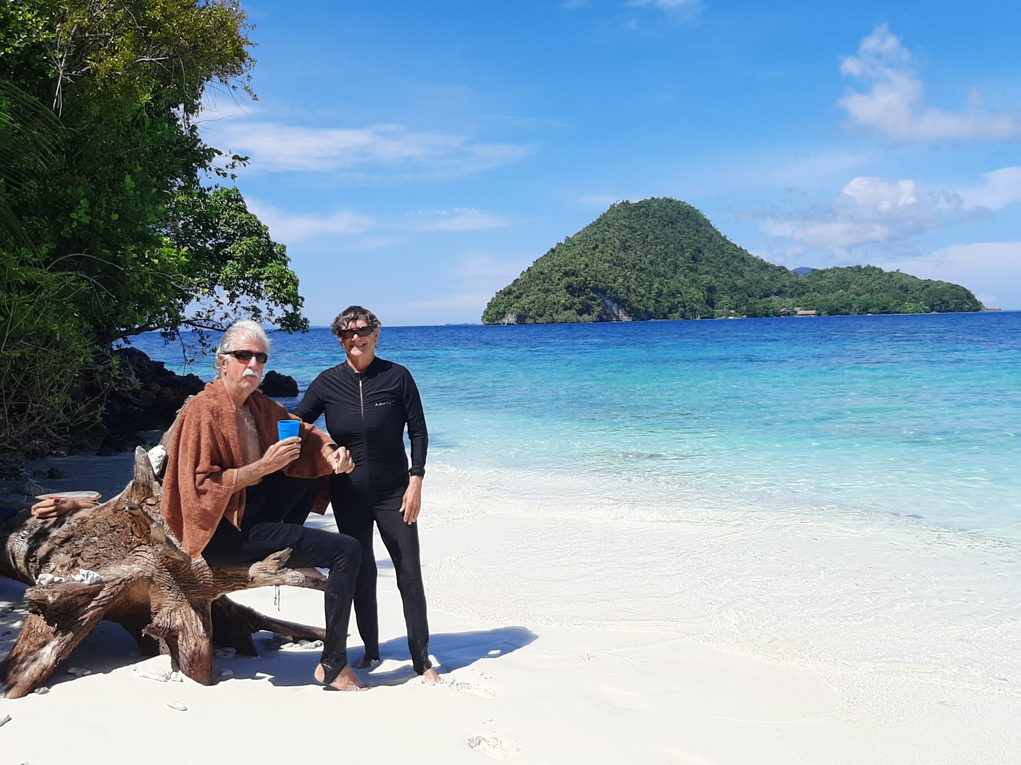
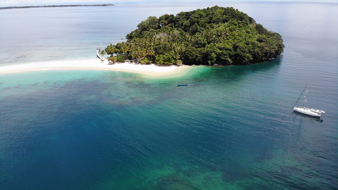
Legendary Cape Kris in the Background

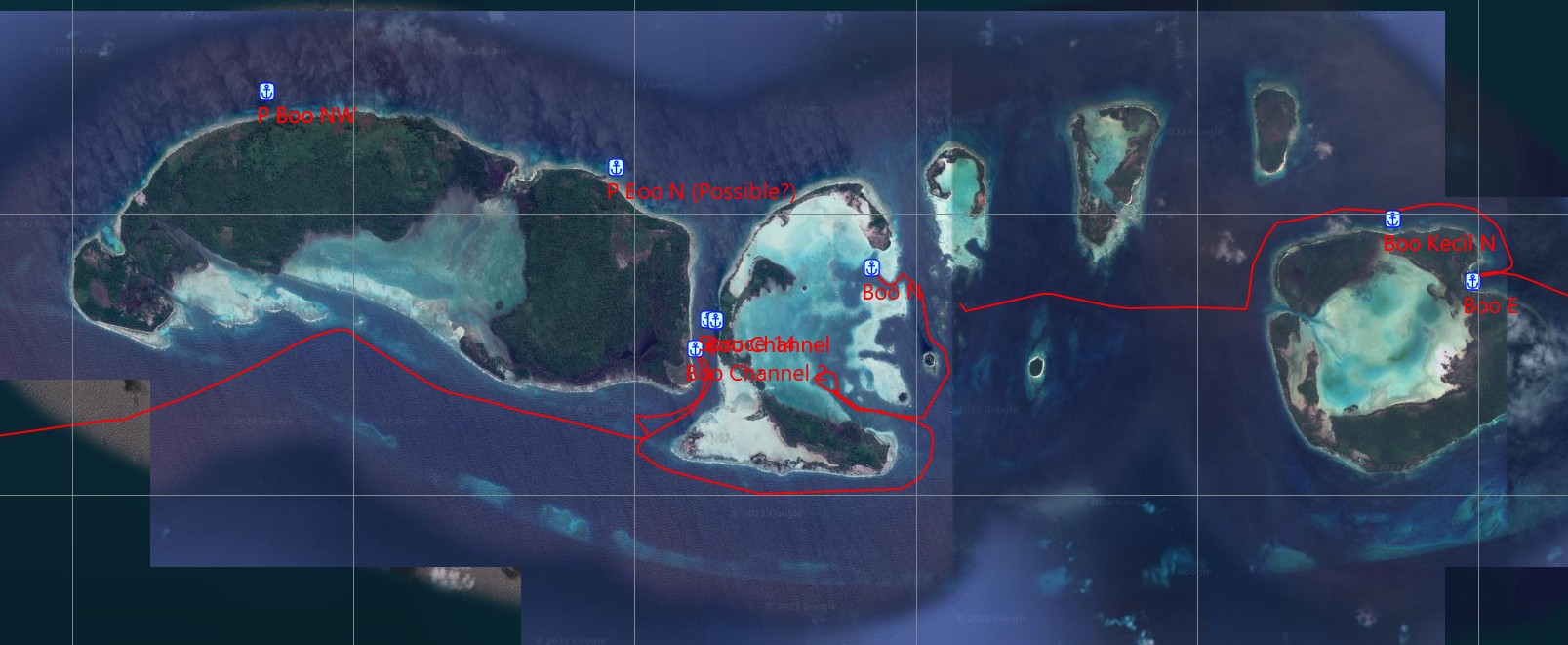
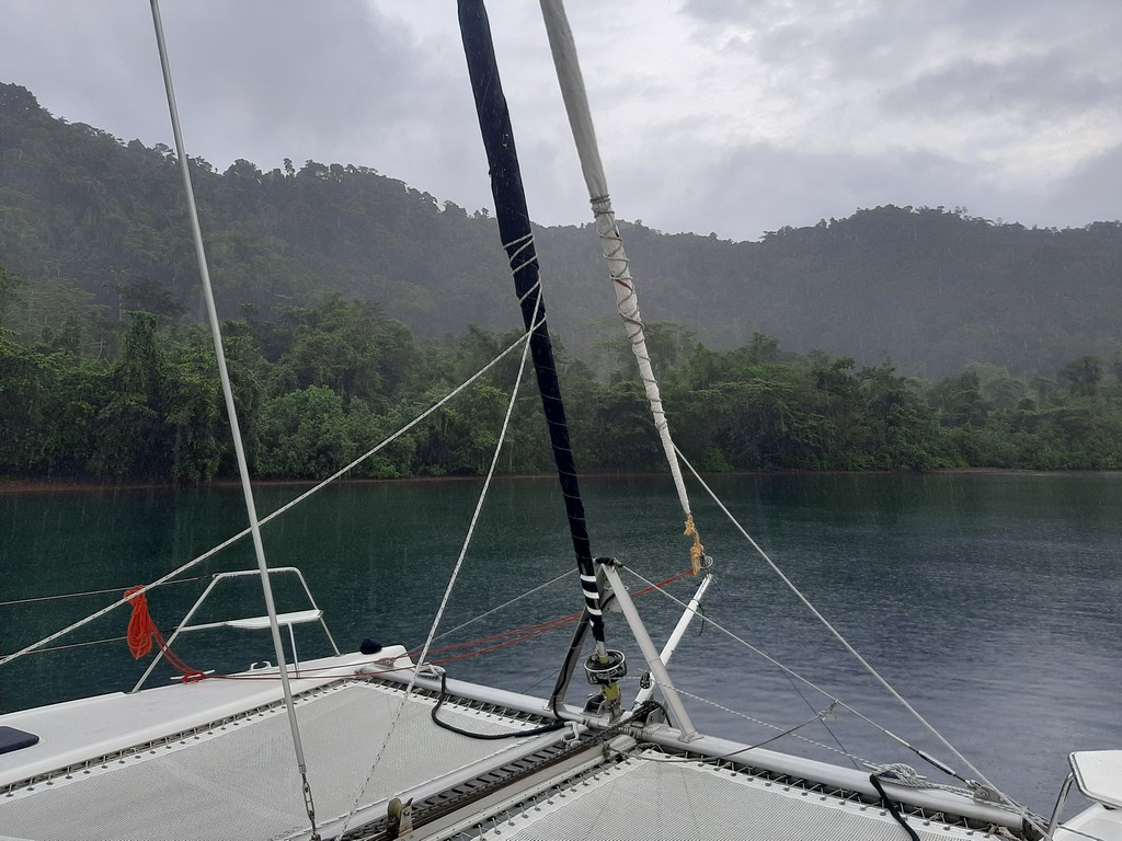
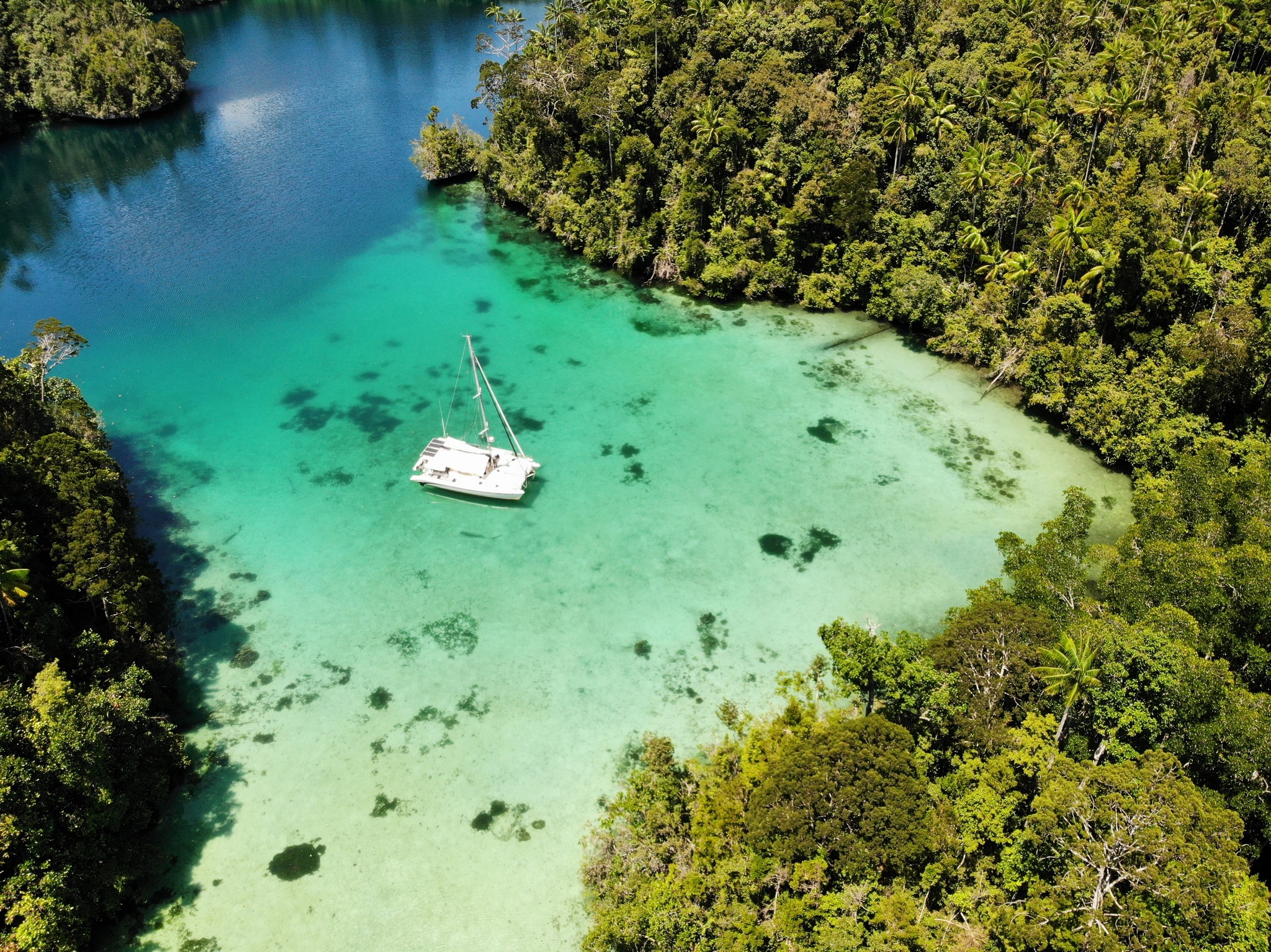
Kabui Bay For A Few Days: After we finished diving, we left Screensaver at Biodiversity and went up into Kabui Bay. We had gunk-holed a spot in the dinghy in 2016 that Dave really wanted to take Soggy Paws into...a very shallow sand spot unsuitable for monohulls. 00°25.05'S / 130°36.86'E

Our Very Private Anchorage


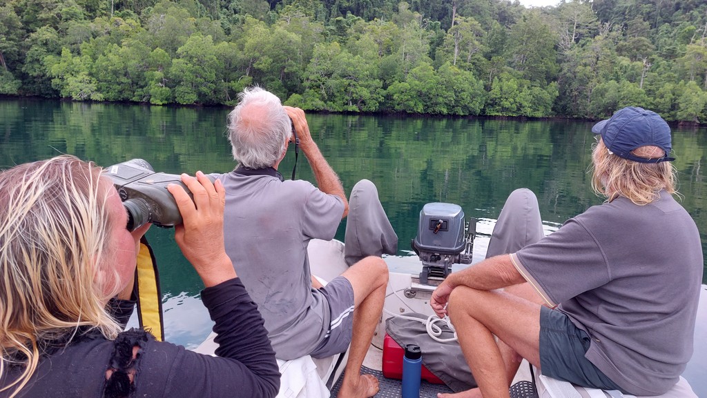
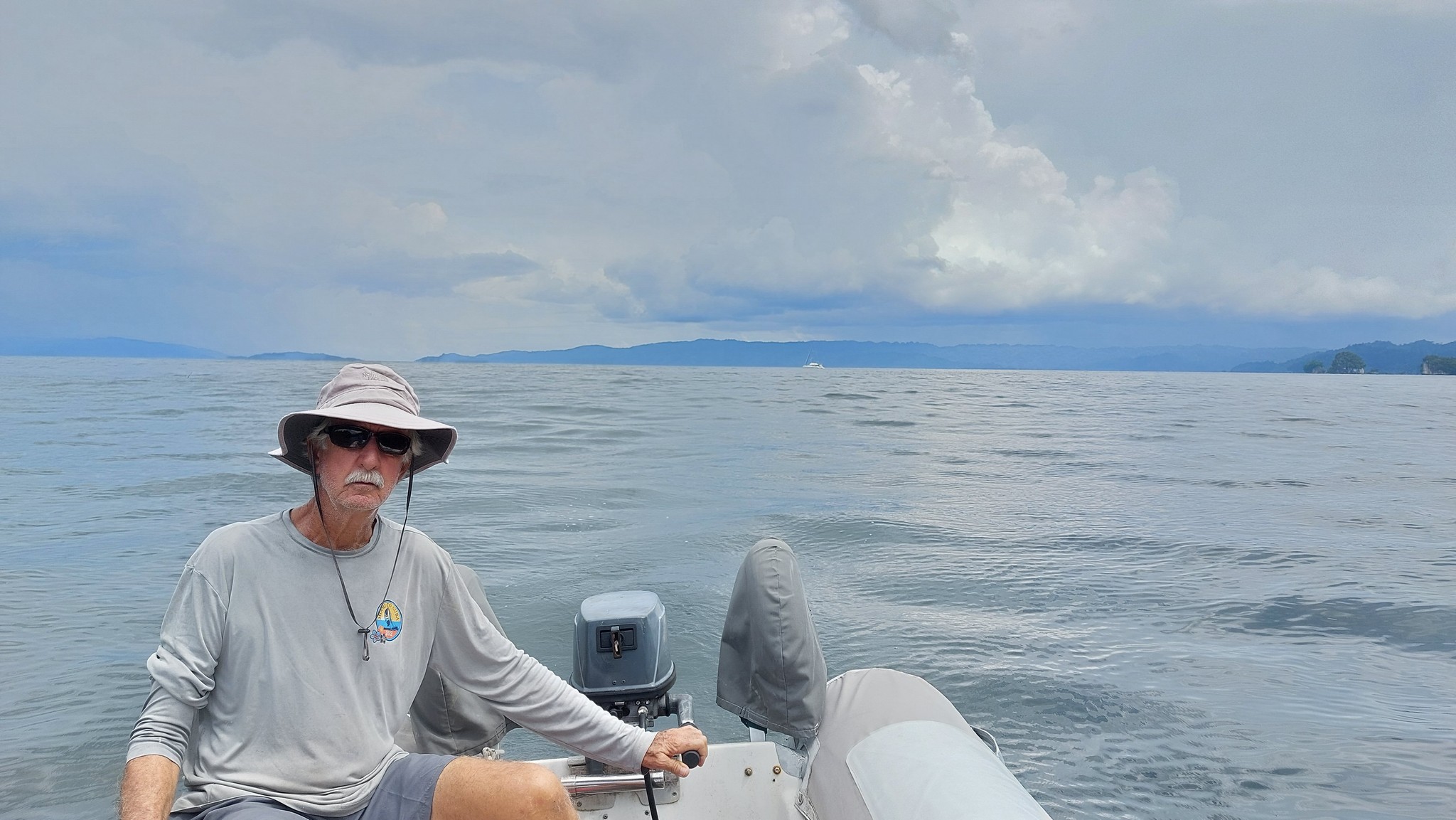
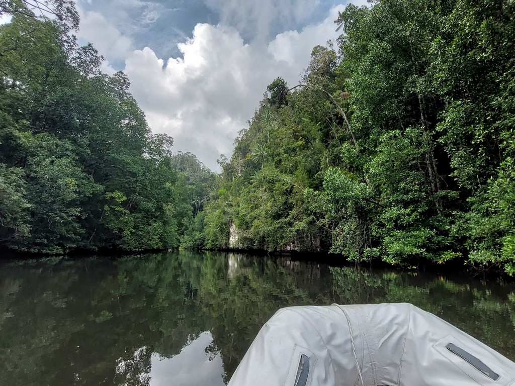
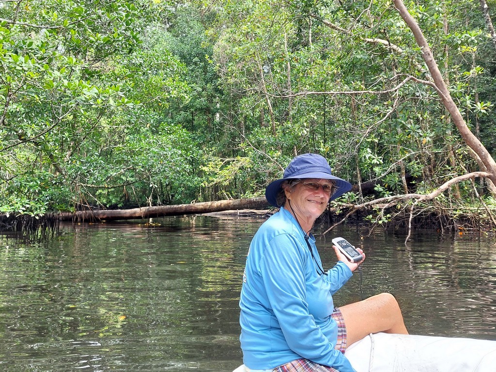
A River Trip: Another adventure we had in Kabui Bay is a dinghy trip up a river on the north side of Kabui Bay. We anchored the big boat off the river at 00°19.31' S / 130°35.75' E in about 8 feet of water (shallows slowly, pick your depth). Took the dinghy as far as we could go up the river... about 2-3 miles.

Headed into the River


Marking the Very End on the GPS

Stay Tuned for Part 2 of our Raja Ampat Adventures!

Tuesday, March 1, 2022

On Our Way to Raja Ampat

I can't believe it has been a year without a single blog post. It was a busy year!  This post is an effort to try to catch up on last year's adventures (Jan-Dec 2022) in May 2023.  We are currently (May 2023) in Pangkor Marina, Malaysia, doing a lot of work to prep for next year's dash to the Mediterranean.

Late Feb, 2022, location Bitung, NE Sulawesi, Indonesia.
The last time we went from NE Sulawesi to Sorong, we went over the top of Halmahera, with a stop in Morotai and Wayag.  We were leading a small rally that time, and our stops were cast in concrete.

This time we went the other way around Halmahera / Maluku--south about.

Our Track from Bitung to Sorong

We blasted out of Bitung/Lembeh Strait on Feb 9, 2022, with a plan of making it a long day-hop and anchoring overnight in the middle of the Molucca Sea (between Sulawesi and Halmahera), at either the tiny island of Maju, or the even tinier island of Gureda. This was after a heated discussion between the Captain, who hates going overnight, and Navigator, who hates rushing all day--motoring usually--to make it to some half-assed anchorage at the crack of dark, or maybe after dark. We have this discussion regularly. In theory, if we got going at just before daylight, and had good winds, we could make it the 72 miles to the open roadstead anchorage at Maju. Nobody we knew had ever been there, but it looked anchorable on a satellite picture. Though the island was misplaced by 3/4 of a mile--our anchor waypoint dropped using the satellite view plotted well inland.

Well, we didn't actually get underway right at the crack of dawn, and we ran into some current going around the north tip of Lembeh Island, and the winds were not good enough to consistently make the 6+ knots we needed to make.

Coming around the N End of Lembeh Island

I finally convinced Dave that we weren't going to make it before dark, and we should plan to go overnight. We hadn't seen a fishing boat or a FAD for hours, and unlikely to encounter much out in the middle. This ended up saving us 3 days of long up early-motorsailing all day-and in late day-hopping. The next morning, we were approaching the islands off the SW coast of Halmahera. By sunset we had made our way to an decent-looking anchorage. This spot wasn't quite as good as it looked because the pretty beach had been taken over by fishermen and a fish farm. We ended up anchoring in 72 feet at 00°01.40' S / 127°13.43' E. We had a little 2G internet--enough to pick up email.

Though there were some interesting places to explore on Halmahera, we had already seen a bit of the island, and were hurrying to catch up with another boat--Screensaver, with Alan and Yanina aboard. Alan had been loitering around in hopes we would catch up, and we could cruise together for awhile. And THEY were on a schedule due to visa renewal issues. So we didn't really cruise this area, but proceeded south and east through the islands just west of Bacan Island west of the southern peninsula of Halmahera. We spent one night in an anchorage called Firefly Bay (00°26.94' S / 127° 16.44' E). Cruisers a few years before had seen a lot of fireflies there, but we didn't see any. No cell signal here.

A Fast Ferry from Labuha

In 2 more days, we finally caught up with Screensaver. We ended up cruising together with them for 3 weeks all the way to Sorong. The weather was good and we were in a pretty remote area. As always, we could have spent weeks exploring the area, but we were on a MISSION. My motto for 2020 had been "Singapore or Bust", and it was Feb 2022 already and we had 5,000 miles to go still. Also, Screensaver had visas coming up for renewal soon, so we had to get to Sorong by March 1.

Ahhh! Sunset on the Foredeck with Friends--This is Why We Cruise!

It took a couple of days to finally clear Bacan Island.  We stopped overnight at a few small islands, and then we were treated to a long day SAIL to reach the Boo Islands. We actually caught a fish on this sail!

Oh my Paws! What is that!?
Here are our anchorages between south Bacan and Boo:

Labuha       00°37.741' S / 127°27.664' E  25-45 ft mud. 4G.
Siliang       00°50.991' S / 127°43.784' E   25-50 ft sand. No cell 
Waringen   00°48.376' S / 128°09.282' E   42 ft sand. No cell.
Damar        00°59.216' S / 128°22.382' E   40-45 ft sand, 30 ft bar
Tadoku       01°08.779' S / 128°25.998' E   15 ft, shallowing slowly.
Boo Chan   01°10.948' S / 129°22.419' E   52 ft, sand, buggy
Boo Beach  01°10.378' S / 129°23.673' E  45 ft nice sand beach


Note:  All of our anchorages have been send to Terry Sargent, and are maintained in the Indonesia Anchorage gpx file maintained by Terry.  See Terry's Topics to download this file, and his accompanying satellite charts.

Beautiful Anchorage in Boo Channel

Our Track and Stops in the Boo Islands
Click on the Picture to see a larger version

We did do a little playing as we cruised through the area. We got the drones out one day and took some nice pictures. Screensaver almost lost his drone by flying it too far away while we were underway (exploring the channel at Damar). We had to turn the boat around and race back to the launch spot to try to reconnect with the drone. These pics were taken with our drone at a pretty beach on Boo
Pretty Beach Inside the Reef


The next stop was Kofiau, another group of islands a little further east. We holed up here at for a few days due to bad weather. We managed to pick up a little cell signal by motoring around one day, halfway to the town on the north side of Kofiau Island.

Our Track and Stops in Kofiau
Click on the Picture to see a larger version


Then we finally made the jump to the west end of Batanta Island. This was another long hop. We thought we had a good anchorage big enough for both boats identified, but once we got there, it was too deep right up to the reef. One boat may have been able to plant a hook somewhere, but definitely not 2. So, with the light waning and a light drizzle, we moved east along the south coast of Batanta, bay by bay, looking for a suitable anchorage. We finally found a deep bay with a river emptying into the end of the bay. Sounding it out, we found anchorable depths that looked like black sand all the way in, with enough room for 2 boats. This turned out to be such a nice rain-foresty place that we stayed for a day to enjoy the birds and the sounds of the waterfall. 00°53.806' S / 130°28.233' E

Anchored Next to a Rainforest

Birdwatching at Sunset on Batanta

We spent a few more days poking east along the south coast of Batanta before finally arriving in Sorong on February 28. We couldn't really dally, however, because Screensaver HAD to get to Sorong to renew their visas.


We spent one night at Yefman Island--the site of a World War II Japanese airfield. After walking around and asking a few of the locals, we found a few bunkers still around.

A WW2 Bunker at Yefman Island

Our last anchorage was a day anchorage off tiny/beautiful Matan Island.  Yanina just HAD to go visit the beautiful sand spit, and what looked like nice coral for snorkeling.  So we tagged along.  It does look beautiful, but it's a lousy anchorage (too much coral), the locals want to charge you for stepping ashore, and the snorkeling wasn't very good (murky water).


Beautiful Looking but Crappy Anchorage at Matan Island


An afternoon squall was brewing, so we left Screensaver there and went for a better anchorage.

Guess who we finally hooked up with in Sorong, at Wick's Tampa Garam Marina? Our old Soggy Paws. Poor girl had been stored for 2 years--the owner, whom we had hope to hook up with in 2020, had left her at the marina to fly home to Australia for 2 weeks. Then COVID happened, and he didn't get back for 2 years. There was supposed to be some caretaking going on, but no boat does well sitting for 2 years.

We did eventually meet John, and actually shared an anchorage with him for a few weeks... but that's a story for another blog post.