Showing posts with label Gambiers. Show all posts

Wednesday, May 5, 2010

Taravai

Taravai is one of the islands in the Gambiers group. It is only about 6 miles from the main harbor of Rikitea, but being away from the main harbor, it is quite tranquil.

The primary harbor in Taravai is in front of an old church. But in the prevailing ESE wind conditions, that seemed to be pretty exposed to us, and there were already 4-5 boats anchored there. So we opted to follow the advice of another cruiser, and work our way into the uncharted south bay.
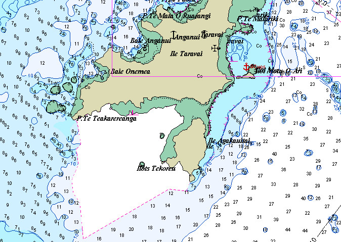
Chart of Southern Half of Taravai
Our tracks are in red

You will find little about these 'uncharted' areas in cruising guides. Even detailed S Pacific cruising guidebooks tend only to have a page or two at most on this entire archipeligo. Navigation is done by reading the color of the water, so our travel between islands is limited to 10 AM to 3 PM or so, moving with the sun behind your back in order for us to properly "read" the bottom. Dark blue is friendly and light blue is fine. Tourquise can be tricky as depth depends on water clarity. The water is getting thin as tourquise turns green and then to tan/yellow in sand, or brown over a reef. You don't go there!

We went on a day with good sun and it was easy to work our way into the bay. The trickiest spot was at 23-10.059S / 135-02.596W. Before this and after this, it was pretty easy. Though the water clarity in the bay is not very good, so proceed carefully.
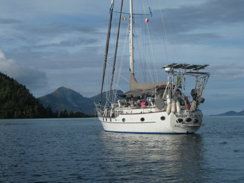
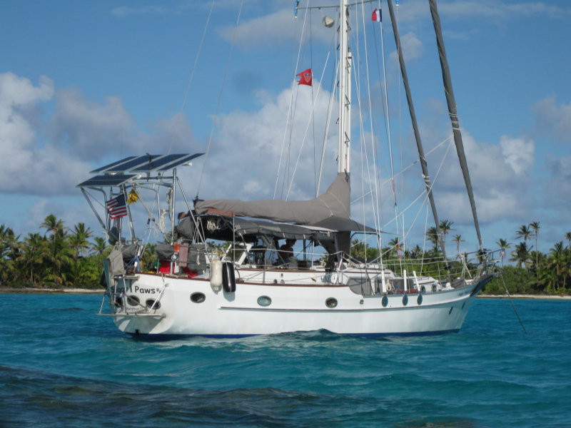
Soggy Paws in the Bay at Taravai

We found a beautiful bay with a nice beach, and good protection from almost 270 degrees, plus pretty good protection for the 'open' sectur, due to the reef. We spent about 4 days there. If you work your way into the bay, there is one anchor spot in about 25-35 feet of water, good sand bottom, and enough swinging room (23-09.606S / 135-02.217W). Since that spot was occupied, we anchored a little further out, in about 40-45' and a few coral heads. We eventually had 6 boats in the bay, with adequate room for a couple more.
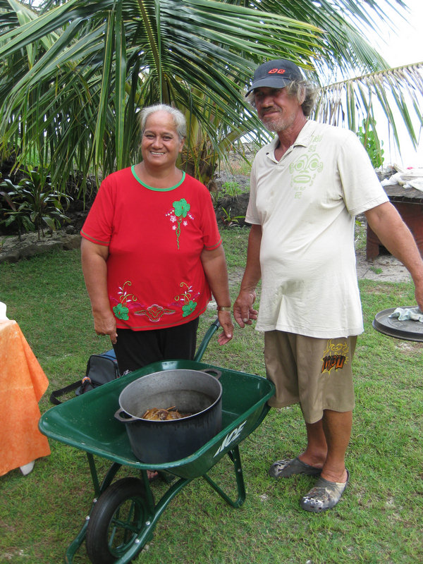
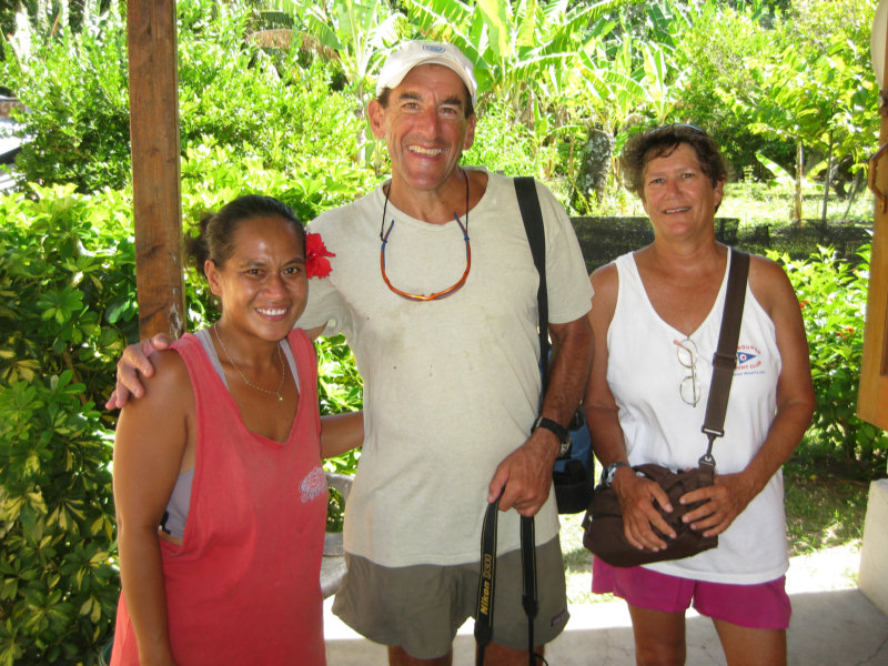
Denise et Eduard

While there, we went ashore and met Eduard and Denise living in a nice home on a lovely bay.
Eduard was born on Taravai, had gone off and worked in Hao as a welder on the French Navy base, and was now back on his family 'farm' for good. They are living nicely off the property, keeping pigs and ducks, and growing pretty much everything they might need.
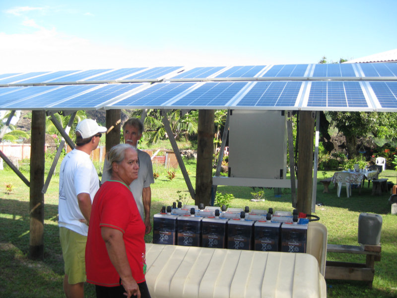
Eduard's Awesome Solar System

They do have a few of the modern comforts--a very large solar array, a refrigerator and freezer, and satellite TV. From their house, they can't quite get cell phone coverage from the tower in Rikitea, but we could get it from where we were anchored in the bay.

They were very generous with us with their fruits and vegetables--giving us armfuls of pampelmouse, lemons, papayas, eggplant and coconuts.

Lunch with Denise and Eduard

One day we had a 'potluck' ashore with them. They had cooked a couple of canard (ducks) in the traditional polynesian 'rock oven', and also made a big pot of 'Poisson Cru'. Poisson Cru is a polynesian dish that consists of raw fish, chopped onions and such, in a coconut milk broth. It is sweetish and coconutty, but otherwise somewhat like a South American ceviche. We and the crew from Visions brought in desert and drinks for everyone (and an old pack of cigarettes for Eduard, which was much appreciated).
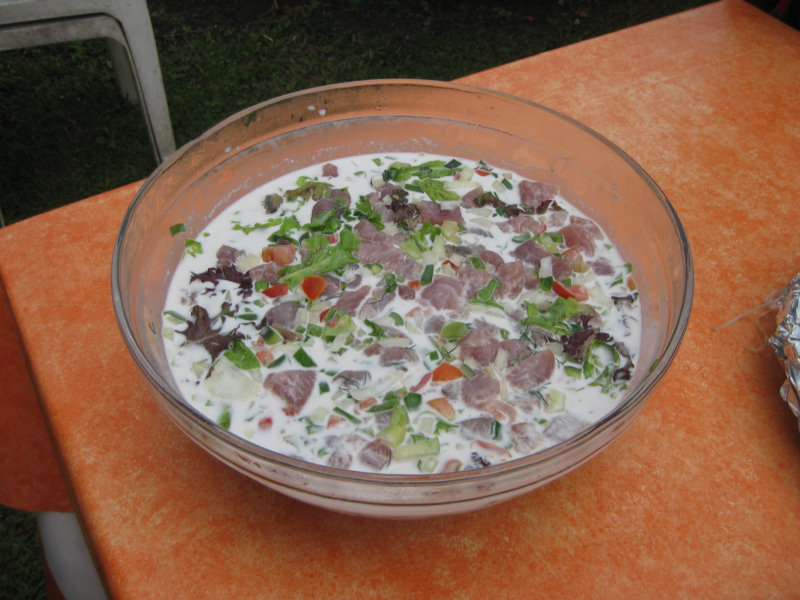
Poisson Cru

As we sat digesting our meal, we asked Eduard, in our broken French, about fishing. What lures did he use, and where were the best fish. This led to a 'fishing expedition' on Soggy Paws the next day.
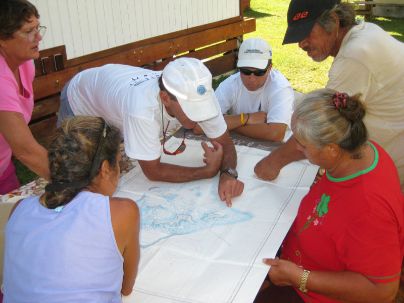
Planning our Fishing Expedition

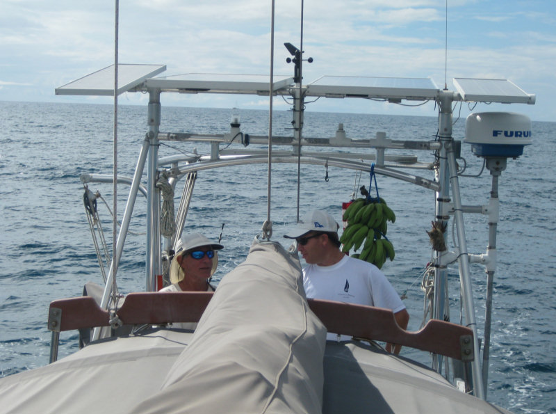
We loaded Eduard and Denise and the crew from Visions on Soggy Paws, and set out for the SW reef. We trailed 3 fishing lines, with all the right color lures, out the pass and around the reef, and back in through the reef at the north end of Taravai. We had nary a nibble.
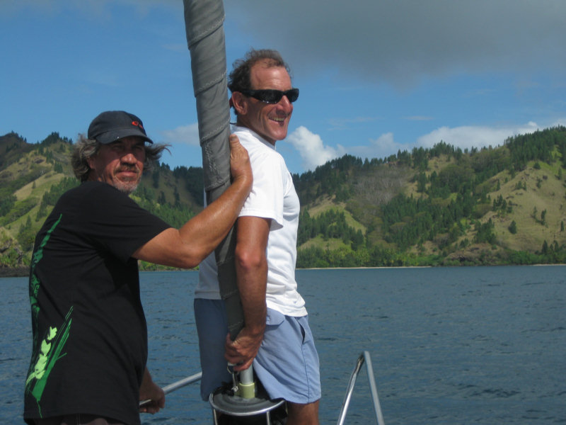
Eduard Pilots Us Out Through the Reef

Gram (Visions) and Mike (Infini) Tend the Lines

Eduard had tried to tell us the day before that the time (moon/wind/currents) wasn't right. But we had fun anyway. And we got a chance to run down the west side of Taravai and explore a little. Again, the reefs are numerous, but accurately plotted on the Maxsea CM93 charts, and easily navigated with good light.

We re-entered the south bay at 23-09.720S / 135-03.627W and proceeded carefully back to our anchor spot without incident.
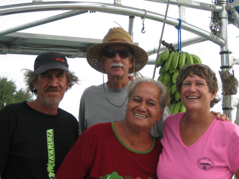
Denise and Eduard on Soggy Paws

A few days later, we did anchor in front of the church at Taravai. When we had been anchored in the south bay, we had dinghied around to the church and met Valerie and Herve on the north side of the church, and another guy on the south side of the church. They were both selling fruits and veggies to cruisers.

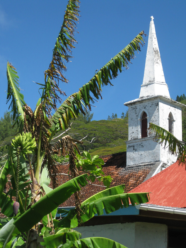
The Church at Taravai


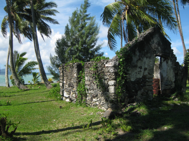
Some Ruins Near the Church

Bill (Visions) and Sherry with Valerie

Dave especially wanted to visit Valerie again, because they had some really nice avocados. On our way out of Rikitea to stage for leaving the next day, we made a pitstop in the 'main' Taravai anchorage. We didn't know the way, so we just approached with a direct frontal assualt (with the wind at our backs and the sun in our eyes--a bad combination. We managed to cross the reef safely with a minium depth of about 10'. Once across the reef, it was deep and easy to navigate to a safe anchor spot. Though this anchorage seemed exposed, there really is pretty good protection from the offshore reef.

The proper entry is around 23-08.957S / 135-01.119W, where there are a couple of pearl bouys marking a 'channel'. From this point, you proceed carefuly NW around the prominent reef to your left, watching out for isolated coral to your right. Good light is mandatory. Our anchor spot was 23-08.751S / 135-01.499W in 45 feet sand.

Our final anchorage in Taravai was a bay on the NW side, where we staged to leave. This bay has great protection from the prevailing easterlies, with good 270 degree protection from N - E - SW. We anchored at 23-08.564W / 135-02.803W in 45'. With this anchorage, we completed a complete circumnavigation of Taravai.

In all, the Gambiers were worth more than the month we spent there, but with winter coming on (in the Southern Hemisphere) it was time to be headed north.

Monday, May 3, 2010

Oh No! No Baguettes!!!

Well, the bakery here is out of flour, so there are no baguettes until the next ship comes in. :(

From what we understand, flour is a subsidized item, and the bakery gets an allotment of government-subsidized flour, and when that's gone, they go on vacation til the next ship comes in with a new allotment.

With all the cruisers passing thru now (gobbling up baguettes like they're going outta style), they really ran through their normal amount of flour early.

We still have one or two left in our fridge (we stockpiled when they were available). Since we can't get regular sliced bread, we use the baguettes for all our bread needs, so we buy 6 or 8 at a time. They're not too bad when re-heated in the oven--they get nice and warm like they were just baked, and soft on the inside and crunchy on the outside, just like good French bread should be.

I COULD bake some bread. I bought tons of flour in Ecuador before we left. But so far this year, I have only baked one loaf of bread!! Dave is a nut when it comes to stockpiling bread, and though I'd much prefer fresh baked bread... it's a lot of work!!
-----
At 4/18/2010 4:04 PM (utc) our position was 23°09.61'S 135°02.27'W

----------
radio email processed by SailMail
for information see: http://www.sailmail.com

Friday, April 30, 2010

A Grey Day in Paradise

Yes, we are still at anchor in Rikitea.

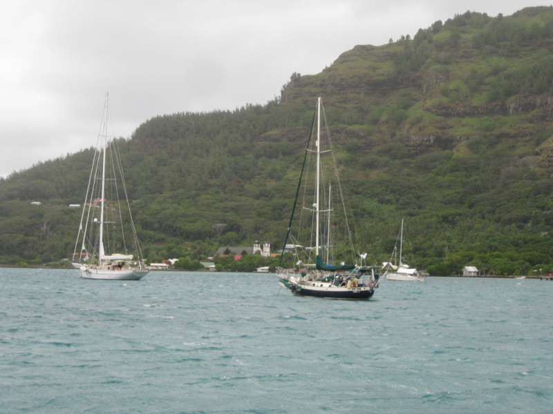
Blustery Weather in the Anchorage

I've been trying to catch up on posting pictures to our blog posts in March and early April. I am finished with the 'On Passage' stuff as far as Easter Island, and Easter Island itself. You can see the final result by clicking here Easter Island. Next is Pitcairn, and a couple of Gambiers posts I haven't gotten to yet. The internet here is R-E-A-L-L-Y slow, and I often get up at 5am to try to get a little better speed.

Our friends on Visions pulled out of the Gambiers almost a week ago, on a nice weather window. We just weren't quite ready. I lobbied strongly to pass on the window and take a few days to just relax. It is tough when my Dave and Bill from Visions of Johanna get together. It's go-go-go all the time!!

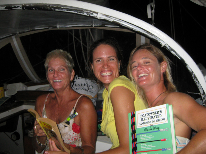
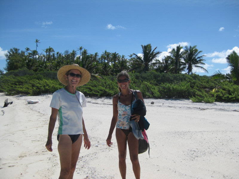
We have had a nice round of dinners and happy hours around the anchorage. Dave celebrated his birthday, and all of our group gathered for pizza and birthday cake. (Thanks, Sue, from Infini, for making the cake!!) We haven't remembered to take our camera often, but Dave caught this great picture of a few of the 'girls' during one happy hour in which we had a book swap.


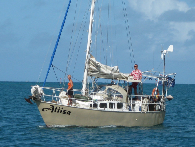
Our friends on Aliisa finally arrived. They left Peru just about the same time we left the Galapagos, but it took them nearly a month longer to get here. They had better luck (or more fortitude) at Easter Island and managed to stay for 2 weeks.


Lauri and Anina are on the last leg of a 6 year circumnavigation. They hope to be in Cairns, Australia by September, where Lauri started from. You can see his adventures on his website at Aliisa.net.

The pizza parlor in town is only open Fri-Sat-Sun, so Saturday after Aliisa got in, we all went in for pizza. It was good--better than South American pizza, but we just about choked when we did the math and found they cost about $11 each for what was essentially a personal-sized pizza.

Now the weather has moved in, and we've got forecasts for 20-35 knot winds over the next 5 days as fronts and highs and lows roll past us.

We are actively looking for a weather window for the next jump--up to the Tuamotus. We have had nearly an unending succession of Lows roll past, bringing mostly NW-ly winds.

It is 450 miles NW to the Hao atoll. Though there are many islands and atolls between here and there, all are either islands with no real anchorage, or a closed atoll, with no pass big enough for a sailboat. We need a 5-day weather window, and looking at the GRIB files, it looks like the first possible departure date is May 4th or 5th.

Friday, April 16, 2010

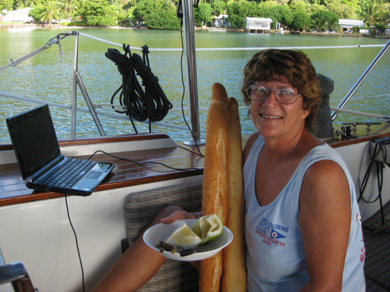
Fresh Baguettes and Internet, Who Could Ask For More?

We are enjoying being back in civilization, with fresh baguettes available daily, and internet to keep up with our friends and family.

Sherry Enjoys a Baguette with her Morning Internet

That thing on the plate is 1/4 of a fresh pamplemousse (French Polynesian grapefruit).

A Visit to a Pearl Farm

We had an opportunity to visit a pearl farm here in the Gambiers. They supposedly produce the best 'black pearls' here of all of French Polynesia.

There is no tourism industry here in Gambiers, so no one is really set up for tours. However, if you ask the right person, they will give you a short look around. Bill from Visions of Johanna set up this trip with Benoit at his pearl farm about a 20 minute walk out of town.

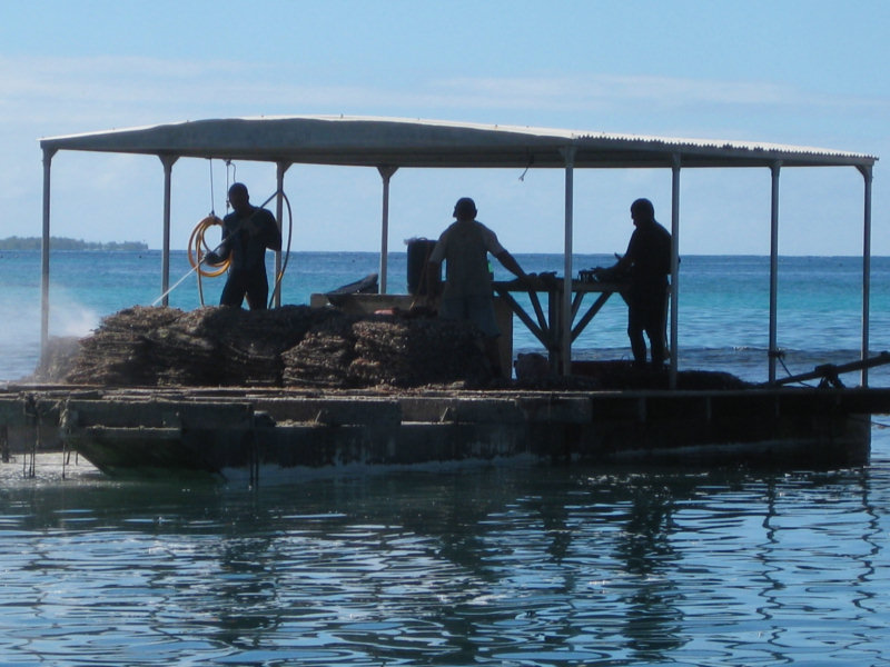
A Typical Pearl Farm Building

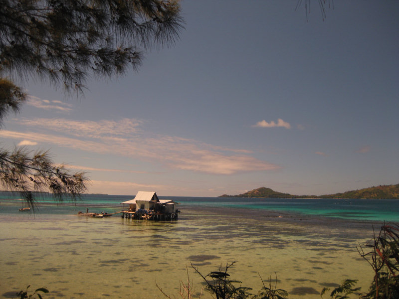
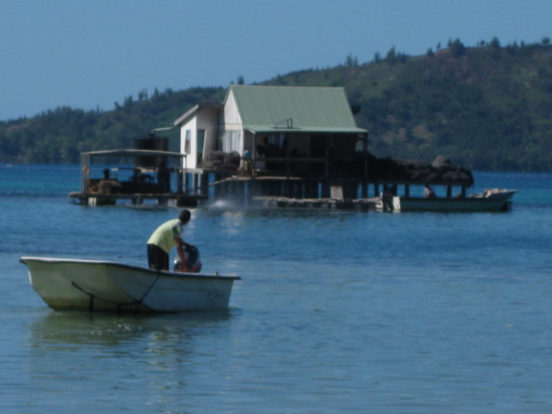
The first thing we learned is that the pearl farming work is usually done at a little building on stilts built over the water. We had thought those quaint little houses on the water were for living in, but it turns out to be a convenient way to deal with the pearl activities without stinking up the town. And easier for the coming and going of the oysters, etc. People commute to work from town everyday in launches with outboard motors.

A Typical Pearl Farm Launch

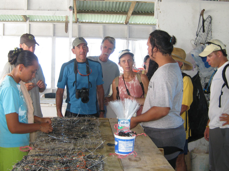
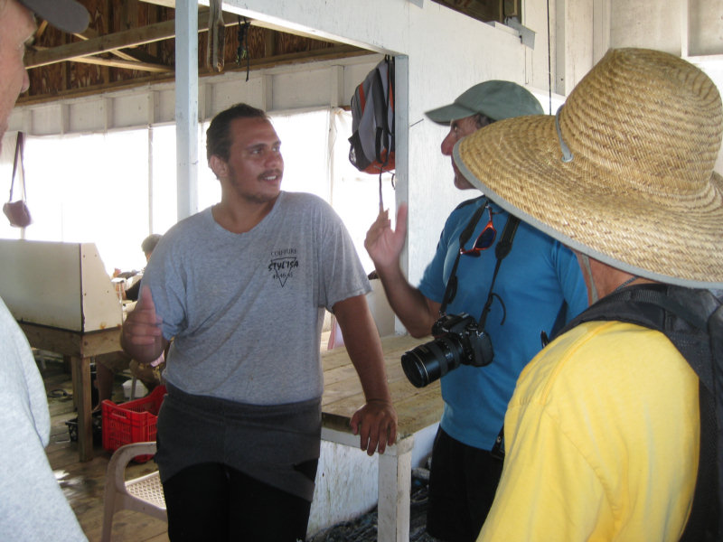
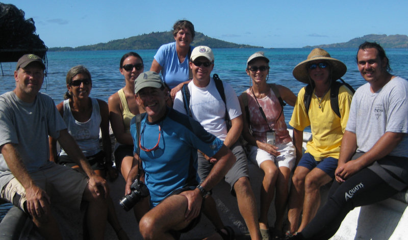
They loaded all 9 of us up in the launch and took us out to their building. Benoit's son gave us a nice explanation of the process.

Benoit's Son Explains the Process to Us


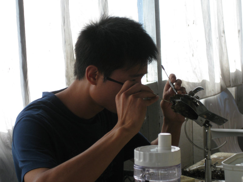
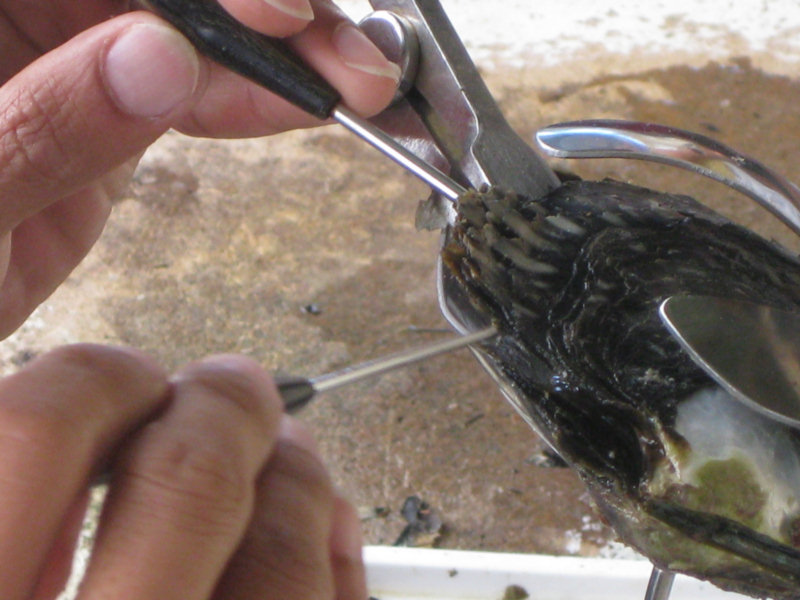
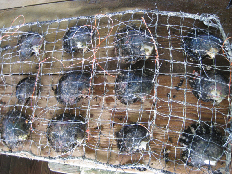
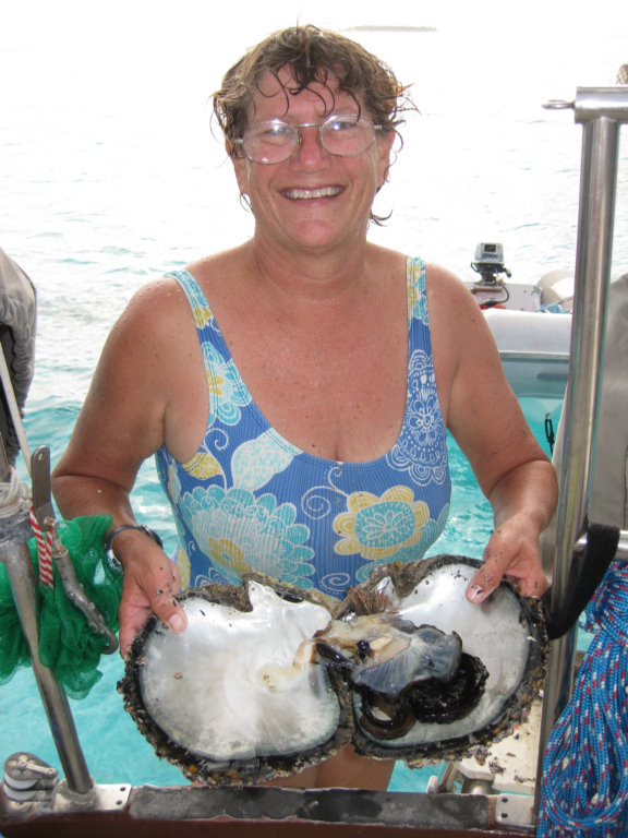
The first step in the pearl farming process is get oysters of the right size and development and implant both a seed pearl and a tiny chip of oyster shell into the gonads. The Japanese perfected this technique and some pearl farmers still use skilled Japanese workers to do this, though the French Polynesians are also learning how to do it.


Then they tie the oysters into racks and take them out in strings to their open water 'farm'. In the Gambiers, you can see many pearl farm bouys scattered around the open parts of the lagoon.


Periodically, they must retrieve the racks and clean the oysters, as clean oysters are happy oysters, and produce better pearls.


Some pearl-producing oysters are recycled, seeded again, after producing a good pearl. Others are saved for their shells. You can also eat the oyster muscle (similar to a scallop).


The hope was, at a pearl farm, that not only would we get some insight into pearl farming, but also be able to buy some pearls at a discount. Alas, it seems that all their production is controlled and they are not supposed to sell their pearls from the farm. There is a nice shop in town that has individual pearls and pearls in settings (rings, earrings, bracelets, and necklaces).

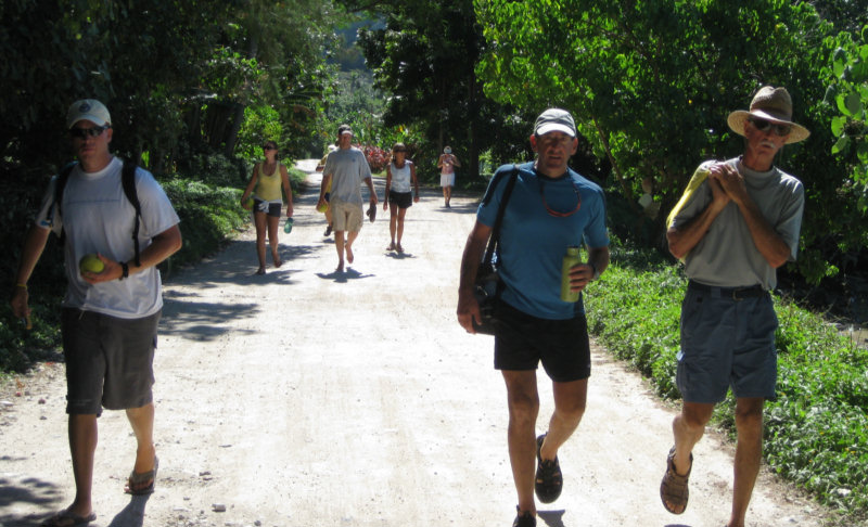
On our walk back from the pearl farm, someone invited us into their yard for free 'pampelmousse' (large sweet grapefruit grown on the island). We gathered all that we could carry!

Thursday, April 15, 2010

Hiking Mount Duff

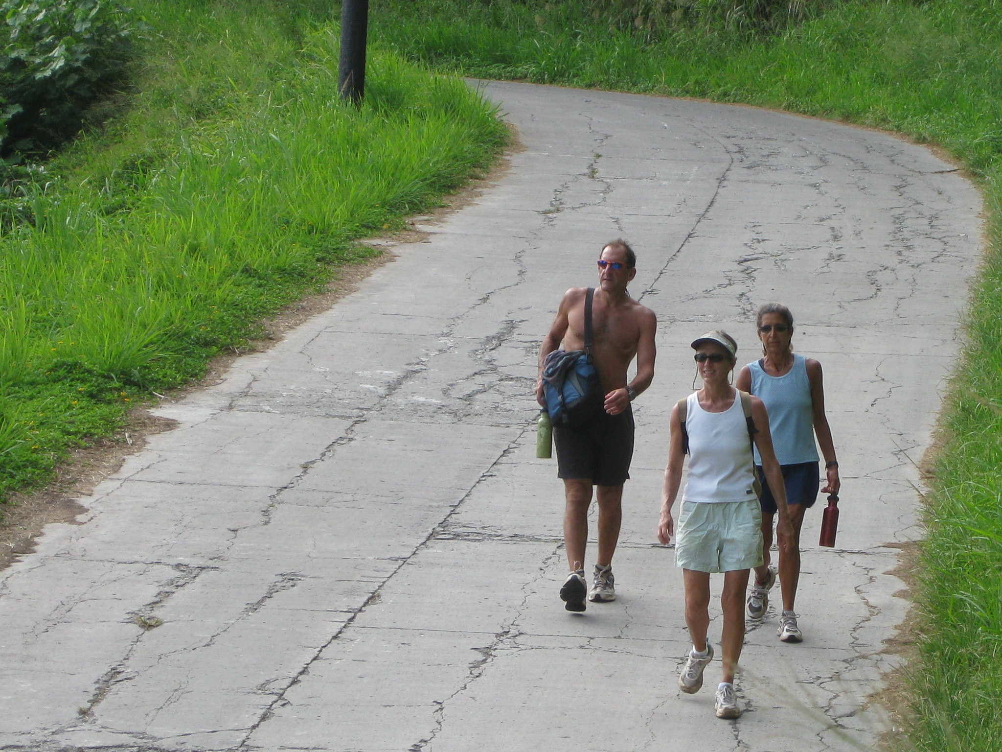
One of the cruiser things to do here in Mangareva is to hike to the top of Mt. Duff. Without much information about where EXACTLY the path to Mt. Duff was, we set out on the road out of town.


I actually stopped and asked directions. One of the storekeepers in town that speaks English drew me a sketch map that helped us get on the right road. But his sketch was rough and turned out to not be quite accurate. He showed a path coming off the left side of a curve in the road, and that was accurate, it was WHICH curve that was the problem.

While Bill and Sue explored the path on the first curve with a path that we came to, I stood out on the side of the road and waited for someone to drive by. We had been passed by several pickups and motorcycles on the walk up, but of course when I WANTED a car to come, none did. Finally some guy came by on a motor scooter and I got him to stop. In my horrible (almost non-existent) French I asked where the path to Mt. Duff was, and we were able to communicate enough that I knew THAT path wasn't it. He indicated (sign language) that it was just ahead on the next curve.

There it was, properly marked with a sign that said Mt. Duff.


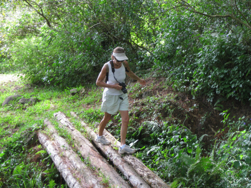
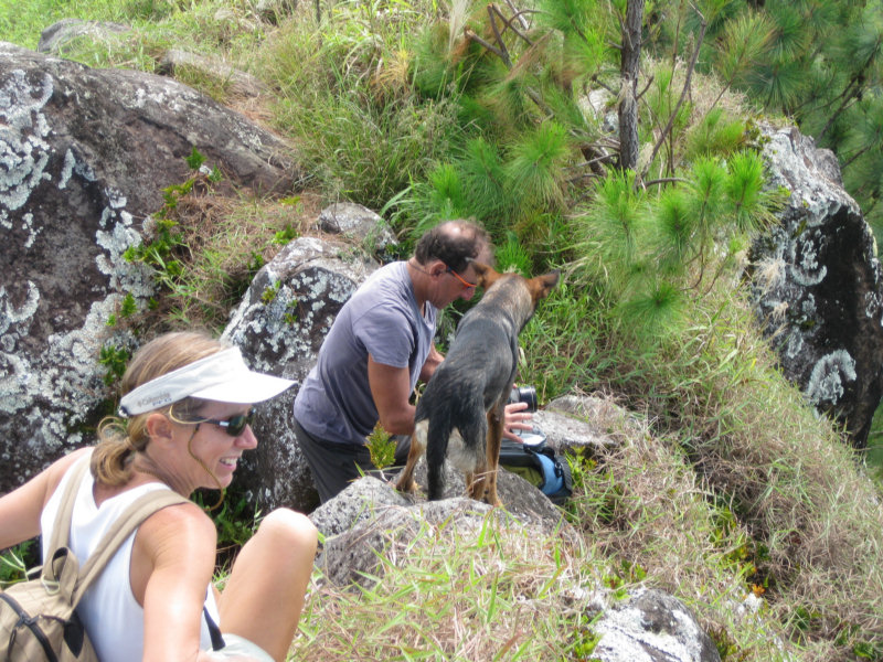
Once on the right path, it was actually a very pleasant walk thru a pine forest--a nice improved path for the tourists. We were joined by a skinny friendly dog of German Shepherd descent who was having a good time romping along with us.


We got to a Y in the path, with 2 signs in Polynesian, one pointing one way and one pointing the other. Neither said Mt. Duff! (this is a British name). If we had actually known when we started WHICH peak was Mt. Duff, it would have been easier. Our dog friend wanted to go to the right. We almost followed him. But Bill said the path to the left looked a little more worn. Hmmm... follow the dog who lives here or the cruiser who doesn't?? We followed Bill and went left.

After the Y in the path, we started scrambling up, still in pine forest. The slippery pine needles made the going tricky. In a few spots, there were lines between trees with knots in them, placed to help us go up and down the steep slope. At the very end, we got above the tree-line, and the path switched to wading through high grass. By this time, Bill was way ahead of us, out of sight, and Jo and Sue and I kept telling each other that there were no snakes in Paradise. (ha ha)


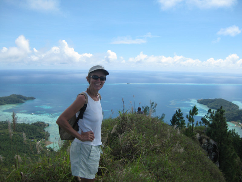
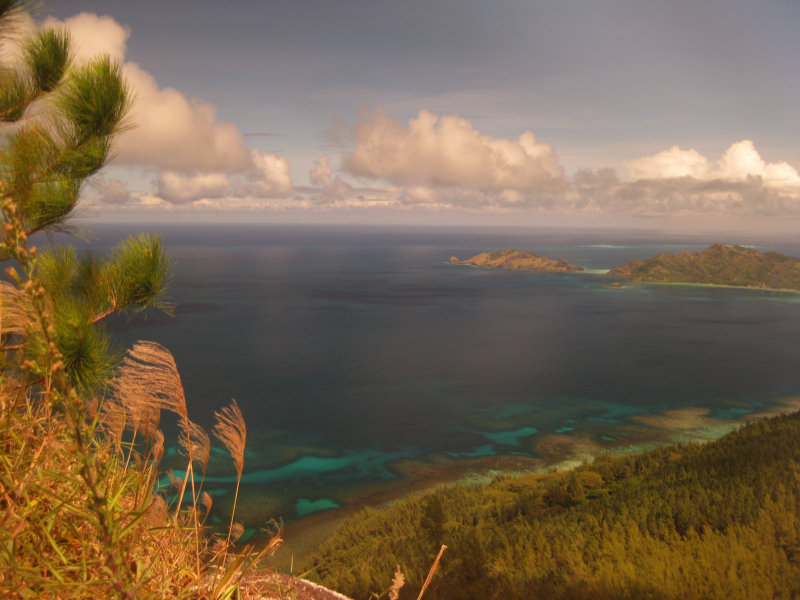
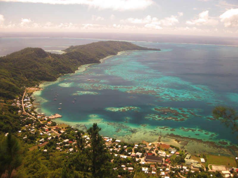
We finally made it to the top and climbed up on the rock outcropping. Wow, wow, WOW! What a view! We could see 50 miles in every direction. Out to the surrounding reef and well beyond. It was a beautiful clear day and we got some great shots of the clear water below.


-----
At 4/18/2010 4:04 PM (utc) our position was 23°09.61'S 135°02.27'W

Wednesday, April 14, 2010

Exploring Motu Puaumu

A few more pictures from around Puaumu... (the Polynesians pronounce every vowel, so this is pronounced Poo-ah-ooh-moo)

We went on a dinghy expedition to the neighboring motu.


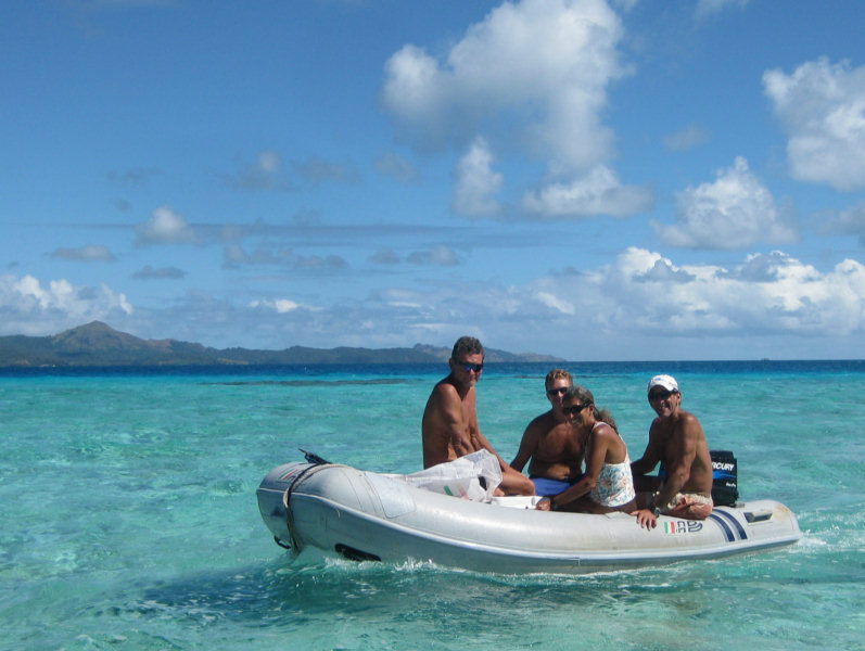
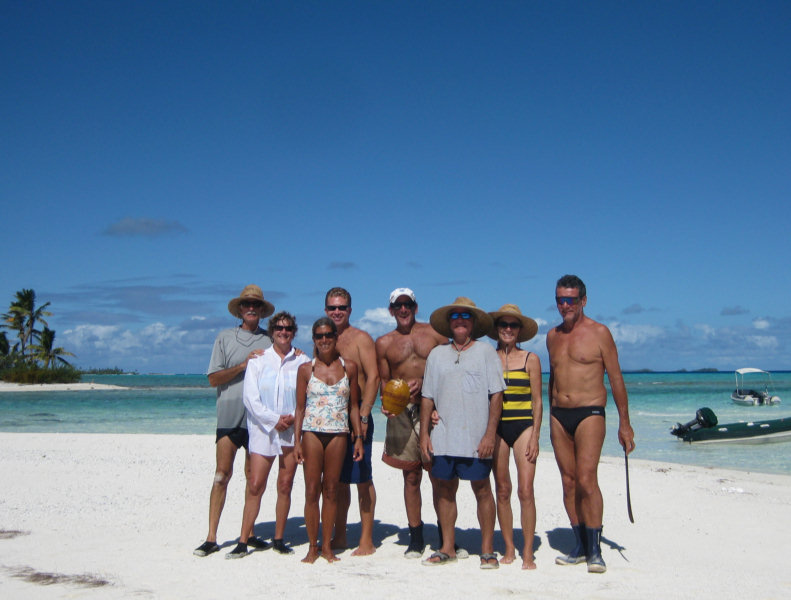
The crews from Soggy Paws, Visions, Infini, and Steel Band
in 'safari mode'

Sue and Jo enjoying the beach

Sherry found what we at first thought was a scallop, but which turns out to be a Black Pearl Oyster. They were found individually just laying around in the sand near a coral head. Like a scallop, we ate only the meaty muscle. It was good.


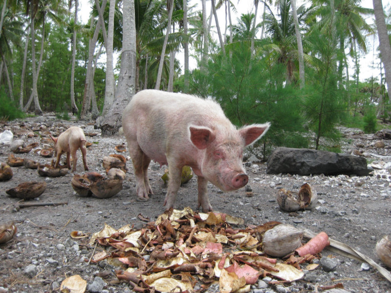
When we finally went ashore on the Puaumu motu, we found an abandoned house, and some pigs and chickens. They came running up when we came to the beach, looking for food. We found out the next day that someone comes from the 'mainland' every few days to feed them coconuts.

Tuesday, April 13, 2010

Reef Walking at Night for Lobster


Pascal from Steel Band is a 'hunter/gatherer' of the first kind. When we asked him where the best place was to get something to eat on the reef, he told us we probably won't find any lobster while snorkeling. And unfortunately, spearfishing is very risky here...ciguatera is very prevalent in Gambiers and those big fat grouper looking at us from under every coral head could be lethal.

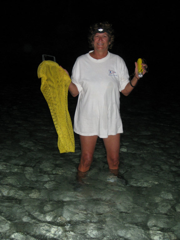
Apparently, the way to find lobster here in the Pacific is to walk on the reef for them at night. The best time to do this, according to Pascal, is on a rising tide on a new moon (when it is darkest out and the buggers can't see you coming). The lobster are supposed to be coming up onto the reef top to feed around that time.

OK, well, we are not generally night people. It is safest to be back aboard when it gets to be dark, and we are usually not ready with dinner until 7:30 or 8pm. However, this sounded like a lark, and Visions was up for it too. We had an early dinner and withheld the drinks til after our adventure.

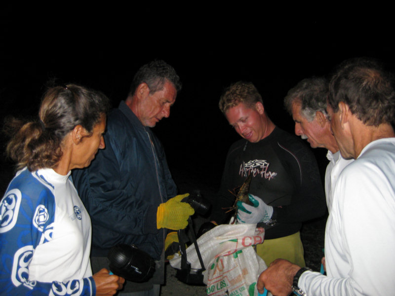
We gathered on the east end of the beach at Puaumu at 7pm, armed with sturdy tennis shoes, bright flashlights, gloves, and mesh bags. Dave also brought his Keys 'tickle stick' and net, which turned out to be useful. Pascal said we should be walking along the top of the reef (old dead reef) a couple of meters just inshore from the breakers. You just spot them with your flashlight and pick them up. How cool is that?

Gram from Visions and Pascal from Steel Band tromped off down the reef pretty quickly. Bill and Jo and Dave and I were much more tentative. Dave had to go back to the dinghy for something, and while he was gone, Jo found a smallish slipper lobster and Bill bagged him. When Dave came back, he already had 2 more.

We proceeded out to where Pascal said we should be--it was more difficult--deeper, rockier, and some wave action. After 10 minutes of nothing, we went back inshore a little where we'd found the other slipper lobster, and eventually found a total of 7 of them. It was slightly easier to bag them with the net and tickle stick, but it was not that hard to just grab them with a gloved hand.

Meanwhile, Pascal and Gram came back from way down the reef, with a stone crab and a good sized lobster.


We had had enough, and had at least something to show for our efforts. We ate Lobster Penne and Lobster Alfredo for dinner the next night, and it sure beat 'old frozen chicken (again)'!

Sunday, April 11, 2010

Ahhhhhh!!


THIS is what we traveled 5,000 miles for!!

We left Rikitea harbor yesterday morning to go out to the outer reef and hang out for a few days. Bill on Visions of Johanna had gotten some waypoints from a French boat (Steel Band aka Asterix) for going up into the 'unsurveyed' part of the atoll. And we could see a light wind period coming up, for a few days.

So about mid-day, us and Infini and Visions and Steel Band all headed out of the harbor, east to the edge of the reef, and north along the reef. We left first and ended up in the lead. It turned out to be a 'no-brainer' for us (we don't need no stinkin' waypoints!)--the water is really clear and easy to read. It is mostly very deep--60-80 feet. There are brown spots that are submerged coral heads at about 20 feet.

There is a solid reef all along the eastern side of the Gambiers atoll, with periodic 'motus'... little sand/coral islands. A few have palm trees... they look JUST like that Windows background with the sailboat and the island.

When we arrived at the island that Steel Band had put an anchor waypoint on, we worked our way into shallow water. It turned out to be a little harder than we anticipated to find a good anchor spot. There are too many very shallow coral heads. We picked the largest open area and dropped our anchor in what we hoped was the middle. The depth was only 10 feet, nice sand, so we didn't need a lot of scope. When Visions and Infini arrived, they didn't like the shallow coral-studded area and went back out into deeper water.

See the Coral Head off Our Stern!

Ooops... we forgot to factor in the weather. All we had taken note of was wind SPEED when we looked at the forecast. It turned out that the reason the wind is dropping off is because of an approaching front. Last night the wind backed about 180 degrees. It left us sweating how close we were to a specific coral head. Just at dusk we had the foresight to swim out a second anchor to help keep us centered--we ended up hanging on that anchor all night long.

Fortunately, this 'front' was VERY mild. We had one rain shower and clocked 20 knots, but it didn't last long. Though the wind was most of the night coming from across the atoll, it was under 10 knots and so not a problem. Now, 24 hours after we arrived, it has back on around to the SE, and we are now hanging behind the reef again.

We are still getting used to this 'upside-down' weather. The cold fronts come from the south. And when they approach, the wind goes NE-N-NW-W and then blows cold air from the South after the front passes. Weird. And there is no Herb/Southbound II or Chris Parker here to explain the weather to us. Once we get a little further west and north, there are more nets and some weather gurus, but especially in this part of the Pacific, it's just us and the GRIB files. We are finally in the French Polynesia weather area. But the weather we can get from Saildocs is sparse, for only 'today and tomorrow', and in French. Here's yesterday's forecast for our area:

GAMBIER
SECTEUR EST 11/16KT MOLLISSANT 07/10KT A MI-ECHEANCE PUIS REVENANT AU SECTEUR SUD-OUEST EN FIN DE PERIODE, RAFALES 25/30KT SOUS GRAINS, MER AGITEE DEVENANT PEU AGITEE, AVERSES EPARSES OU GRAINS ISOLES.

Yep.

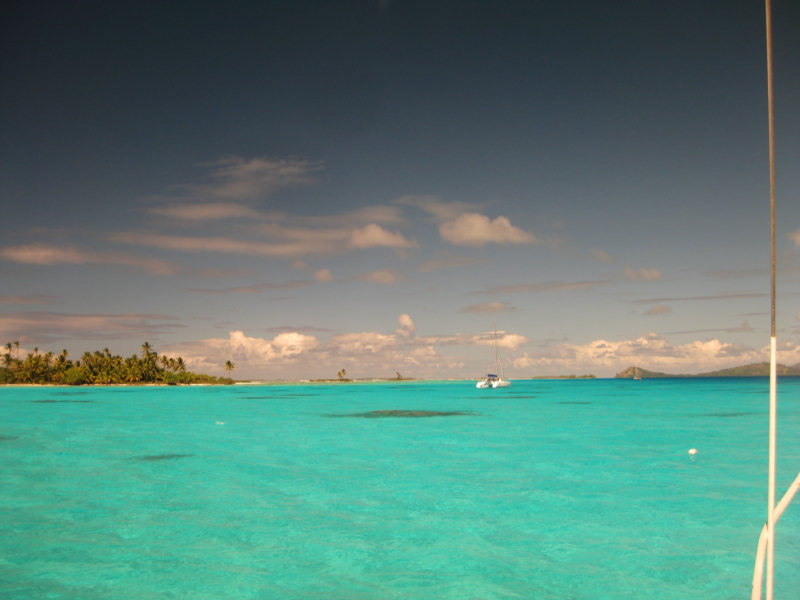
Anyway, where we are is just GORGEOUS. Sand beaches, palm trees, aquamarine water, beautiful coral, warm water, sunshine. It doesn't get any better than this.
-----
At 4/10/2010 5:48 AM (utc) our position was 23°01.09'S 134°55.21'W

----------

Friday, April 9, 2010

Rikitea Harbor, Mangareva


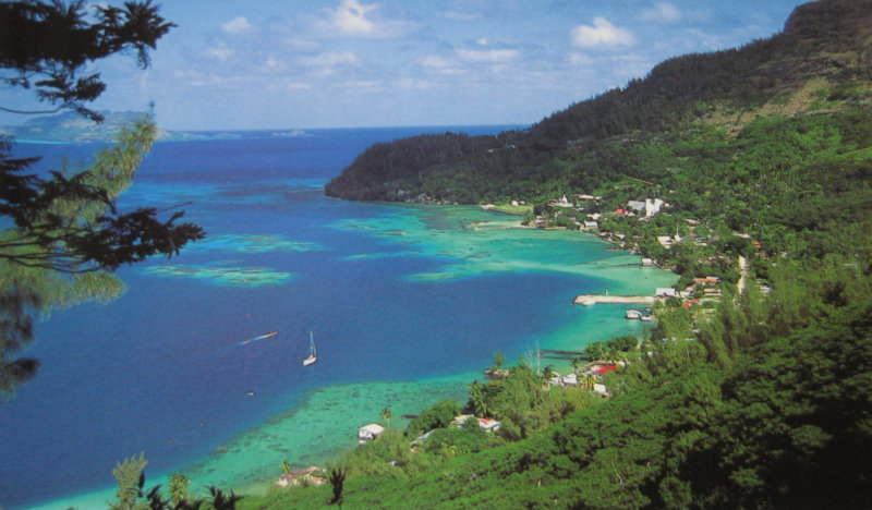
We are in Rikitea Harbor, on Mangareva Island, in the Gambiers group of islands, in French Polynesia. We are glad to be back in the tropics. (This image is from a postcard)

We have a little bit of internet, but it is VERY VERY slow. We are asking all our friends to please please please DO NOT send us any attachments, or those cutsie email forwards.

We love hearing the news from back home and very much welcome emails, but we just can't take any big emails. Someone today sent me a 9MB email that would have taken us an hour to download (and we are paying by the minute for all our internet these days).


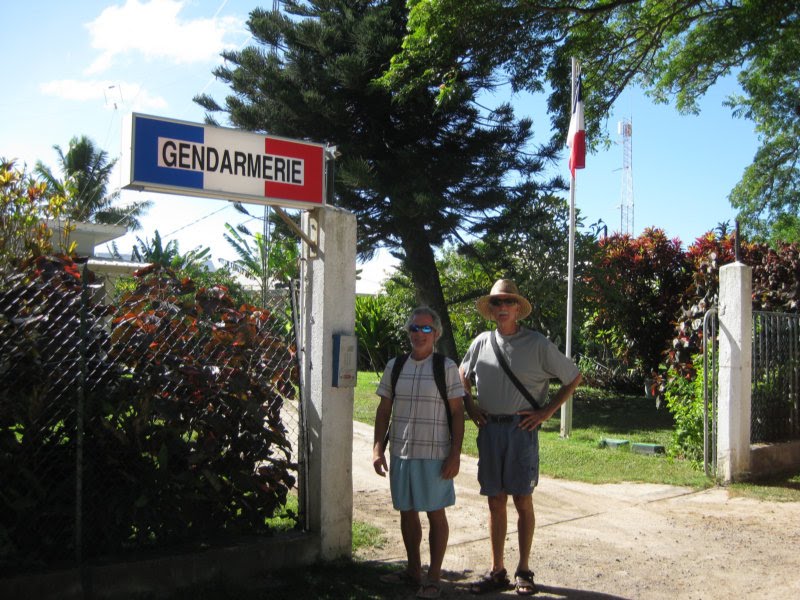
We got checked in with the Gendarmerie. It took us 15 minutes and a 70-cent stamp (to mail our paperwork to Papeete).


A supply ship came in yesterday, so we spent most of yesterday and part of today getting everyone topped off with diesel. We bought 6 55-gallon drums of fuel for 3 boats, and then pooled all our jugs and dinghies to ferry the jugs back and forth. What a process! And it 'only' cost $5.50/gallon. Our share was almost $500!! We are very thankful in these capers, for our ECSA siphon hose!!! Hopefully it is the last diesel we'll have to buy before we leave the Marquesas for Hawaii in September.

The wind is supposed to drop off starting this afternoon, so we are planning to go out somewhere to the edge of the reef behind a 'motu' (small island on the edge of the reef) and hang out and go snorkeling, etc, for a few days.

Wednesday, April 7, 2010

Arrive a Polynesie Francais

We crossed the reef at the SE Pass this morning just at daybreak... in a squall. It was interesting for a few minutes (too much sail, wind, rain while crossing an unknown reef!). We were still wing-on-wing and so couldn't 'wave off' easily. But we knew the pass was wide and we had no problems.

We anchored in the lee of Akamaru island for about an hour, to get things sorted out, have breakfast, and wait for Infini. While we were there, a guy came up in a skiff, introduced himself, welcomed us to Mangareva, and presented us with a few huge 'pampelmouse'. These are the Polynesia version of grapefruit. Very tasty! Anchorage position: 23-11.289 S 134-55.466 W.

An hour later, having navigated across the lagoon using the very accurate CM93 charts in Maxsea, we dropped anchor in 45 feet in Rikitea harbor. Anchorage position: 23°06.91'S 134°58.05'W

We will clean up, have lunch, launch the dinghy, and go ashore this afternoon to the Gendarmeria to present our paperwork.

We are now on French Polynesia time, which is -9 from UTC, and -5 from EDT.

----------
radio email processed by SailMail
for information see: http://www.sailmail.com