Tuesday, May 11, 2010

Safe Arrival Tahanea (and Diving!)

We dropped the hook around 10am inside Tahanea, the pass was no big deal (3 knots incoming current with mild wind and sea conditions).

At 11:30, we took off in the dinghy behind the crew from Visions of Johanna, to dive the pass at the tail end of the incoming current. Nice dive!!

There are only 3 boats here that we know of... Visions, Soggy Paws, and Nakia (svnakia.blogspot.com).

Happy Hour on Soggy Paws tonight--coconut steamed breadfruit is my appetizer, along with breadfruit french fries.
-----
At 5/10/2010 5:22 PM (utc) our position was 16°49.35'S 144°28.47'W

----------
radio email processed by SailMail
for information see: http://www.sailmail.com

Dodging Unseen Dangers at Night

We spent the night still sailing downwind, dodging small atolls. It's a little scary, but with GPS, accurate charts, radar, and a complete backup navigation system, I guess it's not too dangerous.

But 20 years ago, everyone just thanked their lucky stars when they could get safely past the Tuamotus, giving them a wide berth. The atolls are only coral reef with a few palm trees, so they are not visible for more than 3 miles. There are currents around here, between the atolls. It took some pretty tricky and risky navigation to do what we've done in the past 2 days.
-----
At 5/10/2010 5:13 PM (utc) our position was 16°49.48'S 144°27.51'W

----------
radio email processed by SailMail
for information see: http://www.sailmail.com

Monday, May 10, 2010

The Best Sail We've Had So Far

Since about midnight last night, the winds eased to just under 15 knots, and the seas eased to about 4 feet. We have had a nice sunny, warm, tradewind sailing day. We have only had the big genoa up, and haven't had to touch it all day. With no main, "Janet", our autopilot, doesn't have to work so hard. No black clouds, and all the wind shifts have been favorable ones!

We've been sailing along in gentle winds and gentle seas all day, but still making about 5.5 knots. Nice!

I got several Happy Mother's Day's from Dave, a nice email from daughter Nicki (followed up by a short satellite phone call from me to her), and even the guys on the Pacific Seafarer's Net wished me a Happy Mother's Day.

We are eagerly anticipating landfall tomorrow morning sometime at Tahanea.

I went looking for other sources of slack current information, and found contradicting information in the British Admiralty and the US Pacific Pilot guide (Pub 126). The cruising guides seem to quote one or the other. Gram on Visions has put together a spreadsheet, presumably to enter the moon rise/set times and come out with expected slack times. I'm not sure which one he's based it on, but they've been in and out of 3 atolls now, so we are assuming they know. He told us to shoot for 9am tomorrow or 3:15pm. It looks like we'll get there in time for the 9am.
-----
At 5/10/2010 7:21 AM (utc) our position was 17°03.30'S 143°39.45'W

----------
radio email processed by SailMail
for information see: http://www.sailmail.com

Sunday, May 9, 2010

Hello Hao, Goodbye Hao

We were all set to arrive at Hao with possibly enough time to make a possible slack current event this afternoon. But due to really crappy weather last night, we missed it.

Just when we were starting to count our chickens, we got a wind switch that drove us more west than we planned. This was complicated by the fact that we had set the spinnaker pole up on the jib, and with the pole up, we couldn't 'harden up' and keep our original course line. We didn't want mess with trying to take that big spinnaker pole down in big seas in the dark. (For the non-sailors, a spinnaker pole is an aluminum pole about 20 feet long and 4 inches in diameter, used to 'pole out' a sail to keep it from flopping when sailing downwind).

We spent the whole night dodging squalls with 25 knots of wind, rain, and wind from the wrong direction. Neither of us got much sleep.

We took the pole down at first light, but by then the damage was done. We couldn't make our waypoint without really bashing into 20 knot winds and 8 foot seas. No thanks. So we took the easy way out, and sailed up the west side of Hao. It afforded enough protection from the big seas to give us a breather, time to take a nap, and consider what we wanted to do. We were close enough to see some tiny palm islands on the rim (called 'motus' in Polynesia).

We had planned to arrive at Hao with winds having eased to under 15 knots for at least 24 hours. But the forecast changed and it had been blowing almost 20 for at least 24 hours. We were pretty sure that, even if we'd made it on time, we would have found a 5+ knot outgoing current anyway.

If we'd really been stuck on Hao, we would have just hove to for the night and tried it in the morning. But it takes the lagoon several days to empty off all the water that washes into it when the seas/winds are high. So it was iffy. And Dave really wanted to go to Tahanea anyway. :)

So we had lunch, plotted a course for Tahanea, and bore off WNW for Tahanea, 230 miles away. Its almost, but not quite, dead down wind. So we will gybe a couple of times to get there (unless the wind shifts). We will have to dodge around a few atolls also. (Thank goodness for our GPS and very accurate French electronic charts).

So we are enjoying a nice downwind sail--no moon right now, but lots of stars. No squalls tonight, thank God. The wind has eased to the 15 knot range and the seas are much better also. ETA Tahanea sometime Monday, in light winds.

Our friends on Visions of Johanna are there, and the big attraction at Tahanea is DIVING!! (The visibility at Hao was very poor, Visions said). We are FINALLY going to do some serious diving in some seriously fantastic atolls.
-----
At 5/9/2010 7:37 AM (utc) our position was 17°45.33'S 141°43.76'W

----------
radio email processed by SailMail
for information see: http://www.sailmail.com

Destination: Hao, in the Tuamotus

In anticipating our arrival at Hao, the next thing we are sweating about is when we will be able to enter the pass. Most of the Tuamotus are sunken volcanos--atolls with large fringing reefs that totally enclose the lagoon, and one or two passes that a big boat can use to enter. As you might imagine, the small pass on a big atoll can get a pretty good current going, so you have to time your entry/exit for a time of slack current. Fortunately the tidal range here is only about 2 feet.

The challenge we face in calculating the best arrival time is twofold. Exactly when is high/low tide and therefore when to expect a slack current. And what effect will the wind and seas have on things. (and third, how long we feel like hanging out outside waiting...)

We learned that at Hao, when the wind has been blowing hard for a few days, there is NEVER a slack current--the current is always outgoing at 5-10 knots!! This is caused by the waves breaking over the windward side of the reef, filling up the lagoon, and the only outlet is the passes, which are typically on the downwind side of the reef. Our friends on Visions, with a 62' boat that motors comfortably at 8-9 knots, went in without paying too much attention to the slack current issue, and got pooped by a huge standing wave (first time in 5000 miles of voyaging). They have a pretty good blog post about it (vofj.blogspot.com, about 10 days ago).

So the reason we left Gambiers in 'boisterous' conditions was to arrive at Hao when the wind was easing. We're hoping there will be a slack current at some point.

We use WXTide32 (freeware downloaded from the web) to figure our tides. Generally it is pretty accurate. But for the Tuamotus, there are only 2 tide points, and there is some confusion about what time zone the tide points are on. For Hao, there are actually 2 tide points--basically the same one but on 2 different timezones. One is labelled '-10', meaning, we think, UTC -10, which is the time zone that Hao is on (one further west than Hawaii). The other is labelled Tz: Pacific/Marquesas. The tide times are 1.5 hours different! (For some reason the Marquesas are on a half a time zone).

But knowing when the tide turns doesn't always tell you when the current will be slack. We have a reference from the Pacific Islands Pilot that says "To avoid a difficult passage through the reef, vessels should wait for the two periods of slack water associated with the flood current, which are short. Slacks usually occur about 4.5 hours and 2 hours before moonrise; and again 5 hours and 3 hours before moonset. When the tidal race slows or stops, the channel may be entered".

So this is what we'll be basing our slack current information on. (Plus the advice of Visions of Johanna, who was at Hao for a few days).
-----
At 5/7/2010 6:39 PM (utc) our position was 20°03.82'S 138°42.00'W

----------
radio email processed by SailMail
for information see: http://www.sailmail.com

Saturday, May 8, 2010

Enroute Gambiers to Hao in the Tuamotus - Day 3

Just another 500 mile passage!

No one warned me that the Pacific was so big and the islands so far apart. I long for the Bahamas, only 75 miles from home, with lots of islands only hours apart, and enclosed by a big protecting reef. (And fish you can actually eat!)

Dave keeps telling me that the Bahamas are crap, and he'll never pay $300 to go there (that's the entry fee they enacted for boats over 40 feet a few years ago). And he says... wait til you see the diving in the Pacific. Well, I'm still waiting. (Though our friends on Visions have been diving at Makemo in the Tuamotus and raving about it).

And we'd never get around the world hanging out in Marsh Harbor!! (or Double-Breasted Cays).

Anyway, I digress. We left the Gambiers 2 days ago, in pretty rough (for us) conditions. The wind was blowing 18-20 kts and the seas were about 8 feet. If we hadn't been going on a broad reach, I would never have been able to get Dave to leave in those conditions. But he is learning that wind is good!! (even if it does get the boat all salty).

It has been relatively easy. The biggest challenge has been getting our autopilot to steer well on a broad reach with the big genny up and a small triple reefed main. Dave likes to have the main up for a steadying sail and a 'last resort' sail in a squall. But it makes us unbalanced and Janet (the autopilot) doesn't like broad reaching with that sail combo at all.

Every time we get things set up so we're going where we want to go, the wind speed changes a little and we have to rebalance all over again. (Let sails in and out, tweak the heading on the autopilot). Add in the 'dark as hell' factor at night, where you can't see what your sails are doing (or the weather coming at you), and it makes life interesting!! When Janet doesn't like the heading we've picked, she responds by veering back and forth about 100 degrees... luffing the sails because we're too far upwind on one extreme, and because we're too far downwind on the other extreme. Tweak the heading 5 degrees, and she's happy and settles right down and steers properly.

We are threading our way between many small atolls, but unfortunately, none have passes that would let us go inside, and it doesn't seem possible to drop a hook on the outside in most conditions. (At least we have no guidebooks or cruiser accounts of anyone who has done it successfully). So we are going direct to Hao, which has a big pass, marked entry, and for which we have detailed charts.

We have about 180 miles to go--about 25-30 hours more at our current speed.
-----
At 5/7/2010 6:34 PM (utc) our position was 20°04.16'S 138°41.62'W

----------
radio email processed by SailMail
for information see: http://www.sailmail.com

Wednesday, May 5, 2010

Getting Underway for Hao in the Tuamotus

Well, I still haven't caught up on all our past adventures. But it's time to move on from the Gambiers. We are leaving this morning for Hao or Amanu in the Tuamotus. They are neighboring atolls at approx 23N 135W.

This trip will be about 465 miles, and we expect to get into Hao late in the day on Saturday, May 8th. If you want to read up on Hao, check Visions' blog at vofj.blogspot.com. They were there about a week ago.

The weather forecast looks pretty good. We expect 15-20 kts on our port quarter for the whole trip, and are projecting an average speed of about 6.3 knots.
-----
At 5/5/2010 2:44 PM (utc) our position was 23°08.56'S 135°02.81'W

----------
radio email processed by SailMail
for information see: http://www.sailmail.com

Taravai

Taravai is one of the islands in the Gambiers group. It is only about 6 miles from the main harbor of Rikitea, but being away from the main harbor, it is quite tranquil.

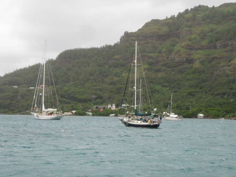
The primary harbor in Taravai is in front of an old church. But in the prevailing ESE wind conditions, that seemed to be pretty exposed to us, and there were already 4-5 boats anchored there. So we opted to follow the advice of another cruiser, and work our way into the uncharted south bay.

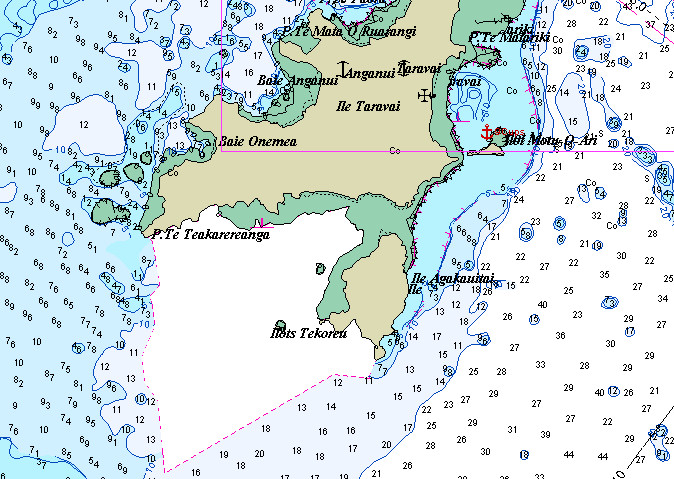
Chart of Southern Half of Taravai
Our tracks are in red

You will find little about these 'uncharted' areas in cruising guides. Even detailed S Pacific cruising guidebooks tend only to have a page or two at most on this entire archipeligo. Navigation is done by reading the color of the water, so our travel between islands is limited to 10 AM to 3 PM or so, moving with the sun behind your back in order for us to properly "read" the bottom. Dark blue is friendly and light blue is fine. Tourquise can be tricky as depth depends on water clarity. The water is getting thin as tourquise turns green and then to tan/yellow in sand, or brown over a reef. You don't go there!

We went on a day with good sun and it was easy to work our way into the bay. The trickiest spot was at 23-10.059S / 135-02.596W. Before this and after this, it was pretty easy. Though the water clarity in the bay is not very good, so proceed carefully.

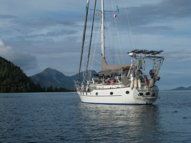
Soggy Paws in the Bay at Taravai

We found a beautiful bay with a nice beach, and good protection from almost 270 degrees, plus pretty good protection for the 'open' sectur, due to the reef. We spent about 4 days there. If you work your way into the bay, there is one anchor spot in about 25-35 feet of water, good sand bottom, and enough swinging room (23-09.606S / 135-02.217W). Since that spot was occupied, we anchored a little further out, in about 40-45' and a few coral heads. We eventually had 6 boats in the bay, with adequate room for a couple more.
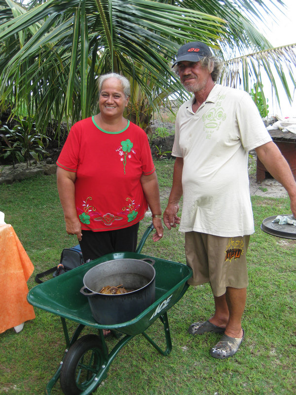
Denise et Eduard

While there, we went ashore and met Eduard and Denise living in a nice home on a lovely bay.
Eduard was born on Taravai, had gone off and worked in Hao as a welder on the French Navy base, and was now back on his family 'farm' for good. They are living nicely off the property, keeping pigs and ducks, and growing pretty much everything they might need.

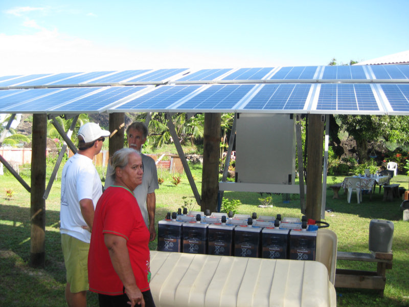
Eduard's Awesome Solar System

They do have a few of the modern comforts--a very large solar array, a refrigerator and freezer, and satellite TV. From their house, they can't quite get cell phone coverage from the tower in Rikitea, but we could get it from where we were anchored in the bay.

They were very generous with us with their fruits and vegetables--giving us armfuls of pampelmouse, lemons, papayas, eggplant and coconuts.

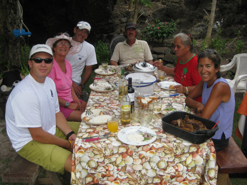
Lunch with Denise and Eduard

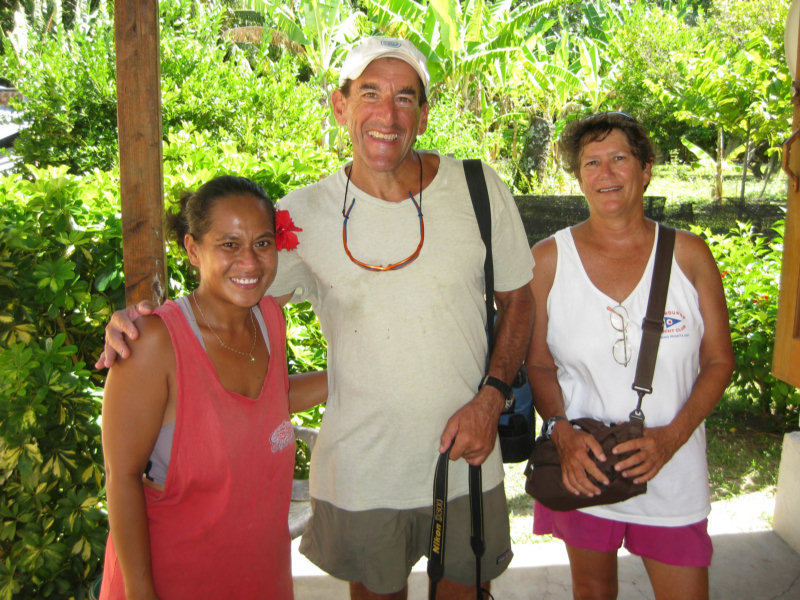
One day we had a 'potluck' ashore with them. They had cooked a couple of canard (ducks) in the traditional polynesian 'rock oven', and also made a big pot of 'Poisson Cru'. Poisson Cru is a polynesian dish that consists of raw fish, chopped onions and such, in a coconut milk broth. It is sweetish and coconutty, but otherwise somewhat like a South American ceviche. We and the crew from Visions brought in desert and drinks for everyone (and an old pack of cigarettes for Eduard, which was much appreciated).
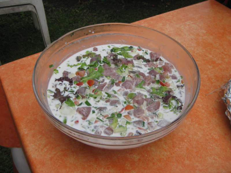
Poisson Cru

As we sat digesting our meal, we asked Eduard, in our broken French, about fishing. What lures did he use, and where were the best fish. This led to a 'fishing expedition' on Soggy Paws the next day.

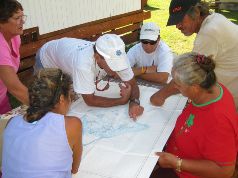
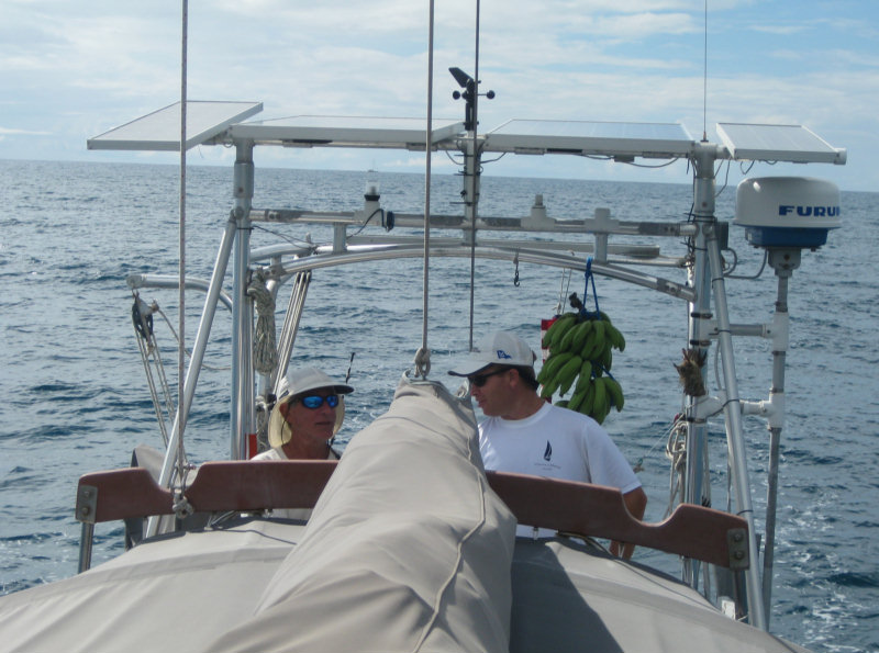
Planning our Fishing Expedition

We loaded Eduard and Denise and the crew from Visions on Soggy Paws, and set out for the SW reef. We trailed 3 fishing lines, with all the right color lures, out the pass and around the reef, and back in through the reef at the north end of Taravai. We had nary a nibble.

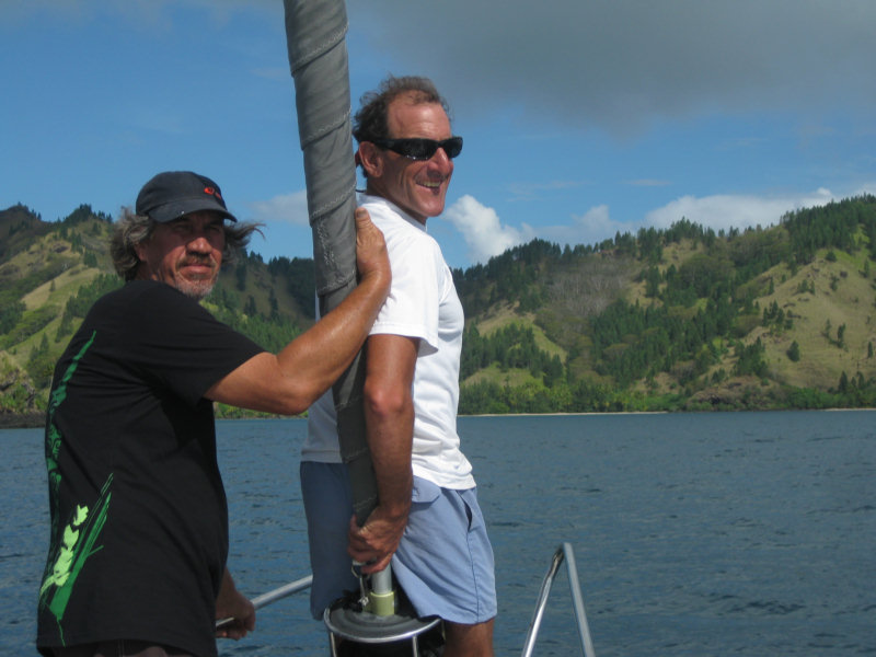
Eduard Pilots Us Out Through the Reef

Gram (Visions) and Mike (Infini) Tend the Lines

Eduard had tried to tell us the day before that the time (moon/wind/currents) wasn't right. But we had fun anyway. And we got a chance to run down the west side of Taravai and explore a little. Again, the reefs are numerous, but accurately plotted on the Maxsea CM93 charts, and easily navigated with good light.

We re-entered the south bay at 23-09.720S / 135-03.627W and proceeded carefully back to our anchor spot without incident.

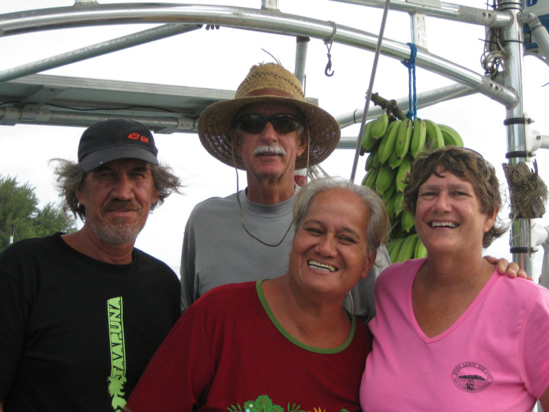
Denise and Eduard on Soggy Paws

A few days later, we did anchor in front of the church at Taravai. When we had been anchored in the south bay, we had dinghied around to the church and met Valerie and Herve on the north side of the church, and another guy on the south side of the church. They were both selling fruits and veggies to cruisers.

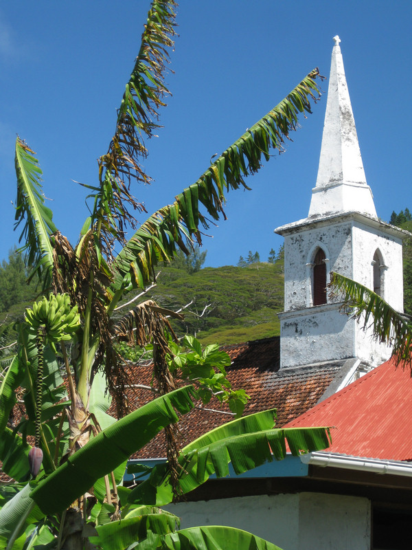
The Church at Taravai


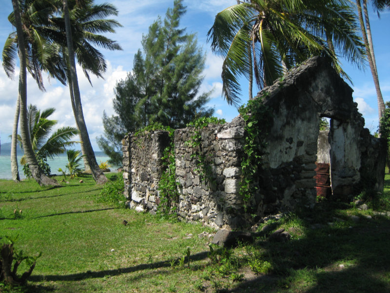
Some Ruins Near the Church

Bill (Visions) and Sherry with Valerie

Dave especially wanted to visit Valerie again, because they had some really nice avocados. On our way out of Rikitea to stage for leaving the next day, we made a pitstop in the 'main' Taravai anchorage. We didn't know the way, so we just approached with a direct frontal assualt (with the wind at our backs and the sun in our eyes--a bad combination. We managed to cross the reef safely with a minium depth of about 10'. Once across the reef, it was deep and easy to navigate to a safe anchor spot. Though this anchorage seemed exposed, there really is pretty good protection from the offshore reef.

The proper entry is around 23-08.957S / 135-01.119W, where there are a couple of pearl bouys marking a 'channel'. From this point, you proceed carefuly NW around the prominent reef to your left, watching out for isolated coral to your right. Good light is mandatory. Our anchor spot was 23-08.751S / 135-01.499W in 45 feet sand.

Our final anchorage in Taravai was a bay on the NW side, where we staged to leave. This bay has great protection from the prevailing easterlies, with good 270 degree protection from N - E - SW. We anchored at 23-08.564W / 135-02.803W in 45'. With this anchorage, we completed a complete circumnavigation of Taravai.

In all, the Gambiers were worth more than the month we spent there, but with winter coming on (in the Southern Hemisphere) it was time to be headed north.

Monday, May 3, 2010

Oh No! No Baguettes!!!

Well, the bakery here is out of flour, so there are no baguettes until the next ship comes in. :(

From what we understand, flour is a subsidized item, and the bakery gets an allotment of government-subsidized flour, and when that's gone, they go on vacation til the next ship comes in with a new allotment.

With all the cruisers passing thru now (gobbling up baguettes like they're going outta style), they really ran through their normal amount of flour early.

We still have one or two left in our fridge (we stockpiled when they were available). Since we can't get regular sliced bread, we use the baguettes for all our bread needs, so we buy 6 or 8 at a time. They're not too bad when re-heated in the oven--they get nice and warm like they were just baked, and soft on the inside and crunchy on the outside, just like good French bread should be.

I COULD bake some bread. I bought tons of flour in Ecuador before we left. But so far this year, I have only baked one loaf of bread!! Dave is a nut when it comes to stockpiling bread, and though I'd much prefer fresh baked bread... it's a lot of work!!
-----
At 4/18/2010 4:04 PM (utc) our position was 23°09.61'S 135°02.27'W

----------
radio email processed by SailMail
for information see: http://www.sailmail.com

Friday, April 30, 2010

A Grey Day in Paradise

Yes, we are still at anchor in Rikitea.

Blustery Weather in the Anchorage

I've been trying to catch up on posting pictures to our blog posts in March and early April. I am finished with the 'On Passage' stuff as far as Easter Island, and Easter Island itself. You can see the final result by clicking here Easter Island. Next is Pitcairn, and a couple of Gambiers posts I haven't gotten to yet. The internet here is R-E-A-L-L-Y slow, and I often get up at 5am to try to get a little better speed.

Our friends on Visions pulled out of the Gambiers almost a week ago, on a nice weather window. We just weren't quite ready. I lobbied strongly to pass on the window and take a few days to just relax. It is tough when my Dave and Bill from Visions of Johanna get together. It's go-go-go all the time!!

We have had a nice round of dinners and happy hours around the anchorage. Dave celebrated his birthday, and all of our group gathered for pizza and birthday cake. (Thanks, Sue, from Infini, for making the cake!!) We haven't remembered to take our camera often, but Dave caught this great picture of a few of the 'girls' during one happy hour in which we had a book swap.


Our friends on Aliisa finally arrived. They left Peru just about the same time we left the Galapagos, but it took them nearly a month longer to get here. They had better luck (or more fortitude) at Easter Island and managed to stay for 2 weeks.


Lauri and Anina are on the last leg of a 6 year circumnavigation. They hope to be in Cairns, Australia by September, where Lauri started from. You can see his adventures on his website at Aliisa.net.

The pizza parlor in town is only open Fri-Sat-Sun, so Saturday after Aliisa got in, we all went in for pizza. It was good--better than South American pizza, but we just about choked when we did the math and found they cost about $11 each for what was essentially a personal-sized pizza.

Now the weather has moved in, and we've got forecasts for 20-35 knot winds over the next 5 days as fronts and highs and lows roll past us.

We are actively looking for a weather window for the next jump--up to the Tuamotus. We have had nearly an unending succession of Lows roll past, bringing mostly NW-ly winds.

It is 450 miles NW to the Hao atoll. Though there are many islands and atolls between here and there, all are either islands with no real anchorage, or a closed atoll, with no pass big enough for a sailboat. We need a 5-day weather window, and looking at the GRIB files, it looks like the first possible departure date is May 4th or 5th.