Tuesday, March 16, 2010

Land Ho! Easter Island!!

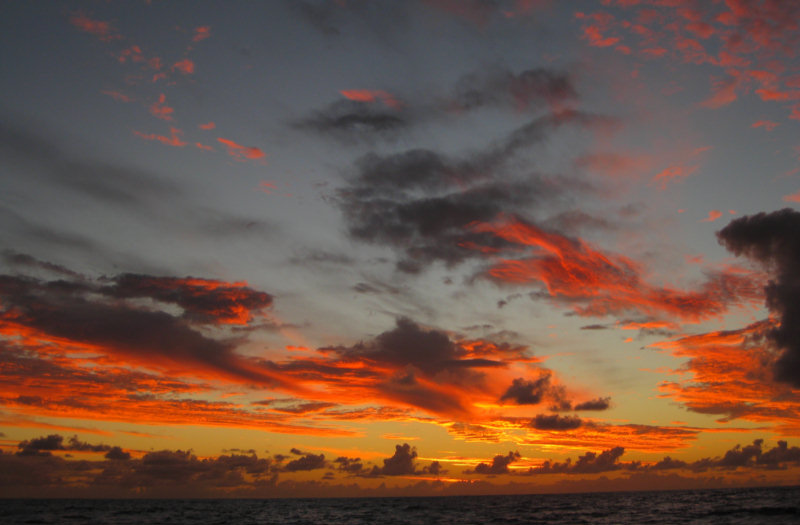
Our Last Sunset of the Easter Island Trip

We are currently 32 miles out from Easter Island. We could just see the tip of the island at about 50 miles out.

Today was a very nice day--moderate winds and seas, sunshine, and just smooth sailing. We tried to hold off the 'horse heading for the barn syndrome' as long as we could, but finally caught it in the late afternoon, as we were drifting along at 4 knots in only 8 knots of wind. So as soon as we got through with dinner (seared tuna and coleslaw), we cranked up Mr. Perkins, to get us in these last few miles a little quicker.

After much discussing about how wise it was to go in and anchor after dark, we have decided to make for Anakena Cove, on the north coast. Our friends on Visions of Johanna anchored there this afternoon. They gave us a waypoint, scouted an anchoring spot for us, and promised to get up at 1 am to turn their lights on and help guide us in. There is almost no wind and no seas, so it should be a pretty easy anchoring exercise.

We will get a few hours of sleep, have a nice breakfast on Visions, and then head for Hanga Roa, 10 miles away, to check in. This will let us see the coast (and the famous 'moai' along the coast) during the daylight.

The sunset tonight was spectactular. The air here in the higher latitudes is much clearer than along the equator, where we've been for the last 2 years. We took yet another sunset picture for our collection.
-----
At 3/16/2010 2:05 AM (utc) our position was 26°34.96'S 109°07.94'W

Monday, March 15, 2010

Enroute to Easter Island - Day 13

We had a good day today--the winds have moderated to just plain good sailing weather.

Last night, the skies were mostly clear, with billions and billions of stars. Today we had a nice blue sky, puffy white fair weather cumulus clouds. We had our best day ever, logging 150 miles noon to noon, an average of 6.25 knots over 24 hours. We have had hardly any squalls in the last 24 hours.

Our friends on Infini, who left about a day ahead of us, just put their anchor down at the Hanga Roa (main) anchorage at Easter Island. We are looking forward to finally catching up to them tomorrow evening!

Only 155 miles to go!!!
-----
At 3/15/2010 1:40 AM (utc) our position was 24°44.38'S 108°04.28'W

----------
radio email processed by SailMail
for information see: http://www.sailmail.com

Sunday, March 14, 2010

Our Daily Routine at Sea

After 12 days at sea, we have gotten into a pretty comfortable routine aboard.

0500 - 0900 Dave on Watch
0735 Dave wakes Sherry for 0745 Radio Schedule
0745 Radio Sked with Infini
0830 Sherry on the Computer / Radio getting weather, etc
0900 - 1200 Sherry on Watch
Dave takes a 2 hr nap
1200 - 1600 Dave on Watch
Sherry takes a 2 hr nap, plans dinner
Dave attends to maintenance issues
1600 - 1930 Both up and about
Showers
Sherry cooks dinner
1700 Radio Sked with Infini
1800 Dinner
1915 Radio Sked with Visions
1930 - 2300 Sherry on Watch
Sherry gets updated weather info
Sherry checks in with Pacific Seafarer's Net
2300 - 0200 Dave on Watch
0200 - 0500 Sherry on Watch

We chose a 3 hour nighttime watch schedule, over a 4 hour one, because it gives each of us 2 3-hour blocks of off-watch time to sleep. With a 4 hour schedule, one of us would get 2 off-watch period and the other only 1.

Dave Chats with Other Boats On Passage

We seem to be getting adequate sleep, with the 2 blocks of sleep time during the night, catnaps during our watches, and a 2 hour nap during the day.

We've ended up with 4 different times on the radio during the day. That may seem a lot, but when it's you're only contact with other human beings, it's a social thing, as well as a safety thing (exchanging positions, weather information, etc).

We are now 310 miles away from Easter Island. At our overall average speed, we'll get there about 2am on the 16th. But we are expecting the wind to gradually die off over the next couple of days, and so expect landfall around dawn on the 16th.

Our friends on Infini are still a little over a day ahead of us. And Visions of Johanna is still at Easter Island (and getting tied of the rolly anchorage).
-----
At 3/13/2010 6:17 PM (utc) our position was 21°56.16'S 106°20.83'W

Saturday, March 13, 2010

Enroute to Easter Island - Day 11

Are we there yet? Of course, we've been saying that since about the 2nd day.

Last night wasn't bad and today was OK. We had a lot of squalls today... passing rain showers that take the wind to about 20-25 knots and then the wind drops off to 5 knots. We can handle the 20-25 knot part (just a lot of cranking to furl the genoa in). But the seas are still so big that when the wind drops to 5 knots, there's nothing to keep us from rolling. So we ran the engine for about 2 hours today during the worst of the lulls.

We had a nice rain shower about an hour ago that was hard enough to wash some of the salt off the decks and windshields.

We're getting closer... 440 miles to go. At our current average speed of 5.7 knots, that will put us in at about midnight on Monday the 15th. We are anticipating some lighter winds the last day or so, so we'll probably aim to get in early on Tuesday the 16th.
-----
At 3/13/2010 1:52 AM (utc) our position was 20°36.49'S 105°31.14'W

----------
radio email processed by SailMail
for information see: http://www.sailmail.com

Friday, March 12, 2010

Enroute to Easter Island - Day 10

Last night sucked. High winds, big seas. We were tossed around all night and neither of us got much sleep.

However, today has been nice, sunny with about 12-15 knots of wind. Good sailing. We both took long naps to catch up on our sleep.


Conditions finally moderated enough that Dave braved going out on the swim platform at the back of the boat to hook up 'Henry', our Monitor wind vane. For you non-sailors, this is a device that uses mechanical means to steer the boat automatically, relative to the wind. We have been carrying this expensive, pretty, stainless steel device around on the stern of Soggy Paws since 2007, and it (so far) has gotten about 1 hour of use. Normally, we use 'Janet' our electronic autopilot.

Janet has been doing a GREAT job of keeping us on course over all these miles. But on long trips like these, we should be using the Wind Vane.


It's a little bit of voodoo magic to get it set up and working right. Dave bought ours second-hand, and it wasn't put together right. So the first couple of times we tried to use it, it didn't do the job. Dave took it apart and re-assembled it correctly, and we've finally gotten around to setting it up and using it. We tried once on the way to the Galapagos, but the wind was too light for it to be effective.


Henry has been steering now flawlessly for the past 3 hours. Henry's biggest benefit is that he runs without electricity, saving us about 24 amp-hours a day. And he doesn't eat much :) Henry is named after our friend Henry Mikelait, who is another world traveler. We are happy to have Henry guiding us around the world.

600 miles to go! About 4-5 days. We know the wind is forecast to get pretty light as we approach Easter, so we expect to slow down some the last day.

One of the other boats we've been talking to on the radio--s/v Aliisa--who left from Lima, Peru for Easter Island, said he was passed by a big cruise ship, the Oceanic, who's AIS signal said its next port was Easter Island on March 15. There goes the neighborhood! We hope it has come and gone before we get there!
-----
At 3/11/2010 10:44 PM (utc) our position was 18°20.33'S 104°03.34'W

Thursday, March 11, 2010

Enroute to Easter Island - Day 9

We covered another 140 miles in the last 24 hours. 725 miles to go.

The wind has been blowing 'briskly' all day, about 15-20 knots. But the direction is now almost on our beam (this is better than before). We are no longer beating to windward, but now just trying to keep from rolling our guts out. We have learned that too little sail is as bad (or worse) than too much sail on this point of sail. Too little sail and we roll. Too much sail and we go so fast we get scared :p We like to to keep our speed between 6 and 7 knots.

With the wind up, the seas have gotten bigger. Janet, our autopilot has been working hard to keep us on track. With the big waves slewing us around, she has to work extra hard. I hope she keeps it up!

But it was a nice sunny day all day.

Still have seen no other ships, or other signs of life. But I did see one bird today.
-----
At 3/11/2010 1:14 AM (utc) our position was 16°38.57'S 102°41.77'W

----------
radio email processed by SailMail
for information see: http://www.sailmail.com

Wednesday, March 10, 2010

Enroute to Easter Island - Day 8

Today was a pretty good day. We had some fun dealing with too little wind and then too much wind back and forth over several hours. I spent a lot of time cranking the genoa in and out today. The wind got so light (and the sea was so sloppy) that we ran the engine for an hour twice today.

We saw rain clouds going across our bow several times today, and tried vainly to catch them--we could REALLY use a fresh water rinse at this point. (Even our salt crystals have salt crystals!).

But a few hours ago all that cleared away and the wind settled down at 12-13 knots, and the sun came out, and we've been having a pretty good sail. We anticipate another nice sunset, and hopefully an uneventful night.

The forecast (GRIB files) shows that we should expect some fairly strong winds for about 24 hours, starting late tonight or early tomorrow. We are not looking forward to that! But after that, the winds look nice for sailing right on in to Easter Island.

The trade winds peter out at about 20°-25° South latitude, and Easter Island is at 27°S. So we have a couple of hundred miles to cover in the 'variables'. Our friends on Visions ended up in this area with no wind for 24 hours, and then having to motor the last 100 miles into light headwinds. We are hoping our forecast holds and we'll be able to sail right on in.

We still haven't seen hardly any life out here... only one freighter, a few birds, and no whales or dolphins. We do see lots of flying fish, and quite a few have ended up on deck in the night--I almost got hit in the head by one one night (our dodger deflected it). "We're a long way from Kansas, Toto."
-----
At 3/10/2010 12:42 AM (utc) our position was 14°31.21'S 101°23.31'W

----------
radio email processed by SailMail
for information see: http://www.sailmail.com

Tuesday, March 9, 2010

We Passed the Halfway Mark!!

At 0630 local time this morning, we reached 945 miles to go. We are finally half way to Easter Island.

We had a pretty good night. The wind was up and down, but within manageable ranges, and the seas were not too bad. The wind direction has eased to just barely forward of the beam, which is much better than close hauled!

The stars last night were just awesome!! It was brilliantly clear until about midnight, and we could see everything.

It has started to get quite a bit cooler here. This morning's air temp is 73 degrees F, and the water temp is down to 74.5 (they were both 80 in the Galapagos). It would be delightful if we didn't also have 20 knots of wind blowing across the deck. I've had to put long pants on and a jacket for my night watches.

We are now talking regularly to 5 or 6 boats on passage... one boat is Windy Too, 3 guys from Newfoundland, enroute from Galapagos to the Marquesas. We met them at Puerto Lucia Yacht Club in August. Another boat is Aliisa, they are a 32 footer, completing a 6 year circumnavigation in Australia. They are enroute from Lima, Peru to Easter Island. And of course, our friends on Infini, about 200 miles ahead of us, and Visions of Johanna, at Easter already.

We can still talk to some of the boats with better antennas 1000 miles away in the Galapagos, but the bulk of the Panama Pacific Net, where we have been participants and a Net Controller for the last year, is fading into the ether.

It's still early for the bulk of the boats making the Galapagos to Marquesas run. Though the World ARC boats were supposed to leave a couple of days ago. I think most people target arriving 1 Apr or later, because it's still officially typhoon season in French Poly until Mar 30. Most of our friends from Ecuador and Panama are either enroute to the Galapagos, or in the Galapagos still touring the Galapagos and getting ready to leave soon for the Marquesas.
-----
At 3/9/2010 3:00 PM (utc) our position was 13°45.18'S 100°56.44'W

----------
radio email processed by SailMail
for information see: http://www.sailmail.com

Enroute to Easter Island - Day 7

Last night we had a terrible night. Just about sunset, the wind came up really strong--eventually reaching 20-25 knots. And with the wind came the seas--we had big steep seas on our beam again, and were rolling like crazy, as well as banging into a pretty good wave train coming off our port bow. We tried everything to make it more comfortable--heading changes and sail reduction. We finally gave up and rolled the genoa all the way in and basically rolled and banged all night. Neither one of us got much sleep.


But this morning, the wind was down and we got a nice light rain to help wash the salt off the boat. For the first 2-3 hours, the seas were really confused... the washing machine again. But with the overcast, we needed to charge the batteries anyway, so we motored for a couple of hours. By late morning, the sun was out, the wind was steady, the seas were fine, and we were having a great sail. This continued all day, and was capped off by a beautiful sunset.

Now, about 8pm, the wind is still steady and the seas not bad. Hope this continues all night!!

We have 'only' 1006 nautical miles to go! Tomorrow morning we should reach our halfway point of 945 miles. Current ETA Easter Island is March 16. The forecast looks pretty good for the next week all the way into Easter Island.
-----
At 3/9/2010 1:49 AM (utc) our position was 12°39.91'S 100°13.60'W

Monday, March 8, 2010

Enroute to Easter Island - Day 6

We have 750 miles behind us and 1140 miles to go. ETA Easter Island sometime Mar 15 or 16.

Today has been a pretty fast day, with good winds all day, and they are starting to swing a little more east. So we've been making 6.5 knots all day with a double reefed main, staysail, and only about a third of the genoa out. The wind has been up and down between 12 and 18 knots all day.

Just before dark, the wind piped up to 20+ knots (in gusts). We now have the genoa reefed in to 'scrap' size again and we are still going 6.5-7knots. It feels like we're rocketing along. The relative wind is about 70 degrees off our port bow, so we've been able to ease the sheets a little.

Infini, about 165 miles ahead of us, said they'd been through some very windy conditions today, and it had just started to ease for them. We are hoping ours will die down through the night (it is supposed to).

We saw a ship today. They weren't transmitting on the AIS, so Dave called them the old way "Ship at 9 degrees 44 minutes south..." The ship finally answered after several calls. They are enroute from Long Beach California to the Straits of Magellan, with cargo for Brazil. When I drew a great circle line on the chart (using the charting program), it bisected our course right about where we saw the ship. I put a mark on our electronic chart to pass on to others making this passage to be especially alert in this area.

I baked oatmeal cookies today when the wind moderated a little. Something for the long night watches. I studied some more French. I spent a lot of time adjusting sails as the wind went up and down... trying to keep us moving as fast as possible but as comfortably as possible. Dave fixed a few minor things around the boat and read up on Charlie's Charts of French Polynesia (the best French Poly guidebook we have).
-----
At 3/8/2010 2:09 AM (utc) our position was 10°43.45'S 099°09.45'W

----------
radio email processed by SailMail
for information see: http://www.sailmail.com