Friday, March 14, 2008

Cayos del Este Sudeste (near San Andreas)


Some details about our anchorages and two night stay in Cayos del Este Sudeste.

This island group, located about 15 miles ESE of San Andreas, belongs to Colombia. It has a barrier reef, 3 islands, and a sandbar with a statue on it. The barrier reef runs for about 5 miles north-south along the eastern side. Though mostly awash, the reef has several wide gaps in it that do not break.

The permanently inhabited island is Cayo Bolivar. There is a small Colombian Navy detachment there, and a light structure that sticks up high over the trees (makes it easy to identify). Nearby to the west is a clearly visible large sandbar with a white statue on it. The light was working, but on a slow blink (15 second interval according to the chart).

The other two islands are located where Cayo del Este is on the chart. They are close together with a cut between, may have originally been one island. These two islands seem to have fishermen coming and going in lanchas, and probably a fish camp there. Though remote, they are close enough to San Andreas that they may also be visited by tourist boats or weekenders.

The water here was very clear (visibility approaching 100') everywhere we went. The chart (M26081S3 - Cayos Del Este Sudeste) seems fairly accurate in features and depths, except displaced about 200 yards to the NW. Our track through a pass in the reef showed up on the chart as 200 yds SE of the pass.

We rounded the NW end of the island about 4pm at waypoint SENW and proceeded south on visual behind the reef, in the deeper water between the reef and the scattered heads to the west. The water was clear, and even at that late hour, it was pretty easy navigating around the reef areas. We looked for a good anchorage in the the extensive sand near the NE corner, but the sand was either 5 feet deep or 35 feet deep, so we kept working our way south.

There was another sailboat anchored west of Cayo Bolivar, so we decided to go down there and check it out. As we got closer to Bolivar, we got a VHF call 'Yate yate, Bolivar'. We eventually figured out they were calling US, and it was the Colombian Navy on the island. The caller spoke only Spanish and wanted to know the name of the boat, our nationality, the Zarpe number, where we were from, how many people on board, and how long we planned to stay. We were not required to physically go to the island. We told them we were going to try finding a 'mas tranquilo' anchorage to the east, and they said 'OK'.

We could see that the sailboat anchored there (a Dutch vessel named s/v Garimar) was rolling a little, so we decided to try to work up closer to the reef and behind Cayo Este.

We eventually worked our way up into about 8 feet of deep sand behind Cayo Este, with a minimum depth of about 6-7 feet getting in. See way points SE11-SE13 below, and the anchorage at SEESTE. This is definitely a 'requires good light' entry, and we did have to weave around a few coral heads. This was a relatively calm anchorage in ENE 10-15. However, it would be EXPOSED in SE winds, as the reef to the SE was pretty broken in that area. The water here was crystal clear, and the sandy bottom flat for several hundred yards in all directions. The two cute little cays ahead and off the port beam had sandy beaches and palm trees. Unfortunately, we had the dink on deck, and needed to get going, so we didn't explore the islands. There was no coral within swimming distance from the boat so we didn't snorkel either.

The next morning, we moved to an anchorage to do some snorkeling and allow an easy departure in the wee hours of the morning. We went out from our first anchorage a different way than we came in. This route was deeper than coming in the previous day, and would be a better approach to SEESTE than the first one. See waypoints SE13-SE17 below. We passed a nice anchorage in 9-10 feet sand on the way out, more protected than where we ended up. See SE15Anch.

When we reached deep water, we looped back to the east and anchored between a reef area to the north and east and a grassy area to the south in 15 feet of nice deep sand. This would be a good daytime anchorage for snorkeling, with several nice reef areas nearby and a few conch in the grassy area. It would also be a possible night approach anchorage, or early morning departure anchorage. But it was pretty rolly, with swell from the south wrapping around the south end of the barrier reef, even in light ENE wind. See SE18 and SE18Anch. It might be possible to get away from some of the roll by moving several hundred yards further east in this same anchorage.

Waypoints NOTE: GOOD LIGHT REQUIRED!!!

SENW 12 27.750 N 81 29.713 W Approach waypoint in 50', from the north
SE11 12 24.221 N 81 28.638 W 1st wpt to Cayo Este Anchorage
SE12 12 24.377 N 81 28.131 W 2nd wpt to Cayo Este (skinny water, heads, between 11 & 12)
SE14 12 24.049 N 81 27.786 W 3rd wpt to Cayo Este Anchorage
SE13 12 24.038 N 81 27.561 W 4th wpt to Cayo Este Anchorage
SEESTE 12 23.971 N 81 27.386 W Anchorage at Cayo Este

Note: An easier entry to SEESTE is below

Navigate around Cayo Bolivar to the west and start WSW of SE17

SE17 12 23.727 N 81 28.197 W 1st waypoint in 35 feet, approach from WSW
SE16 12 23.794 N 81 28.136 W 2nd waypoint in 20 feet
Between 16 & 17, coral heads, but none shallower than about 15 feet
SE15 12 23.945 N 81 27.942 W 3rd waypoint
SE15Anch 12 23.945 N 81 27.942 W Nice sandy anchorage in 10 feet
Can also proceed from SE15 to 14 & 13 to SEESTE, carry 7' in.

Easy in/out Anchorage (rolly)
SE18 12 23.679 N 81 28.023 W 1st waypoint in 35 feet
SE18Anch 12 23.713 N 81 27.938 W Anchorage (don't drift left of course in

You might do better anchoring behind Cayo Bolivar
for an easy in/out anchorage.

Thursday, March 13, 2008

Passage from Providencia to Cayos Este Sudeste

We raised anchor this morning at 0550 local time (in the dark) for a 55 mile passage from Providencia to the small reef area SE of San Andreas called Cayos Este Sudeste (East Southeast Keys).

We don't know anyone who's been here before and couldn't find any info about them in any SSCA bulletin, website, or guidebook. But the chart looked pretty detailed, so we thought we'd give it a try. Our bailout plan was to head for San Andreas if it looked like a dangerous place.

Our course was a comfortable 185 degrees, and we had a nice 15 kt breeze from the ENE, so as soon as we cleared the SW tip of Providencia, WE TURNED OFF THE ENGINE. We sailed for 9 hours averaging 6.1 knots, without the motor on! Free miles!! We have been waiting for this sail for about 11 months (or 5 years, depending how you look at it).

Needless to say, it was a very nice day.

We trolled a line but did not catch any fish. Looks like it will be chicken for dinner tonight.

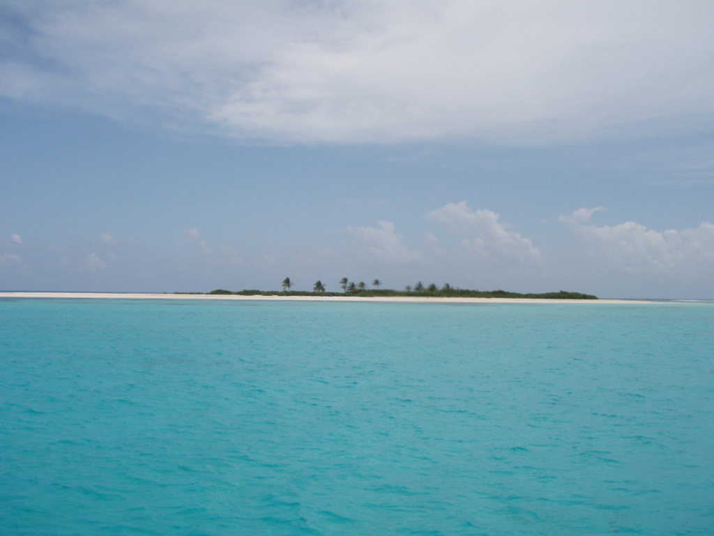
Dave did an excellent job of piloting us into a quiet anchorage in 10 feet of water, snuggled up behind Cayo de Este. It is a small island encircled with beach, and populated only with palm trees. (I'll take a picture for you). We had to weave around a bunch of reefs and coral heads, with the sun setting behind us.

The weather for the next few days is expected to be 10kts or less. So we hope to be able to spend a couple of days poking around this place, and the Albuquerques, a similar reefy area about 20 miles WSW of here. We currently plan to leave for an overnight to Bocas del Toro, Panama on Saturday.

Isla Providencia, Colombia

We stayed a week in Providencia, and enjoyed this quiet little island.

Check in was easy using Mr. Bush's services as an agent (call Bush Agency on Ch 16). An agent is required in Colombia, and Mr. Bush arranges to bring the officials out in a launch to your boat. We paid $20 USD per person for a tourist visa for Colombia. This only needs to be paid once (a year?). The agent's fee for combined check in and check out was $50 USD, paid on departure, making the total for stopping at Providencia $90. We understand that clearance in to San Andreas, the bigger island
50 miles south of Providencia, also requires an agent and a similar fee (even though we have cleared in to Providencia).

Mr. Bush is a source of all the information and services available in Providencia... if you need it, and it's available in Providencia, he can tell you where and how to get it. About the only thing we needed was water, and Bush arranged for us to jerry-jug water from the cistern at the base of the town dock. We paid only a $5 tip to Francisco, the guy that Mr. Bush arranged to help us dispense the water.

One day, Dave and I and Stephen and Josie from s/v Elysian rented motorbikes and 'did' the island. The main road on the island is only 11 miles in circumference, so even allowing for several photo stops, a lunch stop, stops at some dive shops to ask about diving, and a hike out to the big white cross overlooking the harbor, we had arrived back in the town by about 3pm. So we decided to ride back the other way around without stopping.

That was a fun trip. My first time solo on a motorcycle. I was assigned a brand new scooter with automatic shift, and thoroughly enjoyed it. There was virtually no traffic on the road, so it was pretty trouble free. We paid about $17 per scooter for the day. No deposit, no paperwork, we just took them and paid him when we got back.

We had lunch at a place in a beach restaurant called El Divino Nino (the Divine Child), in Southwest Bay, all the way at the end of the beach. Under the palm trees, on a sandy beach, gentle breeze blowing, all we could eat seafood, and a couple of beers, for $10 pp (a single plate of whatever is considerably less). The other place that looked interesting was Rolands, on Manchineel Bay. This was a little less of a shack, and seemed interesting, but we were told by friends that Divine Child was
a 'don't miss' (and we agree).

There's a cute little airport on the island. We didn't inquire about a schedule, but I would assume there's service at least a few times a week to San Andreas, where connections can be made to other places.

In addition to the Divine Child, we ate several times at the patio restaurant that is to the right of the dinghy dock on the main waterfront road. Prices are reasonable (about $1 for a beer and $5 for a chicken meal, $6 for seafood meal).

There is a weak open wifi ('default') available in the area of the dinghy dock. Most of the cruisers sat in the shade (on the ground) on the north side of the bank building. If you have a pretty good wifi receiver on your laptop, you can also pick it up at the nearby restaurant. One of the cruisers there now is trying to get them to get a better antenna and stronger wifi, so it could be picked up in the anchorage, but for now, the only strong signal available in the anchorage is locked.

There are 2 banks with ATMs in the town, we used a Master Card and had no trouble getting money. The currency is Colombian pesos at about 1,800 to the US dollar. Most places in town will take US dollars.

There are cell phones on the island, but we opted to wait til Cartagena to buy a Colombian cell phone chip.

The grocery stores (a total of 3 within a block of the dinghy dock) were OK--typical of a small island. We heard the supply boat comes on Friday, but didn't get ashore to look for groceries til Monday, and by Monday the only fresh stuff we was older and uglier looking than our 2-week-old stuff from Guanaja. So we didn't buy much except bread, a little beer, wine and rum, and some really nice Oatmeal. Decent white wine (hard to find in Central America for a reasonable price) was about $6.50 for
a low-end Argentinian Chardonay.

There is a very good hardware store along the waterfront road about 300 yards south of the city dock, with a large assortment of stainless steel fasteners and brass pipe fittings.

We ended up not diving anywhere. Though the water looked exceptionally clear, and we had fairly good weather for diving on the back side of the island, they were asking $65-$75 USD for a 2-tank dive, but nobody had much info on where the dives were (wherever you want to go, was the answer when we asked). (And we were getting low on water and I was trying to keep Dave focused on the watermaker project).

After a day in the inner harbor (anchored very close to where we were anchored on Island Time in Nov 96 for Tropical Storm Marco), we moved out to a nice anchorage off the little beach on Catalina Island, just outside the harbor. This anchorage is nice... in 20' deep, nice sand, and cleaner water. With nothing much more to do, this was a perfect place to finish the watermaker project. (see next post...)

We did a snorkel or two around the boat. There are several nice reefs within dinghy distance. In 1996 we dinghied around to the two small islands WNW of the harbor which we found "productive". But we did not get out there this trip.

By Monday, we came to a standstill on the watermaker project, and the weather indicated that the wind was going to go lighter in the next few days. So we cleared out yesterday for an early morning departure.

Some Providencia Harbor Waypoints:

13-23.95N 81-23.62W Outer Harbor 'Safe Water' buoy, lit with flashing white light
13-23.26N 81-23.13W In the 'fairway' between Red & Green buoys

13-22.82N 81-22.66W Corner of dogleg to inner harbor (diverges from main channel, but where yachts anchor)
13-22.82N 81-22.43W Inner Anchorage in 7 feet
13-22.96N 81-22.70W Beach anchorage

If coming in at night, you could drop anchor at 13-23.85N 81-22.62W in about 15' sand.

Right now, there are 2 red buoys and a green buoy before the dogleg into the inner harbor. All the lights are working, and we actually saw them doing maintenance on the buoys while we were there.

Tuesday, March 11, 2008

Looking Back

Miles Traveled in 2008: 623
Miles Traveled since leaving home May 2007: 1859

A year ago at this time, Dave and I were frantically trying to get ready to leave 'any day now'.

- The 'Sherry Beckett Regatta' was on March 11
- Sherry's last day at work at Globe Wireless was March 16
- Dave and Sherry got married on March 24
- Soggy Paws was hauled out at Cape Marina the first 2 weeks of March
- We were having yard sales to get rid of furniture and misc boat stuff

Our 'To Do' list was still a hundred miles long, and we were working on our list til close to midnight every night.

By the end of March, we were already being asked "Are you guys still here?"

We did manage to make the break in late May. Dave and I managed to keep smiling through all the turmoil of getting ready to go. We have now been traveling together for 10 months and about 2,000 miles, and still feel like we are on our honeymoon.

We still have a 'To Do' list, but are less stressed about knocking items off the list. We're getting a full night's sleep every night. Since this leg of our voyage has been retracing our steps from past voyages, the last year has been relatively worry-free. The pace of our lives is very agreeable these days.

Thursday, March 6, 2008

Seahorses in the Anchorage


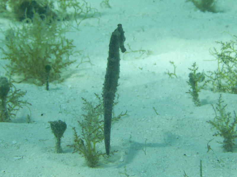
Yesterday when we were snorkeling, I turned over a broken off sea fan (looking for 'Flamingo Tongue' snails) and found a pair of Seahorses.

Dave and I watched these guys motor around... they look like little electric horses... they seem to swim without moving anything (but they have very small fins on their back that move them).

We got the camera out and took a picture of them before we left the anchorage this morning.

Recap of our Trip from Vivarillos/Hobbies to Providencia

Of course, the first step of our trip was the 15 miles northeast from the Vivarillos to the Hobbies (Cayos Cajones). We stayed there about 3 days, playing on the reef and socializing with the 3 other boats there.

Dave and I have been talking about going to Media Luna reef and Quita Sueno reef since we left Florida. Sitting there in the Hobbies, we plotted out an elaborate week-long trek, doing day-hops mostly and stopping first at Media Luna, then at Alagardo (where some fishermen had said they'd seen bronze cannon), and then to Quita Sueno, before moving on to Providencia.

However, once we got going early in the morning two days ago, the wind was more north of east than forecast, and a little lighter, so it seemed like a good time to make some serious east. (ie Get while the getting is good... make hay while the sun shines, etc).

We still didn't abandon thoughts of going to Quita Sueno first... because of the need to get around Media Luna reef, the course to Providencia and to Quita Sueno were the same for about half the way. We made a waypoint at the turn point and said we'd have to make a decision then. By the time we got to the turn point, we didn't want to keep going the direction we were going (hard on the wind) for another 12 hours. So we opted to fall off for Providencia.

What we used as a turn point was 15-16.09N 82-17.58W and we went direct from there to Low Cay at the north end of Providencia's reef system. We went right over the bank that shallows up to 45' deep, that is SE of Alagardo Reef. It was the middle of the night, so we couldn't see, but it didn't seem to be any rougher there than anywhere else. But we did see the current pick up while over the bank.

We almost got run over by a cruise ship in broad daylight, soon after leaving the Hobbies. Dave and I were puttering around doing navigational stuff and really weren't keeping a good watch out. We felt so remote out there in the Hobbies... And didn't really expect anything to be sneaking up behind us. The other boat that left with us, Elysian, called us on the VHF and said "We tried to get a picture of you and the Cruise Ship..." and Dave and I looked at each other... "Cruise Ship, what Cruise
Ship???" He was big and he was close. No danger of getting run over, but we felt really foolish not to have seen him coming.

Other than the cruise ship, the only other boat we saw in 36 hours was a fishing boat several miles away, and the glow of a well-lit vessel over the horizon (10-20 miles away).

No pirates, no drug-runners, and no run-ins with fishing boats (all had been reported by various cruisers on this same passage over the last 10 years).

LOW CAY APPROACH 13-30.848N 81-21.209W
EASY ANCHORAGE 13-30.149N 81-20.159W 30' Sand
BETTER ANCH APP 13-31.221N 81-20.389W
BETTER ANCHORAGE 13-31.374N 81-20.360W 10' Sand

The Low Cay light was working last night and we are anchored just south of it. The Raster chart we have seems to be fairly accurate.

Tuesday, March 4, 2008

Monday, March 3, 2008

Still Enroute to Providencia

Still motorsailing SE at 5-6 knots. ETA about 3:30pm local time.

All is well aboard.

Underway for Quita Sueno or Providencia

We left the anchorage this morning at 7am for points south and east. We got the forecast yesterday morning and decided it was a good weather window for moving. We would like to have stayed a few weeks at Cayos Cajones, but we felt we needed to get moving.

The forecast is for 10-15 kts ENE, gradually moving around toward the E and strengthening to 15 kts by tomorrow morning. Our current plan is to either go to Quita Sueno Bank at 14-22.5W and 81-14.5W or the (offshore) Colombian island of Providencia at 13-21N and 81-23W. The course is the same to both places until we get to a turning point tonight about 10pm.

We would really like to go to Quita Sueno, but not sure we're up to bashing toward it all night long. If we turned for Providencia at 10pm, we could fall off, turn the engine off, and have a pretty good sail, arriving at Providencia mid-afternoon tomorrow.

The wind is already up a bit, and we're already discussing options to turn off sooner. But the area is strewn with reefs and banks, so we can't just go straight anywhere.

Hard to tell right now what we'll do.

Sunday, March 2, 2008

Cayos Cajones (Hobbies) & the Big Fish Waypoint

Saturday, Mar 1, 2008 - 16°02.44'N 083°06.27'W

Just as predicted, in the middle of the night Weds, the wind switched to light NNE and slowly picked up all day Thursday.

On Thursday morning, we set out for the outer reef right after the Northwest Caribbean Net was over, to hopefully find the 'Big Fish' waypoint our friends had told us about. The GPS said it was 1.4 miles NNW of our current location. We took the handheld GPS to help us find the spot. As we skimmed along just inside the outer reef, I took waypoints periodically so we could upload them to our Nobeltec chart program, and plot the approximate edge of the reef on our not-detailed chart, to see how it
compares (it actually matched up pretty well).

We actually had 2 waypoints from different people, for the Big Fish place, located a few hundredths of a degree apart. Once we got there, we circled around in the dinghy until we thought we'd identified the spot. In this area, the outer reef starts breaking up, and there is a large cut where the bottom is about 35' deep, and the tops of the coral heads are just awash, and in light air, it is possible to take your dinghy outside.

There is a dramatic profile between the bottom and the tops of the heads. The 'heads' are not solitary coral heads, but reef structures 100 feet in diameter. At the base of each head, the reef has been undercut by wave action, and most of them have some kind of cave-like area. At least one had a very pretty arch that made a nice swim-through. We circled all the heads within about a 200 yard radius, and found lots of places where the big fish should be (ie cave structures etc). But didn't see
anything like the fish life that had been described (large grouper, snapper, nurse sharks, just teeming with big fish). Bummer!

The next day we called our friends on the HF net (they are in the San Blas now) and got a better description of what the right spot should look like. So yesterday we went back, this time with a different (better?) GPS, and the waypoint entered fresh and double-checked. It seems as we were in the right place the first time. But now the wind was blowing close to 20 knots and all the heads we had snorkled around the day before were breaking. The water was really stirred up and visibility was bad.
So we didn't even bother to go in.

We stopped instead at a few spots near our anchorage that we'd spotted the first day there. Dave managed to spear dinner within a few minutes (a nice fat snapper). One snapper hole has a 4 foot long (~50 lb) snapper with a spear mark on his shoulder. Dave wisely opted to shoot something a little smaller.

While Dave was looking for fish, I went scouting for conch and lobster. I covered a lot of shallow reef area, and it is pretty cleaned out. When the fishing boats anchor here for the night, they send out a couple of guys in a cayuca to find dinner, and they must be pretty thorough. I saw a few horse conch, which I opted to bypass, and a couple of undersized lobster, which I also left alone. The shallow reefs are a combination of live and dead coral. They have lots of pretty fish and invertebrates,
but anything edible has already been taken (how sad).

The wind is forecast to slowly switch to the SE and ease off. This will be better for exploring around here, and not so good for us to head SE.

I think we'll stay here a couple more days and play a little longer, do a couple of boat projects, and wait for the next weather window to head further south.