We did our last trip to Davao for shopping and to renew our visas (good for another 2 months) on the morning of Tuesday March 20. By 1:30pm we were ready to blast out of the marina and start cruising again. I thought we'd never make that schedule, but Dave is relentless once he sets a schedule.
We had waited out the stronger "winter winds" (northeasterlies) that would have made hopping north up the east coast of Mindanao more difficult. All the important repairs were done, engines back together, boat full of fuel, water, food, and essential supplies (beer, rum, and wine!).
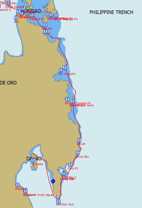
I had been watching the weather, and doing a bunch of planning, making GoogleEarth charts, looking at anchorages, and reading up on others' passage up and down the east coast. I had to laugh when I saw the result of my favorite weather routing program's result for sailing up the coast offshore, against both wind and current.
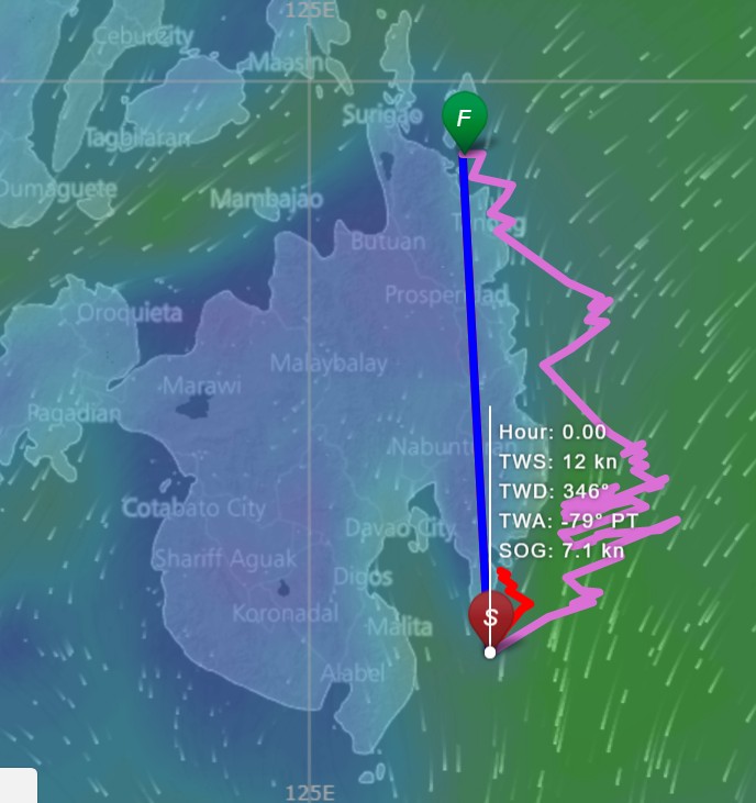
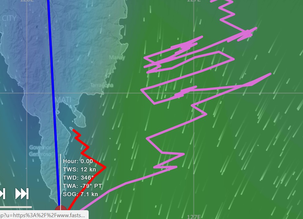
This is why our plan was to do day hops, taking advantage of the early morning light winds, and hugging the coast, staying out of the south-bound current.
Our first hop was across the bay to the east side of the Gulf of Davao...16 miles. We experienced a few "minor" problems that first day, including the starboard engine shutting down due to overheating (solved within a few days), port engine muffler leaking salt water into the galley bilge (still not completely fixed, months later) and a too-big (new) shackle on the anchor swivel causing problems with anchoring (solved on site). Our first night's stop was on the south side of Piso Point in the Gulf of Davao, where a prior cruiser had an anchor waypoint that said "Goes from 20 meters to Oops in a boatlength". He was right! We ended up anchoring in about 70-75 ft, with our stern in 20 ft and shallow reef about half a boatlength behind us. By the time we finally got the swivel issue fixed and the anchor down, it was darn near full dark.
This began a series of very early morning starts to go as far as possible in the lighter morning winds, as generally we were making long day hops and going against the wind. Why? Against our better judgement, we were on a schedule. Last fall we booked an expensive diving workshop in the Puerto Galera area at the end of April, so we had to get the 700+ miles there in time for that. We had thought when booking that we'd be launched and underway by 1 March, and have time to cruise north and explore. For an ocean-crossing cruising boat, 700 miles isn't far--could be done in about 4-5 days. However, it's not really advisable to do overnights in the Philippines due to the proliferation of unlighted fishing boats, FADs, nets, and not to mention quite a few reefs.
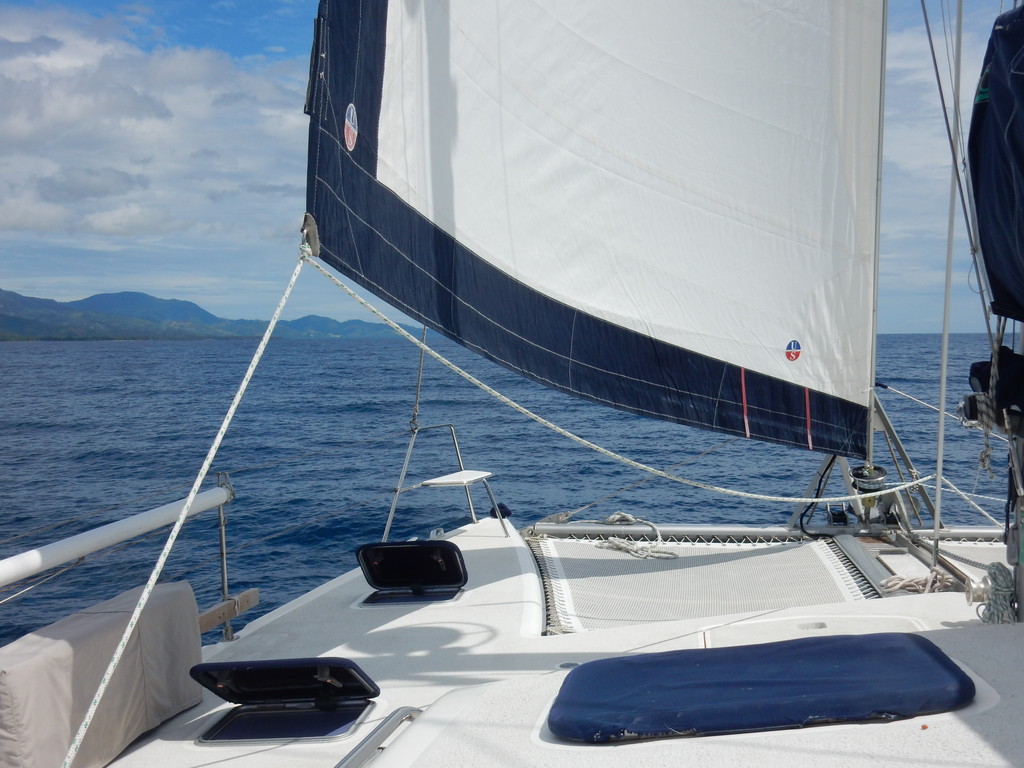
Even though we had a fairly long slog ahead of us, we were super-excited to be out of the marina and underway again.
Our first day hop was 48 miles to Lima Point, as far south in the Gulf of Davao we could get, so the next day we could round San Agustin point and get up into protected Pujada Bay for our next anchorage. 06-18.39N / 126-11.06E dropped in 25 feet, hanging in 70ft. OK anchorage for light wind conditions.
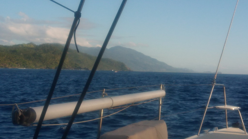
The next morning we were underway at dawn (0530 in the Philippines) and by 6:15 had rounded the point and headed up the east coast of Mindanao, against wind, waves, and current. Due to good planning (good weather window and early start), this was a long but easy motorsail. We stayed as close in to the coast as we dared to stay out of the current. The wind was under 10 kts and due to several days of light winds, the swell coming all the way from Hawaii was down. We used other cruisers tracks and GoogleEarth charts to make sure we didn't have any nasty surprises. By 2pm we were inside Pujada Bay, and spent an hour or so exploring and choosing an anchorage. We ended up off the Blue Bess Resort on the advice of another cruiser. It is quite far inside Pujada Bay, with internet coverage and road access to the rest of Mindanao. 06-52.33N / 126-17.31E
Because the wind forecast was up for the next couple of days, we decided to take a lay day or two to rest up and do inevitable boat chores. One of the first things Dave worked on was the Starboard engine cooling problem (we'd been motoring on Port engine only for the past 3 days). Dave had rebuilt both waterpumps while we were hauled out. After making sure there were no clogs or obstructions, he finally took the starboard engine water pump apart and compared it to the port engine, and discovered that the starboard raw water pump had been re-mounted backwards. No wonder the cooling water wasn't flowing!! New lesson #235 on the new boat...
At the end of the day, we moved out to a beautiful beach near the entrance of the bay. Great location where we had a much better feel for what the weather was doing offshore. 06-48.02N / 126-19.25E Anchored in great sand in 25ft, hanging in 42 ft. Only problem was, we were in a location with no cell coverage... :(
Next day (March 24), with calm winds and most of our chores done, we decided to motor around in the bay a little bit, making water, and exploring possible anchorage, with intentions to eventually return to our nice anchor spot on the point. However, just as we headed back, a squall came up with 25-30 kt winds out of the NNE. So we thought better of returning to our more exposed location, headed back in the bay a few miles to a more protected location. Ended up anchoring at 06-49.51N / 126-17.17E in 25 ft sand. Here we waited another couple of days for the offshore weather to calm down.
(Note, all our anchor waypoints and comments about them have been edited into the Philippines Compendium, which can be downloaded from http://svsoggypaws.com/files/index.htm, and they have been provided to Terry on Valhalla and are included in his Philippines Anchorage Waypoints downloadable from http://yachtvalhalla.net/navigation/terrystopics.htm )
Finally, on Tuesday Mar 27, the weather was good enough to venture out, and we set off at 6am for another hop up the coast. For awhile we had sailable wind and a following current and were making 7.5 knots! Woo hoo! But that didn't last long. Our first possible anchor location was about 25 miles away, and the next possible one was another 25 miles further on. By 9am we had no wind, both engines going, and motorsailing with one foot on the beach, almost no current. At 10:30, with favorable conditions, we were almost to the first anchor spot, and decided we had time to make the next one, so we kept going. Big mistake!
At 1:45pm we were rounding Pusan Point, motoring with both engines and a reefed mainsail, against 20-30 knots of apparent wind in a (thankfully brief) squall, and about 1.5 knots of current. For awhile we were only making about 2 knots and had an ETA of 8pm! We almost turned around and went back to the anchorage we'd passed a few hours before.
Fortunately, once we got around the point and could tack into the next bay, we got out of the wind and current, our speed picked up, and the conditions got better.
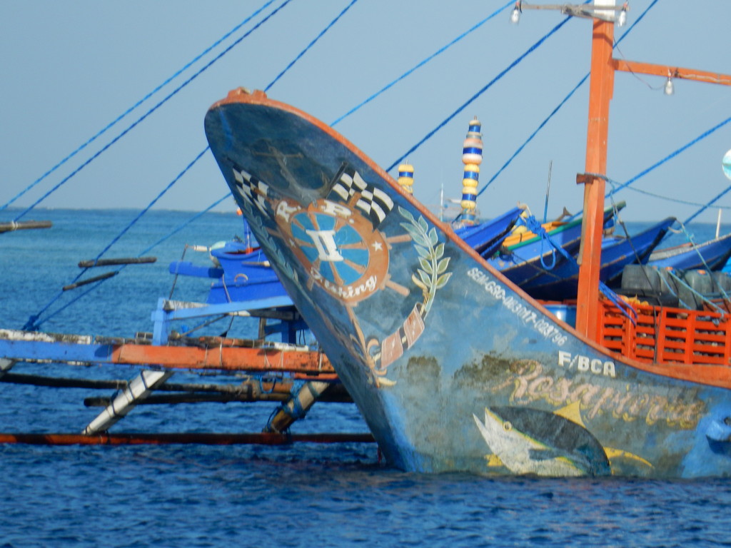
We ended up anchoring near a bunch of fishing boats off the tiny town of Baculit in a nice sand spot in 35-40 ft. Though the wind offshore was blowing 25 kts NNE, we only had about 10 kts and no swell in the anchorage. After we got settled, one of the small boats from a big fishing boat nearby came by to ask about the weather. We told them the storm had gone and the wind and seas were laying down, and the forecast for the next few days was for good weather. They thanked us and gave us a fish... all the fishing boats were gone by sundown. Anchorage position 07-26.75N / 126-34.37E.

Having learned our lesson the day before, we got going even earlier the next day, to take advantage of the calmer morning winds. (Dave is NOT a morning person, so getting him up while it's still dark out is near impossible.)
We had almost no wind but almost 1 kt of current against us, as we were rounding the outermost point on the east coast. Later in the day, the wind pulled to the east a little, so we could put the sails out and get some drive out of them. We got up to 7knots at one point, and then of course the wind went too high and we had to reef down!! But we actually got one who hour of "pure sailing" in this day.
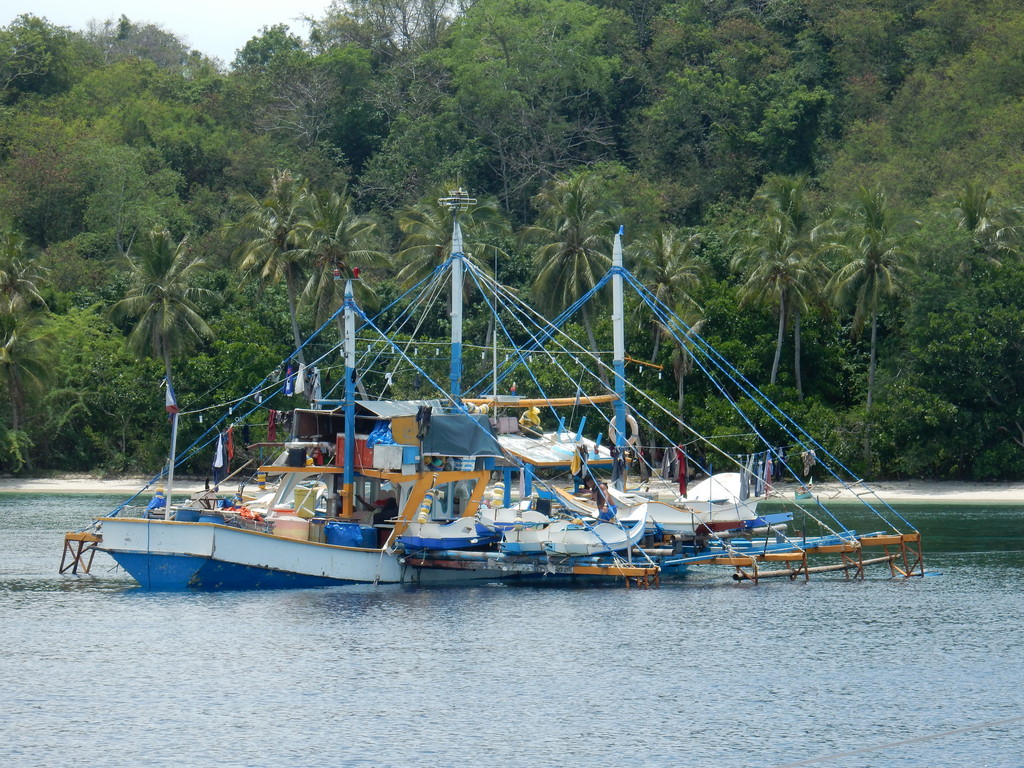
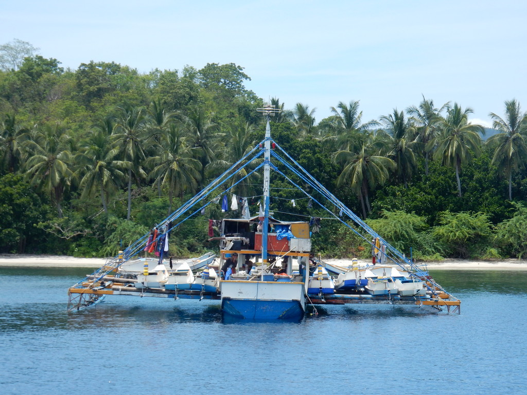
By 3:30pm we were tucked into another small harbor (Barcelona) on the coast. 08-09.64N / 126-26.61E in 18 ft. This harbor was filled with "squid boats". They go out a little ways--still staying within the shelter of the reef--and put out bright lights, and jig for squid. There were hundreds of bright lights in the bay all night long.
Next day, March 29, another early start and another long day of mostly motorsailing in mostly light wind. We actually turned both engines off for 15 minutes, but the wind shifted again and we had to turn one engine on to keep our speed up. Around 1pm a big wind came up on our nose, so decided to tuck in at Aninan Island. There's a karaoke bar ashore and a bunch of surfers near the anchorage, plus a daytripper place on the point. We managed to find a not-too-swelly anchorage 08-46.74N / 126-17.99E.
We are now close enough to the Surigao Strait area that we started looking at tides, to make sure we had a favorable tide to go through the narrow passage. Based on where we were and the tide schedule, we decided to go through the worst part of the strait on Sunday, April 1. We were also now heading NNW and expected to actually be able to sail some rather than motoring into the wind.
As we set out the next day, I had picked an anchorage at Cortez Bay only 32 nm up the coast. The wind forecast for the afternoon was predicted to be a bit higher than normal and I wanted to be tucked in for that. But around our decision point, conditions looked OK, and Dave wanted to push on to the next anchorage at General Island, 15 miles further north. About 1:30 the wind came up from a sailable direction, and we had an exhilarating 2 hrs of sailing in 25-30 kts of wind, but slight seas. We even tacked a couple of times (can't motor straight into that much wind!). Once we got in the lee of the island we could motor up OK. But what looked like a secluded anchorage on Google Earth turned into a bay full of fishing boats and the shore was lined with fishing shacks.
It's now 4pm, the wind is up, and there are no good looking nearby anchorages. Sunset is an hour and a half away. I'm frantically looking at the chart, GoogleEarth images, and other cruisers' waypoints to try to find an alternate anchorage we can reach before dark. One anchor spot we had on our chart was obviously mis-plotted, when I double-checked it on GoogleEarth. The next spot was too far to reach before dark. We finally anchored in a deep bay off a tiny fishing town at 09-26.59N / 125-56.43E. As in many anchorages in this part of the world, it went from too deep to too shallow too fast. We finally found a spot on the slope in "only" 70 ft. It was closer to the village than we would normally anchor, but it was all we could find, good enough for the night.
Saturday March 31, another 5am reville, and it was pouring rain. I let Dave sleep in while I collected weather. It looked like the day would be decent, so we finally got the anchor up about 6:30. We had mild conditions all day, and anchored on the south side of Talavera Island, just shy of the Hinatuan Passage, in the early afternoon. 09-44.15N / 125-42.16E in 30 ft mostly sand, off a nice sand beach. We had made it up the long east Mindanao Coast!!
High tide on Sunday was about 11:45am, and our cruiser notes said to start through the passage about 3 and a half hours before high tide. So our target "underway" time was 0815.
We had a wonderful transit through the "dreaded" Hinatuan Passage, starting out with 1kt of current behind us and going up to a max of 4.5 knots in the narrowest spot. Lots of swirls and overfalls in the strait at the worst part, but easily managable with our boat. We made such good time that rather than stopping in Surigao, we carried on to an anchorage called Sonok at the south end of Leyte Island.
We still had 6 weeks to get to Puerto Galara, and for the rest of our way up to Puerto Galera, we would be inside the Visayas area of the Philippines, with expected milder winds and seas. In retrospect, this trip up the coast was a fairly pleasant experience, except the part about getting up at 5am every day. You just have to pay attention to the weather forecast, and wait until conditions are right.
No comments:
Post a Comment