The last time the MJO was in our area was when Cyclone Cyril popped up overnight, and then was followed a few days later by very strong Cyclone Jasmine. We've been watching the MJO forecast as the wave of wet weather has circled the globe, and knew it was due in our area again soon. Some links are provided below.
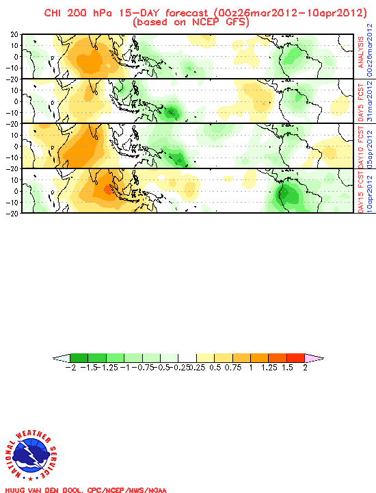
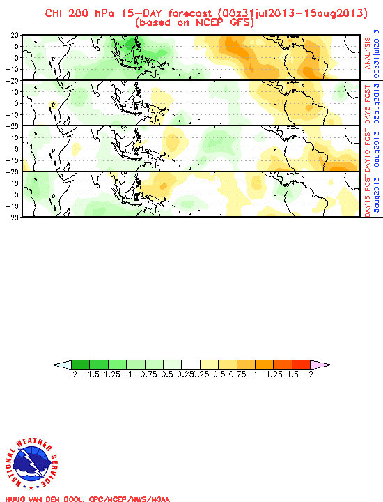
One version of the forecast is a series of strip charts. Each chart is a (very small) flat graphic of the world. The top one is the current status. The succeeding ones are forecasts, advancing every 5 days. The green areas of the chart shows the 'rainy weather' that helps brew up the cyclones. It probably causes less than fine weather in the tropics whenever it passes over, and helps spawn cyclones/hurricanes during the Season. The brown areas show dry weather, where it's likely to be more stable weather. It could be a good long-range planning tool for the sailor in the tropics!
Well, the MJO is almost here in the SW Pacific. Today's 10-day GFS forecast (aka GRIB file) shows no less than 4 1000-MB or less Low Pressure areas forming north and west of us, and heading our way. One, spinning up near Vanuatu (off the East coast of Australia), on April 3rd, is down to 975 Mb. That's a pretty deep low. So we're on high alert. We probably won't be doing much diving in the next 10 days!
The more I research this issue, the less I understand! The Weather Guessers are still trying to figure out how to forecast this phenomenon, so all of this is experimental. Below are some helpful links I have found.
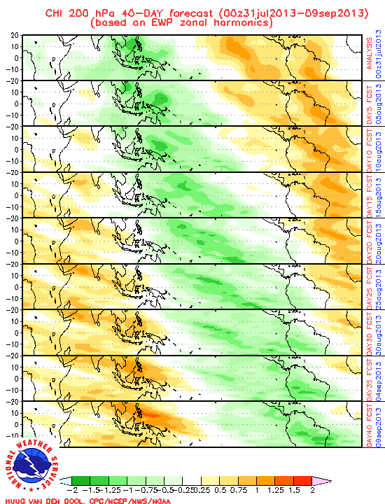
40-Day EWP Version of the MJO Forecast
15-Day GFS Version of the MJO Forecast
(note that the 2 above forecasts do not agree)
Australia's MJO Page
Global Tropical Hazards Outlook - This one is my favorite because I understand the graphics and it tries to take into consideration all the wx factors (ENSO, MJO, SOI, La Nina, El Nino, etc)
-----
Hanging out in Tonga for cyclone season!
At 03/24/2012 8:12 PM (utc) our position was 18°42.83'S 174°02.52'W
http://svsoggypaws.com/currentposition.htm
Hope the bad systems miss you guys this time!
ReplyDelete