Tuesday, March 30, 2010

Life at Sea in 20 Knots

20 knots, for the non-sailor, is about 25 mph. That's a lot of wind. We've been 'messing about' in 20 knots of wind for the last 2 days. But wind isn't the big deal. Wind is actually a good thing. Wind makes the boat go.

What IS the big deal are the seas. Over time, as the wind blows, the seas get bigger and bigger. Right now we have large waves--about 10 to 12 feet in height. Those are pretty big waves... almost twice as big as the average Satellite Beach wave (they are usually in the 5-6 foot range). Waves this big are really awesome.

We are 'running downwind' right now... that means going with the wind. The significance in sailing is that we are not heeled over. That's nice. But we are surfing down these big 10 foot waves, and rolling from side to side.

You cannot sit anywhere aboard, without bracing yourself to keep in place. To walk from our cabin to the main cabin, and then to the forward bathroom, you have to move from handhold to handhold (all conveniently spaced about 3 feet apart, just for this purpose). You have to time your walk with the roll of the boat.

You cannot put ANYTHING down and expect it to still be there in 5 minutes. Anything with any weight will get hurled across the cabin on the next roll. So we have to keep everything put away in cabinets or drawers (all specially designed to be self-locking, so they won't fly open in conditions like these). For a temporary spot to put things, we have a nice deep sink. But stuff slides back and forth in the sink too.

Cooking is truly a challenge. Just simple things like cutting up vegetables is an adventure. Put the knife down for a second, and it goes flying. Chop a piece of carrot off, and IT goes flying. There aren't enough hands to hold on for yourself, hold the knife, and hold on to the pieces of what you're cutting up. The stove is designed for this... it is built on a pivot to stay level when you are heeling (leaning over when sailing). Pull a couple of pins and, voila, it's level. It also has some brackets that you can attach to hold the pans in place, so THEY don't go flying.

In conditions like this, we eat in the cockpit, one-pot meals served in a bowl in our lap. It takes a lot of of inventiveness in the galley (kitchen) to come up with more than one 'delicious' one pot meal in a row. They tend to all start tasting alike after a couple in a row.

We normally drink water from a water bottle--it tends to hold its contents better than a cup when vaulted across the cockpit, and means we have one hand left to actually eat with.

Sleeping is also an adventure. The boat is pretty noisy when we're sailing in 20 knots of wind. Everything is creaking (not just the rigging, but the woodwork inside the boat). As we are going through the water, there's a lot of water pounding on the hull. And there's the sound of the wind and waves going by. The bed is moving in a pretty lively fashion, and it takes some creativity to get yourself wedged in where you can relax in that kind of movement, and sleep. We are usually braced on the downhill side with a foot or two, and spread out on the bed to stabilize things.

Yep, we are having fun out here!
-----
At 3/30/2010 2:13 AM (utc) our position was 27°12.00'S 121°54.77'W

----------
radio email processed by SailMail
for information see: http://www.sailmail.com

Monday, March 29, 2010

Enroute Easter to Pitcairn - Day 6

Well, we ended up motoring for just over 24 hours. We stopped once or twice to try sailing, but it just wasn't possible without slamming the sails (and us) around. We finally found sailable wind yesterday morning at about 11am (just as forecast).

The wind slowly built yesterday afternoon to about 15-20. At first it was not steady and drove us crazy... we'd get everything (3 sails, autopilot) all trimmed up for one windspeed, and then the wind would drop off to 8 knots, and we'd be all screwed up again, with the sails slapping and the boat rolling. When running downwind, as the wind speed changes, everything changes.

Fortunately, by last night, the wind steadied up at about 15-18 knots. We've got a triple-reefed main, staysail, and a scrap of genoa out, and are mostly doing about 6 knots. The seas are pretty big and are slinging us around some, but as long as the wind stays steady, it's not too bad.

The skies cleared last night, so we were able to enjoy a nice bright moon, and we have a pretty crystal blue day today.

We are sailing at 6 knots right toward Pitcairn (for now).

Our friends on Visions are now about 120 miles ahead of us, and they are getting beat up pretty badly. They are closer to the warm front we've been worrying about, and are seeing winds of 25-30 knots. (YUK!!) Infini is about 50 miles behind us (they don't motor as fast as we do), and have the same conditions we do.

We are ALL tired of this... if I could just say "beam me up, Scotty" I would (as long as the Enterprise wasn't under fire from alien forces).

605 miles to go to Pitcairn, and then another 300 miles after that to get to the Gambier archipelago (part of French Polynesia). There we hope to find a calm, enclosed anchorage for the first time in over a month.

This sure is a big patch of ocean down here!

We are not sure we'll be able to actually STOP at Pitcairn...but the current forecast looks like it might be possible. Pitcairn has an even worse anchoring situation than Easter does, and conditions have to be pretty near perfect to be able to stop there AND actually get off the boat and go ashore (safely). We're keeping our fingers crossed!
-----
At 3/28/2010 4:11 PM (utc) our position was 28°09.07'S 119°20.91'W

----------
radio email processed by SailMail
for information see: http://www.sailmail.com

Saturday, March 27, 2010

Enroute Easter to Pitcairn - Day 4

It seems to be always too much wind or too little. We've gone from 20 knots to 5 knots to 25 knots to 5 knots, with very short 'reasonable' periods in between.

Right now we have about 5-7 knots from the SE, and we are headed WNW (almost dead downwind). We could almost sail this if the seas were as flat as the wind. But we still have about 6-8 feet of swell coming from the SE. We can't keep any sail full. Here is my logbook entry for the last hour:

Engine off, main and genoa out, making 3 knots.
Genoa in, Code Zero out
Main down (trying to keep the Code Zero full)
Code Zero in (can't keep it full)
Main up and engine on

Each of these line items entails about 15-20 minutes of screwing around with sails.

At least it isn't hot. Air temp is 70 degrees at night and 75 degrees during the day. Yesterday we spent all day in 100% overcast but today at least we have a nice sunny day with a few puffy clouds.

At our weather conference last night (among our 3 boats), we discussed the next big weather event--a low and a cold front approaching from the west. We're now heading for supposedly north of the NE end of the cold front, to try to stay out of the 25-30 knot winds forecast further south.

We are all thinking longingly of sailing in the tradewinds, where the wind is more or less steady.

I am trying to get a GRIB file in to see what the revised weather outlook--unfortunately we are so far 'out there' that it's difficult connecting with any of the Sailmail stations at this time of day. The closest and easiest station to connect with is Chile, but it is having internet issues and quite often just doesn't pass traffic. I've given up using it, and the rest of the stations are too far away. Thank God we thought to get the Iridium phone as a backup.
-----
At 3/26/2010 6:31 PM (utc) our position was 28°46.71'S 114°58.00'W

----------
radio email processed by SailMail
for information see: http://www.sailmail.com

Thursday, March 25, 2010

What Were We Thinking?

When we were at Easter Island, desperate to get moving to the next 1100 miles further west, the weather for going west didn't look very good. Most of the wind on a direct line between Easter and Pitcairn was on our nose and/or very light.

Our friend Bill on Visions of Johanna, said, "No problemo, lets just head south, cut across a dissipating cold front, and ride the winds between the High and the Low." He has a fancy program (Expedition) that will take the GRIB file forecast and plot out a route. He has also paid a weather forecaster to give him advice on routing for this trip. (Ken at locusweather.com)

We were a little desperate while sitting there at Easter Island, with bad weather where we were and worse weather coming, and nowhere else to go. But seriously, next time I contemplate chasing wind in a Low, please kick me!!

We spent all day yesterday motorsailing SSW in very light air. The latest GRIB file showed the Low receding, and we were worrying about ever finding wind. Then, all of us a sudden (about right where it was supposed to be), we had the wind we were looking for. Beautiful ESE winds at about 10-12 knots. We turned off the engine and piled on all the sail we could muster, and were making 6 knots in the right direction under sail alone.

At our evening radio schedule at 1915 (7:15pm local), Bill, who was then about 50 miles ahead of us and further south, reported that they'd been in 20-30kt winds for hours, and to "watch out, don't come so far south". I changed course from SSW to West immediately, while Dave was still talking on the radio.

Thankfully, forewarned is forearmed, and when just 15 minute later we were hit by the first puff of 20-25kt wind, we knew what it was and rolled in the big genoa. 5 minutes later we were fully engulfed in Bill's 20-30 kt winds. As it got dark, Dave took in a 3rd reef in the mainsail. It was exciting, but with the right sailplan, not dangerous.

We sailed all night in 20-30 kts winds, with just the triple-reefed main and the staysail, making 7-8 knots! The waves were huge, and we were surfing down the face of the waves most of the night. The air temp dropped to a chilly 70 degrees and we had rain off and on during the night.

We started this trip pretty sleep-deprived--the last couple of nights at Easter were pretty sleepless. And the last 2 nights at sea were pretty challenging. We didn't take any day naps during the day yesterday, worrying about whether we'd ever find any wind or not.

Now we need to delicately feel our away along the isobars, trying to stay in wind, but not too much wind. Very far north, and the wind dies completely and/or becomes a headwind. Very far south of here and conditions get much worse.

But we are OK. We are in a sturdy boat, built to take this stuff. "Janet" (our CPT autopilot) is working her little heart out to keep us going in the right direction. No major failures to date.

BTW, we celebrated our 3rd wedding anniversary last night, with cold spaghetti in our laps. (Some anniversary cruise Dave took me on!!) We ARE both thankful to be here, and to be here with each other.
-----
At 3/25/2010 2:32 PM (utc) our position was 29°05.46'S 112°28.40'W

----------
radio email processed by SailMail
for information see: http://www.sailmail.com

Easter Island to Pitcairn Island - Day 2

We left Easter yesterday after a very rushed morning clearing out and getting the boat ready. The winds were honking along the south coast of Easter as we sailed west... 20-25 knots. It wasn't too bad until we cleared the west end of the island and got exposed to the full sea. Big waves!! We had several waves break and wash green water over the top of our dodger.

Things gradually calmed down last night--except for a few 30 knots squalls. This morning the wind went to nothing (something we expected) and we turned the engine on and started motoring SW. We are hoping to find good winds on the other side of the Low that we're motoring across (but the latest GRIB weather files show the windy area receding almost as fast as we're going).

There is a complex group of highs and lows in this area and we're trying to thread our way underneath a low and over a high, but NOT in a 'squash zone'. We are amazed at how relatively accurate the GRIB files are way out in this remote corner of the world. Thank goodness for Sailmail and Saildocs (how we get our weather files).

This could be a long trip!

It is saying a lot that I got a better night's sleep last night on passage than I did the last 3-4 nights at Easter Island.

That's what we call 'Adventure Cruising'!!
-----
At 3/24/2010 11:14 PM (utc) our position was 29°01.40'S 110°45.23'W

----------
radio email processed by SailMail
for information see: http://www.sailmail.com

Unsettled Weather Chases Us from Easter Island Prematurely

Sunday we were supposed to have rented a car to go do a self-tour at the other end of the island. But while we were waiting for the surf to subside after our dinghy disaster, I walked up and canceled the rental--the surfers and the dive shops said the surf would stay bad tomorrow too. And we saw from the GRIB files that a weather change was coming.

The next 36 hours were pretty bad as the swell built from NE, and the wind swung to the NE--a direction that isn't a good one anywhere on Easter Island.

3 of the 7 boats opted to go ahead and leave for Pitcairn/Gambiers that evening, and the Chilean Armada guys were so helpful in coming out to the boats to clear them out of Chile.

Infini Beating to Windard On the South Coast

After the 2nd really rolly awful squally night at Hanga Roa, with the wind backing more toward the north, and a huge swell building, we left at dawn for an anchorage on the south side of the island. It was Soggy Paws and Visions and Infini in a parade out of the anchorage, and then beating our way east against 20-25 kt winds.

When standing off the Hotu Iti anchorage, which we had waypoints for, I could not believe there would be any protected anchorage there. But Visions, much faster than us, had arrived ahead and assured us that it was better than Hanga Roa, at least.

The Rugged Coast and the Hotu Iti Anchorage

If you look closely in this picture, you can see 2 masts at the foot of the black cliff. Infini is on the left, rolling, and Soggy Paws is on the right. Visions is tucked further back in the cove, and is hidden by the headland.

We spent the next 2 nights rolling our guts out at Hotu Iti. It is a pretty place, but we had gusty winds from NE and an 8 foot swell rolling in around the headland, from the SE. We were often exactly sideways to the swell. Very difficult conditions.

Sitting in the anchorage, we wondered where we were going to land a dinghy. It turned out that there is a small man-made 'dinghy harbor' hidden along the shore.

The Dinghy Harbor at Hotu Iti

After we got the anchors down, checked the weather forecast, and assessed the situation, Visions decided they were going to clear out for Gambiers. Officially, you are supposed to bring your boat to Hanga Roa (where we just left, where anchoring is now untenable, and where landing a dinghy would be impossible) So they called the Armada on VHF and asked if they'd come out with their paperwork to this remote anchorage, 10 miles out of town.

Though we hadn't really had as much fun as we planned at Easter Island, faced with a forecast that showed more of the same difficult conditions for about another week, we decided to go to. Dave and Mike hitched back to town with the Armada guys, rented a car, and we spent all day running errands (filling diesel jugs, shopping, last minute internet, etc). We only took a few minutes to snap a photo of the "14 Heads", the big ahu called Ahu Tongariki.

Ahu Tongariki,
as Restored


After another rolly night, the wind was finally starting to switch around to the N and NW, the sun came out, and the swell was calming down. We had hoped to spend the morning exploring the Ranu Raku Volcano, where all the moai were carved. It is only a half hour hike from the Hotu Iti. But the Armada called us on the VHF and said more bad weather was coming, and we should leave. We had enough 'getting ready' to do that we decided not to take time to see Ranu Raku.

So yesterday, Visions left Easter Island in the morning, and Infini and Soggy Paws left just after noon. The forecast shows west winds all across the direct route from Easter to Pitcairn and the Gambiers. So we are doing a tricky 'dive south' maneuver to try to pick up winds off a high pressure area south of here. We'll see how that works out.

We are sad that we didn't get to see all major sites on the island, and didn't get to go diving. Another 2 or 3 days of settled weather would have done it, but that was not to be.

We have a total of 1400 miles to go to our end destination--the town of Rikitea on Mangareva in the Gambier Islands of French Polynesia (approx 23S 135W). We hope to make an intermediate stop at Pitcairn Island, if the weather permits.
-----
At 3/24/2010 11:14 PM (utc) our position was 29°01.40'S 110°45.23'W

Sunday, March 21, 2010

Easter Island Dinghy Disaster

Surfing In the Dinghy On a Settled Day

Today was scheduled to be a 'work day'. Sue from s/v Infini and I went grocery shopping. We walked all over town and shlepped large bags full of meat, veggies, and other necessaries back to the dinghy, while the guys were back aboard doing minor repairs.

We got in thru the surf OK by ourselves in Sue's dinghy, but but when we got back to the dinghy, wow, was the surf big. Getting in and out of the small boat harbor is an adventure on a normal day. Well, this turned out to be more of an adventure than we'd planned.

The Surf Line between Boat and Dinghy Beach on a Mild Day

What we'd been told is to idle at the dinghy beach area and watch and wait for a big "set" of waves to finish, then race out thru the surf zone in the calm that follows.

Well, what we didn't know was that at this time, there was not going to be any calm. And we were in a hurry--the guys were waiting for the dinghy to go get diesel. So we idled out into the surf zone and somehow got 'committed' to going, and there was no calm.

To make a long story short... we made it over the first wave, but then got a little further out where a REALLY BIG wave was coming. There was nowhere to go. We went straight up the wave face and then curled over backward as the wave broke. Sue and I were in the surf, along with the dinghy and all our groceries. It was an exciting time to say the least.

Both Sue and I are good swimmers, but this was really a challenge. The waves were so big, we weren't making a lot of progress toward shore, and were getting tired. We finally gave up trying to save our stuff and concentrated on saving ourselves!!

Fortunately, there were lots of surfers nearby and they soon came to our rescue. I think the locals are used to this drill. One surfer helped Sue up onto her board. She was getting really tired. A couple of guys helped me (between huge crashing waves) get the dinghy flipped back. Then they got me in the dinghy and guided me in to the beach.

Some of the guys were gathering up our floating groceries on their surfboards. And someone called the Chilean Coast Guard, and they were soon out in jetskis helping to collect stuff too.

In the end, we lost about a third of our groceries. Sue lost a handheld VHF, and her camera, which was in a nylon 'drybag', is now toast. She was able to retrieve her bag that had her money and passport in it (though it was all soaked). My camera was in a better drybag, which one of the surfers retrieved. It got a few drops of water on it, but Dave cleaned it up and it's working for now. I did lose my small change purse with 3 credit cards in it, which was just in my pocket.

The bad part was that the dinghy motor needed to be worked on ASAP, to flush the salt water out. But the guys were stuck out on the boats--the conditions were too bad for them to come in. Fortunately, the Chilean Coast Guard mechanic volunteered to take the outboard back to their shop and work on it immediately--gratis. What a very nice gesture.

The Dinghy Beach on a Better Day

Sue and I spent all afternoon on the shore trying to dry our stuff out, and watching the surf, wondering how we were going to get back aboard. Finally, another cruiser with a small dinghy hired a fisherman to load their dinghy on his big outboard-powered launcha, and take them out. So when he came back, we negotiated a ride too. It was an exciting trip thru the surf--still huge waves--with our dinghy in the middle of the boat, and Sue and I crouched in the fish guts, trying to hang on and keep from getting crushed by our dinghy! It was Well worth the $20 we paid him.

Mike and Dave, fortunately, knew nothing of our disaster until it was all over. They were going to come in and 'rescue' us, but we convinced them that the surf was too bad and we didn't need another disaster. They did notice a bunch of bananas float by, so they got in our (Soggy Paws') dinghy and ran around gathering up whatever they could. They retrieved quite a few useful things too.

Unfortunately, no one we know took pictures of our adventure. In these pictures here, the surf is very modest.

Saturday, March 20, 2010

Exploring Easter Island

Soggy Paws at Anchor off Hanga Roas

We did have 2 nice days at the Hanga Roa anchorage, where the weather was settled enough that we enjoyed ourselves.

We took an afternoon amble around the "moai" (big stone heads) near Hanga Roa, the main town, and we went to the Museum.

We liked this sign telling tourists not to climb on the artifacts.

Don't Walk on the Moai!

What is so amazing is that the statues are HUGE. See the picture below with Dave and I in the foreground. The big mystery at Easter Island is how the islanders transported these big statues close to 10 miles over rough terrain, set them upright, and then put the 'hat' on top.

We Pose for Perspective in Front of a Solitary Statue

When the first Europeans arrived at Easter Island in the 1600's, most of the statues were still in place. They ring the coastline and can be easily seen from the sea. But by the time later explorers arrived, many of the statues had been thrown down, presumably by inter-trival warfare. By the end of the 1700's, there were no statues left standing.

The Head of a Statue in Front of a Destroyed Ahu

The statues that are standing today have been restored by various efforts over the last 100 years.

The Birdman Islands

The second day we took a half day tour of the north end of the island, where the 'birdman cult' hung out. This is the Easter Island 'religion' that succeeded the moai-builders, and is centered around an extinct volcano crater and a couple of small islands offshore. To decide who next year's ruler was, a representative from each party would swim out to the island and wait for the seabird nesting to begin. The group who's representative was the first to bring back (swimming across a half mile of open ocean, and scaling a very tall cliff) the first bird egg, got to rule the island for the next year. The actual 'birdman' also got the pretty girl, we understand.

Looking at Cave Art

We also took a walk around town and scoped out things like dive shops, laundry, groceries, internet, and souvenier stands. Dave bought a bunch of Easter Island stamps at the Post Office, and we got an Easter Island stamp in our passports.

Tomorrow we plan to get some chores done... groceries and laundry for Sue and I, and boat repairs and diesel for the guys. Then Sunday we have a car reserved to go see the rest of the island.

Thursday, March 18, 2010

Cleared in to Easter Island

Chilean Officials

When we arrived at Hanga Roa (the town on Easter Island), we called 'Pascua Radio' and reported in. They told us to expect officials to come out to the boat at 3pm.

It was a nice group, very courteous and very professional. The agricultural inspector confiscated my remaining onions and garlic from the hanging basket in the galley. On another boat they confiscated their Panamanian honey. Chile is very protective of their agriculture, and each of these items is a possible threat to their industry.

Once cleared in, we went ashore to meet up with Mike and Sue from s/v Infini. They gave us the 'nickel tour' of town, and we went promptly to the internet cafe. I only had 250 emails waiting for me!!

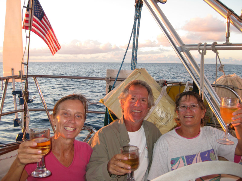
We celebrated our arrival at Easter Island on Infini with a bottle of champagne.


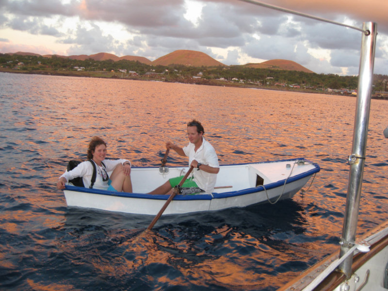
It turned into an all-anchorage party when the boat next door rowed by.

Andy and Reanna sailed in their smallish sailboat from Chile via Juan Fernandez (an island partway between mainland Chile and Easter Island). They were there when the tsunami hit, and barely got away with their boat intact. It happened at night and apparently the wave went very high into the town. They said there were people, houses, and cows floating by screaming in the dark. They picked up everyone they could, and then donated their dinghy and small outboard motor so the people could get back to their island. Andy did not want to take his boat in closer for fear of getting caught in the next wave. Wow, what a story!

We are happy that our Galapagos tsunami story is much less exciting.

Tuesday, March 16, 2010

Arrival at Easter - 13 days, 18 hours, 1891 miles

Visions of Johanna at anchor off Anakena, Moai in the background

Well, we finally made it to Easter Island, almost 3 years after sitting in the Yacht Club bar discussing the possibilities. Though it was a long and sometimes bumpy trip, it was much easier and more do-able than I'd feared.

We made an average speed of 5.73 knots, and and prior to deciding to 'motor in' in the light air last night, had only used 16 hours on the engine, including leaving port, charging batteries on a couple of grey days, and making water. Total engine hours for the trip, anchor to anchor was 23. But all of it was low-RPM motoring, so we probably only burned about 12 gallons of diesel.

We dropped anchor at Anakena Cove last night at 0230 local time. Visions of Johanna was gracious enough to wake up in the middle of the night and help guide us in to a safe anchoring spot. I thought it was a little hairy, but Dave wasn't worried at all. It's an open bay, so it really wasn't that hard.

Now that the sun has risen, we can see the moai (carved stone heads) on the beach. We are in 35-40 feet of water, but it is crystal clear and we can see the bottom easily.

Off to breakfast at Visions of Johanna!
-----
At 3/16/2010 2:01 PM (utc) our position was 27°04.16'S 109°19.47'W

----------
radio email processed by SailMail
for information see: http://www.sailmail.com