Watching the weather has been aggravating the last few days. The forecast changes radically every 6 hours. But at least we were in a nice protected location. We had a couple of nice days, but also several squally blustery days. One weather window we let go by, because the forecast the day before had looked ugly, and we'd committed Dave to fixing someone's water tank in the village. When the day dawned sunny and with the right winds, we weren't ready to leave.
We finally opted to leave this morning in light winds in an iffy window. However, there's no better window in the works in the next week. It looks like the ITCZ (or something similar) is hanging right over 7N in western Micronesia. Waiting another couple of days may bring westerly winds. So we opted to go in light easterlies in somewhat still-unsettled weather.
So far, in the 7 hours we've been underway, we have seen wind from the East, South, and North. There is a really weak low hanging around with light circulating winds. I think we just sailed through the north edge of it. So we are motorsailing right now, trying to see what the wind is going to do before making yet another huge sail change.
It's 300 miles to Woleai, our primary destination. But we go right past Lamotrek in 150 miles, and there are two other smaller atolls between Lamotrek and Woleai, so if things get ugly unexpectedly, we have several places we could duck in.
-----
Sherry & Dave
Heading west across Micronesia in 2014
http://svsoggypaws.blogspot.com
At 04/10/2014 5:29 AM (utc) our position was 07°21.59'N 148°39.42'E
http://svsoggypaws.com/currentposition.htm
Thursday, April 10, 2014


Sunday, April 6, 2014
Enjoying Puluwat & Waiting for Weather
The Low that we've been watching for a week his finally turned into a named storm--Typhoon Peipah. Fortunately it is west of us now, so we don't have any worries from it. But it is trailing the entire ITCZ behind it, so we've had messy weather on and off for the last couple of days. We are on a radio net talking daily with friends in Palau, and Peipah is forecast to go close to Palau in the next 36 hours. Fortunately, current wind forecasts are not too bad--45-55 knots.
We were thinking of leaving here tomorrow and heading for Lamotrek, the next stop, about 170 miles due west of Puluwat, but there's another weak circulation forecast to pass here in about 48 hours, and Puluwat is the best place to be in this whole area for westerly winds. So we'll probably stay here until mid-week and let it go by us. Unfortunately, once it goes by, the wind is forecast to drop to under 10 knots. Sigh.
Oh well, we could be stuck in worse places. Puluwat is gorgeous, and is very traditional. It has a small enclosed lagoon with pretty good protection all around--and a "hurricane hole" we could get into if we needed to. There are nice white sand beaches and millions of palm trees to look at.
We have dipped the entrance to the inner lagoon and found it to be over 6 feet all the way in, so we could go in there if we needed to. We took a couple of waypoints on a sunny day so we could get in even in bad weather.
We are the only boat here. Our friends on Westward II and Kokomo are in Woleai, about 200 miles west, and La Gitana is in Olimarao, a similar distance WNW. The boats at Woleai report that Woleai just got internet as of 1 April!! The times they are a-changing, that's for sure. There are two or three boats behind us in Pohnpei, and one in Yap. By early May, everyone will be in Palau, or down in the Solomons. After May, the typhoons get more frequent and stronger, so boats rarely cross this area except Jan-April.
Here in Puluwat they are still mostly living in traditional houses constructed of natural materials. Some people have concrete or wood frame and corrugated aluminum houses, but not as many as in places like Pohnpei or Chuuk. All the "boat houses" are traditional thatch-roofed wooden huts. There are at least two fiberglass open boats here (one for each village, I think), but almost everyone gets around using handmade wooden "proas". Most are about 12-15 feet long and narrow--hewn out of a single breadfruit tree trunk--they are designed for one big guy. Two smaller guys can manage, but balance is an issue. They have a single outrigger, lashed to the main part of the canoe with small poles and coconut fiber ropes (or sometimes, heavy monofilament fishing line). Some are rigged with sails, but most are just paddled. We have pictures, and will post them later. We have heard that there are several larger ocean-going canoes here, but we haven't seen them out yet.
We have kept ourselves busy here while waiting for a good weather window. We met a very nice guy in Relong village (one of two here) named Sky, who speaks very good English. He sent two of his sons with Dave to show him the way to the old Japanese lighthouse on Alet Island, to the west of where we are anchored. Dave and the guys spent all day on Alet. They left the boats on the southern beach of Alet, and went down the beach almost to the lighthouse, then cut in on a trail to explore the lighthouse. Dave says "It's not an ordinary lighthouse. The construction makes it seem more like an upscale house rather than just a lighthouse." On their way back, they took the old Japanese road down the center of the island, and the guys showed Dave all the Japanese artifacts they knew about, including:
- 10 Japanese howitzer type guns on trailers
- Lots of trucks, road graders, rollers, tracked and wheeled tractors and much other construction equipment
- Several bunkers
Dave was in heaven. I was happily back on the boat enjoying not going on yet another "jungle stomp". I had wrenched my knew on the rough passage from Chuuk, and wanted to give it a rest.
The next day, it was pouring down rain, but during a break, Sky showed Dave where the wing of a downed American airplane was. He marked it on the GPS so we could come back and snorkel it on a sunny day.
Yesterday, we had a beautiful sunny day in the morning, and we went to snorkel on the plane. All we knew about it was that Sky said the plane came in low from the west, and was shot down by anti-aircraft fire and landed in the lagoon. While we were anchoring the dinghy, all the guys from the village came past in their canoes--two to a canoe. They were headed to the edge of the reef to catch fish for Sunday dinner. Normally they would go outside the reef in the big canoes, but the wind was still blowing pretty hard, so they were going to use a net to catch smaller fish in the safety of the lagoon.

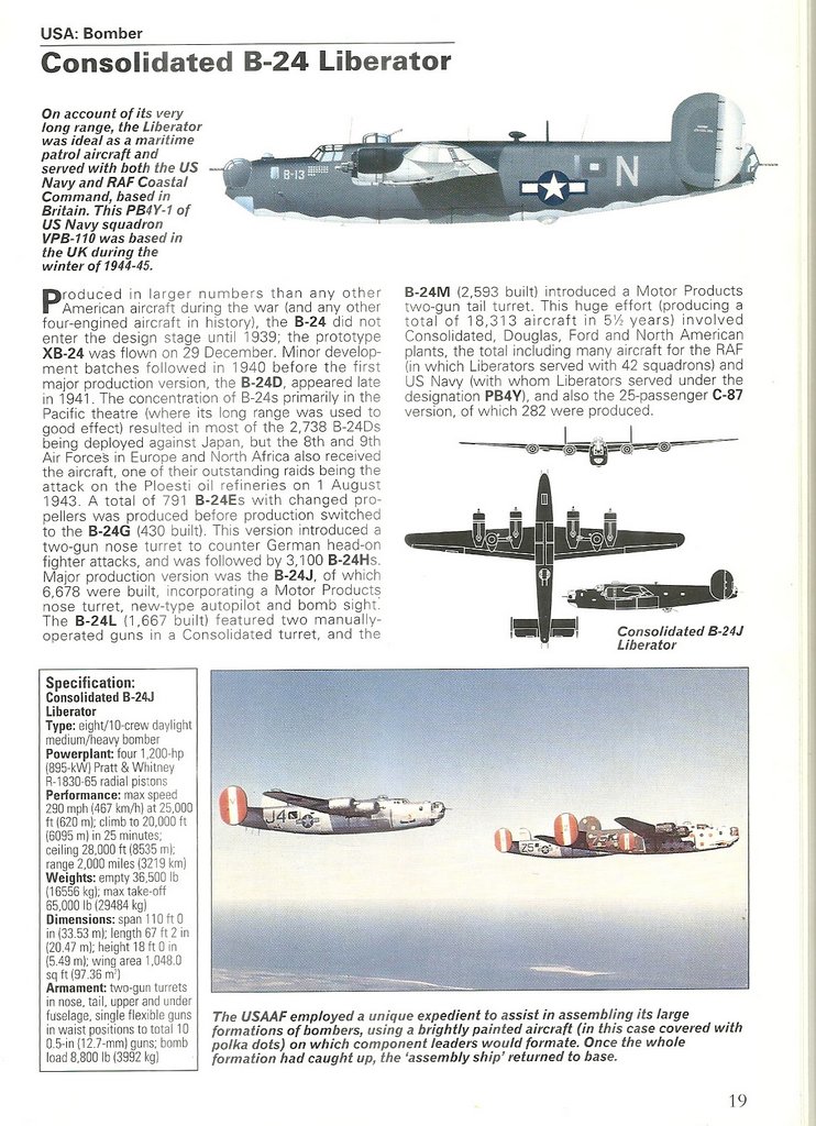
A B24/PB4Y
Sky said as he went past in the canoe "There are more parts of the plane that way," pointing west. What we found when we snorkeled on the wreckage was a large part of one large wing. It was resting in 10-20 feet just on the edge of the sand bank, clearly visible from the surface. We snorkeled it, and Dave took a bunch of pictures (to help identify what kind of plane it was). I got quickly bored of Dave's minute investigation of what was there, and set off to see if I could find more of the plane.
It took awhile, but I finally located two huge airplane propellers and part of one engine, a long way from this wing piece. I finally got Dave's attention and he brought the dinghy closer. In 15 minutes of snorkeling around this spot, we located more parts of the airplane--the other wing, we thought, because we could see another wheel strut under this one too. And pieces of 4 engines. The two propellers I had found were the only ones we located. They were bent in the usual way, which indicates the engines were turning when they hit the water. After looking through some of his aircraft ID books, Dave is pretty sure this is an American B-24. He's emailed a couple of friends to see if anyone can find any info on this particular plane. Though we found the biggest parts of two wings, and most of the engine pieces, we still haven't located the body of the plane, which should be pretty big.
We also dinghied around looking in all the nooks and crannies of the 3 or 4 uninhabited islands. All the people on the two villages live on the one easternmost island. One village is Catholic and one is Protestant, but there is a path between the two villages and lot of intermingling on a daily basis. We heard the traditional chief from Rewo village, the one we're anchored off of, has married someone from Relong and is now living there. We are told there are about 300 people on island. A few speak very good English--apparently it is common to send the young kids off to relatives in Guam to educate them. There are also a lot of people from Puluwat living and working on Chuuk and in Guam.
One Puluwatian we met in Chuuk was Gideon. He is the manager of the stevedores (dock workers) in Chuuk at the main ship dock. He was very helpful to us when we were trying to get in contact with the officials. So when he asked us if we could carry something to his sister in Puluwat, we readily agreed. We ended up with a 20-lb box of frozen "turkey tails", a 50-lb sack of rice, and a big cardboard box of miscellenous stuff. The only address we had was "Judith, 3rd house from the right in Rewo Village)". The box of turkey tails was too big to fit in either our fridge or freezer, so I put it on the floor in the head, and put as much insulation around it as I could manage. I worried about it the whole trip. But it was still partially frozen when we arrived in Puluwat.
We had no trouble finding Judith when we arrived. We had dropped anchor almost right in front of her boat house. Judith was totally surprised by our delivery--apparently Gideon hadn't been able to get word to her that we were coming. She didn't have any refrigeration, but said the turkey tails would be shared out around the extended family. She gave us a handful of limes and a couple of breadfruit as thanks for delivering the stuff from her brother.
Some waypoints for cruisers following in our wake:
Airplane Wing #1 - 07-21.16N / 149-11.24E
Propellers 07-21.14N / 149-11.13E
Airplane Wing #2 07-21.14N / 149-11.14E (and 2 engines)
Jap Dock on Alet 07-21.31N / 149-11.59E (the road starts here)
Patrol Boat 07-21.59N / 149-11.42E
Lighthouse 07-22.28N / 149-10.22E
Because the weather's not been great a lot of the time, and we've been preoccupied with WWII stuff when the weather has been good, we haven't socialized much ashore. But people from both villages have asked us for books & magazines, DVD's, and fishing supplies. We also came prepared with small bags of rice, instant coffee, and cans of Spam. Though we have been offered breadfruit and coconuts, we keep asking for bananas and papayas, indicating we are willing to trade for them. But so far, we haven't been offered any. Mason in Chuuk told us that the Chuukese don't eat papaya much--they use it more for cleaning and medicinal purposes.
-----
At 04/02/2014 3:25 AM (utc) our position was 07°21.11'N 149°11.54'E
http://svsoggypaws.com/currentposition.htm
We were thinking of leaving here tomorrow and heading for Lamotrek, the next stop, about 170 miles due west of Puluwat, but there's another weak circulation forecast to pass here in about 48 hours, and Puluwat is the best place to be in this whole area for westerly winds. So we'll probably stay here until mid-week and let it go by us. Unfortunately, once it goes by, the wind is forecast to drop to under 10 knots. Sigh.
Oh well, we could be stuck in worse places. Puluwat is gorgeous, and is very traditional. It has a small enclosed lagoon with pretty good protection all around--and a "hurricane hole" we could get into if we needed to. There are nice white sand beaches and millions of palm trees to look at.
We have dipped the entrance to the inner lagoon and found it to be over 6 feet all the way in, so we could go in there if we needed to. We took a couple of waypoints on a sunny day so we could get in even in bad weather.
We are the only boat here. Our friends on Westward II and Kokomo are in Woleai, about 200 miles west, and La Gitana is in Olimarao, a similar distance WNW. The boats at Woleai report that Woleai just got internet as of 1 April!! The times they are a-changing, that's for sure. There are two or three boats behind us in Pohnpei, and one in Yap. By early May, everyone will be in Palau, or down in the Solomons. After May, the typhoons get more frequent and stronger, so boats rarely cross this area except Jan-April.
Here in Puluwat they are still mostly living in traditional houses constructed of natural materials. Some people have concrete or wood frame and corrugated aluminum houses, but not as many as in places like Pohnpei or Chuuk. All the "boat houses" are traditional thatch-roofed wooden huts. There are at least two fiberglass open boats here (one for each village, I think), but almost everyone gets around using handmade wooden "proas". Most are about 12-15 feet long and narrow--hewn out of a single breadfruit tree trunk--they are designed for one big guy. Two smaller guys can manage, but balance is an issue. They have a single outrigger, lashed to the main part of the canoe with small poles and coconut fiber ropes (or sometimes, heavy monofilament fishing line). Some are rigged with sails, but most are just paddled. We have pictures, and will post them later. We have heard that there are several larger ocean-going canoes here, but we haven't seen them out yet.
We have kept ourselves busy here while waiting for a good weather window. We met a very nice guy in Relong village (one of two here) named Sky, who speaks very good English. He sent two of his sons with Dave to show him the way to the old Japanese lighthouse on Alet Island, to the west of where we are anchored. Dave and the guys spent all day on Alet. They left the boats on the southern beach of Alet, and went down the beach almost to the lighthouse, then cut in on a trail to explore the lighthouse. Dave says "It's not an ordinary lighthouse. The construction makes it seem more like an upscale house rather than just a lighthouse." On their way back, they took the old Japanese road down the center of the island, and the guys showed Dave all the Japanese artifacts they knew about, including:
- 10 Japanese howitzer type guns on trailers
- Lots of trucks, road graders, rollers, tracked and wheeled tractors and much other construction equipment
- Several bunkers
Dave was in heaven. I was happily back on the boat enjoying not going on yet another "jungle stomp". I had wrenched my knew on the rough passage from Chuuk, and wanted to give it a rest.
The next day, it was pouring down rain, but during a break, Sky showed Dave where the wing of a downed American airplane was. He marked it on the GPS so we could come back and snorkel it on a sunny day.
Yesterday, we had a beautiful sunny day in the morning, and we went to snorkel on the plane. All we knew about it was that Sky said the plane came in low from the west, and was shot down by anti-aircraft fire and landed in the lagoon. While we were anchoring the dinghy, all the guys from the village came past in their canoes--two to a canoe. They were headed to the edge of the reef to catch fish for Sunday dinner. Normally they would go outside the reef in the big canoes, but the wind was still blowing pretty hard, so they were going to use a net to catch smaller fish in the safety of the lagoon.
Sky said as he went past in the canoe "There are more parts of the plane that way," pointing west. What we found when we snorkeled on the wreckage was a large part of one large wing. It was resting in 10-20 feet just on the edge of the sand bank, clearly visible from the surface. We snorkeled it, and Dave took a bunch of pictures (to help identify what kind of plane it was). I got quickly bored of Dave's minute investigation of what was there, and set off to see if I could find more of the plane.
It took awhile, but I finally located two huge airplane propellers and part of one engine, a long way from this wing piece. I finally got Dave's attention and he brought the dinghy closer. In 15 minutes of snorkeling around this spot, we located more parts of the airplane--the other wing, we thought, because we could see another wheel strut under this one too. And pieces of 4 engines. The two propellers I had found were the only ones we located. They were bent in the usual way, which indicates the engines were turning when they hit the water. After looking through some of his aircraft ID books, Dave is pretty sure this is an American B-24. He's emailed a couple of friends to see if anyone can find any info on this particular plane. Though we found the biggest parts of two wings, and most of the engine pieces, we still haven't located the body of the plane, which should be pretty big.
We also dinghied around looking in all the nooks and crannies of the 3 or 4 uninhabited islands. All the people on the two villages live on the one easternmost island. One village is Catholic and one is Protestant, but there is a path between the two villages and lot of intermingling on a daily basis. We heard the traditional chief from Rewo village, the one we're anchored off of, has married someone from Relong and is now living there. We are told there are about 300 people on island. A few speak very good English--apparently it is common to send the young kids off to relatives in Guam to educate them. There are also a lot of people from Puluwat living and working on Chuuk and in Guam.
One Puluwatian we met in Chuuk was Gideon. He is the manager of the stevedores (dock workers) in Chuuk at the main ship dock. He was very helpful to us when we were trying to get in contact with the officials. So when he asked us if we could carry something to his sister in Puluwat, we readily agreed. We ended up with a 20-lb box of frozen "turkey tails", a 50-lb sack of rice, and a big cardboard box of miscellenous stuff. The only address we had was "Judith, 3rd house from the right in Rewo Village)". The box of turkey tails was too big to fit in either our fridge or freezer, so I put it on the floor in the head, and put as much insulation around it as I could manage. I worried about it the whole trip. But it was still partially frozen when we arrived in Puluwat.
We had no trouble finding Judith when we arrived. We had dropped anchor almost right in front of her boat house. Judith was totally surprised by our delivery--apparently Gideon hadn't been able to get word to her that we were coming. She didn't have any refrigeration, but said the turkey tails would be shared out around the extended family. She gave us a handful of limes and a couple of breadfruit as thanks for delivering the stuff from her brother.
Some waypoints for cruisers following in our wake:
Airplane Wing #1 - 07-21.16N / 149-11.24E
Propellers 07-21.14N / 149-11.13E
Airplane Wing #2 07-21.14N / 149-11.14E (and 2 engines)
Jap Dock on Alet 07-21.31N / 149-11.59E (the road starts here)
Patrol Boat 07-21.59N / 149-11.42E
Lighthouse 07-22.28N / 149-10.22E
Because the weather's not been great a lot of the time, and we've been preoccupied with WWII stuff when the weather has been good, we haven't socialized much ashore. But people from both villages have asked us for books & magazines, DVD's, and fishing supplies. We also came prepared with small bags of rice, instant coffee, and cans of Spam. Though we have been offered breadfruit and coconuts, we keep asking for bananas and papayas, indicating we are willing to trade for them. But so far, we haven't been offered any. Mason in Chuuk told us that the Chuukese don't eat papaya much--they use it more for cleaning and medicinal purposes.
-----
At 04/02/2014 3:25 AM (utc) our position was 07°21.11'N 149°11.54'E
http://svsoggypaws.com/currentposition.htm
Thursday, April 3, 2014
Passage from Chuuk to Puluwat
By the time we got checked out from Chuuk and ready to go, the weather forecast had changed drastically for our trip. When we had set our departure date, the winds had been forecast at about 10 knots. By the time we left, the forecast was for 20+ knots!!
Had we been in Pohnpei, a harbor with very good protection and much easier communication with the officials, we would have stayed a couple of days and waited for a better window. But Chuuk isn't the best place to be if the weather deteriorates. AND the text forecast we got at the same time as the GRIB file, was more optimistic about the forecast. At the time there was a tropical depression forming to the east of Chuuk, forecast to drift slowly WNW. We wanted to beat it to Puluwat, which has a better anchorage for weird winds. Since supposedly, a weather forecaster creates the text forecast from the machine-generated GRIB forecast, we opted to believe their forecast over the GRIB files.
Turns out, this time at least, that the GRIB file was more accurate.
We left Chuuk in fairly pleasant conditions, and were congratulating ourselves on the decision to go, right up until about 1am, when the wind (as forecast by the GRIB files) started to pick up. Our "Genoa only, on a pole" sail plan, which was OK when the winds were 10 knots, turned out to be terrible (for steering) when the winds got up to 20 knots. Neither the wind vane nor the autopilot was very good in the windy conditions with large waves going down wind, with only the single headsail out, at least on the heading we were trying to make. Had we had a wing-on-wing configuration with either the mainsail or staysail on the opposite from the genoa, it would have been better. But we don't do sailhandling in the middle of the night in rough conditions if we can avoid it. So we just gutted it out and hand-steered when forced to, when the wind got up.
At dawn it was obvious that we had the GRIB-forecast conditions, not the text forecast conditions. As best we could tell without a real-time satellite photo, the depression had moved west and was nearly at our same latitude but 150 miles south of us. We had about 20-22 knots steady with gusts a little higher when the squalls went past. The seas had built to about 6-8 feet and were pushing the stern around a lot, making the steering situation even worse. (Overall, these are not terrible conditions, we just normally don't choose to go out in weather like this if we can help it).
We finally rolled in the genny to "squall size" and turned on the engine to help steady out the steering. We also pulled out the staysail, sheeted in hard on the other side, to help with the roll. By now the winds had gone east far enough that we were going dead down wind. Had we been on a longer passage, we would have adjusted our sail plan and/or angled off to a heading (temporarily) that would be easier for the steering.
The engine helped a lot for the steering, but I hated to be running the engine when we (finally) had some wind. It also helped us pick the speed up some. We wanted to get in AS SOON AS POSSIBLE. At that point, we were both pretty tired--not much sleep during the night, on or off watch, in those conditions.
On the approach to Puluwat, there is a couple of shoal areas, which I was worried about. The CM93 chart is vague, with few soundings, and the Google Earth chart is "air brushed" out in part of the area. Though the CM93 chart was fairly accurate in Chuuk, it's not accurate everywhere out here. So we got on the morning SSB net and asked about going over those banks in our current nasty weather. Fortunately we were assured that it would be OK. Others in previous weeks had come through there in similar conditions. So we headed straight for our waypoint at 07-20.5N / 149-11.8E just off the entrance to Puluwat's narrow channel.
Going over the banks I'd been worried about, we avoided the shallowest spot (30 feet on the charts, coming up abruptly from about 6000 feet), and so saw least depth of about 40 feet during the whole last 5 miles. But most of the time it was 150 feet or more, only occasionally rising to 60 feet and then dropping off again. I had worried about nasty washing machine seas with this variable bottom, but didn't notice the seas much worse near the banks.
The next thing I was worried about was having seas breaking across the channel. There isn't much protection from the big wind and seas until you get up inside the channel. The depths go from 150 feet to 40 feet to 20 feet in about 100 yards.
We had been warned that it was narrow, and it was! If I hadn't had good Google Earth charts, a good set of waypoints from friends, and assurances that others had come in in similar conditions, we might not have ventured in.
Dave was standing on our lookout position giving encouragement and directions, as I steered our way using the waypoints. One tiny end of a wave did break across the entrance, but we could see it wasn't bad. Fortunately we were between squalls, so visibility was reasonable, at noon, even with the overcast. One minute we were out in the storm, the next minute... ahhh... calm and quiet in a pretty little lagoon with a 25-30' deep sand bottom, and a sand beach. Very pretty and very quiet.
Our waypoints on the way in (from Kokomo) were:
07 20.624N 149 11.529E
07 20.745N 149 11.521E
07 20.802N 149 11.514E
07 20.867N 149 11.516E
07 20.917N 149 11.527E
07 20.982N 149 11.536E
07 21.270N 149 11.528E anchored here
We checked out Kokomo's anchor spot but it looked corally. Later we found that most (but not all) of the black spots on the bottom are grass and not coral. So their anchorage was OK. We anchored further south at 07-21.13N / 149-11.56E
Glad to be here. More on Puluwat later.
-----
Sherry & Dave
Heading west across Micronesia in 2014
http://svsoggypaws.blogspot.com
At 04/02/2014 3:25 AM (utc) our position was 07°21.11'N 149°11.54'E
http://svsoggypaws.com/currentposition.htm
Had we been in Pohnpei, a harbor with very good protection and much easier communication with the officials, we would have stayed a couple of days and waited for a better window. But Chuuk isn't the best place to be if the weather deteriorates. AND the text forecast we got at the same time as the GRIB file, was more optimistic about the forecast. At the time there was a tropical depression forming to the east of Chuuk, forecast to drift slowly WNW. We wanted to beat it to Puluwat, which has a better anchorage for weird winds. Since supposedly, a weather forecaster creates the text forecast from the machine-generated GRIB forecast, we opted to believe their forecast over the GRIB files.
Turns out, this time at least, that the GRIB file was more accurate.
We left Chuuk in fairly pleasant conditions, and were congratulating ourselves on the decision to go, right up until about 1am, when the wind (as forecast by the GRIB files) started to pick up. Our "Genoa only, on a pole" sail plan, which was OK when the winds were 10 knots, turned out to be terrible (for steering) when the winds got up to 20 knots. Neither the wind vane nor the autopilot was very good in the windy conditions with large waves going down wind, with only the single headsail out, at least on the heading we were trying to make. Had we had a wing-on-wing configuration with either the mainsail or staysail on the opposite from the genoa, it would have been better. But we don't do sailhandling in the middle of the night in rough conditions if we can avoid it. So we just gutted it out and hand-steered when forced to, when the wind got up.
At dawn it was obvious that we had the GRIB-forecast conditions, not the text forecast conditions. As best we could tell without a real-time satellite photo, the depression had moved west and was nearly at our same latitude but 150 miles south of us. We had about 20-22 knots steady with gusts a little higher when the squalls went past. The seas had built to about 6-8 feet and were pushing the stern around a lot, making the steering situation even worse. (Overall, these are not terrible conditions, we just normally don't choose to go out in weather like this if we can help it).
We finally rolled in the genny to "squall size" and turned on the engine to help steady out the steering. We also pulled out the staysail, sheeted in hard on the other side, to help with the roll. By now the winds had gone east far enough that we were going dead down wind. Had we been on a longer passage, we would have adjusted our sail plan and/or angled off to a heading (temporarily) that would be easier for the steering.
The engine helped a lot for the steering, but I hated to be running the engine when we (finally) had some wind. It also helped us pick the speed up some. We wanted to get in AS SOON AS POSSIBLE. At that point, we were both pretty tired--not much sleep during the night, on or off watch, in those conditions.
On the approach to Puluwat, there is a couple of shoal areas, which I was worried about. The CM93 chart is vague, with few soundings, and the Google Earth chart is "air brushed" out in part of the area. Though the CM93 chart was fairly accurate in Chuuk, it's not accurate everywhere out here. So we got on the morning SSB net and asked about going over those banks in our current nasty weather. Fortunately we were assured that it would be OK. Others in previous weeks had come through there in similar conditions. So we headed straight for our waypoint at 07-20.5N / 149-11.8E just off the entrance to Puluwat's narrow channel.
Going over the banks I'd been worried about, we avoided the shallowest spot (30 feet on the charts, coming up abruptly from about 6000 feet), and so saw least depth of about 40 feet during the whole last 5 miles. But most of the time it was 150 feet or more, only occasionally rising to 60 feet and then dropping off again. I had worried about nasty washing machine seas with this variable bottom, but didn't notice the seas much worse near the banks.
The next thing I was worried about was having seas breaking across the channel. There isn't much protection from the big wind and seas until you get up inside the channel. The depths go from 150 feet to 40 feet to 20 feet in about 100 yards.
We had been warned that it was narrow, and it was! If I hadn't had good Google Earth charts, a good set of waypoints from friends, and assurances that others had come in in similar conditions, we might not have ventured in.
Dave was standing on our lookout position giving encouragement and directions, as I steered our way using the waypoints. One tiny end of a wave did break across the entrance, but we could see it wasn't bad. Fortunately we were between squalls, so visibility was reasonable, at noon, even with the overcast. One minute we were out in the storm, the next minute... ahhh... calm and quiet in a pretty little lagoon with a 25-30' deep sand bottom, and a sand beach. Very pretty and very quiet.
Our waypoints on the way in (from Kokomo) were:
07 20.624N 149 11.529E
07 20.745N 149 11.521E
07 20.802N 149 11.514E
07 20.867N 149 11.516E
07 20.917N 149 11.527E
07 20.982N 149 11.536E
07 21.270N 149 11.528E anchored here
We checked out Kokomo's anchor spot but it looked corally. Later we found that most (but not all) of the black spots on the bottom are grass and not coral. So their anchorage was OK. We anchored further south at 07-21.13N / 149-11.56E
Glad to be here. More on Puluwat later.
-----
Sherry & Dave
Heading west across Micronesia in 2014
http://svsoggypaws.blogspot.com
At 04/02/2014 3:25 AM (utc) our position was 07°21.11'N 149°11.54'E
http://svsoggypaws.com/currentposition.htm
Chuuk Cruising Information
At no time in the nearly 2 weeks we were in Chuuk did we feel threatened. We DID NOT get harassed, shot at, accosted, nor did we have rocks thrown at us. People we met were in general very friendly and helpful, and interested in us. They hardly get any cruisers through Chuuk, so the people we met on the street assumed we were working there or diving there.
We DID abide advice from other cruisers and locals about where and where not to go. (Do: Truk Stop and Blue Lagoon anchorages. Don't: Anywhere else and especially not in the Tol area). And we made sure we were pretty much theft-proofed on board (same as we would cruising most of the Eastern Caribbean and Central America).
Some useful waypoints and information for cruisers following behind us:
SE Pass we used: 07-12.00N / 151-59.74E Outside
07-13.54N / 151-59.47E Inside
This is basically a on direct line from the Mortlocks (Lekinioch/Satawan) to Chuuk. Visibility entering at 8am was fine, and all the hazards in the lagoon matched our CM93 (2010) chart and Google Earth chart reasonably well. From there we went north around Dublon/Tonowas and up the west side of Moen/Weno.
Truk Stop Moorings: 07-26.52N / 151-50.25E
Our Best Anchorage: 07-26.51N / 151-50.205E
The moorings would be preferred, but there are 2 semi-permanent boats there right now. Their moorings are 3/8" chain around coral heads, and they have the best anchoring spots. Where we anchored was as close as we could get with 360-degree swing. We dropped in sand, but ended up hanging over some coral, so we bouyed our anchor chain with buoys at 90' and 125'. Depending on the wind, we ended up in the middle of the "morning rush hour" small boat traffic lanes. Make sure you have a bright anchor light at all times. To get closer in, out of the traffic, there's not enough swinging room.
Dinghy dock is the Truk Stop pier, where we were welcomed, as long as we didn't get in the way of the dive boats. They also didn't mind if we dumped our trash in their bins. Fuel if you need it in small quantities is by jugging. Large quantities of fuel or water could be had by arrangement at the commercial pier. Gasoline was $5.25 per gallon at the gas station.
Commercial Pier: 07-26.69N / 151-50.39E
This is a large/high concrete pier with big black rubber fenders to keep you off the concrete. It is nicely protected from all directions except west. You will need long lines to tie up here, as the bollards are high and widely spaced. There are usually dock workers loitering about to take your lines (you will need someone on shore to get tied up).
Getting on and off the boat at the pier is a problem--a scramble up the high sides of the pier. Almost all the officials opted to deal with us from up on the dock vs coming aboard. One, the Immigration guy on check-out, wanted to come aboard and take a look around. We weren't sure whether he was looking for stow-aways, or just curious. He was nice and friendly and was more interested in our lifestyle than anything else.
There is no one to contact before going in--NO ONE uses VHF in Chuuk (not the officials, not the dive operations or the dive boats). If there's space at the dock, feel free to tie up. Depth to about 25-30 feet, so no problems for sailboats. If there's no space on the south face, you might be able to raft to someone for clearing in, or use the west face of the dock, or anchor close off the west face until you can arrange to come alongside (mandatory we are told for clearing in). The large ships that come in, do dock on the west face, but they only come in for a few hours once every 2 weeks. The dock workers will know if there is a ship coming in soon. Most of the time there was plenty of space at the pier for a sailboat.
There is a 24 hour guard on the dock, so we felt pretty secure, but we still were at Code Yellow status (everything loose on deck stowed below, and the boat locked up when we left). We had no troubles whatsoever anywhere in Chuuk, and had we not been warned about all the possible bad stuff beforehand, we'd have found Chuuk very friendly.
Blue Lagoon Anchorage: 07-24.86N / 151-50.47E
This is nestled up in a sand spot as close in as we could get, with decent protection from NW through E and almost to S. In about 25' sand. We bouyed the anchor with 2 sets of bouys to minimize any coral damage (this is within snorkeling distance of the Blue Lagoon Resort). We went ashore at night, leaving our dinghy on the beach, and had dinner. There is a security guy roaming the grounds.
Blue Lagoon Odyssey Mooring: 07-24.8N / 151-50.4E
This is the mooring for the Odyssey live-aboard dive boat. It is normally vacant except for Saturday and Sunday evenings, when they do the guest change-over. You can probably use it with permission. But we could not raise Odyssey on VHF, even when we came in and anchored very close next to them. There is reportedly another mooring for Odyssey on the east side of the Blue Lagoon peninsula, but we don't know the exact location.
When we asked where we should go if the winds went west, someone told us "on the other side of the airport". Good Google Earth charts of the north and east side of Weno/Moen would be recommended if you're staying long in Chuuk. We did not do any exploring over there, but a day trip on a calm day exploring would be worthwhile, to suss out a spot for a westerly blow.
NW Pass we used on Exit: 07-26.21N / 151-33.05E
This is a wide-open pass with easy exit. The route direct from the Commercial Pier to this pass is fairly easy. Our CM93 (2010) chart showed 2 or 3 small shallow spots, which (on close inspection) we also found on the Google Earth chart. But this pass is 17 miles from the pier/Truk Stop, so you need to get an early start so you're not navigating with the sun in your eyes. There are two or 3 passes to the north of this one that are closer (closest is about 13 miles, and more to the NW so you wouldn't be absolutely into the sun in the afternoon).
Checking out: We started by making sure we had the phone numbers of all the officials we needed to see on checkout when we checked in. (they are listed in our Micronesia Compendium) Then a day ahead of time, call them and set your departure time and make a firm appointment for them to come visit. Understand that the airplane schedule will affect when they visit. Currently, on Sunday night, there is a 3am flight (they will be less responsive in general on Monday because of this). On M-W-Fr, the regular flight is in the morning. On T-Thu-Sat, the regular flight is in the afternoon.
Because we wanted to leave first thing Tuesday morning, we set up for a Monday afternoon checkout, and planned to pay for an extra night and stay at the concrete dock overnight. They said they normally didn't allow checking out a day in advance, but they allowed us to do it. (Dave was so nice and courteous to everyone, I think it helps).
Once we got into the dock, it turned out that Monday was a holiday, and we paid overtime anyway to Immigration and Customs--double on Holidays, a total of $75. But this was our fault, and once informed by the Immig guy, we could have opted to wait til the next day and not pay any overtime (March 31 was "Cultural Day"). If we'd waited til Tues am, we would have only had to pay the port charges ($130 total, itemized, with a receipt, no overtime included).
The only official we had trouble with was again the Port Captain. Never got an answer on his cell phone. I think he never has it on or doesn't carry it. He told us a text message would have been better, because it's there when he turns his cell phone on. He also said he passes the port a couple of times a day, and will see any boats that are there. Once we got him at the boat, he was friendly and efficient. He went away to prepare the "port clearance" paperwork and came back an hour later with that and the "port charges" bill.
Again, everyone was polite and friendly. I think each official wanted another copy of the crew list, even though it was the same one we gave them on clearing in. I had also made several copies of our Cruising Permit in anticipation, but I don't think anyone asked for it.
We dinghied over to Truk Stop for a last meal, and loaded the dinghy that night, and left about 7am Tuesday morning.
Some helpful people--Mason Fritz--associated with Truk Stop (cell 930-6424). Speaks good English, related to several of the officials, and generally very interested in seeing that visiting yachts have a good experience. Also, a guy by the name of Gideon, who is the head/manager of the stevedores at the port. Speaks good English, and knows the workings of the port well. (cell 932-2644). Gideon has family on Puluwat, so if you are going there after Chuuk, you can thank him by carrying a few items for his family (we took a cardboard box, 50lbs of rice and 20 lbs of "turkey tails" to his sister).
Provisioning: There is an ATM (Bank of FSM) and a grocery store across from Truk Stop. Fair supply of goods. About a block down towards the airport (next to the Yamaha place and just across from the port) is another store with better (and more expensive) stuff. I think it is called Shigato. They had a good supply of veggies after the ship came in. There are two ships. The blue "Hibiscus" ship doesn't carry veggies. The other ship that comes in 3-4 days after Hibiscus has the good veggies, according to the owner of Shigato. Hibiscus is the same ship that stops in Majuro and Kwaj and Pohnpei, so if you figure out the schedule (every 2 weeks) in one of those places, you can have an idea when the ships are due in to Chuuk. Hibiscus came in on a Sunday, and the other ship on Weds. By 10 days after the ship came in, we had trouble finding any veggies that weren't essentially dead. Between Truk Stop and Shigato, there's a Bank of Guam. There's also a lady who sometimes has local vegs for sale (bananas and papayas).
WARNING: We were warned several times NOT to stop at Tol... This is the big set of islands near the far western end of the atoll. These people have a bad reputation as being a bit lawless. It is also pretty reefy getting through there. This is where C'est La Vie ran into trouble. It would be tempting to stop there coming in from the west late in the day, but not recommended. Better to come in the south pass and stop overnight behind Uman, if you have to.
Stopping ANYWHERE but the Commercial Pier, Truk Stop, or Blue Lagoon, and you are likely to be asked for a fee to stay. This is the Chuukese way, and applies to everyone, not just foreign vessels (unless you are part of the clan or connected by friends/family).
This info will all be incorporated into our Micronesia Compendium on svsoggypaws.com when we next have internet, so if you have a later version than A.7, you will have all this info in the Chuuk section already.
We DID abide advice from other cruisers and locals about where and where not to go. (Do: Truk Stop and Blue Lagoon anchorages. Don't: Anywhere else and especially not in the Tol area). And we made sure we were pretty much theft-proofed on board (same as we would cruising most of the Eastern Caribbean and Central America).
Some useful waypoints and information for cruisers following behind us:
SE Pass we used: 07-12.00N / 151-59.74E Outside
07-13.54N / 151-59.47E Inside
This is basically a on direct line from the Mortlocks (Lekinioch/Satawan) to Chuuk. Visibility entering at 8am was fine, and all the hazards in the lagoon matched our CM93 (2010) chart and Google Earth chart reasonably well. From there we went north around Dublon/Tonowas and up the west side of Moen/Weno.
Truk Stop Moorings: 07-26.52N / 151-50.25E
Our Best Anchorage: 07-26.51N / 151-50.205E
The moorings would be preferred, but there are 2 semi-permanent boats there right now. Their moorings are 3/8" chain around coral heads, and they have the best anchoring spots. Where we anchored was as close as we could get with 360-degree swing. We dropped in sand, but ended up hanging over some coral, so we bouyed our anchor chain with buoys at 90' and 125'. Depending on the wind, we ended up in the middle of the "morning rush hour" small boat traffic lanes. Make sure you have a bright anchor light at all times. To get closer in, out of the traffic, there's not enough swinging room.
Dinghy dock is the Truk Stop pier, where we were welcomed, as long as we didn't get in the way of the dive boats. They also didn't mind if we dumped our trash in their bins. Fuel if you need it in small quantities is by jugging. Large quantities of fuel or water could be had by arrangement at the commercial pier. Gasoline was $5.25 per gallon at the gas station.
Commercial Pier: 07-26.69N / 151-50.39E
This is a large/high concrete pier with big black rubber fenders to keep you off the concrete. It is nicely protected from all directions except west. You will need long lines to tie up here, as the bollards are high and widely spaced. There are usually dock workers loitering about to take your lines (you will need someone on shore to get tied up).
Getting on and off the boat at the pier is a problem--a scramble up the high sides of the pier. Almost all the officials opted to deal with us from up on the dock vs coming aboard. One, the Immigration guy on check-out, wanted to come aboard and take a look around. We weren't sure whether he was looking for stow-aways, or just curious. He was nice and friendly and was more interested in our lifestyle than anything else.
There is no one to contact before going in--NO ONE uses VHF in Chuuk (not the officials, not the dive operations or the dive boats). If there's space at the dock, feel free to tie up. Depth to about 25-30 feet, so no problems for sailboats. If there's no space on the south face, you might be able to raft to someone for clearing in, or use the west face of the dock, or anchor close off the west face until you can arrange to come alongside (mandatory we are told for clearing in). The large ships that come in, do dock on the west face, but they only come in for a few hours once every 2 weeks. The dock workers will know if there is a ship coming in soon. Most of the time there was plenty of space at the pier for a sailboat.
There is a 24 hour guard on the dock, so we felt pretty secure, but we still were at Code Yellow status (everything loose on deck stowed below, and the boat locked up when we left). We had no troubles whatsoever anywhere in Chuuk, and had we not been warned about all the possible bad stuff beforehand, we'd have found Chuuk very friendly.
Blue Lagoon Anchorage: 07-24.86N / 151-50.47E
This is nestled up in a sand spot as close in as we could get, with decent protection from NW through E and almost to S. In about 25' sand. We bouyed the anchor with 2 sets of bouys to minimize any coral damage (this is within snorkeling distance of the Blue Lagoon Resort). We went ashore at night, leaving our dinghy on the beach, and had dinner. There is a security guy roaming the grounds.
Blue Lagoon Odyssey Mooring: 07-24.8N / 151-50.4E
This is the mooring for the Odyssey live-aboard dive boat. It is normally vacant except for Saturday and Sunday evenings, when they do the guest change-over. You can probably use it with permission. But we could not raise Odyssey on VHF, even when we came in and anchored very close next to them. There is reportedly another mooring for Odyssey on the east side of the Blue Lagoon peninsula, but we don't know the exact location.
When we asked where we should go if the winds went west, someone told us "on the other side of the airport". Good Google Earth charts of the north and east side of Weno/Moen would be recommended if you're staying long in Chuuk. We did not do any exploring over there, but a day trip on a calm day exploring would be worthwhile, to suss out a spot for a westerly blow.
NW Pass we used on Exit: 07-26.21N / 151-33.05E
This is a wide-open pass with easy exit. The route direct from the Commercial Pier to this pass is fairly easy. Our CM93 (2010) chart showed 2 or 3 small shallow spots, which (on close inspection) we also found on the Google Earth chart. But this pass is 17 miles from the pier/Truk Stop, so you need to get an early start so you're not navigating with the sun in your eyes. There are two or 3 passes to the north of this one that are closer (closest is about 13 miles, and more to the NW so you wouldn't be absolutely into the sun in the afternoon).
Checking out: We started by making sure we had the phone numbers of all the officials we needed to see on checkout when we checked in. (they are listed in our Micronesia Compendium) Then a day ahead of time, call them and set your departure time and make a firm appointment for them to come visit. Understand that the airplane schedule will affect when they visit. Currently, on Sunday night, there is a 3am flight (they will be less responsive in general on Monday because of this). On M-W-Fr, the regular flight is in the morning. On T-Thu-Sat, the regular flight is in the afternoon.
Because we wanted to leave first thing Tuesday morning, we set up for a Monday afternoon checkout, and planned to pay for an extra night and stay at the concrete dock overnight. They said they normally didn't allow checking out a day in advance, but they allowed us to do it. (Dave was so nice and courteous to everyone, I think it helps).
Once we got into the dock, it turned out that Monday was a holiday, and we paid overtime anyway to Immigration and Customs--double on Holidays, a total of $75. But this was our fault, and once informed by the Immig guy, we could have opted to wait til the next day and not pay any overtime (March 31 was "Cultural Day"). If we'd waited til Tues am, we would have only had to pay the port charges ($130 total, itemized, with a receipt, no overtime included).
The only official we had trouble with was again the Port Captain. Never got an answer on his cell phone. I think he never has it on or doesn't carry it. He told us a text message would have been better, because it's there when he turns his cell phone on. He also said he passes the port a couple of times a day, and will see any boats that are there. Once we got him at the boat, he was friendly and efficient. He went away to prepare the "port clearance" paperwork and came back an hour later with that and the "port charges" bill.
Again, everyone was polite and friendly. I think each official wanted another copy of the crew list, even though it was the same one we gave them on clearing in. I had also made several copies of our Cruising Permit in anticipation, but I don't think anyone asked for it.
We dinghied over to Truk Stop for a last meal, and loaded the dinghy that night, and left about 7am Tuesday morning.
Some helpful people--Mason Fritz--associated with Truk Stop (cell 930-6424). Speaks good English, related to several of the officials, and generally very interested in seeing that visiting yachts have a good experience. Also, a guy by the name of Gideon, who is the head/manager of the stevedores at the port. Speaks good English, and knows the workings of the port well. (cell 932-2644). Gideon has family on Puluwat, so if you are going there after Chuuk, you can thank him by carrying a few items for his family (we took a cardboard box, 50lbs of rice and 20 lbs of "turkey tails" to his sister).
Provisioning: There is an ATM (Bank of FSM) and a grocery store across from Truk Stop. Fair supply of goods. About a block down towards the airport (next to the Yamaha place and just across from the port) is another store with better (and more expensive) stuff. I think it is called Shigato. They had a good supply of veggies after the ship came in. There are two ships. The blue "Hibiscus" ship doesn't carry veggies. The other ship that comes in 3-4 days after Hibiscus has the good veggies, according to the owner of Shigato. Hibiscus is the same ship that stops in Majuro and Kwaj and Pohnpei, so if you figure out the schedule (every 2 weeks) in one of those places, you can have an idea when the ships are due in to Chuuk. Hibiscus came in on a Sunday, and the other ship on Weds. By 10 days after the ship came in, we had trouble finding any veggies that weren't essentially dead. Between Truk Stop and Shigato, there's a Bank of Guam. There's also a lady who sometimes has local vegs for sale (bananas and papayas).
WARNING: We were warned several times NOT to stop at Tol... This is the big set of islands near the far western end of the atoll. These people have a bad reputation as being a bit lawless. It is also pretty reefy getting through there. This is where C'est La Vie ran into trouble. It would be tempting to stop there coming in from the west late in the day, but not recommended. Better to come in the south pass and stop overnight behind Uman, if you have to.
Stopping ANYWHERE but the Commercial Pier, Truk Stop, or Blue Lagoon, and you are likely to be asked for a fee to stay. This is the Chuukese way, and applies to everyone, not just foreign vessels (unless you are part of the clan or connected by friends/family).
This info will all be incorporated into our Micronesia Compendium on svsoggypaws.com when we next have internet, so if you have a later version than A.7, you will have all this info in the Chuuk section already.
Chuuk Wrap-Up
We had a nice time the last few days at Chuuk. Our final count on dives was 15 dives. Deepest depths we went was about 130 feet, but most dives we did you could see all you wanted above 100 feet.
Nitrox matters, so if you can get Nitrox certified before you go, and opt for the $10 per tank Nitrox fee. At least one day, Cindy from the Truk Stop Dive Shop said "you won't need Nitrox today--no need for you to pay for it extra if you don't need it."
Good buoyancy also matters a lot, so an Advanced PADI certification (or equivalent) and practice on maintaining neutral bouyancy is important. When you are in enclosed spaces in a wreck, with lots of silt around, you need absolute minimum "finning". One ill-placed push of a fin will "brown out" the whole area. Rob and Cindy are great at coaching on wreck diving techniques--at at gearing your dive to your likes/dislikes and capabilities. Even as experienced as we are, we learned a lot from them about wreck diving. That's why we recommend Truk Stop over the other dive operations at Chuuk. A very small diver-to-guide ratio means you get real personal service (and fewer people clouding up the wreck you are diving on).
As for "which dive operation", after 10 days in Chuuk and diving with Truk Stop, and seeing the other operations, we felt that Truk Stop was best for diving. The others have more divers and thus less personal attention and not as good diver-to-guide ratio. Truk Stop makes it a point to leave early in the morning so as to be the first on the wrecks in the morning, therefore you have best visibility. People we met who had stayed on Odyssey for a week the previous year said they had a much better experience diving the wrecks with Truk Stop (fewer divers messing up the visibility). But Odyssey apparently had great food, and an open bar. (The bar is quite expensive at both Truk Stop and Blue Lagoon). Truk Stop is in town, so it's easy to go to a store, get cash, see something besides their place (though, there's not much to see). Blue Lagoon is more of an all-encompassing resort, so if you have non-divers with you, they will probably be happier at Blue Lagoon. Blue Lagoon does more boat trips per day, so its easier to pick and choose what dive you want to do. But Truk Stop works really hard to tailor their dives to what you want to see, on any given day. They have 3 boats, so can accommodate both the tech divers and the recreational divers. If you're going out to Odyssey, you might stop at Truk Stop on the way in or out, as Cindy will take you to places she knows Odyssey doesn't go.
The weather turned nasty in Chuuk unexpectedly one afternoon while we were there. Completely un-forecast, the wind went a little west of North, and picked up to about 15-20. We had 2-3 foot waves where we were. We were safe enough, but uncomfortable, and so opted to pick up late in the afternoon and move down to Blue Lagoon, where there was better protection from the north. (another option would have been to pull into the commercial pier, but there wasn't room at the time). Fortunately we had stopped in at Blue Lagoon on our way in to Chuuk and scoped out an anchor spot, and we had a track there. We snuggled in just inside the live-aboard dive boat Odyssey, who was on their Blue Lagoon mooring to change over passengers on the weekend.
Dave and I went into dinner when we stayed overnight at Blue Lagoon--a very nice-looking resort. Compared to Truk Stop, the restaurant at Blue Lagoon has less ambiance, and the food was not nearly as good. A day or two before the next supply ship was due, and they were out of several key ingredients for their menu, so the selection was limited and what we got was uninspiring. But a little cheaper than Truk Stop. Truk Stop has better internet (free for guests).
We did two land tours while in Chuuk. Both were arranged through Truk Stop and conducted by Mason Fritz (cell 930-6424). The first was a drive-around Weno to several World War 2 sights, including a couple of caves, gun emplacements, and Xavier High School. Even without the sights, a couple of hours talking to Mason gives you excellent background and historical information about Chuuk. Second, we arranged with Mason to get a boat to take us to Dublon (now called Tonowas), which was the main island for the Japanese. There truthfully isn't a lot to see--most Japanese things are either levelled--by U.S. bombings, the locals, or typhoon, or so far back in the jungle that it would be a messy hike to visit (which Mason wasn't offering, but could probably be arranged). But Mason took us around the island and we saw some Japanese sights, and got a lot more of the history. We ended the day at his family's residence, next to an old church, and the site of the large Japanese hospital. He arranged for us to see some handicrafts (sold by the makers at a much cheaper price than at the gift shops), and for a taste of local food at his sister's house at the end of the trip. Both trips were well worth the time and expense, if you want to do more than just dive dive dive at Chuuk.
The internet was totally down for the last 2-3 days of our stay. So I can't post pictures now of our land tours. Maybe later.
-----
Sherry & Dave
Heading west across Micronesia in 2014
http://svsoggypaws.blogspot.com
At 04/02/2014 3:25 AM (utc) our position was 07°21.11'N 149°11.54'E
http://svsoggypaws.com/currentposition.htm
Nitrox matters, so if you can get Nitrox certified before you go, and opt for the $10 per tank Nitrox fee. At least one day, Cindy from the Truk Stop Dive Shop said "you won't need Nitrox today--no need for you to pay for it extra if you don't need it."
Good buoyancy also matters a lot, so an Advanced PADI certification (or equivalent) and practice on maintaining neutral bouyancy is important. When you are in enclosed spaces in a wreck, with lots of silt around, you need absolute minimum "finning". One ill-placed push of a fin will "brown out" the whole area. Rob and Cindy are great at coaching on wreck diving techniques--at at gearing your dive to your likes/dislikes and capabilities. Even as experienced as we are, we learned a lot from them about wreck diving. That's why we recommend Truk Stop over the other dive operations at Chuuk. A very small diver-to-guide ratio means you get real personal service (and fewer people clouding up the wreck you are diving on).
As for "which dive operation", after 10 days in Chuuk and diving with Truk Stop, and seeing the other operations, we felt that Truk Stop was best for diving. The others have more divers and thus less personal attention and not as good diver-to-guide ratio. Truk Stop makes it a point to leave early in the morning so as to be the first on the wrecks in the morning, therefore you have best visibility. People we met who had stayed on Odyssey for a week the previous year said they had a much better experience diving the wrecks with Truk Stop (fewer divers messing up the visibility). But Odyssey apparently had great food, and an open bar. (The bar is quite expensive at both Truk Stop and Blue Lagoon). Truk Stop is in town, so it's easy to go to a store, get cash, see something besides their place (though, there's not much to see). Blue Lagoon is more of an all-encompassing resort, so if you have non-divers with you, they will probably be happier at Blue Lagoon. Blue Lagoon does more boat trips per day, so its easier to pick and choose what dive you want to do. But Truk Stop works really hard to tailor their dives to what you want to see, on any given day. They have 3 boats, so can accommodate both the tech divers and the recreational divers. If you're going out to Odyssey, you might stop at Truk Stop on the way in or out, as Cindy will take you to places she knows Odyssey doesn't go.
The weather turned nasty in Chuuk unexpectedly one afternoon while we were there. Completely un-forecast, the wind went a little west of North, and picked up to about 15-20. We had 2-3 foot waves where we were. We were safe enough, but uncomfortable, and so opted to pick up late in the afternoon and move down to Blue Lagoon, where there was better protection from the north. (another option would have been to pull into the commercial pier, but there wasn't room at the time). Fortunately we had stopped in at Blue Lagoon on our way in to Chuuk and scoped out an anchor spot, and we had a track there. We snuggled in just inside the live-aboard dive boat Odyssey, who was on their Blue Lagoon mooring to change over passengers on the weekend.
Dave and I went into dinner when we stayed overnight at Blue Lagoon--a very nice-looking resort. Compared to Truk Stop, the restaurant at Blue Lagoon has less ambiance, and the food was not nearly as good. A day or two before the next supply ship was due, and they were out of several key ingredients for their menu, so the selection was limited and what we got was uninspiring. But a little cheaper than Truk Stop. Truk Stop has better internet (free for guests).
We did two land tours while in Chuuk. Both were arranged through Truk Stop and conducted by Mason Fritz (cell 930-6424). The first was a drive-around Weno to several World War 2 sights, including a couple of caves, gun emplacements, and Xavier High School. Even without the sights, a couple of hours talking to Mason gives you excellent background and historical information about Chuuk. Second, we arranged with Mason to get a boat to take us to Dublon (now called Tonowas), which was the main island for the Japanese. There truthfully isn't a lot to see--most Japanese things are either levelled--by U.S. bombings, the locals, or typhoon, or so far back in the jungle that it would be a messy hike to visit (which Mason wasn't offering, but could probably be arranged). But Mason took us around the island and we saw some Japanese sights, and got a lot more of the history. We ended the day at his family's residence, next to an old church, and the site of the large Japanese hospital. He arranged for us to see some handicrafts (sold by the makers at a much cheaper price than at the gift shops), and for a taste of local food at his sister's house at the end of the trip. Both trips were well worth the time and expense, if you want to do more than just dive dive dive at Chuuk.
The internet was totally down for the last 2-3 days of our stay. So I can't post pictures now of our land tours. Maybe later.
-----
Sherry & Dave
Heading west across Micronesia in 2014
http://svsoggypaws.blogspot.com
At 04/02/2014 3:25 AM (utc) our position was 07°21.11'N 149°11.54'E
http://svsoggypaws.com/currentposition.htm
Wednesday, March 26, 2014
Some Dive Photos from Truk Lagoon
We have now been here for 4 days, and made 7 dives on 6 different Japanese wrecks.

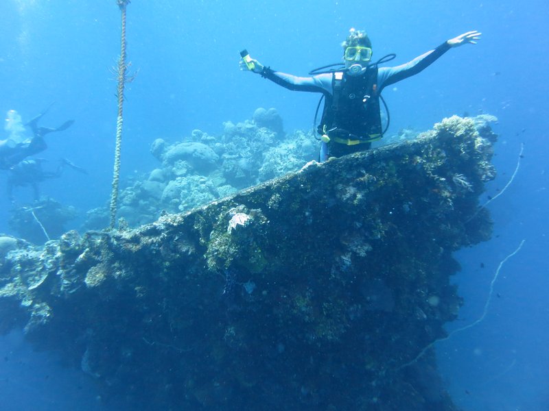
Sherry Doing the Titantic on the Bow of the Sankisan Maru
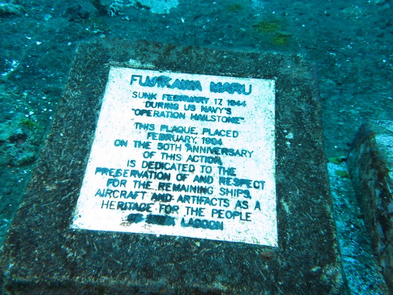
Truk Lagoon (now called Chuuk and pronounced Chook by the Micronesias) was a major Japanese hub during World War II. They had 3 airfields and a major supply and repair depot here. On Feb 17, 1944, the U.S. Navy surprised the Japanese here with "Operation Hailstone" and sunk about 60 ships. Over the years, about 40 wrecks have been found and documented. Most of the wrecks are supply ships and other support vessels, but there is at least one submarine and several seaplanes.
We have found the Truk Stop Hotel & Dive Shop to be excellent--a very professional dive operation--great dive briefings, great dive guides, very safe dive practices, and a great diver-to-guide ratio. We have had a few meals at the restaurant, and all have been good.
Many of the wrecks are at the limit of the normal "recreational diver" depths (60-90 feet), but with PADI Advanced Diver, Nitrox Diver, and Wreck Diver certificates, plus a whole bunch of wreck diving last summer in the Marshalls, and I feel very comfortable, even at 120 feet, in the dark, inside the bowels of a ship's engine room.

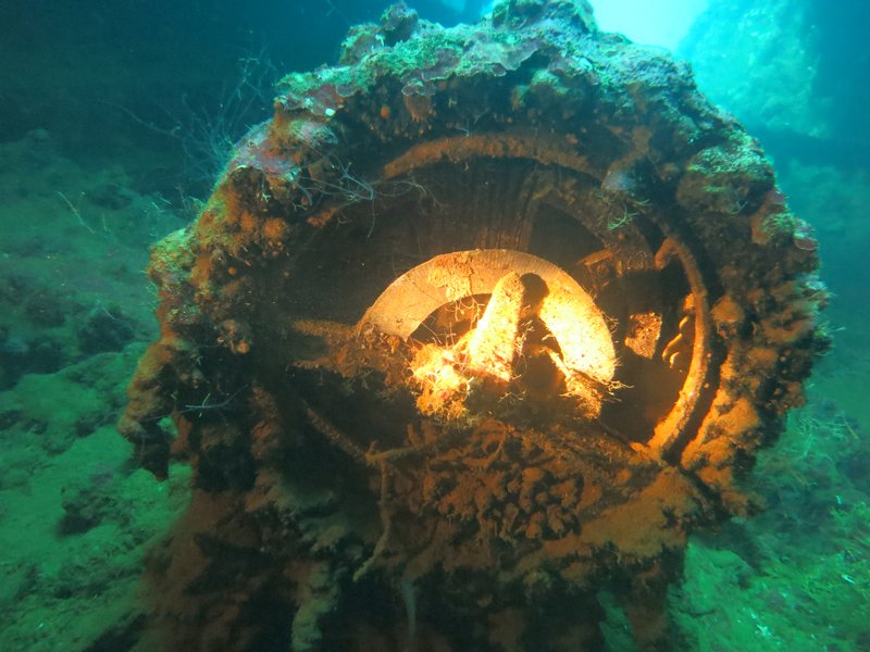
Engine Order Telegraph from the Kansho Maru
What's different about these wrecks than the ones we dove on in the Marshall Islands is that these wrecks have been (mostly) protected from Day 1. So almost all of the "artifacts" are still there for divers to see...mainly instrumentation and cargo items. In the Marshalls, nobody is administering or protecting the wrecks (except in Bikini), and they get quickly looted by divers looking for souveniers to keep or sell.
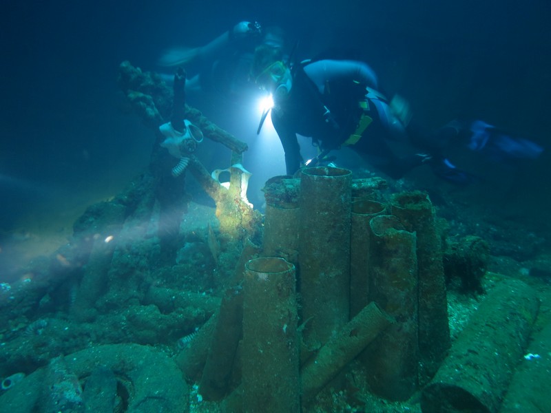
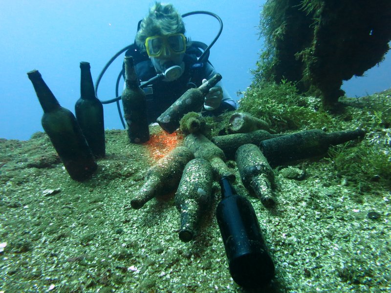
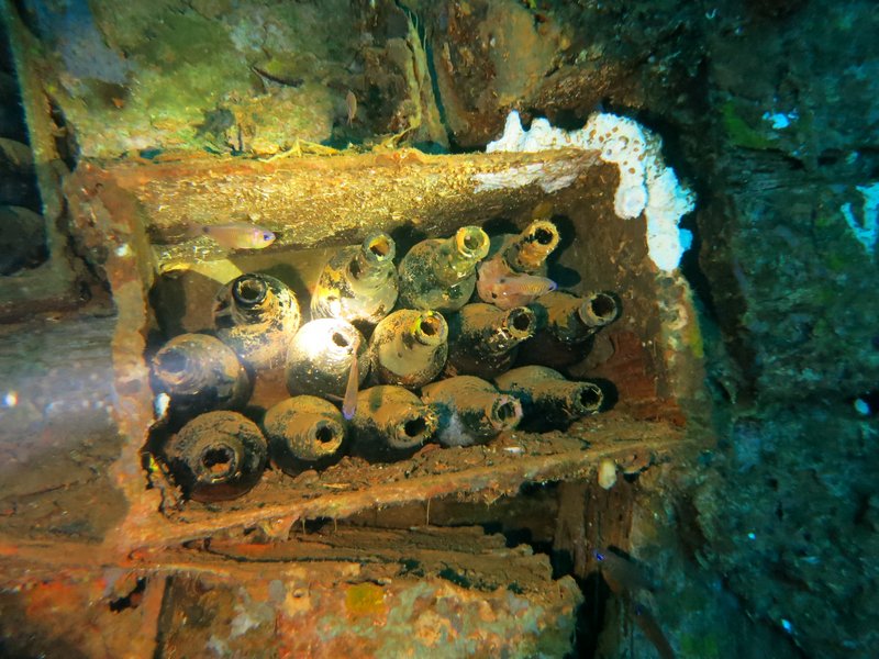
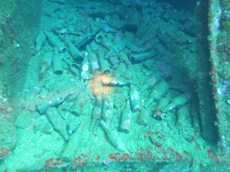
Here are some pics that Dave has taken.

A Commemoration Plaque on the Fujikawa Maru

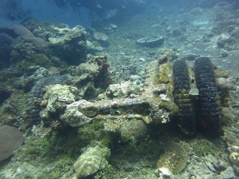
Shell Casings on the Fujikawa Maru

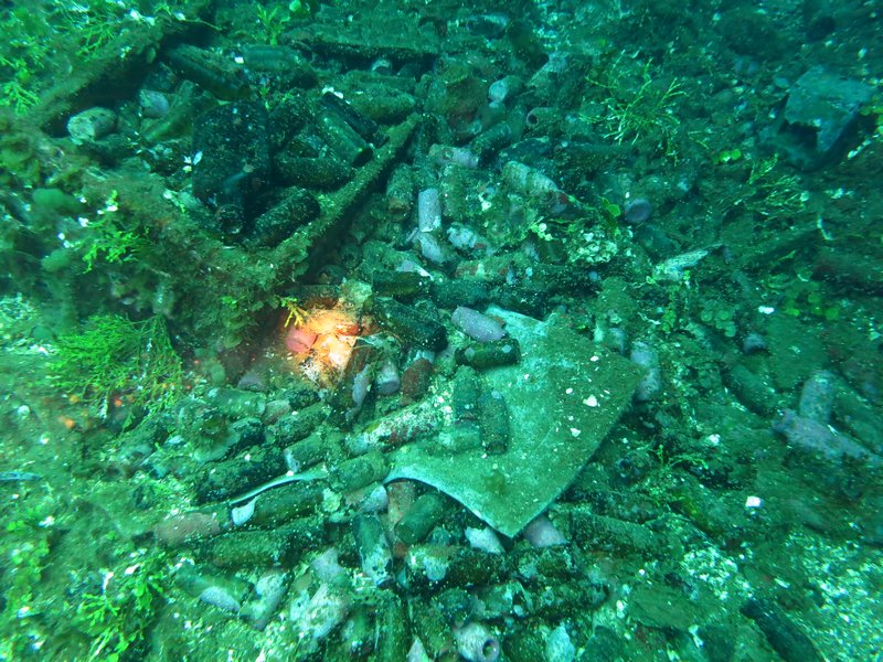
Japanese Beer Bottles on the Rio de Janiero


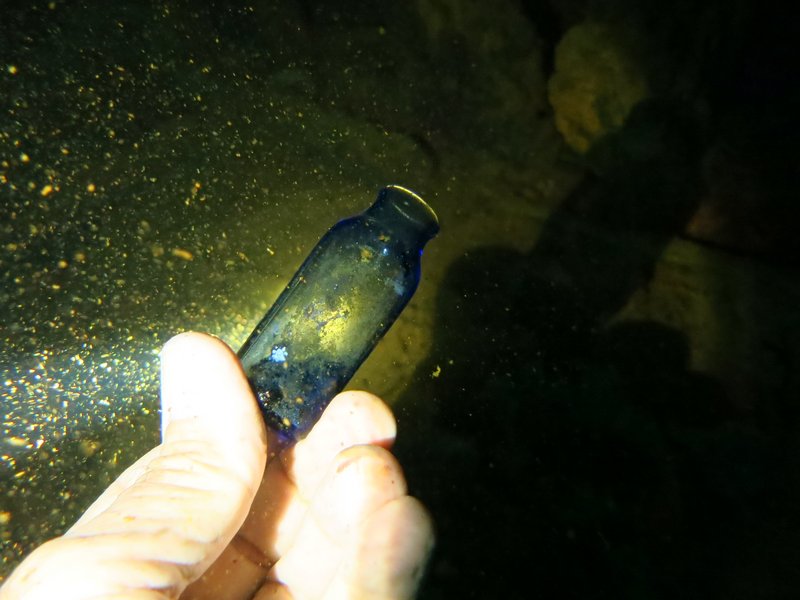
Medicine Bottles on the Sankisan Maru


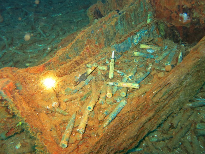
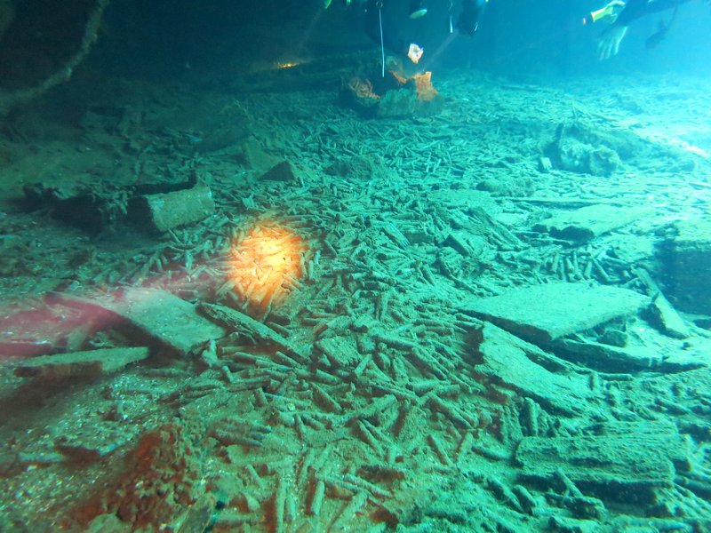
Boxes and Boxes of Bullets on the Sankisan Maru


Truck Stored on the Deck of Sankisan Maru

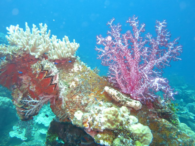
Lots of Soft and Hard Coral Growth on the Outside of the Wrecks

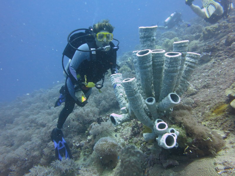
Some Awesome Sponge Formations
Truk Lagoon (now called Chuuk and pronounced Chook by the Micronesias) was a major Japanese hub during World War II. They had 3 airfields and a major supply and repair depot here. On Feb 17, 1944, the U.S. Navy surprised the Japanese here with "Operation Hailstone" and sunk about 60 ships. Over the years, about 40 wrecks have been found and documented. Most of the wrecks are supply ships and other support vessels, but there is at least one submarine and several seaplanes.
We have found the Truk Stop Hotel & Dive Shop to be excellent--a very professional dive operation--great dive briefings, great dive guides, very safe dive practices, and a great diver-to-guide ratio. We have had a few meals at the restaurant, and all have been good.
Many of the wrecks are at the limit of the normal "recreational diver" depths (60-90 feet), but with PADI Advanced Diver, Nitrox Diver, and Wreck Diver certificates, plus a whole bunch of wreck diving last summer in the Marshalls, and I feel very comfortable, even at 120 feet, in the dark, inside the bowels of a ship's engine room.
What's different about these wrecks than the ones we dove on in the Marshall Islands is that these wrecks have been (mostly) protected from Day 1. So almost all of the "artifacts" are still there for divers to see...mainly instrumentation and cargo items. In the Marshalls, nobody is administering or protecting the wrecks (except in Bikini), and they get quickly looted by divers looking for souveniers to keep or sell.
Here are some pics that Dave has taken.
Saturday, March 22, 2014
Safely in Chuuk--Diving!
We had an easy overnight passage, with steady winds from 10-15 knots almost square on the beam.

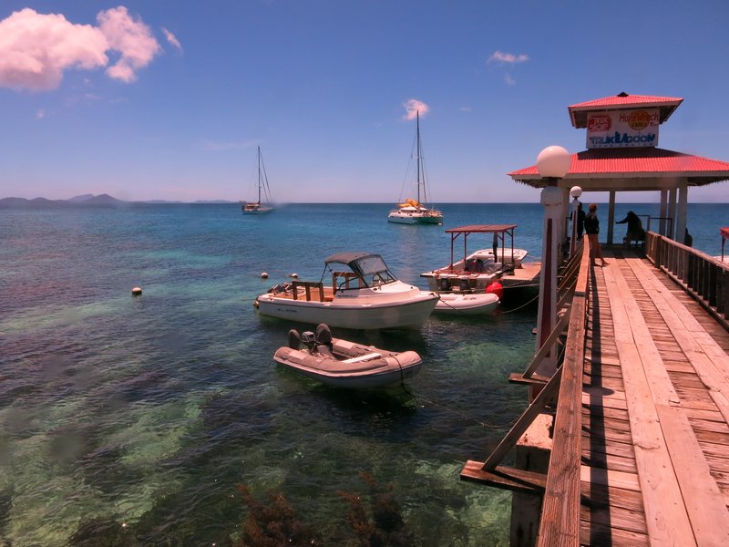
On a Mooring at Truk Stop Hotel and Dive Center
We went through one of the several passes on the SE side at 8:30am. The sun was rising behind us and we could see just fine. My original route had us taking a direct line into Weno, cutting between two big islands. But that track was strewn with various reefs, and our CM93 chart was of unknown reliability, and we didn't have a good Google Earth chart (we hadn't been coming here!). So we decided to take the longer route around. This added about 5 miles to our trip, and would mean that we'd get to the dock around 11:30, pushing it for a "no overtime" check-in.
We decided to slow down and arrive at 1pm. That way, there was little chance of anyone doing the "overtime game" on us. There are numerous horror stories about outrageous checkin fees and hassles at Chuuk. (It turned out that we could probably have easily navigated the trickier route--we had a very nice day and mild conditions).
From another cruiser who came before us (thanks, Trigger), we had the phone numbers of all the officials. And we had a cell phone from Pohnpei AND minutes. So Dave called each one and made an appointment for 1:30pm. The only official we couldn't get ahold of was the Port Captain. Normally, the Port Captain is the FIRST guy you call--usually on VHF. And normally, HE arranges all the other officials. However, Chuuk is different. It turns out that the Port Captain doesn't even have an office or a VHF. We had an office phone for him, but apparently it is disconnected. We had a cell phone number but we got "we are unable to reach this number". Dave called another of the officials back and asked if he could get ahold of the Port Captain for us, but they were not able to reach him either.
We docked at the big ship pier (high concrete docks, but with big rubber fenders) between two fishing boats, at 12:59. At 1:30, Customs and Health showed up, and a few minutes later, Immigration. Why we need so many officials on a "National" check-in, I don't know. But all wanted a copy of our paperwork, so I was hopping taking care of that while Dave schmoozed the officials. Thank GOD for our printer/copier scanner--I wouldn't go international cruising without one.
Within an hour, all our formalities were completed EXCEPT the Port Captain. Dave had one of the other officials try to call him again. And he asked the other two boats nearby, if they knew where he was. We had lots of onlookers--truck drivers and dock workers (a big ship had just departed after unloading a bunch of containers), but nobody knew where the Port Captain was. So we waited. Finally about 4:30, he shows up. We gave him some more copies, and he told us all the fees we'd have to pay on checking OUT. (a couple of $30's, then $25 for first 48 hrs and $10 per day after that). We knew about these already, so instead of gasping, Dave just smiled and said OK. It's a lot cheaper than flying here and staying in a hotel!
So we are now anchored off the Truk Stop Hotel in downtown Weno, Truk Lagoon, Federated States of Micronesia. 07-25.5N / 151-50.23E. We are taking a "land tour" this morning and then diving this afternoon. We actually found some fresh veggies yesterday in a supermarket--broccoli, carrots, lettuce, celery, onions, potatoes, cabbage. We didn't find any Lays (or similar) Potato Chips. Just funky Asian chips (chicken-flavored, and other weird tastes). But we're still looking.
Dave told the officials we'll be here two weeks--but really we'll stay until we are finished diving, and have had a couple of "land tour days" and a day to finish reprovisioning.
-----
At 03/20/2014 8:48 PM (utc) our position was 07°26.51'N 151°50.23'E
http://svsoggypaws.com/currentposition.htm
We went through one of the several passes on the SE side at 8:30am. The sun was rising behind us and we could see just fine. My original route had us taking a direct line into Weno, cutting between two big islands. But that track was strewn with various reefs, and our CM93 chart was of unknown reliability, and we didn't have a good Google Earth chart (we hadn't been coming here!). So we decided to take the longer route around. This added about 5 miles to our trip, and would mean that we'd get to the dock around 11:30, pushing it for a "no overtime" check-in.
We decided to slow down and arrive at 1pm. That way, there was little chance of anyone doing the "overtime game" on us. There are numerous horror stories about outrageous checkin fees and hassles at Chuuk. (It turned out that we could probably have easily navigated the trickier route--we had a very nice day and mild conditions).
From another cruiser who came before us (thanks, Trigger), we had the phone numbers of all the officials. And we had a cell phone from Pohnpei AND minutes. So Dave called each one and made an appointment for 1:30pm. The only official we couldn't get ahold of was the Port Captain. Normally, the Port Captain is the FIRST guy you call--usually on VHF. And normally, HE arranges all the other officials. However, Chuuk is different. It turns out that the Port Captain doesn't even have an office or a VHF. We had an office phone for him, but apparently it is disconnected. We had a cell phone number but we got "we are unable to reach this number". Dave called another of the officials back and asked if he could get ahold of the Port Captain for us, but they were not able to reach him either.
We docked at the big ship pier (high concrete docks, but with big rubber fenders) between two fishing boats, at 12:59. At 1:30, Customs and Health showed up, and a few minutes later, Immigration. Why we need so many officials on a "National" check-in, I don't know. But all wanted a copy of our paperwork, so I was hopping taking care of that while Dave schmoozed the officials. Thank GOD for our printer/copier scanner--I wouldn't go international cruising without one.
Within an hour, all our formalities were completed EXCEPT the Port Captain. Dave had one of the other officials try to call him again. And he asked the other two boats nearby, if they knew where he was. We had lots of onlookers--truck drivers and dock workers (a big ship had just departed after unloading a bunch of containers), but nobody knew where the Port Captain was. So we waited. Finally about 4:30, he shows up. We gave him some more copies, and he told us all the fees we'd have to pay on checking OUT. (a couple of $30's, then $25 for first 48 hrs and $10 per day after that). We knew about these already, so instead of gasping, Dave just smiled and said OK. It's a lot cheaper than flying here and staying in a hotel!
So we are now anchored off the Truk Stop Hotel in downtown Weno, Truk Lagoon, Federated States of Micronesia. 07-25.5N / 151-50.23E. We are taking a "land tour" this morning and then diving this afternoon. We actually found some fresh veggies yesterday in a supermarket--broccoli, carrots, lettuce, celery, onions, potatoes, cabbage. We didn't find any Lays (or similar) Potato Chips. Just funky Asian chips (chicken-flavored, and other weird tastes). But we're still looking.
Dave told the officials we'll be here two weeks--but really we'll stay until we are finished diving, and have had a couple of "land tour days" and a day to finish reprovisioning.
-----
At 03/20/2014 8:48 PM (utc) our position was 07°26.51'N 151°50.23'E
http://svsoggypaws.com/currentposition.htm
Thursday, March 20, 2014
On Passage to Chuuk
We had planned to (reluctantly) skip Chuuk (Truk Lagoon), because of all the bad things we have heard about it. We really wanted to go there to dive the wrecks, but it just seemed like such a lawless place that we decided not to (Dave planned on flying in from Palau a little later in the year). Well, the Peace Corps workers we met in Lekinioch and Satawan, who are based out of Chuuk, told us we should go. They are young mid-twenties women, and say they feel comfortable walking around on their own there, so we shouldn't be scared to go.
So, we are on our way to Chuuk right now...arriving in the morning. We'll stay for about 10 days and then island-hop our way west to Yap. We tried to get Westware II to come with us, but they are more on a schedule than we are, and felt they needed to keep heading west to Palau. So we are on our own for a bit.
We had a really nice visit in the Mortlocks, visiting Lekinioch and Satawan, and I hope to blog about that soon.
-----
At 03/19/2014 10:01 AM (utc) our position was 06°21.57'N 152°47.59'E
http://svsoggypaws.com/currentposition.htm
So, we are on our way to Chuuk right now...arriving in the morning. We'll stay for about 10 days and then island-hop our way west to Yap. We tried to get Westware II to come with us, but they are more on a schedule than we are, and felt they needed to keep heading west to Palau. So we are on our own for a bit.
We had a really nice visit in the Mortlocks, visiting Lekinioch and Satawan, and I hope to blog about that soon.
-----
At 03/19/2014 10:01 AM (utc) our position was 06°21.57'N 152°47.59'E
http://svsoggypaws.com/currentposition.htm
Tuesday, March 11, 2014
On Passage to Lukunor
March 9-11, 2014 265 miles from Ant to Lukunor
After waiting nearly a week at Ant Atoll for the right weather, I can happily say we picked a good weather window!!
Though the weather did do a bit of a double-fake. We had originally planned to leave on Saturday afternoon, but that morning's forecast showed light winds on Saturday, but picking up to about 10 knots overnight and 11-12 on Sunday. So we stayed one more day and had a great snorkel in the pass at Ant Atoll (where, it seems, the current is ALWAYS flowing out).
But at sunset on Saturday, we were kicking ourselves for not going, as the wind seemed very nice. Overnight, however, the wind died again and we awoke to glassy conditions in the anchorage. I got an updated forecast and the forecast was modified a bit--so the wind forecast for Sunday was only about 10 knots and not picking up a little til Monday. Typical. 10 knots going dead downwind in a heavily-laden cruising boat is barely enough. Heck, we're going anyway.
So us and Westward II motored out the pass about 8am. Fortunately, we got a little wind after we got outside the atoll. It looked like really nice wind, in fact. However, that didn't last very long. 2 hrs later we were motoring. Since we'd not gone out the night before, we needed to make at least 4 knots to get in just before sunset in 2 days.
We took advantage of the motoring to finally make some water. There was so much rain in Pohnpei we hadn't yet re-commissioned our watermaker. So while motoring, we made about 80 gallons of nice pure RO water... mmmm... Until we couldn't hold another drop.
We also had more autopilot issues. Dave had done quite a bit of messing with the autopilot while in Ant, and it had seemed to be working. But motor unit that he'd just repaired went goofy again, with the same symptoms as before...it would turn left but not right. So he swapped in another spare, and had the same thing happen... hmmm... maybe it isn't the motor part of the autopilit? So then he swapped in a spare "control head"--and FINALLY--our autopilot is working like it should be (it has been very "wandery" for the last year or so). We have now used this for about 48 hours straight and all is well.
So, about 5pm, the wind came up enough (and we spent an hour changing our pole from starboard to port), we finally turned the engine off. We sailed all night with just the genoa at 3-4 knots, with wind about 150-160 relative at 5 knots apparent.
In the morning, (with much groaning of the crew), we again changed our sail to put out the Code Zero. This is a big light air sail on a small roller-furler... somewhat like an asymetrical, but which can be roller-furled and left in place. We had never tried this big sail on a pole--thought our pole was too short for this big sail. But this turned out to be a wonderful combination--and our speed picked up by almost a knot.
So for the last 36 hours we've been quietly coasting along, almost dead downwind, at around 5 knots. It's really pleasant sailing, with no threatening clouds, and beautiful moonlit nights.
We had been sweating making Lukunor (aka Leukinoch) by sunset today, but with the extra speed, no problems.
Westward II had their big asymetrical up the whole time, and are about 20 miles ahead of us.
We've been talking to 3 other boats on the SSB all underway during this nice weather window. Challenger and Kokomo are going from Pohnpei directly to Puluwat (north and further west than us), and La Gitana is coming up from the equator (he came up from the Solomons about a month ago) also toward Puluwat.
-----
At 03/10/2014 11:35 PM (utc) our position was 05°38.23'N 154°16.55'E
http://svsoggypaws.com/currentposition.htm
After waiting nearly a week at Ant Atoll for the right weather, I can happily say we picked a good weather window!!
Though the weather did do a bit of a double-fake. We had originally planned to leave on Saturday afternoon, but that morning's forecast showed light winds on Saturday, but picking up to about 10 knots overnight and 11-12 on Sunday. So we stayed one more day and had a great snorkel in the pass at Ant Atoll (where, it seems, the current is ALWAYS flowing out).
But at sunset on Saturday, we were kicking ourselves for not going, as the wind seemed very nice. Overnight, however, the wind died again and we awoke to glassy conditions in the anchorage. I got an updated forecast and the forecast was modified a bit--so the wind forecast for Sunday was only about 10 knots and not picking up a little til Monday. Typical. 10 knots going dead downwind in a heavily-laden cruising boat is barely enough. Heck, we're going anyway.
So us and Westward II motored out the pass about 8am. Fortunately, we got a little wind after we got outside the atoll. It looked like really nice wind, in fact. However, that didn't last very long. 2 hrs later we were motoring. Since we'd not gone out the night before, we needed to make at least 4 knots to get in just before sunset in 2 days.
We took advantage of the motoring to finally make some water. There was so much rain in Pohnpei we hadn't yet re-commissioned our watermaker. So while motoring, we made about 80 gallons of nice pure RO water... mmmm... Until we couldn't hold another drop.
We also had more autopilot issues. Dave had done quite a bit of messing with the autopilot while in Ant, and it had seemed to be working. But motor unit that he'd just repaired went goofy again, with the same symptoms as before...it would turn left but not right. So he swapped in another spare, and had the same thing happen... hmmm... maybe it isn't the motor part of the autopilit? So then he swapped in a spare "control head"--and FINALLY--our autopilot is working like it should be (it has been very "wandery" for the last year or so). We have now used this for about 48 hours straight and all is well.
So, about 5pm, the wind came up enough (and we spent an hour changing our pole from starboard to port), we finally turned the engine off. We sailed all night with just the genoa at 3-4 knots, with wind about 150-160 relative at 5 knots apparent.
In the morning, (with much groaning of the crew), we again changed our sail to put out the Code Zero. This is a big light air sail on a small roller-furler... somewhat like an asymetrical, but which can be roller-furled and left in place. We had never tried this big sail on a pole--thought our pole was too short for this big sail. But this turned out to be a wonderful combination--and our speed picked up by almost a knot.
So for the last 36 hours we've been quietly coasting along, almost dead downwind, at around 5 knots. It's really pleasant sailing, with no threatening clouds, and beautiful moonlit nights.
We had been sweating making Lukunor (aka Leukinoch) by sunset today, but with the extra speed, no problems.
Westward II had their big asymetrical up the whole time, and are about 20 miles ahead of us.
We've been talking to 3 other boats on the SSB all underway during this nice weather window. Challenger and Kokomo are going from Pohnpei directly to Puluwat (north and further west than us), and La Gitana is coming up from the equator (he came up from the Solomons about a month ago) also toward Puluwat.
-----
At 03/10/2014 11:35 PM (utc) our position was 05°38.23'N 154°16.55'E
http://svsoggypaws.com/currentposition.htm
Thursday, March 6, 2014
Fixing Boats in Exotic Places
The standard cruiser, in response to some starry-eyed friend who gushes about how wonderful it must be to be cruising, responds with "It isn't as glamorous as you imagine--it's mainly "fixing boats in exotic places"."
Well, yesterday we did just that. The weather was still gorgeous, and our friends wanted to go play--but we really had a couple of things we needed to attend to before we could sail out of Ant.
The most important was the autopilot. On the trip from Kwajalein, our autopilot was struggling with steering properly. It would steer well in one direction but then fail (with tiny movements) to go the other direction. During the trip, Dave hot-swapped the motor part of the CPT autopilot with a spare of "unknown condition". It seemed to work for awhile, but on the trip from Pohpei to Ant Atoll, it, too was having the same kind of troubles. We know from experience that it's probably the relays that have failed. So it was time for Dave to get all 3 CPT autopilots out and assess and repair as necessary.
Dave spent all day on this, taking apart each one, and checking them out. He ended up replacing the relays on one (we have spare relays--they are just $2 car windshield wiper relays), and swapping the motor out of one with bad relays into another with known good relays but a motor issue. So now we think we have a good autopilot, a good spare, and one for parts with a known hard-to-repair problem. Plus we still have some spare new relays left and a spare new motor, for the next time we need to make repairs. We'll test the fix today when we're moving about inside Ant Atoll.
I spent all afternoon scrubbing bottom. With an anticipated light air passage coming up, it's worth making sure the bottom is as clean as we can get it. We put new paint on in Fiji a little over a year ago, and it's holding up pretty well. So a light scrubbing did the trick. But there's a lot of surface area on our big tubby 44-foot boat!
With really light seas now outside the reef, Westward II and Aurora Star went out in a dinghy in the afternoon to fish and dive on the reef. Brent speared one really nice big Trevally (a good-eating Jack common here), and two smaller fish were caught on a hand line. Stephen and Sara had a nice dive on the wall outside.
We had a beautiful evening, with starry skies and a new moon, eating grilled fish on Aurora Star.
At 03/04/2014 8:11 PM (utc) our position was 06°43.78'N 157°56.20'E
http://svsoggypaws.com/currentposition.htm
Well, yesterday we did just that. The weather was still gorgeous, and our friends wanted to go play--but we really had a couple of things we needed to attend to before we could sail out of Ant.
The most important was the autopilot. On the trip from Kwajalein, our autopilot was struggling with steering properly. It would steer well in one direction but then fail (with tiny movements) to go the other direction. During the trip, Dave hot-swapped the motor part of the CPT autopilot with a spare of "unknown condition". It seemed to work for awhile, but on the trip from Pohpei to Ant Atoll, it, too was having the same kind of troubles. We know from experience that it's probably the relays that have failed. So it was time for Dave to get all 3 CPT autopilots out and assess and repair as necessary.
Dave spent all day on this, taking apart each one, and checking them out. He ended up replacing the relays on one (we have spare relays--they are just $2 car windshield wiper relays), and swapping the motor out of one with bad relays into another with known good relays but a motor issue. So now we think we have a good autopilot, a good spare, and one for parts with a known hard-to-repair problem. Plus we still have some spare new relays left and a spare new motor, for the next time we need to make repairs. We'll test the fix today when we're moving about inside Ant Atoll.
I spent all afternoon scrubbing bottom. With an anticipated light air passage coming up, it's worth making sure the bottom is as clean as we can get it. We put new paint on in Fiji a little over a year ago, and it's holding up pretty well. So a light scrubbing did the trick. But there's a lot of surface area on our big tubby 44-foot boat!
With really light seas now outside the reef, Westward II and Aurora Star went out in a dinghy in the afternoon to fish and dive on the reef. Brent speared one really nice big Trevally (a good-eating Jack common here), and two smaller fish were caught on a hand line. Stephen and Sara had a nice dive on the wall outside.
We had a beautiful evening, with starry skies and a new moon, eating grilled fish on Aurora Star.
At 03/04/2014 8:11 PM (utc) our position was 06°43.78'N 157°56.20'E
http://svsoggypaws.com/currentposition.htm
Subscribe to:
Posts (Atom)