Wednesday, March 26, 2014

Some Dive Photos from Truk Lagoon

We have now been here for 4 days, and made 7 dives on 6 different Japanese wrecks.

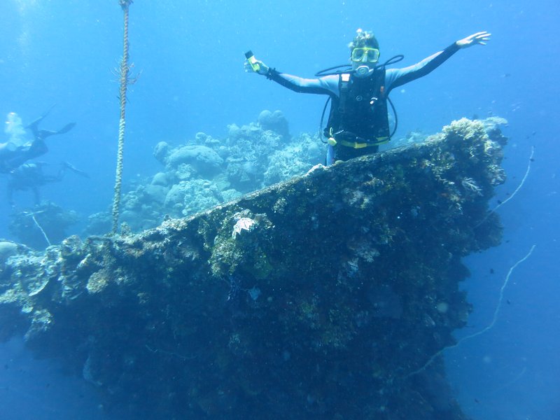
Sherry Doing the Titantic on the Bow of the Sankisan Maru

Truk Lagoon (now called Chuuk and pronounced Chook by the Micronesias) was a major Japanese hub during World War II. They had 3 airfields and a major supply and repair depot here. On Feb 17, 1944, the U.S. Navy surprised the Japanese here with "Operation Hailstone" and sunk about 60 ships. Over the years, about 40 wrecks have been found and documented. Most of the wrecks are supply ships and other support vessels, but there is at least one submarine and several seaplanes.

We have found the Truk Stop Hotel & Dive Shop to be excellent--a very professional dive operation--great dive briefings, great dive guides, very safe dive practices, and a great diver-to-guide ratio. We have had a few meals at the restaurant, and all have been good.

Many of the wrecks are at the limit of the normal "recreational diver" depths (60-90 feet), but with PADI Advanced Diver, Nitrox Diver, and Wreck Diver certificates, plus a whole bunch of wreck diving last summer in the Marshalls, and I feel very comfortable, even at 120 feet, in the dark, inside the bowels of a ship's engine room.

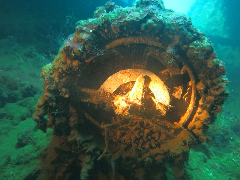
Engine Order Telegraph from the Kansho Maru

What's different about these wrecks than the ones we dove on in the Marshall Islands is that these wrecks have been (mostly) protected from Day 1. So almost all of the "artifacts" are still there for divers to see...mainly instrumentation and cargo items. In the Marshalls, nobody is administering or protecting the wrecks (except in Bikini), and they get quickly looted by divers looking for souveniers to keep or sell.

Here are some pics that Dave has taken.


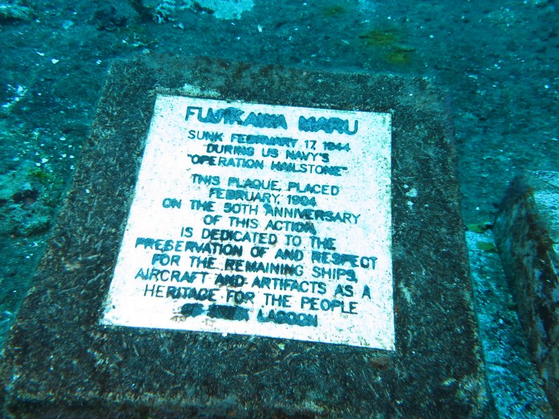
A Commemoration Plaque on the Fujikawa Maru


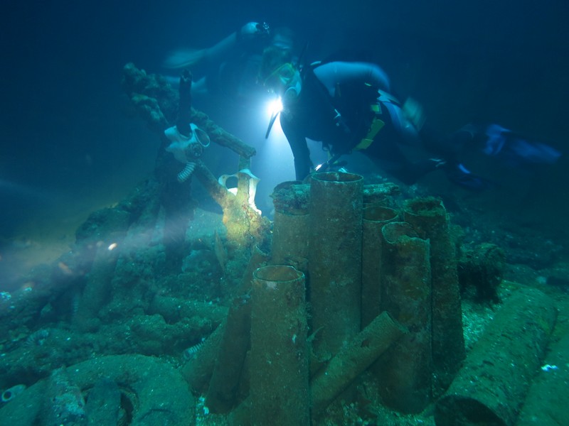
Shell Casings on the Fujikawa Maru

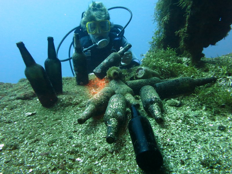
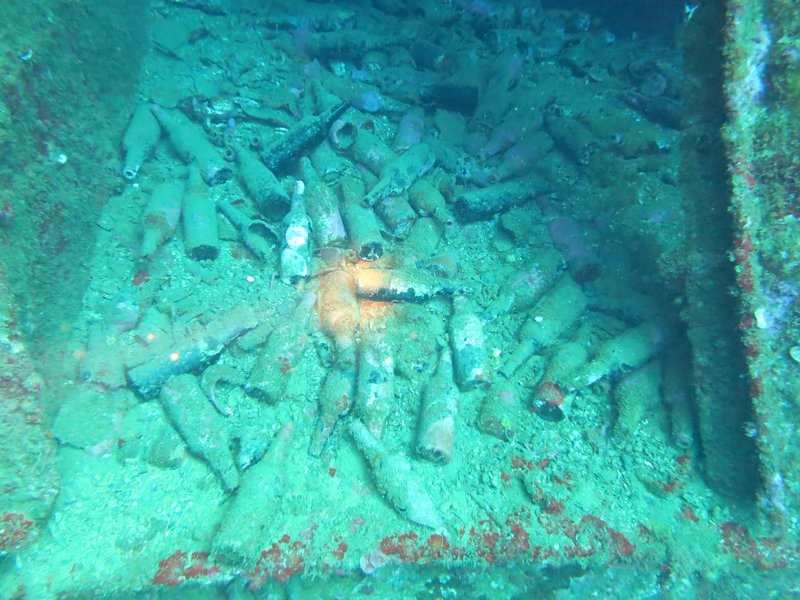
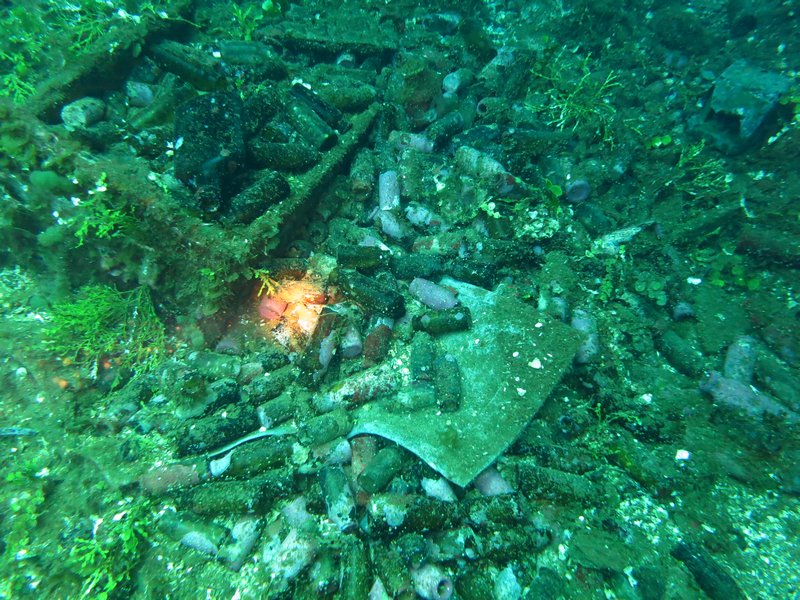
Japanese Beer Bottles on the Rio de Janiero


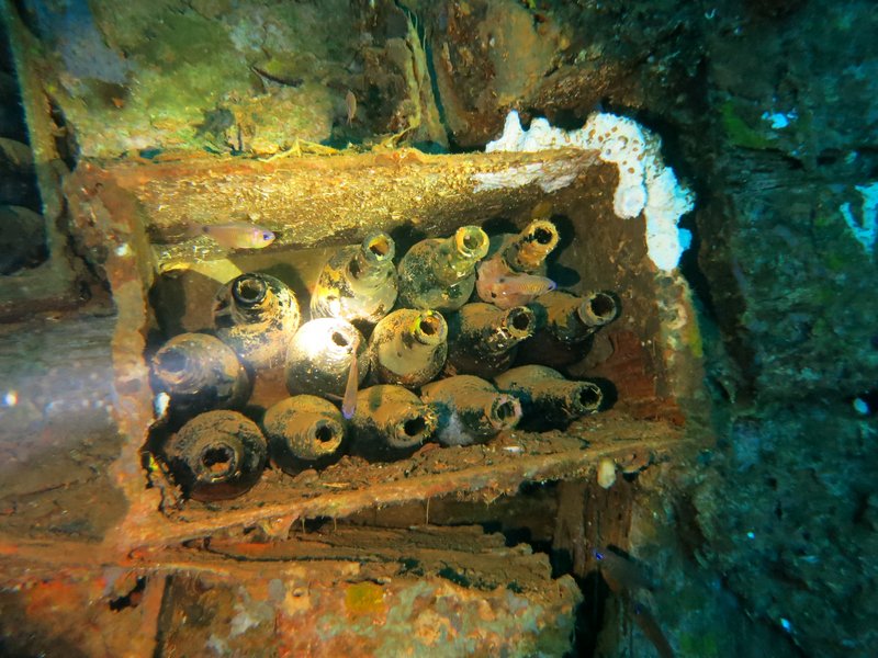
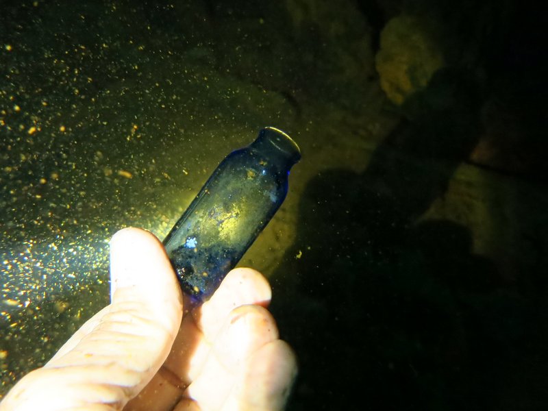
Medicine Bottles on the Sankisan Maru


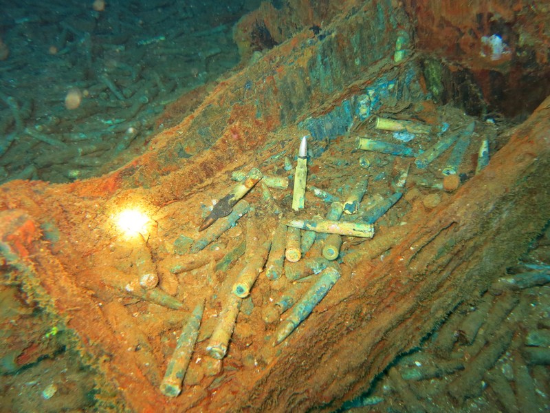
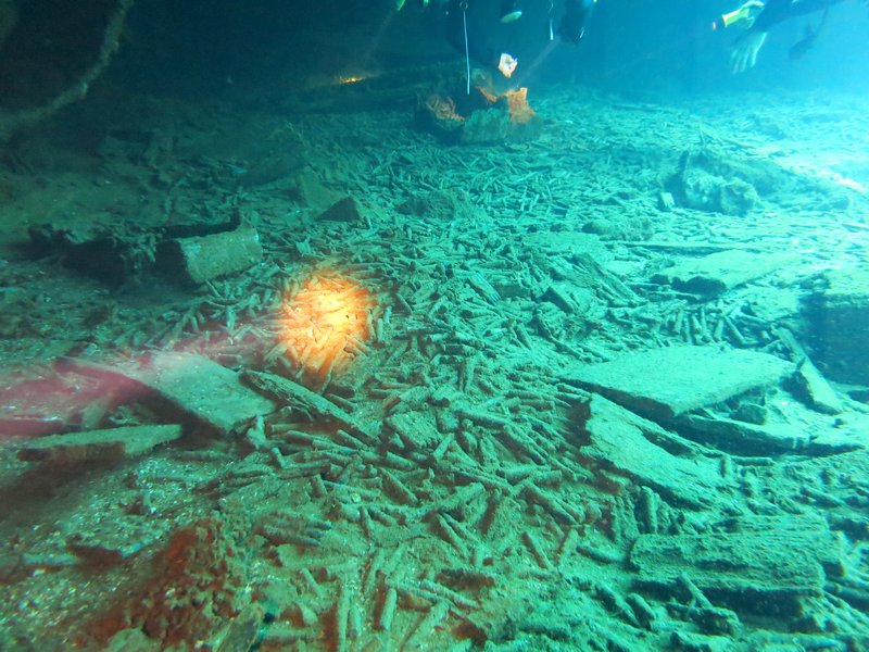
Boxes and Boxes of Bullets on the Sankisan Maru


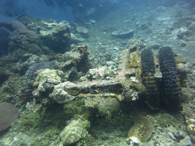
Truck Stored on the Deck of Sankisan Maru

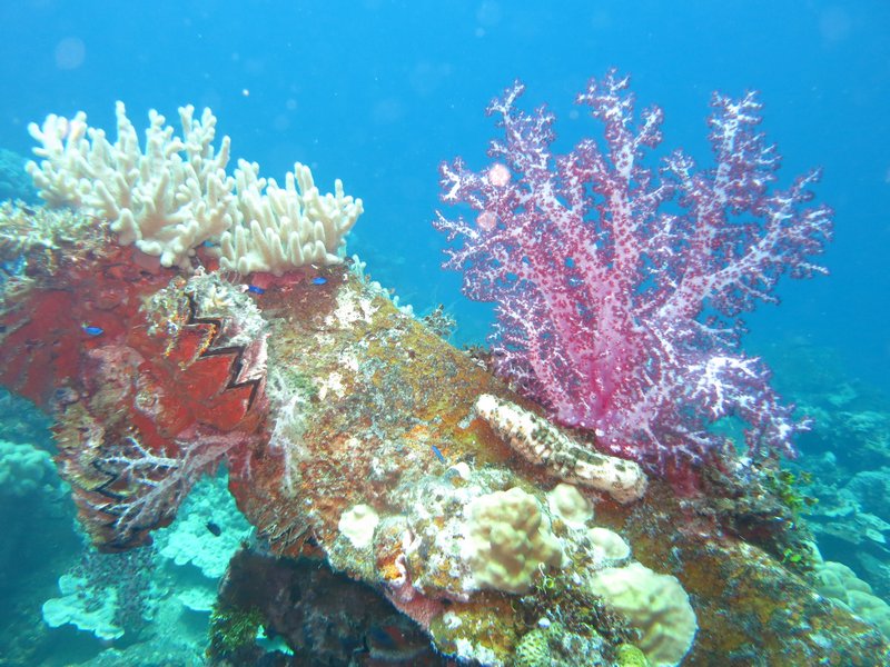
Lots of Soft and Hard Coral Growth on the Outside of the Wrecks

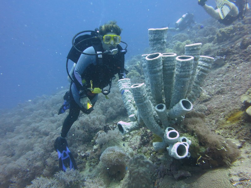
Some Awesome Sponge Formations

Saturday, March 22, 2014

Safely in Chuuk--Diving!

We had an easy overnight passage, with steady winds from 10-15 knots almost square on the beam.

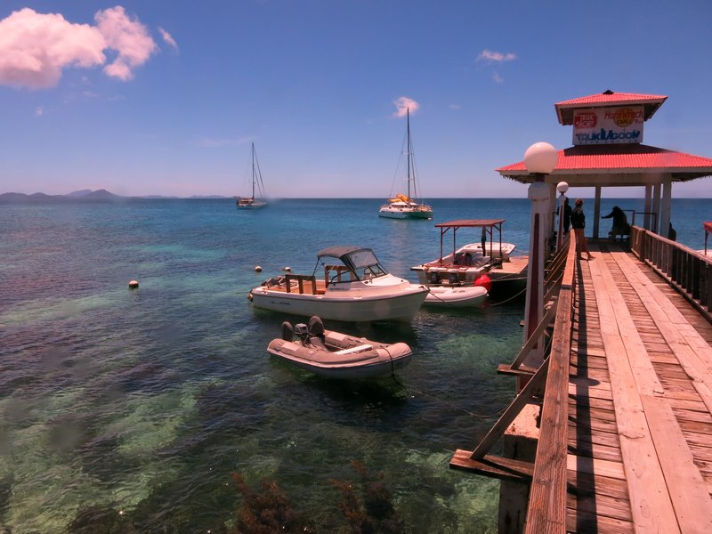
On a Mooring at Truk Stop Hotel and Dive Center

We went through one of the several passes on the SE side at 8:30am. The sun was rising behind us and we could see just fine. My original route had us taking a direct line into Weno, cutting between two big islands. But that track was strewn with various reefs, and our CM93 chart was of unknown reliability, and we didn't have a good Google Earth chart (we hadn't been coming here!). So we decided to take the longer route around. This added about 5 miles to our trip, and would mean that we'd get to the dock around 11:30, pushing it for a "no overtime" check-in.

We decided to slow down and arrive at 1pm. That way, there was little chance of anyone doing the "overtime game" on us. There are numerous horror stories about outrageous checkin fees and hassles at Chuuk. (It turned out that we could probably have easily navigated the trickier route--we had a very nice day and mild conditions).

From another cruiser who came before us (thanks, Trigger), we had the phone numbers of all the officials. And we had a cell phone from Pohnpei AND minutes. So Dave called each one and made an appointment for 1:30pm. The only official we couldn't get ahold of was the Port Captain. Normally, the Port Captain is the FIRST guy you call--usually on VHF. And normally, HE arranges all the other officials. However, Chuuk is different. It turns out that the Port Captain doesn't even have an office or a VHF. We had an office phone for him, but apparently it is disconnected. We had a cell phone number but we got "we are unable to reach this number". Dave called another of the officials back and asked if he could get ahold of the Port Captain for us, but they were not able to reach him either.

We docked at the big ship pier (high concrete docks, but with big rubber fenders) between two fishing boats, at 12:59. At 1:30, Customs and Health showed up, and a few minutes later, Immigration. Why we need so many officials on a "National" check-in, I don't know. But all wanted a copy of our paperwork, so I was hopping taking care of that while Dave schmoozed the officials. Thank GOD for our printer/copier scanner--I wouldn't go international cruising without one.

Within an hour, all our formalities were completed EXCEPT the Port Captain. Dave had one of the other officials try to call him again. And he asked the other two boats nearby, if they knew where he was. We had lots of onlookers--truck drivers and dock workers (a big ship had just departed after unloading a bunch of containers), but nobody knew where the Port Captain was. So we waited. Finally about 4:30, he shows up. We gave him some more copies, and he told us all the fees we'd have to pay on checking OUT. (a couple of $30's, then $25 for first 48 hrs and $10 per day after that). We knew about these already, so instead of gasping, Dave just smiled and said OK. It's a lot cheaper than flying here and staying in a hotel!

So we are now anchored off the Truk Stop Hotel in downtown Weno, Truk Lagoon, Federated States of Micronesia. 07-25.5N / 151-50.23E. We are taking a "land tour" this morning and then diving this afternoon. We actually found some fresh veggies yesterday in a supermarket--broccoli, carrots, lettuce, celery, onions, potatoes, cabbage. We didn't find any Lays (or similar) Potato Chips. Just funky Asian chips (chicken-flavored, and other weird tastes). But we're still looking.

Dave told the officials we'll be here two weeks--but really we'll stay until we are finished diving, and have had a couple of "land tour days" and a day to finish reprovisioning.
-----
At 03/20/2014 8:48 PM (utc) our position was 07°26.51'N 151°50.23'E
http://svsoggypaws.com/currentposition.htm

Thursday, March 20, 2014

On Passage to Chuuk

We had planned to (reluctantly) skip Chuuk (Truk Lagoon), because of all the bad things we have heard about it. We really wanted to go there to dive the wrecks, but it just seemed like such a lawless place that we decided not to (Dave planned on flying in from Palau a little later in the year). Well, the Peace Corps workers we met in Lekinioch and Satawan, who are based out of Chuuk, told us we should go. They are young mid-twenties women, and say they feel comfortable walking around on their own there, so we shouldn't be scared to go.

So, we are on our way to Chuuk right now...arriving in the morning. We'll stay for about 10 days and then island-hop our way west to Yap. We tried to get Westware II to come with us, but they are more on a schedule than we are, and felt they needed to keep heading west to Palau. So we are on our own for a bit.

We had a really nice visit in the Mortlocks, visiting Lekinioch and Satawan, and I hope to blog about that soon.
-----
At 03/19/2014 10:01 AM (utc) our position was 06°21.57'N 152°47.59'E
http://svsoggypaws.com/currentposition.htm

Tuesday, March 11, 2014

On Passage to Lukunor

March 9-11, 2014 265 miles from Ant to Lukunor

After waiting nearly a week at Ant Atoll for the right weather, I can happily say we picked a good weather window!!

Though the weather did do a bit of a double-fake. We had originally planned to leave on Saturday afternoon, but that morning's forecast showed light winds on Saturday, but picking up to about 10 knots overnight and 11-12 on Sunday. So we stayed one more day and had a great snorkel in the pass at Ant Atoll (where, it seems, the current is ALWAYS flowing out).

But at sunset on Saturday, we were kicking ourselves for not going, as the wind seemed very nice. Overnight, however, the wind died again and we awoke to glassy conditions in the anchorage. I got an updated forecast and the forecast was modified a bit--so the wind forecast for Sunday was only about 10 knots and not picking up a little til Monday. Typical. 10 knots going dead downwind in a heavily-laden cruising boat is barely enough. Heck, we're going anyway.

So us and Westward II motored out the pass about 8am. Fortunately, we got a little wind after we got outside the atoll. It looked like really nice wind, in fact. However, that didn't last very long. 2 hrs later we were motoring. Since we'd not gone out the night before, we needed to make at least 4 knots to get in just before sunset in 2 days.

We took advantage of the motoring to finally make some water. There was so much rain in Pohnpei we hadn't yet re-commissioned our watermaker. So while motoring, we made about 80 gallons of nice pure RO water... mmmm... Until we couldn't hold another drop.

We also had more autopilot issues. Dave had done quite a bit of messing with the autopilot while in Ant, and it had seemed to be working. But motor unit that he'd just repaired went goofy again, with the same symptoms as before...it would turn left but not right. So he swapped in another spare, and had the same thing happen... hmmm... maybe it isn't the motor part of the autopilit? So then he swapped in a spare "control head"--and FINALLY--our autopilot is working like it should be (it has been very "wandery" for the last year or so). We have now used this for about 48 hours straight and all is well.

So, about 5pm, the wind came up enough (and we spent an hour changing our pole from starboard to port), we finally turned the engine off. We sailed all night with just the genoa at 3-4 knots, with wind about 150-160 relative at 5 knots apparent.

In the morning, (with much groaning of the crew), we again changed our sail to put out the Code Zero. This is a big light air sail on a small roller-furler... somewhat like an asymetrical, but which can be roller-furled and left in place. We had never tried this big sail on a pole--thought our pole was too short for this big sail. But this turned out to be a wonderful combination--and our speed picked up by almost a knot.

So for the last 36 hours we've been quietly coasting along, almost dead downwind, at around 5 knots. It's really pleasant sailing, with no threatening clouds, and beautiful moonlit nights.

We had been sweating making Lukunor (aka Leukinoch) by sunset today, but with the extra speed, no problems.

Westward II had their big asymetrical up the whole time, and are about 20 miles ahead of us.

We've been talking to 3 other boats on the SSB all underway during this nice weather window. Challenger and Kokomo are going from Pohnpei directly to Puluwat (north and further west than us), and La Gitana is coming up from the equator (he came up from the Solomons about a month ago) also toward Puluwat.
-----
At 03/10/2014 11:35 PM (utc) our position was 05°38.23'N 154°16.55'E
http://svsoggypaws.com/currentposition.htm

Thursday, March 6, 2014

Fixing Boats in Exotic Places

The standard cruiser, in response to some starry-eyed friend who gushes about how wonderful it must be to be cruising, responds with "It isn't as glamorous as you imagine--it's mainly "fixing boats in exotic places"."

Well, yesterday we did just that. The weather was still gorgeous, and our friends wanted to go play--but we really had a couple of things we needed to attend to before we could sail out of Ant.

The most important was the autopilot. On the trip from Kwajalein, our autopilot was struggling with steering properly. It would steer well in one direction but then fail (with tiny movements) to go the other direction. During the trip, Dave hot-swapped the motor part of the CPT autopilot with a spare of "unknown condition". It seemed to work for awhile, but on the trip from Pohpei to Ant Atoll, it, too was having the same kind of troubles. We know from experience that it's probably the relays that have failed. So it was time for Dave to get all 3 CPT autopilots out and assess and repair as necessary.

Dave spent all day on this, taking apart each one, and checking them out. He ended up replacing the relays on one (we have spare relays--they are just $2 car windshield wiper relays), and swapping the motor out of one with bad relays into another with known good relays but a motor issue. So now we think we have a good autopilot, a good spare, and one for parts with a known hard-to-repair problem. Plus we still have some spare new relays left and a spare new motor, for the next time we need to make repairs. We'll test the fix today when we're moving about inside Ant Atoll.

I spent all afternoon scrubbing bottom. With an anticipated light air passage coming up, it's worth making sure the bottom is as clean as we can get it. We put new paint on in Fiji a little over a year ago, and it's holding up pretty well. So a light scrubbing did the trick. But there's a lot of surface area on our big tubby 44-foot boat!

With really light seas now outside the reef, Westward II and Aurora Star went out in a dinghy in the afternoon to fish and dive on the reef. Brent speared one really nice big Trevally (a good-eating Jack common here), and two smaller fish were caught on a hand line. Stephen and Sara had a nice dive on the wall outside.

We had a beautiful evening, with starry skies and a new moon, eating grilled fish on Aurora Star.

At 03/04/2014 8:11 PM (utc) our position was 06°43.78'N 157°56.20'E
http://svsoggypaws.com/currentposition.htm

Wednesday, March 5, 2014

Out of Pohnpei, Waiting on Wind

Tropical storm / Typhoon Faxai is now well to the north of us. Finally, after about 10 days of overcast and unpredictable weather, we have really fine weather....but no wind.

We checked out of Pohnpei 2 days ago and made our way 25 miles SW to tiny Ant Atoll. This is a mostly uninhabited atoll owned by a family who life in Pohnpei. There is a $25 per boat and $10 per person permit fee to come here. They are trying to build an eco-lodge here and set this up as a nature preserve (at least the northern half of the atoll). We got our permit at the Propane Gas station in Pohnpei (also owned by the family who own Ant).

Westward II and Aurora Star have been here now for 2 weeks--Westward II, like us, have been waiting for a good weather window to head west toward Palau. Aurora Star is a young couple from Sydney, Australia on a 2-year sabbatical. They are headed for Fiji from here (somewhat into the wind). They don't want to arrive in Fiji until cyclone season is mostly over--in May. So they are in no big hurry to scurry on yet. Pohnpei is a much better place to hang out than Kiribati and Tuvalu, which are what's between here and Fiji.

We came out from Pohnpei to play with them last weekend, but went back to Pohnpei to see a few more things, do a final provisioning, and get checked out of Pohnpei. We are not leaving the country of Federated States, but you have to check in and check in and out of each State as you move through the country. From what we could tell, the only difference between a National Checkout and an International Checkout was that Immigration didn't take our yellow immigration paper. We still had to go to the Port Captain's dock, pay the $100 port fee, and check out with Port, Customs, and Immigration.

After agonizing for months, I think we're going to pass up stopping in Chuuk (aka Truk). Though we know not to rely too heavily on "cruiser grapevine" (because problems tend to get overblown), we just have heard too many alarming stories about Chuuk. It is a theft-prone and violence-prone place, with reportedly high fees for cruising yachts (the officials connive to make you do your clearance during overtime hours, is what we heard). Dave still would like to dive the wrecks at Chuuk, and we may yet fly there and spend a week diving. (Me, I've seen enough rusty old ships underwater--it can't be any better diving than Kwajalein, which was safe and nearly free).

So our current plan is to skirt around Chuuk Atoll itself, but stop along the way at some of the out-islands. Our first planned stop is at Lukunor (05-30N / 153-48E), about 250 miles downwind. Just the first stop on our 1,400 mile downwind run to Palau.

It looks like the wind will come back on Friday or Saturday, so we have a few more days to play and do maintenance.

We are hanging out at the SE end of Ant (see position below). There's a small beach on the point where we've had a couple of BBQ's. Westward II and Aurora Star went lobstering on the outer reef one night and found quite a few keepable lobster. Yesterday we loaded up on Westward II to explore the tiny island about 5 miles to the north of us (still inside the atoll). We had a nice day beachcombing, snorkeling, and fishing. It was another beautiful night last night--small new moon, starry skies, and a light breeze.

We have now gotten far enough west that we are in an area where the max tidal range is more like 3 feet than the 6 feet we found in Tonga, Fiji, Kiribati and the Marshall Islands. This means that we can again consider anchoring in atoll anchorage where there is little or no land.
-----
At 03/04/2014 8:11 PM (utc) our position was 06°43.78'N 157°56.20'E

Sunday, March 2, 2014

Waiting for Weather

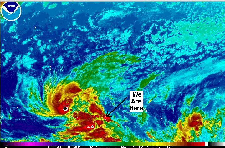
TROPICAL STORM (TS) 03W (FAXAI) HAS TRACKED NORTHWARD AT 05 KNOTS OVER THE PAST SIX HOURS. ANIMATED ENHANCED INFRARED IMAGERY DEPICTS A CONSOLIDATING LOW-LEVEL CIRCULATION CENTER (LLCC) WITH IMPROVED DEEP CONVECTIVE BANDING WRAPPING INTO THE LLCC. A COMPOSITE IMAGE DEPICTS A MICROWAVE EYE FEATURE WITH MULTIPLE DEEP CONVECTIVE BANDS, PRIMARILY OVER THE NORTHERN SEMI-CIRCLE, WRAPPING INTO THE CENTER. THERE IS HIGH CONFIDENCE IN THE CURRENT POSITION.

Typhoon Faxai Brewing Up


TS 03W REMAINS UNDER COMPETING STEERING INFLUENCES, NAMELY, THE WEAK SUBTROPICAL RIDGE (STR) POSITIONED TO THE NORTHEAST AND THE NEAR-EQUATORIAL RIDGE (NER) POSITIONED TO THE SOUTH. THEREFORE, THE SYSTEM IS TRACKING SLOWLY.

NUMERIC MODEL GUIDANCE IS IN FAIR AGREEMENT, HOWEVER, FORECAST CONFIDENCE REMAINS LOW DUE TO UNCERTAINTY IN THE SHORT-TERM MOTION.

We originally planned to check out of Pohnpei Friday, stay the weekend at Ant Atoll (25 mi SW of here) again, and then leave when this weather moved off. We are headed 270 miles SW of Pohnpei to a tiny atoll called Lukunor or Lekinioch.

Well that half-formed tropical system has been sitting just west of us for over a week. At first, every day's new Grib file would show it organizing, picking up speed and intensity, and moving off toward the NW the next day. But it's now a week later and it is still sitting in almost the same place. A big cold front swooped down and blocked it from moving NW. But now the cold front has gone and it's still sitting there.

But they did name it (a weird name--Faxai) yesterday, and the Joint Typhoon Warning Center has gotten involved in the forecasting. So we are hoping Faxai will really move off tomorrow so we can get out of here!

Here's a link if you want to keep track of what's happening via satellite photo:
http://www.ssd.noaa.gov/mtsat/wcpac/flash-rb.html

(of course, if you are reading this next week, this won't show the typhoon, but our CURRENT weather! However, a still shot is above.

The only problem is, as soon as Faxai moves safely away, there won't be any wind left :P

If you want to read about the area we'll be cruising in in the next couple of months, we have published a fairly complete Micronesia Compendium (a PDF file), gathered from internet research and from inputs from other cruisers ahead of us--there is no cruising guide out here. You can download a free copy from here:

http://svsoggypaws.com/files/index.htm#north-pacific
-----
At 03/01/2014 7:20 PM (utc) our position was 06°57.75'N 158°12.06'E

Sunday, February 23, 2014

The Hustle and Bustle of Pohnpei

I can easily see sitting here in Pohnpei, FSM, for a month catching up on boat projects and recovering from our frenzied trip to the U.S. and the last 3 weeks in Kwajalein. But alas... on to the Hustle and Bustle of Pohnpei.

First, we have to see/do everything there is to see/do in Pohnpei. That has included (starting the day after our arrival), dive trips out to the reef, hiking, an around the island tour, ancient ruins, Japanese relics, and meeting and socializing with some of the FSM and American residents.

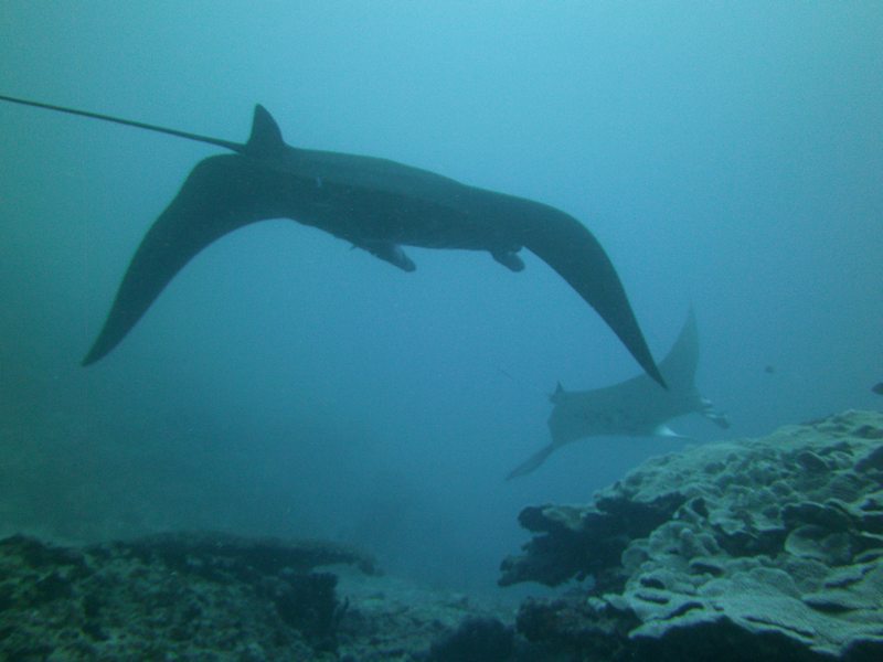
John Ranahan, when he can get 6 interested divers, does dive trips out to the reef. On our first diving day, he took us out to Manta Road, where we got to see about 5 huge Manta Rays hanging out in the current and feeding.

Great Manta Shot by Jerry from Challenger

Though we've swum with Mantas before in French Polynesia, you never get tired of watching these majestic sea creatures. The second dive trip we took, we had an awsome drift dive on a wall on the western side of the island.

For hiking, Stephen on Westward II arranged a trip up to see the "6 Waterfalls". We ended up with 13 yachties on that trip--facilitated by Kumer and Antonia helping to arrange 4WD transportation for that many people. This was an all day hike/scramble in the jungle, punctated by swim stops at a couple of the bigger waterfalls. Very strenuous. Well worth it, and probably the best day hike we've done in years.

Dave blew out his almost-new very rugged-looking hiking sandals on this trip--the uppers completely detached from the lowers halfway through the trip. He ended up putting his socks on OVER his sandals, to keep them together. He looked ridiculous, but it was effective. Two people on the hike ended up barefoot scrambling up the rocky riverbed. They had come in totally inadequat flip-flops. My genuine Keen Sharks (now 4 years and many hikes old) are still hanging in there (thank you Sally, for the hand-me-down).

We did another hike on our own up to Sokeh's Ridge. This is an hour walk away from the dignhy dock, up on a huge rocky outcrop overlooking the harbor.

The View from Sokeh's Ridge

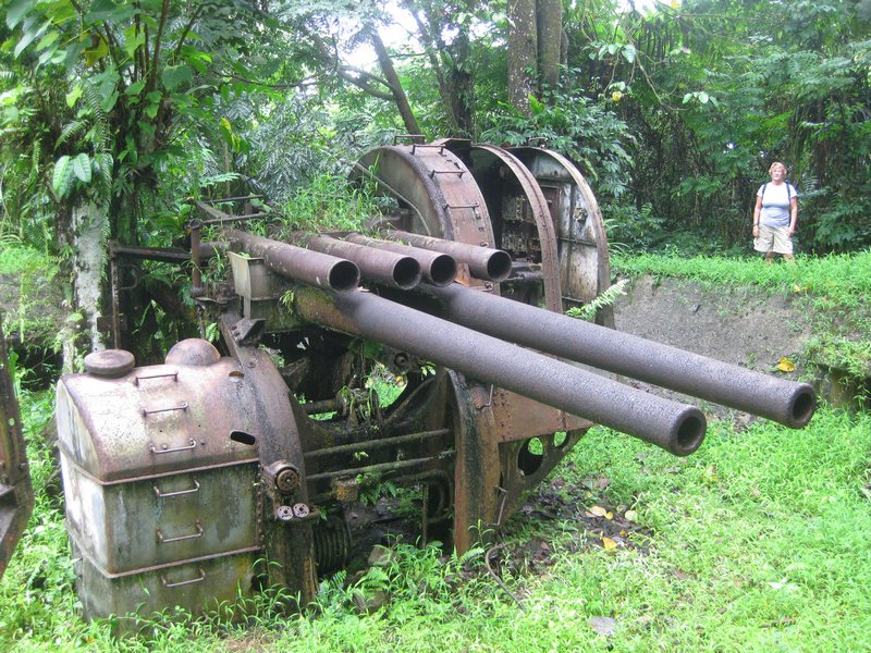
We went up to see the Japanese gun emplacements up there, and we hiked all the way to the primary cell tower. We didn't go on the further hike out to the pinnacle overlooking the commercial harbor, but Westward II and Aurora Star did.

One of the Japanese Guns

A Japanese Memorial Marker

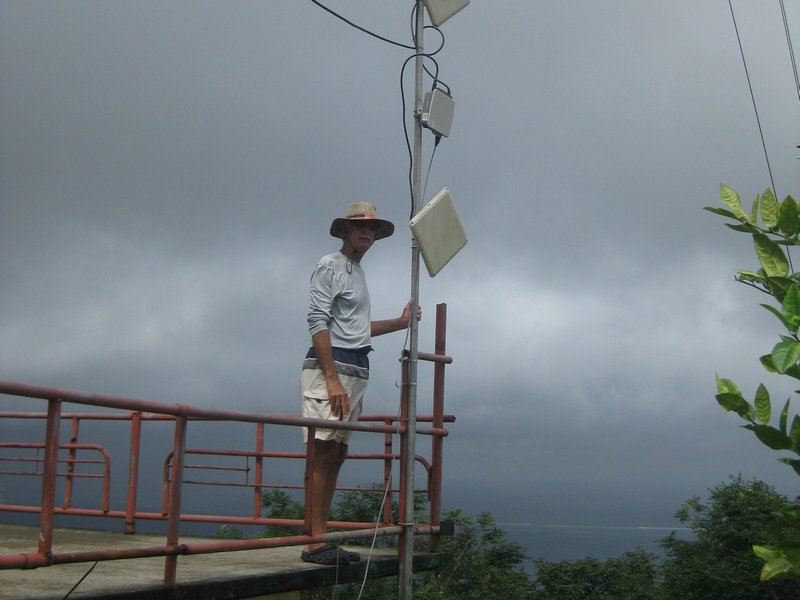
Dave Checking Out the Wifi Antennas

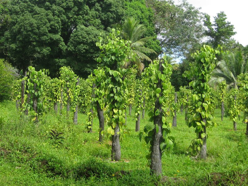
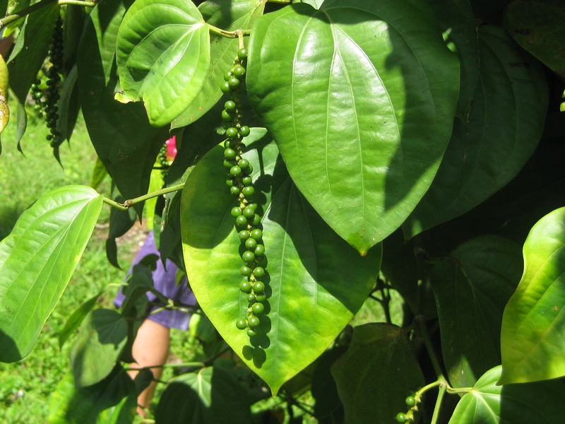
On another day, we went with Westward II and rented a car, and went around the island. The highlights of that trip was the "Botanical Gardens" (and black pepper farm), Nan Midol, and another waterfall. Pohnpei is so small (and with a decent blacktop road all the way around) that you can circle the island without stops in about 2 hours. So a one day rental is all you need to see pretty much everything. We bought a pound of black pepper fresh off the tree (still green) at the Botanical Gardens. We have since dried it and are now wondering what to do with that much pepper!!


Growing Peppers at the Botanical Gardens

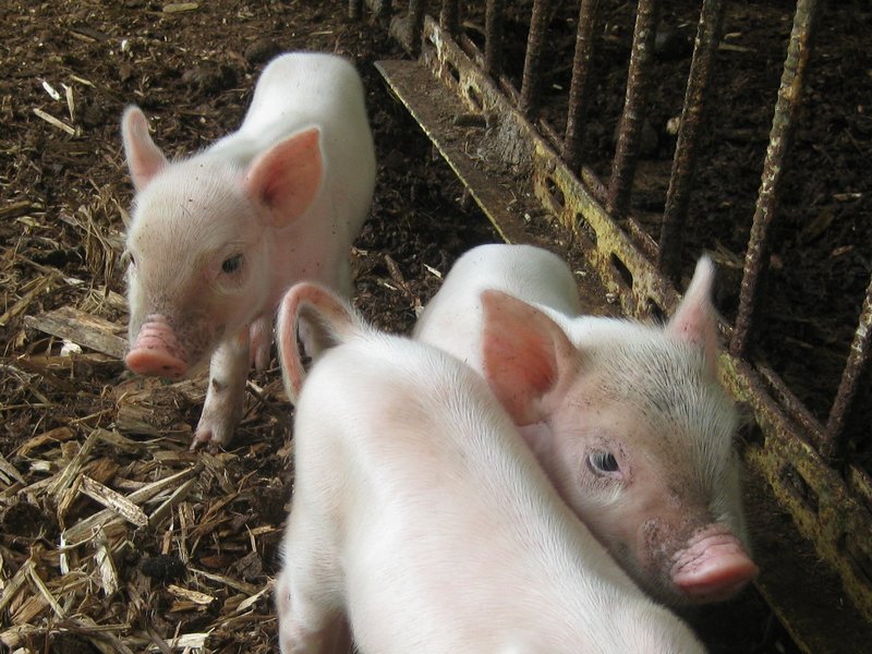
The Cute Baby Pigs at the Pepper Farm

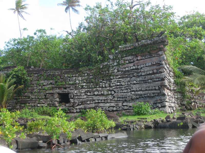
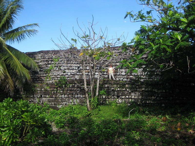
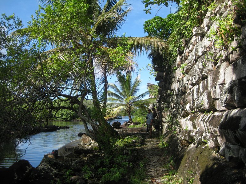
Nan Midol is another one of those ancient civilization archeological sites that are a "must do" when you visit a place like this. This is a large area of large fortifications / religious structures spread over several fringe islands on the shore.

The Layout of Nan Midol (from Wikipedia)

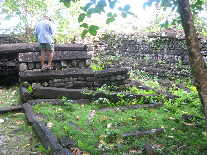
All the structures are made of huge basalt "logs". Basalt is a rock of volcanic origin, with similar properties to granite--heavy and hard. These "logs" (I would call them columns if they were standing up, but they are used laying down and so "logs" gives a better sense) are rough 5 or 6 sided, 1-2 feet in diameter, and 10-20 feet long.

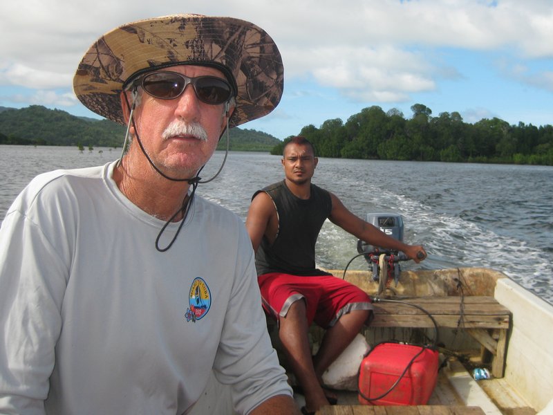
The Boat Ride Out to Nan Midol


The walls on the main structure are 10-15 feet high. So, again, some older civilization has been organized enough to have the manpower to mine, transport, and construct a huge complex with really massive building materials. Like places like Tikal in Guatemala and Machu Pichu in Peru, it's staggering to think of the effort and skills involved. And this is on a relatively tiny island country 1,500 miles of open ocean from the nearest continent.

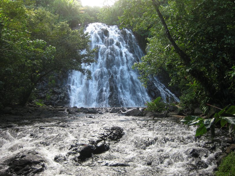
Right across from Nan Midol (by car) is another waterfall. We paid $3pp to park the car and "hike" in (5 minute walk on an improved trail" to the waterfall and take a swim. It is the tourist version of the Pohnpei waterfalls.

The Nice Waterfall

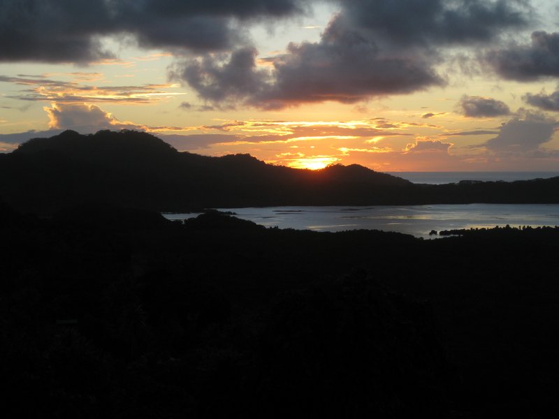
We concluded our day of touring with a nice dinner at Cupid's Restaurant, on a cliff overlooking the harbor. This is a popular wedding spot for locals and tourists. And they serve a pretty good meal.

A Nice Sunset at Cupid's Restaurant

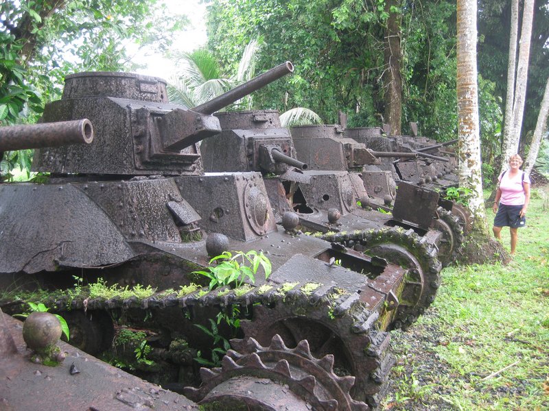
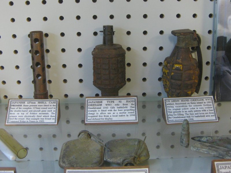
Besides the big tourist excursions above, there are some other interesting things to see around town. The Japanese occupied Pohnpei during World War II. The U.S. never assaulted (with troops), but did bomb the gun emplacements on the hill. There are a few Japanese relics still left in Pohnpei. The Ace Hardware store has a small display of accumulated relics, and if you walk back along the dirt road next to Ace, through the concrete factory, there is a line-up of about 10 small one-man Japanese tanks. They are all pretty much intact but rusted in place. Rumor has it that there's one still operating on the island, and we're trying to get a peek at that.

The Japanese Tanks Behind Ace Hardware

A Nice Display of Japanese Artifacts at Ace Hardware

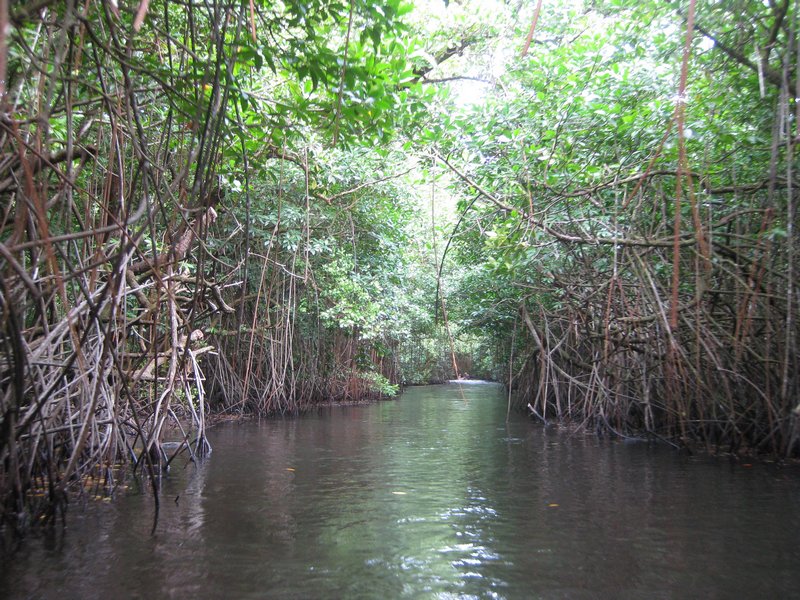
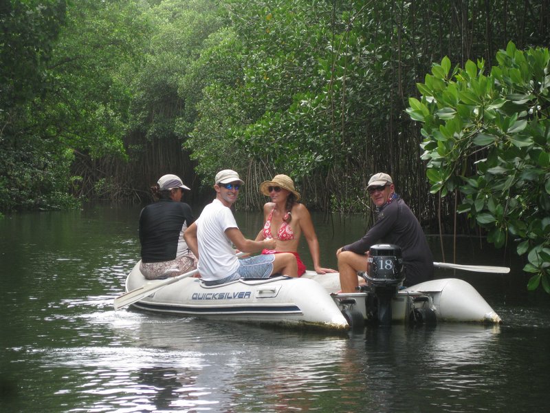
On another day, we got together with the crews of Westward II, Aurora Star, and Challenger and made a dinghy excursion through the mangrove tunnel and out to snorkel on the NW side of the island.

A Dinghy Trip Through a Mangrove Tunnel

Westward II and Aurora Star

Challenger

With all this stuff to see and do, we've been here two weeks and have barely gotten into our "must do" boat projects...
Friday, February 21, 2014

New Island, New Country

With our arrival at Pohnpei (Pon-Pay), we have left the Marshall Islands and entered the Federated States of Micronesia (FSM). The Federated States are another country formed in the mid 80's when The Trust Territories of the Pacific were "liberated" from the United States, who had acquired them from Japan as part of the WW2 settlement.
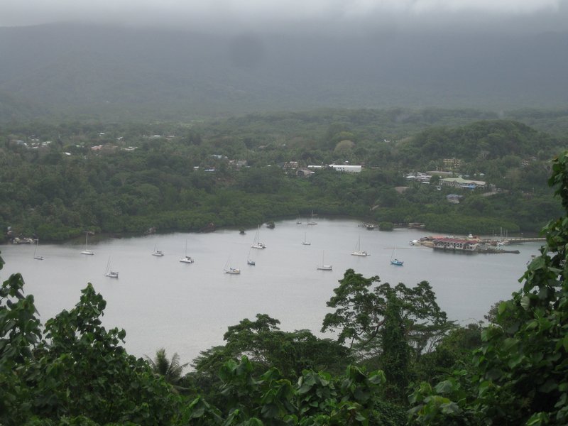
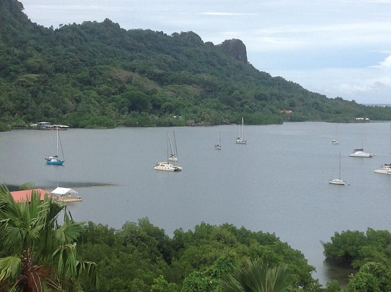
Nice View of the Anchorage from the Harbor View Restaurant

Similar to the Marshall Islands, the FSM have their own constitution and government, but have a clause somewhere that says they are in "Free Association with the United States". This means we protect them militarily and give them heaps of aid money and guidance. While the citizens of the FSM are not considered U.S. Citizens, they are granted unlimited visas to visit and work in the U.S., provided they haven't done anything to cause their visa to be denied.

Since most of our yearly aid money goes into health and education budgets in these tiny islands, there is a sizable chunk of the population who speak pretty good English. This makes it easy for us to travel and interact with people at all levels of the economic scale.

So we have had a pretty pleasant time hanging out in Pohnpei. There is a Seven Seas Cruising Association Cruising Host here, John Ranahan. John is an ex-pat American teacher. He and his wife have traveled all over the world teaching English in foreign countries over the last 40 years. They now call Pohnpei home, and help to welcome visiting yachts to Pohnpei. There is also a native Pohnpeian couple, Kumer and Antonia Panuelo, who are building a marina and boating complex on the water in the yachting end of the harbor. So now we have nice dinghy docks, a place to drop of trash, a cruiser bar, and showers. Currently under construction out on the Quay are a dive shop, restaurant, and small 4-unit apartment complex.

Within walking distance is a decent grocery store, a fresh veggie and fish market, and the public library with internet at $10/month. A $1pp taxi ride away, is the downtown section of Pohnpei with more grocery stores, a U.S. Post Office, and a very well-stocked Ace Hardware and Ace Office Supply. In 2 minutes, no waiting, no paperwork, we got a $10 pay-as-you-go sim card from the Telecom, and recharge card that work both for the cell phone and the wifi internet we can receive on the boat and most places in town.

The anchorage itself is the most protected anchorage we have seen since we left Fiji, deep inside an ancient volcanic caldera. I can see now why our friends on Carina spent last typhoon season sitting here in Pohnpei. It is the first flat-dead-calm no-roll-at-any-tide anchorage we've been in in a year. In a word, nice.
-----
At 02/20/2014 7:20 PM (utc) our position was 06°46.53'N 158°01.03'E

Thursday, February 6, 2014

Safe Arrival at Pohnpei

In spite of a forecast that showed 17-18 knots all day, the light air persisted through yesterday. In classic "horse headed for the barn" fashion, rather than enjoying a quiet last day, we motor-sailed all the rest of the way to Pohnpei.

I was for heaving to and waiting for daylight (or enjoying a slow sail in). But Dave wanted to get in, so we arrived at the entrance to the harbor at about 11pm. We hadn't had a squall all day. But of course, as soon as we proceeded in the narrow channel, a small squall descended on us. Fortunately it didn't last long.

We had a good set of waypoints for the entry, and a good set of Google Earth charts, which showed every coral head and reef on the way in (we think). We went slow, with Dave on the bow looking out, and me at the helm, navigating "on instruments". With the computer screen visible in the cockpit, I couldn't see anything outside the cockpit. I just focused on staying on the plotted course, which had several twists and turns. (insert screen shot).

At the very end, we switched places, so Dave could take us into the dock--I dock Soggy Paws about half the time, but I prefer having Dave take her in in new places.

Anyway, we arrived at the Port Captain's dock at 11:55pm last night. A Port Captain representative was there to take our lines, and welcome us to the Federated States of Micronesia.

We had a good night's rest and have just completed our clearance this morning. Starting at 8am this morning, we hosted individual visits from the Port Captain, Agriculture (Quarantine), Health, Immigration, and Customs. The total cost for clearance was $30 paid to Quarantine, for which we received a receipt. All the officials were friendly and professional.

We already have a dive lined up for tomorrow. Besides Challenger and Westward II, we already know two other boats here (Helena and Java), and have been talking to 3-4 others on the radio. We're looking forward to enjoying Pohnpei.
-----
Sherry & Dave
Heading west across Micronesia in 2014
At 02/05/2014 12:50 PM (utc) our position was 06°58.71'N 158°12.18'E