Sunday, September 15, 2013

Maloelap Corsair Search

We had a nice week in Maloelap. We spent most of the time around Taroa, where the Japanese had a major air base during World War II. The first thing that impressed us, was that the Japanese built their installations as if they were there to stay for a long time. This was no fly-by-night forward base. The concrete pier is massive and built of thick reinforced concrete. They built a massive generator facility on another small island a couple of miles away, and ran heavy-duty electrical cable between the two islands. If you're interested, check out this short tourist overview of the Japanese facilities:

A Virtual Tour of Taroa Airbase

We knew there was a Japanese ship sunk in the bay--it's the first thing you notice as you pull in to the island--the ship lies in about 40 feet of water, and it's tall masts (for lifting cargo) stick 20-30 feet out of the water. We eventually did 2 dives on this ship.
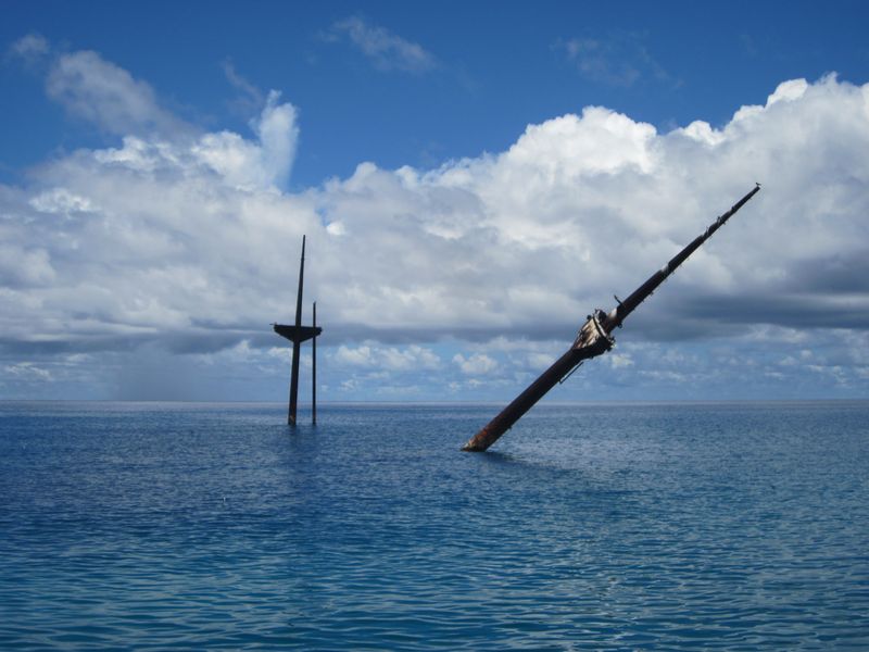
The Masts of the Sunken Japanese Wreck, Tarushima Maru

But the focus for our visit to Taroa was to search for the "missing" Corsair. The F4U Corsair were the primary USN fighters during World War II, and one was supposed to have been shot down over Taroa, landing in the water just off the pier.

Our instructions from Matt Holly were to search "north of the pier and out beyond 60 feet". But in reading the past archaeological studies of the WWII stuff in Taroa, we saw that the University of Hawaii had done a magnetometer survey in the area off the pier, found some "hits", but had never gone and investigated them. So (geek that I am) I snatched the rough graphic of the search area out of the study PDF file, sucked it in to SeaClear (a charting program that you can use to create your own charts), used a couple of landmarks (the pier, the ship, and N and S points of the island) to "geo-reference" the magnetometer search area onto a chart. Then we took waypoints off of the two major anomalies that were in our search area, and went directly there to investigate them.
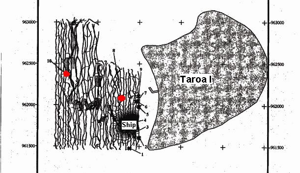
The Output of the University of Hawaii
Magnetometer Survey of Taroa in 1999

Red dots are the two uninvestigated magnetic anomalies
that we checked out

I was amazed that we found something in both places! (ie my hairbrained idea wasn't so hairbrained). But, alas, they were definitely not "airplane debris". The #10 anomaly was a coil of what we think was the heavy generator cable, and the #8 anomaly was maybe ship debris, or something off the pier.
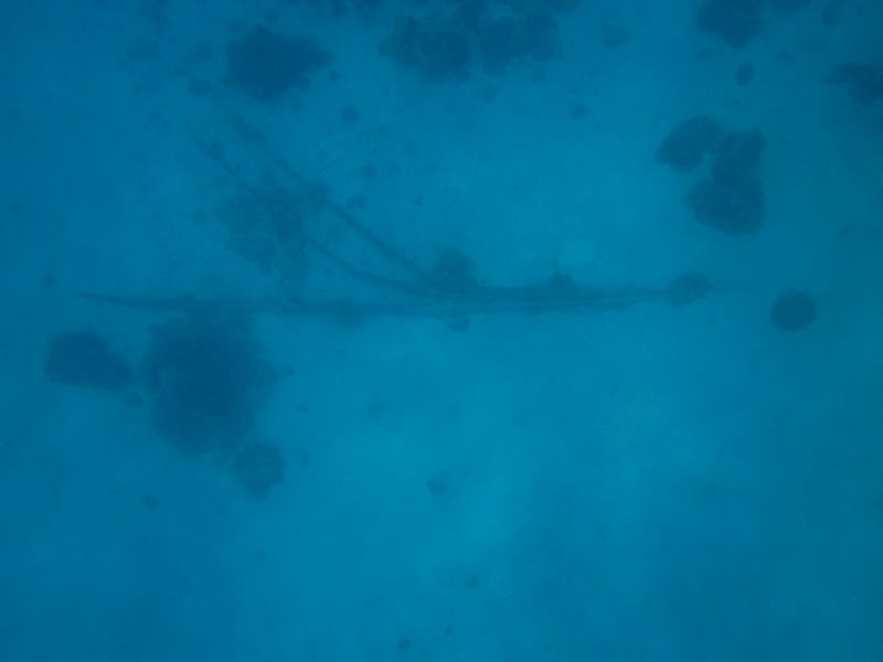
The Debris We Found at the #8 Magnetometer Anomaly

What it did do was validate the now-georeferenced magnetometer survey. It also gave us a feel for the diving conditions. #10 was in about 100 feet of water and #8 was in about 60-70 feet of water. From the dinghy, with days of calm conditions behind us, in 60-70 feet of water, we could clearly make out shapes on the bottom in the sand. So we knew it would be feasible to tow behind the dinghy with a snorkeler and do a systematic search--at least until the water got too deep to see the bottom from the surface.

So I figured out how to use OpenCPN's Search and Rescue plug-in to have it lay out an organized search pattern in a "box" shape, with lanes 60 feet apart. We downloaded this as a route to our hand-held Garmin GPS, and set out to do a systematic search. The Garmin laid a "snail trail" showing where we went, and we then uploaded this back into the computer to keep a record of where we searched.
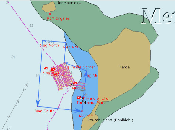
Our Corsair Search off Taroa Island
The pinkish lines are our actual search path
The magnetometer survey is outlined with light blue arrows.
The westernmost dive flag is where the #10 anomaly was, in 100'

We laid out our search pattern to parallel the shore, so that we (hopefully) had even depths. We started in about 60 feet of water, and ended up in 80-90 feet of water. Unfortunately, the amazingly clear conditions did not stay with us. After the 3rd day, the visibility went down to 30 feet or less. And by then we were out in pretty deep water. Even snorkeling down to 20-30 feet (while being towed behind the dinghy at 2 knots), it was difficult to distinguish features on the bottom. We'd have to use SCUBA and be towed at about 60 feet to see anything on the bottom.

Dave made a 'diving plane' out of plywood that helped us control our depth--this worked well when snorkeling, to allow the towed person to dive deeper as he was being towed. (We forgot to take a picture of it, but here's a YouTube Video from someone else. Ours is just an 14" x 24" board). This would also be useful if we had to resort to SCUBA. But we kept hoping the viz would improve so we could continue searching further out--out beyond the magnetometer survey borders. But it never did, even though the winds stayed calm. We suspect that the better-than-normal visibility we had when we first arrived may have been due to the fact that the tidal range went down to only about a foot. Normally the tidal range is 4-5 feet.

Jerry on Challenger was there with us the whole time, and helped us with the search. Dave and I and Jerry took turns, with one person being towed, one person driving the dinghy (watching the GPS very closely to stay in the "lane"), and the 3rd person checking depths and watching the person in the water.

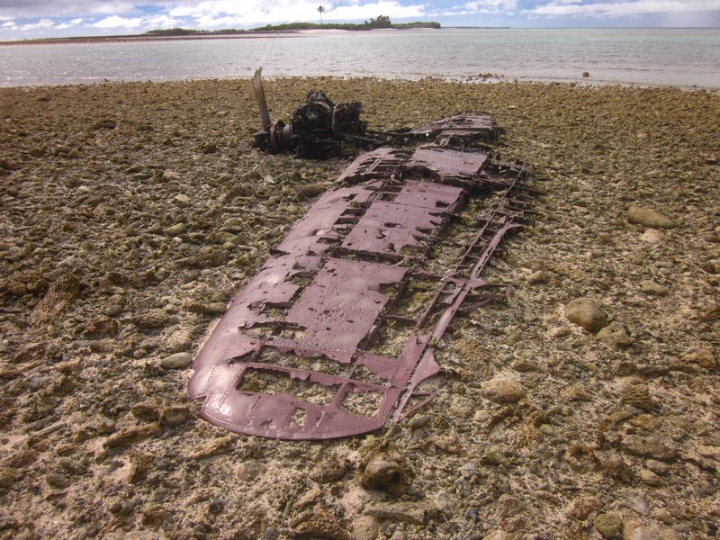
While we were waiting for our friends on Westward II to show up, we took Soggy Paws and Challenger 5 miles north to check out Pigeeyatto (aka Bigat or Pigget) and Ollot islands. Pigeeyatto was where the generator facility was, and Ollot had a couple of sunken small Japanese freighters, and the remains of two Japaneze Zero airplanes.

The locals claim that one of the two sunken ships at Ollot was the ship that transported Louis Zamperini to Kwajalein. Zamperini is the downed US pilot who drifted in a liferaft for 46 days, only to drift into Japanese hands at Maloelap or Wotje (they're not sure which). He spent the rest of the war trying to survive in Japanese prisons in the islands and on mainland Japan. (see Unbroken: A World War II Story of Survival, Resilience, and Redemption for this amazing story).
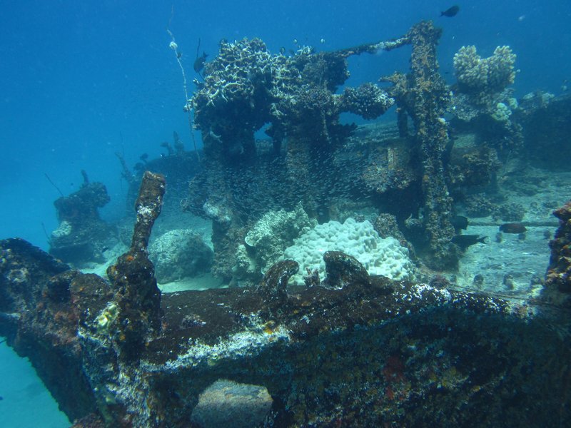
The Wreck of the Ship that Transported Zamperini to Kwajelein

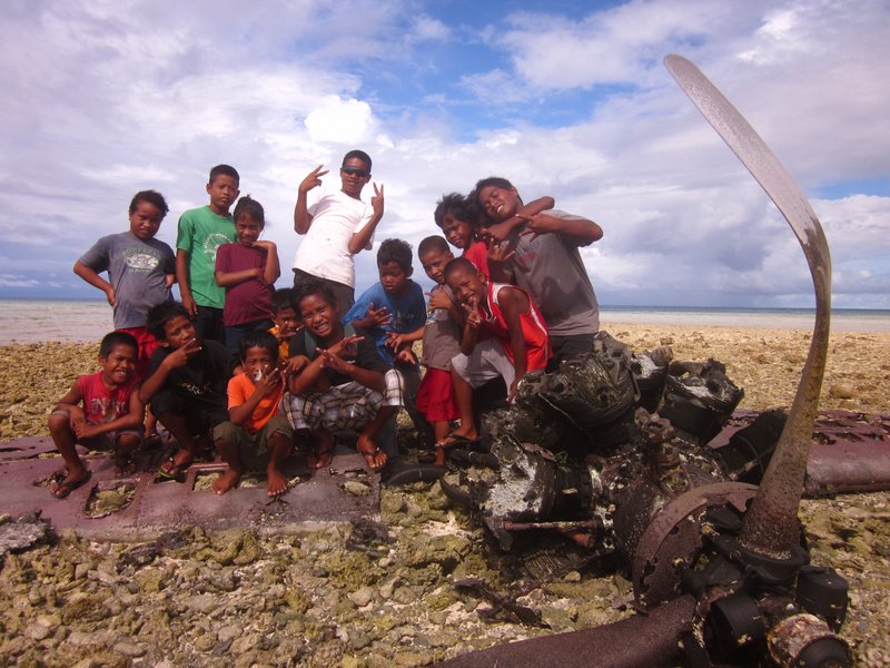
Japanese Zero Wreckage on the Reef Near Ollot

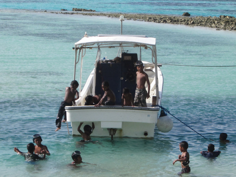
Ollot Kids Who Came Out to See What We Were Looking At

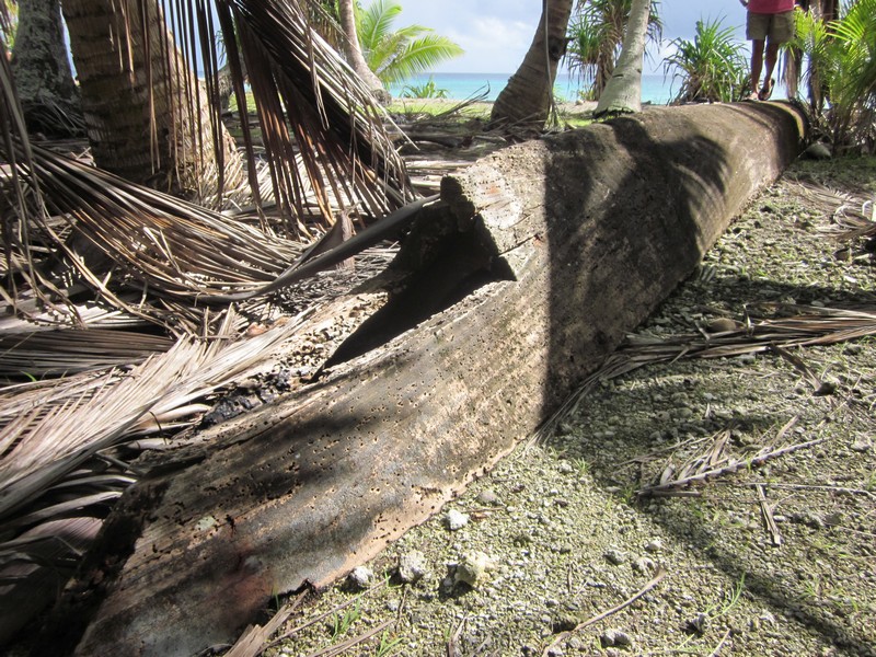
An Old Canoe Ashore at Pigeeyatto

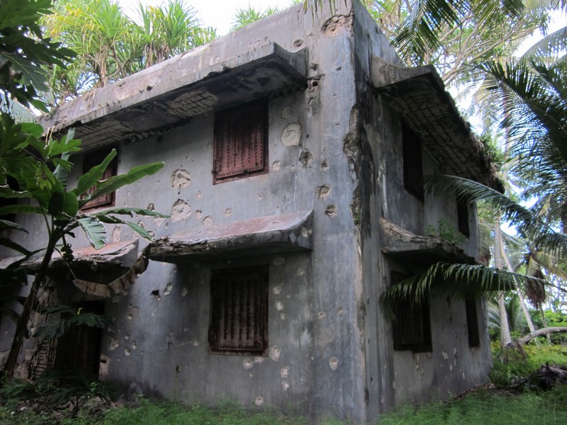
The Huge Generator Building at Pigeeyatto

A Sailboat Wreck on Pigeeyatto

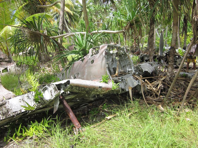
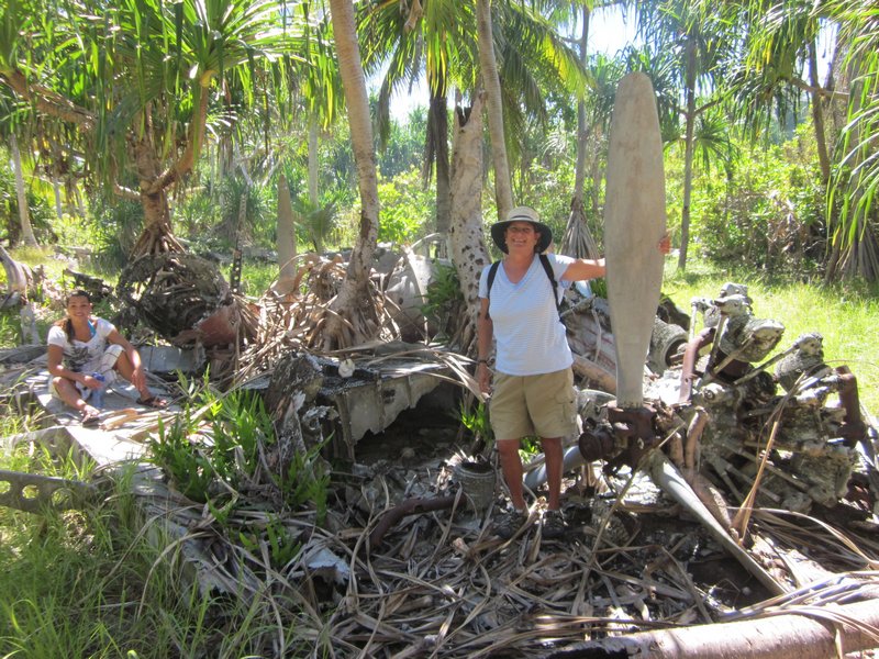
We also spent two afternoons tromping through the bush on Taroa looking at the extensive WWII debris--the remains of airplanes (bombed by American forces while on the ground), gun emplacements, runways, and buildings.
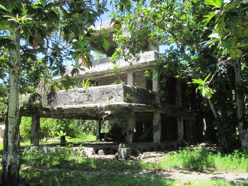
The Bombed-Out Japanese Command Center on Taroa

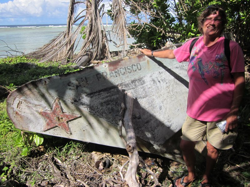
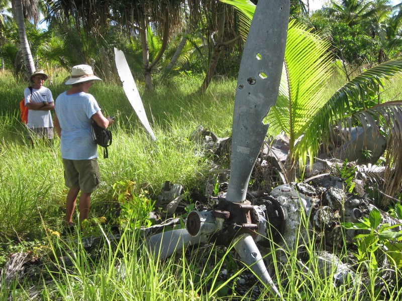
The Airplane Graveyard at Taroa

The Airplane Graveyard at Taroa

Note Bullet Holes in the Propeller!

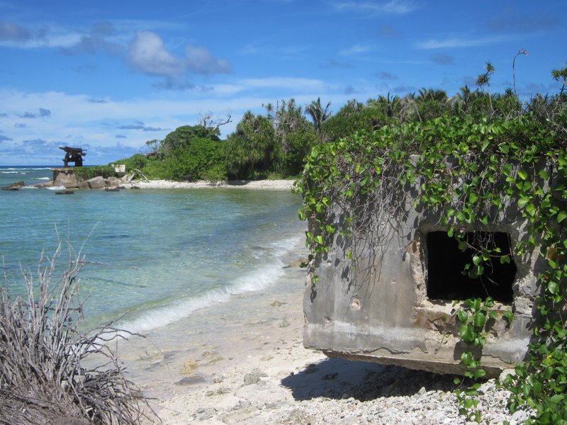
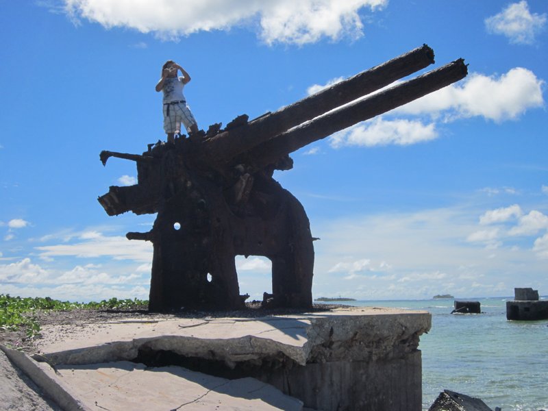
Anti-Aircraft Guns on the Beach

Ulyana on a 127 mm Gun Emplacement

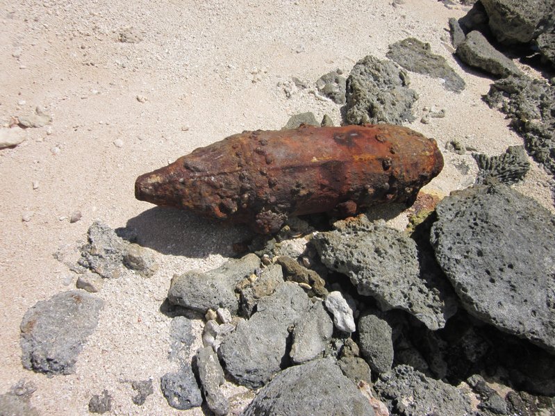
Old Unexploded Bombs are Still All Over the Place

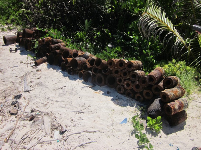
These Old Bombs Have Been Cleared
by an Unexploded Ordnance Squad
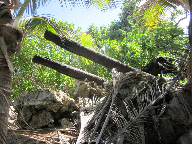
Lots More Stuff Hard to Find in the Jungle

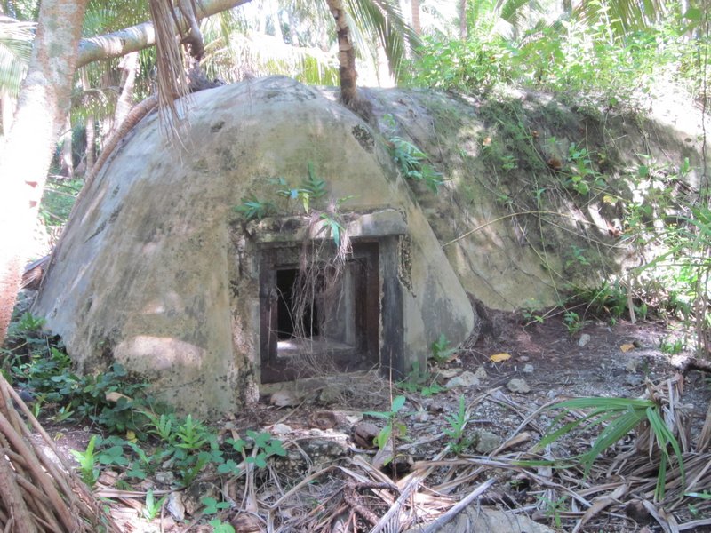
An Ordnance Bunker?

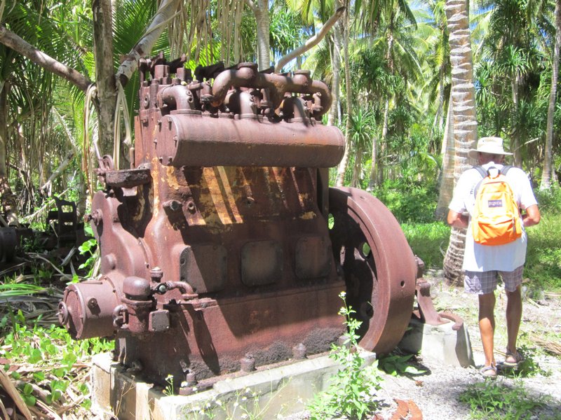
Circa 1940 Yanmar Generator

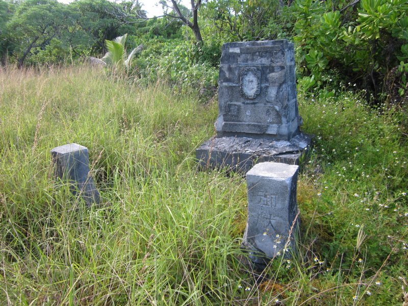
A Memorial Erected by the Japanese to their Lost Soldiers

We never really did engage with the people of Maloelap on this trip. We were too busy in our "seeing WWII artifacts" mission. The people who live here don't really give a rat's ass about the "artifacts". They don't really understand the benefits of tourism, and the debris just gets in the way of farming the land. And of course it brings in these odd people who want to look at 70-year old war debris.

And we never did find the Corsair--but we did expand the area that we know where it's NOT. We handed over our search information to Matt Holly and the Marshall Islands Historical Preservation Office, so next group of interested people can pick up where we left off.

We are on a mission to fit in one more atoll (Jaluit) before we have to head to Kwajalein and park Soggy Paws for our annual trip back to the U.S. So we hurried off back to Majuro to reprovision, leaving Challenger and Westward II in Maloelap. They moved south to Airik Island (still in Maloelap Atoll), and spent a few days there "fixing things" for the locals. On the list: hooking up replacement batteries to their hospital solar system, diagnosing solar controller problems, fixing a chainsaw, looking at a strange VHF radio problem, and tinkering with a couple of outboard motor issues. In return, they were amply rewarded with local produce--papayas and limes, and lobster.

We are now back in Majuro, getting ready to head to Jaluit, another Japanese base in WWII, and then on to Kwajalein. We are scheduled to fly out to the U.S. on October 8, from Kwajalein.

Friday, August 30, 2013

On our way back to Maloelap

Date: Today!

I am chagrined to report that I have still not had the time/taken the time to catch up on my blog. We are ever-moving ever-doing and it seems like there's no time to just sit in a quiet cabin and catch up (and there's SO much to catch up on besides the blog, when we've been out for the whole summer).

I still am hoping to get around to doing blog posts on

- Relatively uneventful sail/motorsail from Ailuk to Majuro with an unplanned stop at Maloelap (leaky exhaust)

- A short stop in Majuro for re-supply and internet

- A week in Mili Atoll, where we were able to dive in flat calm conditions on a B-25 bomber shot down in WW2 off the end of the Mili airfield. Because the conditions were so good, we located, photographed, and mapped parts of the airplane that had never been located before. We have shared our results with the Historical Preservation Office in Majuro (and with Matt Holly, the original discoverer of this airplane).

- Another very short stop in Majuro to provision for our trip to Maloelap

Plus of course, updating the existing blog posts with a few of the hundreds of photos we have taken!

We are now on our way 90 miles north to Maloelap Atoll, where we plan to do some more diving and land exploration of WW2 sites.

Tops on the agenda is to try to locate an as-yet-missing Corsair airplane reported shot down over Taroa Island in Maloelap. We have been trying to work with Matt Holly (who has been searching for this airplane for a number of years) and get a group of cruiser/divers together to do an organized search. Matt's been delayed and his disorganization has put off a couple of the boats that had expressed interest. But we and Challenger are going to get started anyway. We have enough information from Matt to know where he has determined the plan is NOT. Hopefully Westward II will be able to join us in a few days (they are working on engine issues in Majuro). And maybe Matt will actually join us in a few days also--sailing up with s/v Tribute.

The wind has been more or less "light and variable" for 3 weeks now, and the GRIBS look like it will stay that way for at least another week. Light winds are not unusual in the summer here, but a stretch this long with winds this light ARE unusual. It makes for terrible sailing but great diving.

So on we motor... ETA Taroa anchorage in Maloelap around noon.

Our future plans are to spend about 10 days in Maloelap, hit Majuro one more time for provisions, then stop in Jaluit (another Japanese base during WW2) on our way back to Kwajalein. We plan to leave Soggy Paws in Kwaj for October and November while we fly back to the U.S.
Tuesday, August 20, 2013

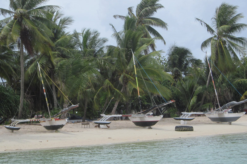
Traditional Sailing Canoes in Ailuk Atoll

We finally made it to Ailuk! Ailuk Atoll is one of the "outer outer" atolls. That's why I wanted to visit here. I also wanted to visit because "Pumpkin", one of the Ailuk islanders, is on the Yokwe Net (SSB) every morning. There are 3 or 4 Marshallese on different islands who participate in the HF net. Pumpkin has been asking for weeks when we (several boats out cruising this summer) are coming to Ailuk.

The View from Pumpkin's House

As we were laboriously tacking our way into Ailuk, we heard Pumpkin calling us on the VHF... welcoming us to his atoll. When we finally got anchored, he told us where his house was on the beach, and that's where we went first. Pumpkin's wife Emily greeted us with real flower lei's, and fresh coconuts.

It turns out that Pumpkin is the pastor of the Assembly of God church here in Ailuk. He and Emily grew up in Ailuk, but they went to high school in Majuro. They spent some time as pastor of a church in Mili, another Marshall Islands atoll.

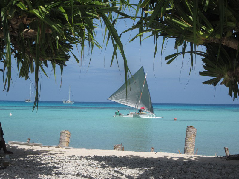
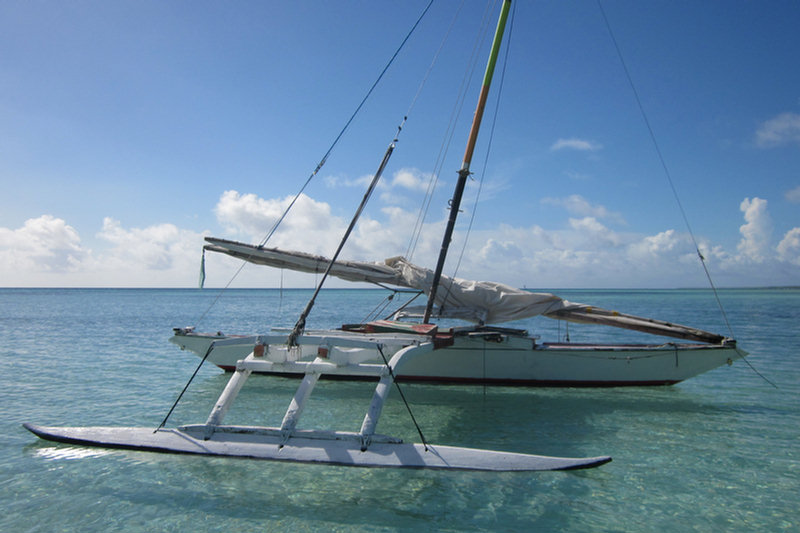
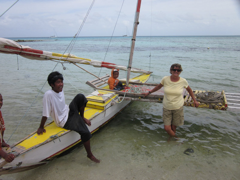
Ailuk is unique among the atolls we have visited so far, in that they use the traditional Marshallese sailing canoe in everyday use.

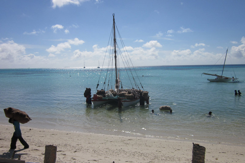
Men Unloading Coconuts To Process As Copra

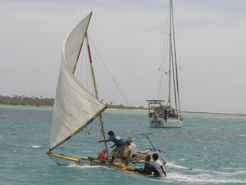
Most atolls have a few canoes sitting around under palm trees, but most of them are paddle-powered. We have never seen a traditional canoe actually sailing. Here in Ailuk, they are the main means of transportation to the outer islands in the atoll.

Ailuk's Main Means of Transportation


Ailuk gets a supply ship... maybe... every 3 months. They have a small weekly plane flight... maybe. Gasoline, if you can buy it, is $9-10 per gallon. We have been amazed at how prevalent the fiberglass boat with a 25-45 HP outboard has been all through the islands (Tonga, Fiji, Tuvalu, Kiribati). They are always short of gasoline, and always struggling to keep the outboards running. Most of these islands have totally lost the art of making, maintaining, and sailing the canoes. But not Ailuk.

Ailuk is also one of the atolls that produces some of the best Marshallese handicrafts. The only "cash crops" in Ailuk are copra (dried coconut meat used to produce coconut oil) and the handicrafts. This they normally send to relatives in Majuro, who then sell it and send back by ship the things that the Ailuk people need.

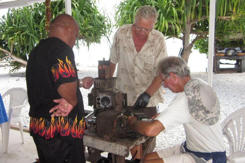
One of the first things we did after completing the formalities (showing our Internal Affairs permit for Ailuk, and paying our "atoll fee" of $50), was offer to help Pumpkin fix things. It is one of the common ways that yachties "give back" to the islanders for their hospitality. Pumpkin promptly produced a couple of broken inverters, and a generator.

John from Opus Working on Pumpkin's Generator

Dave and John from s/v Opus spent one whole morning taking apart the generator. John, who's an excellent mechanic, did most of the work, while Dave watched and learned, and Pumpkin and Emily produced coconuts and lunch.

Unfortunately, after all morning taking the generator apart, John found a broken crankshaft. The oil had been allowed to run very low, and the engine just froze up and died catastrophically.

When we were hanging out on their back porch, Pumpkin's wife Emily offered to show me how to make the elaborate baskets that she and the other Ailuk ladies make. I never did take the time to sit and learn how to do it myself, but I did get Emily to make me a few beautiful Marshallese woven crafts.

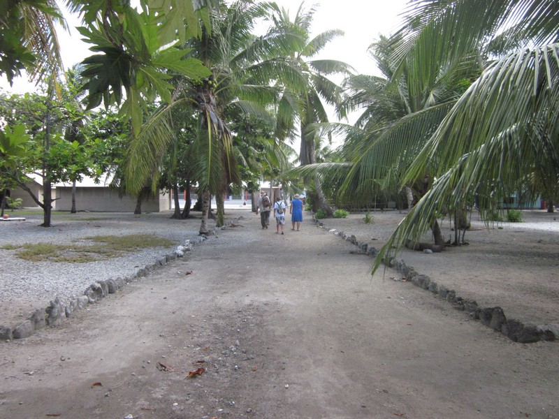
Downtown Ailuk

On our walk around the island, we found a quiet and neat village, with the streets and yards swept clean, and no trash around.

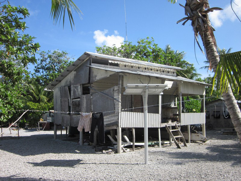
A Fairly Typical Marshallese House

The Boys of Ailuk Enjoying Summertime Freedom

Cute Kids!

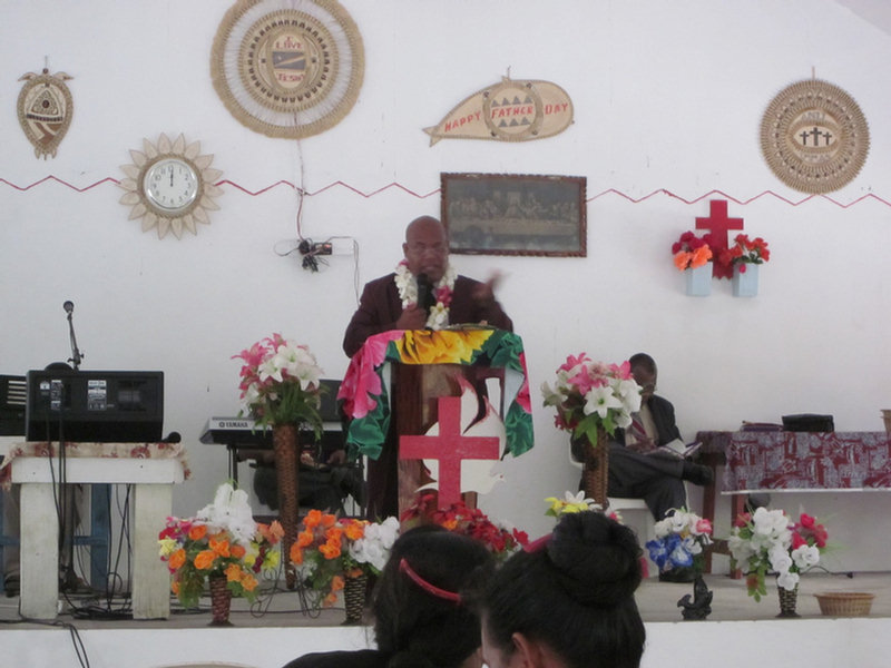
On Sunday, we were invited to Pumpkin's Assembly of God service. We were introduced in English, but the rest of the service was in Marshallese. We were especially taken with their practice of everyone in the church getting up from their seats and shaking hands with everyone else in the church (kind of a 7th inning stretch, before the main sermon, methinks).

Emily's Sunday School Crowd

Pumpkin Delivering His Sermon

But the absolute highlight of our trip was when Pumpkin and Emily arranged for us to go sailing on two of the canoes.

Readying Our Boat to Sail

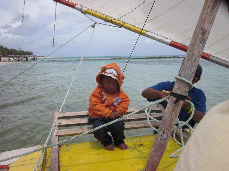
This Little Guy Came With Us--No Lifejacket Either

Our Skipper (The Kid's Dad)

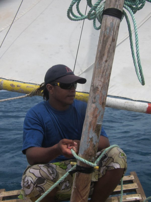
The Afterguard

The Marshallese canoes are a proa design, and to tack them, you have to reverse the boat--the bow becomes the stern and the stern becomes the bow. They unfasten the bottom of the V-shaped sail from the (former) bow, and swing it to the new bow. They detach the rudder from the pintles at the (former) stern and move it to the new stern. Everyone turns around, and off we go again. (Sorry we didn't capture this process).

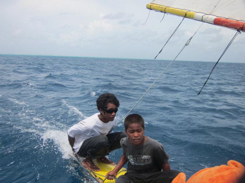
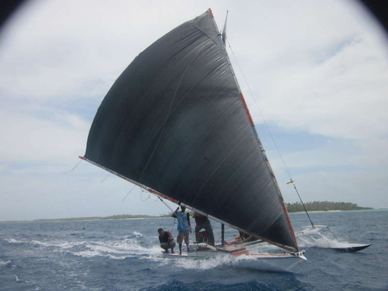
John, On the Other Canoe Is Haulin' Ass

And So Are We!

See Our Ailuk Sailing Video


Interested in more about life on a remote Marshall Islands Atoll? I really liked this book: Surviving Paradise: One Year On A Disappearing Island

Tuesday, August 13, 2013

Passage from Likiep to Ailuk Atoll

July 29-30

We really liked Likiep and could have stayed for a lot longer. But the horizon beckons...

In the last few hops, we've been traveling southeast, and so our weather watch was always for northeast winds. In this passage, we'd be going northeast, so we needed to wait for southeast winds.

The winds in the Marshall Islands in the summertime are somewhat similar to those in the Caribbean in the summertime. There are "tropical waves" coming from the east every few days. Each wave brings a "wiggle" in the winds. As the wave approaches, the wind goes northeast. When it arrives, it brings wet weather, and a wind shift to the southeast. So the trick is to catch whatever part of the wave suits the wind you are looking for. And to watch out "vigorous" waves (or mentions of "Upper level support" in the text forecasts)

As much as people revile the GRIB, we really rely on them here. There is no real local weather forecast office. So the big computer in the sky is all we have to go on. That, and our eyes, of course.

So we knew from the GRIB files to expect the wet, and the wind switch to the southeast in the middle of the day. We were all ready--goodbyes ashore said, dinghy loaded, deck canvas down, passage meals cooked, cabin prepped. So when the sky started clearing and the wind shifted, we got underway immediately.

The point-to-point distance on this hop is only about 50 miles. If it was downwind, or a reach, we could have managed it as a daysail. But upwind, and tacking on 5-10 miles on each end to get from the pass into the atoll to the anchorage, we made it an overnight.

We picked up anchor about 1:30pm, and were out the SW pass by 2:30pm. Once out the pass, we had to go straight east for about 6 miles to clear the SE tip of Likiep. We did the first part motorsailing really close to the Likiep coast, trying to take advantage of the little protection it offered. Then when we started feeling the waves, we fell off a bit and sailed ESE.

Finally about 5pm we tacked over to head for the pass at Ailuk. We kept the motor on for another hour, until we were really clear of the reef that sticks out the east end of Likiep. At first we were making about 30 degrees true, but we got into the current, and most of the night we only made 15-20 degrees true. At dawn we were even with Ailuk Atoll, but 20 miles west of where we needed to be. So we tacked over and spent the next few hours sailing to the SE. The waves were really choppy behind the atoll--waves coming around both sides of the island meeting where we were!!

Finally we got close enough to the atoll where the waves weren't so bad, so we turned on the engine and motorsailed in. We went in the middle pass on the western side of the atoll, using Google Earth charts to navigate through the pass.

As soon as we were inside, we hooked up the watermaker (directly belted to the engine, like an alternator), and made water while motorsailing the 12 miles down to the village at Ailuk. We have to motor at reduced RPM, and the wind was up, so for some time we were only making about 2.5-3 knots. We finally got anchored behind our friends on Opus about 2pm. But with full water tanks of beautiful reverse-osmosis water.

Our anchor spot was 10-13.43N / 169-58.59E

Thursday, August 8, 2013

Likiep Atoll

July 25-29, 2013

I have this in my notes about Likiep: "Likiep is unique in the Republic of the Marshall Islands in that it is the only series of islands and communities that were owned by Europeans. With the intent of developing a Copra (coconut) plantation, A. Capelle, a German, and J. deBrum, a Portuguese, acquired rights to the Atoll in 1876. From then through several generations, the Capelles and deBrums dominated the culture and community of the island of Likiep and its affiliated atoll islands, running them as a company community. The islands seem to have prospered during the peak years of copra production." (sorry, not sure the original source, maybe Lonely Planet, maybe Wikipedia).

Soggy Paws in Likiep Harbor

The deBrums and Capelle's are still prominent names throughout the Marshall Islands, but especially on Likiep.

So when we went ashore and met "Junior" deBrum, and James Capelle, we knew we were talking to the direct descendants of these two European traders. James and his wife Samantha keep a small store, and in the store hangs a portrait of the original Capelle, whom James still very much resembles.

The Catholic Church in Likiep

Though the descendants are thoroughly Marshallese now, the village retains just a hint of European order. We were amazed at how clean and neat everything was. We saw people regularly raking the leaves in their yards. There was none of the "Marshallese" trash that you find in Majuro and Ebeye--where every disposable item goes from hand to curb without thought of a trash can. That, combined with the thoroughly island setting, with a gorgeous beach and a nice protected anchorage, reminded me a bit of New Plymouth in the Bahamas.

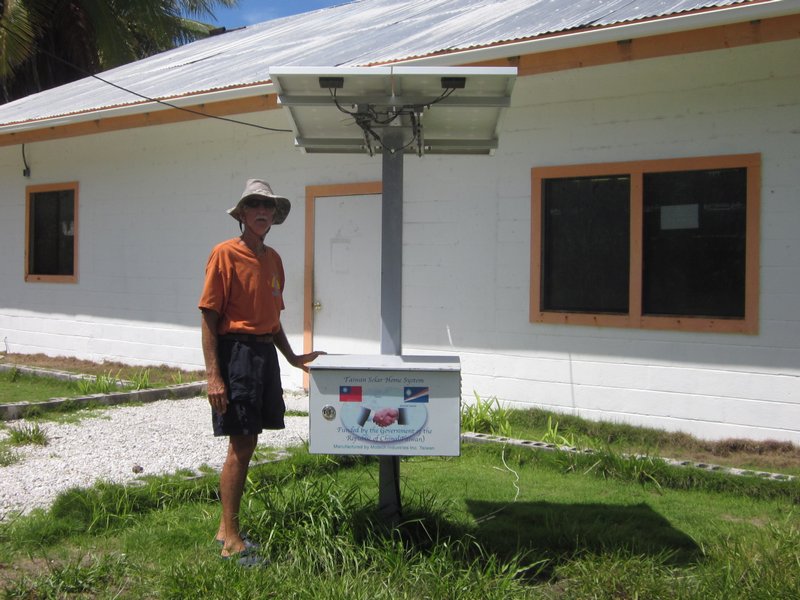
Each House Has a Small Solar Panel

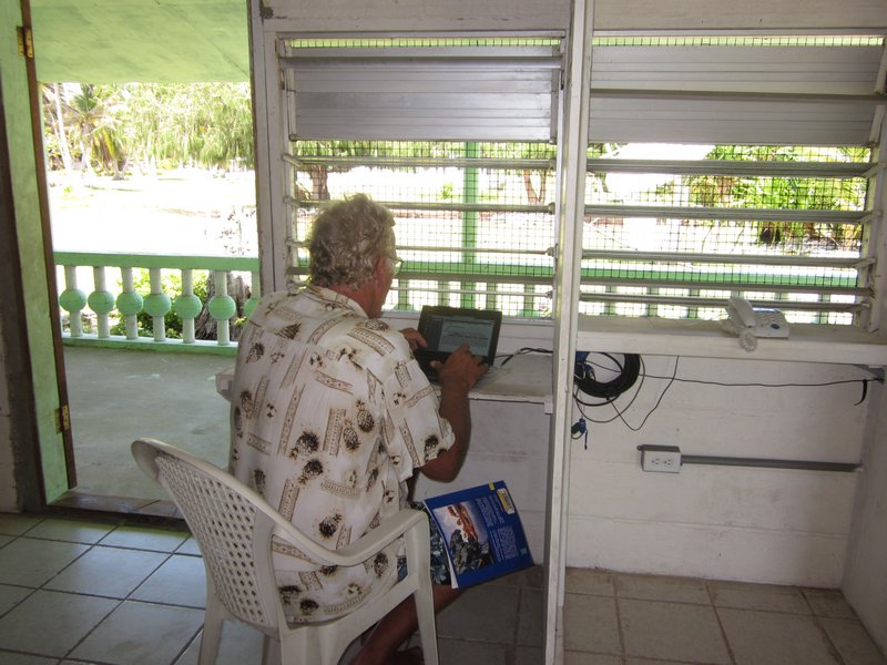
Everyone in Likiep made us feel very welcome. As we wandered around trying to find the "mayor", to present our paperwork, we first made our way to where the "internet" was. This ended up being in what looked like the school library. Here a satellite dish provided a one-computer internet connection and a telephone connection.

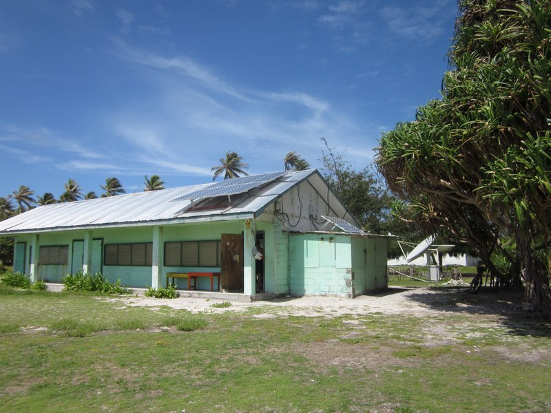
The Library and Internet Center

John from Opus Checking His Email

I am told that Likiep was the first outer atoll to get such service. Here we found fellow cruiser, John, from Opus, trying to check his bank balance. And here we also met Junior deBrum. Junior grew up on Likiep, speaks excellent English, and was a wealth of information. He also offered to show us where the former deBrum homestead was (mentioned as a historical place in the Lonely Planet) and the Mayor's house.

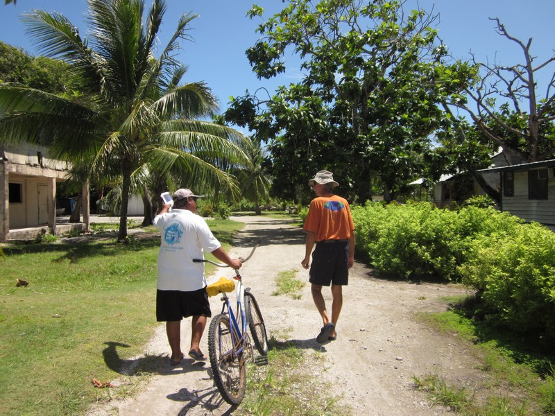
Junior Showing Us Around

Junior is the head of the Likiep Fisheries department, and offered later to take us out to see the Giant Clam farm on a neighboring island.

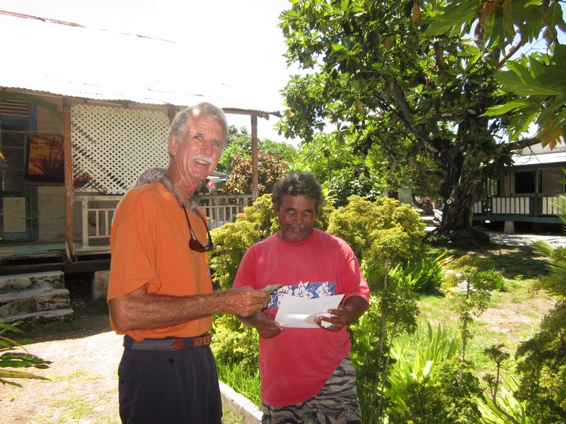
Dave and Mayor Anthony John Handling the Paperwork

With Junior's guidance, next we met the acting Mayor of Likiep, Anthony John. (The Mayors of each village are usually in Majuro taking care of business, so visiting cruisers are usually dealing with the ACTING Mayor). We showed him our Internal Affairs permit for Likiep, and paid the $50 fee required to visit the atoll. He welcomed us to Likiep and answered a lot of our questions. And kindly took us to Capelle's store.

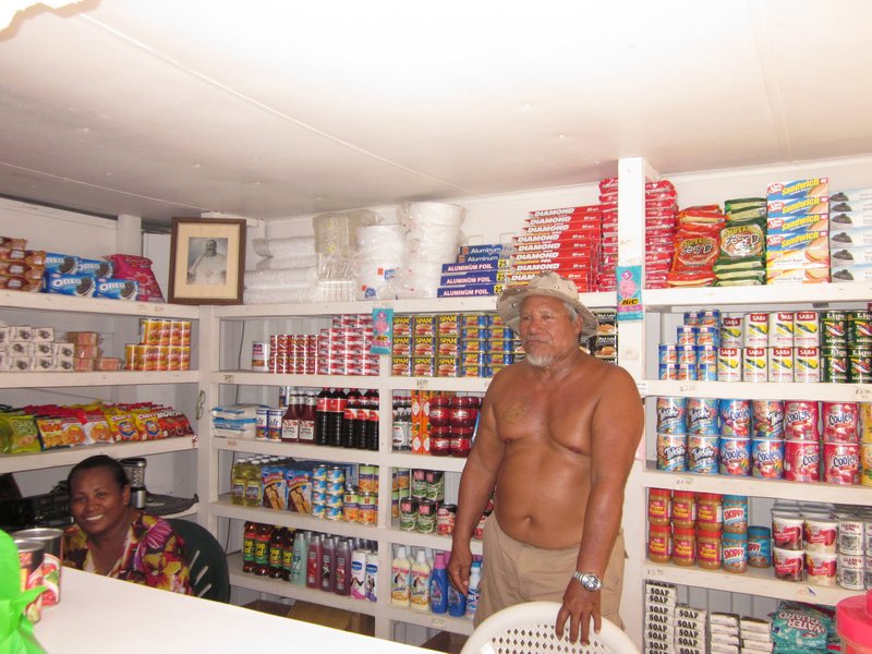
The Capelle's Store on Likiep

The store was open but unattended, but shortly James and his wife Samantha smilingly hustled out to say hello. The store was surprisingly well stocked for an outer-island store that only gets re-stocked every 3 months when the ship comes. Of course Dave asked if they had tomatoes or papayas and bananas, and they just laughed. Normally bananas and papayas are grown on the island, but the prolonged drought had pretty much killed everything. We bought a few items at shocking prices--a can of green beans, a $6 package of Chocolate Chip Cookies, and a package of crackers I hadn't seen before.

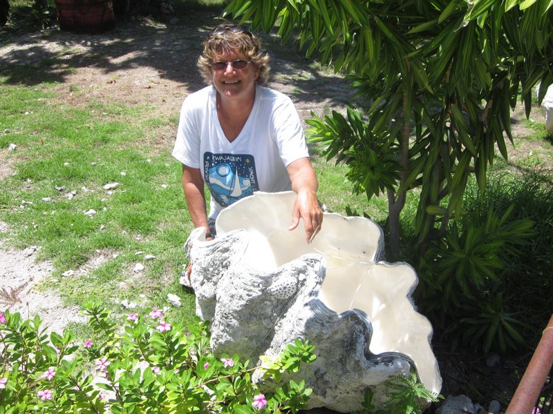
Giant Clam Shells for Lawn Ornaments

Later we sought out Joe deBrum, the operator of the Plantation Haus on the beach. He was mentioned in other cruiser accounts as being "a true friend of the cruisers". But unfortunately Joe's wife is sick, and he is in Majuro with her for the time being, though we did meet Joe's daughter and grandson, who are care-taking the hotel. The hotel isn't open anymore, as the Air Marshall Islands service to Likiep is too irregular.

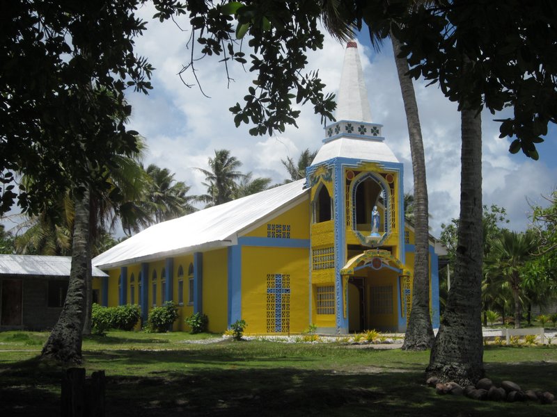
As we were photographing the striking yellow church on the waterfront, we met Josef, the Catholic Priest. Later we had a chance to socialize with Josef and the two nuns who run the church, at a beach barbecue arranged by Junior deBrum. They come from other places to serve the Catholic community in Likiep--Josef is from Indonesia, and the nuns were from the Philippines.

Jerry from Challenger with Titi, Junior's Wife, and Josef, the Priest from the Catholic Church

When Dave asked if there were any World War II wrecks around, Junior told him about the Japanese ship that was sunk on the reef to the SW, and the American plane that had bombed the ship, but was disabled in the attack, and landed in the water right in front of the village. Though we could find no remnants of the plane in the place Junior pointed out (right next to the wharf in front of the village), Junior recalled playing in the cockpit of the plane at low tide, when he was little. We didn't get a chance to go see the shipwreck, but a few days after we left, Junior took the crews of Westward II and Challenger out to dive on it. Stephen from Westward II told us that it was pretty broken up--interesting but not spectacular.

Junior Takes Us to the Clam Farm and On a Picnic

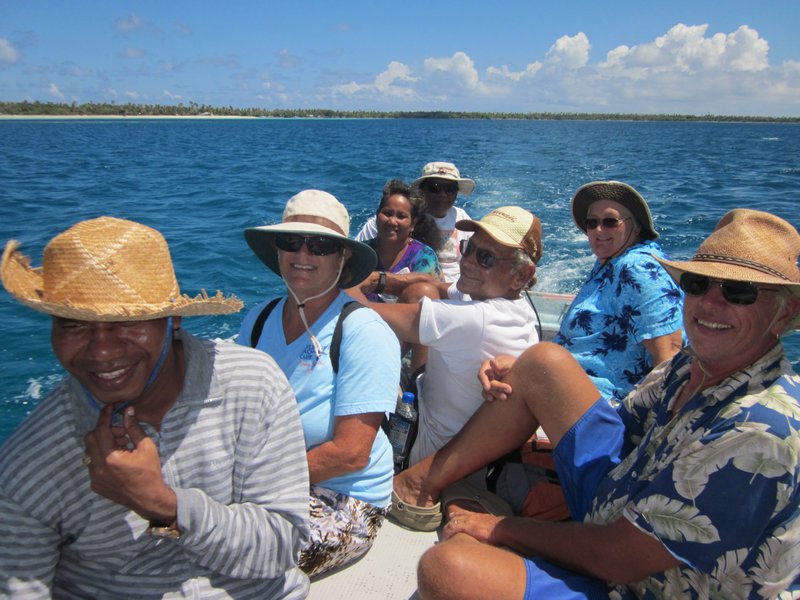
On Sunday afternoon, Junior finally come through on his promise of taking us to see the Clam Farm, and combined it with an afternoon picnic with his extended family. He loaded one launch with family and the two nuns from the church, and us and Father Josef in the other, and we motored across to the next island to the north. While our boat made a short stop on the SE point to see the Clam Farm, the other one went to the deBrum's beach camp to start meal preparations.

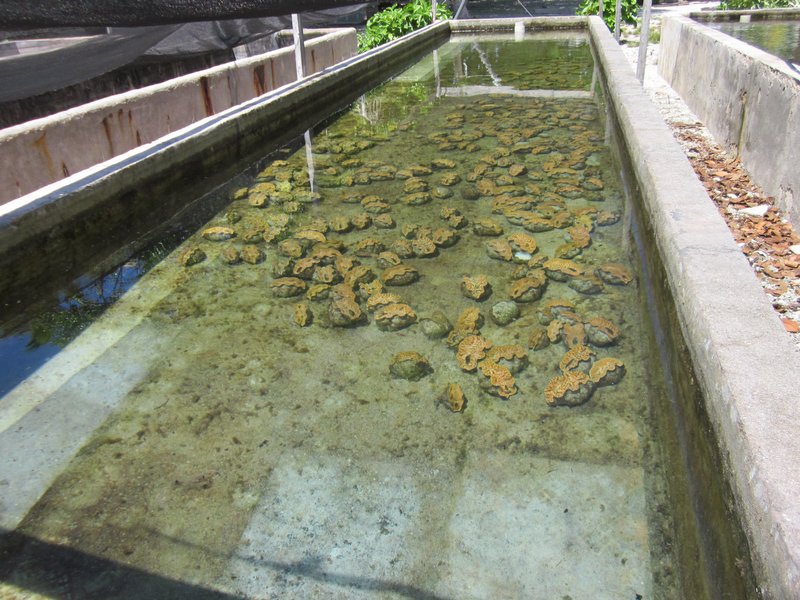
Baby Clams in a Tank at the Clam Farm

The original idea behind the Clam Farm was to re-populate the nearly extinct Giant Clams throughout the atolls. However, the lack of any regular transport between atolls has pretty much shut that idea down. Now the clams grown by Junior get shipped off to Majuro when they are about 3-6" across, and then flown to the U.S. for the aquarium market! He said his next shipment was headed for Florida!!

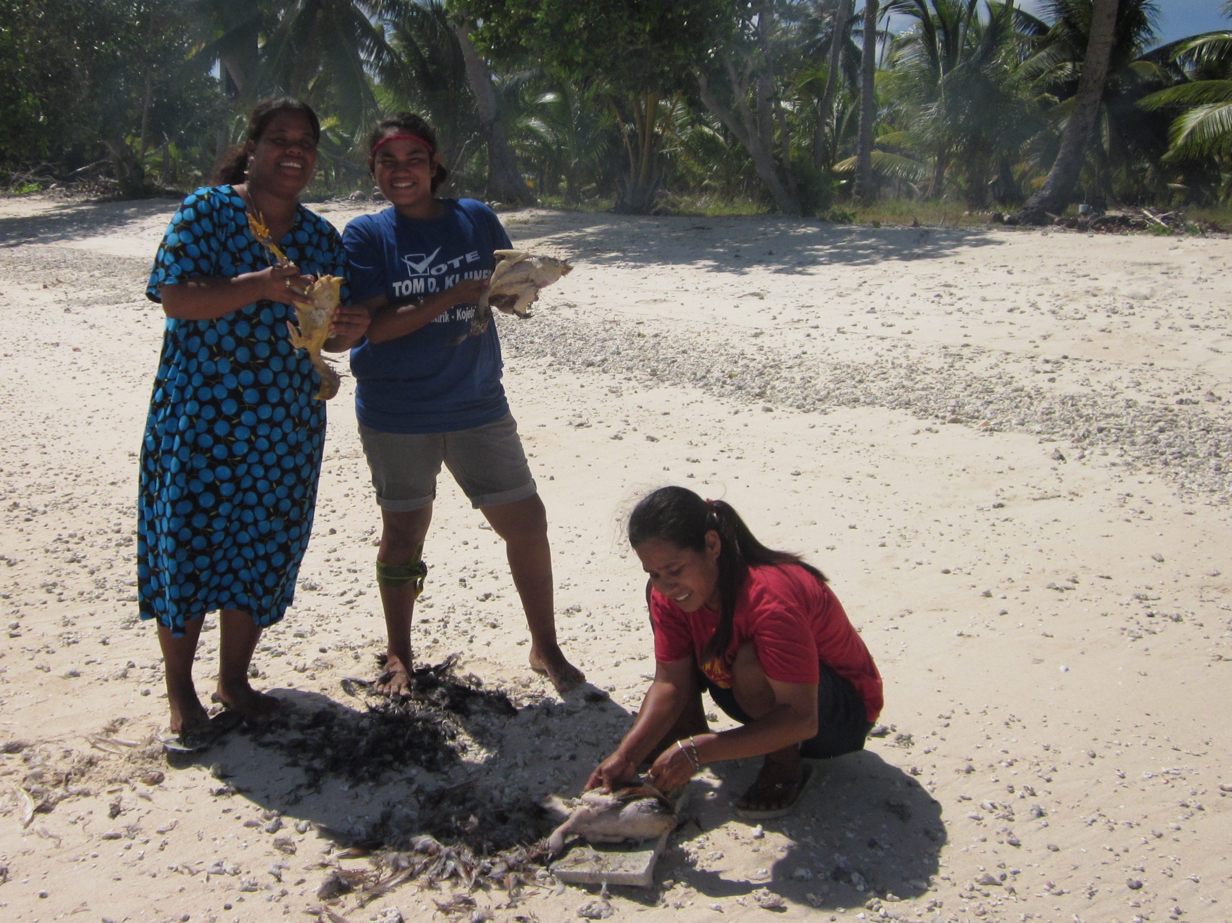
The Girls Plucking Chickens on the Beach

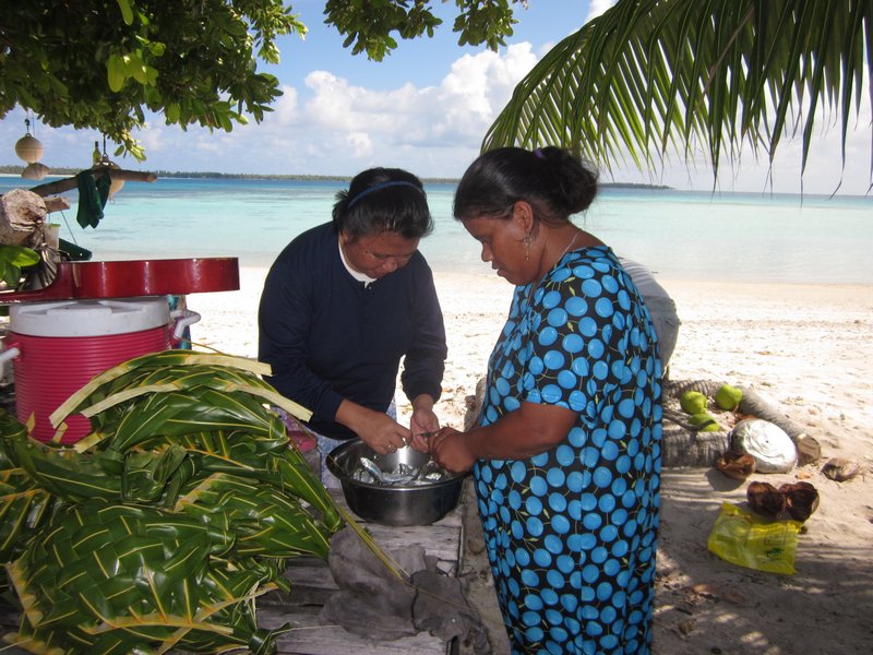
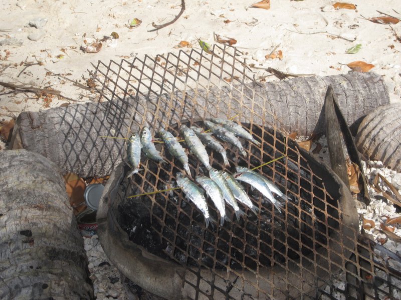
We had a great time at the "beach barbecue". Junior's wife Titi started with live fish and live chickens and a sack of rice, and fed 5 cruisers, Father Josef and the nuns, and about 10 family members, over an open fire on the beach. We had fresh coconuts to drink, and woven palm baskets to eat from. I got to watch the chicken operation from squawk to soup. But boy, are those island chickens chewy!! (The Marshallese must, conversely, think our farm-raised chicken are "soft").

Tiny Fish Being Prepared for the Grill

Tiny Fish on the Grill


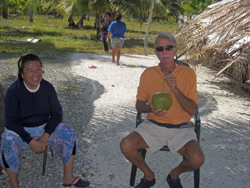
While we waited in the shade of a coconut tree for lunch to be ready, they sent a kid after drinks for the group. 2 minutes later we had fresh coconut water, complete with a straw made out of a local reed.
The Marshallese Version of a Soft Drink


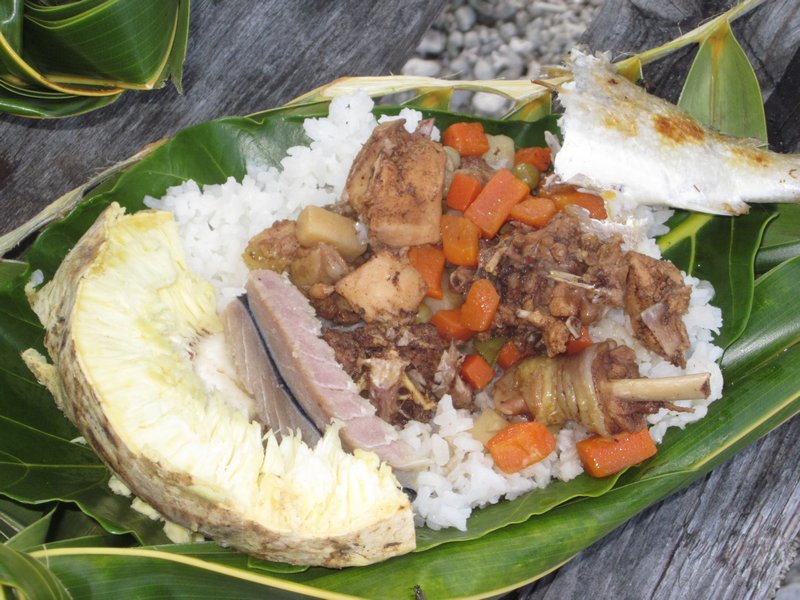
While the women were cooking the meal, the younger girls were getting the "plates" ready. In seconds they had whacked a coconut leaf and woven a plate for us, complete with coconut leaf spoon. (Though the Marshallese normally use their hands to eat, they know us visitors would prefer an implement).
Our Lunch Plate
Chicken, Breadfruit, Canned Veggies, Fish, Rice

We could have spent a month in Likiep. But Dave and I had a heart to heart about cruising plans. I REALLY wanted to go see Ailuk (another 24 hour beat to the NE). Several cruisers had said it was "the best Marshallese atoll". But Dave firmly wants to spend a good bit of time--the remaining months of the summer--diving shipwrecks and exploring old Japanese bases in the atolls of Maloelap, Mili, and Jaluit. So if we wanted to go to see Ailuk, AND see what Dave wants to see, we had to get going.

So the next day, we took what looked like a decent weather window--light SE winds--to do a short overnight to Ailuk.