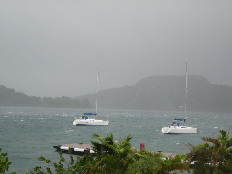
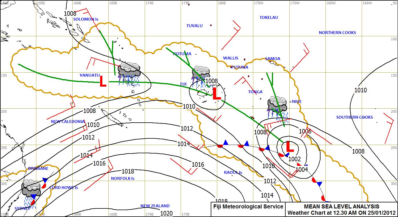
We were expecting bad weather overnight, as yet another Tropical Depression went past us. But it was supposed to peak at about 9pm and get better over time. By morning, the forecast was for less than 20 knots, and we hoped, sunny skies.
We got back from our overnight trip into town (for the Super Bowl) in the late afternoon, in the middle of a squall. Since Super Sunday (Monday here) was supposed to be nasty, we had gone ashore on Sunday evening, taken an inexpensive room in town, and watched the Super Bowl on (here) Monday afternoon.
It was a tossup whether to stay in town another night, to let the weather go by, or go back to the boat. Since the weather wasn't too bad after the Super Bowl, we decided to go ahead back to the boats.
We managed to time our arrival on the beach terribly, and ended up going back to the boats in the dinghy in a squall, but got back OK with no troubles. We were glad to be "home".
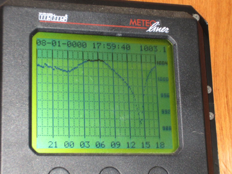
 Barometer Trace from TC Cyril
The low point on the graph was about 8am our time
As predicted, it was a little wild in the evening, but a reasonably quiet night. However, about 6am, we were woken up by a nasty squall. And I noticed the wind was out of the north. "It shouldn't be north--north means we have something else coming," I said knowingly.
I started trying to pick up weather, but gave up when the 'latest' Spot forecast (taken from a GRIB file), said the wind this morning was supposed to be about 15 knots. It was gusting to about 45 then.
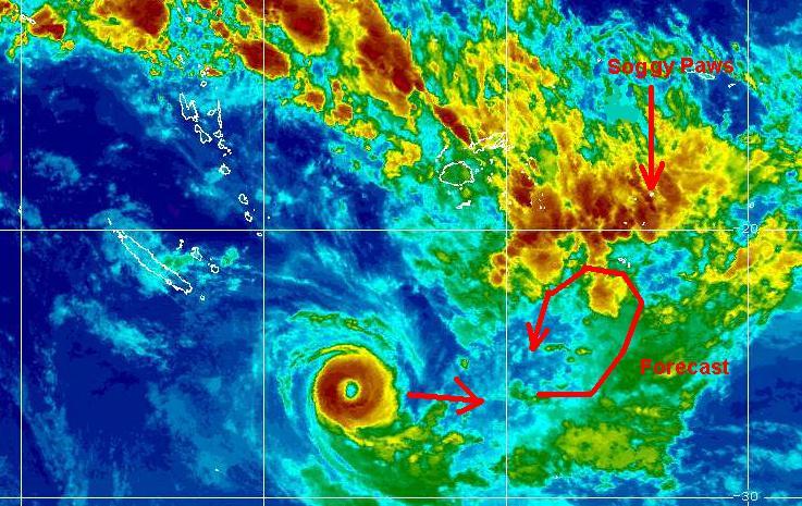
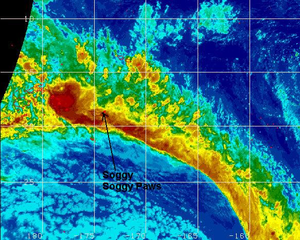
One of the local ex-pats got on the radio with a special weather bulletin. Apparently about midnight, a "bad spot" in the satellite picture strengthened up into Tropical Storm Cyril. Our "fun meter" (wind meter) quit working yesterday (in a 42 knot gust), so we don't really know what the wind got up to this morning, but two of our hatches blew open, and the last time it did that, the wind was 60 knots.
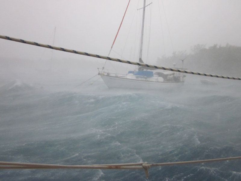
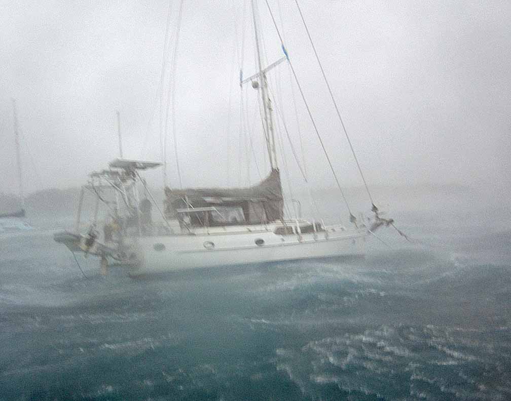
 Soggy Paws in the Storm (taken by Sea Flyer)
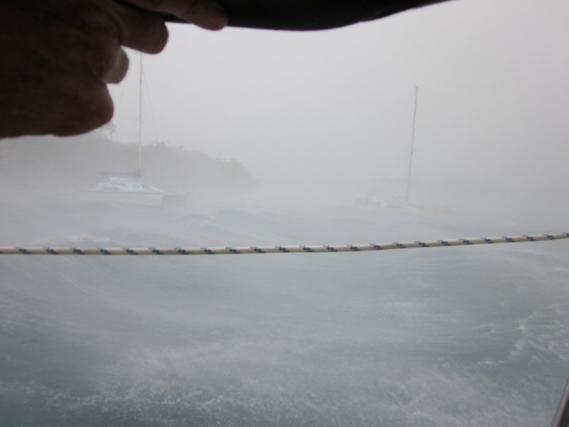
And, the really fun part was... we were on a lee shore with quite a fetch. At the height of the storm we had 5' waves, and were taking sheets of water over the bow. Fortunately we were well secured to a "hurricane mooring". Unfortunately, the mooring started dragging in the middle of the worst part of it.
And our dinghy, which we'd pulled up in the squall last night, was on the davits and starting to tip over. Dave was back trying to do something with the dinghy when I noticed we were getting really close to the boat behind us. I suggested we forget the damned dinghy and start the engine. Too late... we ended up with our stern caught on the other boat's mooring and bow pulpit. We couldn't seem to pull loose manually, and couldn't run the engine for fear of wrapping our prop. Dave finally went in the water to see the situation, and their mooring line was between our skeg and our rudder. No way it was coming out under those conditions.
The other boat (Sea Flyer) had 2 lines to the mooring, and only one was caught in our rudder. Dave was trying to get Gary to cut his mooring line so we could get free, and Gary was up there trying, but the situation was so violent that Gary couldn't get in close enough with a knife without losing his arm.
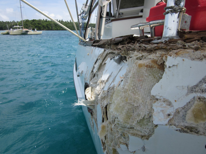
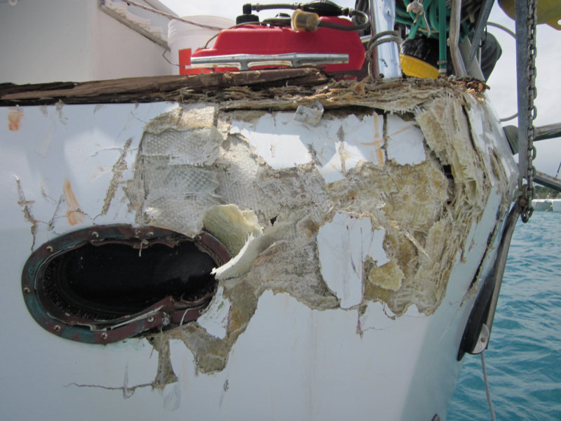
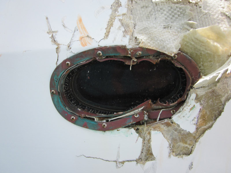
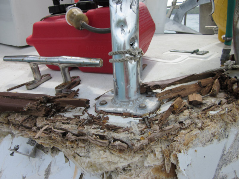
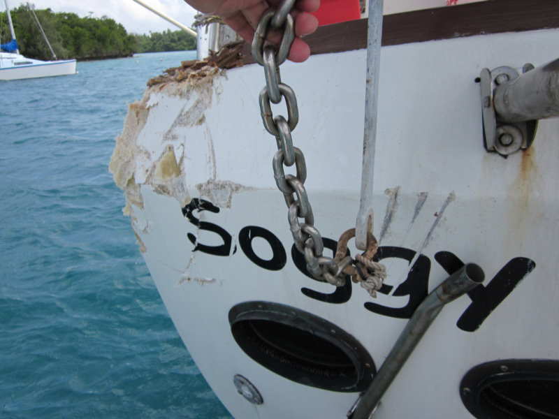
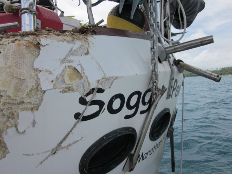
Fortunately for us, the 1 1/2" mooring line finally parted. But not until we spent 10 minutes with our port quarter caught on his bow. Slamming and slamming... tearing up his bow pulpit and anchor rollers, and tearing up our fiberglass, port quarter porthole, swim platform, wind vane, etc. We had about 5 foot seas at that point, and we were broadside to the wind, about 50 feet from a really rocky shore. I really thought we were done for.
Once Sea Flyer's mooring line broke, we floated forward just enough that I could motor out of there. Fortunately Sea Flyer's secondary line held them for the rest of the storm. Dave was still in the water, and couldn't get back aboard, because our boarding ladder is the swim platform, and it was gone. So he climbed up on Sea Flyer. I spent the next 2 hours by myself on Soggy Paws, motoring to relieve the strain on our mooring, and try to keep out of Sea Flyer's mooring and away from their boat.
The wind just wanted to line us up right up on Sea Flyer, so I had to keep "tacking" back and forth, still tied to the mooring. I couldn't just motor into the wind--eventually the wind would gust from another direction, push the bow around, and I'd have to gun the motor to get past Sea Flyer's mooring again on the other tack. Dave couldn't get back aboard under the conditions, and I couldn't do anything, but keep trying to keep us off Sea Flyer.
As we came free from Sea Flyer, our dinghy, which was attached to our davits, stayed with Sea Flyer. I think Dave eventually cut it loose, because it was beating Sea Flyer to death. It ended up on the rocks, but fortunately 'only' has one chamber (of 3 punctured). Our motor is completely toast. It got beat to death--we still had the motor mount attached to the dinghy, but the head was broken off.
In looking at the port quarter after it was all over--thank god we have a CSY. We took a severe beating--it totally stove in the heavy bronze porthole, and the fiberglass is beat to hell. But the boat is still mostly intact. It will be an extensive repair, but we are floating. And no one got hurt.
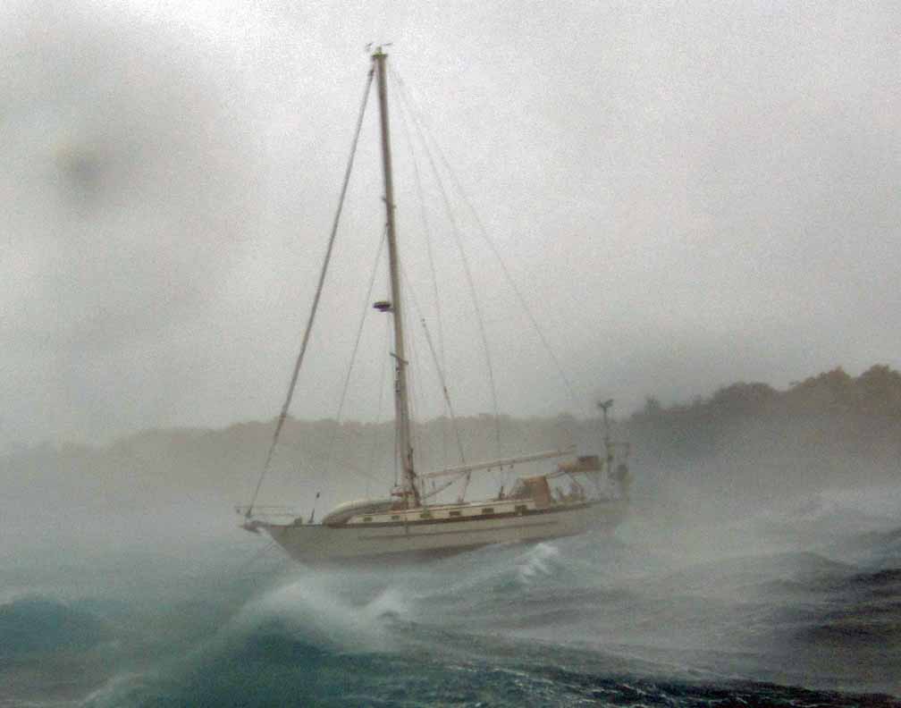
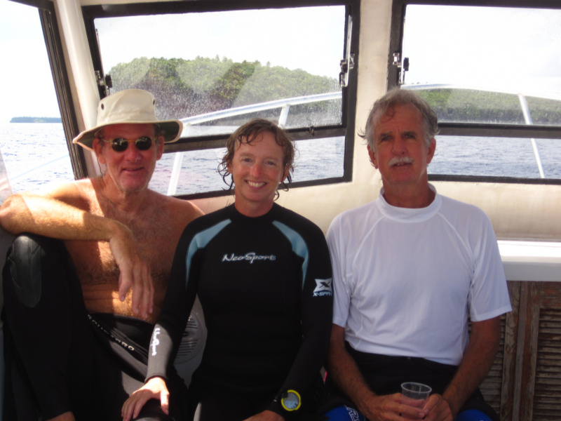
 Our Friends on Shango (taken by Sea Flyer)
Fortunately, this thing was really fast moving, and by about 10am, it had calmed to about 20 knots. I was still motoring--couldn't leave the helm for more than about 30 seconds--and Dave was still stuck on Sea Flyer. Fortunately, the only neighboring boat with a dinghy that they could deploy, offered to go get Dave and bring him home. Shortly thereafter, we got a line on another mooring, where we are now.
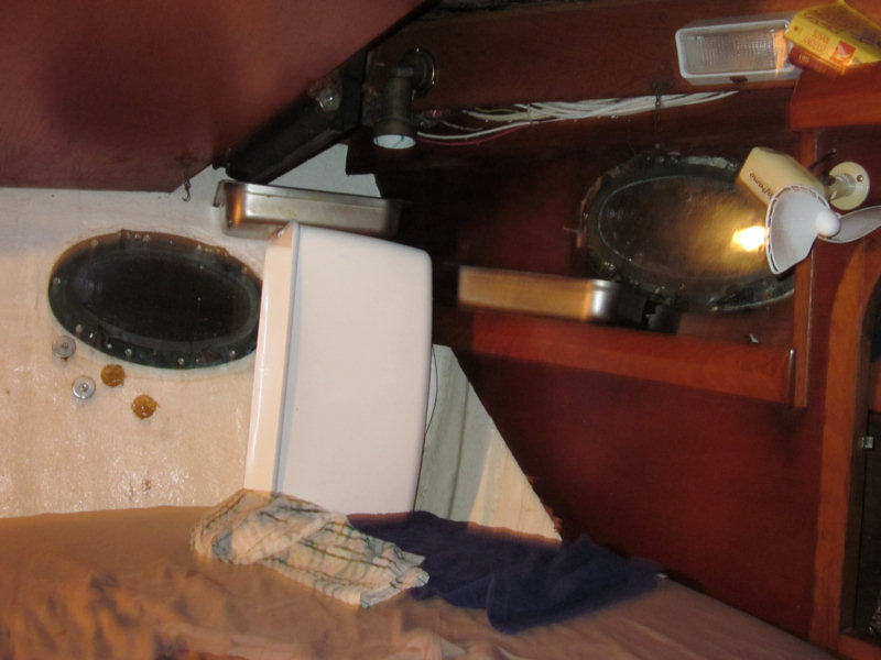
We are safe, we have at least a day before the next high wind event is due. Trying to dry our bed out so we can have a good night's sleep, and attack the problems fresh tomorrow.
One forecast says the wind will be light tomorrow. Another one says "fresh breezes to 25 knots". Not sure who to believe.
I want some calm wind and sunshine!!
 Dave's article on South Pacific Crossing Strategies just got published in the February edition of Latitude 38. Latitude 38 is a west coast sailing magazine similar to Southwinds in the SE.