Saturday, June 5, 2010

Diving the Yellow Dog Canyon

Current Location: Anse Amyot, Toau Atoll, Tuamotus, French Polynesia 15-48.21S / 146-09.14W

The diving in general at Anse Amyot is spectacular. Unlike the other anchorages we have been in in the Tuamotus, we are only a couple of hundred yards from the lee side of the atoll. Here, the coral reef goes from 10' deep, to 30' deep, and then plunges to untold depths.

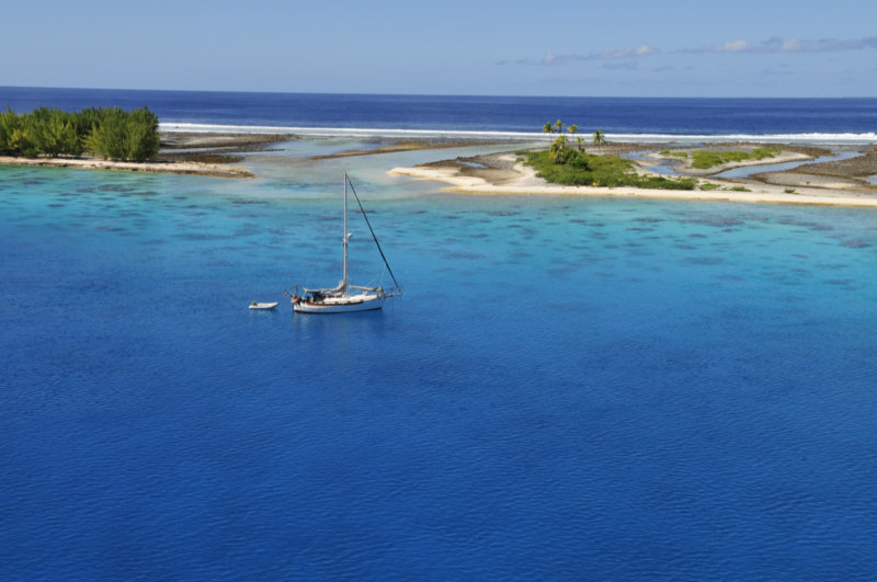
Gaston and Valentine, the Tuamotuan family that lives here, not only has put big boat moorings in their small cul-de-sac, but also put dinghy moorings out on the wall, to facilitate diving. There is one bouy just outside the anchorage, and another down the wall a little ways.

The best dive, according to Gaston, is called Yellow Dog. It is 1500 meters east of the channel entrance. Gaston has marked the spot with a bouy, so divers can hook their dinghy to the bouy and easily dive the spot. The feature of this spot is not just the 100+ foot visibility, nor the near-vertical wall, but a big canyon.

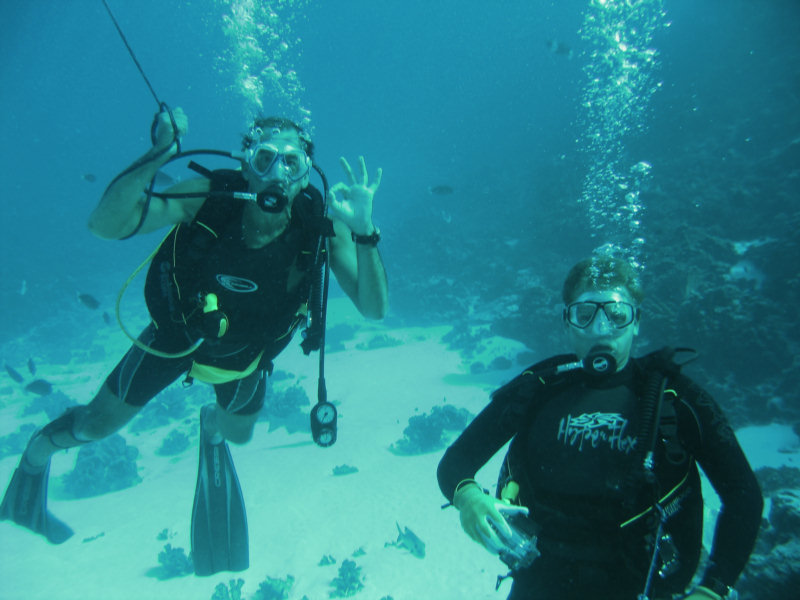
The wall plunges from 30 feet to nearly bottomless in a short space. The bottomless depths are deep dark blue, and as you drift down into the canyon, it almost feels like you are diving into deep space. It is a really weird feeling. Johanna, from Visions says she felt she was going to be sucked down into the hole. But there is no current, nothing but crystal clear 82-degree water, live coral, and thousands of fish. And of course, the spectactular vista.

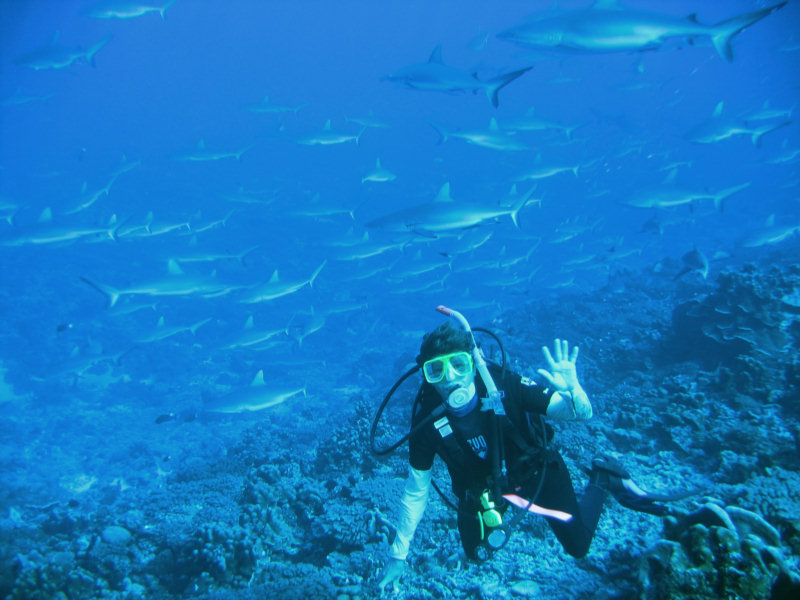
As a group, we drifted down to close to 100' deep, and then looked up. The water is so clear, it does feel like you are in a canyon on land. Dave got a couple of great pics of me down in the canyon.

The canyon does go deeper... I ventured to 130' (that's pretty deep for casual sport diving) before Dave motioned me back up.

We have since dived on that spot 2 more times, and will likely go back a couple of more to show our friends the spot.

But the whole rest of the wall is pretty fantastic too. We have started a series of slow drift dives down the wall from the Yellow Dog, doing about 400-500 yards a dive. I tow the dinghy, and Dave takes the camera. There is about a quarter knot of current with us, and only 10 knots of wind in the lee of the island, so it is a really easy, gentle drift. We bounce up and down between 80 deep along the wall, to 30' deep on top of the wall, following the contours and the fish.
-----
At 6/3/2010 7:13 PM (utc) our position was 15°48.21'S 146°09.14'W

----------
radio email processed by SailMail
for information see: http://www.sailmail.com

Friday, June 4, 2010

Dancing with Manta Rays in Toau

Current Location: Anse Amyot, Toau Atoll, Tuamotus, French Polynesia 15-48.21S / 146-09.14W

We have been at Toau's Anse Amyot for almost a week now, and I haven't blogged anything about this wonderful place. (Too busy having fun.)

We had planned to only stay a couple of days here, and leave for the next atoll, Apataki, when Visions left for Papeete. But we have finally found paradise. Dave says we may never leave!

On our first full day here, our host Gaston took all of us in his small outboard-powered boat inside the lagoon to 'a secret place' where the Manta Rays feed. It took him only a couple of minutes to locate the Manta Rays--flashing alternately white and black underwater. He anchored and urged us to jump in.

7 of us donned snorkel gear and went to swim with the Mantas. These rays are normally pelagic fish, and a HUGE. A typical manta has a 10 foot 'wingspan'. We found a total of 10 rays feeding on plankton. Even Gaston was impressed to see so many in one place. These mantas were doing graceful back loops, essentially staying in one general location, and scooping the numerous plankton into their giant mouths.

We had 2 underwater cameras in the group. Dave got a bunch of good still pictures, which we will eventually post here, and Gram, from Visions, took some nice video. You can probably see these videos by now on their photo site, linked from their blog at vofj.blogspot.com. It was amazing swimming among these giant rays. Our presence didn't seem to bother them at all, and we were literally swimming among them for 45 minutes.

We marked the spot on my handheld GPS, so we could go back again by dinghy if we wanted to. But Gaston seems more than willing to take small groups out there.

Later in the afternoon, we made a SCUBA dive with the crew from Visions on the spot that Gaston and Valentine call 'Yellow Dog'.
-----
At 6/3/2010 6:45 PM (utc) our position was 15°48.21'S 146°09.14'W

----------
radio email processed by SailMail
for information see: http://www.sailmail.com

Friday, May 28, 2010

At Anse Amyot, Toau

We sailed yesterday from Fakarava to Toau. We are on a nice mooring at Anse Amyot for a few days. Anse Amyot is a 'false pass' (or more aptly, a dinghy pass). An enterprising couple has put moorings out and invites cruisers in for dinner (more on the facilities here in a later post). We have heard the moorings are free for 3 nights if you have dinner there.

We are still following in Visions of Johanna's wake, and this was their selection as the final stop before the leave for Tahiti in a couple of days. They wanted a place that was easy to leave from, so they could time their departure for a convenient arrival time in Tahiti.

There is actually a pass that takes you inside the Toau lagoon. We hope to get back there later to check it out.

Our sail yesterday was relatively easy. We did an early exit from Fakarava on the last of the outgoing tide... with the current still running at 3-3.5 knots out. There was quite a chop in the middle of the pass, but we edged over to the east side, and it was no big deal, since the wind and the current were going the same direction. The wind blew all night in the 15-20kt range from ESE (right down the 25 mile length of Fakarava), so the 'chop' inside the lagoon was getting pretty big...2-3 feet when we left, and we had a fast beam reach for the 6 miles from the town anchorage to the pass. The pass would have been really nasty on an incoming current, with the current directly opposing the strong wind.

We set our route to sail right by the main pass at Toau, to get a look at it. The current was still running out, 2-3 hours after it should have turned to run in. We think this is the classic wind/wave effect, where the wind is blowing strong, pushing water into the lagoon over the low reef to the south. We thought we were passing far enough out that we wouldn't have been affected by the current, but we did get into some dicey waves, with the current still blasting out against the ESE wind and waves. We took one good square wave across the deck before we managed to get out of there... and we were almost a mile off the pass!

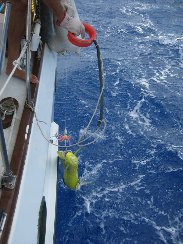
After that we had a really nice downwind sail along the coast of Toau. By the time we got halfway up the coast, Toau was sheltering us from the big southerly swell, which really smoothed the ride out. We gybed once to get around the corner, and on converging with the coast again near Anse Amyot, caught a nice big Mahi Mahi.

Fish for Dinner Tonight!


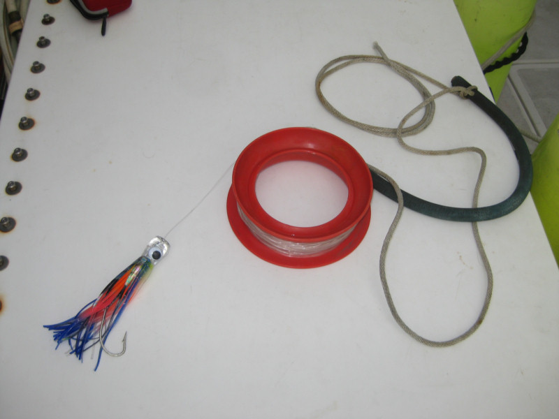
Our Open Ocean Trolling Rig


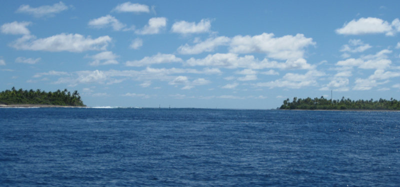
The entry into Anse Amyot is in the lee of the atoll. So even though the wind was blowing in the 20 knot range, it was an easy entry. It is pretty well marked, and the reefs are easily visible. The one thing we didn't expect was the 2-3 knot outgoing current. We understand that anytime the wind is blowing hard from the SE, there is an outgoing current here. This made picking up a mooring a little challenging, but fortunately, we had help from Visions in their dinghy. Fortunately there were 2 free moorings available when we arrived. (Our friends on s/v Puerto Seguro had answered our call on Ch 16 and confirmed there were moorings available, while we were still enroute.)

More on Anse Amyot itself later...
-----
At 5/27/2010 4:03 PM (utc) our position was 15°48.14'S 146°09.09'W

Fakarava Diving

I can sum it up in one word... WOW!!


Sherry & the Sharks

We did 4 dives at the South Pass in Fakarava, and each dive got better. 3 of the dives were on the low tide slack and one was on the high tide slack. Best clarity was on the high tide slack... go at the end of the flood, when all the clean ocean water has been washing in for the past 6 hours. You just need to be careful not to mistime it, and end up being carried out on a strong ebbing tide.


Dave Gets a Close-Up

Basically we estimate the time of slack, get to the pass a little early, where you can actually see the conditions, and wait until it looks about right. Once the current slows, we get the rest of our gear ready, wetsuits on, etc, and take the dinghy into the pass, a little up-current from where we want to be. Then, without anchoring, we jump in the water, go down quickly, and then do the dive, drifting with the current and towing the dinghy behind us on a 100' leash. With the light winds we've had, towing the dinghy is not hard at all. It drifts at about the same pace we do, 75 feet below it.


Bill and Gram from s/v Visions of Johanna

The waypoint we used as our dive spot was 16-31.086S 145-27.679W. If the sea is calm you can start a little further out, but on a day with any offshore wave action, be careful going much further out. This spot is over a big sand trench that is easily visible from the surface. From here, once on the bottom, you head for the NE side of the pass (the one with buildings). The sharks are most numerous about 10 minutes into the dive (at a slow drift in). We heard that other side of the pass is good too, but the NE side was so good, we never got to the SW side.

On the best dive we had, the visibility was over 100', that's double or triple the visiblity on a typical 'good vis' Florida dive!

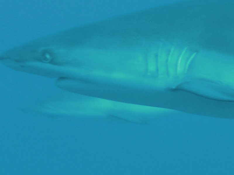
The big attraction of the South Pass is the sharks. There are over a hundred fairly docile sharks just hanging out in the pass. Mostly gray reef sharks, some black tips and some white tips.

Once you're tired of watching the sharks (thankfully, they just sit there mostly), there is a nice sloping wall full of coral and lots and lots of fish. And at the end of the dive, about a half mile of 15' reef. In the shallower water after the incoming current has picked up, you just fly over this part.

Because of the challenges of the drift dive and towing the dinghy, we only took our camera on the last dive. Dave got a couple of great shots of me and the sharks.


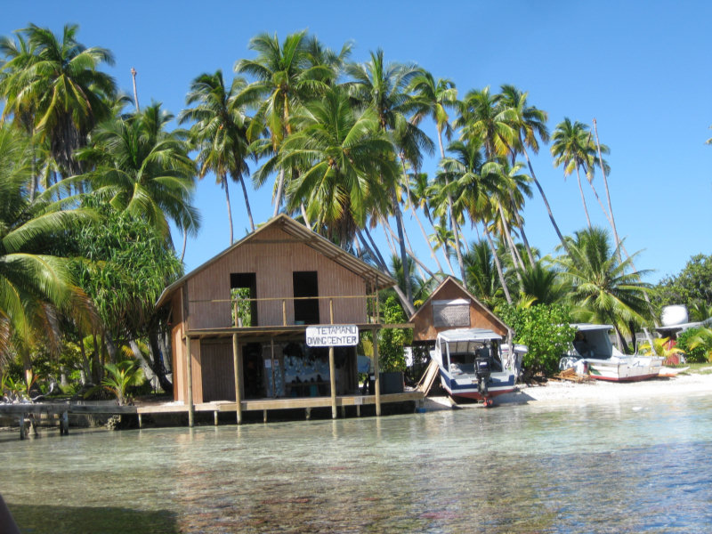
Tetamanu Dive Center

There is a dive shop in the South Pass, Tetmanu Dive Center. They declined to fill our tanks, though. Liability issues, they claimed. They did encourage us to dive with them, but we didn't see that they added much value to our approach with the dinghy. Though a first dive with them would probably be a nice way to get your feet wet.

The pass at the north end of Fakarava is much further from the anchorage, so we contracted with Te Ava Nui dive shop for a package of 3 dives. With 5 of us and 3 dives each, we managed to negotiate a package price of $50 US a dive, using our equipment and their tanks.


Headed Out to the N Pass with Te Ava Nui

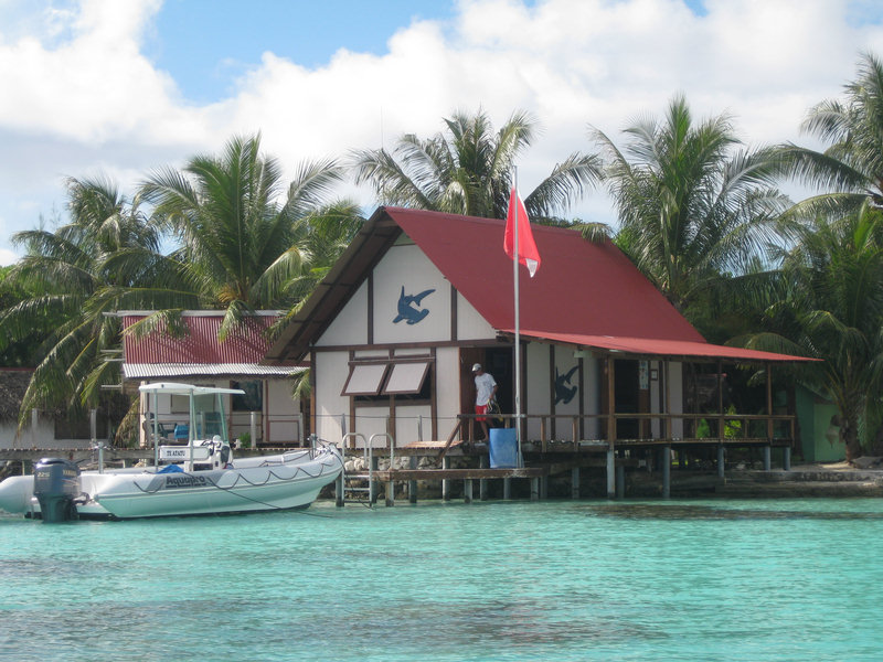
There are 2 other dive outfits at the north end. These two are almost side-by-side about 3 miles south of town. You can anchor off in this area, but then it is a long hike (hitchhike/bicycle ride) to town. Both Top Dive, associated with Sunset Beach Resort, and Serge at Fakarava Diving Center get good reviews from divers, but Diving Fakarava is a smaller outfit with a more personal touch. On scubaboard.com they got rave reviews, but you probably need to book them in advance to make sure you get the dives you want in a limited time.


Fakarava Diving Center is Easily Recognizable by the Big Dive Flag

Te Ava Nui is the biggest outfit, so they always have dives going someplace. Typically they want to you do the outside-the-pass dive with them first, so they can assess your ability and comfort in the water. Their actual pass dive is quite challenging. They do not time the dive for slack current, so you are often diving in fairly strong current. And the first stop of the dive is at 100', which is pretty deep for a novice diver. They basically take you to the bottom quickly, and anchor you there--holding on for dear life to the dead coral--to watch the sharks and other pelagic fish. After 10 minutes of flapping in the current, the divemast signals, and the group lets go and drifts a fast drift over the bottom, up to about 70'. Toward the end of the dive, there is a depression in the bottom, and they take you down into this area to get out of the current and give you some time to look around.

All 3 north Fakarava dive shops also make trips to the south pass. Typically this is done as a 2-dive all-day trip, for about 2.5 times the normal cost of a 1-dive north pass dive.

Our preference overall was the South Pass, hands down. The ability to wait for slack current and drift more slowly was a big one. So if you only have time for one or two dives, our recommendation is the South Pass.


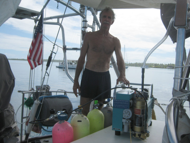
Dave Refilling Tanks on the Back of Soggy Paws

-----
At 5/27/2010 4:03 PM (utc) our position was 15°48.14'S 146°09.09'W

Thursday, May 20, 2010

Entering Fakarava at the South Pass


The South Pass at Fakarava, from Outside, on a Calm Day

Our plotted course from Tahanea to Fakarava hugged the atolls as much as possible, trying to take advantage of the protection from the ever-present swell. (Light wind + large swell = hell). This course took us close along the coast of Faaite, another small atoll. We had about 5 miles of 'open ocean' between the west end of Tahanea and the east end of Faaite, which we crossed easily just at sunset. The wind was still OK, and we let the genoa out full, and we didn't roll very much.

When we got to Faaite, we stayed close (a little scary in the dark, but we were trusting our accurate charts, and checked occasionally our distance off with radar). We had just enough sail out to make 2.5-3kts. The plan was to lurk along the N coast of Faaite until we could bear off NW to Fakarava (11 miles away) and just make the slack current at daybreak at 6am. We were sailing in company with John and Linda on Nakia (svnakia.blogspot.com). (Pronounced Na-KEE-ah)

We met up with them in Tahanea and have enjoyed their company. We tracked their trip from Marquesas to Hawaii last fall, and their sail back to the Marquesas this spring, via the Pacsea Net. So we were glad to finally meet them in person, and have been able to talk extensively about their experiences wintering in Hawaii last year.

On my watch, it a pleasant sail and I enjoyed playing with the sails to try to match speed with Nakia. And keep from running into them--since we each only had a single light showing, it was sometimes hard to see when we were getting close together!!

Just at the time I turned it over to Dave, the wind died completely. We still had 15 miles to go and 7 hours til daylight and slack tide. And we were still in the lee of Faaite. So Dave rolled in the Genoa and lashed the wheel on centerline, and we just drifted west at about half a knot under the triple-reefed main. (The sailors are asking... "Why do you have a triple-reefed main in 10 knots of wind?" Our power sail is the genoa, and it's much easier to handle when sailing off the wind, and to change sail area. We knew we would be stalling, so we just left the triple reef in the main when we raised it.

At 3am when Dave turned the watch over to me, I turned on the engine and headed straight for our waypoint outside the pass, timing our arrival for 5:45am. The wave action wasn't as bad as we'd feared, considering that the big blow we had a couple of days ago was still blowing further south. It had turned into a long swell. We rolled a little, but not bad.

On arrival at our waypoint, it was just starting to get light enough to see. We circled once and wait for the sun to actually come up, and then went in close to have a look at the pass. Dave opted to circle again to give us better light for actually entering the pass. It was a little scary looking from outside, because the big swell was crashing on the beach on both sides. Dave could see enough to tell that it was NOT crashing in the middle. At about 6am we finally got the courage to enter the pass--we thought it was on the last of the incoming tide. Once we got fully IN the pass, we could tell the tide had turned and we had a little current against us (which turned into 2.5 against us by the time we got to the narrowest portion of the pass).

The trickiest part of the whole entry was trying to figure out where to go inside the pass. There is a range that you use to stay lined up while coming in. The range, when you get close, turned into red channel marks, which you put on your port side, and there are 2 green sticks ahead, which you put on your starboard side (passing between the range and the green marks). The pass splits then after the green marks. We had tracks from another boat that went left, but we knew that Visions was anchored to the right, so we went right.


s/v Nakia in South Fakarava

Photos by Bill Strassberg s/v Visions of Johanna, from the Rigging


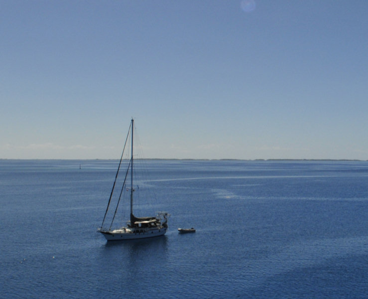
Soggy Paws at South Fakarava

Though it is a lovely area, the north side anchorage turns out to be a pretty crummy anchorage. It is very very corally. When we circled around a couple of boats anchored in 25-35' ahead of Visions, we could see the bottom profile on our fishfinder was very erratic--lots of high-profile coral. Out further, in 50', there was less profile, and we could see small patches of sand. So we finally dropped anchor in 50', and did NOT set the anchor. I went down later with the tail end of one of our used SCUBA tanks to survey the situation, and was able to pull the anchor into a sand spot, and unwrap the chain from the worst of the coral. (old dead coral) Dave buoyed the last 100' of chain by putting a pair of buoys about 50' from the bow. It's not perfect, but it will hold if we need it to. We may have to dive to free the anchor, though, when we try to leave.

We're keeping a close eye on the weather, but for now, the forecast is for less than 10 knots for the next 4 days. (Of course, this was also the forecast just before the big blow we had a week ago).

We managed a drift dive in the south pass on the mid-day slack. (more on diving in another blog post).
-----
At 5/19/2010 7:36 PM (utc) our position was 16°30.28'S 145°27.36'W

Leaving Tahanea

The distance between Fakarava and Tahanea is only 50 miles--normally an easy 8-10 hour daysail. However, when complicated by the fact of needing to wait for slack current in the passes--every 6 hours or so--and the fact that there is only barely 12 hours of daylight here, it's nearly impossible to do as a daytrip. Visions was able to make it as a daytrip, but they easily make 8 knots.

We opted to make our hop as an easy overnight. We picked a great weather window--the weather was fine and the wind started out about 12 knots from the SE and was forecast to die off from SSW during the night. Using Gram from Vision's 'current predictor' spreadsheet (which takes an available tide point, makes an adjustment for an estimate wind/wave factor, and also some minor adjustments based on personal observations at that pass, we had an easy out of Tahanea.

We sailed off our anchor from our favorite anchorage at Tahanea (Taha5) about mid morning, and used Vision's waypoints to go direct across the lagoon to the middle pass. We could easily see the coral patch reefs that Visions had mentioned to us, and also noted dozen more on our chart. Because 'Janet', our autopilot, was in a cranky mood, we wandered quite far from the intended route at times, and so got to explore more of the lagoon. The water in the middle of the lagoon is quite deep--100-125 feet. The coral comes up to within a foot or two of the surface. Each patch reef is more than just one coral head, but really a small patch reef--usually something like 20' wide and 100' long, with light brown/yellow coral. In decent light, they stand out from half a mile away. If there was any significant chop in the lagoon, there would probably be disturbed water over the heads to make them visible, too.

We had a beautiful sail across the lagoon. Sunny skies with 12 knots on the beam, and we weren't in a hurry!! We circled inside the pass once to take a close look at conditions in the pass, then headed out, still under sail. We did turn on the engine as we entered the pass, just in case, but it was not necessary. There was a little chop on the west side of the pass, but the east side, still in 50' of water, was smooth. As we got outside, we were greeted by a large pod of dolphin. They raced to meet us, jumping out of the water ensemble in their haste (sorry, we didn't get the camera on deck in time to catch this beautiful sight).

The current was still in full ebb and pushing water out the passes close to a mile offshore. But with a SE wind, the north side of Tahanea was calm, and we had a very nice sail close in along the coast in calm water.

Next stop, Fakarava, 50 miles away.
-----
At 5/19/2010 7:36 PM (utc) our position was 16°30.28'S 145°27.36'W

----------
radio email processed by SailMail
for information see: http://www.sailmail.com

Wednesday, May 19, 2010

Lovely Lovely Tahanea

We have been here about a week now, and we could easily stay for a month. This is a beautiful place! And no one is here!

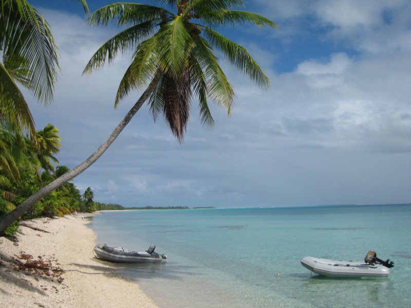
View of Our Favorite Beach


For the whole time we have been here, only our 3 cruising boats have been here. There was another boat (a large private yacht) who came in and anchored right by the pass for 2-3 nights during the stormy weather, but as soon as the weather cleared, they left. And they never went anywhere else but that one anchorage by the pass.

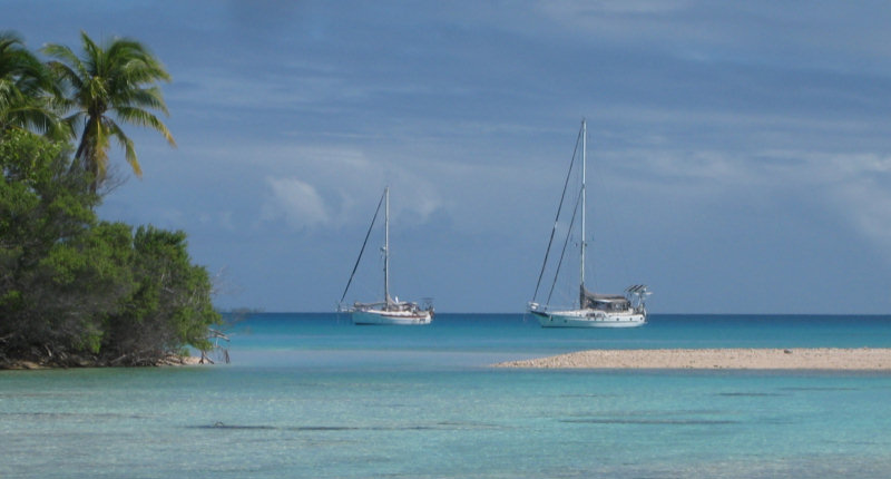
The Boats at Anchor


We have anchored in about 6 places and traversed twice the NE and E sectors of the atoll (see below for waypoints). The anchorage that we found as a refuge from the strong SE winds (Taha5, in the SE corner of the atoll) has been the best so far. It is 9 miles SE of the main pass.

Exploring in the Dinghy


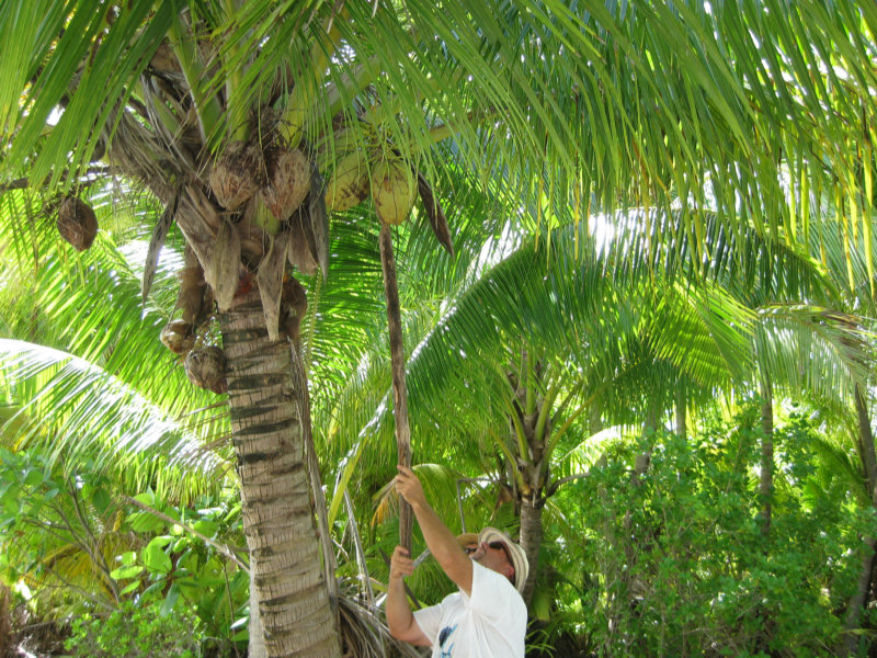
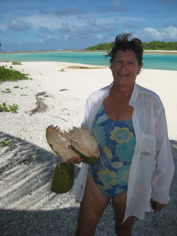
We have a nice anchorage in 15' of water in good sand, with protection from ENE to SSW. There is a nice palm-studded motu protecting us from the wind and chop. We have been shelling and opening coconuts on the beach. And we actually walked around the whole island, and explored the shallow windward lagoon between the motu and the reef (where we could go lobster-walking at night, if we wanted to).

Coconut Gathering


We did drift dives in the passes, and had planned to do a couple of more before the bad weather set in. There are 3 passes side-by-side in Tahanea, so a lot of varied terrain to explore. On the outside of the pass, we saw sharks, dolphins, and big pelagic fish. In the pass... tons and tons of live coral of every variety and all the pretty reef fish you can imagine... We have yet to take a camera on a drift dive yet... still getting used to the procedure.

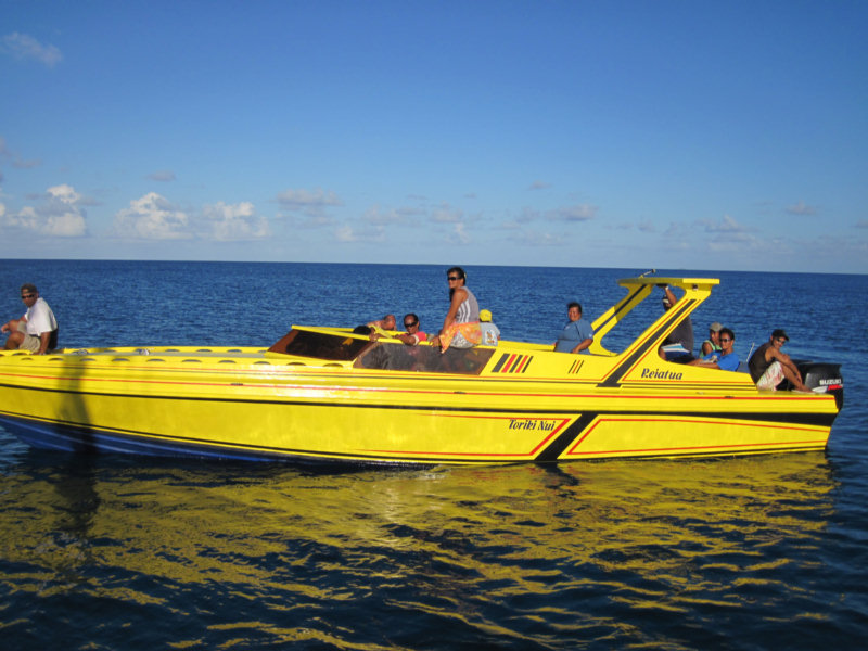
There is no one living here on this atoll. It has been turned into a park, so there are no permanent habitations and no pearl farms. We saw a 'park ranger' come by via speedboat from a neighboring atoll when we first got here.

Does This Look Like A Park Ranger To You?


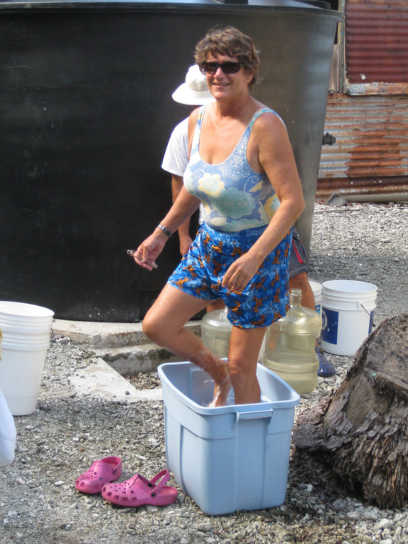
He welcomed us to use the water in the cistern next to the block building at the east pass, which is normally unoccupied. We took our laundry ashore and did it right there at the cistern.

Sherry Doing Laundry


He said he visits Tahanea about once a month to check on things. He and a few friends stayed overnight and left the next morning. The only formalities, when he was here, was to look at our passports to make sure we had cleared in to French Polynesia somewhere else.

John on s/v Nakia has an intriguing Google Earth photo of the lagoon, and the 3/4 of the lagoon we have NOT explored looks very inviting. With a few days of settled weather, we could explore the whole atoll inside the rim, and try to find a location that has perfect protection from the occasional weather systems. We were especially looking at a spot at 16-57N and 144-44.6W, where a spit of coral comes way off the surrounding rim into the lagoon. If an anchorage could be found on both sides of that spit, by moving once, you could get almost complete 360 degree protection.

But alas... there are other atolls to explore, and we promised Visions that we'd hook up with them at Fakarava as soon as the weather moderated. They took off 2 days ago and made it there on a day trip. But the distance is such that we can't easily make it daylight and in the 12 hours imposed by the requirement to enter and leave lagoons at slack current. So we are looking for an overnight window, and are a little more particular about our weather window than they were. We have opted to hang out and let the SE winds drop a little. It looks like today is a good window. But Dave is already talking about coming back, after Visions has blasted West for Tahiti in 10 days. The South Pass at Fakarava is supposed to be some of the best drift diving in all of French Polynesia.

Here are our Tahanea waypoints, for our cruising friends following in our wake.

Anchorages:
TAHA1 S16°51.7245' W144°39.8052' Near E Pass, Moderate depth, some coral
TAHA2 S16°54.8479' W144°34.4900' E side of atoll, nice snorkeling
TAHA3 S16°50.6107' W144°41.8510' Lots coral, some NW protection
TAHA4 S16°51.0551' W144°41.5240' 25-30' LOTS OF CORAL, GOOD SNORKELING, near main pass
TAHA5 S16°57.2234' W144°34.8063' 14' SAND, FEW CORAL HEADS, GOOD PROT ENE TO SSW

Day snorkel spots
TAHA6 S16°52.1230' W144°37.8250' DAY ANCHORAGE. GOOD SNORKELING, ANCHOR 25' SOME HEADS
T16 S16°54.4110' W144°34.4916' NICE HEADS
T17 S16°52.5911' W144°36.0481' SNORKELING

Going in the Pass
TAHAAPPR S16°50.1375' W144°39.2266'
TAHAPASS S16°50.9968' W144°41.0125'
TAHA IN S16°51.5110' W144°41.1084'

Route from Taha5 back to Middle Pass
TH RT#1 S16°56.6190' W144°35.5768' There ARE isolated heads on this route, but easily
TH RT#2 S16°56.1030' W144°36.4693' spied with a good deck watch
TH RT#3 S16°54.4900' W144°38.0397' Depths 75-100 feet, with heads at 2'
TH RT#4 S16°53.5460' W144°38.7766'
TH RT#5 S16°51.8160' W144°41.0232'

Easiest navigation between anchorages is close around the rim. Stay in ~60. Only dicey spot is at Taha6. Easily seen and avoided from the deck on a reasonable day, but we recommend a stop to snorkel. This was the best snorkeling IN the lagoon. There is a pinnacle that comes up from about 40' with tons of pretty fish and sea life at about 5' deep, easy dinghy (or moderate swim) distance from Taha6.
-----
At 5/17/2010 5:56 PM (utc) our position was 16°57.20'S 144°34.80'W

Sunday, May 16, 2010

Clear Weather and Calm Seas

We are happy to report that after crossing the lagoon in a horrific thunderstorm to find protection from the SE, things finally started to clear. Last night was very gentle, and we are anchored off a nice little palm/sand island, and we've actually found an anchorage clear of coral heads (at least for the swinging radius) in 15' of water.
-----
At 5/15/2010 4:45 PM (utc) our position was 16°57.22'S 144°34.82'W

----------
radio email processed by SailMail
for information see: http://www.sailmail.com

Saturday, May 15, 2010

Anchoring in Coral

We are at the atoll of Tahanea, in the Tuamotus of French Polynesia. Around here, your anchoring conditions are

(1) Solid coral bottom
(2) Sand with a lot of coral heads
(3) Sand with a few coral heads (rare)

Due to being chased around by weather, we are currently anchoring in sand with a lot of coral heads. The water depth is usually 35-50 feet, and the coral heads are 4-5' off the bottom, and scattered on the bottom at about every 6-10 feet or so, with sand in between. This is a perfect setup to badly wrap your chain, damaging the coral and endangering your boat. If your chain gets wrapped close to the boat, you no longer have the 'catenary' of chain that provides a shock absorber when the wind blows or the waves get big. You can snap the chain or break bow rollers and windlasses in this situation.

On the advice of another cruiser (also fairly new to cruising this area), we bouyed our chain in 2 places to make it hang in the water above the coral heads. This turned out to be a pretty neat arrangement. Using readily available 'pearl farm' bouys, which can be found on any windward beach, we tied 2 together with a short line, and tied that line thru the anchor chain, to make one 'bouy'. The amount of flotation required depends on how heavy your chain is and how far apart you place the bouys. We found that 2 pearl farm bouys is just perfect to suspend 25-50' of our 3/8 HT chain.

Our friend recommended one bouy 1.5x the water depth from the anchor, and another 2.5x the water depth, with enough floatation to hold your chain up. You first put all your normal scope out and get the anchor set well, then pull up carefully to add the bouys in the right place.

After deploying ours as recommended (using a total of 4 pearl bouys in 2 sets of 2 bouys), I snorkeled to check the anchor and the chain. It looked pretty slick. The anchor was well set, the chain was hanging eerily over the coral heads and we were ready for the expected windshift, no problem.

Well, the middle of the night brought almost a 180 degree shift, and 25-30 knot winds in gusts. The fetch across the 10 miles of coral lagoon caused 4-5 foot waves in the anchorage, and our bow was pitching heavily, with a few waves breaking over the bow. Dave actually sent me below in the middle of our anchor drill, to batten all the hatches as if we were at sea!.

For the first time in a long time, we actually dragged anchor. Over a period of several hours and several squalls, we first held OK, then came loose from one coral head and held at another position, but then in a particularly bad squall (when a neighboring boat also dragged), we dragged our big 88-lb Delta about a hundred feet through the coral heads before it finally re-set itself.

We ended up in 10' of water (after having initially anchored in 35 feet), on a lee shore in a blow, with an isolated coral head within about 2 feet of our keel (unbeknownst to us at the time), and the reef right behind us around 100'. It was rainy and dark as hell, so we couldn't actually see the reef behind us, but we knew it was there, and our chart plotter told us we were 'on the coral' already, so we knew it was very close.

Fortunately, with the shallower water, our 'scope' ended up about 10:1, our anchor had found a good pocket of sand, and we held finally pretty well. We were damned lucky. We spent the last 4 hours of darkness with the engine on (in neutral, but ready to go) and one of us at the helm, watching the GPS and ready at the throttle if we needed to. We counted the minutes to 'first light' so we could safely assess the situation and decide how to extricate ourselves.

We considered, but rejected, trying to re-anchor in the night. But, not knowing how our chain might be wrapped, and the complexity of getting the snubber and the bouys aboard as we're pulling in the chain, and the 25 knot gusts that would make low-speed maneuvering almost impossible, we opted to sit tight and hope our anchor would continue to hold. Fortunately, it did.

At dawn, holey moley, there was the reef close behind us!

I jumped in the water to assess the situation, and saw the one coral head a few feet under our keel as we swung back and forth. By then the wind had eased some, and gone back East a little, giving us a little protection from the waves. We turned out not to be too badly wrapped, the bouys having done the job well. To solve the problem of bouy retrieval while pulling in the chain, I took a sharp knife out and cut the bouys free.

As to why our 'never drags' Delta did drag, Dave suspects that the bouy close to the anchor was set too close, and interfered with our Delta's holding/resetting power under extreme conditions. We probably were also not set in really deep sand.

So when we re-anchored, we opted to go with only one (set of) bouys, placed about 1.5x the water depth from the BOW (vs the anchor). This leaves about 30-40' of chain laying on the bottom, where it might wrap, but also provides the correct angle of pull for the anchor. But the last 100' of chain is neatly suspended about 10' above the tops of the coral heads. If the wind switches, we would probably wrap the first 50', but we always have more chain we can let out (and another set of bouys we can deploy, if necessary).

To facilitate bouy attachment and retrieval, Dave found a snap shackle that fits the chain, so he now has 2 bouys tied together with a 3-4' line, with the shackle tied in the middle. He can easily snap on and remove a pair of bouys in a few seconds, as the chain is coming in or going out. The shackle only has to hold a few hundred pounds of chain, in water, so it doesn't need to be super-hefty. Caribiners or something similar might be scrounged out of your spare hardware box to do the trick. We have the second set of bouys ready to attach another 50' down the chain, should we need to let out more scope.

We'll let you know how the whole thing works out in the end.
-----
At 5/14/2010 8:14 PM (utc) our position was 16°51.06'S 144°41.55'W

----------
radio email processed by SailMail
for information see: http://www.sailmail.com

Which Way is the Wind Going to Blow?

Or... we finally meet "The Beast"

Our Weather Right Now

Next time all you East Coasters are sitting waiting for a cold front to pass, thank your lucky stars for the millions of dollars that our government puts into the NOAA weather service. Between GRIB files, scatterometers, and high resolution IR satellite photos, all available at your fingertips, and NOAA Weather Radio, you have everything you need to figure out what the weather is doing..

Out here in the paradise of French Polynesia, we are struggling to get believable weather forecasts. The French forecast only gives 'today and tomorrow', in French, and it is similar to the Bahamian weather forecasts 'Wind SE to NE at 10-20 knots with higher gusts in squalls'. And 'tomorrow' is really 'this afternoon' by the time we get the forecast in the morning.

There are some products from the Hawaii NOAA Office and the Fiji Met Office. There are almost no satellite photos available, even if I had the internet to get them. And our O-Holy-GRIB files, which were uncannily accurate when we were down near Easter and Pitcairn, and have generally been pretty good, are just flat wrong right now.

The problem is, there is a very complex weather picture, and the GFS computer program that generates the GRIB files doesn't deal with it well. What's buggering up our weather here is called the South Pacific Convergence Zone, sometimes called "The Beast" by knowledgeable cruisers. A convergence zone is a quasi-stationary area of very unstable warm moist air. What happens in this area is that cold fronts from New Zealand, moving east and bringing cold unstable air, stall out on top of a Convergence Zone, and then you mix in 2 strong high pressure areas side-by-side down south, with a trough in between, and the weather picture is VERY unstable and very unclear.

We are sitting in an atoll that is about 10 miles across and about 20 miles long. It is rimmed by coral and sand motus, but seems to be very deep in the middle. As far as we know, there is no protection in the interior of the atoll, but reasonable protection along the coral rim. There is no place at this atoll (Tahanea) to get 360 degree protection, and the next atoll that *might* have better protection is over 50 miles away over open ocean.

As this weather approached us, the GRIB files were forecasting almost a 180 degree wind switch, but not very strong, with a period of light and variable weather in between. We were watching it approach pretty carefully, and thought we were on top of the situation.

Well, 2 nights ago, the forecast was for the wind to clock from ENE-N-NNW through the night. So we picked a spot accordingly. As it approached and the wind started to go NE, we snuggled up to the coral rim in a place giving us good protection from ESE - N - NNW. Well, the wind went S-SE instead, and we were completely exposed across miles of 'fetch' on a lee shore, with our backs to the coral reef.

To complicate matters, there is no good sand anchorage here. Anchorages either have sand and lots of coral heads or sand and not so many coral heads. So it totally complicates the situation when a wind switch is expected. There is just no way to keep your chain from wrapping in the heads if you swing much, eliminating your 'scope', and making re-anchoring in the middle of a blow almost impossible. This adds a whole 'nother dimension of 'fun' to the bad weather equation. (See our next blog post 'Anchoring in Coral').

Anyway, the wind switched, putting us on a lee shore, with 15 miles of 'fetch' in 20-30 kts winds. We eventually had breaking waves over the bow due to the wind-driven waves. Even though our anchor was well set, we still broke loose in the wild conditions and dragged about 100' toward shore. Fortunately we finally stopped and held for the rest of the night.

Yesterday, we re-positioned to a better spot close by, and the wind went back to a more easterly direction, in which we had better protection. We and the 2 other cruising boats here, and 3 more cruising boats scattered among atolls within a few hundred miles of us, have been anxiously gathering weather, trying to figure out where the next bad blow will come from. The GRIBS are still not showing the weather we are seeing, so we do not trust their prediction.

Because we have explored the atoll some in good weather, and laid down GPS 'tracks' we can follow back to other anchorages, we do feel we can move around if need be. We just can't figure out which way to go. The GRIBS are showing that our wind now should have been clocking around through the north, when we actually experienced very strong southerly winds. 36 hours later, they are still predicting moderate northerly winds and we've mostly had strong SE winds. Do we head for the southern rim of the atoll to protect us from SE-SW winds, or the northern rim to protect us from NE-NW?? We are still pondering that question.

We did have a few days of fun here in Tahanea, in gorgeous weather, and I will blog about them later... but for now, off to go collect some more weather (and share weather data via radio with other boats).
-----
At 5/14/2010 7:44 PM (utc) our position was 16°51.06'S 144°41.55'W