July 18th
From the north end of Taveuni, it was a short daysail up to Budd Reef. Yes, we actually sailed!! (This is a rarity moving upwind in Fiji--you wait for the light air days and motorsail.)
Budd Reef on the chart looks like an atoll reminscent of places like Bora Bora in French Polynesia--solid reef around a center set of islands. But the reality is that the reef is not as solid as it looks on the chart. We were using the Opus/Billabong set of waypoints, who's original source was Curly. Using that set of waypoints, and a Google Earth chart that wasn't perfect, and no other information, it looked like we could go in a SW corner pass, and make our way up to the village anchorage.
We ended up with 5 boats headed for Budd Reef, and it seemed like everyone took a different path in through the reef and headed for a different anchorage. Eagle's Wings and Sidewinder headed for the "school anchorage" on the north side of the main island. Us and Challenger headed for the "village anchorage" on the south side of the main island, and Chesapeake, coming late, was trying to decide which group to follow. We found that the ESE winds, which gained a little in strength after we took our sails down, was not conducive to either anchorage.
As Soggy Paws and Challenger were wandering back and forth in front of the village, scoping out the village anchorage, and preparing to anchor in a small patch of sand with not enough protection, we got a call from the Chief's son Willy, on a hand-held. He suggested that the best anchorage in the prevailing winds was neither of the ones we were collectively looking at, but on the west side of the main island. This was one we didn't have a waypoint for, and the light was getting worse due to clouds and late afternoon sun. But we agreed the village anchorage wasn't that great, so we all headed for the west side of the big island.
What we found there was enough space for about 3 boats to squeeze into the lee, and not much more. Eagle's Wings, a larger boat, opted to anchor out in 70 feet of water, and Chesapeake went back to the rolly "school anchorage". A day later, the wind went a little more south, and our tiny lee was gone. We ended up anchoring on the west side of the westernmost island, and that turned out to be a pretty good anchoring area, with enough space for all 5 boats. It was just a little far from the village.
After we got anchored, Willy came by in the village launch and picked up the crews from all boats to take them into the village for sevusevu. This was very nice, as it would have been a long wet dinghy ride.
We found a small, clean, and neat village of about 100 people. Willy assembled us on the floor in house, and collected his father the chief, to perform the sevusevu. Again, it was short and sweet, in Fijian, and with our presentation of kava and a prayer, we were accepted into the village. Willy gave us a short tour of the village and answered our questions, some of the ladies bought a few craft items, and then Willy took us all back to our boats before dark.
Village Anchorage: 16-29.96S / 179-41.29W - OK in E-NE thru W
School Anchorage: 16-29.69S / 179-41.77W - Southerly winds
West Anchorage: 16-30.09S / 179-42.12W - E-NE
Better Anchorage: 16-29.9S / 179-42.98W - SE-NE less wind and swell
Monday, July 30, 2012
Saturday, July 28, 2012
Somosomo for Shopping and then to Matei
July 17
We could see a weather window to make the jump to the Lau Group--NE winds 15 knots or less--coming up, so we decided to position ourselves in the best spot to jump off to the Lau, and do a little provisioning on the way.
We had planned an early departure--with Challenger and Chesapeake following. But Challenger was anchored and hung up on the coral. Jerry almost had to don a tank to get free, but they persisted and eventually got their chain unwrapped from the coral. Once Jerry was free, we tried to start our engine and found that the battery/starter problem was still unsolved (in spite more work on it while in Viani Bay). Fortunately, the easy solution is to haul out the Honda EU2000 generator, plug in the charger, wait 2 minutes, and the engine starts every time. So, with only a little delay, we were on our way.
Navigation is Fiji is difficult--lots of reefs, historically very inaccurate charts, and sometimes not-so-clear water. I have done a lot of work to prepare for this--making Google Earth charts, collecting waypoints, and other peoples' tracks, which I use as 'layers' on my Maxsea navigation program (NOTE: Maxsea's new offering, Time Zero, does not support layer files, I do NOT recommend this version of Maxsea). This is a lot of effort and does require some level of dedication AND computer expertise. Consequently, we seem to have picked up a following of boats willing to let us go first... :)
So Chesapeake and Challenger followed us across the Somosomo Strait, across the dateline, through the reefs, to the tiny town of Somosomo, where we had heard there was an MH Grocery Store, and some fresh veggies to be had. Sure enough, as we got close to Somosomo, we could see the MH Grocery Store sign. We edged our way in really close to the black sand beach, before the bottom shallowed up to anchorable depths. We ended up anchoring in about 25' in what felt like good holding sand, at 16-48.18S / 179-58-295W.
We opted to take 2 dinghies for 3 boats, with no motors, so we could carry our dinghies clear of the beach and up to high ground. We actually ended up carrying them into someone's yard at the south end of the beach (Dave was worried about someone molesting the dinghies while they sat unattended).
A 5 minute walk to the left of the beach, and we found the MH Grocery Store, for a quick survey trip. It was reasonably well-stocked with staples and frozen goods, plus the more durable imported fruits and vegetables (potatoes, onions, carrots, garlic, celery, apples). We had provisioned well in Savusavu, so didn't need much, but Dave did buy all the 'plain' potato chips on the shelf and and Challenger was happy to find Raisin Bran cereal. Both bought right then on the spot in case they wouldn't be there when we came back to really buy stuff later. Next, we walked 15 minutes in the other direction to find the actual 'downtown' of Somosomo, where we heard there was a fresh veggie market. By the time we got there, we were all starving, so we first took advantage of a nice little restaurant next to the BSP bank (with an ATM). We got a nice sit-down meal for $6FJ, and enjoyed talking with the ladies running the tiny road-side restaurant.
The village market actually ends up being stalls lining the road in Somosomo. We found all the normal Fijian fruits and veggies there--nice tomatoes, cucumbers, lettuce, green beans, snake beans, bok choy, papaya, bananas, root vegetables, etc. We were under-stocked with Kava (for the village acceptance ceremony called sevusevu), and so Dave arranged to buy another 5 bundles at better prices than we found in the market at Savusavu. (Later we talked with a Fijian on the beach and he told us that the Indian shopkeeper who sold it to us charged us about double, because we were foreigners--he said we should have only paid about $6 for what was being sold in $10-15 bundles in Savusavu).
Because we were now lugging many pounds of fruits and vegetables, we organized a taxi back to the MH Grocery Store, for $1 per person. I volunteered to get out at the 'park' where our dinghies were, and babysit all the veggies, while the rest of the group went shopping at the MH. The park turned out to be the playing field for the school, and there was a constant stream of kids coming and going, plus games of 'dodge ball' and rugby going on. I got a chance to chat for awhile with the headmaster, who was enjoying his afternoon sitting under the tree and watching over his school.
By 4pm we were back aboard and hauling anchors, headed for the anchorage at Matei, the small town at the north end of Taveuni. Here, friends on Sidewinder and Eagle's Wings had been anchored for a week. The normal anchorage at Matei is up inside the reef, north of the point. But because of our late arrival, we opted to anchor in the open bay west of the point, at approx 16-41.59S / 179-53.66W, in about 35 feet with good sand and isolated coral heads. There is some swell in the bay, but it wasn't bad for an overnight anchorage.
Tuesday, July 24, 2012
Viani Bay for a Few Days
July 12-16
After one calm night and one really windy bouncy night on anchor, we checked out Jack's second mooring and found it adequate for most conditions, so we moved to his mooring.
Jack's mooring is in about 60 feet. It had about a 60-lb CQR, about 5 feet of heavy ship's chain, then about 20 feet of normal yacht-sized anchor chain, which was wrapped securely around a big coral head. From this, 1.25" line on a good shackle comes up to the bouy (several lengths tied together, and one length was 2x5/8" line)... a typical 'island' mooring--not storm strength but good enough for most conditions. The mooring loop at the top was nearly chafed through by some lazy cruiser who put only one length of line thorugh the loop from one bow to the other--a sure way to saw through a mooring loop in a short time. (The proper way is 2 lines, one from each bow cleat, through the loop, and back to the SAME cleat, which eliminates the 'sawing' effect as your boat swings back and forth). We tied our mooring lines, a primary and a backup, around the stout mooring line itself.
We had already arranged a day of diving (by email and phone) with Taveuni Ocean Sports. Our friend Linda from Sea Flyer had dived with Julie for a couple of dives on the reefs off Taveuni and just raved about Julie. Unfortunately, she wasn't aboard the first day, but her guys were good safe dive boat operators (just not as good as Julie). We ended up doing a second day's worth of diving with them the next day, as the conditions were supposed to be 'perfect' for the White Wall dive. There are several other operators in the area, but I highly recommend Taveuni Ocean Sports.
Had we not been in a hurry and had not already booked dives with TOS, we probably would have ended up just going out diving with Jack Fisher as our guide. Though TOS is very good, they are expensive, and with all our own equipment and a compressor aboard, we don't need that kind of service. Though we negotiated a 'backpacker' rate with them, it was still pricey for our limited budgets. Jack, on the other hand, guides divers on the same dives for $20 FJD per person per day (about $12US). You take him aboard your boat, he takes you out to the dive area to a safe big-boat anchor spot, and then he takes you to the 'famous' dive spots in your dinghy. These are all 'high current drift dives', so you need a surface support vessel. He gives you the dive briefing on the surface, and then stays in your dinghy and follows your bubbles until you surface. It is typical to have 3-4 yacht crews doing this at the same time--pick one big boat to go out in, drag 3-4 dinghies, and Jack deftly pilots the 'raft' of dinghies while the divers are down. We met several boat who'd been hanging out in Viani bay for weeks diving with Jack. We plan to come back during the summer months and do a lot more diving on the reefs off Viani Bay with Jack.
The dives we did were great, especially the famed 'White Wall' dive. But even the 'lesser' spots were full of fish, and lots of live soft and hard corals. Dave got some great pics which we'll post when we have time and good enough internet.
Though it would be easy to spend a month in Viani Bay, we really wanted to stay focused on getting to the Lau group, about 60 miles to the SE (directly against the trade winds). Getting to the Lau Group is akin to getting from Florida to the Bahamas... not that far, but can be tough to do during the stronger wind months.
Looking at the 10 day GFS forecast, we could see a possible weather window coming up. So we made plans to move from Viani Bay the next day, do a provisioning stop in Somosomo on Taveuni, and then move up to the north end of Taveuni, to be positioned to jump if the right weather presented itself. We'll have more time to explore Viani Bay and Taveuni during cyclone season--it is only a day hop downwind to get back to our cyclone mooring in Savusavu from there.
Sunday, July 22, 2012
Reef Passage Between Dakuniba and Viani Bay
June 12, 2012
After nearly a week at Dakuniba, the wind hadn't let up much, but we were ready to move. So we opted to take the 'inside the reef' passage to Viani Bay. Ideally, this passage should be done at low tide (so the reefs are visible) and in good light. Well, the day we did it, it was nearly high tide and cloudy.
But we had a really good Google Earth chart of the reef area we had to go through, and 2 sets of tracks from other boats. The most helpful track was one that was annotated with 'Don't go this way!'
Side note on depth-sounder issues... since we left Hawaii over a year ago, we have been having depth-sounder issues. This is a critical piece of equipment on a boat--especially a boat that likes to explore unknown waters. The sounder didn't quit altogether--that would have been fixed pretty soon. But it is getting interference from somewhere and would no longer read in deep water or very shallow water. By now it had gotten so bad that it's usable range was down to about 30 feet to 10 feet. We are not often in waters of that depth, so it just blinks and gives random readings. Dave has spent several days swapping out heads (the part of the equipment that sits in front of us in the cockpit) and troubleshooting. But we can't swap the sounding unit itself without being hauled out of the water. So we have just been doing without. (I think it's the wire between the sounding unit and the head, but Dave says it's fine).
Fortunately, in our big Rubbermaid tub of Dave's 'Future Projects', we have a spare depth sounder that was destined for the dinghy. This has been sitting waiting for appropriate bandwidth in Dave's maintenance time since Guatemala!! Obviously not a high priority. We picked up this Hummingbird 'fish finder' unit at a West Marine 'end of season' sale for only $88. It's sounding unit is a little removable tab on a bracket that you attach to the transom of a small power boat. We bought a motorcycle battery to power it. I envisioned this as a removable sounder we could use for surveying uncharted places in the dinghy before we took the big boat in.
So I've been pushing Dave to give up on his installed sounder and dig our dinghy sounder out and give it a try. The first experiment was to sit in the dinghy (with the sounder head in the cockpit) and hold the sounding part in the water. Voila, steady depth readings!!. So, for the time being, Dave duct-taped the sounder to a 6' piece of PVC pipe we had laying around, and tied the PVC pipe to the stanchion, and this is what we used for our depth sounder going through the reef. It worked fine, as long as we didn't go over 3 knots. More to follow on this saga...
I had used the Google Earth chart and the tracks from others to plot a route through the reef (several zig-zags were required), and downloaded it to the Garmin. With Dave on the bow, and me following the planned route, and Challenger following, it was pretty easy. Even on a cloudy day at high tide, Dave could see the shallow spots pretty well. And every one he pointed out, I could see on the chart anyway.
We arrived in Viani Bay about an hour later. We surveyed most of the eastern shoreline of the bay on our way in (making water, so needed to keep running the engine anyway. We were looking for a protected-from-the-wind, not-too-deep, no-coral anchorage big enough for 2 boats. There were a couple of not-too-deep spots, but we could see on the fishfinder that the bottom was full of coral. We ended up dropping anchor in a corally spot near Jack Fisher's place (where there were a couple of other boats already).
-----
At 07/12/2012 9:15 PM (utc) our position was 16°45.03'S 179°53.17'E
http://svsoggypaws.com/currentposition.htm
Thursday, July 19, 2012
Hanging out in Nasusobu/Dakuniba for a Few Days
July 6-12, 2012
We really enjoyed Nasusobu Bay. It is a very protected anchorage and nice to just hang out and feel secure. As cool and windy as it is this time of year, we enjoyed the protection. In the summer, it might be a little hot and buggy.
One surprise was that in this remote place, we found weak 2G Vodafone internet (with a USB extension cable, and the dongle having in the rigging). Cell phone bars were also almost nil, but almost usable if you get high enough on the boat.
There are several settlements nearby. An extended family (David is the 3-family patriarch) lives on the hill on the SW end of the bay we are anchored in. They are very nice people. We stopped in to say hello on our first afternoon (and to ask about doing sevusevu in the village). David welcomed us profusely and told us about all the hikes nearby. He told us to come up and visit anytime.
We eventually did 2 hikes on David's property, one with him guiding us (to the overlook over Viani Bay). He shared with us whatever fruit was in season (Mandarin Oranges, Papaya, Banana, Passion Fruit, etc) and urged us to come ashore and use his water to do laundry. If you go all the way up the middle of the 3 creeks at the NE end of the bay, you will end up at David's Copra Shed (at high tide).
But the 'chief' who 'owns' the area and the waters is in Dakuniba Village (approx 16-44.75S / 179-50.79E), around in the next bay. So the next morning we dinghied around and did our sevusevu with Chief George. This was our first and we were really nervous about the whole thing. It it was easy.
A young guy named Chris who spoke good English met us on the beach, and presented us to Chief George. Chris said he was the village's designated representative for meeting village visitors. Chris collected the chief and a number of villagers and we sat in a circle on the woven mat in the meeting area, the kava was presented, the chief said a few words in Fijian with head bowed, and we were introduced, and they said we were done. No kava drinking was required (which is a good thing--it doesn't taste very good to the uninitiated!) We took a few pictures, then sat and chatted with them for a few minutes about things to do around there, and then left, free to explore on our own.
We were fortunate that it was nearly high tide when we went to the village. High tide is best, and don't stay too long (or plan accordingly). With a 4-6 foot tidal range, it can be quite a challenge getting back to water at low tide, after you've left your dinghy under the trees at high tide. There is a long tidal flat in front of the village beach at low tide. We anchored our dinghy off the beach as deep as we could wade, if the tide was going out.
In the afternoon, the weather was really settled, so we went out to the reef to anchor and snorkel. Chris recommended that we go back in during the night, just in case bad weather comes, but the conditions were nice enough (and forecast to stay that way) we decided to stay out overnight. From about 2 hours before high tide to 2 hours after high tide, it got a little rolly, but otherwise wasn't bad.
The winds here in Dakuniba do not seem to blow with the prevailing weather (which right now is supposed to be 12 knots ESE). In the late afternoons we've had light westerly winds, and overnight light NEly winds. The swell is currently supposed to be 1.5m outside. In higher winds and seas, the reef anchorage might be a challenging anchorage.
Reef Anchor position: We picked our way in in good light to anchor at: 16-46.473S / 179-50.216. This is in 15-feet good sand with 360 degree swinging room. Room for at least 3 boats. There is supposedly a high-tide dinghy pass to get outside the reef, near here, but we haven't found it yet.
Diving: We went out into the pass at what we believe to be low tide, and found very little current. We waited awhile for the current to positively start flowing in, to do a pass dive. Two hours later, it still felt like there was some current flowing out. While we waited, we snorkeled around and eventually decided to anchor the dinghies on the point on the S side of pass, well out from the breakers, and dive down the the face of the reef--no current there, slightly better visibility, and somewhat interesting. Even 2 hours after what we believed to be low tide, the visibility in the pass was not very good. High tide was after dark, and again early in the morning, so we never went back to check if it eventually got better.
We only stayed one night out at the reef. The winds were forecast to pick up a little, so we went back inside the protected bay.
Yana, Jerry's new crew, had finished her PADI Open Water Diver certification in Savusavu, and so Jerry and I alternated doing some shallow water training dives in the inner pass of the bay. The conditions weren't great--too much suspended junk in the water, even on an incoming tide. But the coral and fish life was suprisingly prolific. Yana and I enjoyed getting int he water some. But Jerry and I eventually refered to this as 'mud diving'. But we did get a few more dives under Yana's belt, in preparation for drift diving in the currents off Viani Bay.
Hiking: We did a hike up up the hill behind David's house one afternoon. Nice exercise and a great view of the boats anchored in the harbor. We had to climb a tree to see out at the reef. Another day, Chris from the village took us on a short hike above the village to see the stream and the pretroglyphs. They turned out to be heiroglyphics about a foot tall and and inch wide, etched into the stone. Interesting, but no one really knows what they mean or how old they are.
Another day, David led us up up the valley to the east and over the hill to the overlook above Viani Bay. That was a nice hike, about 5 hours round trip. We also got a brief tour of David's copra operation, which was interesting.
The last day we were there, Dave and Jerry went with Chris from Dakuniba Village to see some waterfalls well into the interior of Vanua Levu. Chris said that 'no white men had ever been there'. The rest of us had already done 3 hikes, but Dave was keen to go see the waterfalls higher up. They spent about 7 hours hiking, and Dave and Jerry both said it was worth all the effort. Pics later.
Savusavu to Dakuniba
July 5, 2012
Getting way behind on my blog, have to catch up!!
Though we had originally intended to go out and anchor off Cousteau Resort (3 miles south of Savusavu mooring area) the night before we left, the 4th of July party organized by Far Star and Ogopogo kept us on the mooring right off Copra Shed for that last night. It was fun, but no fireworks (too many boats in the harbor to shoot any flares).
We dropped our mooring at just before first light, which around here in the wintertime is about 6am. As it almost always is, it was calm in the harbor. As we motored south around Cousteau and Reef Point, we put our main up. We knew we weren't going to sail, but the main helps even very close to the wind. The forecast was for 10-12 knots ESE.
The wind picked up after getting around the point--to about 20 knots for a short while, and the seas started building some. I think there's a small venturi effect off that point. At one point, Jerry on Challenger was worrying about our progress (we were making only 3.5kts motorsailing fairly hard) and being able to make the cut in the reef at Dakuniba in good light.
I was sure that once we got a little further east, we'd get both wind and wave protection in the big bay formed by Taveuni and the reef we were headed for. So we encouraged Jerry to keep going, and it turned out to be the right decision. A few days later, Far Star was experiencing the same thing, and unfortunately turned back.
By the time we were off the point just before Fawn Harbor, the seas were down, the wind was down, the sun was out, and our speed was up to 6kts.
We made our waypoint off the Dakuniba reef entrance at about 2pm, with no problems, motorsailing the whole way. The light wasn't perfect when we arrived, but we had waypoints for the pass, we had a pretty good Google Earth Chart of the pass, and Dave said he could see well enough. So we motored on in, with Challenger following us.
We even felt bold enough to go check out a couple of sand spots out by the reef for a reef anchorage the next day.
Maxsea shows this place as 'Dakuniba' but Google Earth has it labeled Nasasobu. They are a pair of bays about 6 miles east of Fawn Harbor. Mid channel waypoint is 16-46.168S / 179-49.534E. The pass is easy, but you need a good lookout on the bow as there are occasional bommies once inside the pass.
These are the waypoints we (Soggy Paws) used, and they worked for us, but we also had a good lookout on the bow. Use the waypoints to find the entry, but your eyes and common sense on going through the pass.
DAKUN1 S16°46.5997' E179°49.3001'
DAKUN2 S16°46.1688' E179°49.5346'
DAKUN3 S16°46.0512' E179°49.6722'
DAKUN4 S16°45.8628' E179°49.7657'
DAKUN5 S16°45.8441' E179°50.2099'
Note that this pass is where the sailboat Touche was lost in May 2012, exiting, following their inbound track, in 25 kt winds. We have never heard exactly what happened, but based on our snorkel reconnaissance, if a large SW swell is running, the pass may be breaking in areas that weren't breaking on calmer days. Or maybe they weren't exactly on their track--it's really hard to stay on track, especially when the wind and seas are up.
We chose to go to Dakuniba because it is linked by an inside-the-reef route into Viani Bay (takes eyeball navigation, but saves some miles of open ocean). If weather conditions were such that we couldn't make Dakanuba in time, our plan was to stop at Fawn Harbor instead. But we got going at 6am, on a light easterly day, and motorsailed and made Dakanuba at about 2:30pm.
We went inside the eastern bay (Nasasobu) and anchored in 40-45' mud/sand, great holding and great protection. This would be a good place to be in a blow, and is in fact one of Curly's "hurricane holes".
Anchorage position: 16-54.07S / 179-51.05E
Google Earth also shows a catamaran anchored at: 16-45.29 S / 179-51.10E, right off David's house, but we found that to be about 60' deep, and so anchored further in, in 45'.
We ended up with 6 boats in the bay and there was still plenty of room. The bay is completely mangrove-lined and offers some interesting exploration by dinghy and kayak, as well as some hiking ashore. We met one boat who had been there almost 2 weeks.
-----
Sherry & Dave
Cruising Fiji for the next few months
http://svsoggypaws.blogspot.com
At 07/17/2012 7:07 PM (utc) our position was 16°41.59'S 179°53.66'W
http://svsoggypaws.com/currentposition.htm
Sunday, July 15, 2012
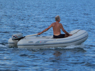
Our 5hp Outboard Rides Again
June 28, 2012
We are happy to report that our 5HP motor that was torn in half and sunk in Cyclone Cyril is now fully operational.
Our new gaskets, ordered in the U.S. from Internet Outboards, shipped to North Carolina, flown by a friend of a friend to NZ, carried from NZ to Minerva Reef by s/v Challenger, and then on to Savusavu by s/v Far Star, were waiting for us in Savusavu when we arrived. (Note: these parts are available in NZ, but at 25% higher prices. Since we weren't in a hurry for them, we opted for the carrier pigeon route).
It Lives!!
It took Dave only about a half an hour to disassemble the outboard one more time and install the new gaskets. He was soon buzzing around the harbor, and it's been running fine ever since. It's a little louder than before--but Dave thinks that's just a gasket in the foot somewhere, and he can probably fix that eventually.
We are happy to have our lightweight, fuel efficient, and durable 19-year-old Nissan outboard running again. (But glad our bigger 15HP Tohatsu is also hanging on the stern as a spare, and for longer dinghy runs).
We are happy to report that our 5HP motor that was torn in half and sunk in Cyclone Cyril is now fully operational.
Our new gaskets, ordered in the U.S. from Internet Outboards, shipped to North Carolina, flown by a friend of a friend to NZ, carried from NZ to Minerva Reef by s/v Challenger, and then on to Savusavu by s/v Far Star, were waiting for us in Savusavu when we arrived. (Note: these parts are available in NZ, but at 25% higher prices. Since we weren't in a hurry for them, we opted for the carrier pigeon route).

It took Dave only about a half an hour to disassemble the outboard one more time and install the new gaskets. He was soon buzzing around the harbor, and it's been running fine ever since. It's a little louder than before--but Dave thinks that's just a gasket in the foot somewhere, and he can probably fix that eventually.
We are happy to have our lightweight, fuel efficient, and durable 19-year-old Nissan outboard running again. (But glad our bigger 15HP Tohatsu is also hanging on the stern as a spare, and for longer dinghy runs).
More Power!!
June 28, 2012
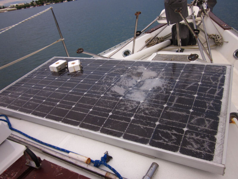
One of the few remaining issues after our Cyclone Cyril encounter in February is our 2 damaged solar panels. One had been on the port quarter and got T-boned by Sea Flyer's bow (when we dragged into them, mind you). The other was on the arch, and must have gotten hit by Sea Flyer's forestay--he had a dent in his furler extrusion right about solar panel height. (Our Cyclone Cyril Posts)
Crunched 12-Volt Panel
While we were sitting in Neiafu waiting for the fiberglass repair materials, Dave took the 2 damaged panels off and tested them. The 12-v nominal solar panel was still putting out about 60% of its rated amperage and the 24-v nominal solar panel, those visually much less damaged, was only putting out about 30% of it's rated amperage. Dave was hopeful of magically repairing the big (nearly new) 24-v panel, but after a lot of questioning, it seemed difficult to diagnose exactly which cell(s) were dragging down the output. And even after diagnosing, the repair would be (probably) beyond his skills.
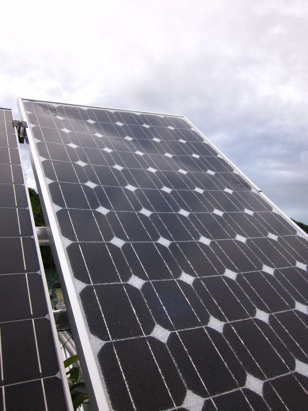
Bent 24-v Panel
(You can't see it in this picture, but the glass surface
of the panel is quite crazed).
Once we got to Savusavu, Dave asked the 'old hands' where in Fiji he could obtain a new solar panel. The two answers came back several times 'Labasa' and 'Clay Engineering in Suva'. Since Labasa is close, that was our first choice. That was one reason we took the bus trip to Labasa. We did find a shop on the main street in Labasa that sold solar equipment, but they didn't have any individual solar panels for sale in their shop. And our requirements were pretty specific. If we could get it, we wanted EXACTLY the same panel that was damaged--a 175W Solar World (ex Siemens) 24-v nominal panel. Anything else would require a lot of extra work to meld a new panel into our existing array.
So next, he called Clay Engineering in Suva. Not very hopeful, mind you, but worth a phone call. Lo and behold, Clay Engineering had a shipment of Solar World panels coming in in a couple of days, AND there were 175-watt panels of exactly the same specs and dimensions as our damaged panel. WOW!! After a few email exchanges with the sales person there, we got a firm quote and instructions for payment--deposit cash directly in their bank account at the ANZ Bank in Savusavu, and they would ship the panel via the twice-a-week ferry from Suva to Savusavu. We were amazed that the price, shipped to Savusavu, was LESS than our 'heavily discounted' price we got in Hawaii a little over a year ago.
Within a week, we had the brand new panel in hand, and mounted on our arch. Yahoo! We still have one damaged panel, but replacing the big panel has been enough for now, we think. We are now almost back to full strength. When the sun shines we are completely self-sufficient, and even on cloudy days, we make enough solar energy that we only have to run a fossil-fuel powered energy source every few days.
One of the few remaining issues after our Cyclone Cyril encounter in February is our 2 damaged solar panels. One had been on the port quarter and got T-boned by Sea Flyer's bow (when we dragged into them, mind you). The other was on the arch, and must have gotten hit by Sea Flyer's forestay--he had a dent in his furler extrusion right about solar panel height. (Our Cyclone Cyril Posts)
While we were sitting in Neiafu waiting for the fiberglass repair materials, Dave took the 2 damaged panels off and tested them. The 12-v nominal solar panel was still putting out about 60% of its rated amperage and the 24-v nominal solar panel, those visually much less damaged, was only putting out about 30% of it's rated amperage. Dave was hopeful of magically repairing the big (nearly new) 24-v panel, but after a lot of questioning, it seemed difficult to diagnose exactly which cell(s) were dragging down the output. And even after diagnosing, the repair would be (probably) beyond his skills.
(You can't see it in this picture, but the glass surface
of the panel is quite crazed).
Once we got to Savusavu, Dave asked the 'old hands' where in Fiji he could obtain a new solar panel. The two answers came back several times 'Labasa' and 'Clay Engineering in Suva'. Since Labasa is close, that was our first choice. That was one reason we took the bus trip to Labasa. We did find a shop on the main street in Labasa that sold solar equipment, but they didn't have any individual solar panels for sale in their shop. And our requirements were pretty specific. If we could get it, we wanted EXACTLY the same panel that was damaged--a 175W Solar World (ex Siemens) 24-v nominal panel. Anything else would require a lot of extra work to meld a new panel into our existing array.
So next, he called Clay Engineering in Suva. Not very hopeful, mind you, but worth a phone call. Lo and behold, Clay Engineering had a shipment of Solar World panels coming in in a couple of days, AND there were 175-watt panels of exactly the same specs and dimensions as our damaged panel. WOW!! After a few email exchanges with the sales person there, we got a firm quote and instructions for payment--deposit cash directly in their bank account at the ANZ Bank in Savusavu, and they would ship the panel via the twice-a-week ferry from Suva to Savusavu. We were amazed that the price, shipped to Savusavu, was LESS than our 'heavily discounted' price we got in Hawaii a little over a year ago.
Within a week, we had the brand new panel in hand, and mounted on our arch. Yahoo! We still have one damaged panel, but replacing the big panel has been enough for now, we think. We are now almost back to full strength. When the sun shines we are completely self-sufficient, and even on cloudy days, we make enough solar energy that we only have to run a fossil-fuel powered energy source every few days.
Tuesday, July 10, 2012
Two Weeks in Savusavu Fiji
June 21 - July 4
We spent nearly two weeks in Savusavu, enjoying this small Fijian town. We loved the social life, the restaurants, the quiet anchorage, hot showers, a good veggie market, and of course, the very friendly Fijian people.
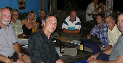
Our Welcome Dinner at Joseph's Decked Out Cafe
Around the table: Bill-Solstice, Kennedy-Far Star, Jerry/Yanna-Challenger, Linda/Gary-Sea Flyer, Me/Dave-Soggy Paws, Shawn-The Dealer
To put it in perspective for my Florida and Caribbean friends, Savusavu is somewhat like Marsh Harbor in the Bahamas--you spend weeks outside cruising the 'out islands', and then drop in to socialize, restock, get internet, eat out, etc. It is also a place that cruisers visit again and again. So, while there are always many first-time-to-Fiji cruisers there, there are also many 'old hands' here, willing to share their advice and cruising experience with the newbies.
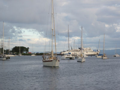
Looking Out the 'Creek' at Savusavu, Suva Ferry in the Background
There are 2 marinas in Savusavu, the Copra Shed Marina and Waitui Marina. We got reservations for a mooring at Copra Shed (on the good advice of a friend). Waitui's moorings are very good, and the cruisers running it are very helpful and friendly, but their 'complex' needs a little renovation (we hear that the Fijian owner does not want to invest any money to spruce up the building).
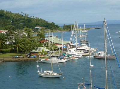
Copra Shed Marina Complex
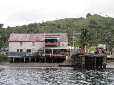
The Other Marina in Savusavu
Savusavu is only a little bigger in local population than Marsh Harbor, but it is more connected to civilization. It is linked by road to Labasa, the 2nd or 3rd largest city in Fiji. And it is linked by overnight ferry to the main island of Viti Levu, where the capital, international airport, and primary industrial area is.
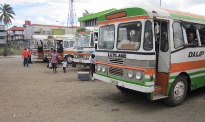
Local Buses Lined up In Labasa
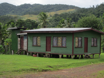
A Typical House in Central Vanua Levu Fiji
We took the bus to Labasa one day. A friend wanted to visit the dentist there, so a few of us accompanied her, just to see the sights. It was a 3-hour bus ride over the small mountains, costing only about $4 USD each way. It was a nice cheap way to see some of the local countryside, but Labasa only has slightly bigger stores (with slightly cheaper goods) than Savusavu, so I wouldn't make this 6 hour round trip just for grocery shopping.
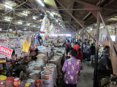
Labasa Market
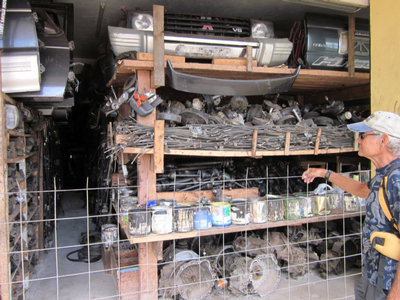
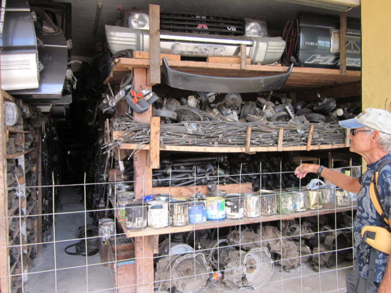
Jerry and Dave Check Out a Hardware Store in Labasa
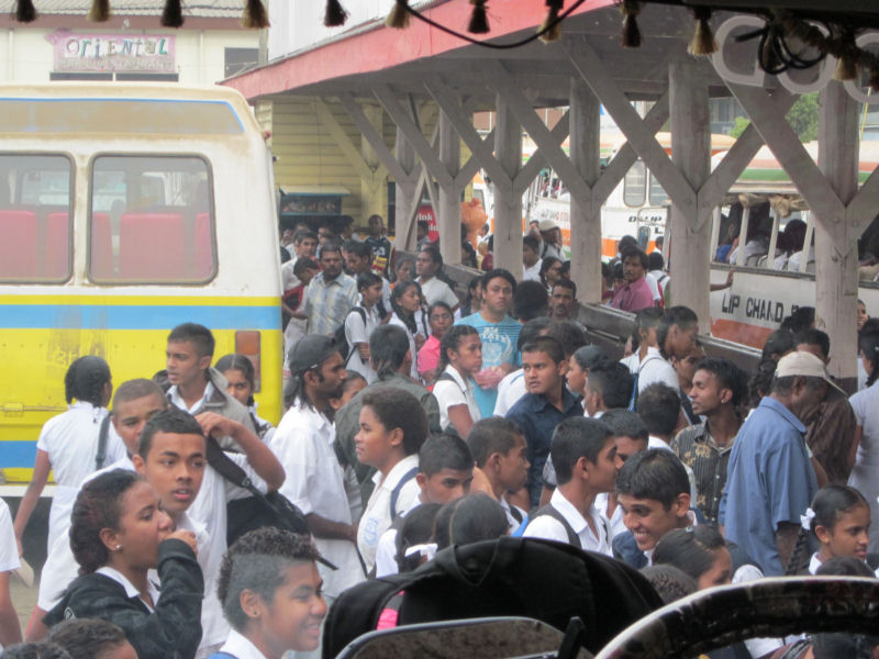
On the bus back, our bus was jammed with kids coming home from school. They were all in uniform (white shirts and blue shorts/skirts) and fairly well-behaved.
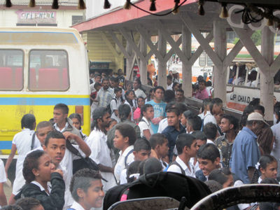
School Kids at the Labasa Bus Station
Another day, Linda from Sea Flyer, Yanna from Challenger, and I went out to the nearby Cousteau Resort for snorkeling.

This photo of Jean-Michel Cousteau Fiji Islands Resort is courtesy of TripAdvisor
This is a fairly exclusive $300/night place, and I was sure they would turn us away. But we arrived in a taxi, looking fairly upscale, and Yanna talked our way in the door. We spent the afternoon trying to blend in. Most of the guests were away on a day hike, so there was hardly anyone to see us low-life cruisers hanging out there. We snorkeled off the beach, but the water was not real clear, the coral mostly dead, and we got cold rather quickly. After snorkeling, we showered off at the beach shower, made ourselves decent, and had a round of poolside drinks (at double town prices, of course). We stayed long enough to see the sunset and the daily torch lighting, and then left. We've heard that dinner for 2 there can easily run over $100 (in a place where dinner is usually $10-15).
The last few days were consumed with 'getting ready'. I provisioned for 2 months in the outer islands--schlepping groceries, veggies, beer, and wine in multiple trips to the stores. We topped off our money supply, and our cell phone and internet 'pre-pay' dollars. I paid all the bills ahead that I could.
Meanwhile, Dave was caught up in his usual round of helping other cruisers out with their boat problems--one boat had refrigeration issues, another had a transmission issue, and another rigging issues. This is all 'pay it forward' kind of stuff. Dave likes looking at other people's problems--it means he has experience fixing that thing before it breaks on our boat. He is now nearly an expert on Frigoboat refer repair, and ours still are running well.
Just yesterday, we were hiking up to a waterfall, and the phone rang, and it was another cruiser with a Perkins engine with some questions. They had Googled 'Perkins 4-154' and our website came up. We keep our local cell phone number posted on the website Contact page, so friends can call us if they want to.
Anyway, back to Savusavu and getting ready to leave. Our last day there was 4th of July, and Kennedy on Far Star and Peggy on Ogopogo organized an impromptu 4th of July potluck/BBQ at the Copra Shed Marina. It was a fun way to end our time in Savusavu... for now.
On our way to our current location...offshore...using our Vodafone internet 'dongle', I booked our tickets back to the US for our annual trip. Sep 27 to Dec 15. So we will have to be back in Savusavu by about Sep 15 to put the boat on the mooring and get ready to leave.
More on Dakanuba, where we are now, in the next post.
At 07/06/2012 5:37 PM (utc) our position was 16°46.47'S 179°50.22'E
We spent nearly two weeks in Savusavu, enjoying this small Fijian town. We loved the social life, the restaurants, the quiet anchorage, hot showers, a good veggie market, and of course, the very friendly Fijian people.

Around the table: Bill-Solstice, Kennedy-Far Star, Jerry/Yanna-Challenger, Linda/Gary-Sea Flyer, Me/Dave-Soggy Paws, Shawn-The Dealer
To put it in perspective for my Florida and Caribbean friends, Savusavu is somewhat like Marsh Harbor in the Bahamas--you spend weeks outside cruising the 'out islands', and then drop in to socialize, restock, get internet, eat out, etc. It is also a place that cruisers visit again and again. So, while there are always many first-time-to-Fiji cruisers there, there are also many 'old hands' here, willing to share their advice and cruising experience with the newbies.

There are 2 marinas in Savusavu, the Copra Shed Marina and Waitui Marina. We got reservations for a mooring at Copra Shed (on the good advice of a friend). Waitui's moorings are very good, and the cruisers running it are very helpful and friendly, but their 'complex' needs a little renovation (we hear that the Fijian owner does not want to invest any money to spruce up the building).

Savusavu is only a little bigger in local population than Marsh Harbor, but it is more connected to civilization. It is linked by road to Labasa, the 2nd or 3rd largest city in Fiji. And it is linked by overnight ferry to the main island of Viti Levu, where the capital, international airport, and primary industrial area is.
We took the bus to Labasa one day. A friend wanted to visit the dentist there, so a few of us accompanied her, just to see the sights. It was a 3-hour bus ride over the small mountains, costing only about $4 USD each way. It was a nice cheap way to see some of the local countryside, but Labasa only has slightly bigger stores (with slightly cheaper goods) than Savusavu, so I wouldn't make this 6 hour round trip just for grocery shopping.

On the bus back, our bus was jammed with kids coming home from school. They were all in uniform (white shirts and blue shorts/skirts) and fairly well-behaved.

Another day, Linda from Sea Flyer, Yanna from Challenger, and I went out to the nearby Cousteau Resort for snorkeling.
This photo of Jean-Michel Cousteau Fiji Islands Resort is courtesy of TripAdvisor
This is a fairly exclusive $300/night place, and I was sure they would turn us away. But we arrived in a taxi, looking fairly upscale, and Yanna talked our way in the door. We spent the afternoon trying to blend in. Most of the guests were away on a day hike, so there was hardly anyone to see us low-life cruisers hanging out there. We snorkeled off the beach, but the water was not real clear, the coral mostly dead, and we got cold rather quickly. After snorkeling, we showered off at the beach shower, made ourselves decent, and had a round of poolside drinks (at double town prices, of course). We stayed long enough to see the sunset and the daily torch lighting, and then left. We've heard that dinner for 2 there can easily run over $100 (in a place where dinner is usually $10-15).
The last few days were consumed with 'getting ready'. I provisioned for 2 months in the outer islands--schlepping groceries, veggies, beer, and wine in multiple trips to the stores. We topped off our money supply, and our cell phone and internet 'pre-pay' dollars. I paid all the bills ahead that I could.
Meanwhile, Dave was caught up in his usual round of helping other cruisers out with their boat problems--one boat had refrigeration issues, another had a transmission issue, and another rigging issues. This is all 'pay it forward' kind of stuff. Dave likes looking at other people's problems--it means he has experience fixing that thing before it breaks on our boat. He is now nearly an expert on Frigoboat refer repair, and ours still are running well.
Just yesterday, we were hiking up to a waterfall, and the phone rang, and it was another cruiser with a Perkins engine with some questions. They had Googled 'Perkins 4-154' and our website came up. We keep our local cell phone number posted on the website Contact page, so friends can call us if they want to.
Anyway, back to Savusavu and getting ready to leave. Our last day there was 4th of July, and Kennedy on Far Star and Peggy on Ogopogo organized an impromptu 4th of July potluck/BBQ at the Copra Shed Marina. It was a fun way to end our time in Savusavu... for now.
On our way to our current location...offshore...using our Vodafone internet 'dongle', I booked our tickets back to the US for our annual trip. Sep 27 to Dec 15. So we will have to be back in Savusavu by about Sep 15 to put the boat on the mooring and get ready to leave.
More on Dakanuba, where we are now, in the next post.
At 07/06/2012 5:37 PM (utc) our position was 16°46.47'S 179°50.22'E
Tuesday, July 3, 2012
Still Enjoying Savusavu
Well, for another 24 hours, we are still in Savusavu... But hope to be on our way to the 'out islands' soon.
Our friend Jim on the Rag of the Air talks about the 'Dens of Iniquity' in Savusavu, but it's really just a cruiser's heaven. Flat dead calm water, hot showers, cheap beer, easy provisioning, reasonably priced laundry, etc etc etc.
The marinas are great cruiser hang-outs, so lots of chances to meet other boats and crews. Fiji is somewhat of a cross-roads. Many cruisers sort of stop here, and spend multiple seasons summering in New Zealand and wintering in Fiji. It is 'only' a 2-week trip between NZ and Fiji or Tonga.
Other cruisers hurry through on their circumnamvigation, or trying to reach Australia. Several of our friends are headed soon from Fiji to Vanuatu, New Caledonia, and then on to Australia. Our good friends on Infini skpped Fiji altogether, opting for the 'accelerated' route to Southeast Asia, via Darwin Australia.
But for us, we are scoping out the cyclone (hurricane) moorings in Savusavu. Even after our experiences in Tonga, we still feel that we'd prefer to stay in the tropics for Cyclone Season--we are looking forward to 'summer' diving conditions. The current 'winter' conditions are a bit cool for us--and windy, of course. Think of the 'Christmas Winds' (in the Caribbean)., but our mid-winter here is in July..
Subscribe to:
Posts (Atom)