Well, the wind finally quit blowing, and we did get in a few more dives with Fins and Flukes. The last one was the best, out at a remote bommie (patch reef) called Lafa Lafa. It was very live with coral, LOTS of fish, a turtle, a few sharks, etc.
Meanwhile, our friends on Dreamaway, coming up from NZ, started emailing us about meeting them in Niue (pronounced New Way). Niue is 250 miles EAST of Tonga, kinda dead upwind. We had really wanted to go there least year, but just ran out of time. And the weather at the time we were contemplating it was 'blowin' a hoolie' and we decided to hang out longer at Suwarrow instead.
At first we thought "No Way!", and we talked Dreamaway into stopping off where we were in Tonga, since it wasn't far off their path from Minerva Reef to Niue. But we started looking at the logistics, and the weather, and decided it really was do-able for us, without having to t-t-t-tack.
There is a front and low passing south of us, which has turned the wind to a westerly direction. This is usually a problem in the Ha'apai Group of Tonga, because the chain runs North and South, and there aren't many places to hide in West winds. So we solved that problem by checking out for Niue.
We met Dreamaway at an anchorage just near the pass, late yesterday, had a reunion dinner and bottle of wine, and got ready to go this morning.
We left the pass just south of Uoleva (near Lifuka) today at 1pm, and expect these winds to carry us right to Niue in 2 days. In fact, right this second, we are struggling with having to run too far DOWN wind. (Our autopilot, Janet, does well 'DDW' (dead down wind), but doesn't like ~135 degrees apparent AT ALL, and that's where we want to steer for the direct course to Niue. She wanders like crazy and the sail's either luffing up or flogging because it is blanked by the main. But the wind is expected to slowly back from SW to S to SE in the next 36 hours. We have timed our arrival at Niue for when the winds have turned back East.
Niue is a unique place with no harbor, and almost no anchoring space (the Niue Yacht Club has put in moorings for passing yachts to use). There is no dinghy dock, but a lifting crane--you have to have a bridle on your dinghy, and hook it to the crane and lift it out of the water. Renowned for great diving, sea snakes, and very friendly people. Check out niueyachtclub.com.
If the wind turns west while we are there, we'll have to get out of there quickly, as there is no protection at all. So we'll watch the forecast carefully, and probably only stay about a week. Then we'll head for Savu Savu, Fiji, I think.
-----
Sherry & Dave
Still in Tonga for another few weeks, then Fiji
http://svsoggypaws.blogspot.com
At 05/31/2012 7:01 AM (utc) our position was 19°49.39'S 173°48.13'W
http://svsoggypaws.com/currentposition.htm
Thursday, May 31, 2012
Wednesday, May 30, 2012
Moving on to Uoleva
Sunday, May 27
Since it looked like the weather was getting worse and not better, we decided to move south to Uoleva. It is only a few miles away, but seems far far away in character.
The entire 6 mile circumference of Uoleva is a beautiful sand beach lined with palm trees. After the mostly-volcanic-rock of Vavau, this seems more like 'home' (the Bahamas). Lots of deep sand to anchor in, too!
There is no civilization on Uoleva except for 2 or 3 small 'backpacker' 'resorts'. Each has a few small bungalows with people lounging in hammocks. No electricity or running water, and no direct access from the 'mainland' of Lifuka. The only way that people can get here is by boat.
Because of its wide, protected bay, beautiful beaches, and proximity to Lifuka, this is a popular cruiser stopping place. But I had to laugh when I read Ken's Cruising Guide to the Kingdom of Tonga--he didn't like this anchorage because, with 3 or 4 boats, it felt too crowded. There is about a 2 mile expanse of beach to anchor off of--you could put 50 boats in here before it would be truly crowded. But that's why we're cruising in Tonga--4 boats in an anchorage truly is a crowd.
The wind has picked up here and is forecast to blow for a couple more days, 20-25kts SE. Today it is truly nasty--squally, overcast and rainy. And cold! It might even be below 70 degrees F (absolutely freezing for us'ns who stayed in Tonga for the summer). Fortunately, this is a great anchorage for SE winds--we can tuck in close to shore, and the holding is great.
We were hoping to get a dive in tomorrow, but the high wind forecast has stretched out, and there's no way it will calm down by tomorrow.
At 05/25/2012 6:25 PM (utc) our position was 19°50.95'S 174°24.81'W
http://svsoggypaws.com/currentposition.htm
Monday, May 28, 2012
More on Pangai
We suffered through a couple of windy days anchored off Pangai, mainly because we had internet there, which was nice.
One morning we heard a long loud horn blowing, and popped our head out of the cabin to see one of the Tongan big red ferries bearing down on us from the SW. We had specifically tried to anchor SW of the entrance to the harbor, to be out of the way of what we perceived as the main channel. But it turned out we anchored right in the main approach lane for ferries coming from Tongatapu. Apparently they come straight in and pick up a marker off Uoleva, and then turn 45 degrees or so and run up the coast of Lifuka, using the marker on Hakau Loa reef and then direct to the Hakau Vonu light right off Pangai harbor. If you anchored where Ken's Guide or Sailingbird Guide placed their anchor spots, you would probably be OK, but we were between them. (We had anchored where the wifi was strongest, of course!!) Ken's waypoint is definitely more out of the way, but a farther dinghy ride.
When the ferries exit to the north, they head virtually straight out the way the harbor points, toward the marker at the end of the reef off the airport. Neither of the 2 ferries that came and went as we were anchored there seemed too fazed by having to navigate between anchored yachts. Dave called the first one on the radio and offered to move, but he didn't slow down and just went right between us and another boat. Both ferries we saw came and went during daylight hours. But if I were anchoring there, I'd for sure have a good anchor light.
We went back into the market on Friday morning and were astounded to find the best leafy lettuce we've seen in 6 months--much better than anything we'd been able to get in Neiafu. But no tomatoes, snake beans, carrots, cabbage or anything else resembling crispy vegetables. Just the typical Tongan "roots and fruits". We did find some avocados for sale at Mariner's Cafe.
Finally, a word of caution to other cruisers. We have gotten pretty lax in Tonga--it seemed pretty safe and crime-free in Neiafu, and in our 6 months there had never heard of anything being stolen from a yacht. But we had our dinghy anchor stolen from our dinghy while at the smaller fisherman's dock in Pangai. It was in the dinghy in a bag, and unfortunately we didn't notice that it was gone until after we'd left. They were probably mostly after our 150' of nearly new double-braid (which we use for diving and towing the dinghy with us). Now we are anchorless--this is one of the few items aboard that we don't have a spare for.
Diving with Fins n Flukes
We arranged a nice 2 tank dive with Brian and Sabina of Fins n Flukes (finsnflukes.com), with our friends from Impala and Downtime.
We met on the dock at Pangai and loaded up our gear into their Tongan fishing boat--a 34-foot long narrow wooden boat with a small cabin, and powered by an outboard motor. Brian and his Tongan crew, Lani, took us out to 2 sites near Pangai. We didn't go further afield because the wind was blowing over 15 kts.
The first site was called Atlantis--a nice patch reef with a lot of profile, and lots of live coral and small fish. Brian was a great dive guide--pointing out a lot of stuff we would have missed, and looking for Nudibranchs for Dave to photograph. Nudibranchs are small organisms about 1/4" to 1/2" long, usually very colorful. In addition to the beautiful hard and soft coral and all the reef fish, we also saw a Spotted Eagle Ray and Giant Trevally. Between the wind and the cooler Fall water temps, it was a little cool for us Florida divers, but Brian and Lani had hot tea ready for us when we came up, and the cabin was big enough for us all to get out of the wind.
The second dive was on Mariner's Patch, a spot of reef known for the last anchoring site of the Port au Prince, a British trading boat that visited Tonga in the early 1800's. The Tongans coveted their iron nails and implements, and attacked the Port au Prince, killing all but one or two sailors. Local legend says the Port au Prince was dragged to the beach and burned, to recover all the iron nails, and what was left was set adrift. One of the sailors spared was a young Midshipman named William Mariner. Legend has it that he was specifically spared because he was the only crew member that showed up in uniform, and the leaders thought he must be royalty. Anyway, William Mariner lived with the Tongans for several years before heading back to England. He wrote an account of his life with the Tongans which is now heralded as the best anthropological information about Tongan ways and customs before the European impact changed everything.
Brian showed us an anchor that is supposed to be from the Port au Prince. (Dave says it is too small to be the primary anchor--probably a smaller kedge anchor to hold them in place). Plus lots of other interesting things, including a few swim-throughs.
We definitely got more out of our dives with Fins and Flukes than we would have otherwise. I am sure, even if we had been given the waypoint, we would never have found the anchor or seen nearly as many interesting things.
Wednesday, May 23, 2012
In Lifuka, Checked In, Going Diving Today
We arrived OK in Pangai (just a few miles south of where we were anchored before), and have shown our papers at Customs.
We took a half an hour and walked the whole town. We located the Mariner's Cafe (yachtie hangout and wifi bar), 2 or 3 small grocery stores, and the market. The market only had bananas and watermelons. The nice-looking fish market (right next to the open air market) was locked up. The Tourist Office was open, but didn't have much of use. The one brochure they had was the same as we had, that covered all of Tonga (with a useless map of Pangai).
We met some other cruisers wandering around town looking for a trash can (never found one suitable for their bag of trash, so they took it back to the boat. This was Dreamweaver 3 from Oz, on a 6 month sabattical from their jobs in Australia. They had already sailed from Australia to NZ and then up to Tonga, and were already feeling 'behind schedule'. They are going to head Fiji-Vanuatu-New Caledonia, and back to Australia in the next 2-3 months.
We also met our old friends Nick and Cathy on Impala, whom we first met in Ecuador, after they had been dismasted in the Galapagos. We saw them again briefly last year on the beach in Moorea, at the Puddlejump party. They ended up skipping Tonga altogether, and went on to NZ. They are back for their first visit to Tonga.
Dave talked with Fins and Flukes, the local dive shop, and arranged a 'group rate' for a full boat of 6 divers. So we are going today with Impala and Downtime. The weather isn't perfect--still a little cool and windy for our tastes (it IS wintertime here now), but better than it will be tomorrow.
At 05/20/2012 11:30 PM (utc) our position was 19°48.06'S 174°21.33'W
http://svsoggypaws.com/currentposition.htm
Sunday, May 20, 2012
A Cold Squally Night Off Foa
All those Kiwi's arriving in the area in droves have brought their nasty cold weather with them.
After a long summer of temperatures consistently above 80 degrees F, where we like it, the temp this morning was a chilly 67 degrees. BRR!!! Definitely too cold to go snorkeling, even if the sun was shining.
The weather last night turned out pretty much as forecast... gusty winds 20-30 knots SE. Our Gust Meter recorded a peak gust at 33 knots at 6:30 in the morning. We had hoped for a short bout of heavy rains (as forecast), to wash all our salt off from the passage, but it merely dripped all night--seemed more like condensation falling from the sky than actual rain. I guess this is the nature of the 'Convergence Zone' in the wintertime.
What is a little puzzling is how high the barometric pressure is for these latitudes and these conditions. Without looking at a forecast, I would expect low pressures, in the range of 1010 mb to go with this weather, but our two barometers are showing about 1015 mb. We haven't gotten much of a dip in pressure at all, as this thing approached.
The nasty weather is forecast to persist through today and then ease off a little tomorrow. And hopefully clear some.
We have finally gotten the chance to spend some time reading the guidebooks and other cruiser' accounts of cruising and diving in the Ha'apai. We are really psyched about doing some diving ourselves. If only the weather will give us a break...
At 2012/05/19 4:24 AM (utc) our position was 19°44.16'S 174°17.33'W
http://svsoggypaws.com/currentposition.htm
Nukanamo and Foa
In the Ha'apai area of Tonga...
We had a great night's sleep at the Ha'ano anchorage, it was very protected from the wind, and not too swelly. Also nice snorkeling nearby.
But there were higher winds in the forecast, and higher swell from the SW, so we opted to move further south to what looked like a more protected, enclosed-by-reef anchorage at Foa.
After the SSB Net, breakfast, and a swim, we didn't get the anchor up until a little after 11am, so when we worked our way in to check out the first anchorage at Nukanamo Island, only 2-3 miles south of Ha'ano, it was just about lunchtime. So we decided to throw out the hook and stop for lunch and a snorkel there. This is a beautiful anchorage off an uninhabited island with a nice beach. Just to the south is the north end of Foa, and Sandy Beach Resort, on the beach. It is reasonably protected, even though there is a fairly large gap between Nukanamo and the islands to the north and south. The outer reef seems to pretty much knock all the easterly swell down. In better conditions, we would have love to have stayed, but with winds forecast to 30 knots from the SE, we opted to continue a few miles further south to S Foa, which looked more protected.
Using approach waypoints from the Sailingbird Guide (which weren't perfect), and our Google Earth chart (which was), we worked our way in close toward an anchorage waypoint that I had only marked on my chart as 'RCC'. Garnered, no doubt, from forays on the internet or from a data/info swap with another boat, from an account from a boat writing into a Royal Cruising Club newsletter. After doing our own prospecting around the bay surrouding Foa town, we ended up nearly on top of that waypoint. It is protected from the SW-NE, and though quite a bit of scattered coral is visible on the bottom, we found a big sand spot where we could drop our anchor in the clear. We ended up anchoring in about 25 feet of sand, away from town, off a nice little beach with a landing from which one could walk or hitchhike into Pangai.
At 05/19/2012 4:24 AM (utc) our position was 19°44.16'S 174°17.33'W
http://svsoggypaws.com/currentposition.htm
Saturday, May 19, 2012
Fonua One One Anchorage on the way to Ha'apai from Neiafu
Oops, looks like I didn't post one from there...
We had originally intended to stop overnight at Maninita, as that is the southernmost anchorage in the Neiafu group. It supposedly makes a good jumping off point for the Ha'apai. The guidebooks say it is a beautiful and protected 'one boat' anchorage. (We know of friends last year that had 2 boats in there, though).
However, when we arrived around 3pm, the conditions--windy, 85% overcast, and swell from the south, it looked very dicey to get in, and very confining. A narrow pass in the reef, and reef all around, all breaking. The swell was forecast to rise, and we didn't want to get trapped in a crappy anchorage. It is supposedly very beautiful, and I encourage people to visit it (it is also a bird sanctuary, so be kind to the bird life), when conditions are right--light winds, good sun, slight seas. It is close enough to places like Tapana to be a good day stop. I don't think it makes a very good overnight stop for an early departure for the Ha'apai.
The anchorage we'd recommend for your jumping off point to the Ha'apai is Fonua One One (I'm pretty sure that One One is pronounced "onay onay"). It is only a few miles north and west of Maninita. I don't think either of the 3 guidebooks we use cover it as an anchorage, and the chart is not very good for it. But on the north side of this island, off the west tip of the island, the reef extends far enough to the west that there is good protection from SSW through E. There is a dip in the middle of this spot that has a 15-foot sand shelf, with DEEP sand, and (just) enough swinging room in case the wind gets backwards. The big advantage over Maninita is that you can escape in any light, and any conditions as it is completely open to the north. As long as you don't mind anchoring off the drop-off, 2-3 boats could share this anchorage area easily.
When departing to the south around the east end, make sure you miss the reef that extends north and east from the island, and also the large, breaking detached reef a couple of miles to the south an east. You can go between Fonua One One and the detached reef. The reef breaks pretty spectacularly, so you can see it easily in most sea conditions.
On our 'wide area' Google Earth chart, Fonua One One doesn't even show up, though the islands to the north and east are there. I did go back in my 'historical' depictions and find one blurry shot (not properly downloaded to my cache, probably) that does include Fonua One One and the detached reef. If you are going there, I would suggest you try to get a good depiction of that area.
For reference, we dropped anchor at about 18-48.935S / 174-03.918W in the deep sand in 15 feet at the edge of the shelf SE of us.
There was a strong current running north through the gap in the reef just ahead of us, which seemed to persist no matter what the tide was doing. We believe it was caused by the southerly swell breaking on the reef.
At Ha'ano in the Ha'apai
We had a quiet night at Fonua One One, where we anchored the night before--a little rolly but decent protection. Certainly a LOT better than trying to get into Maninita under dicey conditions. We had one small Tongan fishing boat, with barely a cabin on it, anchored next to us for the night.
We got up at the crack of dawn and left the anchorage about 7:15am, with one reef in the main. The forecast indicated we'd have SE winds about 12-15 kts. Our course being about 195 degrees, this seemed like perfect sailing conditions.
We'd gotten a fish strike the day before, which had broken our 'sport' fishing line. So I made sure Dave had our strong hand-line rigged to put out as soon as we got going. I have been hungry for Mahi Mahi all summer, and you can't find them for sale at the market.
By about 7:30 we had all our sails up and were headed SSW for our northern tip waypoint at Ha'ano, about 53 miles away. We turned the engine off and, for the first time in 6 months, were actually sailing again. Ahhh!! We had sunny skies and perfect wind for our first passage in months. Even the autopilot, which we hadn't used in 6 months (and we hadn't got around to testing before departure) worked fine. We did have a little swell on our nose from a storm down off NZ, but it wasn't affecting us too much. While Dave napped in the cockpit, I watched the autopilot and read "Little Bee" on my Kindle.
Our perfect sailing conditions lasted only a couple of hours before the wind went to 10 knots on our beam--at those wind speeds, with any wave action, we just wallow along at 3 knots. And with an unknown anchorage, a long way to go, and sunset at 6:08pm, we couldn't afford to go 3 knots. I spent an hour playing with sails trying to get us going again. We pointed up a little, let out all the sail we had, and waited a little while, hoping for either a change in direction or a little more speed--a few more knots of wind and we would have been flying. Sadly, we ended up having to the engine back on to keep our speed up.
Around noon, we boated a very nice 3-foot Mahi Mahi--our first fish since somewhere in French Polynesia. Normally we wait til we are at anchor and clean the fish while standing on our swim platform on the stern. But as we would be getting in late, 6 hours hence, we had to figure out how to clean it while underway. Dave doesn't want to do it on the deck, where most people clean their fish, as we use our decks for our fresh water collection system. He did a nice job of cleaning it in our big sink, without getting too much fish blood over everything. Fresh Mahi for dinner last night!!
We ended up motorsailing the rest of the day. When the wind strengthened again late in the afternoon, it had gone back to SSE--too close for us to make our waypoint without a little assistance from the engine. By the time we were approaching the northern tip of Ha'ano, our conditions had changed considerably. The wind was now 20 knots and we had 100% overcast and rain threatening.
We arrived at our reefy 'open roadstead' anchorage just at sunsent, with 100% cloud cover, and barely enough light to see. Fortunately we had our Google Earth Charts, and 2 other boats' tracks, to help us in safely. The regular C-MAP charts are not very accurate here--they show us anchored on the land. But the GE charts are fantastically accurate (most of the time). Dave could see enough looking straight down that we were able to drop the anchor in a sand spot, and it held well. We are out of the wind and the wind-waves and safe for the night.
For information on making your own charts from Google Earth, google GE2KAP, a fabulous utility made by a fellow cruiser that will capture any Google Earth picture you have on your Google Earth screen, geo-reference it automatically, and save it as a KAP format file--which can be used in most computer-based charting programs. If you find it useful, make sure you drop the author a donation--he's put a lot of work into it and is offering it still as 'donationware'.
It was a good passage, and we are glad to be in the Ha'apai. Anyone following our blog who plans this leg from Neiafu should look carefully at Fonua One One (see previous post) as a jumping off point for the Ha'apai. This is a MUCH easier anchorage to get into and get out of than Maninita, and protected from ESE to SW, with an obvious shelf with good deep sand. It only costs you a couple of miles and a couple of degrees for the long leg, over starting from Maninita.
The anchorage we are in now, is well protected from the SE to N, but is open to the SW. The forecast is for a somewhat large swell rolling in from the SW, and we are starting to feel it now. The southern Ha'apai and Tongatapu do break the swell somewhat, but not completely. We're going to look at an anchorage today a few miles away at Foa (sun conditions permitting) that should give us protection from the swell too.
-----
Still in Tonga for another few weeks, then Fiji
At 05/18/2012 6:08 PM (utc) our position was 19°40.23'S 174°17.36'W
http://svsoggypaws.com/currentposition.htm
Thursday, May 17, 2012
Underway Again!!
Well, we've made the big break from the sweet cocoon of Vavau, and are setting sail today for the Ha'apai group of Tonga. The northern end is only about 75 miles south of here, but it is for a short while 'open ocean'.
We are currently tucked away in Hunga, an extinct volcano crater about 5 miles WSW of Neiafu. We wanted to visit this spot, as another old friend of ours said that Hunga was his prefered Cyclone Hole in the Vavau area. And I've got to say, this looks more protected than either Neiafu or Tapana. And it's a beautiful (but a bit remote) spot. The moorings that are available seem a bit light (we haven't actually dove to the bottom to look at what's down there, but the lines are not the huge lines we are used to from Neiafu and Tapana).
We are currently off Ika Lahi Lodge, a beautiful eco-fishing-lodge. It is run by Caroline and Steve, a very nice couple from NZ, who sailed this area for a long time before settling here 12 years ago to build their fishing lodge. They have 4 bungalows, and 2 sport fishing boats. Typically they get groups of 6-12 who are crazy about sport fishing.
The lodge is one of the best-kept structures we have seen in the area--exceedingly well constructed, very elegant and upscale, and kept really clean and neat (even though it is off-season still for a couple more weeks). Since they are perched on the western edge of Vavau, they are also in a perfect spot for whale-watching. Caroline said that they have had several mama whales give birth right under their west-facing cliff lookout spot.
We did some snorkeling around in the two west-facing openings in the basin. It looked very diveable in both places, but we're on a mission to get going, so did not haul out the dive gear. Snorkeling around just to the south of the main pass, I saw 2 sharks and several pelagic fish. Plus there is some very interesting topography (pillars and overhangs).
This morning we leave here and head SE about 12 miles to a tiny island/reef bird sanctuary called Mananita. We have light SW winds today (switching to S and then SE overnight and picking up to 15 kts). We'll overnight at Mananita and then hopefully will have good winds to sail the 60 miles SSW to the northern end of Ha'apai on Friday.
At 05/14/2012 8:48 PM (utc) our position was 18°41.33'S 174°07.88'W
http://svsoggypaws.com/currentposition.htm
Wednesday, May 9, 2012
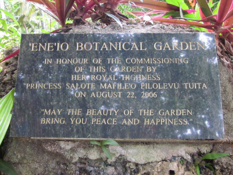
Ene'Io Botanical Gardens
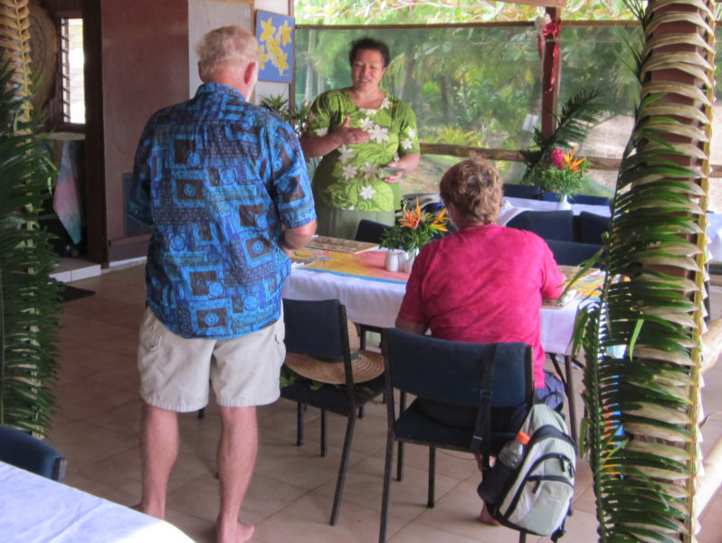
The last thing on our Vavau 'Bucket List' from a tourist standpoint was a visit to the Ene'Io Botanical Gardens. We had a quick visit on our day trip around Vavau a month or so ago, but didn't get to actually tour the gardens.
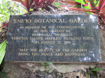
So, with our friends from Changing Spots, we arranged for Primrose (Taxi) to take us out to the Botanical Gardens at the other end of the island. We called ahead the day before to make a reservation for lunch (required, if you want to eat).
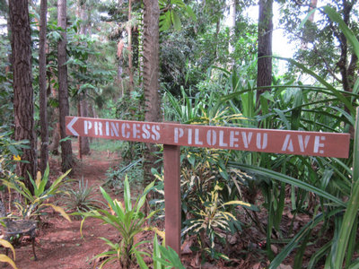
The Main Drag in the Gardens, Sponsored by Princess Pilolevu of the Royal Family
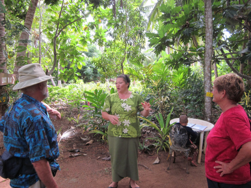
When we arrived, we were dismayed to find that Haniteli Fa'anunu, the Tongan who's passion for plants started the gardens back 50 years ago when he was a teenager, was not there. However, we were delighted to find that Lucy, his wife, was just as knowledgeable, and almost as passionate, as Haniteli.
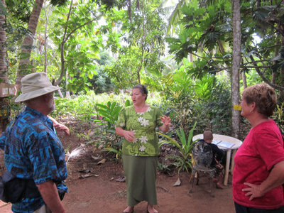
Lucy Explains the Native Plants to Us
Haniteli served for many years in the Tonga Ministry of Agriculture. In that capacity, he has been all over Tonga, and all over the world, collecting plants for the Botanical Gardens. His first passion is to preserve the diversity of native Tongan plants for future generations of Tongans. But the gardens also have a variety of imported plants as well.
The plants are well labeled with local Tongan names, as well as the common Western names, and their uses in Tonga. Many are medicinal and food value plants. Lucy explained their uses, and often the preparation for that use, in detail to us. Lucy has taken an active role in helping the women of Vavau produce and market their weavings, and she explained the whole (extensive) process to us.

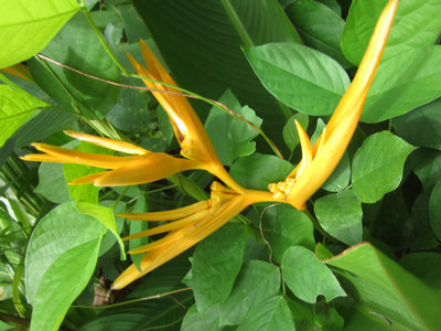
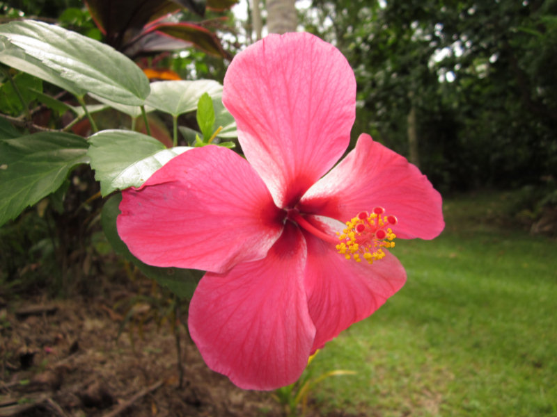
Yellow Ginger
During the 'Season', or when a cruise ship is in Vavau, they also hold Tongan Feasts and other Tongan cultural events. Their beach is also popular with tourists and locals alike.
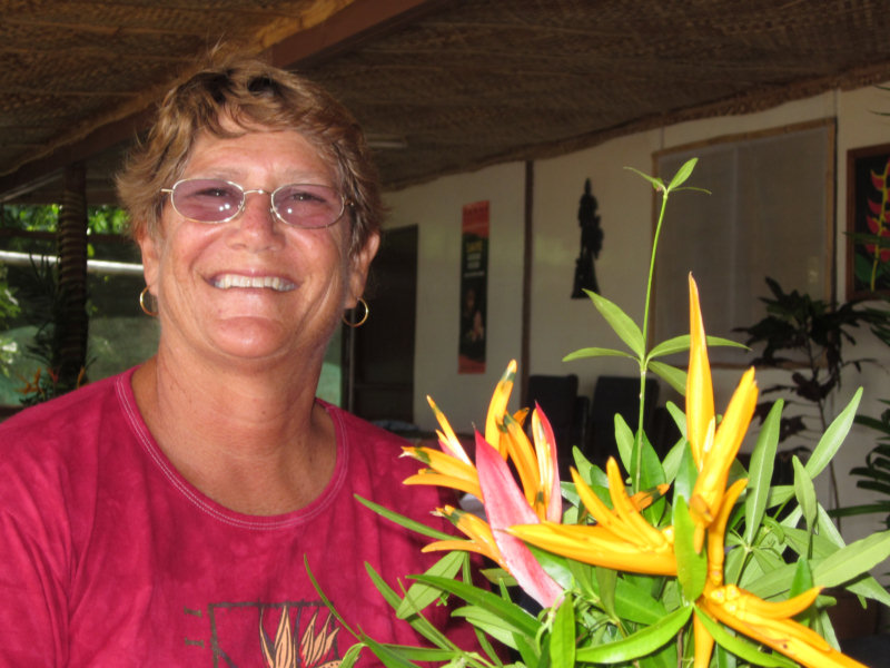
We had a great lunch there, too, complete with Ene'Io's home-made 100% organic taro chips (delicious!).

Lunch on their Waterfront Cafe
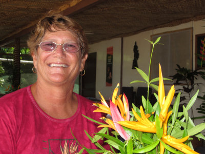
Sherry Loves the Exotic Centerpiece
For plant lovers, or those interested in Tongan customs and lore, this is a 'don't miss' visit in Vavau.
So, with our friends from Changing Spots, we arranged for Primrose (Taxi) to take us out to the Botanical Gardens at the other end of the island. We called ahead the day before to make a reservation for lunch (required, if you want to eat).

When we arrived, we were dismayed to find that Haniteli Fa'anunu, the Tongan who's passion for plants started the gardens back 50 years ago when he was a teenager, was not there. However, we were delighted to find that Lucy, his wife, was just as knowledgeable, and almost as passionate, as Haniteli.
Haniteli served for many years in the Tonga Ministry of Agriculture. In that capacity, he has been all over Tonga, and all over the world, collecting plants for the Botanical Gardens. His first passion is to preserve the diversity of native Tongan plants for future generations of Tongans. But the gardens also have a variety of imported plants as well.
The plants are well labeled with local Tongan names, as well as the common Western names, and their uses in Tonga. Many are medicinal and food value plants. Lucy explained their uses, and often the preparation for that use, in detail to us. Lucy has taken an active role in helping the women of Vavau produce and market their weavings, and she explained the whole (extensive) process to us.

During the 'Season', or when a cruise ship is in Vavau, they also hold Tongan Feasts and other Tongan cultural events. Their beach is also popular with tourists and locals alike.
We had a great lunch there, too, complete with Ene'Io's home-made 100% organic taro chips (delicious!).
For plant lovers, or those interested in Tongan customs and lore, this is a 'don't miss' visit in Vavau.
Hiking Mount Talau
In Tonga on Sunday, EVERYTHING is closed, and it is actually against the law to work. We could get away with it out on the boat away from town, but with our last major repair/maintenance item completed, and with a windy and cool Fall day, we decided it was a good time to finally hike up to Mt. Talau.
At 131 meters, Mt. Talau is the highest point in Vava'u, but this is definitely not a tough hike. It is close to Neiafu town, and most of the hike is on paved or dirt roads. When you get close to Mt. Talau, the only hard part is finding the correct path up to the mountain.
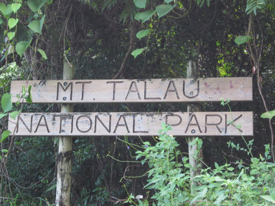
Mt. Talau Sign
Fortunately, our friends on s/v Forty Two had told us that we should take the turn BEFORE this sign, not continue down the road next to the sign, like they did. This road apparently continues on around the base of the mountain, and not up to the top.
You know you are on the right path when you encounter this sign:
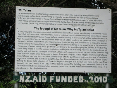
Sign with the Legend of Mt. Talau
This explains the Tongan legend as to why Mt. Talau is flat on top. It is so typically Tongan (and quite cute).
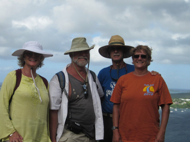
The views from the top are outstanding, and we picked a great day for pictures.

Great View of Neiafu Harbor

Closeup of Neiafu Town (with the Eastern Reef in the Background)

Soggy Paws on the West Side of Neiafu
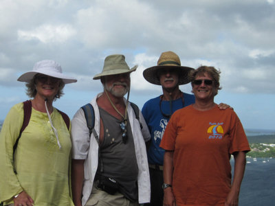
Us and Changing Spots at the Top
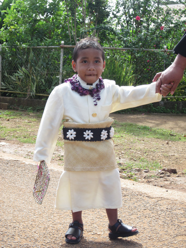
On our way up, we encountered children on their way to church. It was some kind of special day for the children at the Wesleyan Church, and they and their parents were ALL decked out.
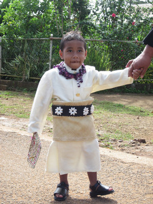
Young Tongan Boy On His Way to Church
Notice his tiny 'mat' around his waist. This the Tongan version of a tie--you are not properly dressed, for formal occasions, without your mat. Notice that Mom had firm hold of his hand, making sure he didn't get messed up on his walk to church.
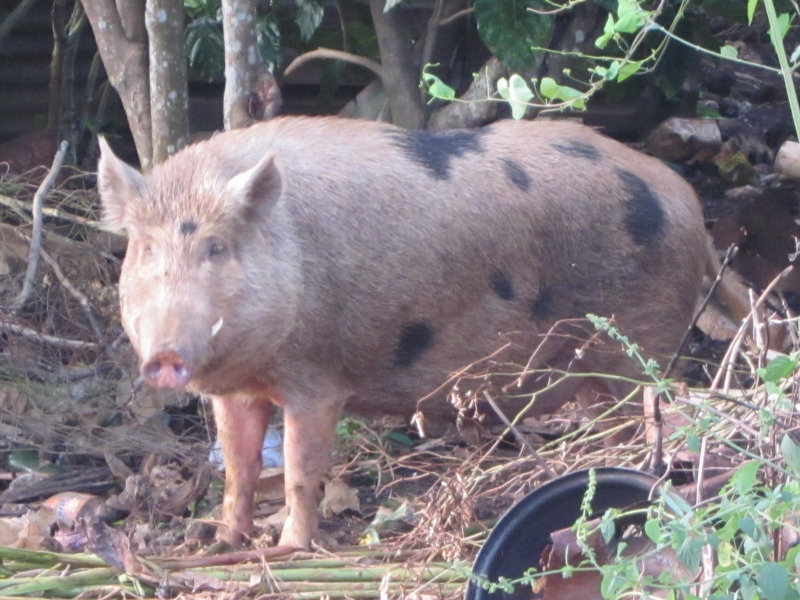
Here is another character we encountered on our walk

Big Pig On The Side of the Road
Pigs are a fact of life in Vavau. Almost every house outside of town has a litter of pigs loitering around. The baby pigs are quite cute as they skip around and wiggle their curly little tails.
At 131 meters, Mt. Talau is the highest point in Vava'u, but this is definitely not a tough hike. It is close to Neiafu town, and most of the hike is on paved or dirt roads. When you get close to Mt. Talau, the only hard part is finding the correct path up to the mountain.

Fortunately, our friends on s/v Forty Two had told us that we should take the turn BEFORE this sign, not continue down the road next to the sign, like they did. This road apparently continues on around the base of the mountain, and not up to the top.
You know you are on the right path when you encounter this sign:
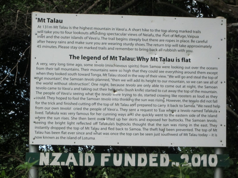
This explains the Tongan legend as to why Mt. Talau is flat on top. It is so typically Tongan (and quite cute).
The views from the top are outstanding, and we picked a great day for pictures.


On our way up, we encountered children on their way to church. It was some kind of special day for the children at the Wesleyan Church, and they and their parents were ALL decked out.
Notice his tiny 'mat' around his waist. This the Tongan version of a tie--you are not properly dressed, for formal occasions, without your mat. Notice that Mom had firm hold of his hand, making sure he didn't get messed up on his walk to church.
Here is another character we encountered on our walk
Pigs are a fact of life in Vavau. Almost every house outside of town has a litter of pigs loitering around. The baby pigs are quite cute as they skip around and wiggle their curly little tails.
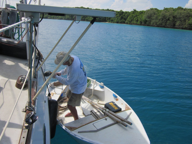
Headstay Repaired
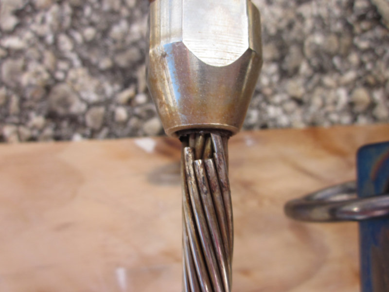
As I mentioned a week ago, we found a couple of broken strands at the top of the headstay during our regular pre-season rig inspection.
Broken Strands on Headstay
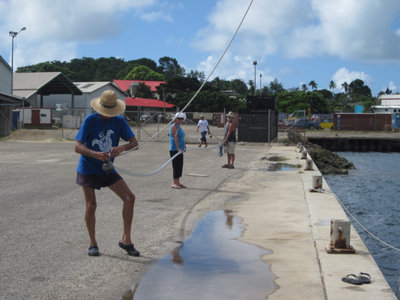
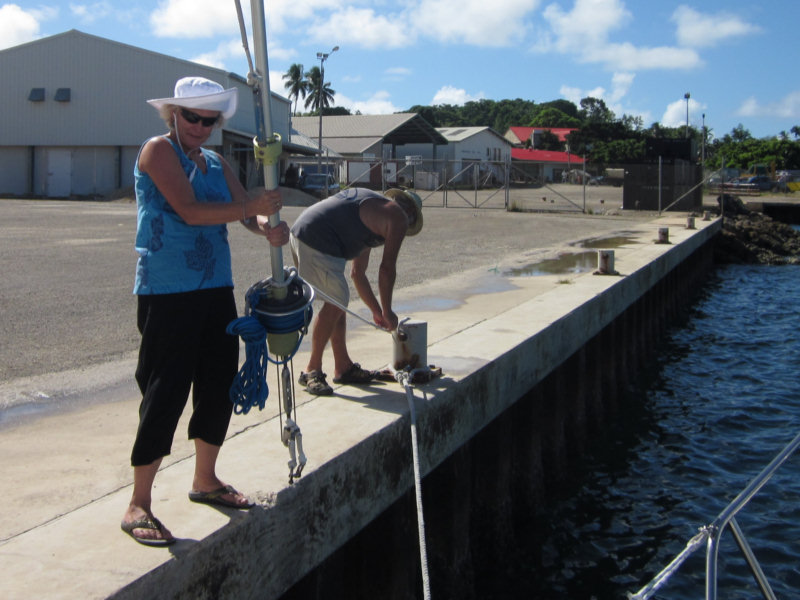
So we pulled into the 'Fisheries' dock in the harbor on Saturday to repair the headstay. We got Rob and Pauline from Changing Spots to help us.
The first step was to take down the sail, which we did the night before when the wind was light. (Dave originally thought we could do it with the sail still furled on the headstay, but we thought the weight of the sail would make things pretty unmangeable).
Second, we disconnected the headstay (with the furling drum still attached) at the bottom, and pulled it gently out on the dock with a short line.
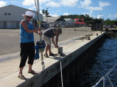
Rob & Pauline With Lower End of Headstay
Next, we cranked Dave up the mast on the main halyard, with the genoa halyard still attached to the upper swivel of the roller furler. I then tensioned the genoa halyard an inch or two, to take the pressure off the headstay terminal clevis pin. Dave pulled the pin, disconnecting the headstay from the top of the mast.
Then we let Dave back down to the deck, so he could help with the headstay. With Dave and Rob and Pauline on the dock, I let the halyard down, easing the headstay down slowly. It is important to support the headstay as much as possible, to avoid kinking the aluminum extrusion for the roller furling.
Headstay On The Dock
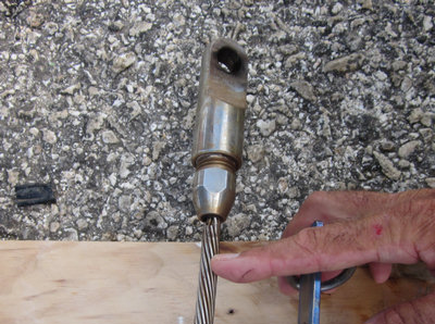
Once the headstay was completely on the dock alongside the boat, Dave cranked up our small Honda generator, and cut the headstay about an inch below the break. He used a grinder with a cutting wheel, while Rob supported the headstay for him.

We Get A Close Look At The Broken Strands
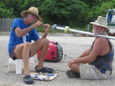
Rob Supports the End While Dave Gets Ready To Cut
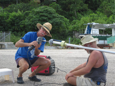
Dave Cuts the Headstay Below the Broken Strands
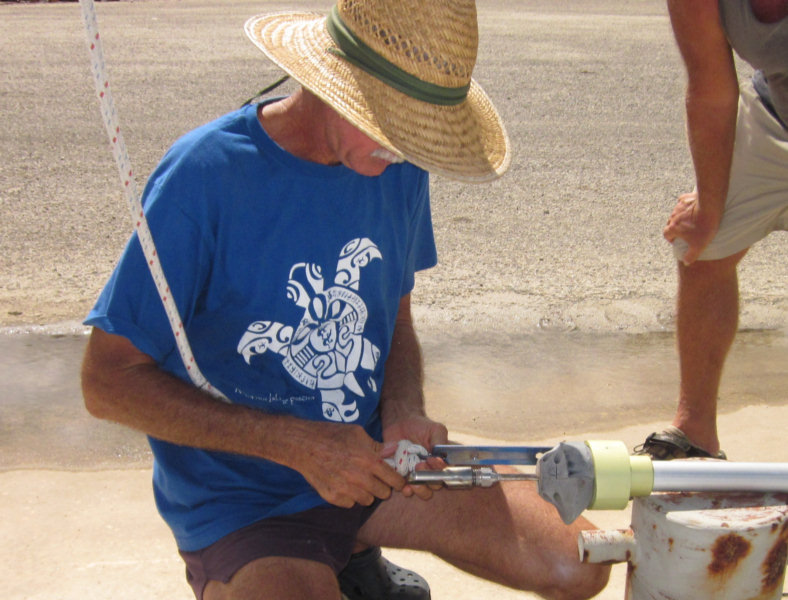
Dave unscrewed the Staylok fitting from the broken piece, cleaned it up, and using a new Staylok 'cone' put the re-usable fitting on the new end of the forestay.

Repaired Forestay Ready to Hoist
Then we reversed the process, pulling the forestay back to the top of the mast with the halyard. We put an extra 'toggle' at the top of the mast, to replace the length of headstay that was cut off, and to provide another flex point. One theory Dave has as to why the strands broke is that flexing at the top of the mast 'hardened' the metal, making it brittle.
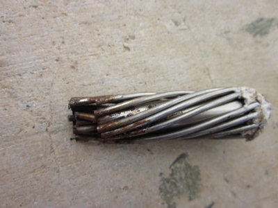
Broken Strands with Fitting Removed
The whole thing only took about 4 hours. The hardest part of the whole process was getting off the dock in the afternoon after the SE wind picked up. (Rob had to help pull our bow out with his dinghy).
We'll keep a close eye on that part of the forestay, and for sure plan to replace that wire within the next year.

So we pulled into the 'Fisheries' dock in the harbor on Saturday to repair the headstay. We got Rob and Pauline from Changing Spots to help us.
The first step was to take down the sail, which we did the night before when the wind was light. (Dave originally thought we could do it with the sail still furled on the headstay, but we thought the weight of the sail would make things pretty unmangeable).
Second, we disconnected the headstay (with the furling drum still attached) at the bottom, and pulled it gently out on the dock with a short line.
Next, we cranked Dave up the mast on the main halyard, with the genoa halyard still attached to the upper swivel of the roller furler. I then tensioned the genoa halyard an inch or two, to take the pressure off the headstay terminal clevis pin. Dave pulled the pin, disconnecting the headstay from the top of the mast.
Then we let Dave back down to the deck, so he could help with the headstay. With Dave and Rob and Pauline on the dock, I let the halyard down, easing the headstay down slowly. It is important to support the headstay as much as possible, to avoid kinking the aluminum extrusion for the roller furling.

Once the headstay was completely on the dock alongside the boat, Dave cranked up our small Honda generator, and cut the headstay about an inch below the break. He used a grinder with a cutting wheel, while Rob supported the headstay for him.


Dave unscrewed the Staylok fitting from the broken piece, cleaned it up, and using a new Staylok 'cone' put the re-usable fitting on the new end of the forestay.
Then we reversed the process, pulling the forestay back to the top of the mast with the halyard. We put an extra 'toggle' at the top of the mast, to replace the length of headstay that was cut off, and to provide another flex point. One theory Dave has as to why the strands broke is that flexing at the top of the mast 'hardened' the metal, making it brittle.

The whole thing only took about 4 hours. The hardest part of the whole process was getting off the dock in the afternoon after the SE wind picked up. (Rob had to help pull our bow out with his dinghy).
We'll keep a close eye on that part of the forestay, and for sure plan to replace that wire within the next year.
Friday, May 4, 2012
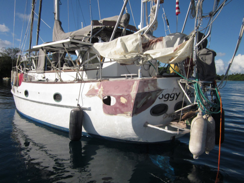
Look Ma, No Holes!!
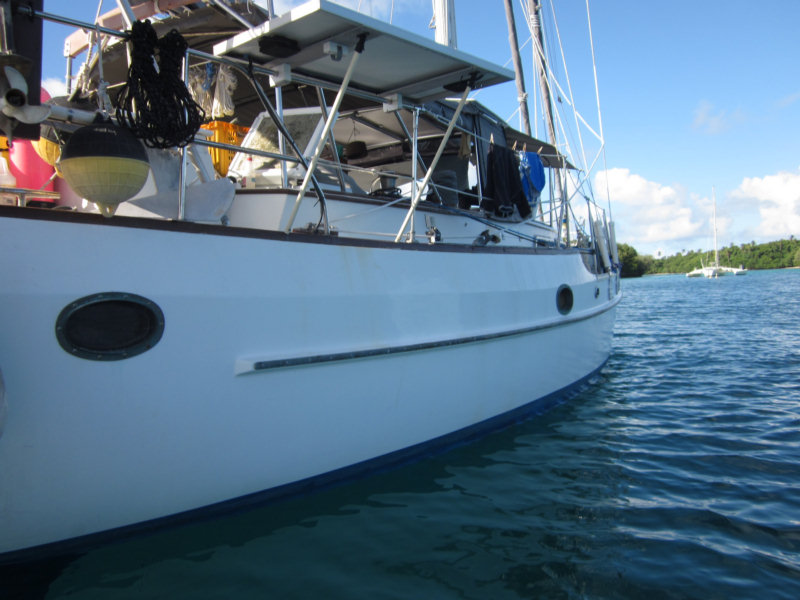
As of late yesterday, we are finished with the fiberglass repairs, except for a final coat or two of Awlgrip. The hole is well sealed, as is the starboard side porthole, both sides have had 2 coats of white primer, and the porthole is in place on the port side. We are heading for Neiafu today.
Our Port Quarter, After 2 Coats of Primer
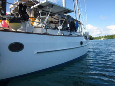
And the Starboard Side Looks Good Too
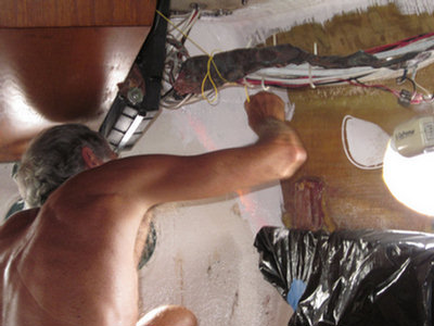
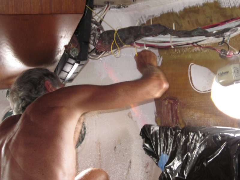
Dave Painting the Interior
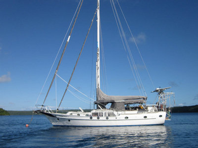
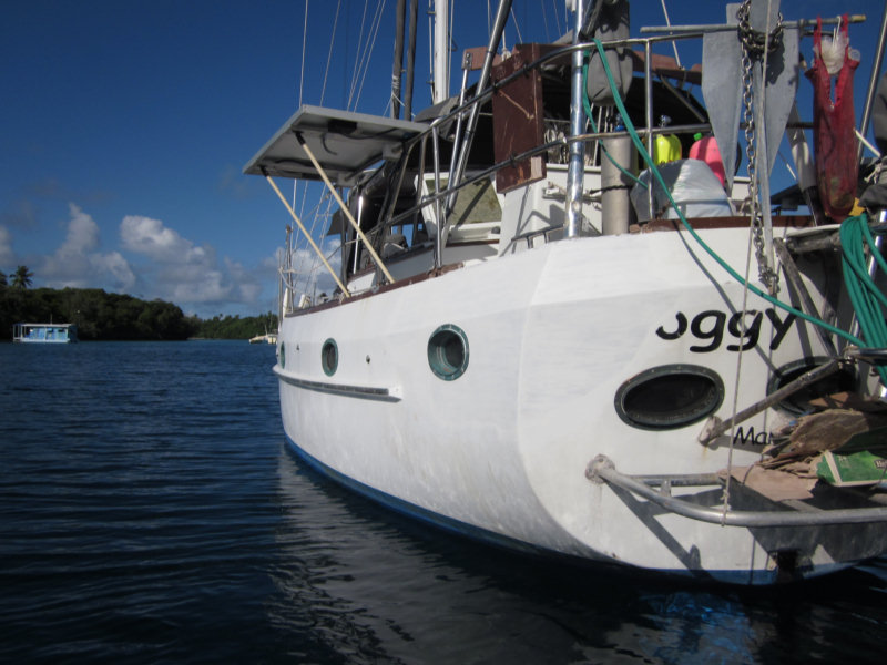
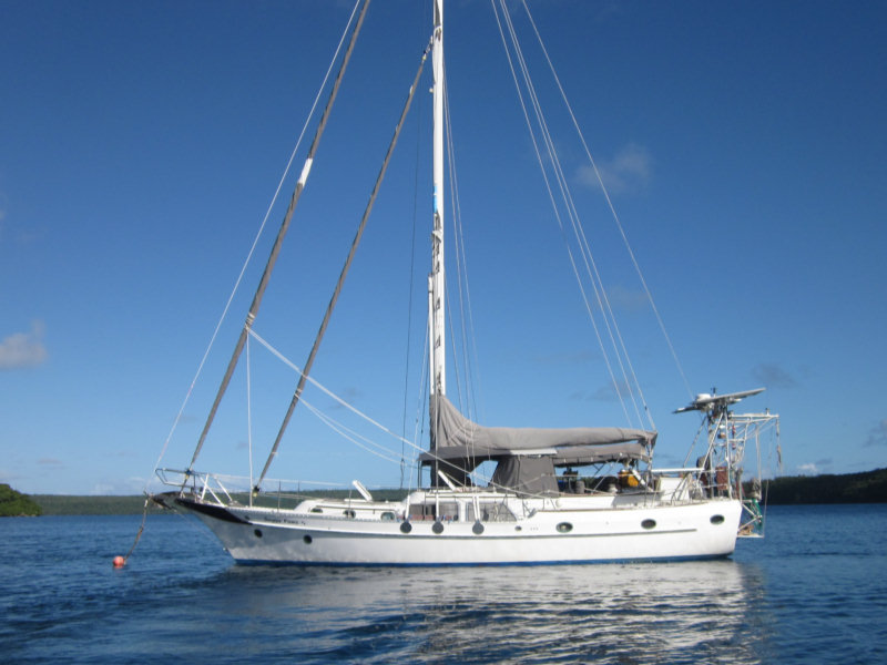
Soggy Paws Looking Good Again
We still need to finish up with a coat or two of Awlgrip, which we have aboard. But the Primer coat looks OK for now.
On the inside, we have some woodwork and electrical work to finish up, but again, not critical for getting underway.
We still need to finish up with a coat or two of Awlgrip, which we have aboard. But the Primer coat looks OK for now.
On the inside, we have some woodwork and electrical work to finish up, but again, not critical for getting underway.
Tuesday, May 1, 2012
Progress Update - Apr 29
Yesterday our fiberglass guy did a lot of grinding on the port side. The wind was light and the dust swirled all over the boat. Since the previous grinding had been on a windy day, we weren't expecting so much dust, and we weren't as closed up as we should have been. Fiberglass dust everywhere! (but not too much down below). Fortunately I hadn't yet started doing the laundry, so at least we don't have fiberglass dust all over our clothes. So now, instead of looking at the sky and hoping for no rain, we are looking at the sky and hoping for rain. Of course, it's a nice sunny day today.
Our Fiberglass Guy at Work
I think today our expert is doing the last day of fiberglassing on the port side. He is currently grinding and smoothing what he did yesterday--while I'm closed inside the cabin with all the hatches shut, to keep the dust out. He said he has about 2 more final layers of cloth to lay on that side, then the final round of filling and fairing tomorrow.
Nearly Ready for Paint
The starboard side porthole is also coming along--he put about 6 layers on that early this morning. And plans 3-4 more layers later today. So we're still here for a couple more days. But we may finally be getting close enough to being done with the fiberglass work to be able to clean up and move back into our aft cabin in the next day or so.
Meanwhile, Dave has been doing some rigging work, and doing a pre-season inspection of the whole rig. Yesterday he found 4 broken strands in the headstay wire at the top of the mast, just where it goes into the Stay-lok fitting. That's not good (but exactly why we do a full rig inspection prior to every major passage). For non-sailors, the headstay is the big wire on the front of the rig that holds the mast up. A broken headstay can mean a dismasting (mast falls down), which is very expensive, and potentially life-threatening and boat-threatening. We'll have to repair that before we can go anywhere. *sigh*
Fortunately it is self-repairable with a day or two's worth of work, and Dave has the skills and the tools to do it himself. We might not even have to take the sail off the headstay. For now, he'll just cut off a few inches of the headstay, and replace that length with one of our spare toggles. It's pretty easy with the Stay-lok fitting. This will get us by until we can get an entire new length of wire from the U.S. Assuming the repair looks OK (no new broken strands after a couple of days sailing), we can wait to bring the wire back with us in our luggage after our trip home in the fall, to replace the whole headstay (which is now about 12 years old).
I think today our expert is doing the last day of fiberglassing on the port side. He is currently grinding and smoothing what he did yesterday--while I'm closed inside the cabin with all the hatches shut, to keep the dust out. He said he has about 2 more final layers of cloth to lay on that side, then the final round of filling and fairing tomorrow.
The starboard side porthole is also coming along--he put about 6 layers on that early this morning. And plans 3-4 more layers later today. So we're still here for a couple more days. But we may finally be getting close enough to being done with the fiberglass work to be able to clean up and move back into our aft cabin in the next day or so.
Meanwhile, Dave has been doing some rigging work, and doing a pre-season inspection of the whole rig. Yesterday he found 4 broken strands in the headstay wire at the top of the mast, just where it goes into the Stay-lok fitting. That's not good (but exactly why we do a full rig inspection prior to every major passage). For non-sailors, the headstay is the big wire on the front of the rig that holds the mast up. A broken headstay can mean a dismasting (mast falls down), which is very expensive, and potentially life-threatening and boat-threatening. We'll have to repair that before we can go anywhere. *sigh*
Fortunately it is self-repairable with a day or two's worth of work, and Dave has the skills and the tools to do it himself. We might not even have to take the sail off the headstay. For now, he'll just cut off a few inches of the headstay, and replace that length with one of our spare toggles. It's pretty easy with the Stay-lok fitting. This will get us by until we can get an entire new length of wire from the U.S. Assuming the repair looks OK (no new broken strands after a couple of days sailing), we can wait to bring the wire back with us in our luggage after our trip home in the fall, to replace the whole headstay (which is now about 12 years old).
Subscribe to:
Posts (Atom)