Sunday, July 31, 2011

In Bora Bora for a Week or Two

I still have several days of Raiatea / Tahaa adventures to relate, including a scooter ride around Raiatea and two great hikes, one in Raiatea and one in Tahaa. But I am getting so far behind, I'd better at least continue with what's happening right now.

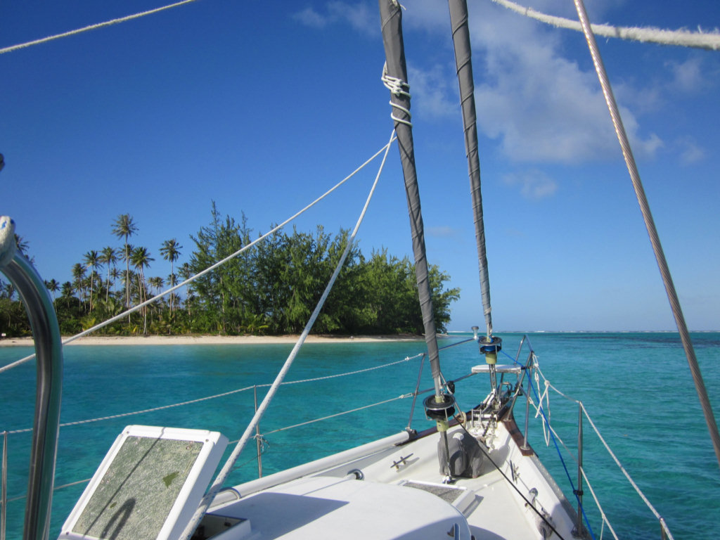
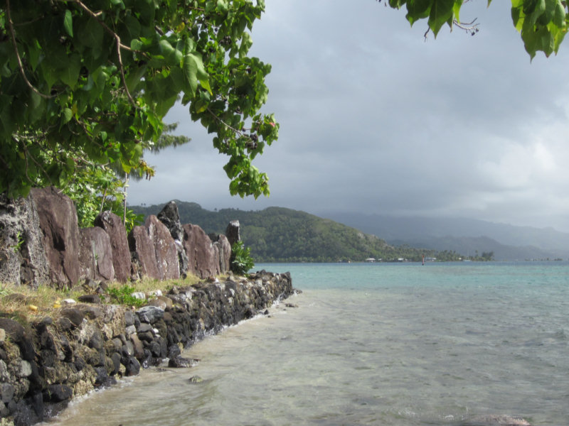
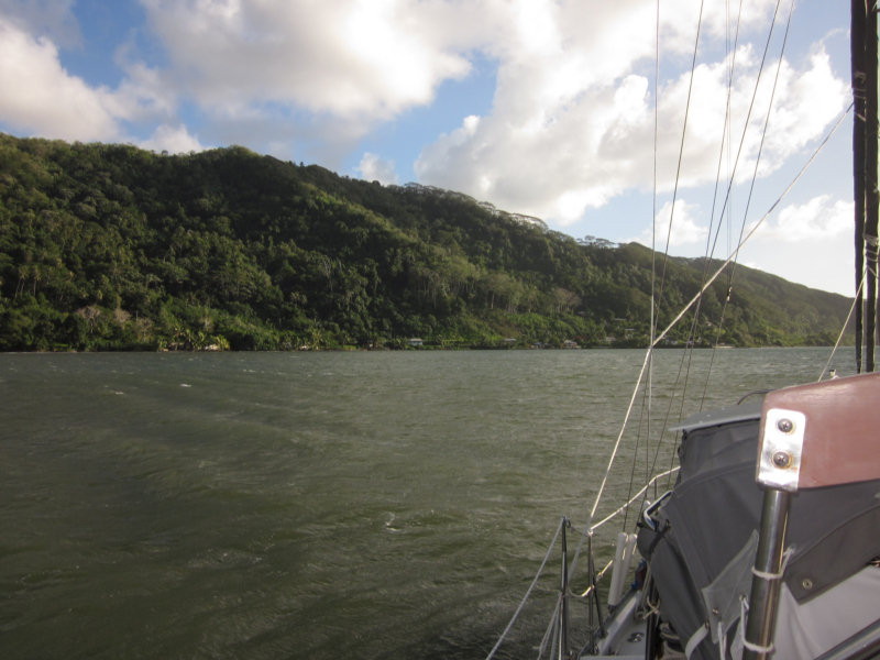
We crossed over from Tahaa to Bora Bora a day or two earlier than we originally planned--there were big winds forecast and we didn't want to get stuck making the crossing in 25 knots and 12' seas. It's only about 25 miles, and downwind, but still... no point in getting all salty if you don't have to.

The cruiser-friendly facilities in Bora Bora are in a state of flux right now. The facility everyone talks about in years past is the Bora Bora Yacht Club. But the cruiser-friendly couple with the lease (Teiva and Jessica), who have overcome several setbacks to build the BBYC into a going concern over the last few years, have been hit with another cyclone and had a falling out with the owner of the property (one issue, we heard, was the liquor license that wasn't). So they have leased another facility closer to town, maybe less cyclone-succeptible, and are in the process of renovating the building and setting up moorings. This new place is called the Mai Kai Marina and Yacht Club.

Right now, the 12 new Mai Kai Moorings are free (until Aug 1), so they have been chock-a-block with freeloading cruisers. There are no shore-side facilities yet at Mai Kai. But the anchoring area near town is 85 feet deep, so anyone who can get a mooring wants one, especially since it is free.

We haven't been down to the Bora Bora Yacht Club yet. But we understand is still sort of operating... they are charging for their moorings, so they are everyone's second choice, and they are further from town. We heard from the grapevine that Teive and Jessica actually own the moorings that are still at the Bora Bora Yacht Club, and they plan on moving them to the Mai Kai eventually. Plans are for a total of 30 moorings eventually at Mai Kai. We don't know about the long term prospects of the BBYC.

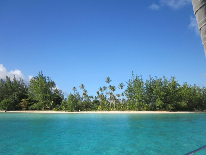
We crossed over from Raiatea on a day when everyone else was getting ready for the 25 knot winds in the forecast, so all the moorings were taken in both places. We motored around and scoped out a place behind Motu Toopua that looked good for weathering a blow. But Dave really wanted to get settled close to town, so we could pick up our incoming guests easily.

We finally found a 'shallow' spot in 'only' 65 feet, close inshore by the Mai Kai Marina, and a short dinghy ride to town. Once we got anchored, we feel comfortable enough here that we have passed on several opportunities for mooring buoys. We are actually better protected where we are than we would be on the moorings.

We have spent the last 2 days with our nose to the grindstone--working on clearing out the V-Berth for our incoming guests. We have been so busy in the last 9 months that we have just been jamming stuff in the V-Berth, and it was time to go through everything and organize it better. After 2 days of work, we have reduced the 'stuff' from 6 Rubbermaid tubs to 4, and refreshed our memories about what's in all those tubs. One is 'boat spares' that we have no other place to put. A second is 'new projects'--things we have bought but haven't gotten around to installing. A third is 'computer stuff' (spare monitor, old hard drives, etc) . And the fourth is half-full of food, and topped off with miscellaneous items. These 4 tubs fit on the forward half of the port side setee without taking up too much room.

So the V-Berth is clear, and I've thoroughly cleaned and aired it. It got pretty wet up there in our bash down from Hawaii.

My cousin, Fred Twogood, and his wife Suki, are coming for a week. They flew into Tahiti last night, and are flying here tomorrow evening. We have 6 days of 'fun in Bora Bora' planned for them. Thankfully, it looks like the 20-25 knot winds will start abating tomorrow, so we should be able to explore the whole atoll with them without too much trouble.
-----
At 7/28/2011 1:26 AM (utc) our position was 16°30.06'S 151°45.17'W
http://svsoggypaws.com/currentposition.htm

Thursday, July 21, 2011

Motu Nao Nao, Raiatea

After a quick jaunt in to see the marae, we picked up anchor from our 'pinnacle' and motored SE around Raiatea. It was a beautiful sunny day with light wind. We hooked up the watermaker and made water all the way to our next stop--Motu Nao Nao on the southern tip of Raiatea.

The West End of Motu Nao Nao

We had heard from others that this was a nice spot, and we were glad to find it was even better than expected. You would think that by now, anchorage off a nice beach would be pretty ho-hum. But really, it is not. Though French Polynesia is beautiful, it really is lacking in nice sand beaches. Many that look sandy in the pictures really are crushed coral and not so nice to walk on.

The West End of Motu Nao Nao

But, my was it shallow in the anchor spot we had from our friends on s/v Nakia! But Nakia has a slightly deeper draft than we do, so we knew that if they got in there, we could too. We had to stall a bit out in deep water until we got full sun to see our way in. We could tell visually that the water went from 'very deep' (over 100 feet) to 'very shallow sand' (under 10 feet) in the space of a boat length.

As an aside, our depth sounder has been acting wonky lately--we're still trying to figure out what happened to it. It reads OK in depths from 10 feet to 90 feet, but gets messed up in shallower or deeper water. We can live without the deeper water readings, but not having an accurate sounding in shallow water is nerve-wracking.

So we edged slowly up to the sand bank, with Dave on the bow with his polarized sunglasses on, and me in cockpit reading off depths. Once we got on the bank, the depth sounder was flashing again (grrr!). But occasionally it would stop flashing and display around 8 feet. So we were on, not aground, and it looked like the sand was about the same depth around us. So we threw the anchor out in the lee of the little motu, just off the nice sandy beach, and I jumped in to sound the water around us. Feet on the bottom, hand in the air--if my hand is under water, it is over 7' deep. Fins outstretched adds another 18 inches. So we were in 8-10' of water--plenty of depth for Soggy Paws' 5.5 foot draft.

Ahhh!! Beautiful! Unfortunately, this spot is on the charter boat circuit, so later in the day, two other boats came in and dropped anchor near us. But we knew they would only stay overnight. Though we only planned to stay a day there, we ended up staying two. That meant we would have skip a spot on the west coast of Raiatea for the next anchorage (to stay on the rough schedule we had worked out). But it was worth it just to rest for a day and catch up on laundry and small chores.

The wind was still blowing in the 20 knot range, and forecast to continue to do so for a couple more days. But west of Motu Nao Nao, all was tranquil. We were out of the wind, out of the chop, and anchored in deep sand. We felt fortunate that we were in such a comfortable spot, when we heard our friends on the radio talking about the conditions in their anchorages.

The snorkeling on the coral heads out behind the boat, and ahead to the right, was pretty darned good for this part of French Polynesia--the best we have seen since we left the Tuamotus.
-----
At 7/20/2011 6:29 AM (utc) our position was 16°55.15'S 151°25.91'W
http://svsoggypaws.com/currentposition.htm

Wednesday, July 20, 2011

Anchored on a Coral Pinnacle

July 18 - Marae Taputapuatea, Raiatea

Marae Taputapuatea

By the time we got out of the river, it was close to 2pm. We made a quick stop at the house of the guy who helped Dave with the dinghy in the morning, to drop off a few presents (fishing lures, and a stuffed animal and alphabet book for his son), and then picked up anchor. We really didn't want to spend another night in the wind tunnel.

Our friends on Endorfin were anchored 5 miles away off the Marae Taputapuatea (Polynesia religious platform). They said they were in a 15' foot deep sand spot and the conditions were OK. They said there was another sand spot that looked good just next to them. So we headed out there. It turned out there were 3 of these 'sand spots'. Another boat had taken the bigger one next to them, and there wasn't room for us to anchor there too.

So we went to the 3rd spot and looked it over. The depths went from 100' to 65' to 15' in about the length of Soggy Paws. The water was very clear and we could see everything on the top. It looked like good sand with only one low coral head. So we dropped the anchor somewhat toward the windward side of the sand spot, in the middle (left and right-wise). We backed down hard, and it seemed to be holding fine. So I donned mask and snorkel and went to look at the set. If we dragged off the pinnacle, there would be no-resetting.

Nope--that 'sand' was NOT sand, but white-colored sheet rock. We had only about an inch of the point on our 88 pound Delta anchor in a small hole. Definitely not good enough. I criss-crossed the top of the pinnacle and there wasn't 10 grains of sand on the whole thing. But, there was a very nice ledge, that, if I could... just... drag... the... anchor... Nope--I could easily drag Island Time's 60 lb anchor and 50' of chain around, but this beast (with 150' of chain out) I couldn't budge.

So I swam back and told Dave we had to move the anchor about a boat-length further to windward, and drop it just off the edge of the pinnacle. That sounds easy--clear water, and we're hardly moving it, but with the 20 knot winds, it was hard getting into just the right place. The next time we dropped, we were just literally 2 feet short, and the next time only about a foot short (Dave didn't want to drop it over the abyss, so he was a little short each time). Each time, I had to jump in the water and go visually check the anchor. Finally on the 5th time, we got it over the ledge and the point and the whole fluke area were set well into a nook. And honestly we weren't screaming at each other. We both knew how important it was to get it right, and how difficult a thing we were trying to do. Fortunately, with our big strong electric windlass, it wasn't too much of a chore.

We still spent a somewhat uneasy night, with the wind still blowing 20-25 knots (but fortunately not gusting to 40 like the previous night). We have our old Garmin GPSMap 76 hand-held GPS mounted in our cabin, and had it on and zoomed in, and the anchor alarm set. I could sit up, turn on the backlight, and verify we were still in the right spot, without hardly waking up.


In the morning, we felt comfortable enough with our set that we dinghied ashore and walked around the Marea for an hour or so. This is an extensive group of stone platforms--the largest and most sacred in the Society Islands. There were some nice plaques in English, with illustrations, describing the marae, their purpose and construction, and a little about the social structure in the Societies. Because the Polynesians never had a written language, most of what we know of their history comes from the detailed accounts from the first explorers, especially Captain James Cook, who made 3 trips to French Polynesia. It was interesting to note the footnotes on the sketches on the plaques--one was drawn by Captain William Bligh, and most were done by Webber, one of Captain Cook's 'resident artists', who were carried on board just for such documentation of culture, plants, and animals they discovered.


Also in the Taputapuatea area, they were holding an Agricultural Fair. We took some pictures of the strange stuff they had on display.


At 7/18/2011 3:27 AM (utc) our position was 16°49.77'S 151°21.59'W
http://svsoggypaws.com/currentposition.htm

The Faaroa River Trip, Raiatea

We did finally do the Faaroa River trip. Some friends who had met James, the guy who gives the free 'Botanical Gardens Tour' by kayak, the day before, had told him we were coming.

At the Botanical Gardens

So he paddled out to our boat to let us know he was there. We told him we were coming in soon. He said he'd go back inside (it was still blowing 20-25 kts out in the bay), but he made sure that we knew the way in over the river bar... between the two sticks and then to the left of all the dead tree trunks.

Following James in the River

On the way in, we kicked our motor up partway, and I sat on the bow of the dinghy dipping with the oar. It got down to about 2 feet at one point, but deepened quickly again after we were over the bar. Once in the river, the water clarity was good enough that we could see the shallow spots.

Another Dinghy Adventure

James met us just inside the river and motioned for us to follow him. We never did quite figure out James' role in the river and the 'Botanical Gardens'. His command of English is limited, so we had a hard time asking him questions other than about the plants. And sometimes the answers to THOSE questions were only partially understandable. But nonetheless, he made sure we stayed in the deep part of the river, and took us all the way to the end. Then we backtracked a little to a small side canal, where we parked the dinghy and went walking through the 'gardens' with him.

Cat's Whiskers

It was a fantastic array of native tropical plants, from vanilla beans to star fruit, and including things like baslil, tiny Polynesia chili peppers, citrus trees, taro, coconuts, and many flowering plants. For each plant, he stopped and gave us the Polynesian name as well as the common English name, and then explained what its uses were in the islands.

Ginger?

Many of the flowers and variegated plants were in the garden because they looked good on Polynesian dancers, or smelled good, or made baskets, or...

James Gets Us a Coconut

At the end, James cut us down a stalk of bananas and climbed a coconut tree Polynesian style and threw us down a couple of coconuts. If we had wanted (according to other cruisers) we could have purchased from one of the local farms, fruits and veggies as a very reasonable price. But we had just stocked up, and were only lacking bananas.

Sherry & James

We gave James a 'gratuity' of 1000 CFP (about $10) for his time and the bananas, and felt it was well worth the time and money.

At 7/18/2011 3:10 AM (utc) our position was 16°49.07'S 151°24.87'W
http://svsoggypaws.com/currentposition.htm

Tuesday, July 19, 2011

The Amazing Flying Dinghy

We are on the 10 day plan for Raiatea/Tahaa. Dave has read all the guidebooks and wants to do 'everything'. The first stop was the bay of Faaroa, a long narrow bay directly shoreward from the Passe Iriru Ou Maire. The attraction here is a trip up the only dinghy-able river in French Polynesia. Previous cruisers have written about making this dinghy trip and receiving a 'botanical gardens tour' and copious fruits and vegetables, while up the river.

I wasn't so sure this was a good idea. With a NE wind blowing 20 knots into a NE facing bay, opposite a break in the reef... and the bay goes from 100' deep to 60' deep to 25' to 5' in the space of 100 yards. Didn't sound that good to me, but Dave really wanted to do this river trip, so in we went.

It took us twice to get properly anchored. The first time we congratulated ourselves on finding a 25' spot to drop the anchor. But once things settled out, with the proper amount of scope out, we were just touching the 5' (or less) spot. I could feel our rudder bump on something occasionally.

Our Windy Lee-Shore Anchorage

So we pulled it all in, and re-anchored further out. But with such a steep slope, and the need for appropriate scope, we ended up having to drop the hook in 60' of water... and still were only a couple of boatlengths away from the 5' shelf. But we backed down hard, and knew we were hooked up well. We set our anchor alarm (an old Garmin GPS mounted in our bunk where we can hear it), and went to sleep.

The wind increased during the night from 20 kts to 25 with gusts. We kept a close eye on the GPS but felt we were securely anchored, and were mostly sleeping. Then at 4am, I heard this 'whump' sound. Hmmm, wonder what the heck that was? I looked out our porthole on the side of the bunk and there was our dinghy floating past, shining bright in the moonlight. "Dave, there goes our dinghy!" And he says "Oh shoot, I untied it yesterday afternoon, thinking we were going to launch it right away." The 40 knot gust had somehow gotten under our dinghy, which was stowed for sea upside down on the foredeck, and flew it completely free of our boat, almost without touching anything else onboard, and landed it upright in the water with a "Whump". Wow! The power of the wind!

We scrambled out of bed and went up in the cockpit to watch our dinghy sailing away downwind in the moonlight. We didn't even need a spotlight to watch it go! The wind was blowing really hard, so thoughts of jumping in after it only lasted a microsecond before sanity took over. Fortunately, fortunately, we are in this nice cul de sac, and we were fairly certain that the dinghy wasn't going very far. What more could we do but go back to bed and wrestle with dinghy rescue plans in our sleep? (And, of course, Dave spent the rest of the night kicking himself for not at least clipping the bowline to the lifeline). (We both were thanking our lucky stars that we didn't have 2,000 miles of open ocean behind us that night).

The big problem was, for recovering it, that the wind forecast was not good--we expected 20-25 knots for the next 3 days. We have kayaks aboard, but they are really lightweight inflatables--not suitable for going anywhere in 20 knots. They are barely usable in 5 knots. And, in only the second anchorage since we left Hawaii in April, there were no other cruisers in the anchorage with us.

As soon as it got light enough, I went out with the binoculars to scan the shoreline. I expected to be able to see it easily behind us, but no sign of the dinghy!! Our white RIB should show up against the trees like a neon sign. I finally roused Dave. He didn't see it either. So we discussed search and rescue options. We finally settled on digging the inflatable kayaks out of deep storage under the V-Berth, and sending Dave out in one kayak and a handheld, to look for the dinghy. Since we were in a cul de sac, the worst thing that could happen was that he'd get blown ashore and have to swim back out.

Dave Sets Out in the Kayak

I was to stay aboard and try to contact friends on the HF radio, in case we needed help, but also stand by with the VHF and the second kayak in case Dave needed help.

Before he launched out in the kayak, Dave took one last look with the binocs, and thought he saw the dinghy under the trees behind us, at the water's edge. We felt that even though he couldn't tow the dinghy back with the kayak, he should be able to walk along the shore with it, to some houses off our beam, and either row back from there, or get help from people on shore.

So Dave set out in our very light blow-up kayak in 20-25 knots of wind. (Unfortunately, I forgot to take a picture until he was too far away). Meanwhile, it was time for the SSB net, and I got on and made contact with our friends on Endorfin, only 5 miles south of us. We confirmed that we were close enough for VHF contact, and they volunteered to come help, if we needed it. But I told them to hang out for awhile--I thought we could handle the rescue ourselves.

And sure enough, within a few minutes, Dave had extricated the dinghy from the swampy area under the trees, loaded the kayak in the dinghy, and was wading alongshore towing the dinghy. He got to a point 200 yards abeam of Soggy Paws, at someone's house with a small dock. While he was tying it off, a woman came out, and I could see him trying to explain, in Polynesian, how the dinghy flew off in the night, and that the wind was blowing too hard to row the dinghy back to the boat. A few minutes later, she came back with her brother who at first offered to help Dave paddle out. Then as they stood there and watched the wind blow, the final solution was to get a motor boat and tow Dave, the dinghy, and the kayak out to Soggy Paws.

This they did, and by 8:45 am, Dave was back safe and sound with the dinghy. YES! The only thing we lost permanently was our dinghy bimini, which had been resting on top of the dinghy. A pretty cheap price to pay for another new lesson. (Tie the dinghy down, mate!).

The ironic thing was that we'd had dinner a few nights ago with our friends on Dreamaway, who were celebrating recovering their old tiny Avon, which had blown off THEIR deck in the Marquesas. It had finally turned up at a Gendarmerie a few weeks later (after they'd left the Marquesas for the Tuamotus), and friends had loaded it up, and it had only just arrived in Papeete a few days before. We wondered how anyone could be so stupid as to let their dinghy blow off their deck...

At 7/18/2011 4:18 AM (utc) our position was 16°49.07'S 151°24.87'W
http://svsoggypaws.com/currentposition.htm

Our Last Night in Huahine

July 16

We had originally planned to spend about 2 weeks in Huahine, relaxing and gunkholing. But we had dinner with our friends on Dreamaway, and got to talking about the trip to Suwarrow. Graham reminded us that it's really nice to have a full moon for a passage. So then and there, Dave decided that we want to be on our way to Suwarrow with the next full moon.

Originally, we had planned to have some leisure time in Huahine, and skip Raiatea/Tahaa, meet my cousin in Bora Bora on 31 July and then double back to Raiatea/Tahaa after they left on the 6th of August. Now, Dave wants to squeeze in Raiatea/Tahaa before we go to Bora Bora. Back to double-time again!! (Life with Dave, never dull...)

Anyway, so we moved back from Avea Bay to Fare early on Friday, loaded the bikes in the dinghy, and headed ashore to bike over to the Marae (old Polynesian stone structures) at Maeva. After Nuku Hiva, I'm still haven't been impressed with any of the Society Islands Marae. More rocks. But we had a nice bike ride out, and then a hike up into the hillside over the Marae.

The best part of the whole day was Happy Hour at the bar next to the Dinghy Dock in Fare. Pints of beer for only 250 CFP (about $3). This is a huge deal in French Poly. AND, the folks on Don Quixote bought us a beer, and so did Bruce and Clark on Two Amigos... (both of whom, being good cruisers, figured that cheap beer was a great time to discharge that 'I owe you one' feeling).

The next morning, we made a quick trip ashore to buy a few more baguettes and a few other necessities, and then hauled anchor and sailed the 20 miles downwind to Raiatea.
-----
At 7/16/2011 4:18 AM (utc) our position was 16°42.77'S 151°02.38'W
http://svsoggypaws.com/currentposition.htm

Saturday, July 16, 2011

Avea Bay, Huahine

We have had a beautiful time here anchored in the SW corner of Huahine. It is just a gorgeous location. We are anchored in about 25' of very clear water, behind a huge sandbank that is only 3' deep, and then there's the reef with the breaking waves on it out ahead of us 1/4 mile. If the sand were just a little bit deeper, we'd be out there with the catamarans, anchored in the aquamarine water.

We got here a couple of days ago. One day we went on the short hike up on the ridge to take pictures of the bay. Unfortunately, the Australian Pines are growing up in the middle of the picture--we had a hard time finding a clear shot. I was disappointed that none of the pics we took really convey what a stunning place this is.

This time of year, there are always 7 or 8 boats anchored here--a couple of charter cats and the rest cruisers. The charter boats usually anchor up ahead in the shallower water, and only stay one night. The cruisers come for a couple of days. But the bay is so huge that we could put 30 boats in here and not feel crowded.

Another day we went exploring in the dinghy, east around the point. We were looking for a good snorkel spot, plus exploring the pass and the town. The pass was breaking across, so we didn't go outside, or even just in the pass. The town is tiny, but we did find an open grocery store and bought a couple of baguettes for lunch. The coral we found was alive but only in about 3' of water. Lots of sand. Lots of clear water. Not what I'd call great snorkeling. The best we found was actually between the 2nd and 3rd stakes that mark the way around from Avea Bay to the town of Pareo.

Yesterday, we took the bikes ashore and ended up riding all the way around Huahini Iti--about 20 miles on good mostly-flat paved roads. Yesterday was 'Bastille Day', basically the 4th of July date for France. So nearly everyone was home in their small houses on the water. The 2 or 3 small 'magasins' (stores) we passed were locked up tight, and traffic was very light A few tourist restaurants and boutiques were open. We enjoyed seeing the variety of homes and waving at the people we passed. Nearly every one had carefully tended gardens--some just ornamental, but most a combination of flowers and food--including taro, yucca, pineapple, banana, coconut, papaya, mango, green beans, melons. And of course, everyone has a few chickens hanging around. Most of the homes had 'million dollar views', even though some were just barely shacks. We envied them their simple lives, and I'm sure they envy us in our big boats and shiny new bikes.

We would like to go to the east side of Huahine, where there are more beautiful behind-the-reef anchorages. But you have to go outside the reef and beat your way around to get there, and enter through the reef on the east side. And the wind forecast in the next few days is for 20+ knots. So we'll skip that. We got a pretty good sampling of that side just riding the bikes around yesterday.

Today we head back up for the big town of Fare in the NW.
-----
Sherry & Dave
In French Polynesia til August, then west toward Tonga
http://svsoggypaws.blogspot.com

At 7/11/2011 11:46 PM (utc) our position was 16°48.72'S 150°59.63'W
http://svsoggypaws.com/currentposition.htm

Tuesday, July 12, 2011

Fare, Hauhine

We arrived here Saturday morning after an overnight passage.

The main harbor here is at the small town of Fare, with a big, wide, easy pass to come in. There is a town dock for the dinghies and other small boats, with a big welcome sign and a map of the island. There is also a small 'freighter dock' where the inter-island freighters pull in to load/unload. Steps from the dinghy dock is the main street of Fare, where one can find a reasonably well-stocked grocery store, fresh baguettes, and the morning fresh fruits, vegetables, and fish market.

To put it in perspective for my Florida friends, the town reminds me a little of Green Turtle in the Bahamas.

Like the other French Society Islands, Huahine is an old volcano with an encircling barrier reef. So it seems to combine the best of the Marquesas Islands (the beauty of the mountains, more rainfall, some arable land, cooler temps) with the Tuamotus (better harbors, snorkeling, surf).

The challenge in the Societies is finding anchorages shallower than 80-100' and deeper than 2'. But Huahine has a number of spots where there is a good sand shelf in 10-30' of water. We are anchored in what's known among the cruisers as the 'town anchorage'. Off a nice beach, in 30' of nice sand. We can see the best surf spot in Huahine from our boat, and hear the pounding of the surf on the reef. But our anchor spot is very tranquil.

Huahine is nice, we think, because tourists rarely come here. There is an airport, and of course, the freighters. But it is well off the beaten path. It IS within reach of the charter boats who operate out of Raiatea (Moorings, Sunsail, Dream Yacht), but few boats have the time or motivation to get over to Huahine. So, the inhabitants are less 'touristed', and therefore more friendly and welcoming of strangers.

On Saturday night, we heard there was a 'Heiva' dance festival at the arena outside of town, and a bunch of cruisers said they were going. We missed one group who left before us, and another group was still eating dinner. So Dave and I walked out on our own. We had asked directions in my limited French, and so we knew what road to take, and that it was about a 15 minute walk. But it was after dark and it seemed we were heading down a dark road to nowhere. After 10 minutes of walking, we heard drums and music, and I said "See, we made it." But it turned out to be someone's loud music in their house. So we kept walking. Fortunately, not many dogs here. Another 10 minutes walking and we could hear music again. We came around the bend and saw cars pulling into a big area, and knew we were there.

We paid 500 CFP (about $5.50) each to get in. A dance group was already in the middle of a number, so we found our friends in the bleachers and sat down to watch. This was, I think, a regional competition for the island, with each group of 20 or 30 people performing native song and dance, with judges. The winning group goes to Papeete for the 'finals' next weekend. A local told us that last year, there were 8 groups performing, admittance was free, and the stands were packed. This year, we saw only 2 groups, and the stands were very sparse. Many of the locals were hanging around outside, complaining about the entry fee. French Polynesia, like everyone else, is really suffering in the economic downturn.

The singing, dancing, and music (drums, ukelele's, etc) was entertaining, but not as good as what we saw on the beach at the Puddle Jump Rendezvous. And all of us had just been on an overnight passage. I saw more than one head nodding as the second group was finishing up. So we were not much dismayed when it was over.

As we were walking back as a group, someone with a larger car stopped and asked if we'd like a ride back into town. "All 7 of us?". Oui, I have a friend. So he got on his cell phone and got a friend to stop, and we all piled into two cars for the short ride back to town. THAT's how friendly the locals are.

Yesterday was a gorgeous day--a beautiful sunny day, not too hot, not too windy. We should have been out exploring the island in the boat. But it was Sunday, and I insisted on a 'day of rest'. We have good internet here, and no schedule pressures until we have to be in Bora Bora on 1 August to meet my cousin and his wife. Bora Bora is only 50 miles downwind, so we have time to relax a little and explore here, and be in Bora Bora a few days before they get there.

So we spent the day hanging out on the computers and watching the boats come and go (cruisers, charterboats, and locals). A church just off the beach had a nice church service with lots of music that we could hear onboard. We made a big breakfast and enjoyed a day of leisure. Late in the afternoon we hopped in the dinghy and went exploring. We were primed to take advantage of the half-priced happy hour at the bar by the dinghy dock, but they were closed on Sunday, so we had some friends over for Sundowners. All in all, a nice Sunday.

Today we plan to head out of town for the SW corner--Avea Bay, which is supposed to be the nicest anchorage on the island. We are looking forward to some snorkeling, hiking, and bicycling down there.

At 7/9/2011 8:05 PM (utc) our position was 16°42.77'S 151°02.38'W
http://svsoggypaws.com/currentposition.htm

Monday, July 11, 2011

Overnight Passage to Huahine

We were finally ready to move on from Moorea to the next island, Huahine. Huahine is pronounced 'Wah hee nee' (just like the Hawaiian Wahine). We had pretty much 'done' Moorea, and we had the weather we'd been waiting for--15 knots from the east and settled weather.

The trip from Moorea is only 80 miles, so we spent the day rearranging things after Jim's visit, and getting ready for the passage. At 4pm we motorsailed out the Opunohu pass, and pointed for the north end of Huahine 305 degrees, 80 miles.

We had a pretty nice night, except that Dave really wanted to have the main up in addition to the Genoa. He thought our genoa-only trip from Toau to Tahiti was too rolly.

With the mainsail up, we couldn't quite make our course, because the main would blank the genoa. So we had to sail about 320 degrees all night. There were about 10 boats on passage, plus two inter-island freighters that passed us during the night. Fortunately, the freighters had AIS, but almost none of the other boats on passage even had receivers. So there were a few close encounters, and a lot of 'are you the boat to my south?' conversations during the night, some quite comical.

Many of the 'Puddle Jumpers' who arrived in the Marquesas in April are running out of time--their 90-day visas are expiring, so they leaving Tahiti and Moorea in droves, hurrying west, trying to see a little more of the Society Islands before they have to leave.

Though it was really a nice night, I didn't really enjoy this passage much. I stubbornly refused to accept that we couldn't make the heading I wanted, and Janet, our autopilot doesn't steer well on that point of sail. She wandered all over and flogged the genoa frequently. And the swell was still pretty big from the huge swell a few days before, and it was slewing us around quite a bit. By the time it was Dave's watch, I was pretty grumpy and ready for sleep. When Dave called me up to gybe for Huahine at 5am, I was sleepy and even more grumpy--I was not very nice to him. These short passages are hell!!

We gybed at 5am, and once we got close to Huahine the wind got really light and we gave up and motored the last 7 miles around to Fare.
-----
At 7/9/2011 8:05 PM (utc) our position was 16°42.77'S 151°02.38'W
http://svsoggypaws.com/currentposition.htm

Hike to the 3 Palm Trees

July 8, 2011

After Dave saw Jim off on the bus to the ferry, we moved Soggy Paws around the corner to anchor up inside Robinson's Cove, deep inside Opunohu Bay. This is a totally different sort of anchorage than the Opunohu Beach anchorage, which was off a palm-studded beach in aquamarine water. Robinson's Cove is in a deep bay with high mountains on all sides and a lush vally 'ahead'. The water is not that clear, because of the stream emptying into the bay, but it is a beautiful anchorage.

When we anchored there, only our friends on Dreamaway were anchored in the cove, so we felt very remote after the crowded and busy beach anchorage. Though friends had told us there was no internet up inside the bay, we were delighted to find an open wifi spot (seemed only to be turned on in the afternoon and evenings).

We had a great dinner aboard Dreamaway, with fresh shrimp from the shrimp farm on the way to Belvedere. Over dinner we made plans with Graham and Avril for our hike to the '3 Palm Trees'.

It's easy to get to the 3 Palms lookout using the path from the Belvedere, but Avril wanted to try getting there using one of the other paths shown in the Lonely Planet, and come back down the easy way.

We set out from the boats at about 9:15, and walked up the road toward the Belvedere. We had a little trouble finding the starting point of Avril's alternate route. It seemed to be at the right turn-off just before the 2Km marker on the way up to the Belvedere. This is actually part of the agricultural school. When we asked some people working there how to get to the 3 Cocos, they pointed up the road to the Belvedere. But we didn't want to go that way, so we wandered off on our own.

After hiking across the ag school property, through pineapple fields and past the pig farm, generally heading toward the lone palm tree on the ridge, and trying to follow the directions in the Lonely Planet, we eventually stumbled on the start of a path going the right direction. We found a few pieces of red and white tape fluttering from tree branches as we walked along, so we were pretty sure we were on the right path.

Eventually, after a long way hiking through huge mape (map-ay) trees, and crossing the stream a bunch of times, our path merged with the one from the Belvedere, and we met a couple of other hikers who confirmed we were on the right route.

Finally, at 1pm, we emerged on the ridge. We had brought lunch with us, so we enjoyed the view and ate our lunch. There were a couple of scraggly young coconut trees where we were eating, but not 'the' coconut tree that is so visible from down below. Where was it? Dave said we had, in our last scramble to get to the top, must have passed right by it and didn't even notice it. We must slow down and take notice of it on our way down!!

The way down was easier, of course. But we still somehow blew right past the lone coconut tree without seeing it. We remembered one level down in the vegetation, but it wasn't visible. I know it's there, but we never saw it!

For the route down, we went across to the Belvedere first. This was a much easier route, because it was mostly going across the face of the hills and not up and down the hills. We stopped again at the Ice Cream shop on the road down from the Belvedere.

We were really dog tired by the time we arrived back at our dinghies--at 5pm. We'd been hiking for 8 hours!!

And 10 boats had moved into our 'private' anchorage, due to gusty winds out in the beach area.

A Long Way Home

July 6, 2011

Dave's friend Jim Neale left today for his 40-hour trip back to Florida. Here was his route:

- Dinghy trip to the beach (09:30am)
- Bus on Moorea to the Ferry Dock
- Ferry to Papeete
- Shopping and lunch downtown
- Bus to the airport (last bus leaves at 6pm)
- Overnight Flight to LAX (departure 11pm)
- 12 hour layover in LAX
- Flight to Orlando

He arrived on Friday morning, and was picked up at the Orlando airport by his friend Rene. Then he had to make 2 stops for us before he could go to sleep... one in Orlando to drop off an electronic device for repair, and one to the Post Office to mail a package for us.

He had a great time visiting us for 2 weeks in Tahiti and Moorea, but I think he was ready to head home by the time he left. (Life aboard with Dave can be kind of exhausting!)

Wednesday, July 6, 2011

Safely Back in Opunohu Bay

We did manage to get out of Haapiti 2 days ago. We checked the pass twice in the dinghy, and then waited for the most propituous time (high tide, good daylight, lessening seas), and battened down the hatches tighter than we've ever done for almost any passage. The wind was starting to pick up as forecast, and we were feeling pretty isolated. We did NOT want to get stuck there for the next 5 days of high swell.

We put a single reef in the main, and then hung on tight and motored at about 4kts out the pass (with an additional 2 kts of current behind us). We had huge breakers about 100' either side of us, but the pass WAS clear. It was scary in anticipation, but the end result wasn't as bad as we had feared. All went well, and we only buried the bow once or twice, and not that bad. (It was much much much worse, as far as water over the deck, 2 or 3 days out of Hawaii when we were beating to weather in 20-25kts).

Once we cleared the pass by 1/4 mile, all the excitement was over. We put some more sail up and had a nice sail for the 10 miles around to Opunohu. The huge swell wasn't bad--it was a very long period swell and no bid deal. We didn't see any whales, but once we were free of that pass, it was a beautiful day.

Opunohu is crowded again--back up to about 24 boats in the outer anchorage and 10 or so inside each of Cook's Bay and Oponohu Bay. Many boats left the Marina Taina anchorage in Papeete because of the weather forecast.

Today we're heading out for a 'bus adventure'. We will go out and try to take the bus around the island. It's a little more difficult than it sounds, because the bus only goes halfway--to the ferry terminal, and then doesn't go all the way around on the other side. And the schedule is erratic--it is timed to the ferry schedule, according to Lonely Planet. But it should be a great adventure. Our friends tell us that hitchhiking, if you get stuck, is a pretty good solution in Moorea.

Monday, July 4, 2011

Trapped Inside the Reef!!

In the middle of the night we could hear the noise of the surf pick up. And it belatedly occurred to me that I'd never gotten around to checking the swell height forecast along with the wind. Sure enough, when I pulled down the day's forecast, though the wind forecast was still for under 10 knots, the swell height had jumped from 1.6 meters to 3.9 meters overnight. This is from a deep low down in the 'Roaring Forties'--600+ miles away from us.

And, guess what? Our 'deep pass that rarely breaks' was breaking all the way across. And, there's no other way out of this area. And there's no really good spot to get out of the winds that are forecast to blow up to 20-25knots in the next couple of days. And, there's no real town here, or internet. Sheesh!

We checked the pass by dinghy as soon as we got through breakfast, and it was definitely too bad to get out safely. By mid-day when we checked again, it was even worse, and we had a roaring 2 knot current now in our nice quiet anchorage. This is caused by the waves breaking over the reef pouring tons of water into the lagoon, and the only way out for the water is via the one deep pass. Quite a different scene from when we came in the day before.

We saw only one local fishing boat go out early in the morning. And there were no surfers out in the pass at all. The surf out in front of us was booming on the reef all day.

There was nothing to do but hang out and enjoy the scenery and hope the waves subside as forecast. We did re-anchor, inching a little further onto the sand bank, to let out more scope and still be out of the deep area, which was very agitated because of the current.

This is a nice enough anchorage now, but the seas are forecast to go even higher in the next couple of days, and the wind is supposed to pick up and blow for a few days in the 20 knot range. There isn't any protection from the wind where we are, so we'd really like to get out of here to a more protected location.

The forecast for today is that the wind will pick up some--to the 15-20 range, and the seas will subside a little, before starting to pick back up again tomorrow morning. So we are hoping to get out at midday. We took a peek by dinghy this morning and the pass does look marginally passable--scary as hell, though, motoring out in a slow sailboat into seas like that. We are waiting for a few more hours before attempting to go out at high tide. If we don't make it out this afternoon or tomorrow morning, we'll be stuck here for 3-4 more days.
-----
Sherry & Dave
In French Polynesia til August, then west toward Tonga
http://svsoggypaws.blogspot.com

At 7/1/2011 10:54 PM (utc) our position was 17°34.42'S 149°52.13'W
http://svsoggypaws.com/currentposition.htm

Exploring Moorea's West Coast

After a few days of hanging out in Opunohu Bay, Dave got itchy paws and wanted to go exploring. So we looked in our guidebook (Cruising Guide to Tahiti and the French Society Islands by Marcia Davock), for a less well-known anchorage. Though this guide was last updated in 1985, it is still the best, most complete cruising guide for this area.

The weather was perfect for exploring--sunny skies, light and variable winds and slight seas. The forecast was for 2 more days of these nice conditions. We headed out of the Oponohu anchorage on Friday morning, headed 11 miles around the corner to the west coast of Moorea. We were headed for Passe Matauvau and the town of Haapiti.

Several of the west coast passes were marked with 'shallow and often covered with breakers', but Matauvau is supposed to be wider and deeper and more of an all-weather pass. The Davock guide shows several possible anchorages inside the reef near the pass, and starts the writeup with "Port Haapiti is our favorite anchorage on Moorea's west coast."

It was another gorgeous day, and we motored slowly down to the pass, making water as we went. Jim was on the bow looking out for whales, as July marks the start of whale season in French Polynesia. We did see a 'whale watching boat' out with tourists, but only spotted a few porpoises nearby.

The Matauvau Pass is well known among the surfers as a great surf spot (which is not always a good recommendation for an anchorage), and we saw a number of surfers and surf-watchers in boats hanging out on the south side of the pass as we approached. The surf on the edges of the pass looked pretty awesome, but the pass was OK, and we motored right in.

With no wind for 2 days, the lagoon inside the reef was flat calm and crystal clear, and it was easy to find our chosen anchor spot in 8-9' of sand at 17-34.43 S / 149-52.14 W. Our choice of anchoring depths were 8' or 60', so we chose the shallow sand bank. We contemplated taking Soggy Paws further south into another anchorage shown in the guide, but we decided to anchor in the easy spot and take the dinghy down to check out the anchorage first--the way south was in a narrow channel through coral, and the sun would be a factor if we didn't like the anchorage and wanted to backtrack. There were 3 other sailboats anchored right off the town. We figured they were surfer boats. One of the three loaded up a surfboard and left right after we arrived.

We had a nice time exploring by dinghy--but were glad we'd anchored where we did. And we took a nice snorkel in the shallow sand and scattered coral heads.

As we were enjoying our 'sundowners' and admiring the sunset, we were surprised to see the other two boats pick up anchor and leave. But the next island in the chain, Huahine (pronounced Wah-heenee), is only 80 miles away, and so most boats leave late in the afternoon for the short overnight passage. And they did, in face, head off in that direction.
-----
Anchored off Haapiti in Moorea
At 7/1/2011 10:54 PM (utc) our position was 17°34.42'S 149°52.13'W
http://svsoggypaws.com/currentposition.htm

Hanging Out in Oponuhu Bay

June 25-July 1

After the Rendezvous was over, the 50 boats that had been anchored off the beach thinned out rapidly. Many boats went back to Tahiti to finish provisioning and checking out. A good number also headed west toward Huahine, the next island downwind. We stayed right where we were and enjoyed ourselves.

One day, we got together with Mike and Sue from Infini and Neil and Ruthie from Rutea and made the hike up to 'The Belvedere' (belvedere is French for scenic overlook). We dinghied deep into Opunohu Bay itself, locked our dinghies to a couple of trees, and hiked up to the Belvedere. This route is on a pretty nice paved road, and only takes about 3 hours round trip. The road goes right past the Agricultural School, which has a little stand out front, and makes a nice potty and ice cream stop. We stopped both ways. They also sell a variety of tropical jams, and also fresh pineapple grown on the island. We bought some of each.

Also, on the way up, the road passes two 'Marae'--old Tahitian stone structures that have been excavated by archaeologists and partially rebuilt.

Once up at the Belvedere, Dave talked with a helpful tour guide, who told us about two short side-hikes... one to the '3 Pine Trees' and one to the '3 Coconut Palms'. Both are on side paths through the forest in either direction. He said the 3 Pine Trees was only 30 minutes, and provided a nice look down into adjacent Cook's Bay. So we went off in that direction. The tour guide was off by a factor of 2--the round trip out to the 3 Pine Trees took us another 2 hours, but it was a very nice walk through the cool forest. We were pretty hot and tired and thirsty by the time we got back to the dinghies.

Another day, we borrowed a 3rd bike from another cruiser and toted all 3 bikes ashore for a nice afternoon of bicycling around. We cycled over to Cooks Bay, stopping along the way at several places, including a 'Gump Scientific Research Station' (google Gump Moorea for more info). We met up with Mike and Sue from Infini, who had moved Infini over into Cooks Bay for a couple of days. We took the coastal road on the way out and the 'Pineapple Road' on the way back. The coastal road was flat but had periodic traffic. The Pineapple Road was much quieter and scenic--off the beaten path--but required a little hill work, which none of us was in shape for. But the coast down the hill at the end was great!

On another day, we dinghied downwind about 2 miles inside the reef for snorkel stops at 'The Stone Tikis' and the 'Ray Feeding Station'. Both were kinda cool. The stone tikis are a bunch of 3-4' high stone statues (traditional carvings) sunk in 8' of sand. Not sure how they got there or why, but probably some tourist-minded person put them there to give us something to go look at!! And the Ray feeding is a shallow sandy area off a resort where people hand-feed the big stingrays. These rays are about 3 feet, wingtip to wingtip, and do have a stinger at the base of their tail. They are so used to being fed that when we arrived in our dinghies, they immediately congregated under our boats. There are boatloads of tourists coming and going all the time. Swarms of people shuffling in the sand among the rays. We took a can of sardines to feed them and they would come and almost crawl up your body trying to get to the food. A little creepy.

I kept looking at the stingers on the rays and thinking about the Crocodile Hunter getting stung in the heart. Methinks he must have been doing more than just observing the rays to get stung like that (or those rays have their stingers in a different location). The only way you could get stung by these would be to actually step on them, at the base of their tail.

Our final adventure, when the wind got really calm, was to go snorkel on the wreck of a German warship in the pass. The wreck is pretty old and broken up. Some structure is visible on the reef itself, in very shallow water that usually has surf breaking on it. But the interesting parts of the wreck--the huge old engine, and the anchor, were out by the green marker in the pass.

We also ran out to the mooring buoys outside the reef, where we'd seen dive boats coming and going. We hooked up on one and snorkeled around to see if it was worth a dive. But it was pretty barren. I would hate to pay $100/dive to see that. Apparently they had a really really bad Crown of Thorns outbreak here in 2008, and then a cyclone (hurricane). The reef is still struggling to recover. There is supposed to be some interesting rose-like coral at 150 feet, but we didn't want to dive that deep.

I could easily have just hung out for a few more days there, but Dave got 'wanderlust' and wanted to go exploring more of Moorea while the wind was down.

Tahiti Moorea Rendezvous - Day 3

Sunday, June 26

Day 3 of the Rendezvous was set aside for 'Fun and Games on the Beach'. We were on the beach promptly at 9am, when the canoe races were supposed to start. Since we'd been the first team to sign up, we knew we were in the first heat. Of course, after hustling my team off Soggy Paws and onto the beach at 9am, we didn't really get started with the canoe races until about 10am.

We had high hopes of winning our heat, but even though we paddled our guts out, we only came in 'not last' (3rd) in our heat of 4 boats. Dave blamed it on our boat, after someone pointed out to us that our boat looked a little wider and heavier than the others (a slightly tourist-ized version of the traditional outrigger canoes). But in a later heat, our boat won with a different team, so maybe it was just our tired old bodies.

25 4-person teams ended up signing up. The local team canoes hold a total of 6 people, so they put 4 cruisers to a team, with a big strong Tahitian in the bow to set the pace and another in the stern to steer. The Tahitians stayed with the boat in race after race. Except--after awhile two of the canoes' bowmen just disappeared during a crew changeover, so it ended up 5 cruisers and the guy steering. With 7 heats planned, I would imagine the Tahitians just got a little tired. There were enough 'Kid Boats' in the anchorage that they did one heat of just kids, which everyone thought was pretty cool.

The original race plan was to race from the beach out around a bouy and back. But then as we started asking questions about making the turn, etc, they decided that it would be better to make it a shorter, straight line race from the buoy, along the beach, and finishing right off the beach where everyone was gathered. It was fun--both participating and watching.

Since the last heat only had one boat, they asked if anyone who performed poorly in an earlier heat wanted to go again. Our team volunteered, but when we went to get in the boats, a kid team materialized out of nowhere and commandeered our boat--they were faster than us to climb in, and we were only half-interested in going again. But Dave ended up going as their bowman. Unfortunately, these were the smallest and skinniest of the kids, also on their second try, and they ended up in last place in that heat.

In addition to the canoe races, (which went on almost all day, with 7 heats and semifinals and finals), they had lots of other things organized. There were ladies doing more craft demonstrations--making lei's, making elaborate flowered hats, making tie-dye and batik pareus, and even a black pearl jewelry stand. For the men, there was a Tahitian rock carrying demonstration, and the 'fruit carry race'. One team member from each team got to compete in the fruit carry--2 heavy bunches of bananas on opposite ends of a pole--pick it up and race around the grounds. The 20-something guys inevitably won each heat of the fruit carry. Jim represented our team and did an outstanding job (but didn't win). A tug of war was listed on the events, but I guess they ended up scrapping that, and nobody missed it.

They also organized an impromptu swim race. They were talking about having us swim from the beach and out around a buoy, and back. Dave suggested instead, a straight line race in to the beach starting in the water from the nearest boat. This avoided the 'around the buoy' which could involve contact, and made the race shorter. But the organizer misunderstood and made it from the beach, out to the boat, and back. That was about 200 yards. Dave can easily smoke me in a short race, but I can beat him in a longer race. So I did beat him. But another guy--who looked like just another overweight cruiser when we were getting ready for the swim on the beach--smoked both of us. A ringer! 3 or 4 other people participated, and all barely made it back to the beach (no one but the winner was ready for 200 yards of hard swimming!)

We had paid an extra $25 for a 'Traditional pig roast meal' for lunch, but that was kind of a bust. They may have roasted a pig, but not where we could see/watch/participate. The meal came in a truck in large vats and was served cafeteria style into styrofoam plates. Hardly what we'd envisioned when we forked over $25 each. It was convenient having a meal ashore without having to make it on board, but at $25 wasn't a good value, to me. Much of the meal was 'traditional' starchy Polynesia stuff like taro, which tastes yucky to me.

They had drinks available after lunch, and I was being lazy and let Jim and Dave bring me refills. It was several hours later that I went for a refill myself and realized that the drink stand had both 'Juice' and 'Punch'--where the Punch had rum in it. My guys, non-party animals that they are, had been supplying me with straight juice, not punch.

The days festivities ended with an informal awards ceremony officiated by Stephanie, the Tahitian Tourist Board representative, and Andy Turpin from Latitude 38. They had a bunch of giveaway prizes, and a nice carved pearl shell memento for each boat. And everyone who didn't already have a lei on got lei'd.

A great time was had by all! Hopefully, pics coming soon!
-----
Sherry & Dave
In French Polynesia til August, then west toward Tonga
http://svsoggypaws.blogspot.com

At 7/1/2011 10:54 PM (utc) our position was 17°34.42'S 149°52.13'W
http://svsoggypaws.com/currentposition.htm

Sunday, July 3, 2011

Tahiti Moorea Rendezvous - Day 2

Saturday, June 25, 2011

We left Tahiti Yacht Club at 8am Saturday for a 9:30am start off the main channel going into Tahiti Harbor. We opted to exit out of the TYC mooring area using the entrance to the west, which turned out to be very tricky. It wasn't bad for us--we had a good chart and good light behind us, but I would choose the other channel (on the east end) in other conditions. Two other boats followed us out (baaa... like little lambs). Fortunately, even though they didn't stay close enough to really follow us, they managed to negotiate the hairpin turn with a little cross current with no problems, and made it out safely too.

Because of organizational issues and (I think) wind conditions, they announced after we had dropped the mooring that the start was delayed until 10am. So we hung out off Tahiti and finished our breakfast. Unfortunately, what we thought was going to be a nice downwind sail in reasonable winds, turned into a beat in 5 knots of wind. (Local land effect combined with generally light air). There was a huge starting line, but one end was about a half mile closer to Moorea than the other, so the start was a zoo with about 25 cruising boats trying to cross the starting line in the same 2-boat length area (and not sailing well because of the very light air). We decided to be safe and just cross the line on the other side of the committee boat--not technically starting, but who cares. But the committee boat--which was not anchored--because it was over 400 feet deep--obligingly stretched the line to include us too.

After an hour of drifting around and obviously not in any contention for the lead, we turned on our engine and motored the rest of the 18 miles to Opunohu Bay, Moorea. Only 9 boats out of the 42 registered actually sailed the whole way. The wind finally filled in some in the middle of the channel, but died again as the boats approached the finish. The boats that sailed finished around 4pm.

As we approached Opunohu Bay, we said "Holy Moley, look at all the boats!" But there was still plenty of room and we eventually had about 50-60 boats anchored there. We made our way to the very head of the anchoring area, where the water was very shallow (9' deep). We knew that most of the California boats (which are the real cruising newbies out here, and also 7' draft) would not venture into such shallow water. We got a lovely anchorage, away from the crowd, inside the reef, in 9' sand and good holding. If the wind picked up--no one would drag down on us. Eventually (2 days later) the wind did pick up and 2 boats dragged through the fleet--they had anchored in 25' on short scope and not set their anchor.

Since we motored in early, we missed the welcoming canoe race that was supposed to start at 3pm--when all the boats were SUPPOSED to be finishing. But we got there in plenty of time for the music and drinks on the beach. It was fun meeting lots of people we had been talking to on the radio, but hadn't met in person yet.

They put out the signup board for the activities the next day, and we signed up "Team Paws". We recruited Kathy from Endorfin to be our fourth person.

Andy Turpin in his welcome speech the night before had mistakenly said that there would be dinner on the beach on Saturday--but the handout didn't mention dinner. So we were hoping for dinner, but I also took something out of the freezer just in case. It turned out that no dinner was forthcoming as part of the Rendezvous, but we were tired and ready for showers and the quiet of Soggy Paws by then anyway.
-----
In French Polynesia til August, then west toward Tonga
At 7/1/2011 10:54 PM (utc) our position was 17°34.42'S 149°52.13'W
http://svsoggypaws.com/currentposition.htm

Friday, July 1, 2011

Tahiti Moorea Rendezvous - Day 1

Friday, June 24, 2011

The Rendezvous, organized by the Tahiti Tourism Council and Andy Turpin of Latitude 38, kicked off with a briefing and cocktail party on Friday night. The briefing included a bunch of useful information (in English) about facilities and anchorages in the Society Islands. In addition to French Polynesia information, the Tahiti Tourism bunch have partnered with the New Zealand Opua bunch, and there were representatives from several businesses in Opua, NZ handing out packets of information about NZ and answering questions.

They also had a few spots where Tahitians were doing native craft demonstrations (making lei's and etc). After a blessing of the fleet by a Tahitian in an impressive traditional costume, they served up a nice rum punch. The final step was to lead the PPJ crowd down to the Quay-side, to the Roulotte area, and where there was to be native dancing after dinner. Someone in our group wanted 'steak frites' (steak and fries), so we chose a roulotte with some good-smelling steak and fries. We all had a great time.

We had been stressing about transportation back after 6pm when the buses quit running, and had even toyed with coming around from TYC in the dinghies. Because of weather fears (rain/wind) and navigating the channels at night in the dinghies, we decided to take the bus in and taxi back. We easily found a mini-bus taxi on the water side of the roulottes that agreed to take all 5 of us (us, guest Jim, and Mike & Sue on Infini) back to TYC for the standard fare of 2,500 CFP (about $30). A little steep, but safer than the dinghy option.
-----
Sherry & Dave
In French Polynesia til August, then west toward Tonga
http://svsoggypaws.blogspot.com

At 6/26/2011 12:56 AM (utc) our position was 17°29.30'S 149°51.05'W
http://svsoggypaws.com/currentposition.htm